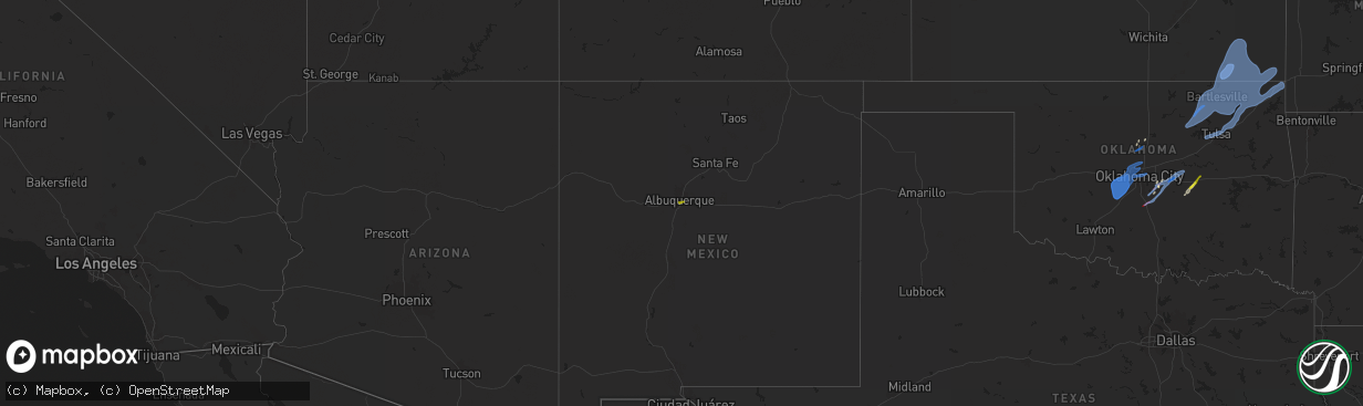
Hail Map on January 8, 2026
The weather event on January 8, 2026 includes Wind, Tornado, and Hail maps. 6 states and 338 cities were impacted and suffered possible damage. The total estimated number of properties impacted is 1,103.
Wind
Tornado
Hail
1,103
Estimated number of impacted properties by a 1.00" hail or larger0
Estimated number of impacted properties by a 1.75" hail or larger0
Estimated number of impacted properties by a 2.50" hail or largerStorm reports
Kansas
| Date | Description |
|---|---|
| 01/08/20264:39 PM CST | A couple of reports of wires down near the riverview area. Social media report of small limbs down at a residence in this area as well. Time estimated from radar. |
| 01/08/202610:35 AM CST | Video of court house flag pole bending over in high winds. Posted to koam facebook page. Personal weather station 6 nnw of columbus recorded wind gust of 57 mph at 10:3 |
| 01/08/20269:58 AM CST | At least one 6-inch diameter tree limb down. |
| 01/08/20269:38 AM CST | Additional information added to previous report. Powerlines and power poles down... Several outbuildings blow down... Lots of fence damage. A semi trailer was blown ove |
| 01/08/20269:38 AM CST | Powerlines and power poles down... Several outbuildings blow down. |
| 01/08/20269:35 AM CST | A local report indicates 81 MPH wind near Independence Airport |
Missouri
| Date | Description |
|---|---|
| 01/08/20264:45 PM CST | A couple of social media reports of minor property damage between gladstone and avondale. Public utility also reported wires down in this area. Time estimated from rada |
Texas
| Date | Description |
|---|---|
| 01/08/20266:06 AM CST | Delayed report: damage was reported in and around olney with power poles broken... Damaged shingles and damage to commercial flat-roof membrane. |
Mississippi
| Date | Description |
|---|---|
| 01/08/202612:44 AM CST | Couple trees down along red dog road. |
Illinois
| Date | Description |
|---|---|
| 01/07/202610:10 PM CST | Limbs down with unknown size. |
| 01/07/20269:34 PM CST | Traffic light downed onto a moving car at cicero avenue and 55th street. The cars windshield was cracked... But no serious injuries were reported. Time estimated using |
| 01/07/20269:34 PM CST | Traffic light downed onto a movin |
| 01/07/20269:26 PM CST | Power lines downed at 3800 s artesian avenue. |
| 01/07/20268:45 PM CST | Semi blown over on i-57 near pesotum. |
| 01/07/20268:35 PM CST | Delayed report from broadcast media of a semi blown over on i-72 near bondville. Time estimated by radar. |
| 01/07/20268:25 PM CST | Delayed report relayed by emergency manager of 4 poles down/snapped just west of minier on stringtown road. Time estimated by radar. |
| 01/07/20268:25 PM CST | Delayed report relayed by emergency manager of tree down on power line near n. Minier and e. Olive rd. Time estimated by radar. |
| 01/07/20268:14 PM CST | Delayed report relayed by emergency management of a pole down with line arcing. Reported road being closed. Time estimated by radar. |
| 01/07/20267:50 PM CST | Power pole down near the location of mccords trail and il 16 along the union pacific rail. |
| 01/07/20267:40 PM CST | Delayed report: sporadic damage reported from hillsboro area all the way to the montgomery/shelby/christian county line. |
| 01/07/20267:30 PM CST | Delayed report: tree fell across county road 000e 1 mile north of address. |
| 01/07/20267:10 PM CST | Tree down across road at n idler ln and iron gate trail intersection. |
| 01/07/20266:53 PM CST | Delayed report relayed by emergency manager of broken pole with lines down near concord and hinman roads. Time estimated by radar. |
| 01/07/20266:40 PM CST | Delayed report relayed by emergency manager of power lines on top of tree and arcing. Time estimate by radar. |
| 01/07/20266:17 PM CST | Delayed report relayed by emergency management of power line down across the road near springfield and par 3 rd in east peoria. Time estimated by radar. |
| 01/07/20266:17 PM CST | Delayed report relayed by emergency manager of a light pole that had fallen. Time estimated by radar. |
Nevada
| Date | Description |
|---|---|
| 01/08/20268:45 AM CST | A local report indicates 78 MPH wind near 12 NNE Amargosa Valley |
| 01/08/20268:15 AM CST | Convective gusts above 58 mph from 0615 pst to 0630 pst. The peak gust during this time was 72 mph and occurred at 0615 pst. |
| 01/08/20268:00 AM CST | A local report indicates 75 MPH wind near 19 N Mercury |
| 01/08/20267:00 AM CST | Convective gusts above 58 mph from 0500 pst to 0515 pst. The peak gust during this time was 88 mph and occurred at 0500 pst. |
New Mexico
| Date | Description |
|---|---|
| 01/07/20267:00 PM CST | A local report indicates 1.00 inch wind near 4 ENE South Valley |
Oklahoma
| Date | Description |
|---|---|
| 01/08/20268:48 AM CST | Roof damaged to a home. Shop building damaged... And several power poles damaged. All of this was on the south end of town. |
| 01/08/20268:48 AM CST | Roof damaged to a home. Shop building damaged... And several |
| 01/08/20268:45 AM CST | Thunderstorm wind gust to 88 mph at the wynona mesonet. |
| 01/08/20268:39 AM CST | Thunderstorm wind gust to 66 mph at the wynona mesonet. |
| 01/08/20268:10 AM CST | A local report indicates 59 MPH wind near 3 NNW Shawnee |
| 01/08/20268:09 AM CST | Roof damage to holiday inn. Time estimated from radar. |
| 01/08/20268:06 AM CST | A local report indicates a tornado near 4 N Shawnee |
| 01/08/20268:05 AM CST | Delayed report. A large tree was uprooted. Time estimated from radar. |
| 01/08/20268:03 AM CST | 4 inch tree limbs downed. |
| 01/08/20267:52 AM CST | Scattered damage from near the cleveland-pottawatomie county line to near the shawnee twin lakes. |
| 01/08/20267:50 AM CST | A local report indicates 1.00 inch wind near Cromwell |
| 01/08/20267:45 AM CST | Radar confirmed tornado. |
| 01/08/20267:31 AM CST | Radar confirmed tornado. |
| 01/08/20267:20 AM CST | A local report indicates 60 MPH wind near 3 E Oklahoma City |
| 01/08/20267:20 AM CST | Damage to farm outbuildings and fence posts. Time estimated by radar. |
| 01/08/20267:15 AM CST | Damage to rooftop ac units and bleachers lifted at macarthur middle school. Time estimated from radar. |
| 01/08/20267:05 AM CST | A local report indicates 60 MPH wind near 2 N Yukon |
Cities Impacted by Hail Map on January 8, 2026
- Crescent, OK
- Mulhall, OK
- Oklahoma City, OK
- Yukon, OK
- Mustang, OK
- Wheatland, OK
- Tuttle, OK
- Blanchard, OK
- Newcastle, OK
- Bethany, OK
- Piedmont, OK
- Edmond, OK
- Mcloud, OK
- Norman, OK
- Newalla, OK
- Purcell, OK
- Lexington, OK
- Seminole, OK
- Shawnee, OK
- Spencer, OK
- Wewoka, OK
- Okemah, OK
- Maud, OK
- Prague, OK
- Meeker, OK
- Paden, OK
- Cleveland, OK
- Osage, OK
- Barnsdall, OK
- Hominy, OK
- Skiatook, OK
- Pawhuska, OK
- Wynona, OK
- Fairfax, OK
- Ochelata, OK
- Bartlesville, OK
- Ramona, OK
- Copan, OK
- Dewey, OK
- Wann, OK
- Talala, OK
- Collinsville, OK
- Nowata, OK
- Delaware, OK
- Oologah, OK
- Tulsa, OK
- Owasso, OK
- Catoosa, OK
- Claremore, OK
- Chelsea, OK
- Faxon, OK
- Grandfield, OK
- Lawton, OK
- Chattanooga, OK
- Walters, OK
- Loveland, OK
- Cache, OK
- Geronimo, OK
- Union City, OK
- Minco, OK
- Pocasset, OK
- El Reno, OK
- Amber, OK
- Chickasha, OK
- Caney, KS
- Havana, KS
- Niotaze, KS
- Independence, KS
- Coffeyville, KS
- Tyro, KS
- Lenapah, OK
- Liberty, KS
- Dearing, KS
- Cherryvale, KS
- S Coffeyville, OK
- Vinita, OK
- Thayer, KS
- Edna, KS
- Neodesha, KS
- Mound Valley, KS
- Big Cabin, OK
- Guthrie, OK
- Welch, OK
- Bluejacket, OK
- Dennis, KS
- Bartlett, KS
- Altamont, KS
- Parsons, KS
- Oswego, KS
- Galesburg, KS
- Chetopa, KS
- Afton, OK
- Fairland, OK
- Miami, OK
- Columbus, KS
- Baxter Springs, KS
- Quapaw, OK
- Wyandotte, OK
- Sand Springs, OK
- Sapulpa, OK
- Elk City, KS
- Fredonia, KS
- Altoona, KS
- Benedict, KS
- Chanute, KS
- Erie, KS
- Noble, OK
- Macomb, OK
- Tecumseh, OK
- Franklin, IL
- Waverly, IL
- Modesto, IL
- Alexander, IL
- New Berlin, IL
- Murrayville, IL
- Loami, IL
- Armington, IL
- Minier, IL
- Buffalo, IL
- Elkhart, IL
- Williamsville, IL
- Mechanicsburg, IL
- Tremont, IL
- Greenview, IL
- Athens, IL
- Middletown, IL
- New Holland, IL
- Riverton, IL
- Sherman, IL
- Hartsburg, IL
- Lawndale, IL
- Lincoln, IL
- Atlanta, IL
- Jacksonville, IL
- Springfield, IL
- Mason City, IL
- Cantrall, IL
- Petersburg, IL
- McLean, IL
- Emden, IL
- Beason, IL
- Delavan, IL
- Illiopolis, IL
- Mount Pulaski, IL
- Morton, IL
- Washington, IL
- Groveland, IL
- Pekin, IL
- Deer Creek, IL
- Rochester, IL
- Pleasant Plains, IL
- San Jose, IL
- Green Valley, IL
- Chestnut, IL
- Stanford, IL
- Danvers, IL
- Onarga, IL
- Gilman, IL
- Carlock, IL
- Bloomington, IL
- Normal, IL
- Hudson, IL
- Forest City, IL
- Topeka, IL
- Manito, IL
- Tallula, IL
- Oakford, IL
- Ashland, IL
- Chandlerville, IL
- Virginia, IL
- East Peoria, IL
- Peoria, IL
- Easton, IL
- Mapleton, IL
- Creve Coeur, IL
- Metamora, IL
- Peoria Heights, IL
- Kilbourne, IL
- Hopedale, IL
- Gridley, IL
- South Pekin, IL
- Mackinaw, IL
- Lowpoint, IL
- Washburn, IL
- Pittsfield, IL
- Nebo, IL
- High Ridge, MO
- Fenton, MO
- Imperial, MO
- Arnold, MO
- Eureka, IL
- Shirley, IL
- Roanoke, IL
- Saint Louis, MO
- Maryville, IL
- Troy, IL
- Edwardsville, IL
- Alhambra, IL
- Glen Carbon, IL
- Marine, IL
- Granite City, IL
- Collinsville, IL
- Benson, IL
- Minonk, IL
- Waynesville, IL
- Towanda, IL
- Toluca, IL
- Dawson, IL
- Varna, IL
- Albuquerque, NM
- Worden, IL
- Winchester, IL
- Bingham, IL
- Fillmore, IL
- East Saint Louis, IL
- Witt, IL
- Goodfield, IL
- Secor, IL
- Congerville, IL
- Irving, IL
- Hillsboro, IL
- Pana, IL
- Taylor Springs, IL
- Coffeen, IL
- Nokomis, IL
- Ramsey, IL
- Donnellson, IL
- Walshville, IL
- Oconee, IL
- El Paso, IL
- Bath, IL
- Concord, IL
- Arenzville, IL
- Chapin, IL
- Downs, IL
- Le Roy, IL
- Lexington, IL
- Clinton, IL
- Dana, IL
- Taylorville, IL
- Rosamond, IL
- Ohlman, IL
- Tower Hill, IL
- Sorento, IL
- Panama, IL
- Flanagan, IL
- Decatur, IL
- Havana, IL
- Woodson, IL
- Long Point, IL
- Shelbyville, IL
- Lakewood, IL
- Lovington, IL
- Atwood, IL
- Sullivan, IL
- Bethany, IL
- Tolono, IL
- Arthur, IL
- Champaign, IL
- Sadorus, IL
- Hammond, IL
- Pesotum, IL
- Tuscola, IL
- Savoy, IL
- Urbana, IL
- Owaneco, IL
- Philo, IL
- Edinburg, IL
- Assumption, IL
- Morrisonville, IL
- Palmer, IL
- Findlay, IL
- Moweaqua, IL
- Saint Joseph, IL
- Butler, IL
- Addieville, IL
- Okawville, IL
- Dalton City, IL
- Marissa, IL
- Baldwin, IL
- Lenzburg, IL
- Bement, IL
- Ivesdale, IL
- Oakdale, IL
- Nashville, IL
- Bartelso, IL
- Odin, IL
- Carlyle, IL
- Sandoval, IL
- Centralia, IL
- Patoka, IL
- Homer, IL
- Sidney, IL
- Ogden, IL
- Arcola, IL
- Brownstown, IL
- Salem, IL
- Fithian, IL
- Villa Grove, IL
- Windsor, IL
- Dix, IL
- Hillsboro, IN
- Iuka, IL
- Kell, IL
- Ingraham, IL
- Noble, IL
- Newton, IL
- Dundas, IL
- Kingman, IN
- Bloomingdale, IN
- Woodlawn, IL
- Texico, IL
- Mount Vernon, IL
- Marshall, IL
- Dennison, IL
- West Liberty, IL
- Marshall, IN
- Veedersburg, IN
- Crawfordsville, IN
- Waynetown, IN
- Willow Hill, IL
- Oblong, IL
- Sumner, IL
- Olney, IL
- Claremont, IL
- Calhoun, IL
- Mount Erie, IL
- Albion, IL
- West Salem, IL
- Golden Gate, IL
- Saint Francisville, IL
- Dugger, IN
- Sullivan, IN
- Jasonville, IN
- Worthington, IN
- Linton, IN
- Lawrenceville, IL
- Bondville, IL