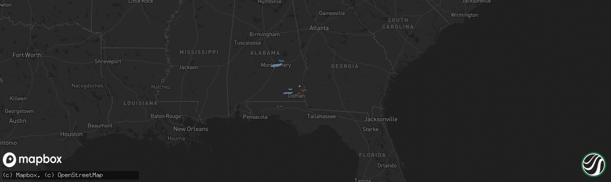
Hail Map on January 25, 2026
The weather event on January 25, 2026 includes Wind, Tornado, and Hail maps. 4 states and 41 cities were impacted and suffered possible damage. The total estimated number of properties impacted is 0.
Wind
Tornado
Hail
0
Estimated number of impacted properties by a 1.00" hail or larger0
Estimated number of impacted properties by a 1.75" hail or larger0
Estimated number of impacted properties by a 2.50" hail or largerStorm reports
Florida
| Date | Description |
|---|---|
| 01/25/20264:15 PM CST | Tree limbs down across state rd 20. |
| 01/25/20264:00 PM CST | Tree down along hwy 71 south bound. |
| 01/25/20263:46 PM CST | Tree down on highway 20 near john f bailey road. |
| 01/25/20263:41 PM CST | Trees and power lines reported down in chattahoochee. |
| 01/25/20263:20 PM CST | Mping report of shingles blown off. |
| 01/25/20263:15 PM CST | Large tree down on hartsfield road. |
| 01/25/20263:15 PM CST | Tree down at 2544 douglas pond rd. |
| 01/25/20263:13 PM CST | Trees down on powerline road. |
| 01/25/20263:11 PM CST | Tree on a power line on laramore road. |
| 01/25/20263:05 PM CST | Tree and power line down along gardenview rd. |
| 01/25/20262:55 PM CST | Trees and power lines reported down across western jackson county. |
| 01/25/20262:53 PM CST | Corrects time on previous tstm wnd dmg report from 2 sw sills. Downed tree hit a power line that caused a fire near holyneck rd and dudley rd. |
| 01/25/20262:53 PM CST | Corrects previous tstm wnd dmg report from 2 sw sills. Downed tree hit a power line that caused a fire near holyneck rd and dudley rd. |
| 01/25/20262:40 PM CST | Tree down on church ave near coopers. |
| 01/25/20262:30 PM CST | Tree down at hwy 79 and acy rd. |
| 01/25/20262:24 PM CST | Tree down at stumpknocker trail. |
| 01/25/20262:22 PM CST | Smokey road tree down. |
| 01/25/20262:12 PM CST | Picture of trees down in the bonifay area. |
| 01/25/20262:12 PM CST | Significant tree damage reported near bonifay. |
| 01/25/20261:51 PM CST | Picture of tree on house. |
| 01/25/20261:40 PM CST | Ham radio operator reported trees down on ingl |
| 01/25/20261:40 PM CST | Reports of trees down along ingle rd. |
| 01/25/20261:40 PM CST | Ham radio operator reports of trees down near sunrise/331 n. |
| 01/25/20261:40 PM CST | Ham radio operator reported trees down on ingle rd near defuniak springs. |
| 01/25/20261:39 PM CST | Reports of trees down near sunrise and hwy 331 north. |
| 01/25/20261:30 PM CST | Reports of trees and power lines down along with roof damage. Damage was reported to be across northern defuniak springs along hwy 83. |
| 01/25/20261:25 PM CST | Power line down along county highway 1084. |
| 01/25/20261:24 PM CST | Destin-fort walton beach airport |
| 01/25/20261:24 PM CST | Ef1 tornado confirmed by storm survey. Lasted from 1:23 ct to 1:25 ct. |
| 01/24/20267:53 PM CST | Downed tree hit a power line that caused a fire near holyneck rd and dudley rd. |
| 01/24/20266:22 PM CST | Tree wa |
| 01/24/20266:22 PM CST | Tree was reported down at jumping gulley rd and loch laurel rd. |
Alabama
| Date | Description |
|---|---|
| 01/25/20262:24 PM CST | Trees and power lines reported down. |
| 01/25/20262:17 PM CST | Trees down along highway 95 near the power plant. |
| 01/25/20262:16 PM CST | Trees and power lines reported down. |
| 01/25/20262:10 PM CST | Trees and powerlines reported down. |
| 01/25/20262:08 PM CST | Emergency management reported a tree down on a structure at 12744 hwy-134 in new brockton. Tree on roof... No injuries in addition to downed power lines. |
| 01/25/20262:02 PM CST | Ef0 tornado confirmed by storm survey. Started at 2:02 cst and ended at 3:03 cst. |
| 01/25/20262:00 PM CST | Corrects ef rating of previous tornado report from pleasant plains. Ef1 confirmed by storm survey. Started at 1:52 pm ct and ended at 2:09 pm ct. |
| 01/25/20261:59 PM CST | Tree down on powerlines in the 100 block of reid road. |
| 01/25/20261:58 PM CST | Low hanging power line at 2200 shannondoah. |
| 01/25/20261:53 PM CST | Pictures of shed damage between midland city and pinckard. |
| 01/25/20261:52 PM CST | A trailer was reported to be flipped and damaged. |
| 01/25/20261:48 PM CST | Line down near brannon stand and pine needles drive. |
| 01/25/20261:48 PM CST | A tree was reported down in headland. |
| 01/25/20261:46 PM CST | Part of the roof of a chicken house was blown off along county road 105. |
| 01/25/20261:46 PM CST | Ham radio operator reported trees down on nathan rd... In addition to power outages. |
| 01/25/20261:41 PM CST | Roof damage reported in the midland city area. |
| 01/25/20261:38 PM CST | Tree down blocking lanes on holland road. |
| 01/25/20261:36 PM CST | Tree damage reported on a facebook live stream on cr-428 in the ino community. |
| 01/25/20261:35 PM CST | The enterprise municipal airport asos/awos reported a 66 mph gust. |
| 01/25/20261:32 PM CST | Ham radio operator reported an all in credit union sign blown over on north daleville ave. |
| 01/25/20261:32 PM CST | Picture of trees down. |
| 01/25/20261:30 PM CST | Widespread damage across geneva city. Reports of trees and power lines down... Barns blown away and buildings blown over. |
| 01/25/20261:29 PM CST | Ef2 tornado confirmed by storm survey. Started at 1:29 pm ct and ended at 1:33 pm ct. |
| 01/25/20261:27 PM CST | Resident called about storm damage at their property at 72 cr 607... Elba 36323. |
| 01/25/20261:25 PM CST | Power lines down across the road. |
| 01/25/20261:25 PM CST | Power lines and trees down across the roadway. |
| 01/25/20261:25 PM CST | Power lines and tress down across the road. |
| 01/25/20261:25 PM CST | Power lines over the road. |
| 01/25/20261:25 PM CST | Power lines and tress down across the road. |
| 01/25/20261:25 PM CST | Power line down to dan ray tires. |
| 01/25/20261:25 PM CST | Power lines down along the road. |
| 01/25/20261:25 PM CST | Daleville manor - power lines down in the complex. |
| 01/25/20261:25 PM CST | Trees on power lines. |
| 01/25/20261:18 PM CST | Damage reported in the flat creek area. |
| 01/25/20261:15 PM CST | Trees and power lines down across ozark. |
| 01/25/20261:13 PM CST | Trees and power lines down across level plains. |
| 01/25/20261:09 PM CST | Report of a tree down in enterprise. |
| 01/25/20261:08 PM CST | Report of tree down on a roof and power lines. |
| 01/25/20261:02 PM CST | Florala municipal airport |
| 01/25/20261:02 PM CST | Emergency management reported a blown transformers in the battens community. |
| 01/25/202612:36 PM CST | Widespread damage across the city of elba with trees and power lines down. |
| 01/25/202611:58 AM CST | Damage to car ports in the foley grove neighborhood. |
| 01/25/202611:36 AM CST | Report of a tree down along marshell road in central elmore county. Time estimated by radar. |
| 01/25/202611:36 AM CST | Report of a power line down along redland road. Time estimated by radar. |
| 01/25/202611:32 AM CST | Report of a power line down along firetower road. Time estimated by radar. |
| 01/25/202611:32 AM CST | Broadcast media live stream reports powerlines down across taylor road near interstate 85. Time estimated by radar. |
| 01/25/202611:32 AM CST | Report of a power line down along firetower road. Time estimated by radar. |
| 01/25/202611:32 AM CST | Report of a power line down along alabama highway 14 near firetower road. Time estimated by radar. |
| 01/25/202611:30 AM CST | Public reports 2 trees snapped near the intersection of vaughn road and bell road. Time estimated by radar. |
| 01/25/202611:29 AM CST | Public reports a tree down near the intersection of vaughn road and eastern blvd. Time estimated by radar. |
| 01/25/202611:28 AM CST | Photos submitted to broadcast meteorologist of trees snapped with one blocking the road near mayfair road in the bellehurst midtown area of montgomery. Time estimated b |
| 01/25/202611:27 AM CST | Photos submitted to broadcast media showing a large tree that fell onto a house... Penetrating the roof and damaging the ceiling in a room. Location between ann street |
| 01/25/202611:26 AM CST | Photos submitted to broadcast media of trees down near and across robinson hill road. Time estimated by radar. |
| 01/25/202611:25 AM CST | Photos submitted to broadcast media show multiple trees down along with some power lines and poles down along agnew street near navarro ave. In the old cloverdale area |
| 01/25/202611:24 AM CST | Photos submitted to broadcast media show several tree branches snapped and downed with some down onto a home in the cloverdale area of montgomery. Time estimated by rad |
| 01/25/202611:24 AM CST | Broadcast media stream showed video of several trees down near the intersection of boultier street and magnolia curve. Time estimated by radar. |
| 01/25/202611:24 AM CST | Report of 15-20 trees down near huntingdon college with powerlines down along fairview avenue. Also some trees down on vehicles along college court near campus. Time es |
| 01/25/202611:24 AM CST | Trained spotter measured 71 mph wind gust using a home weather station with an anemometer 7 feet agl. |
| 01/25/202611:19 AM CST | Photo submitted to broadcast media shows significant structural damage to a home in the rolling acres subdivision. Time estimated by radar. |
| 01/25/202611:16 AM CST | An ef-1 tornado was confirmed in the rolling acres community along the lowndes/montgomery county line. The worst damage was done to two residences along treat road. |
Georgia
| Date | Description |
|---|---|
| 01/25/20264:16 PM CST | Tree down in colquitt county from the storms on sunday. |
| 01/25/20263:49 PM CST | Tree limbs reported on the road along hwy 93 outside of pelham. |
| 01/25/20263:38 PM CST | Two trees reported down at lake seminole. |
| 01/25/20263:12 PM CST | Tree damage in newton including 1 large pine tree uprooted. |
| 01/25/20263:09 PM CST | Trained spotter reported damage to mobile home. |
| 01/25/20263:06 PM CST | Blown transformer near publix along highway 19. |
| 01/25/20262:49 PM CST | Trees and power lines reported down along grady-cobb rd. |
| 01/25/20262:46 PM CST | Trees and power lines reported down along griggs lucille rd. |
| 01/25/20262:33 PM CST | Tree reported down along hwy 45 and daniels rd near rowena. |
| 01/25/20262:20 PM CST | Trees and power lines reported down along mlk jr. Blvd in blakely. |
| 01/25/20262:12 PM CST | Trees and power lines reported down along hwy 62 and lower river rd. |
Cities Impacted by Hail Map on January 25, 2026
- Lowndesboro, AL
- Montgomery, AL
- Pike Road, AL
- Tallassee, AL
- Eclectic, AL
- Wetumpka, AL
- Fort Rucker, AL
- Ozark, AL
- Defuniak Springs, FL
- Ponce De Leon, FL
- New Brockton, AL
- Enterprise, AL
- Midland City, AL
- Daleville, AL
- Newton, AL
- Abbeville, AL
- Columbia, AL
- Blakely, GA
- Headland, AL
- Cherokee, TX
- Brookesmith, TX
- Richland Springs, TX
- Pontotoc, TX
- Voca, TX
- Brady, TX
- San Saba, TX
- Valley Spring, TX
- Mullin, TX
- Rochelle, TX
- Brownwood, TX
- Lohn, TX
- Llano, TX
- Goldthwaite, TX
- Sonora, TX
- Hope Hull, AL
- Geneva, AL
- Black, AL
- Ashford, AL
- Webb, AL
- Foley, AL
- Florala, AL