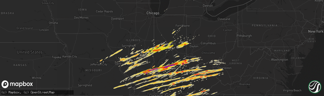
Hail Map on March 2, 2012
The weather event on March 2, 2012 includes Hail map. 17 states and 1,963 cities were impacted and suffered possible damage. The total estimated number of properties impacted is 537,820.
Hail
537,820
Estimated number of impacted properties by a 1.00" hail or larger264,964
Estimated number of impacted properties by a 1.75" hail or larger156,689
Estimated number of impacted properties by a 2.50" hail or largerStates Impacted by Hail Map on March 2, 2012
Storm reports
Texas
| Date | Description |
|---|---|
| 03/02/20124:08 PM CST | Driver on hwy 96 headed south from center encountered up to quarter sized hail near san augustine |
Arkansas
| Date | Description |
|---|---|
| 03/02/20123:40 PM CST | Reported along grand lake loop |
| 03/02/20123:02 PM CST | Golf ball sized hail reported in lake village along highway 82 |
| 03/02/20122:52 PM CST | Strong winds also reported. Along highway 82 n of lake village. |
| 03/02/20122:52 PM CST | Powerlines down |
| 03/02/20122:44 PM CST | Few trees and a light pole blown down |
| 03/02/20122:44 PM CST | A local report indicates 1.75 inch wind near 3 E MONTROSE |
North Carolina
| Date | Description |
|---|---|
| 03/02/201212:40 PM CST | Severe damage to a home including windows broken and collapsed garage. Several large trees and power lines reported down. |
| 03/02/201210:30 AM CST | A local report indicates 1.50 inch wind near MOCKSVILLE |
| 03/02/20123:52 AM CST | Dispatch reported trees down countywide. |
| 03/02/20123:15 AM CST | Multiple trees down with damage to a house on glovers church road |
| 03/02/20123:00 AM CST | Several small to medium softwood trees uprooted and down. Straightline thunderstorm wind gust estimated at 65 mph. |
| 03/02/20123:00 AM CST | Several small to medium softwood trees uprooted and down. Small section of tin blown off barn roof. Straightline thunderstorm wind gust estimated at 65 mph. |
| 03/02/20122:40 AM CST | Tree down on a home on emmanuel church road in seagrove. Report relayed by emergency manager. Time estimated by radar. |
| 03/02/20122:10 AM CST | Two old barns were blown down and one home sustained minor damage on substation road. |
| 03/02/20121:37 AM CST | Preliminary reports of six houses damaged and trees and other debris in the road south of harrisburg...generally between robinson church road and 485. Damage also noted |
| 03/02/20121:36 AM CST | Charlotte-mecklenburg fire marshall reports damage in far eastern mecklenburg there is damage in the plaza road extension area. Officials are in the area and will have |
| 03/01/20128:09 PM CST | Numerous trees snapped and uprooted at the intersection of pine creek and north norton roads. |
| 03/01/20128:05 PM CST | Golf ball sized hail reported in south central jackson county as storm passed. |
| 03/01/20128:05 PM CST | Trees down along pine creek road. One tree that fell on a brand new car. Debris in the road near pine creek road and cullowhee road. |
| 03/01/20127:58 PM CST | Fire department in cullasaja had hail larger than golf ball but likely a bit less than tennis ball. Therefore...lime sized hail fell at their location. |
| 03/01/20127:50 PM CST | Golf ball sized hail fell in or near franklin as storm passed. Got a report from a traveler passing through about a mile north of downtown franklin of very strong wind |
| 03/01/20127:48 PM CST | Golf ball hail and trees down |
| 03/01/20127:45 PM CST | Spotter under the storm reported hail one and a half inch diameter. Does not know of any wind damage in his area. |
| 03/01/20127:45 PM CST | A few trees down near franklin. |
| 03/01/20127:38 PM CST | Golf ball hail and several trees down |
| 03/01/20127:37 PM CST | Quarter sized hail lasted a few minutes near yancey county border not far from mars hill. |
| 03/01/20127:30 PM CST | Golf ball sized hail as storm crossed. |
| 03/01/20127:26 PM CST | A hail producing storm crossed madison county with the largest hail reported between walnut and mars hill. Spotter halfway between those locations reported sounded like |
| 03/01/20127:25 PM CST | Numerous trees down in the nantahala area. |
| 03/01/20127:05 PM CST | Ef2 tornado...120 mph max winds. Moderate to major damage to buisnesses as well as homes. |
| 03/01/20127:03 PM CST | Possible tornado...damage to several buildings and a few homes destroyed. Numerous trees down across murphy. |
| 03/01/20127:00 PM CST | Multiple power lines down |
| 03/01/20126:50 PM CST | Murphy power reports multiple power lines down |
Indiana
| Date | Description |
|---|---|
| 03/02/20123:45 PM CST | A local report indicates 60 MPH wind near 4 SE LEXINGTON |
| 03/02/20123:44 PM CST | A local report indicates 1.00 inch wind near 3 S LEXINGTON |
| 03/02/20123:25 PM CST | 3/4 of roof off of house. |
| 03/02/20123:15 PM CST | A local report indicates 58 MPH wind near CHARLESTOWN |
| 03/02/20123:09 PM CST | A local report indicates 1.00 inch wind near SELLERSBURG |
| 03/02/20122:59 PM CST | Report of tornado on the ground. Flipped car several times. |
| 03/02/20122:58 PM CST | Pekin road and highway 150. |
| 03/02/20122:58 PM CST | A local report indicates 1.75 inch wind near VEVAY |
| 03/02/20122:57 PM CST | A local report indicates 1.75 inch wind near RICHMOND |
| 03/02/20122:54 PM CST | Media sourcing the county sheriff reporting 4 killed in holton. |
| 03/02/20122:49 PM CST | A local report indicates 2.00 inch wind near VEVAY |
| 03/02/20122:49 PM CST | A local report indicates 1.75 inch wind near CAMBRIDGE CITY |
| 03/02/20122:47 PM CST | Borden high school was damaged. |
| 03/02/20122:45 PM CST | Damage reported.. |
| 03/02/20122:43 PM CST | Highway 61 north blocked by downed tree. |
| 03/02/20122:42 PM CST | Tree down at sr 3 and 500 n. Right after this report was a report of a tornado on the ground east of butlerville but still in jennings county. No damage could be confir |
| 03/02/20122:42 PM CST | A local report indicates 1.75 inch wind near RICHMOND |
| 03/02/20122:42 PM CST | 60 mph winds |
| 03/02/20122:41 PM CST | A local report indicates a tornado near OTISCO |
| 03/02/20122:40 PM CST | A local report indicates 1.00 inch wind near 1 E STRAUGHN |
| 03/02/20122:39 PM CST | Gust measured by ham operator. Resulted in broken anemometer. |
| 03/02/20122:36 PM CST | A local report indicates 1.75 inch wind near 1 N HANOVER |
| 03/02/20122:32 PM CST | A local report indicates 2.00 inch wind near FREDERICKSBURG |
| 03/02/20122:30 PM CST | Ef1 tornado about 20 minutes after ef4 tornado on nearly the same path. Lifted 0.5 mi e henryville. |
| 03/02/20122:30 PM CST | Downed trees blocking several streets within the community. |
| 03/02/20122:28 PM CST | A local report indicates 1.75 inch wind near NEW PEKIN |
| 03/02/20122:26 PM CST | Downed trees and power lines reported in the community. |
| 03/02/20122:26 PM CST | *** 1 fatal *** ef4 tornado with 49 mile track from washington co to trimble co. Clipped southeast corner of scott county |
| 03/02/20122:26 PM CST | *** 4 fatal *** ef4 tornado with 49 mile long track from washington co to trimble co entered jefferson co 4.3 mi w paynesville and crossed the ohio river 3 mi ene payne |
| 03/02/20122:25 PM CST | Reported on the ground. |
| 03/02/20122:24 PM CST | A local report indicates 1.00 inch wind near ROCKPORT |
| 03/02/20122:23 PM CST | A local report indicates 2.75 inch wind near NEW PEKIN |
| 03/02/20122:20 PM CST | A local report indicates a tornado near NABB |
| 03/02/20122:20 PM CST | A local report indicates 2.00 inch wind near FREDERICKSBURG |
| 03/02/20122:18 PM CST | A local report indicates a tornado near HENRYVILLE |
| 03/02/20122:14 PM CST | Significant damage |
| 03/02/20122:11 PM CST | Tornado on the ground west of sellersburg. |
| 03/02/20122:11 PM CST | A local report indicates a tornado near 4 W HENRYVILLE |
| 03/02/20122:09 PM CST | *** 1 fatal *** ef4 tornado with 49 mile long track from washington co to trimble co. Entered clark co 5.5 mi wsw henryville and exited 3.7 nw new washington |
| 03/02/20122:06 PM CST | Reported on the ground. |
| 03/02/20122:04 PM CST | 53 foot semi tractor trailer blown over on eastbound interstate 74 just west of mile marker 123. |
| 03/02/20122:03 PM CST | At east washington elementary school |
| 03/02/20122:03 PM CST | Injuries in town |
| 03/02/20122:02 PM CST | Damage reported acorss the area.. |
| 03/02/20122:00 PM CST | Just north of new pekin. |
| 03/02/20121:55 PM CST | A local report indicates 1.00 inch wind near NOBLESVILLE |
| 03/02/20121:54 PM CST | Reported on the ground and moving northeast. |
| 03/02/20121:52 PM CST | A local report indicates 1.75 inch wind near VALEENE |
| 03/02/20121:50 PM CST | *** 5 fatal *** ef4 tornado with 49 mile track began on the south side of fredericksburg and proceeded through the counties of clark scott jefferson and ended in trimbl |
| 03/02/20121:44 PM CST | A local report indicates 70 MPH wind near BEDFORD |
| 03/02/20121:43 PM CST | A local report indicates 1.75 inch wind near CELESTINE |
| 03/02/20121:40 PM CST | A local report indicates 1.75 inch wind near ST. ANTHONY |
| 03/02/20121:40 PM CST | A local report indicates 1.00 inch wind near CAMBY |
| 03/02/20121:36 PM CST | A local report indicates 1.75 inch wind near ENGLISH |
| 03/02/20121:36 PM CST | A local report indicates 1.00 inch wind near MOORESVILLE |
| 03/02/20121:32 PM CST | A local report indicates 1.00 inch wind near PLAINFIELD |
| 03/02/20121:27 PM CST | A local report indicates 1.75 inch wind near TASWELL |
| 03/02/20121:23 PM CST | Two inch hail covering the ground |
| 03/02/20121:23 PM CST | A local report indicates 1.00 inch wind near IRELAND |
| 03/02/20121:15 PM CST | A local report indicates 1.00 inch wind near BIRDSEYE |
| 03/02/20121:14 PM CST | A local report indicates 1.00 inch wind near STENDAL |
| 03/02/20121:08 PM CST | A local report indicates 1.00 inch wind near HUNTINGBURG |
| 03/02/20121:07 PM CST | A local report indicates 1.50 inch wind near 4 ESE BAINBRIDGE |
| 03/02/20121:04 PM CST | News media is reported significant storm damage across the northern half of vanderburgh county. |
| 03/02/20121:00 PM CST | A local report indicates 1.00 inch wind near GREENCASTLE |
| 03/02/201212:57 PM CST | Tennis ball size hail reported south of fort branch. |
| 03/02/201212:55 PM CST | Golf ball size hail reported in the community of fort branch. |
| 03/02/201212:53 PM CST | A local report indicates 2.00 inch wind near PRINCETON |
| 03/02/201212:52 PM CST | A local report indicates 1.00 inch wind near BRAZIL |
| 03/02/201212:51 PM CST | Half dollar size hail reported. |
| 03/02/201212:50 PM CST | A local report indicates 1.75 inch wind near 2 N EVANSVILLE |
| 03/02/201212:48 PM CST | Quarter size hail reported. |
| 03/02/201212:47 PM CST | Golf ball size hail reported just south of town. |
| 03/02/201212:47 PM CST | Late report...sheriff reporting significant residential structure damage throughout central posy county. |
| 03/02/201212:46 PM CST | 2 story home lost the roof. |
| 03/02/201212:46 PM CST | Tennis ball hail reported just north of wadesville. |
| 03/02/201212:45 PM CST | Late report time estimated...large hail damaged several homes and a few vehicles. |
| 03/02/201212:43 PM CST | Tornado reported by trained spotters. Tornado is estimated to be 300 yards wind. |
| 03/02/201212:43 PM CST | Quarter size hail reported just north of town. |
| 03/02/201212:38 PM CST | On highway 165. Also a funnel cloud was reported. |
| 03/02/201212:37 PM CST | Ef-2 tornado with peak winds near 125 mph. 6 mile path length. Average path width 140 yards. One house destroyed and several others moderately damaged. Equipment sheds |
| 03/02/201212:36 PM CST | Golf ball hail reported by trained spotter. |
| 03/02/201210:30 AM CST | A local report indicates 1.50 inch wind near 2 E INDIANAPOLIS INT'L |
| 03/02/201210:10 AM CST | Hail measured at the university of indianapolis |
| 03/02/201210:07 AM CST | Emerson avenue and southeastern avenue |
| 03/02/20129:58 AM CST | A local report indicates 1.25 inch wind near INDIANAPOLIS |
| 03/02/20129:56 AM CST | A local report indicates 1.25 inch wind near 1 S INDIANAPOLIS |
| 03/02/20129:51 AM CST | A local report indicates 1.00 inch wind near NORTH SALEM |
| 03/02/20129:44 AM CST | A local report indicates 1.00 inch wind near PLAINFIELD |
| 03/02/20129:34 AM CST | A local report indicates 1.75 inch wind near 1 NNW BAINBRIDGE |
| 03/02/20129:31 AM CST | A local report indicates 1.50 inch wind near 2 SW BAINBRIDGE |
| 03/02/20129:21 AM CST | A local report indicates 1.00 inch wind near 3 SE GREENCASTLE |
| 03/02/20129:07 AM CST | A local report indicates 1.75 inch wind near BRAZIL |
| 03/02/20129:07 AM CST | A local report indicates 1.75 inch wind near ROCKVILLE |
| 03/02/20128:52 AM CST | A local report indicates 1.75 inch wind near TERRE HAUTE |
| 03/02/20128:51 AM CST | 13th and wabash streets in terre haute. |
| 03/02/20128:50 AM CST | At 13th and delaware streets in terre haute. |
Louisiana
| Date | Description |
|---|---|
| 03/02/20125:43 PM CST | Reported near hebert |
| 03/02/20125:04 PM CST | Hail ranging from nickel sized to half dollar sized near clarence |
| 03/02/20124:43 PM CST | Trees and powerlines down north of calvin...reported by emergency manager of winn parish. |
| 03/02/20124:20 PM CST | Property damage to a farm in northern west carroll parish. Barns and storage sheds heavily damaged or destroyed. |
| 03/02/20124:20 PM CST | Hail up to golf ball sized in the terry community |
| 03/02/20124:17 PM CST | Trees down across janesville and browns roads |
| 03/02/20124:17 PM CST | A local report indicates 1.00 inch wind near 3 NW OAK GROVE |
| 03/02/20124:10 PM CST | Multiple trees down and quarter-sized hail reported by the assistant emergency manager of natchitoches parish. |
| 03/02/20124:00 PM CST | Half dollar sized hail just west of hwy 1 |
| 03/02/20123:53 PM CST | Trees down across a road |
| 03/02/20123:53 PM CST | A local report indicates 1.00 inch wind near 5 NE BASTROP |
| 03/02/20123:20 PM CST | Quarter sized hail reported near the intersection of hwy 2 and 143 |
| 03/02/20123:00 PM CST | Half dollar sized hail covering the road near hwy 33 |
| 03/02/20123:00 PM CST | Reported along jones lake rd |
| 03/02/20122:45 PM CST | Golf ball sized hail coming down in sheets |
| 03/02/20122:35 PM CST | Quarter sized hail near the intersection of hwy 151 and 146 |
| 03/02/20122:30 PM CST | Numerous trees down near marion |
| 03/02/20122:15 PM CST | Golf ball sized hail reported on salem road near farmerville |
| 03/02/20122:15 PM CST | Portable building destroyed along salem road northeast of farmerville |
| 03/02/20122:10 PM CST | Numerous trees down on camp road near farmerville |
| 03/02/20121:45 PM CST | Golf ball sized hail reported 2 miles south of bernice |
| 03/02/20121:40 PM CST | Half dollar sized hail reported near hico |
| 03/01/20128:50 PM CST | Ping pong ball sized hail reported in the sandy lake community. |
| 03/01/20126:42 PM CST | Trees down along sharkey rd |
| 03/01/20126:40 PM CST | Few trees and telephone poles down...vehicles blown off of us highway 65 and interstate 20 including a tractor trailer blown into the median of i-20 at mile marker 171. |
| 03/01/20126:36 PM CST | Trees down along hunters bend rd |
| 03/01/20126:30 PM CST | A local report indicates 1.00 inch wind near 8 S TENDAL |
| 03/01/20126:00 PM CST | Quarter to golf ball sized hail covered the ground. Reports from emergency manager and amateur radio. |
Mississippi
| Date | Description |
|---|---|
| 03/02/20125:49 PM CST | Possible tornado damage. Structual damage at intersection of egypt and whiterock roads. |
| 03/02/20125:47 PM CST | Possible tornado. |
| 03/02/20125:45 PM CST | Tornado appeared on front edge of bow apex as it crossed highway 45. |
| 03/02/20125:40 PM CST | Several trees down in southern chikasaw county. |
| 03/02/20125:31 PM CST | A local report indicates 1.00 inch wind near WINONA |
| 03/02/20125:31 PM CST | 1 inch hail |
| 03/02/20125:30 PM CST | Car blown off of highway 49. Another car had the front windshield busted out by large hail. |
| 03/02/20125:30 PM CST | Trees on cars and cars blown off road in chickasaw county. Report relayed from nws jackson. |
| 03/02/20125:30 PM CST | Numerous trees down and awnings on trailors ripped off. |
| 03/02/20125:30 PM CST | Roof blown off baptist church and structural damage to a home on 4th st in the sand hill area. |
| 03/02/20125:30 PM CST | Numerous trees down across belzoni. Tractor trailer blown off of highway 49. |
| 03/02/20125:30 PM CST | Trees on cars and cars blown off road in chickasaw county. Report relayed from nws jackson. |
| 03/02/20125:30 PM CST | Trees on cars and cars blown off road in chickasaw county. Report relayed from nws jackson. |
| 03/02/20125:30 PM CST | Estimated 70 mph wind. |
| 03/02/20125:28 PM CST | Quarter to golf ball sized hail |
| 03/02/20125:25 PM CST | A roof was blown off a shed |
| 03/02/20125:23 PM CST | Trees down in the mantee and montevista communities |
| 03/02/20125:20 PM CST | Roofs off a trailer homes along with trees and power lines down in city limits. |
| 03/02/20125:15 PM CST | Ping pong sized hail in new albany along highway 30. |
| 03/02/20125:05 PM CST | Steeple and a few shingles blown off the roof of a church and a few trees down in ingomar. Report off a local media website. |
| 03/02/20125:01 PM CST | Quarter sized hail along us highway 49e at the leflore/holmes county line |
| 03/02/20124:45 PM CST | 1 inch hail at hwy 8 and 9 intersection. |
| 03/02/20124:41 PM CST | Powerlines down |
| 03/02/20124:34 PM CST | From local tv media website. Size estimated from picture. |
| 03/02/20124:15 PM CST | Quarter sized hail reported along highway 82 two miles west of carrollton. |
| 03/02/20124:10 PM CST | Several trees down |
| 03/02/20124:02 PM CST | Quarter size hail south of grenada |
| 03/02/20123:50 PM CST | Several power poles and medium to large trees blown down |
| 03/02/20123:48 PM CST | 7 power poles down...4 along highway 49w and 3 along highway 3 |
| 03/02/20123:45 PM CST | Three power poles blown down |
| 03/02/20123:41 PM CST | One inch hail. |
| 03/02/20123:35 PM CST | A local report indicates 1.25 inch wind near AMORY |
| 03/02/20123:25 PM CST | Report from local tv media website. Size estimated from picture. Hail could have been large when it fell. |
| 03/02/20123:18 PM CST | A local report indicates 2.00 inch wind near WREN |
| 03/02/20123:07 PM CST | A local report indicates 1.00 inch wind near NEW HOPE |
| 03/02/20123:02 PM CST | Couple of trees down across nashville ferry and old yorkville roads |
| 03/02/20122:48 PM CST | Tennis ball to baseball sized hail |
| 03/02/20122:45 PM CST | A local report indicates 1.75 inch wind near 3 N CRAWFORD |
| 03/02/20122:43 PM CST | A local report indicates 1.00 inch wind near WINTERVILLE |
| 03/02/20121:38 PM CST | A local report indicates 1.00 inch wind near 4 N MARIETTA |
| 03/01/201211:47 PM CST | Tornado rated ef0 with max winds of 85 mph...path width of 50 yards and was 1/4 mile long. The tornado began at 1147 pm 4 miles nne of carson and ended 4 miles nne of c |
| 03/01/201211:41 PM CST | Tornado rated ef0 with max winds of 85 mph...path width of 50 yards and was 1/4 mile long. The tornado began at 1141 pm 4 miles nne of carson and ended 4 miles nne of c |
| 03/01/201210:15 PM CST | A local report indicates 1.00 inch wind near MARTIN |
| 03/01/20128:40 PM CST | Numerous large limbs down in area along rice road...additionally...two trees were blown down in northbay subdivision...one on a house |
| 03/01/20128:11 PM CST | A local report indicates 3.00 inch wind near 5 W HOULKA |
| 03/01/20128:05 PM CST | A local report indicates 2.75 inch wind near STEENS |
| 03/01/20127:45 PM CST | Covered the ground |
| 03/01/20127:35 PM CST | Several reports around the city. Reported by msu meteorology |
| 03/01/20127:35 PM CST | A local report indicates 1.75 inch wind near 6 NNE BIGBEE VALLEY |
| 03/01/20127:34 PM CST | Reported by msu meteorology |
| 03/01/20127:33 PM CST | Reported by off duty natchez trace parkway officer |
| 03/01/20127:10 PM CST | Power lines downed in the 4000 block of oak ridge rd |
| 03/01/20127:05 PM CST | In the bywy community. |
| 03/01/20127:00 PM CST | Trees down across us highway 11...white chapel...harold tucker roads...and interstate 59 near the forrest/lamar county line...possible tornado. One unconfirmed injury d |
| 03/01/20127:00 PM CST | A local report indicates 1.00 inch wind near 4 NW ACKERMAN |
| 03/01/20127:00 PM CST | A tree was downed along washington st...causing an car accident |
| 03/01/20126:55 PM CST | A local report indicates 1.75 inch wind near 2 N FRENCH CAMP |
| 03/01/20126:40 PM CST | Spotters reported estimated wind gusts of 60 to 70 mph in poplar creek and lodi. At least one tree reported down. |
| 03/01/20126:38 PM CST | In causeyville community |
| 03/01/20126:28 PM CST | A local report indicates 1.00 inch wind near VAIDEN |
| 03/01/20126:23 PM CST | Tornado rated ef1 with max winds 100 mph and path width of 300 yds...began at 623 pm 5 ene of baxterville and tracked 12 miles to 6 s of hattiesburg at 645 pm...at leas |
| 03/01/20126:12 PM CST | Emergency managers reporting path of damage from near the town of baxterville to the north side of purvis to near the dixie community south of hattiesburg. At least two |
| 03/01/20126:12 PM CST | From local tv media website. Size estimated from picture. |
| 03/01/20126:08 PM CST | Quarter sized hail covering the ground |
Georgia
| Date | Description |
|---|---|
| 03/02/20123:21 AM CST | Dispatch reported a couple of trees down on augusta hwy southeast of lincolnton. |
| 03/02/20122:06 AM CST | Newton county 911 relayed a report of 2 downed trees in the county as the line of storms passed through. |
| 03/02/201212:37 AM CST | Dekalb county 911 center reported power lines down on dekalb industrial way and lawrenceville highway. |
| 03/01/20129:24 PM CST | A local report indicates 1.00 inch wind near 4 NE WALESKA |
| 03/01/20128:14 PM CST | Cobb county 911 reported trees and powerlines down at roswell road and providence road. |
| 03/01/20128:14 PM CST | An nws storm survey team determined that an ef1 tornado with a maximum wind speed of 100 mph occurred in cobb county. The path length was one mile with a path width of |
| 03/01/20128:14 PM CST | An nws survey team determined an ef1 tornado with a maximum wind speed of 100 mph occurred in cobb county. The path was 1.4 miles long and 150 yards wide. The tornado t |
| 03/01/20128:08 PM CST | Cherokee county emergency management relayed a trained spotter report of quarter-sized hail 2 miles west of woodstock at 908 pm est. |
| 03/01/20128:06 PM CST | Mobile home destroyed |
| 03/01/20128:06 PM CST | Mobile home destroyed |
| 03/01/20128:05 PM CST | A local report indicates 1.75 inch wind near 4 N CAVE SPRING |
| 03/01/20128:05 PM CST | Golf ball sized hail reported near acworth on sugar maple lane. |
| 03/01/20127:40 PM CST | Paulding county fire department reported damage to structures in the area 4 miles west of dallas and to the area around the paulding county-northwest atlanta airport. N |
| 03/01/20127:40 PM CST | Paulding county fire department reported damage to structures in the area 4 miles west of dallas and to the area around the paulding county-northwest atlanta airport. |
| 03/01/20127:35 PM CST | Amateur radio relayed a spotter report of a tornado on the ground near yorkville...off old yorkville road. Numerous roads are closed to due debris. Three miles south of |
| 03/01/20127:28 PM CST | The haralson tornado entered nw paulding county near yorkville around 828 pm. Numerous roads were closed to due debris. Three miles south of yorkville there was an over |
| 03/01/20127:25 PM CST | Haralson county 911 relayed reports of downed trees east of felton around 825 pm est. This is damage assocaited with the haralson/paulding county tornado. See the 809 p |
| 03/01/20127:25 PM CST | Haralson county 911 relayed reports of downed trees east of felton around 825 pm est. |
| 03/01/20127:15 PM CST | Amateur radio relayed public safety radio reports of a collapsed house near bethel church road and us 27 in haralson county. |
| 03/01/20127:09 PM CST | *** 1 inj *** an ef-3 tornado touched down in haralson county at approximately 809 pm near cross roads church road and tallapoosa hwy. The tornado continued across hara |
| 03/01/20126:05 PM CST | Amateur radio relayed reports of several downed trees closing interstate 24 in dade county. |
Ohio
| Date | Description |
|---|---|
| 03/02/20125:30 PM CST | Large branches broken. |
| 03/02/20125:20 PM CST | Several trees down outside of mcarthur. Timed from radar |
| 03/02/20124:53 PM CST | Storm survey revealed a brief...weak tornado touched down along wynn road and uprooted/snapped numerous trees. There was damage to a mobile home and a barn as a result |
| 03/02/20124:51 PM CST | A weak tornado touched down in extreme northwest scioto county along left fork road and tracked along camp creek road in pike county ohio. Numerous trees were snapped a |
| 03/02/20124:47 PM CST | Possible tornado. Old school roof gone. Fire dept. Bldg roof collapsed. Two houses have received structural damage. |
| 03/02/20124:40 PM CST | A local report indicates 70 MPH wind near PEEBLES |
| 03/02/20124:39 PM CST | Two houses/one barn destroyed |
| 03/02/20124:38 PM CST | *** 3 inj *** 1 male seriously injured on knox rd near cedar mills rd. Also a mother and son both injured on spurgeon hill rd. Numerous trees down and blocking roads ne |
| 03/02/20124:36 PM CST | A local report indicates 65 MPH wind near SEAMAN |
| 03/02/20124:31 PM CST | Damage to metal roofing and siding at a residence on e south street. |
| 03/02/20124:30 PM CST | Roof off county garage. Car lot just south of garage had pole knocked down...damaging several cars. Time estimated from radar. |
| 03/02/20124:30 PM CST | Roof torn off house. Time estimated from radar. |
| 03/02/20124:25 PM CST | Possible tornado. 2 houses have received substantial damage north of seaman near sr 247. |
| 03/02/20124:22 PM CST | Reported tornado on the ground. |
| 03/02/20124:19 PM CST | House trailer blown into road and trees down. |
| 03/02/20124:16 PM CST | Numerous trees and power poles down on greathouse rd. Also a camper trailer flipped on john woods rd. Possible tornado damage. |
| 03/02/20124:16 PM CST | Numerous trees and power poles down on greathouse rd. Also a camper trailer flipped on john woods rd. Nws storm survey indicates this damage was caused by nontornadic w |
| 03/02/20124:10 PM CST | Numerous trees down on catalpa corner rd. |
| 03/02/20124:04 PM CST | Near brown county line |
| 03/02/20124:03 PM CST | Dime to quarter size. |
| 03/02/20124:00 PM CST | Possible tornado. Trailer destroyed. |
| 03/02/20124:00 PM CST | 2 homes damaged and numerous trees down near sr774 and pride hill rd. Also a trailer and home destroyed near poetown. |
| 03/02/20124:00 PM CST | Person trapped under home on kincheloe rd. |
| 03/02/20123:58 PM CST | Quarter to half dollar sized hail. |
| 03/02/20123:57 PM CST | A local report indicates 1.00 inch wind near BETHEL |
| 03/02/20123:55 PM CST | Tornado reported on the ground along 756 between felicity and bethel. |
| 03/02/20123:55 PM CST | Possible tornado. Widespread structural damage. |
| 03/02/20123:44 PM CST | Photo of hail about 1.5 inches in diameter |
| 03/02/20123:25 PM CST | 1 tree and phone lines down. Time estimated from radar. |
| 03/02/20122:50 PM CST | A local report indicates 1.00 inch wind near HOLLANSBURG |
Kentucky
| Date | Description |
|---|---|
| 03/02/20125:58 PM CST | Baseball to apple size hail in downtown campton. |
| 03/02/20125:57 PM CST | A local report indicates 1.00 inch wind near PONGO |
| 03/02/20125:56 PM CST | A local report indicates 1.75 inch wind near WALLINS CREEK |
| 03/02/20125:51 PM CST | *** 2 fatal *** a tornado touched down 1 mile east of cutuno and moved east across magoffin...johnson and martin counties kentucky before moving into west virginia. Thi |
| 03/02/20125:51 PM CST | Tennis ball sized hail was reported. |
| 03/02/20125:50 PM CST | A local report indicates 1.00 inch wind near WALLINS CREEK |
| 03/02/20125:50 PM CST | A nws storm damage survey team found tree damage consistent with an ef-1 tornado along hwy 1094 just southeast of the burkhart community in wolfe county. This is now co |
| 03/02/20125:49 PM CST | A local report indicates 1.00 inch wind near 4 NW BEREA |
| 03/02/20125:45 PM CST | A local report indicates 1.50 inch wind near 3 WSW BLAINE |
| 03/02/20125:45 PM CST | A local report indicates 1.00 inch wind near 2 S CANNEL CITY |
| 03/02/20125:45 PM CST | A local report indicates 1.75 inch wind near PULASKI |
| 03/02/20125:45 PM CST | A local report indicates 2.75 inch wind near 1 W INSULL |
| 03/02/20125:42 PM CST | A local report indicates 1.00 inch wind near BLACKMONT |
| 03/02/20125:40 PM CST | A local report indicates 1.75 inch wind near SCIENCE HILL |
| 03/02/20125:35 PM CST | Trees were blown down in pineville. |
| 03/02/20125:35 PM CST | A local report indicates 1.25 inch wind near LOUISA |
| 03/02/20125:35 PM CST | A swath of baseball to apple size hail fell from downtown campton to the east to near gilmore. |
| 03/02/20125:30 PM CST | *** 2 fatal *** confirmed by phone with emergency manager via phone 0800 on 03 03 2012. |
| 03/02/20125:30 PM CST | Trees were blown down in middlesboro. |
| 03/02/20125:30 PM CST | Half dollar hail was reported at the county highway garage. |
| 03/02/20125:30 PM CST | A local report indicates 1.75 inch wind near LOUISA |
| 03/02/20125:26 PM CST | A local report indicates 2.75 inch wind near 4 N SANDY HOOK |
| 03/02/20125:26 PM CST | A local report indicates 1.50 inch wind near 3 N BEREA |
| 03/02/20125:22 PM CST | 1.5 and 2.0 inch hail. Numerous 3-4 inch diameter trees reported down. |
| 03/02/20125:21 PM CST | A local report indicates 60 MPH wind near 4 W MOREHEAD |
| 03/02/20125:20 PM CST | Spotter reports 1 inch hail. |
| 03/02/20125:18 PM CST | A local report indicates 1.75 inch wind near 5 N RUSSELL SPRINGS |
| 03/02/20125:15 PM CST | Tornado on ground. Also 3 inch diameter hail. |
| 03/02/20125:13 PM CST | Roof damage and vinyl siding damage as well as broken windows from the large hail in the cartersville area.. |
| 03/02/20125:11 PM CST | Covering ground |
| 03/02/20125:10 PM CST | Event occurred between 555 pm and 610 pm. |
| 03/02/20125:10 PM CST | A local report indicates 1.00 inch wind near 2 S CAINS STORE |
| 03/02/20125:10 PM CST | A local report indicates 1.75 inch wind near 1 S COMBS |
| 03/02/20125:10 PM CST | A local report indicates 1.00 inch wind near OLIVE HILL |
| 03/02/20125:10 PM CST | One structure with roof damage. |
| 03/02/20125:10 PM CST | Multiple homes damaged along with car windows broken. |
| 03/02/20125:10 PM CST | Possible |
| 03/02/20125:08 PM CST | An ef1 tornado touched down near the bath county high school. The tornado had a intermittent path to the east-northeast crossing i-64 and causing damage to trees...barn |
| 03/02/20125:06 PM CST | Damage reported at wal mart. |
| 03/02/20125:05 PM CST | A local report indicates 1.75 inch wind near COLUMBIA |
| 03/02/20125:05 PM CST | A local report indicates 62 MPH wind near 8 E RICHMOND |
| 03/02/20125:04 PM CST | Numerous trees and homes damaged. |
| 03/02/20125:01 PM CST | There have been reports of multiple injuries and deaths. |
| 03/02/20125:00 PM CST | Small porch ripped off a home |
| 03/02/20125:00 PM CST | One tree and several limbs down along rt 7 |
| 03/02/20125:00 PM CST | Covered the ground. |
| 03/02/20125:00 PM CST | Tennis ball sized hail left indentions in the ground. |
| 03/02/20124:59 PM CST | A local report indicates 1.00 inch wind near 5 N MOUNT STERLING |
| 03/02/20124:59 PM CST | A local report indicates 70 MPH wind near 5 N MOUNT STERLING |
| 03/02/20124:59 PM CST | Some trees down near the airport. |
| 03/02/20124:58 PM CST | Homes and garages damaged. |
| 03/02/20124:58 PM CST | Tornado on the ground in west liberty. |
| 03/02/20124:56 PM CST | State police reports tornado on the ground just west of west liberty. |
| 03/02/20124:55 PM CST | A local report indicates 1.75 inch wind near KIRKSVILLE |
| 03/02/20124:55 PM CST | Significant damage in the judy area. |
| 03/02/20124:54 PM CST | A local report indicates 1.00 inch wind near EDMONTON |
| 03/02/20124:52 PM CST | A local report indicates 1.75 inch wind near JUNCTION CITY |
| 03/02/20124:51 PM CST | A local report indicates 1.75 inch wind near RICHMOND |
| 03/02/20124:50 PM CST | A local report indicates 1.50 inch wind near 4 NE NORTH MIDDLETOWN |
| 03/02/20124:49 PM CST | A tool shed destroyed just north of edmonton on don lyle road. A portion of a roof was blown off of a structure on odell-vanzant road. |
| 03/02/20124:49 PM CST | Roof off residence and barn at 880 duncannon lane |
| 03/02/20124:49 PM CST | Golf ball hail covered the ground |
| 03/02/20124:48 PM CST | A local report indicates 1.75 inch wind near WELLINGTON |
| 03/02/20124:48 PM CST | Houses damaged from tornado. |
| 03/02/20124:48 PM CST | A local report indicates 2.75 inch wind near MUNFORDVILLE |
| 03/02/20124:47 PM CST | A local report indicates 2.75 inch wind near MUNFORDVILLE |
| 03/02/20124:46 PM CST | A local report indicates 2.00 inch wind near 2 W RICHMOND |
| 03/02/20124:45 PM CST | A local report indicates 60 MPH wind near 5 E MUNFORDVILLE |
| 03/02/20124:45 PM CST | A local report indicates 60 MPH wind near 5 W EDMONTON |
| 03/02/20124:44 PM CST | Tornado was reported on the ground. |
| 03/02/20124:43 PM CST | Houses damaged in wellington. Golf ball size hail also reported. |
| 03/02/20124:43 PM CST | Trees and lines down with wind estimated at 65 mph |
| 03/02/20124:42 PM CST | A local report indicates 1.00 inch wind near KIRKSVILLE |
| 03/02/20124:42 PM CST | A local report indicates 1.75 inch wind near MUNFORDVILLE |
| 03/02/20124:41 PM CST | Golfball size hail covering the ground |
| 03/02/20124:40 PM CST | Golfball sized hail reported near olympia...bethel and sharpsburg. |
| 03/02/20124:40 PM CST | Heavy damage to church on sr 10 |
| 03/02/20124:40 PM CST | Barn destroyed from wind damage. |
| 03/02/20124:40 PM CST | Golfball size hail was reported. |
| 03/02/20124:39 PM CST | A local report indicates 1.75 inch wind near MUNFORDVILLE |
| 03/02/20124:39 PM CST | *** 8 fatal *** a tornado touched down 2 miles southwest of mariba and moved east across menifee and morgan counties for 34 miles. This tornado hit west liberty kentuck |
| 03/02/20124:39 PM CST | Tornado on jim hills road near randolph |
| 03/02/20124:38 PM CST | Power lines down and poles snapped. |
| 03/02/20124:35 PM CST | Half dollar size hail was reported. |
| 03/02/20124:35 PM CST | A local report indicates 1.75 inch wind near GRAVEL SWITCH |
| 03/02/20124:35 PM CST | A local report indicates 1.75 inch wind near 2 E LANCASTER |
| 03/02/20124:32 PM CST | A local report indicates 1.75 inch wind near MEANS |
| 03/02/20124:32 PM CST | A local report indicates 64 MPH wind near BOWLING GREEN |
| 03/02/20124:30 PM CST | Large trees down...gutters ripped away from houses...fence laid over and also a porch damaged on a house. |
| 03/02/20124:29 PM CST | A local report indicates 1.00 inch wind near HAYWOOD |
| 03/02/20124:28 PM CST | A local report indicates 1.00 inch wind near 2 SE MOUNT STERLING |
| 03/02/20124:26 PM CST | A local report indicates 1.00 inch wind near GLASGOW |
| 03/02/20124:26 PM CST | A local report indicates 1.75 inch wind near ALTON |
| 03/02/20124:26 PM CST | A local report indicates 1.75 inch wind near 4 N LAWRENCEBURG |
| 03/02/20124:25 PM CST | A local report indicates 1.00 inch wind near GEORGETOWN |
| 03/02/20124:25 PM CST | A local report indicates 60 MPH wind near GLASGOW |
| 03/02/20124:25 PM CST | Baseball sized hail in jeffersonville. |
| 03/02/20124:23 PM CST | A local report indicates 1.75 inch wind near GEORGETOWN |
| 03/02/20124:23 PM CST | A local report indicates 60 MPH wind near GEORGETOWN |
| 03/02/20124:23 PM CST | Large trees down. Roofs off homes. Time estimated from radar. Possible tornado based on radar. |
| 03/02/20124:23 PM CST | Houses damaged in wellington. Golf ball size hail also reported. |
| 03/02/20124:21 PM CST | Baseball size hail along highway 11 between levee and powell county line. |
| 03/02/20124:20 PM CST | A local report indicates 1.25 inch wind near 2 N CLAY CITY |
| 03/02/20124:20 PM CST | A mobile home blown off foundation. |
| 03/02/20124:15 PM CST | A local report indicates 2.75 inch wind near TRAPP |
| 03/02/20124:12 PM CST | A local report indicates 1.75 inch wind near 10 E CREAL |
| 03/02/20124:10 PM CST | A local report indicates 60 MPH wind near 3 NW HOLY CROSS |
| 03/02/20124:10 PM CST | A local report indicates 1.75 inch wind near ALTON |
| 03/02/20124:10 PM CST | A local report indicates 60 MPH wind near 4 W BOWLING GREEN |
| 03/02/20124:10 PM CST | A local report indicates 1.75 inch wind near FRANKFORT |
| 03/02/20124:08 PM CST | Media reports trailers damaged...power lines down and light poles down near aa ky highway near flagg spring |
| 03/02/20124:08 PM CST | A local report indicates 1.75 inch wind near FRANKFORT |
| 03/02/20124:07 PM CST | A local report indicates 1.75 inch wind near 3 SW FRANKFORT |
| 03/02/20124:07 PM CST | Straight-line winds destroyed a barn just southeast of cave springs. Also had minor roof siding damage to a home in the area along with severeal trees down. Peak wind s |
| 03/02/20124:07 PM CST | Power line down |
| 03/02/20124:06 PM CST | Ef1 tornado dropped down along highway 961 east of alvaton in warren county. It destroyed a barn and a tool shed with winds estimated at 95 mph. |
| 03/02/20124:05 PM CST | A local report indicates 1.00 inch wind near 4 N BEREA |
| 03/02/20124:05 PM CST | Ef1 tornado dropped down along highway 961 east of alvaton in warren county. It destroyed a barn and a tool shed with winds estimated at 95 mph. |
| 03/02/20124:04 PM CST | A local report indicates 1.75 inch wind near WADDY |
| 03/02/20124:02 PM CST | Roof damage |
| 03/02/20124:02 PM CST | Numerous treetops snapped off and trees down...as well as 8 to 10 buildings severely damaged along a path encompassing berlin...powersville...brooksville...and germanto |
| 03/02/20124:02 PM CST | A local report indicates 1.00 inch wind near WADDY |
| 03/02/20124:00 PM CST | A local report indicates 1.00 inch wind near WADDY |
| 03/02/20123:59 PM CST | The emergency manager reported that tennis ball sized hail damaged numerous buildings and cars in mount eden...which is on the spencer anderson county line. |
| 03/02/20123:56 PM CST | A local report indicates 1.25 inch wind near SHELBYVILLE |
| 03/02/20123:56 PM CST | A local report indicates 62 MPH wind near SHELBYVILLE |
| 03/02/20123:55 PM CST | Wind gust measured at the kentucky mesonet site in owen county. |
| 03/02/20123:55 PM CST | A local report indicates 1.75 inch wind near TAYLORSVILLE |
| 03/02/20123:55 PM CST | On hwy 357 s... One mile south of hwy 728... A single-wide mobile home was destroyed... With the roof and most of the exterior siding gone. |
| 03/02/20123:54 PM CST | Lsr |
| 03/02/20123:53 PM CST | Trees and power lines down. |
| 03/02/20123:53 PM CST | Trees down. |
| 03/02/20123:53 PM CST | Lsr |
| 03/02/20123:50 PM CST | Two trees down. |
| 03/02/20123:49 PM CST | A local report indicates 83 MPH wind near FORT CAMPBELL NORTH |
| 03/02/20123:49 PM CST | Tree fell on a house at 138 n maple st |
| 03/02/20123:48 PM CST | Large shallow rooted hardwood tree uprooted |
| 03/02/20123:45 PM CST | A local report indicates 1.75 inch wind near BRYANTSVILLE |
| 03/02/20123:45 PM CST | Trees down |
| 03/02/20123:44 PM CST | Garage heavily damaged on parkers grove rd |
| 03/02/20123:43 PM CST | A local report indicates 70 MPH wind near ELK CREEK |
| 03/02/20123:43 PM CST | Possible tornado damaged 18 homes and destroyed 2 near peach grove. Also a church building destroyed. Time estimated from radar. |
| 03/02/20123:42 PM CST | Possible tornado damaged or destroyed around 50 houses or more as it tracked along the pendleton/campbell county line. Time estimated from radar. |
| 03/02/20123:41 PM CST | A local report indicates 62 MPH wind near 4 S ELIZABETHTOWN |
| 03/02/20123:40 PM CST | A local report indicates 2.50 inch wind near MOUNT WASHINGTON |
| 03/02/20123:40 PM CST | Pockets of widespread damage...including some reports of injuries. Specific locations not known at this time. Report from dry ridge state police post. |
| 03/02/20123:36 PM CST | Many trees snapped. Church destroyed. Mobile home damaged. Damage occurred in morning view. |
| 03/02/20123:35 PM CST | A local report indicates 1.75 inch wind near MOUNT WASHINGTON |
| 03/02/20123:35 PM CST | Several reports of damage caused by possible tornado...including trailer destroyed as well as silo and barn damage. |
| 03/02/20123:35 PM CST | 1 foot to 2 foot pieces of plywood fallnig from the sky |
| 03/02/20123:33 PM CST | A local report indicates 1.75 inch wind near 5 E SHEPHERDSVILLE |
| 03/02/20123:32 PM CST | Semi blown over at mile marker 95 on interstae 65. |
| 03/02/20123:32 PM CST | Possible tornado. Barn and home destroyed. Tractor trailer pushed on its side. High tension structure damaged. Trees snapped. Possibly 3 injuries. Most damage near the |
| 03/02/20123:31 PM CST | A local report indicates 2.50 inch wind near BROMLEY |
| 03/02/20123:30 PM CST | Straight-lined winds downed a few trees on deer lick road. Wind speeds estimated at 60 mph. Survey done by nws nashville. |
| 03/02/20123:30 PM CST | Reported near four corners. |
| 03/02/20123:30 PM CST | Spotter report of extensive structural damage north of long ridge. Possible injuries. |
| 03/02/20123:29 PM CST | Some reports of structural damage also in new liberty but not specific at this time |
| 03/02/20123:28 PM CST | A local report indicates 1.75 inch wind near SHEPHERDSVILLE |
| 03/02/20123:27 PM CST | A local report indicates 1.00 inch wind near DRY RIDGE |
| 03/02/20123:26 PM CST | Dime size hail reported with this storm along pennyrile parkway and hwy 80. |
| 03/02/20123:25 PM CST | Near jonesville. |
| 03/02/20123:22 PM CST | A local report indicates 1.75 inch wind near CANEYVILLE |
| 03/02/20123:21 PM CST | Vacant mobile home was turned over from straight line winds. Power outages across the county as well. |
| 03/02/20123:21 PM CST | *** 1 inj *** |
| 03/02/20123:20 PM CST | A local report indicates 60 MPH wind near CANEYVILLE |
| 03/02/20123:18 PM CST | A local report indicates 1.75 inch wind near LEITCHFIELD |
| 03/02/20123:17 PM CST | A local report indicates 1.75 inch wind near GRAVEL SWITCH |
| 03/02/20123:17 PM CST | Several six inch limbs were down 2 miles east of port royal on route 389. |
| 03/02/20123:15 PM CST | At renfrow |
| 03/02/20123:14 PM CST | Time estimated by radar. |
| 03/02/20123:13 PM CST | Thunderstorm winds caused power poles to lean on bishops lane east of campbellsburg. |
| 03/02/20123:12 PM CST | Tree damage |
| 03/02/20123:12 PM CST | Trees down |
| 03/02/20123:10 PM CST | Debris falling out of the sky. No tornado sighted at this location by this spotter. |
| 03/02/20123:09 PM CST | A local report indicates 1.25 inch wind near DOE VALLEY |
| 03/02/20123:08 PM CST | A local report indicates a tornado near 5 NW FORT KNOX |
| 03/02/20123:07 PM CST | A local report indicates 60 MPH wind near BRANDENBURG |
| 03/02/20123:06 PM CST | A local report indicates 2.75 inch wind near BRANDENBURG |
| 03/02/20123:05 PM CST | Time estimated from radar. |
| 03/02/20123:05 PM CST | From the kentucky mesonet site. |
| 03/02/20123:04 PM CST | At the intersection of hwy 55 and hwy 389 - relayed from wfo louisville |
| 03/02/20123:03 PM CST | On hi-grove hill road... There was a very concentrated area of snapped trees. A power line was down... And a gutter was partially ripped off a garage. |
| 03/02/20123:03 PM CST | On hi-grove hill road... There was a very concentrated area of snapped trees. A power line was down... And a gutter was partially ripped off a garage. |
| 03/02/20123:02 PM CST | Ef0 on us 60 near guston and hill grove |
| 03/02/20123:01 PM CST | A 30 by 60 foot old barn and a single-wide home were destroyed on willard wilson road. One large oak tree was downed along with several other smaller trees. Further dow |
| 03/02/20123:01 PM CST | A 30 by 60 foot old barn and a single-wide home were destroyed on willard wilson road. One large oak tree was downed along with several other smaller trees. Further dow |
| 03/02/20123:01 PM CST | Ef1 tornado touched down on willard wilson road and traveled east northeast to at least carmon creek road. An aerial survey is being conducted to see if this tornado tr |
| 03/02/20123:00 PM CST | Roofs off homes. |
| 03/02/20123:00 PM CST | Funnel cloud spotted. |
| 03/02/20123:00 PM CST | A local report indicates 1.25 inch wind near CARROLLTON |
| 03/02/20122:57 PM CST | Barn and silo damage...structural damage to outbuilding and several power lines down on highway 276. |
| 03/02/20122:56 PM CST | Roofs off homes and cars overturned. |
| 03/02/20122:56 PM CST | Reported on ky mesonet. |
| 03/02/20122:55 PM CST | Pea size hail reported with this storm. |
| 03/02/20122:53 PM CST | Barn totally destroyed - fairview road. |
| 03/02/20122:52 PM CST | Roof completely ripped off house/garage - hwy 81. |
| 03/02/20122:52 PM CST | Large shed destroyed near hwy 175 near lynn city rd. |
| 03/02/20122:51 PM CST | At least 8 to 10 houses reported to have significant damage on kings ridge rd. 1 home destroyed. Numerous trees and wires down. All damage reported to be in a 3 to 4 bl |
| 03/02/20122:51 PM CST | Muliple reports of tornado along lind city road. |
| 03/02/20122:51 PM CST | Dime size hail reported with the storm along with downed trees. |
| 03/02/20122:50 PM CST | Golf ball size hail damaged roof of homes along princeton road and stone road. Late report. |
| 03/02/20122:50 PM CST | Roof removed from barn near millport at hwy 175 near hwy 423 intersection. |
| 03/02/20122:50 PM CST | Late report...roof blown off of home. Fire/rescue is responding. |
| 03/02/20122:47 PM CST | Spotters report tornado on the ground near kingdale road in western carroll county. |
| 03/02/20122:47 PM CST | Ef2. Path length 5 miles. Path width 60 to 200 yards. Wind speed 95 to 120 mph. Two structures destroyed on new bethel cloverport road. Tree damage and two chicken barn |
| 03/02/20122:46 PM CST | At least 8 to 10 houses reported to have significant damage on kings ridge rd. 1 home destroyed. Numerous trees and wires down. All damage reported to be in a 3 to 4 bl |
| 03/02/20122:46 PM CST | Fire department damaged. |
| 03/02/20122:44 PM CST | Ef0. Path length 120 yds. Path width 30 yds. Near the swan lake estates a 30 by 60 metal building was damaged. Eyewitness reported a small rope tornado was observed. |
| 03/02/20122:43 PM CST | Ef2 tornado from hancock co entered breckinridge co 1.8 w cloverport. Lifted 9.5 e cloverport. |
| 03/02/20122:42 PM CST | Dime size hail reported with this storm. |
| 03/02/20122:41 PM CST | Ef3 tornado began 5 mi s of milton and lifted just east of monitor on county line |
| 03/02/20122:40 PM CST | Home on jaygeo street lost back of roof and the other side is peeled back. Time estimated. Roof of the ky trans. Cabinet district 2 headquarters ripped off. Several hwy |
| 03/02/20122:40 PM CST | A local report indicates a tornado near MILTON |
| 03/02/20122:40 PM CST | Reported by ky mesonet. |
| 03/02/20122:39 PM CST | Golf ball size hail reported. |
| 03/02/20122:38 PM CST | Ef2 tornado with 1.7 mile path from oh river near trout to 5 nw bedford |
| 03/02/20122:38 PM CST | Ef2 touched down 4.5 ssw hawesville and continued into breckinridge co 1.8 w cloverport. |
| 03/02/20122:37 PM CST | Gofl ball size hail reported along with wind gusts estimated 60 mph. |
| 03/02/20122:37 PM CST | Roof and tree damage reported in the community. Several sections of town without power. |
| 03/02/20122:35 PM CST | Quarter size hail reported. Damage to gas station canopy and signs reported. |
| 03/02/20122:34 PM CST | *** 2 inj *** ef4 tornado with 49 mile track from washington co in to trimble co entered trimble co 7.2 nw bedford and lifted 3.9 nnw bedford |
| 03/02/20122:28 PM CST | Power lines down. |
| 03/02/20122:25 PM CST | Half dollar hail reported in the community of beach grove. |
| 03/02/20122:25 PM CST | A local report indicates 76 MPH wind near OWENSBORO |
| 03/02/20122:25 PM CST | Reported near eastview elementary school off hwy 405. |
| 03/02/20122:22 PM CST | Tornado reported near 25th street in owensboro proper. |
| 03/02/20122:21 PM CST | Nickel to quarter size hail reported in the community. |
| 03/02/20122:15 PM CST | Late report. Golf ball size hail reported. |
| 03/02/20122:10 PM CST | Public report of shingles blown off a home. |
| 03/02/20122:10 PM CST | Very large tornado reported by storm chaser just outside of the community of clay. |
| 03/02/20122:08 PM CST | Golf ball size hail reported. |
| 03/02/20122:05 PM CST | Tornado spotted by trained spotter on east side of community. Numerous power flashes and loud roar. |
| 03/02/20122:02 PM CST | A local report indicates 1.75 inch wind near HENDERSON |
| 03/02/20122:00 PM CST | Golf ball size hail reported. |
| 03/02/20121:55 PM CST | Wind gusts estimated 60 to 70 mph near lourdes hospital at exit 7. |
| 03/02/20121:55 PM CST | A local report indicates 1.75 inch wind near 2 E CORYDON |
| 03/02/20121:52 PM CST | Quarter size hail reported by state police. |
| 03/02/20121:43 PM CST | Quarter size hail reported on south side of town as well as downtown. |
| 03/02/20121:40 PM CST | Golf ball size hail reported. |
| 03/02/20121:38 PM CST | Roof blown off of home and laying across highway 268 just west of hwy 62 intersection. |
| 03/02/20121:33 PM CST | Measured at barkley regional airport asos. |
| 03/02/20121:30 PM CST | Part of roof barn blown off between possum trot and reidland. Late report. |
| 03/02/201212:00 PM CST | 2 trees down in georgetown |
| 03/01/20127:40 PM CST | A local report indicates 1.25 inch wind near MIDDLESBORO |
| 03/01/20127:25 PM CST | Quarter sized hail reported was reported by the public |
| 03/01/20127:10 PM CST | A local report indicates 1.25 inch wind near FONDE |
| 03/01/20127:00 PM CST | Trees were blown down in arjay. |
| 03/01/20126:40 PM CST | Significant damage in eastern sections of martin county near the lovely and beauty communities. |
| 03/01/20126:39 PM CST | Dispatch reported quarter sized hail and strong winds. |
| 03/01/20126:38 PM CST | A local report indicates 1.00 inch wind near INEZ |
| 03/01/20126:32 PM CST | Damage to the second story of a brick home. Time of event was estimated from radar. |
| 03/01/20126:30 PM CST | Two story brick building damaged and several huge trees down. |
| 03/01/20126:26 PM CST | A local report indicates 1.75 inch wind near PAINTSVILLE |
| 03/01/20126:25 PM CST | A local report indicates 1.25 inch wind near FONDE |
| 03/01/20126:23 PM CST | Event occurred between 708 and 723 pm. |
| 03/01/20126:20 PM CST | 10 to 20 houses and a former church with roofs blown off on a 3 mile stretch of rt 302. |
| 03/01/20126:20 PM CST | House blown onto road blocking hwy 825. Two different appartment buildings callapsed...one onto hwy 321 and the other on hwy 1428. |
| 03/01/20126:19 PM CST | Church building destroyed and mobile homes severely damaged or destroyed. Time of event is estimated. |
| 03/01/20126:17 PM CST | Tornado blew truck off road near the 49 mile marker 3 miles north of the rockcastle county line. |
| 03/01/20126:17 PM CST | A local report indicates 1.75 inch wind near 1 W PAINTSVILLE |
| 03/01/20126:17 PM CST | Mostly golf ball size hail occurred but hail up to hen egg size fell and hail covered the ground to a depth of about two inches. |
| 03/01/20126:17 PM CST | A local report indicates 2.75 inch wind near LENARVE |
| 03/01/20126:15 PM CST | A local report indicates 1.00 inch wind near NOETOWN |
| 03/01/20126:15 PM CST | A local report indicates 1.75 inch wind near PAINTSVILLE |
| 03/01/20126:15 PM CST | Roof damage to the paintsville high school was reported. Time of event is estimated from radar. |
| 03/01/20126:15 PM CST | A doublewide mobile home was reported to have been destroyed near leander. Time of event is estimated from radar. |
| 03/01/20126:14 PM CST | On the ground |
| 03/01/20126:10 PM CST | Near laurel/rockcastle line...the tornado was moving east. |
| 03/01/20126:10 PM CST | Advanced auto roof ripped off. Rescue squad flipped with active power lines on unit. Tornado on the ground. |
| 03/01/20126:10 PM CST | Multiple mobile homes damaged on little county road. |
| 03/01/20126:10 PM CST | Tree down on vehicle. |
| 03/01/20126:05 PM CST | Trees down on hwy 522. |
| 03/01/20126:05 PM CST | Power poles down at hwy 80 and i-75 interchange. |
| 03/01/20126:05 PM CST | *** 5 fatal *** a tornado touched down 4.3 miles west of east bernstadt and moved northeast before lifting 3.6 miles nne of east bernstadt. Path length was 6.3 miles. T |
| 03/01/20126:04 PM CST | A local report indicates 1.75 inch wind near OIL SPRINGS |
| 03/01/20126:03 PM CST | A local report indicates 58 MPH wind near 2 N MONTICELLO |
| 03/01/20126:03 PM CST | A local report indicates 1.00 inch wind near OIL SPRINGS |
| 03/01/20126:02 PM CST | Roofs blown off apartment buildings. |
| 03/01/20126:02 PM CST | Semi flipped off of i-75 north between mile markers 46 and 47...damage to houses seen just off of the interstate behind the flipped semi. |
| 03/01/20126:00 PM CST | State police reported golf ball sized hail in the city of harlan. |
| 03/01/20126:00 PM CST | A local report indicates 1.00 inch wind near 3 SSE HARLAN |
| 03/01/20126:00 PM CST | A local report indicates 2.00 inch wind near GRAYS KNOB |
Missouri
| Date | Description |
|---|---|
| 03/02/201212:35 PM CST | Late report...shingles blown off of roof of home. Wind gusts estimated 60 to 70 mph. |
| 03/02/201212:22 PM CST | 3 inch diamter branches falling with shingles ripped off on one roof in the community of scott city. |
| 03/02/201212:06 PM CST | Quarter size hail reported near wallmart along highway h. |
| 03/02/20126:51 AM CST | A local report indicates 1.25 inch wind near HARVESTER |
| 03/02/20126:43 AM CST | A local report indicates 1.00 inch wind near MONTGOMERY CITY |
| 03/02/20126:16 AM CST | A local report indicates 1.75 inch wind near FULTON |
| 03/02/20126:14 AM CST | A local report indicates 1.00 inch wind near FULTON |
| 03/02/20126:09 AM CST | A local report indicates 1.75 inch wind near 1 N FLORISSANT |
| 03/02/20126:04 AM CST | A local report indicates 1.00 inch wind near FLORISSANT |
Illinois
| Date | Description |
|---|---|
| 03/02/20122:25 PM CST | At beach grove |
| 03/02/20121:16 PM CST | A local report indicates 68 MPH wind near ROUND KNOB |
| 03/02/201212:55 PM CST | Golf ball size hail reported. |
| 03/02/201212:32 PM CST | Estimated 45 mph winds |
| 03/02/201212:31 PM CST | Large amount of power lines down throughout the community. |
| 03/02/201212:27 PM CST | Dime size hail reported with this storm. |
| 03/02/201212:24 PM CST | Power lines down |
| 03/02/201212:02 PM CST | Reported at i57 and route 161...relayed from wfo ilx |
| 03/02/201212:00 PM CST | A local report indicates 1.00 inch wind near MCLEANSBORO |
| 03/02/201212:00 PM CST | A local report indicates 1.00 inch wind near 12 SW IUKA |
| 03/02/201211:58 AM CST | A local report indicates 1.75 inch wind near 3 NE WALNUT HILL |
| 03/02/201211:54 AM CST | A local report indicates 1.00 inch wind near CENTRALIA |
| 03/02/201211:50 AM CST | A local report indicates 1.75 inch wind near CENTRALIA |
| 03/02/201211:49 AM CST | A local report indicates 1.00 inch wind near NASHVILLE |
| 03/02/201211:47 AM CST | A local report indicates 1.00 inch wind near HOYLETON |
| 03/02/201211:41 AM CST | Quarter size hail reported with near zero visibility. |
| 03/02/201211:40 AM CST | A local report indicates 1.00 inch wind near NEW MINDEN |
| 03/02/201211:25 AM CST | Quarter size hail reported in the community. |
| 03/02/201211:13 AM CST | A local report indicates 1.00 inch wind near FARINA |
| 03/02/201210:33 AM CST | Minor shingle damage |
| 03/02/201210:21 AM CST | A local report indicates 1.75 inch wind near 3 N BREESE |
| 03/02/201210:20 AM CST | A local report indicates 1.25 inch wind near AVISTON |
| 03/02/201210:10 AM CST | Tornado observed funnel cloud 50ft off the ground with debris under it...minor damage...fences knocked down |
| 03/02/201210:00 AM CST | 8 50 foot pine trees snapped half way up along rentchler road |
| 03/02/20128:46 AM CST | Swop report. |
| 03/02/20128:29 AM CST | A local report indicates 1.75 inch wind near WESTFIELD |
| 03/02/20128:02 AM CST | Swop |
| 03/02/20128:02 AM CST | A local report indicates 1.50 inch wind near NEOGA |
| 03/02/20127:45 AM CST | Delayed report |
| 03/02/20127:44 AM CST | A local report indicates 1.75 inch wind near 7 ENE RAMSEY |
| 03/02/20127:44 AM CST | A local report indicates 1.75 inch wind near 2 S HERRICK |
| 03/02/20127:32 AM CST | A local report indicates 1.75 inch wind near RAMSEY |
| 03/02/20127:25 AM CST | A local report indicates 1.00 inch wind near RAMSEY |
| 03/02/20127:22 AM CST | A local report indicates 1.00 inch wind near 4 NW RAMSEY |
| 03/02/20127:10 AM CST | A local report indicates 1.00 inch wind near NOKOMIS |
| 03/02/20127:03 AM CST | A local report indicates 1.00 inch wind near COFFEEN |
| 03/02/20126:46 AM CST | A local report indicates 1.00 inch wind near NEW DOUGLAS |
| 03/02/20126:29 AM CST | A local report indicates 1.25 inch wind near ALTON |
| 03/02/20126:25 AM CST | A local report indicates 1.00 inch wind near EDWARDSVILLE |
| 03/02/20126:24 AM CST | A local report indicates 1.75 inch wind near BETHALTO |
| 03/02/20126:22 AM CST | A local report indicates 1.00 inch wind near WOOD RIVER |
| 03/02/20126:22 AM CST | A local report indicates 1.00 inch wind near GODFREY |
| 03/02/20126:20 AM CST | A local report indicates 1.00 inch wind near GODFREY |
| 03/02/20126:19 AM CST | A local report indicates 1.00 inch wind near ALTON |
South Carolina
| Date | Description |
|---|---|
| 03/02/201212:00 PM CST | Several trees down. Trampoline in a tree. Power lines down |
| 03/02/20125:43 AM CST | Tree on roadway at 2160 resting place road |
| 03/02/20125:31 AM CST | Tree on roadway at whipporwill road and new market road |
| 03/02/20125:28 AM CST | Tree on roadway at 1261 e old camden road |
| 03/02/20125:21 AM CST | Trees down at beatty road and morningside drive. |
| 03/02/20125:19 AM CST | Diapatch reported trees down on lee state park road north northwest of bishopville. |
| 03/02/20125:15 AM CST | Tree down across whippoorwill rd. |
| 03/02/20125:11 AM CST | Trees down on calks ferry road near pond branch road. |
| 03/02/20125:02 AM CST | Trees down at broad river road and haviland circle. |
| 03/02/20124:56 AM CST | Dispatch reported a couple of trees and powerlines down on mill st and also hwy 97 near the land fill. |
| 03/02/20124:47 AM CST | Dispatch reported trees down in elgin. |
| 03/02/20124:47 AM CST | Trees blocking roadway on burning tree road near bush river road. |
| 03/02/20124:43 AM CST | Skywarn spotter reported some trees down in forest acres. |
| 03/02/20124:39 AM CST | Trees blocking roadway near goodsprings road and hwy 19. |
| 03/02/20124:38 AM CST | Trees in roadway at 1500 corley mill road. |
| 03/02/20124:36 AM CST | Skywarn spotter reported antennas and trees down. |
| 03/02/20124:33 AM CST | Dispatch reported a few trees down on hwys 34 and 69. |
| 03/02/20124:19 AM CST | Dispatch reported trees down around the jenkinsville area. |
| 03/02/20124:06 AM CST | Dispatch reported trees and powerlines down in newberry and pomeria. |
| 03/02/20123:52 AM CST | Dispatch reported trees down countywide. |
| 03/02/20123:34 AM CST | Tree down on louden rd |
| 03/02/20123:34 AM CST | Trees down on gervais street |
| 03/02/20123:28 AM CST | Dispatch reported a couple of trees down in the west end of the county on garret road. |
| 03/02/20123:26 AM CST | Dispatch reported a couple of trees down hwy 221. |
| 03/02/20123:20 AM CST | Trees down on county line road. |
| 03/02/20123:12 AM CST | Trees blocking roadway. |
| 03/02/20122:40 AM CST | One tree down on bethlehem rd |
| 03/02/20121:11 AM CST | Public report of hail an inch and a quarter in diameter which is half dollar sized in roebuck. |
Alabama
| Date | Description |
|---|---|
| 03/02/20125:52 PM CST | Dime to quarter size hail was reported. |
| 03/02/20125:49 PM CST | Quarter size hail was reported. |
| 03/02/20125:39 PM CST | Fire dept reported quarter size hail in springville. |
| 03/02/20125:36 PM CST | Roof off building on highway 266. |
| 03/02/20125:12 PM CST | Up to quarter size hail was reported. |
| 03/02/20125:01 PM CST | Several reports of a tornado received west of brooklyn. |
| 03/02/20124:58 PM CST | Quarter size hail was reported on bryant mountain. |
| 03/02/20124:53 PM CST | Two tornadoes reported in the town of opp about a mile apart. |
| 03/02/20124:50 PM CST | A local report indicates a tornado near OPP |
| 03/02/20124:50 PM CST | Quarter size hail was observed in dora. |
| 03/02/20124:49 PM CST | Depth upto an inch of quarter sized hail reported |
| 03/02/20124:45 PM CST | Dime to quarter size hail was reported. |
| 03/02/20124:40 PM CST | A local report indicates 1.50 inch wind near YELLOW BLUFF |
| 03/02/20124:39 PM CST | Clarke county emergency manager reported quarter size hail in cunningham. |
| 03/02/20124:37 PM CST | Quarter size hail near sipsey. |
| 03/02/20124:34 PM CST | A local report indicates 1.00 inch wind near 3 S HALEYVILLE |
| 03/02/20124:31 PM CST | Trees were blown down at sr 269 and 24th st. |
| 03/02/20124:31 PM CST | Quarter size hail at 1302 8th ave in jasper. |
| 03/02/20124:22 PM CST | Large hail up to the size of golf balls were observed along highway 69 along the walker...tuscaloosa county line. |
| 03/02/20124:18 PM CST | Quarter sized hail reported near austinville rd. |
| 03/02/20124:09 PM CST | Measured in the 1500 block of elkwood section road. |
| 03/02/20124:06 PM CST | Golfball size hail reported. |
| 03/02/20124:05 PM CST | Quarter sized hail reported at butler rd and new market rd |
| 03/02/20124:03 PM CST | Quarter to half dollar sized hail reported at joe quick rd and tanner rd |
| 03/02/20124:00 PM CST | Golfball size hail reported. |
| 03/02/20123:59 PM CST | Golfball size hail was reported. |
| 03/02/20123:58 PM CST | Hail of just over one inch reported just south of new lexington. |
| 03/02/20123:55 PM CST | A local report indicates 1.00 inch wind near DOUBLE SPRINGS |
| 03/02/20123:53 PM CST | Nws storm survey teams concluded that an ef1 tornado touched down just north of braggs in western lowndes county and travelled across the county impacting numerous comm |
| 03/02/20123:52 PM CST | Tree damage was reported. |
| 03/02/20123:49 PM CST | Trees down and structural damage to roof 3 miles north of rogersville. |
| 03/02/20123:48 PM CST | Golf ball sized hail reported at ready section rd and wall triana hwy |
| 03/02/20123:45 PM CST | Half dollar sized hail falling 4 miles nnw of hazel green |
| 03/02/20123:39 PM CST | An ef1 tornado with path length of 2.6 miles and max path width of 150 yards touched down just west of the intersection of thach road and oak grove road. It paralleled |
| 03/02/20123:26 PM CST | An ef-0 tornado touched down on the west side of edgewood road/cr 65 a little south of the intersection with coffman road. Several trees were uprooted in this area with |
| 03/02/20123:26 PM CST | An ef-0 tornado touched down on the west side of edgewood road/cr 65 a little south of the intersection with coffman road. Several trees were uprooted in this area with |
| 03/02/20123:21 PM CST | Trees were blown down on a house in white pike area. Fire and ems enroute to location. Injuries unknown. |
| 03/02/20123:15 PM CST | Several trees and powerlines were blown down. |
| 03/02/20123:05 PM CST | 2 inches of hail up to the size of quarters was reported. |
| 03/02/20123:00 PM CST | Quarter size hail was reported. |
| 03/02/20122:46 PM CST | Roof was blown off of a building at 2nd street and woodward. Possible tornado damage. |
| 03/02/20122:45 PM CST | Dime to quarter size hail was reported covering the ground. |
| 03/02/20122:35 PM CST | Half dollar sized hail reported in florence |
| 03/02/20122:35 PM CST | Small tree limbs down north of florence |
| 03/02/20122:35 PM CST | Quarter size hail was reported. |
| 03/02/20122:30 PM CST | Quarter size hail was reported. |
| 03/02/20122:18 PM CST | Golfball size hail was reported. |
| 03/02/20122:15 PM CST | Baseball sized hail reported in barton |
| 03/02/20122:07 PM CST | Quarter and nickel sized hail reported |
| 03/02/20122:02 PM CST | An ef-0 tornado first touched down in farm fields near the intersection of easter farm road and cr 49/morris road. Several tree limbs were snapped in this area along wi |
| 03/02/20122:00 PM CST | Quarter sized hail and possible wall cloud reported near i-65 welcome center. |
| 03/02/20121:55 PM CST | An ef-0 tornado first touched down in farm fields near the intersection of easter farm road and cr 49/morris road. Several tree limbs were snapped in this area along wi |
| 03/02/201210:54 AM CST | Power lines down on roads and damage to farm building |
| 03/02/201210:43 AM CST | Powerlines down at beth and butler roads |
| 03/02/201210:32 AM CST | Trees down...cars damaged and farm house destroyed near buckhorn high school |
| 03/02/201210:19 AM CST | House destroyed |
| 03/02/201210:19 AM CST | People trapped in rubble with injuries |
| 03/02/201210:15 AM CST | Tornado on ground |
| 03/02/201210:08 AM CST | Tornado on ground |
| 03/02/201210:07 AM CST | Rain wrap tornado |
| 03/02/201210:06 AM CST | An ef-2 tornado touched down just south of the madison county executive airport in meridianville and tracked east-northeast for 7.3 miles before lifting just east of bu |
| 03/02/201210:05 AM CST | A local report indicates 1.75 inch wind near MERIDIANVILLE |
| 03/02/201210:01 AM CST | Rain wrap tornado |
| 03/02/20129:58 AM CST | A local report indicates 1.75 inch wind near ARDMORE |
| 03/02/20129:56 AM CST | Rain wrapped tornado reported on the ground at nick david and jeff rd. |
| 03/02/20129:49 AM CST | Research park blvd and dan tibbs...funnel cloud |
| 03/02/20129:47 AM CST | Power lines down on car |
| 03/02/20129:43 AM CST | 50 mph winds with power lines sparking...rotation reported. Tornado reported on ground |
| 03/02/20129:20 AM CST | Wind picking up debris with estimated wind gust of 50mph. Rotation seen in storm. No injuries. |
| 03/02/20129:20 AM CST | Power lines and trees down and structural damage seen at craft road and mooresville road. |
| 03/02/20129:10 AM CST | A long track ef-3 tornado began in east central limestone county and tracked over 34 miles lifting in extreme northeast madison county. Maximum path width was 250 yards |
| 03/01/201211:50 PM CST | Several trees were blown down in piney wood |
| 03/01/201211:05 PM CST | Quarter size hail fell along cr 19. |
| 03/01/201211:04 PM CST | Tree blown down on a home along 5th ave. |
| 03/01/201210:58 PM CST | Trees and powerlines down across denver road for approximately one mile. Possible tornado. |
| 03/01/201210:51 PM CST | A local report indicates 63 MPH wind near 5 NE HOKES BLUFF |
| 03/01/201210:40 PM CST | Trees down along hwy 411 in gadsden. |
| 03/01/201210:40 PM CST | Tree down on a car at dewey heights road and hickory trail in pinson. |
| 03/01/201210:36 PM CST | Damage to at least 2 homes and numerous trees down in attalla. One business sustained damage to brick veneer. Two business signs blown out. |
| 03/01/201210:03 PM CST | Damage to homes along hwy 31 just south of verbena. Possible tornado. |
| 03/01/201210:01 PM CST | Tornado in southern chilton and southern coosa counties. At least a dozen homes were damaged or destroyed. Hundreds of trees were snapped or uprooted. Path was 28 miles |
| 03/01/20129:35 PM CST | Quarter size hail was reported. |
| 03/01/20129:31 PM CST | Multiple trees were blown down on al hwy 22 just south of plantersville. Possible tornado. |
| 03/01/20129:29 PM CST | Multiple trees and power lines were blown down at the state park. Possible tornado. |
| 03/01/20129:15 PM CST | Chicken house damaged with front corner and approximately 20 feet of roof blown off and wrapped around tree. |
| 03/01/20128:30 PM CST | A local report indicates 1.75 inch wind near 3 NNE MILLPORT |
| 03/01/20128:28 PM CST | A local report indicates 1.00 inch wind near 2 SSW FOWLERS CROSSROAD |
| 03/01/20128:25 PM CST | Golf ball size hail fell at markland rd and empire rd. |
| 03/01/20128:15 PM CST | Multiple cars damaged. |
| 03/01/20128:10 PM CST | Quarter size hail along with a couple of trees blown down. |
| 03/01/20128:07 PM CST | A local report indicates 1.75 inch wind near SAMANTHA |
| 03/01/20128:05 PM CST | Trees were blown down near the intersection of cr 2 and hwy 96. |
| 03/01/20127:50 PM CST | Quarter size hail was reported in winfield. |
| 03/01/20127:50 PM CST | Reported just south of shelton state community college. |
| 03/01/20127:40 PM CST | Quaretr size hail was reported near the north winds subdivision on old fayette rd. |
| 03/01/20127:35 PM CST | Golf ball size hail was reported near the intersection of rue rd and bone camp rd. |
| 03/01/20127:33 PM CST | Quarter size hail fell in odenville. |
| 03/01/20127:33 PM CST | Quarter size hail fell at margaret. |
| 03/01/20127:33 PM CST | Quarter size hail was observed in livingston. |
| 03/01/20127:29 PM CST | Golf ball size hail was reported at cr10 firehouse 2. |
| 03/01/20127:25 PM CST | Hoover apartnemts uwa campus |
| 03/01/20127:25 PM CST | Unknown damage reported at the hoover apartments at the uwa campus. |
| 03/01/20127:15 PM CST | Quarter size hail was observed near reece city. |
| 03/01/20127:14 PM CST | Half dollar size hail was observed at the ross bridge resort. |
| 03/01/20127:14 PM CST | A local report indicates 1.75 inch wind near BLUFF PARK |
| 03/01/20127:11 PM CST | Quarter size hail was observed in bluff park. |
| 03/01/20127:11 PM CST | Bluff park |
| 03/01/20127:10 PM CST | Dime to quarter sized hail fell for 5 to 10 minutes in scottsboro. |
| 03/01/20127:07 PM CST | Unknown damage reported at the hoover apartments at the uwa campus. Also trees down near the sumter county board of education in livingston. |
| 03/01/20127:03 PM CST | Golf ball size hail was reported in laceys chapel. |
| 03/01/20126:58 PM CST | Nickel to quarter size hail was reported. |
| 03/01/20126:57 PM CST | Two trees down in york. One tree was blocking highway 11 near hill hospital. |
| 03/01/20126:57 PM CST | Large hail was observed east northeast of jasper. |
| 03/01/20126:55 PM CST | National weather service meteorologists surveyed eastern cleburne county. Damage was consistent with strong inflow winds on the south side of the storm. Maximum winds w |
| 03/01/20126:55 PM CST | Quarter size hail fell near double springs. |
| 03/01/20126:55 PM CST | A tin roof blown off of a shed near the intersection of cr 10 and hwy 11. Metal awning blown off of a mobile home near the intersection of hwy 11 and sheepskin rd. Roof |
| 03/01/20126:55 PM CST | Several trees were blown down near piney wood and cr 14. |
| 03/01/20126:52 PM CST | Quarter size hail fell near mccalla. |
| 03/01/20126:50 PM CST | Quarter size hail fell near double springs. |
| 03/01/20126:49 PM CST | Quarter size hail was reported. |
| 03/01/20126:48 PM CST | Golf ball size hail was observed at the tannehill ironworks state park. |
| 03/01/20126:46 PM CST | Trees down on eastern valley rd near the tuscaloosa county line. Power outages also reported in the same area. |
| 03/01/20126:45 PM CST | Large hail was observed east northeast of jasper. |
| 03/01/20126:45 PM CST | Hail up to one inch in downtown jasper. |
| 03/01/20126:44 PM CST | A local report indicates 1.00 inch wind near 2 E WOODSTOCK JUNCTION |
| 03/01/20126:39 PM CST | Half dollar size hail fell in susan moore. |
| 03/01/20126:30 PM CST | Quarter size hail was observed in jacksonville. |
| 03/01/20126:30 PM CST | A local report indicates 1.25 inch wind near 5 SW BRIDGEPORT |
| 03/01/20126:27 PM CST | Quarter size hail was observed in blountsville. |
| 03/01/20126:25 PM CST | Quarter size hail was reported in wellington. |
| 03/01/20126:23 PM CST | Trees down on a residence near the intersection of cr 35 and georgia circle. |
| 03/01/20126:18 PM CST | Reported by instructor pilot out of fort rucker. |
| 03/01/20126:15 PM CST | Trees snapped and uprooted in detroit. People trapped in a storm shelter. |
| 03/01/20126:07 PM CST | Unconfirmed report of a tornado as person was driving along state highway 52 near hartford. The location of the tornado was estimated to be to the north of the town lim |
| 03/01/20126:06 PM CST | Significant tree damage was reported along state road 21 near the beechwood community. Possible tornado. |
| 03/01/20126:03 PM CST | Nws storm survey teams concluded that an ef1 tornado touched down just north of braggs in western lowndes county and travelled across the county impacting numerous comm |
Tennessee
| Date | Description |
|---|---|
| 03/02/20125:53 PM CST | Lawrence county ema reported golfball size hail at ethridge. |
| 03/02/20125:45 PM CST | From volunteer electric reported multiple power lines down from trees and lightning. |
| 03/02/20125:43 PM CST | A local report indicates 1.25 inch wind near 3 W OOLTEWAH |
| 03/02/20125:36 PM CST | Tennis ball size hail on highway 27 in chattanooga. |
| 03/02/20125:32 PM CST | Over 100 trees down and people trapped near east white hall road 6 m n of cookeville. |
| 03/02/20125:32 PM CST | Tornado reported near hwy 136 near the putnam county-overton county line. |
| 03/02/20125:31 PM CST | A local report indicates 1.75 inch wind near CHATTANOOGA |
| 03/02/20125:30 PM CST | House and barn destroyed at 135 cummins mills road in putnam county. Possible tornado. |
| 03/02/20125:30 PM CST | Putnam county emergency management reported the following damage...two houses destroyed in northern putnam county near the jackson county line. Possible tornado at zion |
| 03/02/20125:30 PM CST | Public reported a tornado outside of chattanooga on interstate i-24. |
| 03/02/20125:30 PM CST | A local report indicates 1.00 inch wind near RED BANK |
| 03/02/20125:26 PM CST | *** 3 inj *** ef2 tornado with maximum estimated wind speeds of about 125 mph touched down in the dodson branch community of southeastern jackson county. The tornado sp |
| 03/02/20125:25 PM CST | Possible tornado in the dodsons branch community.....27 houses with major damage plus an additional 38 houses with minor to major damage. Damage area is 1 mile deep by |
| 03/02/20125:25 PM CST | *** 3 inj *** extensive damage and 3 injuries in dodsons branch. Reported by 911 center. Possible tornado. |
| 03/02/20125:20 PM CST | Trees down on power lines. |
| 03/02/20125:11 PM CST | A local report indicates 1.75 inch wind near LYNNVILLE |
| 03/02/20125:11 PM CST | A tree fell on a house on rally hill road...also a light pole was downed on highway 31 near columbia. |
| 03/02/20125:10 PM CST | Trees down near dayton |
| 03/02/20125:08 PM CST | Golf ball size hail in downtown jellico. |
| 03/02/20125:06 PM CST | Spotter reported golfball-size hail at the grandview medical center. |
| 03/02/20125:00 PM CST | Quarter size hail in souths pittsburg. |
| 03/02/20125:00 PM CST | A local report indicates 2.75 inch wind near 3 SW JASPER |
| 03/02/20124:55 PM CST | Spotter reported half dollar size hail at carthage. |
| 03/02/20124:55 PM CST | Golfball size hail reported. |
| 03/02/20124:53 PM CST | Baseball size hail broke windows on house in tuckers crossroads area |
| 03/02/20124:45 PM CST | Couple of trees down northern part of hamiton county |
| 03/02/20124:45 PM CST | Trees down countywide bledsoe county |
| 03/02/20124:45 PM CST | A double-wide trailor was pulled off its foundation and flipped. |
| 03/02/20124:45 PM CST | Multiple trees down around 845pm near highway 27 |
| 03/02/20124:37 PM CST | Quarter size hail reported by spotter just north of lebanon. |
| 03/02/20124:34 PM CST | 2 inch hail reported by spotter. |
| 03/02/20124:34 PM CST | Hen egg size hail reported by a spotter on the western side of lebanon. |
| 03/02/20124:30 PM CST | Hen egg size hail reported just east of lebanon at 8000 trousdale ferry pike. Homes and vehicles damaged. |
| 03/02/20124:30 PM CST | Volunteer electric reports multiple power lines down across roane county from trees and lightning |
| 03/02/20124:18 PM CST | A local report indicates 1.75 inch wind near 4 SW MOUNT JULIET |
| 03/02/20124:16 PM CST | Trained spotter reports quarter sized hail in antioch. |
| 03/02/20124:10 PM CST | A local report indicates 1.50 inch wind near SW BERRY HILL |
| 03/02/20124:10 PM CST | Golfball hail at 23rd avenue and patterson in nashville. |
| 03/02/20124:10 PM CST | Numerous reports of golfball size hail around the nashville airport. |
| 03/02/20124:10 PM CST | A local report indicates 2.00 inch wind near 1 WNW BERRY HILL |
| 03/02/20124:08 PM CST | Quarter size hail covering ground in community of olive hill. |
| 03/02/20124:08 PM CST | A local report indicates 1.00 inch wind near NASHVILLE |
| 03/02/20124:07 PM CST | A local report indicates 1.75 inch wind near NASHVILLE |
| 03/02/20124:06 PM CST | Half dollar sized hail reported 1 m w of nashville. |
| 03/02/20124:06 PM CST | Golf ball sized hail reported at lipscomb university. |
| 03/02/20124:04 PM CST | A local report indicates 1.00 inch wind near 1 WNW BELLE MEADE |
| 03/02/20124:03 PM CST | Hail up to golfball size reported at the nashville emeregency operations center. At least two dozen vehicles damaged. |
| 03/02/20124:03 PM CST | Trained spotter reported quarter sized hail 1 m e of nashville. |
| 03/02/20124:00 PM CST | Hail fell in the community of olivet. |
| 03/02/20124:00 PM CST | Hail broke house windows |
| 03/02/20124:00 PM CST | Report of ping pong sized hail in bellevue. |
| 03/02/20124:00 PM CST | A few small trees down and tree limbs down along with some shingle damage in the cravens area of savannah. |
| 03/02/20123:57 PM CST | Tornado damage reported in boonshill. Shingles blown off of the community center and several trees were uprooted. |
| 03/02/20123:56 PM CST | Golfball sized hail reported on interstate 40 and exit 196 in bellevue. |
| 03/02/20123:50 PM CST | Trees down over southern dickson county. |
| 03/02/20123:48 PM CST | Ef-1 tornado with maximum wind speeds around 90 mph touched down along mt pleasant road just south of kingston springs. The nearly 1 mile damage path of the tornado con |
| 03/02/20123:45 PM CST | Accompanied by golfball hail ...noted in previous report |
| 03/02/20123:45 PM CST | Golfball hail with 60 mph winds producing severe tree damage and broken windows |
| 03/02/20123:44 PM CST | A local report indicates 3.00 inch wind near STANTONVILLE |
| 03/02/20123:40 PM CST | Trees down and power out in southern cheatham county. Reported by cheatham county emergency management. |
| 03/02/20123:30 PM CST | Dickson co ema - reports roof blown off the hampton inn at hwy 46 interstate 40. Possible tornado. |
| 03/02/20123:30 PM CST | Some nickel to quarter sized hail but mainly half dollar sized hail. |
| 03/02/20123:30 PM CST | Volunteer electric reports multiple power lines down from rees and lightning across miegs and rhea county |
| 03/02/20123:25 PM CST | Emergency management reports golfball size hail at dickson. |
| 03/02/20123:25 PM CST | Possible tornado has produced the following damage in dickson...damage to a waffle house at highway 46 and interstate 40 and homes damaged in southern parts of the city |
| 03/02/20123:25 PM CST | Baseball size hail was reported. |
| 03/02/20123:25 PM CST | Quarter size hail near lenoir city. |
| 03/02/20123:13 PM CST | Roof blown off a barn and several trees down. |
| 03/02/20123:12 PM CST | A local report indicates 1.75 inch wind near MIDDLETON |
| 03/02/20123:10 PM CST | Quarter size hail was reported. |
| 03/02/20123:03 PM CST | Deep enough to cause fog in the valleys |
| 03/02/20123:00 PM CST | Quarter size hail was reported. |
| 03/02/20123:00 PM CST | Estimated 75 mph winds produced tree and power line damage. Some minor structural damage. In addition...pea hail covered the ground. Roof torn off a building on west ma |
| 03/02/20122:55 PM CST | A local report indicates 1.75 inch wind near GRAND JUNCTION |
| 03/02/20122:53 PM CST | A local report indicates 1.00 inch wind near GRAND JUNCTION |
| 03/02/20122:52 PM CST | A local report indicates 1.75 inch wind near 6 ENE WARTRACE |
| 03/02/20122:45 PM CST | A few stray trees down countywide...mainly of dunlap |
| 03/02/20122:45 PM CST | Golf ball size hail reported at park city. |
| 03/02/20122:45 PM CST | Spotter reported one inch hail at wartrace. |
| 03/02/20122:45 PM CST | Golfball hail reported at beechgrove by amateur radio. |
| 03/02/20122:45 PM CST | An ef-0 tornado with maximum winds at 65 mph had a .6 mile path and a 50 yard path width. The tornado produced minor shingle damage to the boonshill community center... |
| 03/02/20122:42 PM CST | Trees down across southern carroll county. Specifically near goodrum...black gully...and purdy roads. |
| 03/02/20122:41 PM CST | Emergency management reported large hail 5 miles southeast of shelbyville. |
| 03/02/20122:40 PM CST | Tornado damage reported in boonshill. Shingles blown off of the community center and several trees were uprooted. |
| 03/02/20122:40 PM CST | Several trees down |
| 03/02/20122:35 PM CST | Golf ball size hail reported. |
| 03/02/20122:20 PM CST | An ef-0 tornado with maximum winds at 65 mph had just over 1/2 mile path length and a 50 yard path width. The short-lived tornado produced minor shingle damage to the b |
| 03/02/20122:03 PM CST | Deep enough to cause fog in the valleys |
| 03/02/201212:54 PM CST | Survey found an ef-2 with max winds of 130 mph. Path width of 300 yards. Path length of 7 miles. |
| 03/02/201212:45 PM CST | Possible tornado. Tornado spotted in tellico plains. Numerous trees and power lines down. |
| 03/02/201212:40 PM CST | Several trees down county-wide. |
| 03/02/201212:40 PM CST | Multiple power lines down from fallen trees and lightning county-wide. |
| 03/02/201212:40 PM CST | Severe damage to a home including windows broken and collapsed garage. Several large trees and power lines reported down. |
| 03/02/201212:33 PM CST | A local report indicates 1.00 inch wind near ETOWAH |
| 03/02/201212:30 PM CST | Couple of trees down northern hamilton county |
| 03/02/201212:30 PM CST | Possible tornado. Tornado spotted near delano. |
| 03/02/201212:30 PM CST | Preliminary survey found an ef-2 with max winds of 130 mph. |
| 03/02/201212:05 PM CST | *** 6 inj *** emergency manager reports 100 homes damaged and several businesses damaged |
| 03/02/201212:00 PM CST | 2 trees down in georgetown |
| 03/02/201212:00 PM CST | Several trees down. Trampoline in a tree. Power lines down |
| 03/02/201211:55 AM CST | Homes damaged and numerous trees down in the prospect community. |
| 03/02/201211:50 AM CST | Possible tornado. Tornado spotted just west of interstate 75 on hunter rd. |
| 03/02/201211:45 AM CST | *** 30 inj *** preliminary survey found ef3 tornado with max winds of 165 mph. Storm tracked 9.3 miles in hamilton and 16.6 miles in bradley county. The storm entered b |
| 03/02/201211:45 AM CST | Several trees down countywide |
| 03/02/201211:40 AM CST | Numerous trees down. Dock and boats damaged. Numerous homes with damage. |
| 03/02/201211:40 AM CST | Trees and power lines down. |
| 03/02/201211:10 AM CST | Volunteer electric repotrs multiple pwers line down from trees and lightning countywide |
| 03/02/201211:10 AM CST | A local report indicates 1.00 inch wind near JASPER |
| 03/02/201211:04 AM CST | Rv blown over. |
| 03/01/201210:45 PM CST | Couple trees down countywide |
| 03/01/201210:00 PM CST | Seevral trees down. |
| 03/01/20129:45 PM CST | Several trees down. |
| 03/01/20129:45 PM CST | Several trees down. |
| 03/01/20129:15 PM CST | Numerous trees down in the eastern half of the county. |
| 03/01/20129:05 PM CST | Ef0 tornado with max winds of 80 mph. Path length of 2.1 miles and a width of 100 yards. Sporadic tree damage and one trailer rolled. |
| 03/01/20128:45 PM CST | Several trees down. |
| 03/01/20128:40 PM CST | A local report indicates 1.00 inch wind near CLINTON |
| 03/01/20128:35 PM CST | Ping pong ball sized hail near claxton. |
| 03/01/20128:24 PM CST | A local report indicates 1.00 inch wind near OLIVER SPRINGS |
| 03/01/20128:15 PM CST | Several trees down countywide |
| 03/01/20127:38 PM CST | Quarter sized hail report by amatuer radio. Located near the town of lantana. |
| 03/01/20127:29 PM CST | Possible tornado...dispatch reported trees down and a few houses damaged. |
| 03/01/20127:23 PM CST | Ef2 tornado with 120 mph max winds. Path width of 250 yard. Several roofs blown off of homes. |
| 03/01/20127:03 PM CST | Confirmed by photos. Location and time approximate. |
| 03/01/20127:00 PM CST | A local report indicates 1.75 inch wind near JELLICO |
| 03/01/20127:00 PM CST | A local report indicates 1.25 inch wind near WATERVILLE |
| 03/01/20126:50 PM CST | A local report indicates 1.00 inch wind near MCDONALD |
| 03/01/20126:30 PM CST | A local report indicates 1.75 inch wind near ONEIDA |
| 03/01/20126:29 PM CST | Amateur radio operator reports quarter size hail between lewisburg and interstate 65. |
| 03/01/20126:25 PM CST | Quarter size hail reported 6ene wartrace. |
| 03/01/20126:25 PM CST | *** 3 inj *** extensive damage and 3 injuries in dodsons branch. Reported by 911 center. Possible tornado. |
| 03/01/20126:25 PM CST | Several trees down. |
| 03/01/20126:07 PM CST | Quarter size hail reported by amateur radio operator. |
| 03/01/20126:03 PM CST | Amateur radio operator reported golf ball sized hail in shelbyville. |
| 03/01/20126:00 PM CST | Emergency manager reports baseball size hail in campbellsville tn. |
| 03/01/20126:00 PM CST | Quarter size hail in maryville |
| 03/01/20126:00 PM CST | Barn destroyed. Neighbors house roof ripped off. Near the intersection of hardys chapel road and crawfords chapel road. |
| 03/01/20126:00 PM CST | Coop observer reports house destroyed near hardys chapel road near the putnam and overton county line. People trapped in house. |
| 03/01/20126:00 PM CST | Silver dollar size hail reported at ethridge. |
West Virginia
| Date | Description |
|---|---|
| 03/02/20125:55 PM CST | Survey team confirmed an ef3 tornado moving from near dunlow on a path moving near kiahsville and on toward lincoln county. Numerous buildings damaged and numerous tree |
| 03/02/20125:50 PM CST | Numerous trees down and structural damage between dunlow wv and kiahsville wv. |
| 03/02/20125:41 PM CST | A local report indicates 1.75 inch wind near FORT GAY |
| 03/02/20125:40 PM CST | Numerous trees down and structural damage between dunlow wv and kiahsville wv. |
| 03/02/20125:35 PM CST | A local report indicates 1.75 inch wind near SE FORT GAY |
| 03/01/20127:25 PM CST | Kermit had damage. A roof from martin co landed on us-52. |
| 03/01/20127:20 PM CST | 4232 lens rd rt 94 power lines down and tin roof off of trailer. |
| 03/01/20127:05 PM CST | A local report indicates 1.75 inch wind near GRIFFITHSVILLE |
| 03/01/20127:05 PM CST | A local report indicates 1.00 inch wind near 4 NW CHIEF LOGAN STATE |
| 03/01/20127:00 PM CST | A local report indicates 1.75 inch wind near 15 SSE EAST LYNN LAKE |
| 03/01/20126:45 PM CST | Nws survey team confirms ef2 tornado. 280 ft radio tower collapsed. |
| 03/01/20126:45 PM CST | A local report indicates 1.50 inch wind near KERMIT |
| 03/01/20126:30 PM CST | Power is out in the city with powerlines down. Tin roof blown off of trailer home in the hernshaw area of marmet. |
Virginia
| Date | Description |
|---|---|
| 03/02/201212:20 PM CST | Few trees down. |
| 03/02/201210:09 AM CST | A local report indicates 1.00 inch wind near WEBER CITY |
| 03/01/20128:10 PM CST | Survey found an ef-1 with max winds of 95 mph. Path width of 100 yards. Path length of 1 mile. |
| 03/01/20127:45 PM CST | *** 1 inj *** ef1 tornado with 110 mph max winds. Path length of 4.75 miles and a path width of 200 yards. Damaged a home and up-rooted trees. |
| 03/01/20127:42 PM CST | Possible tornado in ewing...dispatch reporting a home was destroyed. |
| 03/01/20126:00 PM CST | A local report indicates 1.00 inch wind near JONESVILLE |
Cities Impacted by Hail Map on March 2, 2012
- Starkville, MS
- Oakdale, IL
- Coulterville, IL
- Salyersville, KY
- West Liberty, KY
- Cannel City, KY
- Saint Charles, MO
- Bowling Green, KY
- Rockfield, KY
- Amory, MS
- Aberdeen, MS
- Okolona, MS
- Fyffe, AL
- Geraldine, AL
- Sewanee, TN
- Winchester, TN
- Johnsonville, IL
- Iuka, IL
- Ladoga, IN
- Roachdale, IN
- Morris, AL
- Pinson, AL
- Ashville, AL
- Jacksonville, AL
- Ohatchee, AL
- Wellington, AL
- Holcomb, MS
- Unionville, TN
- Readyville, TN
- Lewisburg, TN
- Rockvale, TN
- Murfreesboro, TN
- Bradyville, TN
- Beechgrove, TN
- Bell Buckle, TN
- Christiana, TN
- Woodbury, TN
- Mcminnville, TN
- Chapel Hill, TN
- Anguilla, MS
- Richmond, IN
- Keyesport, IL
- Smithboro, IL
- Greenville, IL
- Mason, IL
- Watson, IL
- Effingham, IL
- Altamont, IL
- Brownstown, IL
- Saint Elmo, IL
- Pelahatchie, MS
- Brandon, MS
- Morton, MS
- Ethridge, TN
- Saint Anthony, IN
- Huntingburg, IN
- Birdseye, IN
- Dubois, IN
- Jasper, IN
- Celestine, IN
- Mount Vernon, IN
- Sandy Hook, KY
- Isonville, KY
- Gallipolis, OH
- Thurman, OH
- Patriot, OH
- Gallipolis Ferry, WV
- Henderson, WV
- Bidwell, OH
- Oak Hill, OH
- Point Pleasant, WV
- Cedarbluff, MS
- Pheba, MS
- Gate City, VA
- Weber City, VA
- Hiltons, VA
- Staunton, IL
- Gillespie, IL
- Wilsonville, IL
- Benld, IL
- Bunker Hill, IL
- Sawyerville, IL
- Mount Olive, IL
- Newcomb, TN
- Jellico, TN
- Williamsburg, KY
- Tupelo, MS
- Mooreville, MS
- Thomasville, AL
- Pine Hill, AL
- Camden, AL
- Coy, AL
- Coffeeville, AL
- Grove Hill, AL
- Lower Peach Tree, AL
- Scottsville, KY
- Pitkin, LA
- Richmond, KY
- Stanton, KY
- Winchester, KY
- Frenchburg, KY
- Means, KY
- Jeffersonville, KY
- Clay City, KY
- Pontotoc, MS
- Murphysboro, IL
- Waverly, TN
- Carthage, TN
- White Bluff, TN
- Elmwood, TN
- Kingston Springs, TN
- Holladay, TN
- Hermitage, TN
- Nashville, TN
- New Johnsonville, TN
- Burns, TN
- Mount Juliet, TN
- Lebanon, TN
- Pegram, TN
- Dickson, TN
- McEwen, TN
- Camden, TN
- Watertown, TN
- Fairview, TN
- Gordonsville, TN
- Hurricane Mills, TN
- Baskin, LA
- Delhi, LA
- Millstadt, IL
- Columbia, IL
- Belleville, IL
- Dupo, IL
- East Carondelet, IL
- Lawrenceburg, TN
- Savannah, TN
- Loretto, TN
- Westpoint, TN
- Leoma, TN
- Pulaski, TN
- Collinwood, TN
- Lutts, TN
- Iron City, TN
- Waterloo, AL
- Cypress Inn, TN
- Bessemer, AL
- New Ross, IN
- Advance, IN
- Russellville, IN
- Jamestown, IN
- Cohutta, GA
- Crandall, GA
- Dalton, GA
- New Market, AL
- Ardmore, TN
- Taft, TN
- Fayetteville, TN
- Ardmore, AL
- Kelso, TN
- Hazel Green, AL
- Athens, AL
- Elkmont, AL
- Toney, AL
- Enid, MS
- Pope, MS
- Etta, MS
- Guntown, MS
- Batesville, MS
- New Albany, MS
- Oxford, MS
- Blue Springs, MS
- Thaxton, MS
- Water Valley, MS
- Courtland, MS
- Baldwyn, MS
- Taylor, MS
- Myrtle, MS
- Georgetown, OH
- Poseyville, IN
- Manchester, TN
- Beech Bluff, TN
- Jackson, TN
- Medon, TN
- Grantsburg, IN
- English, IN
- Hartselle, AL
- Danville, AL
- Oliver Springs, TN
- Cub Run, KY
- Mammoth Cave, KY
- Flintstone, GA
- Rossville, GA
- Gattman, MS
- Detroit, AL
- Sulligent, AL
- Greenwood Springs, MS
- Fayette, AL
- Vernon, AL
- Kennedy, AL
- Elizabethtown, IN
- Westport, IN
- Greensburg, IN
- Hartsville, IN
- Columbus, IN
- Bedford, KY
- Hanover, IN
- Nabb, IN
- Scottsburg, IN
- Milton, KY
- Lexington, IN
- Houston, OH
- Piqua, OH
- Covington, OH
- Clay City, IL
- Dix, IL
- Kell, IL
- Texico, IL
- Centre, AL
- Lewisburg, KY
- Dunmor, KY
- Belton, KY
- Greenville, KY
- Elkton, KY
- Estill Springs, TN
- Lascassas, TN
- Mooreland, IN
- New Castle, IN
- Losantville, IN
- Killen, AL
- Florence, AL
- Cherokee, AL
- Warren, IN
- Grant, AL
- Hillsboro, IL
- Livingston, IL
- Moro, IL
- South Roxana, IL
- Beecher City, IL
- Roxana, IL
- East Alton, IL
- Wood River, IL
- Saint Louis, MO
- West Alton, MO
- Hamel, IL
- Fillmore, IL
- Florissant, MO
- Cowden, IL
- Edwardsville, IL
- Granite City, IL
- Cottage Hills, IL
- Worden, IL
- Ramsey, IL
- Coffeen, IL
- Bingham, IL
- Sorento, IL
- Bethalto, IL
- Hartford, IL
- Alton, IL
- Herrick, IL
- Godfrey, IL
- Alhambra, IL
- Dorsey, IL
- New Douglas, IL
- Donnellson, IL
- Toxey, AL
- Campbell, AL
- Dixons Mills, AL
- Silas, AL
- Arlington, AL
- Gilbertown, AL
- Glasgow, KY
- Cromwell, KY
- Horse Branch, KY
- Beaver Dam, KY
- Leitchfield, KY
- Caneyville, KY
- Millwood, KY
- Sweet Water, AL
- Bastrop, LA
- Tuckasegee, NC
- Franklin, NC
- Sylva, NC
- Glenville, NC
- Cullowhee, NC
- Dixon, KY
- Clay, KY
- Winnsboro, LA
- Mangham, LA
- Waverly, KY
- Crawford, MS
- Columbus, MS
- Joelton, TN
- Ashland City, TN
- Farmerville, LA
- Simsboro, LA
- Ruston, LA
- Sterlington, LA
- Choudrant, LA
- Gibsland, LA
- Arcadia, LA
- Marion, LA
- Dubach, LA
- Downsville, LA
- Louisa, KY
- Morehead, KY
- Wayne, WV
- Fort Gay, WV
- Grayson, KY
- Webbville, KY
- Clearfield, KY
- Catlettsburg, KY
- Olive Hill, KY
- Prichard, WV
- Salt Lick, KY
- Coalmont, TN
- Beersheba Springs, TN
- Palmer, TN
- Dunlap, TN
- Gruetli Laager, TN
- Pikeville, TN
- Altamont, TN
- Rogersville, AL
- Muscle Shoals, AL
- Gipsy, MO
- Greenville, MO
- Lowndes, MO
- Marble Hill, MO
- Zalma, MO
- Evansville, IN
- Kennesaw, GA
- Acworth, GA
- London, KY
- East Bernstadt, KY
- Hamlin, WV
- Myra, WV
- Branchland, WV
- Hulen, KY
- Evarts, KY
- Pineville, KY
- Wallins Creek, KY
- Ages Brookside, KY
- Kenvir, KY
- Miracle, KY
- Coalgood, KY
- Cawood, KY
- Grays Knob, KY
- Mary Alice, KY
- Pathfork, KY
- Middlesboro, KY
- Harlan, KY
- Gulston, KY
- Duck Hill, MS
- Hamilton, AL
- Woodland, MS
- Mantee, MS
- Beaverton, AL
- Hamilton, MS
- Gore Springs, MS
- Nettleton, MS
- Vardaman, MS
- Eupora, MS
- Maben, MS
- Prairie, MS
- Smithville, MS
- Calhoun City, MS
- Stewart, MS
- West Point, MS
- Bellefontaine, MS
- Houston, MS
- Lebanon Junction, KY
- Shepherdsville, KY
- Westfield, IL
- Toledo, IL
- Kansas, IL
- Charleston, IL
- Casey, IL
- Ashmore, IL
- Lerna, IL
- Trilla, IL
- Quitman, LA
- Bienville, LA
- Trussville, AL
- Springville, AL
- Shannon, MS
- New Liberty, KY
- Jonesville, KY
- Dry Ridge, KY
- Sanders, KY
- Sparta, KY
- Glencoe, KY
- Williamsport, KY
- Thelma, KY
- Beattyville, KY
- West Van Lear, KY
- Rogers, KY
- Oil Springs, KY
- Mize, KY
- Tomahawk, KY
- Meally, KY
- Hazel Green, KY
- Paintsville, KY
- Tutor Key, KY
- Staffordsville, KY
- Boons Camp, KY
- Campton, KY
- Slade, KY
- Hagerhill, KY
- Pine Ridge, KY
- Philadelphia, TN
- Niota, TN
- Soddy Daisy, TN
- Decatur, TN
- Sale Creek, TN
- Ten Mile, TN
- Athens, TN
- Sweetwater, TN
- Greenback, TN
- Evensville, TN
- Vonore, TN
- Loudon, TN
- Graysville, TN
- Dayton, TN
- Madisonville, TN
- Berry, AL
- Oakman, AL
- Parrish, AL
- Mount Sterling, KY
- Paris, KY
- Winfield, TN
- Oneida, TN
- Marshall, IN
- Rockville, IN
- Chattanooga, TN
- Pleasant Hill, LA
- Coushatta, LA
- Jonesboro, LA
- Winnfield, LA
- Goldonna, LA
- Robeline, LA
- Pelican, LA
- Dodson, LA
- Campti, LA
- Saline, LA
- Michie, TN
- Shiloh, TN
- Ramer, TN
- Selmer, TN
- Guys, TN
- Stantonville, TN
- Scottsboro, AL
- Birmingham, AL
- Dallas, GA
- Edmonton, KY
- Lynnville, TN
- Summertown, TN
- Jasper, TX
- Wiergate, TX
- Newton, TX
- Burkeville, TX
- Rockport, IN
- Olla, LA
- Mississippi State, MS
- Sharpsburg, KY
- Carlisle, KY
- Gardendale, AL
- Murphy, NC
- Prospect, TN
- Gurley, AL
- Middleton, TN
- Hillsboro, TN
- Ocoee, TN
- Meridianville, AL
- Ringgold, GA
- Holly Springs, MS
- Andrews, NC
- Topton, NC
- Harriman, TN
- McDonald, TN
- Decherd, TN
- Harvest, AL
- Sherwood, TN
- Frankewing, TN
- Normandy, TN
- Tuscumbia, AL
- Sardis, TN
- Leighton, AL
- Hollywood, AL
- Cleveland, TN
- Rockwood, TN
- Shelbyville, TN
- Fort Oglethorpe, GA
- Fackler, AL
- Culleoka, TN
- Morris Chapel, TN
- Saltillo, TN
- Saulsbury, TN
- Adamsville, TN
- Iuka, MS
- Tishomingo, MS
- Counce, TN
- Moscow, TN
- Bryant, AL
- Whitwell, TN
- Sequatchie, TN
- Belfast, TN
- Wildwood, GA
- Marble, NC
- Crump, TN
- Hixson, TN
- Grand Junction, TN
- Harrison, TN
- Farner, TN
- Petersburg, TN
- Benton, TN
- Dennis, MS
- Madison, AL
- Huntland, TN
- Reliance, TN
- Waynesboro, TN
- Stevenson, AL
- Rossville, TN
- Elora, TN
- Byhalia, MS
- Spring City, TN
- Cowan, TN
- Bethel Springs, TN
- Red Banks, MS
- Flat Rock, AL
- Turtletown, TN
- Copperhill, TN
- Courtland, AL
- Old Fort, TN
- Morrison, TN
- Ooltewah, TN
- Whiteside, TN
- Lookout Mountain, GA
- Jasper, TN
- Belvidere, TN
- South Pittsburg, TN
- Cornersville, TN
- Flintville, TN
- Hornsby, TN
- Woodville, AL
- Estillfork, AL
- Trenton, GA
- Town Creek, AL
- Grandview, TN
- Huntsville, AL
- Wartrace, TN
- Pocahontas, TN
- Signal Mountain, TN
- Lamar, MS
- Dellrose, TN
- Pelham, TN
- La Grange, TN
- Spencer, TN
- Sheffield, AL
- Monteagle, TN
- Bridgeport, AL
- Olivehill, TN
- Rock Island, TN
- Lester, AL
- Mulberry, TN
- Hayesville, NC
- Hillsboro, AL
- Guild, TN
- Crossville, TN
- Tracy City, TN
- Apison, TN
- Lookout Mountain, TN
- Paint Rock, AL
- Tanner, AL
- Russellville, AL
- Foster, KY
- Greenville, MS
- Lake Village, AR
- Mount Eden, KY
- Walnut Hill, IL
- Odin, IL
- Nashville, IL
- Centralia, IL
- Salem, IL
- Addieville, IL
- Hoyleton, IL
- Shelbyville, KY
- Owensboro, KY
- Morganfield, KY
- Calhoun, KY
- Sebree, KY
- Nebo, KY
- Pittsboro, MS
- Houlka, MS
- Durant, MS
- Vaiden, MS
- Mathiston, MS
- Hollandale, MS
- Millport, AL
- Silver City, MS
- Louise, MS
- Tchula, MS
- Ackerman, MS
- Kilmichael, MS
- Lexington, MS
- West, MS
- Coila, MS
- Ethel, MS
- Steens, MS
- Weir, MS
- French Camp, MS
- Cruger, MS
- Belzoni, MS
- Sturgis, MS
- Fulton, MO
- Science Hill, KY
- Somerset, KY
- Guntersville, AL
- Stonington, IL
- Taylorville, IL
- Palmer, IL
- Morrisonville, IL
- North Salem, IN
- Salem, IN
- Pekin, IN
- Sharon Grove, KY
- Indianola, MS
- Crossett, AR
- Portland, AR
- Doddsville, MS
- Moorhead, MS
- Hamburg, AR
- Dermott, AR
- Leland, MS
- Montrose, AR
- Inverness, MS
- Shaw, MS
- Itta Bena, MS
- Uniontown, KY
- Henderson, KY
- Corydon, KY
- Oak Grove, LA
- Sturgis, KY
- Utica, KY
- Farina, IL
- Shoals, IN
- Columbia, LA
- Olney, IL
- Noble, IL
- Carmi, IL
- Indianapolis, IN
- Avon, IN
- Carmel, IN
- Center, TX
- Leesville, LA
- Anacoco, LA
- Evans, LA
- Campbellsburg, IN
- Pana, IL
- Tower Hill, IL
- Vanceburg, KY
- Stout, OH
- Jena, LA
- Jonesville, LA
- Grayson, LA
- Rayville, LA
- Monroe, LA
- Chatham, LA
- Vicksburg, MS
- Redwood, MS
- Bolton, MS
- Tallulah, LA
- Bentonia, MS
- Sikes, LA
- Columbia, KY
- Alexander City, AL
- Jamestown, TN
- Borden, IN
- Yazoo City, MS
- Rolling Fork, MS
- Morgantown, KY
- La Fontaine, IN
- Converse, IN
- Amboy, IN
- Celina, TN
- Tompkinsville, KY
- Burkesville, KY
- Paris, IL
- Owingsville, KY
- Greenwood, IN
- Holton, IN
- North Vernon, IN
- Butlerville, IN
- Scipio, IN
- Gays, IL
- Windsor, IL
- Woodstock, AL
- West Blocton, AL
- Bethel, OH
- New Richmond, OH
- Moscow, OH
- California, KY
- Alexandria, KY
- Gravel Switch, KY
- Parksville, KY
- Bradfordsville, KY
- Lebanon, KY
- Homer, LA
- Bernice, LA
- Marion, IN
- Waterford, MS
- Potts Camp, MS
- Nancy, KY
- Hartsville, TN
- Castalian Springs, TN
- Bethpage, TN
- Whitleyville, TN
- Moss, TN
- Gallatin, TN
- Gamaliel, KY
- Dixon Springs, TN
- Lafayette, TN
- Red Boiling Springs, TN
- Greenup, IL
- Mattoon, IL
- Martinsville, IL
- Neoga, IL
- Winchester, OH
- Michigan City, MS
- Ashland, MS
- Mount Washington, KY
- Bardstown, KY
- Deatsville, AL
- Titus, AL
- Marbury, AL
- Holly Pond, AL
- New Hope, KY
- Loretto, KY
- New Haven, KY
- Ekron, KY
- Brandenburg, KY
- Guston, KY
- Irvington, KY
- South Shore, KY
- Pedro, OH
- Greenup, KY
- Franklin Furnace, OH
- Wheelersburg, OH
- South Webster, OH
- New Harmony, IN
- Crossville, IL
- Genoa, WV
- Wellington, KY
- East Lynn, WV
- Waco, KY
- Ezel, KY
- Dunlow, WV
- Elkfork, KY
- Adams, KY
- Martha, KY
- Blaine, KY
- Breese, IL
- Trenton, IL
- Aviston, IL
- Carlyle, IL
- Tunnel Hill, GA
- Hillsdale, IN
- Dana, IN
- Chrisman, IL
- Taylorsville, KY
- Knightsville, IN
- Staunton, IN
- Brazil, IN
- Buchanan, GA
- Cedartown, GA
- Whiteville, TN
- Bolivar, TN
- Somerville, TN
- Dawson, AL
- Warsaw, KY
- Florence, IN
- Patriot, IN
- Rising Sun, IN
- Vevay, IN
- Ghent, KY
- Owenton, KY
- Carrollton, KY
- Turners Station, KY
- Worthville, KY
- Campbellsburg, KY
- West Newton, IN
- Camby, IN
- Burnside, KY
- Bronston, KY
- Martinsville, IN
- Bentley, LA
- Pollock, LA
- Booneville, KY
- Lebanon, IN
- Rineyville, KY
- Ellsinore, MO
- Bainbridge, IN
- Greencastle, IN
- Yawkey, WV
- Sod, WV
- Sumerco, WV
- Norris City, IL
- Enfield, IL
- Hagerstown, IN
- Madison, IN
- Joaquin, TX
- Nacogdoches, TX
- Zwolle, LA
- Chireno, TX
- San Augustine, TX
- Marthaville, LA
- Noble, LA
- Atlanta, LA
- Natchitoches, LA
- Converse, LA
- Belmont, LA
- Shelbyville, TX
- Campbellsville, KY
- Raywick, KY
- Magnolia, KY
- Buffalo, KY
- Mount Sherman, KY
- Wildersville, TN
- Coldiron, KY
- Dayhoit, KY
- Baxter, KY
- Bledsoe, KY
- Putney, KY
- Clayton, IN
- Knoxville, TN
- Irvine, KY
- Crab Orchard, KY
- Danville, KY
- Lancaster, KY
- Berea, KY
- Paint Lick, KY
- Stanford, KY
- Carthage, IN
- Knightstown, IN
- Patoka, IN
- Deputy, IN
- Highland, IL
- Advance, NC
- Mocksville, NC
- Columbia, TN
- Terre Haute, IN
- Owens Cross Roads, AL
- Abbeville, MS
- Decatur, IL
- Friedheim, MO
- Fredericktown, MO
- Sedgewickville, MO
- Perryville, MO
- Marquand, MO
- Farrar, MO
- Patton, MO
- Frohna, MO
- Hardyville, KY
- Munfordville, KY
- Roundhill, KY
- Bonnieville, KY
- Horse Cave, KY
- Canmer, KY
- Brownsville, KY
- Aliceville, AL
- Carrollton, AL
- Macon, MS
- Maryville, TN
- Montgomery City, MO
- Junction, IL
- Kermit, WV
- Breeden, WV
- Winfield, AL
- Guin, AL
- Hardinsburg, KY
- Webster, KY
- Cannelton, IN
- Rome, IN
- Lewisport, KY
- Payneville, KY
- Stephensport, KY
- Hawesville, KY
- Union Star, KY
- Philpot, KY
- Maceo, KY
- Laconia, IN
- Helenwood, TN
- Duff, TN
- Frakes, KY
- Clairfield, TN
- Holmes Mill, KY
- Closplint, KY
- Hodgenville, KY
- Cookeville, TN
- Jonesboro, IN
- Swayzee, IN
- Cambridge City, IN
- Straughn, IN
- Greens Fork, IN
- Meridian, MS
- De Kalb, MS
- Daleville, MS
- Collinsville, MS
- Bailey, MS
- Cuba, AL
- Toomsuba, MS
- Mitchell, IN
- West Baden Springs, IN
- French Lick, IN
- Orleans, IN
- Strunk, KY
- Deridder, LA
- Merryville, LA
- Rosepine, LA
- Kirbyville, TX
- Centertown, KY
- Carrollton, MS
- Winona, MS
- Greenwood, MS
- Woodworth, LA
- Alexandria, LA
- Gainesboro, TN
- Granville, TN
- Chandler, IN
- Stilesville, IN
- Mooresville, IN
- Monrovia, IN
- Universal, IN
- Hidalgo, IL
- Fillmore, IN
- Rosedale, IN
- Harmony, IN
- Wheeler, IL
- Yale, IL
- Mecca, IN
- Centerpoint, IN
- Carbon, IN
- Amo, IN
- Cloverdale, IN
- Oblong, IL
- Willow Hill, IL
- Plainfield, IN
- Waveland, IN
- Riley, IN
- Reelsville, IN
- Greenfield, IN
- New Goshen, IN
- West York, IL
- Cory, IN
- Newton, IL
- Putnamville, IN
- Poland, IN
- West Union, IL
- Beech Grove, IN
- Marshall, IL
- Montezuma, IN
- Coatesville, IN
- Clinton, IN
- Annapolis, IL
- Crawfordsville, IN
- Dennison, IL
- West Terre Haute, IN
- Danville, IN
- Sondheimer, LA
- Epps, LA
- Pioneer, LA
- Lake Providence, LA
- Pleasureville, KY
- Lockport, KY
- Bethlehem, KY
- West Liberty, IL
- Dundas, IL
- Ethelsville, AL
- Marysville, IN
- Monterey, TN
- Clarkrange, TN
- Pennington Gap, VA
- Pioneer, TN
- La Follette, TN
- Cranks, KY
- Speedwell, TN
- Saint Charles, VA
- Goodman, MS
- Kosciusko, MS
- Pickens, MS
- McCool, MS
- Sallis, MS
- Benton, MS
- Moody, AL
- Odenville, AL
- Lexington, TN
- Westport, TN
- Old Hickory, TN
- Madison, TN
- Milam, TX
- Eckerty, IN
- Bristow, IN
- Nicholasville, KY
- Calhoun, LA
- West Monroe, LA
- Ridgeland, MS
- Jackson, MS
- Madison, MS
- White Hall, IL
- Clarksville, MO
- Annada, MO
- Hamburg, IL
- Kampsville, IL
- Elsberry, MO
- Eldred, IL
- Roodhouse, IL
- Silex, MO
- Hillview, IL
- Eolia, MO
- Nebo, IL
- Bellflower, MO
- Murrayville, IL
- Salem, KY
- Burnsville, NC
- Hot Springs, NC
- Hartford, TN
- Mars Hill, NC
- Del Rio, TN
- Marshall, NC
- Cosby, TN
- Jones, LA
- Bonita, LA
- Eudora, AR
- Princeton, IN
- Dunkirk, IN
- Muncie, IN
- Albany, IN
- McCalla, AL
- Trout, LA
- Sicily Island, LA
- Harrisonburg, LA
- Ferriday, LA
- Mayersville, MS
- Glen Allan, MS
- Mer Rouge, LA
- Mill Spring, MO
- Brownsburg, IN
- Pittsboro, IN
- Sandoval, IL
- Robards, KY
- Tazewell, TN
- Rose Hill, VA
- Jonesville, VA
- Ozark, IL
- Simpson, IL
- Vienna, IL
- Stonefort, IL
- Farragut, TN
- Lenoir City, TN
- Falmouth, IN
- Milton, IN
- Connersville, IN
- Central City, KY
- Clarkson, KY
- McHenry, KY
- Glendale, KY
- Sacramento, KY
- Madisonville, KY
- Island, KY
- Hartford, KY
- Falls Of Rough, KY
- Rosine, KY
- White Mills, KY
- Princeton, KY
- Fredonia, KY
- Dawson Springs, KY
- Sonora, KY
- Providence, KY
- Eastview, KY
- Manitou, KY
- Bremen, KY
- Big Clifty, KY
- Gracey, KY
- Crofton, KY
- Hardin, KY
- Cerulean, KY
- Cadiz, KY
- Hopkinsville, KY
- Benton, KY
- Cordova, AL
- Gadsden, AL
- Steele, AL
- Blountsville, AL
- Oneonta, AL
- Empire, AL
- Locust Fork, AL
- Leesburg, AL
- Jasper, AL
- Hayden, AL
- Rome, GA
- Cullman, AL
- Altoona, AL
- Collinsville, AL
- Hanceville, AL
- Bremen, AL
- Townley, AL
- Cleveland, AL
- Cave Spring, GA
- Attalla, AL
- Lindale, GA
- Boaz, AL
- Warrior, AL
- Quinton, AL
- Eddyville, IL
- Bryson City, NC
- Langston, AL
- Buena Vista, TN
- Huntingdon, TN
- Moorefield, KY
- Ewing, KY
- Flemingsburg, KY
- Gordo, AL
- Dora, AL
- Elrod, AL
- Mount Olive, AL
- Echola, AL
- Buhl, AL
- Graysville, AL
- Sumiton, AL
- Tuscaloosa, AL
- Coker, AL
- Northport, AL
- Tignall, GA
- Kelly, LA
- Tullos, LA
- Cleveland, NC
- Statesville, NC
- Vincent, KY
- Rushville, IN
- Cumberland Gap, TN
- Ewing, VA
- Harrogate, TN
- Belle Center, OH
- Huntsville, OH
- Bellefontaine, OH
- Walnut, MS
- Anna, IL
- Dongola, IL
- Buncombe, IL
- Nauvoo, AL
- Crane Hill, AL
- Arley, AL
- Double Springs, AL
- Marietta, GA
- Ashford, WV
- Alum Creek, WV
- Auburn, KY
- Russellville, KY
- Livingston, TN
- Mayfield, KY
- Brooksville, MS
- Gilbert, LA
- O'Fallon, MO
- Macedonia, IL
- McLeansboro, IL
- Willow Wood, OH
- Scottown, OH
- Kitts Hill, OH
- Bruce, MS
- Bear Creek, AL
- Big Creek, MS
- Coffeeville, MS
- Grenada, MS
- McCarley, MS
- Haleyville, AL
- Caledonia, MS
- Fulton, MS
- Plantersville, MS
- Tremont, MS
- Amherstdale, WV
- Bim, WV
- Clothier, WV
- Yolyn, WV
- Sullivan, IL
- Oconee, IL
- Findlay, IL
- Lakewood, IL
- Shelbyville, IL
- Eutaw, AL
- Spurlockville, WV
- Alkol, WV
- Denniston, KY
- Lowmansville, KY
- Keaton, KY
- Ranger, WV
- Midkiff, WV
- Julian, WV
- Griffithsville, WV
- Kiahsville, WV
- Peebles, OH
- West Union, OH
- Saint Meinrad, IN
- Ferdinand, IN
- Walland, TN
- Townsend, TN
- Tallassee, TN
- Goodlettsville, TN
- Smiths Grove, KY
- Park City, KY
- Cave City, KY
- Tell City, IN
- Robbins, TN
- Albertville, AL
- Groveoak, AL
- Amelia, OH
- Crown City, OH
- Glenwood, WV
- Lesage, WV
- Nokomis, IL
- Phil Campbell, AL
- Smithland, KY
- Brookport, IL
- Tiline, KY
- Grand Rivers, KY
- Paducah, KY
- Marion, KY
- Walling, TN
- Quebeck, TN
- Livingston, AL
- York, AL
- Powell, TN
- Clinton, TN
- Oak Ridge, TN
- Bridgeton, MO
- Saint Ann, MO
- Hazelwood, MO
- Earth City, MO
- Tennyson, IN
- Boonville, IN
- Kevil, KY
- Golconda, IL
- Karnak, IL
- Grand Chain, IL
- Metropolis, IL
- Olmsted, IL
- Hampton, KY
- Belknap, IL
- Grantsburg, IL
- La Center, KY
- Felicity, OH
- Francisco, IN
- Fort Branch, IN
- Owensville, IN
- Cynthiana, IN
- Oakland City, IN
- Haubstadt, IN
- Reform, AL
- Oakland, KY
- Alvaton, KY
- Mount Vernon, KY
- Russell Springs, KY
- Knob Lick, KY
- Liberty, KY
- Gradyville, KY
- Eubank, KY
- Franklin, KY
- Summer Shade, KY
- Woodburn, KY
- Adairville, KY
- Dunnville, KY
- Windsor, KY
- Centerville, IN
- Eldorado, OH
- Lewisville, IN
- Webster, IN
- Williamsburg, IN
- New Paris, OH
- West Manchester, OH
- Lynn, IN
- Economy, IN
- New Madison, OH
- Fountain City, IN
- Hazleton, IN
- Depauw, IN
- Palmyra, IN
- Eminence, KY
- Kingston, TN
- Mount Olivet, KY
- Mayslick, KY
- Uniontown, AL
- Marion, AL
- De Soto, IL
- Fort Payne, AL
- Cedar Bluff, AL
- Isola, MS
- Canton, MS
- Wisner, LA
- Xenia, IL
- Marble Hill, GA
- Ball Ground, GA
- Altenburg, MO
- Tullahoma, TN
- Spartanburg, SC
- Olympia, KY
- Lake Toxaway, NC
- Sapphire, NC
- Versailles, KY
- Coxs Creek, KY
- Waddy, KY
- Lawrenceburg, KY
- Frankfort, KY
- Brooks, KY
- Midway, KY
- Noblesville, IN
- Hardinsburg, IN
- Fredericksburg, IN
- Louisville, MS
- Heiskell, TN
- Eros, LA
- Inez, KY
- Zoe, KY
- Wilsondale, WV
- River, KY
- Junction City, KY
- Crum, WV
- Dingess, WV
- Beauty, KY
- Wittensville, KY
- Warfield, KY
- Ravenna, KY
- Debord, KY
- Sitka, KY
- Dow, IL
- Portage Des Sioux, MO
- Elsah, IL
- Grafton, IL
- Clanton, AL
- Maplesville, AL
- Whitesville, KY
- Witt, IL
- Ashley, IL
- Saint Peter, IL
- Kinmundy, IL
- Bloomington, IN
- Fenton, MO
- Arnold, MO
- Sieper, LA
- Seaman, OH
- Hillsboro, OH
- Benton, MO
- Charleston, MO
- Oran, MO
- Sikeston, MO
- Vanduser, MO
- Bell City, MO
- Scott City, MO
- Williamstown, KY
- Glens Fork, KY
- Wabash, IN
- Greentown, IN
- Kokomo, IN
- Apple Grove, WV
- Lexington, KY
- Georgetown, KY
- Southside, WV
- New Albany, IN
- Clarksville, IN
- Jeffersonville, IN
- Ironton, OH
- Summersville, KY
- Verona, KY
- Bennington, IN
- Union, KY
- Cedar Grove, TN
- Lavinia, TN
- Pinson, TN
- Griffin, IN
- Hermanville, MS
- West Lafayette, IN
- Alexandria, AL
- Raymond, MS
- Colfax, LA
- Boyce, LA
- Dry Prong, LA
- Lena, LA
- Fultondale, AL
- Union City, IN
- Austin, IN
- Panama, IL
- Jerseyville, IL
- Mulberry Grove, IL
- Glen Carbon, IL
- Marine, IL
- Otwell, IN
- Fraziers Bottom, WV
- Jonesboro, IL
- Harrisburg, IL
- Elizabethtown, IL
- Reed, KY
- Herod, IL
- Equality, IL
- Shawneetown, IL
- Carrier Mills, IL
- Goreville, IL
- Spottsville, KY
- Tamms, IL
- Russellville, OH
- Elmer, LA
- Pine Knot, KY
- Henderson, TN
- Elwood, IN
- Windfall, IN
- Richview, IL
- Okawville, IL
- Simpson, LA
- Slagle, LA
- Cecilia, KY
- Jewett, IL
- Union Grove, AL
- Brilliant, AL
- Fruithurst, AL
- Louisville, KY
- Crestwood, KY
- Pewee Valley, KY
- Camden, SC
- Westville, SC
- Chapmanville, WV
- Vancleve, KY
- Perryville, KY
- Lovely, KY
- Jackson, KY
- Greensburg, KY
- Upton, KY
- Hope, KY
- East Point, KY
- Harts, WV
- Kirksey, KY
- Hustonville, KY
- Van Lear, KY
- Jetson, KY
- South Charleston, WV
- Boligee, AL
- Suwanee, GA
- Alpharetta, GA
- Cumming, GA
- Ansonia, OH
- Union City, OH
- Kenna, WV
- Advent, WV
- Custer, KY
- Vine Grove, KY
- Bankston, AL
- Carbon Hill, AL
- Eldridge, AL
- McClure, IL
- Whitewater, MO
- Chaffee, MO
- Glenallen, MO
- Cape Girardeau, MO
- Advance, MO
- Williamsville, MO
- Wappapello, MO
- Troy, IL
- Summerfield, IL
- O'Fallon, IL
- Saint Jacob, IL
- Lebanon, IL
- Hackleburg, AL
- Battletown, KY
- Hineston, LA
- Huntsville, TN
- Sunbright, TN
- Caryville, TN
- Whiteland, IN
- Bargersville, IN
- Rockholds, KY
- Greenville, OH
- West Paducah, KY
- Wickliffe, KY
- Blue Mountain, MS
- Lambert, MS
- Ragland, AL
- Knoxville, AL
- Adger, AL
- Piedmont, AL
- Porterville, MS
- Emelle, AL
- Scooba, MS
- Tallapoosa, GA
- Saint Francis, KY
- Eddyville, KY
- Rumsey, KY
- Earlington, KY
- Graham, KY
- Olaton, KY
- Livermore, KY
- Burna, KY
- Rockport, KY
- Hanson, KY
- Elizabethtown, KY
- Springfield, KY
- Medina, TN
- Milan, TN
- Arcanum, OH
- Hollansburg, OH
- Morristown, IN
- Palestine, OH
- Spiceland, IN
- Modoc, IN
- Mays, IN
- Arlington, IN
- Lillie, LA
- Spearsville, LA
- Sawyerville, AL
- Akron, AL
- Huntington, IN
- Roanoke, IN
- Fishers, IN
- Westfield, IN
- Moundville, AL
- Spring Hill, TN
- Mount Pleasant, TN
- College Grove, TN
- Waterloo, OH
- Newbern, AL
- Maplewood, OH
- Milltown, IN
- Taswell, IN
- Marengo, IN
- Paoli, IN
- Englewood, TN
- Frankton, IN
- Danville, IL
- Covington, IN
- Edgewood, IL
- Alma, IL
- Patoka, IL
- Dieterich, IL
- Wadesville, IN
- Spurgeon, IN
- Velpen, IN
- Gentryville, IN
- Bethlehem, IN
- Leavenworth, IN
- Dale, IL
- Ramsey, IN
- Benton, IL
- Underwood, IN
- Royalton, IL
- West Frankfort, IL
- New Haven, IL
- Logan, IL
- Elberfeld, IN
- Carterville, IL
- New Salisbury, IN
- Carbondale, IL
- Sulphur, IN
- Dale, IN
- Winslow, IN
- Otisco, IN
- Thompsonville, IL
- Schnellville, IN
- Loogootee, IN
- Stendal, IN
- Henryville, IN
- Memphis, IN
- Pendleton, KY
- Gorham, IL
- Herrin, IL
- Sulphur, KY
- Orient, IL
- Freeman Spur, IL
- Lynnville, IN
- Hurst, IL
- Santa Claus, IN
- New Washington, IN
- Bedford, IN
- Zeigler, IL
- Mulkeytown, IL
- Walton, KY
- Saint Croix, IN
- Holland, IN
- Greenville, IN
- Broughton, IL
- Elkville, IL
- Flora, IL
- Strasburg, IL
- Stewardson, IL
- Fairdale, KY
- Sidon, MS
- Williamsburg, OH
- Galatia, IL
- Floyds Knobs, IN
- Canaan, IN
- Jacob, IL
- Ripley, OH
- Independence, KY
- Crandall, IN
- Eldorado, IL
- Sellersburg, IN
- Smithfield, KY
- Morning View, KY
- Lincoln City, IN
- Marion, IL
- Neville, OH
- Energy, IL
- Omaha, IL
- Mount Orab, OH
- Grayville, IL
- Corydon, IN
- Butler, KY
- Georgetown, IN
- Pittsburg, IL
- Chrisney, IN
- Buckner, KY
- Ava, IL
- Crittenden, KY
- Heltonville, IN
- Hamersville, OH
- Charlestown, IN
- Evanston, IN
- Leopold, IN
- Lamar, IN
- De Mossville, KY
- Sardinia, OH
- La Grange, KY
- Dover, KY
- Pomona, IL
- Falmouth, KY
- Johnston City, IL
- Branchville, IN
- New Castle, KY
- Elizabeth, IN
- Muldraugh, KY
- Fisherville, KY
- West Point, KY
- Fort Knox, KY
- Richland, IN
- Rhodelia, KY
- Clermont, KY
- Hillsboro, KY
- Athens, LA
- Minden, LA
- Wilmot, AR
- Van Buren, IN
- Lanesville, IN
- Lynn, AL
- Center, KY
- Pineville, LA
- Milton, WV
- Oak Ridge, LA
- Auburntown, TN
- Shumway, IL
- Sigel, IL
- Hudson, KY
- Fordsville, KY
- McDaniels, KY
- Westview, KY
- Sparta, TN
- Lizton, IN
- Carthage, TX
- Cloverport, KY
- Cypress, IL
- Stamping Ground, KY
- Rossburg, OH
- Thomaston, AL
- Catherine, AL
- Alberta, AL
- Blackwater, VA
- Pleasant Shade, TN
- Riddleton, TN
- Leeds, AL
- Anderson, IN
- Lapel, IN
- Benton Harbor, MI
- Saint Joseph, MI
- Jackson, MO
- Oak Ridge, MO
- Owaneco, IL
- Bon Aqua, TN
- Only, TN
- Brush Creek, TN
- Yuma, TN
- Rockmart, GA
- Rainbow City, AL
- Silver Creek, GA
- Horton, AL
- Woodruff, SC
- Greer, SC
- Brent, AL
- Finchville, KY
- Newburgh, IN
- Imperial, MO
- Tougaloo, MS
- Clinton, MS
- Goshen, KY
- Dutton, AL
- Section, AL
- Smithville, TN
- Cave In Rock, IL
- New Llano, LA
- Fort Polk, LA
- Woodville, TX
- Brookwood, AL
- Cottondale, AL
- White Plains, KY
- Boggstown, IN
- Needham, IN
- Fairland, IN
- Hendersonville, TN
- Hilham, TN
- Surgoinsville, TN
- Sparta, IL
- Baldwin, IL
- Evansville, IL
- Winchester, IN
- McKee, KY
- Sandgap, KY
- Kellyton, AL
- Equality, AL
- Rockford, AL
- Slaughters, KY
- Calhoun, TN
- Etowah, TN
- Tellico Plains, TN
- Riceville, TN
- Buffalo, WV
- Leon, WV
- Radcliff, KY
- Alabaster, AL
- Cottontown, TN
- White House, TN
- Daisy, MO
- Milton, TN
- Alexandria, TN
- Liberty, TN
- Linden, TN
- Clifton, TN
- Bath Springs, TN
- Roebuck, SC
- Plantersville, AL
- Loami, IL
- Vidalia, LA
- Teutopolis, IL
- Mozelle, KY
- Mauckport, IN
- Central, IN
- Rosiclare, IL
- Vance, AL
- Edwards, MS
- Utica, MS
- Hutsonville, IL
- Ledbetter, KY
- Prospect, KY
- Franklin, IL
- Kyles Ford, TN
- Duffield, VA
- Sneedville, TN
- Collinsville, IL
- Church Hill, TN
- Kingsport, TN
- Letart, WV
- Albany, KY
- Somerville, AL
- Decatur, AL
- Moore, SC
- Portland, TN
- Liberty, WV
- Ingraham, IL
- Marissa, IL
- Bluford, IL
- Walsh, IL
- Louisville, IL
- Sainte Genevieve, MO
- Rinard, IL
- Irvington, IL
- Woodlawn, IL
- Ellis Grove, IL
- Tilden, IL
- Modoc, IL
- Lenzburg, IL
- Ridge Farm, IL
- Flat Lick, KY
- Walker, KY
- Falkville, AL
- Montrose, IL
- Union, MS
- Little Rock, MS
- Warren, TX
- West Milton, OH
- Lewisburg, OH
- Laura, OH
- Markle, IN
- Bartelso, IL
- Emerson, KY
- Madison, WV
- Jeffrey, WV
- Franklin, IN
- Collinston, LA
- Transylvania, LA
- Fairview Heights, IL
- Lynchburg, TN
- Salvisa, KY
- Harrodsburg, KY
- Kingstree, SC
- Jamestown, KY
- Shelbyville, IN
- Fountaintown, IN
- Jacksons Gap, AL
- Fort Recovery, OH
- Portland, IN
- Gaylesville, AL
- Lyerly, GA
- Corinth, MS
- Yorktown, IN
- Gaston, IN
- Wallingford, KY
- Brierfield, AL
- Duncanville, AL
- Humboldt, TN
- Alcoa, TN
- Rockford, TN
- Louisville, TN
- Vandalia, IL
- Shobonier, IL
- Mode, IL
- Pocahontas, IL
- Stearns, KY
- Mount Alto, WV
- Cottageville, WV
- Palmetto, GA
- Chatham, MS
- Houston, AL
- Gallant, AL
- Remlap, AL
- Addison, AL
- Vinemont, AL
- Ralph, AL
- Woodstock, GA
- Taylorsville, GA
- Aragon, GA
- Adamsville, AL
- Logan, AL
- Powder Springs, GA
- Muscadine, AL
- Vina, AL
- Trenton, KY
- Olmstead, KY
- Allensville, KY
- Guthrie, KY
- Burnsville, MS
- Tebbetts, MO
- Harned, KY
- Silva, MO
- Garfield, KY
- Leopold, MO
- Thebes, IL
- Reynolds Station, KY
- Andrews, IN
- Billingsley, AL
- East Saint Louis, IL
- New Baden, IL
- Germantown, IL
- Zionsville, IN
- New Palestine, IN
- Whitestown, IN
- Vernon, IL
- Beckemeyer, IL
- Eaton, IN
- Hartford City, IN
- Cynthiana, KY
- Verbena, AL
- Cayuga, IN
- Stoney Fork, KY
- Beverly, KY
- Arjay, KY
- Williston, TN
- Springfield, TN
- Cedar Hill, TN
- Keokee, VA
- Benham, KY
- Allardt, TN
- Cumberland, KY
- Dryden, VA
- Rochester, KY
- Crossville, AL
- Eva, AL
- Elk Horn, KY
- Mackville, KY
- Portland, MO
- Steedman, MO
- Charlotte, TN
- Selma, AL
- Calvin, KY
- Chunky, MS
- Decatur, MS
- Pell City, AL
- Calhoun, IL
- Falkner, MS
- Anna, OH
- Sidney, OH
- Clemmons, NC
- Woodleaf, NC
- Buffalo Valley, TN
- Willisburg, KY
- Mount Carmel, TN
- Mendota, VA
- Bristol, VA
- Irving, IL
- Rosamond, IL
- Raymond, IL
- Butler, IL
- Brodhead, KY
- Lisbon, LA
- Summerfield, LA
- Arab, AL
- Sardis, MS
- Logan, WV
- Silver Point, TN
- Baxter, TN
- Bloomfield, KY
- Williams, IN
- Lena, MS
- Forest, MS
- Otis, LA
- Docena, AL
- Mulga, AL
- Duluth, GA
- Given, WV
- Clayton, LA
- Bradford, OH
- Hartsburg, MO
- Lucas, KY
- Aurora, IN
- Dillsboro, IN
- Tilton, IL
- Catlin, IL
- Westville, IL
- Dawsonville, GA
- Danville, WV
- New Hope, AL
- Marion Junction, AL
- Parkdale, AR
- New Market, IN
- Claremont, IL
- Sumner, IL
- Westmoreland, TN
- Jasper, GA
- Sadieville, KY
- Springport, IN
- Parker City, IN
- Selma, IN
- Montevallo, AL
- Ridgeville, IN
- Middletown, MO
- Thorsby, AL
- Warbranch, KY
- Charleston, TN
- Maysville, KY
- Fort Wayne, IN
- Fort Necessity, LA
- Georgetown, LA
- Hammond, IL
- Niantic, IL
- Mccordsville, IN
- Springerton, IL