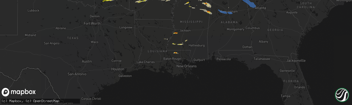
Hail Map on March 9, 2026
The weather event on March 9, 2026 includes Hail, Wind, and Tornado maps. 7 states and 200 cities were impacted and suffered possible damage. The total estimated number of properties impacted is 24,951.
Hail
Wind
Tornado
24,951
Estimated number of impacted properties by a 1.00" hail or larger5,186
Estimated number of impacted properties by a 1.75" hail or larger0
Estimated number of impacted properties by a 2.50" hail or largerStates Impacted by Hail Map on March 9, 2026
Storm reports
Georgia
| Date | Description |
|---|---|
| 03/08/202611:20 PM CDT | Tree down near the intersection of jordan dr and oneal dr. |
| 03/08/202610:15 PM CDT | Ema reports a few trees down in the chapel hill rd area. |
| 03/08/202610:15 PM CDT | Ema reports a tree down on the roadway on the 2000 block of austin bridge rd. |
| 03/08/20269:07 PM CDT | Ema reports a tree down on a power line on the 2000 block of scoggins rd. |
| 03/08/20268:47 PM CDT | A county official reported several snapped trees and a damaged pole barn near the intersection of true gospel road and highway 113. Radar estimates wind speeds of 70-75 |
| 03/08/20268:27 PM CDT | Cedartown police reported quarter-size hail on philpot street. |
Arizona
| Date | Description |
|---|---|
| 03/08/20267:55 PM CDT | Wind damage to a portico attached to a mobile home at an rv park near u.s. 60 and goldfield road. Nearby observing stations reported wind gusts 30 to 40 mph at the time |
Alabama
| Date | Description |
|---|---|
| 03/09/20266:50 PM CDT | Reports of gusty winds and a few tree down reports in blount county. Altoona... Blountsville... Brooksville. |
| 03/09/20266:35 PM CDT | Damage to the canopy of a gas station was reported at 7810 al highway 69. |
| 03/09/20266:19 PM CDT | A tree was knocked down into the roadway at 200 mt. Carmel road. Time estimated by radar. |
| 03/09/20265:49 PM CDT | A tree and some powerlines were reported down near the intersection of alabama highway 33 and cr 6. |
| 03/09/20265:32 PM CDT | Damage involving trees and structures. |
| 03/09/20265:17 PM CDT | A tree was knocked down blocking the road at 501 cr 413. Time estimated by radar. |
| 03/09/20265:14 PM CDT | Lots of trees and power lines were reported down along highway 38 between phil campbell and russellville. |
| 03/09/20265:12 PM CDT | Lots of trees/power lines were reported down along highway 34 between phil campbell and russellville. |
| 03/08/20269:02 PM CDT | Reports of power lines down. Time estimated from radar. |
| 03/08/20268:12 PM CDT | Reports of trees down and halls chapel road blocked off. Time estimated from radar. |
| 03/08/20268:12 PM CDT | Trees down in the homewood area. |
| 03/08/20268:11 PM CDT | Trees down in the vestavia hills area. |
| 03/08/20268:10 PM CDT | Corrects previous tstm wnd dmg report from hoover for time. Trees down in the hoover area. |
| 03/08/20268:06 PM CDT | Trees down on shades crest road. |
| 03/08/20267:58 PM CDT | Trees down in the bessemer area... Some involving power lines. |
| 03/08/20267:57 PM CDT | Large oak tree downed... Taking out a fence. |
| 03/08/20267:50 PM CDT | Roof blown off chicken houses. |
| 03/08/20267:46 PM CDT | Trees downed on the north side of weiss lake. |
| 03/08/20267:46 PM CDT | Trees down in the area of mud creek road and groundhog road. |
| 03/08/20267:46 PM CDT | Trees down in the gaylesville area. |
| 03/08/20267:43 PM CDT | Trees downed in the blanche area. |
| 03/08/20267:40 PM CDT | Trees down in the leesburg area. |
| 03/08/20267:40 PM CDT | Heavy tree fall on betty hill road. Fd conducting search operations and are having to cut their way through. |
| 03/08/20267:26 PM CDT | Trees and powerlines downed. |
| 03/08/20267:10 PM CDT | Trees down in the hoover area. |
| 03/08/20267:05 PM CDT | An 18-wheeler/semi/big rig was flipped on highway 13 near the tuscaloosa county line. |
Arkansas
| Date | Description |
|---|---|
| 03/09/202612:20 PM CDT | At least quarter size hail reported near white hall. |
Mississippi
| Date | Description |
|---|---|
| 03/09/20266:03 PM CDT | Report of a tree down on old highway 6. Time estimated from radar. |
| 03/09/20266:00 PM CDT | A local report indicates 1.00 inch wind near Amory |
| 03/09/20265:57 PM CDT | A local report indicates 1.00 inch wind near New Wren |
| 03/09/20265:55 PM CDT | Motorist reports having to pull off the highway near central grove road due to quarter sized hail falling. |
| 03/09/20265:43 PM CDT | A local report indicates 1.00 inch wind near 2 SSW Norfield |
| 03/09/20265:04 PM CDT | A local report indicates 1.00 inch wind near Geeslin Corner |
| 03/09/20264:42 PM CDT | Several power poles snapped. |
| 03/09/20264:32 PM CDT | Hail up to half dollar size in meadville. |
| 03/09/20264:15 PM CDT | Tree down on liberty road. |
| 03/09/20264:00 PM CDT | Trees down near commerce dr and hwy 7. |
| 03/08/20268:41 PM CDT | A few trees down and some with tops broken out. |
| 03/08/20268:26 PM CDT | Tree down on a home... 4 total trees down on the property... Along old hwy 27 n. |
| 03/08/20268:15 PM CDT | Several trees down along with some power lines and poles. |
| 03/08/20268:15 PM CDT | Nickel to quarter size hail was beginning to accumulate near mt. Vernon church. |
| 03/08/20268:15 PM CDT | A local report indicates 1.50 inch wind near Oakland |
| 03/08/20268:13 PM CDT | A local report indicates 1.50 inch wind near 1 NW New Hope |
| 03/08/20268:07 PM CDT | A tree fell onto a home in the 800 block of alabama street and in the 200 block of taylor street. Scattered power lines were also downed... Including a transformer down |
| 03/08/20268:07 PM CDT | A tree was blown down onto a home in the 900 block of waterworks road in columbus. |
| 03/08/20268:07 PM CDT | Pictures from 0.6 miles north of main street in columbus showed hail the size of quarters. |
| 03/08/20268:06 PM CDT | Trees on homes at 121 and 126 gaylane drive. |
| 03/08/20267:33 PM CDT | Multiple trees were downed around west point. One home had a tree down on it. |
| 03/08/20267:33 PM CDT | Multiple trees were downed around west point. |
Tennessee
| Date | Description |
|---|---|
| 03/09/20263:13 PM CDT | Tree blocking roadway south of pocahontas. |
Louisiana
| Date | Description |
|---|---|
| 03/09/20266:30 PM CDT | Broadcast media submitted viewer photo of quarter sized hail on hatcher road east of clinton. Time estimated by radar. |
| 03/09/20262:25 PM CDT | Multiple trees were downed across northern catahoula parish... Some blocking roads including at the la hwy 124 and tew lake rd intersection. |
Cities Impacted by Hail Map on March 9, 2026
- Caney, OK
- Atoka, OK
- Caddo, OK
- Lane, OK
- Antlers, OK
- Moyers, OK
- Rattan, OK
- Snow, OK
- Finley, OK
- Nashoba, OK
- Clayton, OK
- Milburn, OK
- Kenefic, OK
- Coleman, OK
- Talihina, OK
- Honobia, OK
- Albion, OK
- Broken Bow, OK
- Bethel, OK
- Smithville, OK
- Watson, OK
- Mena, AR
- Cove, AR
- Booneville, AR
- Magazine, AR
- Hatfield, AR
- Vandervoort, AR
- Dierks, AR
- Nashville, AR
- Paris, AR
- Norman, AR
- Caddo Gap, AR
- Heavener, OK
- Murfreesboro, AR
- Waldron, AR
- Mount Ida, AR
- Kirby, AR
- Scranton, AR
- Delight, AR
- Amity, AR
- Hattieville, AR
- Cleveland, AR
- Center Ridge, AR
- Okolona, AR
- Arkadelphia, AR
- Donaldson, AR
- Malvern, AR
- Prattsville, AR
- Bismarck, AR
- Leola, AR
- Sheridan, AR
- Ozone, AR
- White Hall, AR
- Subiaco, AR
- Traskwood, AR
- Poyen, AR
- New Blaine, AR
- Hagarville, AR
- Lamar, AR
- Jefferson, AR
- Pine Bluff, AR
- Sherrill, AR
- Altheimer, AR
- Grady, AR
- Wabbaseka, AR
- Stuttgart, AR
- De Witt, AR
- Almyra, AR
- Gillett, AR
- Jonesville, LA
- Harrisonburg, LA
- Sicily Island, LA
- Clayton, LA
- Ferriday, LA
- Calhoun City, MS
- Vardaman, MS
- Roxie, MS
- Oxford, MS
- Charleston, MS
- Glendora, MS
- Meadville, MS
- Philipp, MS
- Thaxton, MS
- Gloster, MS
- Liberty, MS
- Pontotoc, MS
- Vina, AL
- Hodges, AL
- Grenada, MS
- Holcomb, MS
- Cascilla, MS
- Coffeeville, MS
- Smithdale, MS
- Hackleburg, AL
- Phil Campbell, AL
- Spruce Pine, AL
- Bogue Chitto, MS
- Summit, MS
- Gore Springs, MS
- Duck Hill, MS
- Nettleton, MS
- Shannon, MS
- Okolona, MS
- Plantersville, MS
- Huntsville, AL
- Aberdeen, MS
- Amory, MS
- Clinton, LA
- Slaughter, LA
- Caledonia, MS
- Hamilton, MS
- Smithville, MS
- Greenwood Springs, MS
- Ethel, LA
- Ruth, MS
- Gattman, MS
- Sulligent, AL
- Greensburg, LA
- Mantee, MS
- Berry, AL
- Pheba, MS
- Dora, AL
- Bankston, AL
- Port Gibson, MS
- Warrior, AL
- Vicksburg, MS
- Northport, AL
- Tuscaloosa, AL
- Brookwood, AL
- Adger, AL
- Kearny, AZ
- West Point, MS
- Cedarbluff, MS
- Utica, MS
- Morris, AL
- Gardendale, AL
- Kimberly, AL
- Starkville, MS
- Hermanville, MS
- Bessemer, AL
- Columbus, MS
- Tutwiler, MS
- Oakland, MS
- Tillatoba, MS
- Amite, LA
- Roseland, LA
- Kentwood, LA
- Steens, MS
- Ethelsville, AL
- Birmingham, AL
- Pelham, AL
- Sterrett, AL
- Chelsea, AL
- Mentone, AL
- Cedar Bluff, AL
- Centre, AL
- Leesburg, AL
- Collinsville, AL
- Fort Payne, AL
- Gaylesville, AL
- Rome, GA
- Lyerly, GA
- Piedmont, AL
- Cave Spring, GA
- Cedartown, GA
- Lindale, GA
- Taylorsville, GA
- Silver Creek, GA
- Aragon, GA
- Rockmart, GA
- Dallas, GA
- Kingston, GA
- Cartersville, GA
- Monticello, MS
- Buchanan, GA
- Temple, GA
- Acworth, GA
- Silver Creek, MS
- Sontag, MS
- Carrollton, AL
- Randolph, MS
- Prentiss, MS
- Reform, AL
- Douglasville, GA
- Hiram, GA
- Villa Rica, GA
- Powder Springs, GA
- Sylacauga, AL
- Calera, AL
- Jemison, AL
- Bremen, GA
- Shelby, AL
- Enid, MS
- Tupelo, MS
- Jayess, MS
- Brookhaven, MS
- Houlka, MS
- Scobey, MS
- Haleyville, AL
- Double Springs, AL