Hail Map on April 3, 2026
The weather event on April 3, 2026 includes Hail, Tornado, and Wind maps. 14 states and 363 cities were impacted and suffered possible damage. The total estimated number of properties impacted is 37,867.
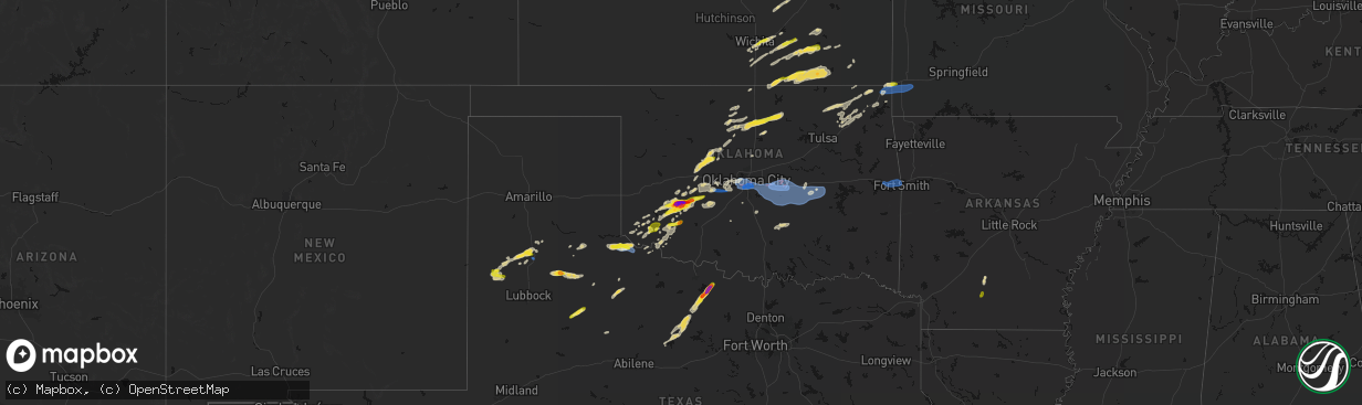
Hail
Tornado
Wind
37,867
Estimated number of impacted properties by a 1.00" hail or larger7,596
Estimated number of impacted properties by a 1.75" hail or larger1,547
Estimated number of impacted properties by a 2.50" hail or largerStates Impacted by Hail Map on April 3, 2026
Storm reports
Texas
| Date | Description |
|---|---|
| 04/03/20263:15 AM CDT | A few trees...power lines...and power poles blown down in nocona. |
| 04/03/20262:26 AM CDT | A local report indicates 58 MPH wind near 1 NNE Sheppard Afb |
| 04/02/202611:50 PM CDT | 30x30 metal carport blown into the street by the county hospital. |
| 04/02/202611:50 PM CDT | Corrects previous tstm wnd dmg report from quanah. Shared images of a center irrigation pivot overturned and 30x30 metal carport blown into the street in quanah. |
| 04/02/202611:40 PM CDT | A local report indicates 86 MPH wind near 3 WNW Goodlett |
| 04/02/202611:25 PM CDT | Portions of roof blown off a gas station in plainview. Time estimated from radar. |
| 04/02/202611:10 PM CDT | A local report indicates 1.00 inch wind near 7 NW Childress |
| 04/02/202611:00 PM CDT | Photo shows several hailstones a bit bigger than quarter size. Location estimated from radar. |
| 04/02/202610:55 PM CDT | Plenty of hail with stones up to about quarter size. Time estimated from radar. |
| 04/02/202610:54 PM CDT | Severe gust associated with outflow from approaching storm. Additional gust to 59 mph measured at 1056 pm. |
Indiana
| Date | Description |
|---|---|
| 04/03/20264:13 PM CDT | Time estimated from radar. |
Oklahoma
| Date | Description |
|---|---|
| 04/03/20266:51 PM CDT | A local report indicates 1.25 inch wind near 3 W Altus |
| 04/03/20266:38 PM CDT | A local report indicates 1.00 inch wind near 4 NE Hobart |
| 04/03/20263:48 PM CDT | Report from mping: hen egg |
| 04/03/20263:32 PM CDT | A local report indicates 1.00 inch wind near Mountain View |
| 04/03/20261:24 AM CDT | Strong thunderstorm wind damaged an outbuilding. |
| 04/02/202610:12 PM CDT | A local report indicates 81 MPH wind near 3 N Little |
| 04/02/202610:00 PM CDT | A local report indicates 62 MPH wind near 3 NNW Shawnee |
| 04/02/20269:50 PM CDT | Estimated 70 to 75 mph winds. |
| 04/02/20269:43 PM CDT | Delayed report. Social media report of a tree blown down along south harrah road. Time estimated by radar. |
| 04/02/20269:27 PM CDT | Delayed report. Social media report of trees down near reno avenue and woodside drive. Time estimated by radar. |
| 04/02/20269:25 PM CDT | Damaged powerlines. |
| 04/02/20269:25 PM CDT | A local report indicates 80 MPH wind near 3 SW Tinker Air Force B |
| 04/02/20269:15 PM CDT | Downed powerlines. |
| 04/02/20269:15 PM CDT | Downed powerlines. |
| 04/02/20269:12 PM CDT | Downed powerlines. |
| 04/02/20269:07 PM CDT | Downed powerlines. |
| 04/02/20269:05 PM CDT | Delayed report. Social media image showing a large tree snapped in half. Time estimated by radar. |
| 04/02/20269:05 PM CDT | Downed trees. |
| 04/02/20269:03 PM CDT | A local report indicates 63 MPH wind near 7 WSW Valley Brook |
| 04/02/20267:16 PM CDT | A local report indicates 2.00 inch wind near 2 E Gotebo |
| 04/02/20267:13 PM CDT | A local report indicates 2.75 inch wind near Mountain View |
| 04/02/20267:06 PM CDT | A local report indicates 1.50 inch wind near 2 E Gotebo |
| 04/02/20267:05 PM CDT | A local report indicates 1.75 inch wind near Mountain View |
| 04/02/20267:03 PM CDT | A local report indicates 2.00 inch wind near 1 E Gotebo |
Ohio
| Date | Description |
|---|---|
| 04/02/20269:57 PM CDT | A local report indicates 1.00 inch wind near 1 E Marion |
| 04/02/20269:55 PM CDT | A local report indicates 1.00 inch wind near Marion |
Wisconsin
| Date | Description |
|---|---|
| 04/02/20268:56 PM CDT | A local report indicates 1.00 inch wind near 1 SE Lake Geneva |
Kansas
| Date | Description |
|---|---|
| 04/03/20263:11 PM CDT | A local report indicates 1.00 inch wind near 1 NNE Andover |
| 04/03/20263:01 PM CDT | Report from mping: quarter |
Georgia
| Date | Description |
|---|---|
| 04/03/20264:16 PM CDT | Tree down near jacob hall road and chula brookfield road. |
| 04/03/20263:00 PM CDT | Report of quarter size hail from the moultrie area. |
| 04/03/20262:50 PM CDT | Tree across entire roadway at old berlin road and horseshoe drive. |
Missouri
| Date | Description |
|---|---|
| 04/03/20264:10 PM CDT | Report from mping: quarter |
| 04/03/20263:42 PM CDT | Report from mping: quarter |
| 04/03/20263:42 PM CDT | Report from mping: quarter |
| 04/03/20263:35 PM CDT | Report of golf ball sized hail. Time estimated from radar. |
| 04/02/202611:39 PM CDT | Quarter sized hail reported at redings mill fire department. |
Iowa
| Date | Description |
|---|---|
| 04/03/20265:02 PM CDT | Largest hail to ping pong ball. |
| 04/03/20265:00 PM CDT | Relayed from media. Time estimated from radar. |
Nebraska
| Date | Description |
|---|---|
| 04/03/20263:02 PM CDT | Public report of hail estimated up to quarter sized. |
Illinois
| Date | Description |
|---|---|
| 04/03/20266:55 PM CDT | A local report indicates 1.00 inch wind near Forest City |
| 04/03/20266:45 PM CDT | Powerlines down on manito blacktop road. |
| 04/03/20266:33 PM CDT | Powerlines down in the topeka area. |
| 04/03/20266:32 PM CDT | Two large trees were blown over. |
| 04/03/20266:32 PM CDT | A local report indicates 2.00 inch wind near 4 E Havana |
| 04/03/20266:17 PM CDT | A local report indicates 1.00 inch wind near 3 SSE Tremont |
| 04/03/20266:03 PM CDT | A local report indicates a tornado near 4 SW Hopedale |
| 04/03/20266:02 PM CDT | Tornado touched down then lifted... Rotating wall cloud shortly after. |
| 04/03/20265:23 PM CDT | A local report indicates 2.00 inch wind near Forest City |
| 04/03/20265:21 PM CDT | A local report indicates 1.00 inch wind near Manito |
| 04/02/20267:18 PM CDT | A local report indicates 1.00 inch wind near Danvers |
Arkansas
| Date | Description |
|---|---|
| 04/03/20265:59 PM CDT | Multiple trees reported down on arkansas highway 7 in the harmony grove area. |
| 04/03/20265:54 PM CDT | Quarter-sized hail reported in the city of camden via the 911 call center. |
| 04/03/20262:05 AM CDT | Tree down north of rudy reported by emergency manager. Time approximated based on radar data. |
| 04/03/20261:46 AM CDT | Picture sent in from broadcast media of tree blocking road near moss rd and richmond rd. Time approximated from radar data. |
| 04/03/20261:44 AM CDT | Large portion of a tree down and up against a house on sylvan hills road. Time approximated from radar data. |
| 04/03/20261:43 AM CDT | Strong thunderstorm wind blew down a tree on riverfront drive near williams lane. |
Cities Impacted by Hail Map on April 3, 2026
- Dawson, NE
- Humboldt, NE
- Du Bois, NE
- Stella, NE
- Verdon, NE
- Moultrie, GA
- Pavo, GA
- Wichita, KS
- Clearwater, KS
- Auburn, NE
- Chillicothe, TX
- Vernon, TX
- Shubert, NE
- Nemaha, NE
- Old Town, FL
- Trenton, FL
- Haysville, KS
- Mcconnell Afb, KS
- Derby, KS
- Wellington, KS
- Florence, KS
- Peck, KS
- Rock Port, MO
- Andover, KS
- Cedar Point, KS
- Belle Plaine, KS
- Pond Creek, OK
- Peru, NE
- Fairfax, MO
- Tarkio, MO
- Falls City, NE
- Enid, OK
- Augusta, KS
- Gotebo, OK
- Mountain View, OK
- Elmdale, KS
- Sidney, IA
- Madison, FL
- Plattsmouth, NE
- Kremlin, OK
- Medford, OK
- Cottonwood Falls, KS
- Franklin, IN
- Tipton, OK
- Elmer, OK
- El Dorado, KS
- Towanda, KS
- Logan, IA
- Douglass, KS
- Udall, KS
- Mulvane, KS
- Hunter, OK
- Nardin, OK
- Braman, OK
- Lamont, OK
- Carnegie, OK
- Cordell, OK
- Westboro, MO
- Frederick, OK
- Geary, OK
- Hydro, OK
- Fairmont, OK
- Waukomis, OK
- Burlington Junction, MO
- Elmo, MO
- Clearmont, MO
- Greenfield, OK
- Watonga, OK
- Garber, OK
- Leon, KS
- Douglas, OK
- Campbellton, FL
- Graceville, FL
- Inglis, FL
- Roosevelt, OK
- Loyal, OK
- Omega, OK
- Kingfisher, OK
- Hobart, OK
- Winfield, KS
- Atlanta, KS
- Snyder, OK
- Billings, OK
- Hennessey, OK
- Fort Cobb, OK
- Hopkins, MO
- Braddyville, IA
- Bedford, IA
- Okarche, OK
- Covington, OK
- Snyder, TX
- Arkansas City, KS
- Newkirk, OK
- Yankeetown, FL
- Rock, KS
- Cottonwood, AL
- Slocomb, AL
- Latham, KS
- Fowler, IN
- Justiceburg, TX
- Girard, TX
- Topeka, IL
- Havana, IL
- Gracemont, OK
- Forest City, IL
- Manito, IL
- Perry, OK
- Easton, IL
- Mount Gilead, OH
- Bellville, OH
- Calumet, OK
- Piedmont, KS
- Red Rock, OK
- Maple City, KS
- Blockton, IA
- Sheridan, MO
- Perrysville, OH
- Otterbein, IN
- Paducah, TX
- Corning, IA
- Gravity, IA
- Cambridge, KS
- Burden, KS
- Green Valley, IL
- West Lafayette, IN
- Versailles, IL
- Grenola, KS
- Dexter, KS
- Danville, IL
- Eureka, KS
- San Jose, IL
- New Market, IA
- Clearfield, IA
- Benton, IA
- Crystal River, FL
- Cedar Vale, KS
- Morrison, OK
- Howard, KS
- Delavan, IL
- Tremont, IL
- Lafayette, IN
- Diagonal, IA
- Pekin, IL
- South Pekin, IL
- Severy, KS
- Lewistown, IL
- Toronto, KS
- Neal, KS
- Newton, GA
- Hopedale, IL
- Fall River, KS
- Pawnee, OK
- Ralston, OK
- Virgil, KS
- Rocky, OK
- Cissna Park, IL
- Rankin, IL
- Sedan, KS
- Lone Wolf, OK
- Galveston, IN
- Mackinaw, IL
- Fairfax, OK
- Edison, OH
- Cardington, OH
- Milford, IL
- Hoopeston, IL
- Bath, IL
- Sparkman, AR
- Rushville, MO
- De Kalb, MO
- Peoria, IL
- Mapleton, IL
- Glasford, IL
- Canton, IL
- Camden, AR
- Stillwater, OK
- Astoria, IL
- Mount Ayr, IA
- Ellston, IA
- Tingley, IA
- Mangum, OK
- Killbuck, OH
- Millersburg, OH
- Stanford, IL
- Danvers, IL
- Minier, IL
- Bearden, AR
- Colony, OK
- Longton, KS
- Altus, OK
- Olustee, OK
- Gould, OK
- Mason City, IL
- Fredonia, KS
- Elk City, KS
- Altus Afb, OK
- Hinton, OK
- Carlock, IL
- Blair, OK
- Morton, IL
- Peru, KS
- Butler, OH
- Fredericktown, OH
- Binger, OK
- Headrick, OK
- Eldorado, OK
- Deer Creek, IL
- Benedict, KS
- Havana, KS
- Lookeba, OK
- Claremore, OK
- El Paso, IL
- Congerville, IL
- Independence, KS
- Breckenridge, TX
- Liverpool, IL
- Duke, OK
- Chelsea, OK
- Glenmont, OH
- Graham, TX
- South Bend, TX
- Woodson, TX
- Union City, OK
- El Reno, OK
- Anadarko, OK
- Minco, OK
- Rushsylvania, OH
- La Rue, OH
- New Bloomington, OH
- Marion, OH
- Prospect, OH
- Goodfield, IL
- Apache, OK
- Ramona, OK
- Ochelata, OK
- Bartlesville, OK
- Green Camp, OH
- Newcastle, TX
- Warsaw, OH
- Caledonia, OH
- Galesburg, KS
- Parsons, KS
- Brinkhaven, OH
- Blissfield, OH
- Baltic, OH
- Coshocton, OH
- Dennis, KS
- Cherryvale, KS
- Adair, OK
- Big Cabin, OK
- Vinita, OK
- Nowata, OK
- Fresno, OH
- Olney, TX
- Dover, OK
- Tuttle, OK
- Yukon, OK
- East Peoria, IL
- Groveland, IL
- Mustang, OK
- Loving, TX
- Decatur, IN
- Windthorst, TX
- Oklahoma City, OK
- Wheatland, OK
- Fairland, OK
- Henrietta, TX
- Afton, OK
- Hoagland, IN
- Monroeville, IN
- Jacksboro, TX
- Delaware, OK
- Bethany, OK
- Marshall, OK
- Newalla, OK
- Choctaw, OK
- Norman, OK
- Lucien, OK
- Guthrie, OK
- Hudson, IL
- Mcloud, OK
- Shawnee, OK
- Tecumseh, OK
- Spencerville, OH
- Venedocia, OH
- Delphos, OH
- Blanchard, OK
- Wyandotte, OK
- Macomb, OK
- Welch, OK
- Bluejacket, OK
- Talala, OK
- Mountain Park, OK
- Lima, OH
- Prague, OK
- Meeker, OK
- Asher, OK
- Earlsboro, OK
- Maud, OK
- Seminole, OK
- Okemah, OK
- Amherst, TX
- Quitaque, TX
- Tulia, TX
- Wewoka, OK
- Bowlegs, OK
- Konawa, OK
- Paden, OK
- Wetumka, OK
- Fieldton, TX
- Earth, TX
- Kress, TX
- Ridgeway, OH
- Albany, TX
- Lafayette, OH
- Harrod, OH
- Ada, OH
- Olton, TX
- Plainview, TX
- Holdenville, OK
- Littlefield, TX
- Ada, OK
- Roff, OK
- Alger, OH
- Bluffton, OH
- Miami, OK
- Weleetka, OK
- Dustin, OK
- Dola, OH
- Kenton, OH
- Henryetta, OK
- Quapaw, OK
- Eufaula, OK
- Hanna, OK
- Joplin, MO
- Neosho, MO
- Childress, TX
- Baxter Springs, KS
- Galena, KS
- Seneca, MO
- Quanah, TX
- Wayne, OK
- Lexington, OK
- Diamond, MO
- Granby, MO
- Turkey, TX
- Aspermont, TX
- Pierce City, MO
- Hale Center, TX
- Floydada, TX
- Matador, TX
- Sallisaw, OK
- Gans, OK
- Muldrow, OK
- Roland, OK
- Lake Geneva, WI
- Roaring Springs, TX
- Burlington, WI
- Van Buren, AR
- Fort Smith, AR
- Kilbourne, IL
- Browning, IL
- Lockney, TX