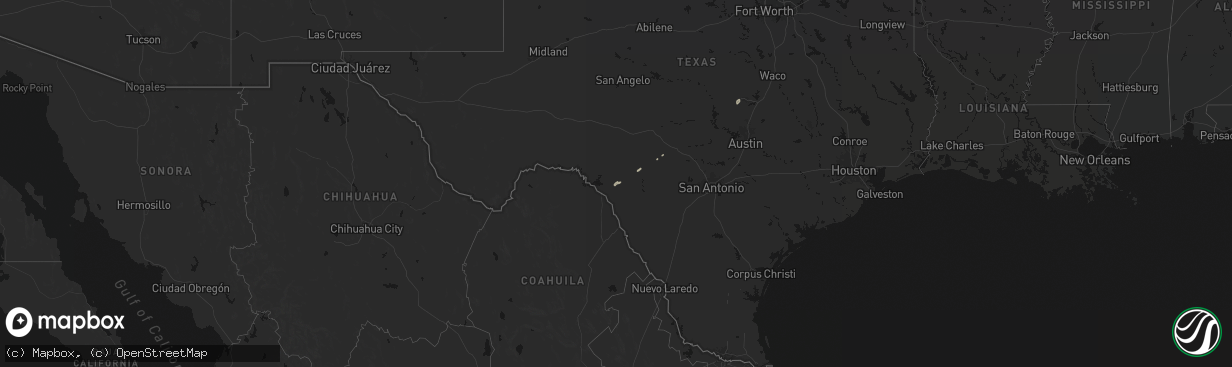
Hail Map on April 12, 2026
The weather event on April 12, 2026 includes Wind, Hail, and Tornado maps. 3 states and 50 cities were impacted and suffered possible damage. The total estimated number of properties impacted is 1,185.
Wind
Hail
Tornado
1,185
Estimated number of impacted properties by a 1.00" hail or larger8
Estimated number of impacted properties by a 1.75" hail or larger0
Estimated number of impacted properties by a 2.50" hail or largerStorm reports
Nevada
| Date | Description |
|---|---|
| 04/12/20265:59 PM CDT | A local report indicates 64 MPH wind near Mountain Springs |
Utah
| Date | Description |
|---|---|
| 04/12/20263:55 PM CDT | Cenews station reported a 59 mph gust. |
| 04/12/20263:34 PM CDT | Public report of a large hardwood tree snapped near the base. Time estimated by radar and time of report received. |
| 04/12/20263:10 PM CDT | Hill afb asos reported a 60 mph wind gust. |
| 04/12/20262:10 PM CDT | Udot i-15 at willard poe reported a gust of 60 mph. |
| 04/11/202610:30 PM CDT | Mesonet station utpch i-15 at pine creek hill. |
| 04/11/202610:16 PM CDT | Asos station kmlf milford municipal airport. |
Minnesota
| Date | Description |
|---|---|
| 04/12/20266:19 PM CDT | Reported via spotternetwork. |
Idaho
| Date | Description |
|---|---|
| 04/12/20264:55 PM CDT | Specific manufacturing inl site. |
| 04/12/20264:50 PM CDT | Specific manufacturing inl site. |
| 04/12/20264:45 PM CDT | Rover mesonet site. |
| 04/12/20264:45 PM CDT | Junction 33/22 summit itd mesonet site. |
| 04/12/20264:40 PM CDT | A local report indicates 61 MPH wind near 1 NE Terreton |
| 04/12/20264:35 PM CDT | A local report indicates 59 MPH wind near 1 NE Terreton |
| 04/12/20264:30 PM CDT | Relay ridge. |
| 04/12/20264:10 PM CDT | Medicine lodge mesonet site. |
| 04/12/20264:00 PM CDT | Tilden flats itd site. |
| 04/12/20264:00 PM CDT | Inl puzzle mesonet site. |
| 04/12/20263:50 PM CDT | Taber mesonet site. |
| 04/12/20263:45 PM CDT | Tom cat summit itd site. |
| 04/12/20263:34 PM CDT | A local report indicates 60 MPH wind near 1 NE Aberdeen |
| 04/12/20263:33 PM CDT | Pocatello regional airport asos. |
| 04/12/20263:30 PM CDT | Sterling itd mesonet site. |
| 04/12/20263:20 PM CDT | A local report indicates 58 MPH wind near 1 NE Aberdeen |
| 04/12/20263:00 PM CDT | Coldwater itd mesonet. |
| 04/12/20262:45 PM CDT | Yale itd mesonet site. |
| 04/12/20262:45 PM CDT | Tom cat summit itd site. |
Montana
| Date | Description |
|---|---|
| 04/11/20267:15 PM CDT | 61 mph convective wind gust. Mesonet station mtnor norris hill |
Texas
| Date | Description |
|---|---|
| 04/12/20265:48 PM CDT | Memphis wtm gust to 59 mph at 5:48 pm cdt. |
| 04/12/20263:26 PM CDT | Report from mping: quarter |
| 04/12/202612:51 PM CDT | Wind damage with a tree down or two... Minor structural damage... And a tossed trampoline or two in southwestern portions of schulenburg. The radar had indicated a micr |
Cities Impacted by Hail Map on April 12, 2026
- Brackettville, TX
- Barksdale, TX
- Camp Wood, TX
- Hunt, TX
- Schulenburg, TX
- Kempner, TX
- Killeen, TX
- Copperas Cove, TX
- Fort Hood, TX
- Sealy, TX
- Cat Spring, TX
- Gatesville, TX
- Brookshire, TX
- American Falls, ID
- Aberdeen, ID
- Fort Stockton, TX
- Burnet, TX
- Houston, TX
- Cypress, TX
- Katy, TX
- Clifton, TX
- Valley Mills, TX
- Meridian, TX
- Morgan, TX
- Meadowlands, MN
- Cotton, MN
- Canyon, MN
- Duluth, MN
- Art, TX
- Memphis, TX
- Wellington, TX
- Hedley, TX
- San Saba, TX
- Pontotoc, TX
- Goldthwaite, TX
- Valley Spring, TX
- Cherokee, TX
- Waxahachie, TX
- Tow, TX
- Lometa, TX
- Lampasas, TX
- Somerville, TX
- Rockdale, TX
- Caldwell, TX
- Bryan, TX
- Waco, TX
- Lorena, TX
- College Station, TX
- Hewitt, TX
- Woodway, TX