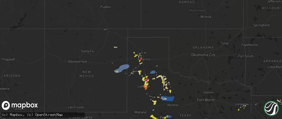
Hail Map on May 22, 2026
The weather event on May 22, 2026 includes Tornado, Wind, and Hail maps. 12 states and 382 cities were impacted and suffered possible damage. The total estimated number of properties impacted is 73,226.
Tornado
Wind
Hail
73,226
Estimated number of impacted properties by a 1.00" hail or larger7,955
Estimated number of impacted properties by a 1.75" hail or larger2,117
Estimated number of impacted properties by a 2.50" hail or largerStates Impacted by Hail Map on May 22, 2026
Storm reports
Kentucky
| Date | Description |
|---|---|
| 05/21/20267:02 PM CDT | Nws storm survey confirmed ef0 85 mph peak wind tornado occurred with a width of 30 yards and length of 0.32 miles. |
Nebraska
| Date | Description |
|---|---|
| 05/22/20265:44 PM CDT | Trained spotter report supported by a photograph of a brief tornado touching down near murrary... Nebraska. |
Iowa
| Date | Description |
|---|---|
| 05/22/20265:16 PM CDT | Very brief touchdown documented via two independent photos. |
Georgia
| Date | Description |
|---|---|
| 05/22/20266:06 PM CDT | Tree down on a power line near carroll ulmer road and dasher road. |
| 05/22/20265:30 PM CDT | Lee county dispatch reports a power line down on batts rd near state road 195. |
| 05/22/20265:20 PM CDT | Em reports tree down at the 300 block of stembridge rd se. |
| 05/22/20265:18 PM CDT | Tree down near intersection of south main street and third street per em. |
| 05/22/20265:15 PM CDT | Tree down near intersection of pettigrew rd nw and wilson drive nw per em. |
| 05/22/20265:15 PM CDT | Em reports a tree down at lawrence rd nw and fishing creek church rd nw. |
| 05/22/20264:59 PM CDT | Mping report of 3 inch limbs broken. |
| 05/22/20264:51 PM CDT | Lee county dispatch reports a tree down in the 200 block of crotwell rd. |
| 05/22/20264:33 PM CDT | Em reports multiple trees down along the 1100 block of jackson springs rd in macon ga. |
| 05/22/20264:31 PM CDT | Em reported destruction of gas station canopy. |
| 05/22/20264:25 PM CDT | Spotter reports tree branches down with power outages reported. Time estimated by radar. |
| 05/22/20264:23 PM CDT | Tree on house at intersection of e6th ave and depot ln. |
| 05/22/20264:19 PM CDT | Tree down in sasser. |
| 05/22/20263:10 PM CDT | Tree down across roadway near intersection of piedmont way and montgomery ferry drive. |
| 05/22/20263:10 PM CDT | Irwin county dispatch reports a tree down on a car in ocilla. |
| 05/22/20263:01 PM CDT | Tree reported down on powerline in sycamore. |
| 05/22/20263:00 PM CDT | Several trees down near smith road and pobiddy rd. |
| 05/22/20262:50 PM CDT | Tree down at geneva rd and putville st. |
| 05/22/20262:40 PM CDT | A few trees reported down in tift county. |
| 05/22/20262:38 PM CDT | Worth county dispatch reports a tree down on mt horeb rd near oakfield. |
| 05/22/20262:30 PM CDT | Fallen trees on sr 36 eastbound at graves springs st. All lanes closed. |
| 05/22/20262:30 PM CDT | Lee county dispatch reports a tree down near hwy 32 and philema rd. |
| 05/22/20262:30 PM CDT | Lee county dispatch reports tree down near hwy 32 and palmyra rd. |
| 05/22/20262:15 PM CDT | Ten or more trees down in the vicinity of billings rd and old dominion rd. |
| 05/22/20262:10 PM CDT | Tree reported down near rosebrier avenue and south mock road. |
| 05/22/20262:05 PM CDT | Spotter reported tree knocked down. |
| 05/22/20262:00 PM CDT | Tree reported down near liberty expressway and moultrie road. |
Texas
| Date | Description |
|---|---|
| 05/22/20266:57 PM CDT | Measured 2.18 inch hail. Time is estimated based on radar. |
| 05/22/20266:53 PM CDT | Report from mping: half dollar |
| 05/22/20266:26 PM CDT | Multiple reports of a dusty tornado. |
| 05/22/20266:11 PM CDT | [landspout] spotter reported a landspout near fluvanna lasting about 7 minutes. |
| 05/22/20266:10 PM CDT | Report from mping: tennis ball |
| 05/22/20266:09 PM CDT | [landspout] spotter report of a landspout. |
| 05/22/20266:09 PM CDT | [landspout] media report of landspout near edmonson. |
| 05/22/20266:00 PM CDT | Report from mping: hen egg+ |
| 05/22/20265:56 PM CDT | Report from mping: ping pong ball |
| 05/22/20265:56 PM CDT | Picture reported on social. |
| 05/22/20265:50 PM CDT | Report from mping: quarter |
| 05/22/20265:48 PM CDT | A local report indicates 1.75 inch wind near 10 SW Aiken |
| 05/22/20265:45 PM CDT | Report from mping: quarter |
| 05/22/20265:43 PM CDT | Report from mping: quarter |
| 05/22/20265:42 PM CDT | [landspout] spotter network report of a landspout. |
| 05/22/20265:34 PM CDT | [landspout] spotter report of a landspout. |
| 05/22/20265:30 PM CDT | A quarter inch hail was reported by the public in sarita... Tx. The report was from a photo posted onto our nwschat 2.0/slack page. Time radar estimated. |
| 05/22/20265:27 PM CDT | [landspout] corrects previous landspout report from 6 s lazbuddie. Spotter report of a landspout. |
| 05/22/20265:27 PM CDT | [landspout] spotter report of a landspout. |
| 05/22/20265:20 PM CDT | Media viewer sent in hail picture. |
| 05/22/20265:09 PM CDT | Isolated quarter size hail... But mostly dime and smaller. |
| 05/22/20265:02 PM CDT | [landspout] multiple reports on x from chasers of landspouts. |
| 05/22/20264:25 PM CDT | [landspout] report of small funnel halfway up to cloud. |
| 05/22/20263:35 PM CDT | A local report indicates 58 MPH wind near 2 S Brownfield |
| 05/22/20266:54 AM CDT | Report of tree down on red bull drive north of harleton... Tx near lake deerwood. |
| 05/22/20266:45 AM CDT | Trees down on fm 449 near carterville community. |
| 05/22/20266:36 AM CDT | Trees down on county road 3102. |
| 05/22/20266:27 AM CDT | Mesonet station hlnt2 g103 san jacinto river at i-10 e. |
| 05/22/20266:15 AM CDT | Report of a tree down on cr 64 west of henderson tx. |
| 05/22/20266:03 AM CDT | Report of a tree down on the 2500 block of fm 1519 near leesburg tx. |
| 05/22/20265:30 AM CDT | Trees down across smith county... Including just north of lake tyler. |
| 05/22/20265:28 AM CDT | Several trees reported down across the entire city of jacksonville. |
| 05/22/20265:12 AM CDT | Reports of hail as large as quarters in the lindsey park area. |
| 05/22/20265:05 AM CDT | A local report indicates 1.25 inch wind near 1 NNW Lindale |
| 05/22/20263:30 AM CDT | Delayed report. A trained spotter reported 1 inch hail in heath on x. |
| 05/22/20262:55 AM CDT | Hail up to 1 inches reported. |
| 05/22/20262:38 AM CDT | Delayed report. A post on x showed 1.5 inch hail near the intersection of trinity mills rd and scott mill rd. |
| 05/22/20262:29 AM CDT | Hail up to 1 inch was reported. |
| 05/22/20262:16 AM CDT | Hail up to 1 inch was reported. |
| 05/21/20269:51 PM CDT | A local report indicates 74 MPH wind near 1 N Shields |
| 05/21/20268:57 PM CDT | A local report indicates 58 MPH wind near 3 N Roaring Springs |
| 05/21/20268:32 PM CDT | A local report indicates 62 MPH wind near 7 ESE Silverton |
| 05/21/20268:24 PM CDT | A local report indicates 1.00 inch wind near Tennyson |
| 05/21/20268:05 PM CDT | A local report indicates 2.75 inch wind near 1 ENE Bushland |
| 05/21/20268:05 PM CDT | Hail started around 8 and would continue for about 15 minutes. Accumulating hail occurred as well. Hail started small but would eventually peak at the size of quarters. |
| 05/21/20268:00 PM CDT | A local report indicates 1.75 inch wind near 2 W Bushland |
| 05/21/20267:30 PM CDT | Social media report of quarter sized hail in joinerville. |
| 05/21/20267:20 PM CDT | Fire department reported hail slightly larger than quarters falling over the east side of snyder. |
| 05/21/20267:15 PM CDT | Quarter size hail reported near martin lake. |
| 05/21/20267:05 PM CDT | Report from mping: ping pong ball |
| 05/21/20267:00 PM CDT | Quarter size hail reported in the price community. |
Mississippi
| Date | Description |
|---|---|
| 05/22/20265:56 PM CDT | Tree downed on jaynesville rd at hwy 49. |
| 05/22/20265:56 PM CDT | Tree downed on jaynesville rd and johnson stewart rd. |
Tennessee
| Date | Description |
|---|---|
| 05/22/20266:05 PM CDT | Roof and wall of the lumber store in new tazewell collapsed leaving debris and insulation strewn across road and powerlines. Rotating wall cloud observed with the storm |
| 05/22/20266:00 PM CDT | Several trees down. |
| 05/22/20265:58 PM CDT | An ef-0 tornado began about 1.5 miles ssw of new tazewell... Damaging trees on coffey road before impacting buildings in new tazewell including significant damage to du |
| 05/22/20265:40 PM CDT | Several trees down. |
South Carolina
| Date | Description |
|---|---|
| 05/22/20264:55 PM CDT | 911 call center reported multiple trees down across the southern part of greenwood county. |
| 05/22/20263:48 PM CDT | 911 call center reported multiple trees down blocking road way on old douglas mill road. |
| 05/22/20262:45 PM CDT | 911 call center reported multiple instances of trees and powerlines down across the southeast half of laurens county. |
| 05/22/20262:27 PM CDT | Greenwood county airport |
Alabama
| Date | Description |
|---|---|
| 05/22/20263:49 PM CDT | Tree reported down in elba. |
| 05/22/20263:02 PM CDT | Covington county 911 reports several trees down in andalusia. Time estimated via radar. |
| 05/22/20262:00 PM CDT | Trees were knocked down at the intersection of cr 63 and cr 73 blocking both lanes of cr 73. |
| 05/22/20262:00 PM CDT | Tree downed on cr73 blocking both lanes. Time estimated by radar. |
| 05/22/20261:51 PM CDT | Tree downed. Time estimated by radar. |
| 05/22/20261:16 PM CDT | 911 report of a tree down off of cr 1763. Time estimated by radar. |
| 05/22/20261:15 PM CDT | Trees down on cr 1769. Time based on radar. |
| 05/22/20261:15 PM CDT | Tree down blocking one lane. Time estimated by radar. |
| 05/22/20261:12 PM CDT | Multiple trees and tree limbs down at the intersection of al 67 and sr 69. |
| 05/22/20261:12 PM CDT | Multiple trees down along cr 1766. |
| 05/22/20261:10 PM CDT | Damage to mobile home near cr 1762 and cr 1763 intersection. Time estimated by radar. |
| 05/22/20261:07 PM CDT | Mobile home lost roof... Barn destroyed... 100 year old trees down on house on cr 1684. |
| 05/22/20261:05 PM CDT | Multiple trees down all along cr 1716 blocking the roadway. |
| 05/22/20261:02 PM CDT | 911 call reporting multiple trees down off of cr 1684. Time estimated by radar. |
| 05/22/20261:00 PM CDT | Multiple trees down on cr 1710 and cr 1711. |
| 05/22/202612:58 PM CDT | 911 received report of tree down blocking the roadway. Timing estimated by radar. |
| 05/22/202612:58 PM CDT | 911 report of tree down at the intersection of hwy 69 n and cr 1583 blocking one lane. Timing estimated by radar. |
| 05/22/202612:57 PM CDT | Nws storm survey resulted in the baileyton ef-1 tornado with a 300 yard width... 8.7 mile length... And max wind of 107 mph. |
| 05/22/202612:55 PM CDT | Multiple trees down on cr 1654. |
| 05/22/202612:17 PM CDT | Emergency manager reported a tree down on county road 114 in scottsboro blocking both lanes. Time estimated by radar. |
| 05/22/202612:16 PM CDT | Tds observed from kbmx radar. |
| 05/22/202612:13 PM CDT | An ef-1 tornado was confirmed in eastern tuscaloosa county. Winds up to 95 mph. Path length 2.65 miles. Maximum width 150 yards. |
| 05/22/202611:00 AM CDT | Tree down across al 69 blocking both the northbound and southbound lanes. |
| 05/22/202610:47 AM CDT | A brief tornado occurred in the exmoor community along county road 6... Between county road 7 and lewis road. The tornado began along the back tree line of a property t |
| 05/22/202610:42 AM CDT | Box truck overturned... Trees down... Various debris strewn. Will investigate further. |
Louisiana
| Date | Description |
|---|---|
| 05/22/20264:53 PM CDT | A local report indicates 1.00 inch wind near 3 E Destrehan |
| 05/22/20263:05 PM CDT | Tree down across highway 1077 at harold core road. |
| 05/22/20263:05 PM CDT | Trees reported down on several streets in the folsom and goodbee area. |
| 05/22/20266:36 AM CDT | Klfy reports a tree fell on a home at 336 wren st in morgan city... La. No injuries were reported. Time estimated by radar. |
| 05/22/20265:36 AM CDT | Corrects previous tstm wnd dmg report from 1 nnw morgan city. Klfy reports a tree fell on a home at 336 wren st in morgan city... La. No injuries were reported. Time es |
| 05/21/202610:11 PM CDT | Corrects previous tstm wnd dmg report from 1 nnw morgan city. Corrects previous tstm wnd dmg report from 1 nnw morgan city. Klfy reports a tree fell on a home at 336 wr |
| 05/21/20267:11 PM CDT | Report of quarter sized hail in cedar grove neighborhood in shreveport. |
New Mexico
| Date | Description |
|---|---|
| 05/22/20266:19 PM CDT | Draper. |
Cities Impacted by Hail Map on May 22, 2026
- Vance, AL
- Dahlonega, GA
- Murrayville, GA
- Gainesville, GA
- Commerce, GA
- Albany, GA
- Columbus, GA
- Baconton, GA
- Danielsville, GA
- Carnesville, GA
- Midland, GA
- Leesburg, GA
- Talbotton, GA
- Buena Vista, GA
- Thomaston, GA
- Sylvester, GA
- Box Springs, GA
- Quitman, MS
- Oakfield, GA
- Warwick, GA
- Omega, GA
- Junction City, GA
- Iva, SC
- Abbeville, SC
- Greenwood, SC
- Mauk, GA
- Hodges, SC
- Waterloo, SC
- Tifton, GA
- Petal, MS
- Bradley, SC
- Ware Shoals, SC
- Ninety Six, SC
- Dawson, GA
- Willacoochee, GA
- Tennille, GA
- Ambrose, GA
- Wray, GA
- Ocilla, GA
- Poplarville, MS
- Georgetown, GA
- Fitzgerald, GA
- Lumpkin, GA
- Leary, GA
- Andalusia, AL
- Red Level, AL
- Calhoun Falls, SC
- Troy, SC
- Bush, LA
- Omaha, GA
- Samson, AL
- Kinston, AL
- Duluth, GA
- Rhine, GA
- Shellman, GA
- Milan, GA
- Elba, AL
- Cusseta, GA
- Blackshear, GA
- Thomson, GA
- Stapleton, GA
- Warrenton, GA
- Chauncey, GA
- Eastman, GA
- Preston, GA
- Richland, GA
- Clewiston, FL
- Clovis, NM
- Labelle, FL
- Cadwell, GA
- Macon, GA
- Riviera, TX
- Mount Carmel, SC
- Plainview, TX
- Lockney, TX
- Washington, GA
- Muleshoe, TX
- Dublin, GA
- Colquitt, GA
- Hammond, LA
- Tahoka, TX
- Slaton, TX
- Wilson, TX
- Friona, TX
- Damascus, GA
- McIntyre, GA
- Gordon, GA
- Lakeland, GA
- Homerville, GA
- Ozona, TX
- Milledgeville, GA
- Lubbock, TX
- Haddock, GA
- McCormick, SC
- Sarita, TX
- Sterling City, TX
- Irwinton, GA
- Ransom Canyon, TX
- Garden City, TX
- Dimmitt, TX
- Waynesboro, GA
- Justiceburg, TX
- Royston, GA
- Plattsmouth, NE
- Floydada, TX
- Petersburg, TX
- Hart, TX
- Morris, GA
- Pittsview, AL
- Eufaula, AL
- Idalou, TX
- Mount Olive, MS
- Lagrange, GA
- Sterlington, LA
- Marion, LA
- Seale, AL
- Olton, TX
- Lorenzo, TX
- Floyd, NM
- Hogansville, GA
- Westbrook, TX
- Del Rio, TX
- Greenville, GA
- Mendenhall, MS
- Magee, MS
- Tulia, TX
- Nazareth, TX
- Sonora, TX
- Raleigh, MS
- Melrose, NM
- Comstock, TX
- Hale Center, TX
- Gail, TX
- Monroe, LA
- Fluvanna, TX
- Ponchatoula, LA
- Abernathy, TX
- Bastrop, LA
- Collinston, LA
- Armstrong, TX
- Mertzon, TX
- Hollandale, MS
- Mosquero, NM
- Pioneer, LA
- Carlsbad, TX
- Henderson, TX
- Oak Grove, LA
- Colorado City, TX
- Snyder, TX
- Ira, TX
- Price, TX
- Bude, MS
- Meadville, MS
- Grady, NM
- Roy, NM
- McCall Creek, MS
- Hazlehurst, MS
- Dryden, TX
- Mer Rouge, LA
- Rocksprings, TX
- Beckville, TX
- Tatum, TX
- Jayton, TX
- Shreveport, LA
- Enigma, GA
- Paducah, TX
- Mcalister, NM
- Texico, NM
- Broadview, NM
- Overton, TX
- Matador, TX
- Lake Providence, LA
- Bossier City, LA
- Barksdale Afb, LA
- Canyon, TX
- Wildorado, TX
- Rotan, TX
- Transylvania, LA
- Sondheimer, LA
- Epps, LA
- Old Glory, TX
- Aspermont, TX
- Amarillo, TX
- Robert Lee, TX
- Roby, TX
- Sylvester, TX
- McCaulley, TX
- Hamlin, TX
- Kilgore, TX
- Rayville, LA
- Oak Ridge, LA
- Roosevelt, TX
- Junction, TX
- Roxie, MS
- Morgan City, LA
- Mayersville, MS
- Rolling Fork, MS
- Delhi, LA
- San Angelo, TX
- Flomot, TX
- Stamford, TX
- Anson, TX
- Rule, TX
- Marshall, TX
- Miles, TX
- Turkey, TX
- Ballinger, TX
- Tallulah, LA
- Bronte, TX
- Rochester, TX
- O'Brien, TX
- Quitaque, TX
- Clarendon, TX
- Silverton, TX
- Big Clifty, KY
- West Monroe, LA
- Rowena, TX
- Lueders, TX
- Avoca, TX
- Hawley, TX
- Abilene, TX
- Vega, TX
- Longview, TX
- Hallsville, TX
- Fritch, TX
- London, TX
- Childress, TX
- Cee Vee, TX
- Seymour, TX
- Masterson, TX
- Hedley, TX
- Gloster, MS
- Benjamin, TX
- Crowell, TX
- Paint Rock, TX
- Stinnett, TX
- Talpa, TX
- Santa Anna, TX
- Borger, TX
- Quanah, TX
- Valera, TX
- Voss, TX
- Coleman, TX
- Gouldbusk, TX
- Albany, TX
- Millersview, TX
- Eden, TX
- Yazoo City, MS
- Benton, MS
- Rockwood, TX
- Lohn, TX
- Rochelle, TX
- Brookesmith, TX
- Richland Springs, TX
- Brownwood, TX
- Mullin, TX
- Bangs, TX
- Doole, TX
- Cisco, TX
- Breckenridge, TX
- Moran, TX
- Eastland, TX
- Ranger, TX
- Caddo, TX
- Baird, TX
- Eldorado, OK
- Chester, OK
- Vernon, TX
- Chillicothe, TX
- Comfort, TX
- Rising Star, TX
- San Saba, TX
- Holliday, TX
- Electra, TX
- Shamrock, TX
- Iowa Park, TX
- Mangham, LA
- Baskin, LA
- Winnsboro, LA
- May, TX
- Fairview, OK
- Seiling, OK
- Wichita Falls, TX
- Dalhart, TX
- Terry, MS
- Snyder, OK
- Sweetwater, OK
- Stratford, TX
- Erick, OK
- Sheppard Afb, TX
- Loveland, OK
- Wheeler, TX
- Walters, OK
- Grandfield, OK
- Burkburnett, TX
- Miami, TX
- Leon, KS
- El Dorado, KS
- Rosalia, KS
- Randlett, OK
- Devol, OK
- Henrietta, TX
- Temple, OK
- Waurika, OK
- Ringgold, TX
- Butler, OK
- Byers, TX
- Ryan, OK
- Carrier, OK
- Lahoma, OK
- Enid, OK
- Goltry, OK
- Yorktown, TX
- Custer City, OK
- Gonzales, TX
- Cherokee, OK
- Helena, OK
- Thomas, OK
- Davis, OK
- Oakwood, OK
- Fay, OK
- Cuero, TX
- Moulton, TX
- Shiner, TX
- Hennepin, OK
- Southlake, TX
- Grapevine, TX
- Desoto, TX
- Duncanville, TX
- Dallas, TX
- Kingfisher, OK
- Roff, OK
- Bison, OK
- Eldorado, TX
- Fitzhugh, OK
- Ada, OK
- Stonewall, OK
- Tupelo, OK
- Hennessey, OK
- Christoval, TX
- Douglas, OK
- Marshall, OK
- Raceland, LA
- Des Allemands, LA
- Vicksburg, MS
- Allen, OK
- Needville, TX
- Beasley, TX
- Rosenberg, TX
- Wharton, TX
- Wardville, OK
- Ama, LA
- Port Saint Joe, FL
- Richmond, TX
- Tyler, TX
- Flint, TX
- Lindale, TX
- Apalachicola, FL
- Franklin, LA
- Stuart, OK
- Gilmer, TX
- Big Sandy, TX
- Gladewater, TX
- Winona, TX
- Sugar Land, TX
- Patterson, LA
- Talco, TX
- Bogata, TX
- Troup, TX
- Jacksonville, TX
- Hartshorne, OK
- Mcalester, OK
- Eastpoint, FL
- Pittsburg, TX
- Theriot, LA
- Detroit, TX
- Mount Pleasant, TX
- Dayton, TX
- Addison, TX
- Carrollton, TX
- Coppell, TX
- Flower Mound, TX