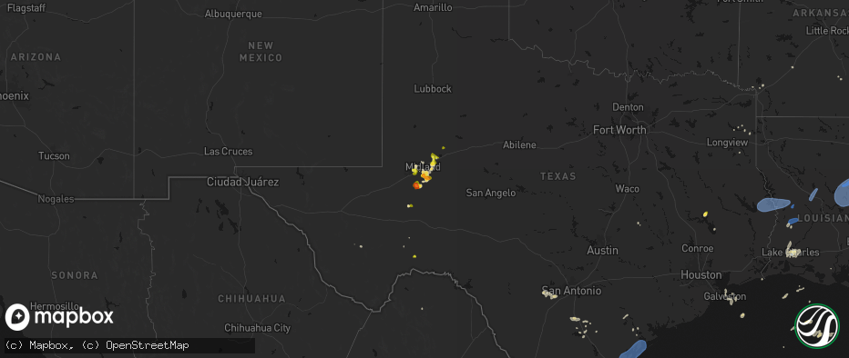
Hail Map on May 23, 2026
The weather event on May 23, 2026 includes Wind and Hail maps. 13 states and 256 cities were impacted and suffered possible damage. The total estimated number of properties impacted is 10,158.
Wind
Hail
10,158
Estimated number of impacted properties by a 1.00" hail or larger311
Estimated number of impacted properties by a 1.75" hail or larger0
Estimated number of impacted properties by a 2.50" hail or largerStates Impacted by Hail Map on May 23, 2026
Storm reports
Nebraska
| Date | Description |
|---|---|
| 05/23/20264:34 PM CDT | Corrects previous tstm wnd gst report from 2 e mccook. Corrects previous tstm wnd gst report from 2 e mccook. Asos station kmck mccook airport. |
| 05/23/20264:34 PM CDT | Corrects previous tstm wnd gst report from 2 e mccook. Asos station kmck mccook airport. |
Mississippi
| Date | Description |
|---|---|
| 05/23/20263:08 PM CDT | Tree downed on ms hwy 432 near vaughan rd. |
| 05/23/20262:49 PM CDT | A tree fell across the natchez trace parkway near mile marker 123. |
| 05/23/20262:26 PM CDT | Utility pole and lines downed across post rd near overlook pointe. |
| 05/23/20262:17 PM CDT | Trees and powerlines were downed on coronet place. |
| 05/23/20262:13 PM CDT | A tree was downed across raymond rd near will-o-wood blvd. |
| 05/23/20262:10 PM CDT | Multiple old/dead trees down across hazelhurst... Particularly on w gallman. |
| 05/23/20262:06 PM CDT | Corrects previous tstm wnd dmg report from 1 e crystal springs. Trees down across lee ave in crystal springs. Multiple trees down across county. |
| 05/23/20261:58 PM CDT | Entire road blocked by a large tree. Multiple large trees down across the entire county. |
| 05/23/20261:23 PM CDT | Trees down across lee ave in crystal springs. Multiple trees down across county. |
| 05/23/20261:17 PM CDT | Multiple trees down on ms 550 in union church. |
| 05/23/20261:02 PM CDT | Lines blown down on meadville gloster rd near the water tower. |
| 05/23/202612:30 PM CDT | Utility poles were downed in the morgantown area. |
| 05/23/202612:27 PM CDT | A tree fell on a house along devereaux dr. Multiple trees were downed around natchez. |
Florida
| Date | Description |
|---|---|
| 05/23/20265:12 PM CDT | A storm spotter reported a large tree branch snapped off near the base of the trunk west of palatka. Time was estimated by radar. |
| 05/22/20269:00 PM CDT | Fire rescue had to remove a downed tree from across county road 225. The time of damage was based on radar data. |
| 05/22/20267:30 PM CDT | A tree was reported down along sw state road 121. Time was estimated by radar. |
South Carolina
| Date | Description |
|---|---|
| 05/23/20264:30 PM CDT | Law enforcement officer reported a tree down with picture of blocking roadway near cedar grove lane and shady grove road. |
| 05/23/20263:45 PM CDT | Public report of golf ball size hail highway 378. |
| 05/23/20262:15 PM CDT | Mccormick county dispatch reported several trees down within the county... Including one on hwy 378 west. |
Texas
| Date | Description |
|---|---|
| 05/23/20265:50 PM CDT | A local report indicates 1.75 inch wind near 2 WSW Stanton |
| 05/23/20265:41 PM CDT | A local report indicates 1.00 inch wind near Stanton |
| 05/23/20265:12 PM CDT | Corrects previous hail report from 2 wsw stanton. |
| 05/23/20265:06 PM CDT | A local report indicates 1.00 inch wind near 8 SE Midland Internatio |
| 05/23/20263:15 PM CDT | Wind damage to a lowes. |
| 05/23/20261:27 PM CDT | Pictures of large tree down onto a residents home and vehicles. Time estimated by radar. |
| 05/23/202612:45 PM CDT | Several trees down throughout the city. |
| 05/23/202612:10 PM CDT | Large trees down due to thunderstorm wind gusts. |
| 05/23/202612:05 PM CDT | Awos station kngp c. Christi nas. |
| 05/23/202611:56 AM CDT | Picture of one large tree trunk on a v-shape trunk tree snapped/split. |
| 05/23/202611:54 AM CDT | Asos station kcrp corpus christi. |
| 05/23/20269:25 AM CDT | Several trees down on highway 87 between yellowpine and six mile. |
| 05/23/20269:25 AM CDT | Report of numerous trees down or damaged in the south toledo bend area... Particularly near tx 255 and tx 87. Time estimated by radar. |
| 05/23/20269:20 AM CDT | Several trees down on fm 1 between pineland and rosevine. |
| 05/23/20269:20 AM CDT | Several trees down on highway 96 between bronson and pineland. |
| 05/23/20269:07 AM CDT | Tree down on fm 705 between broaddus and bronson. |
| 05/23/20269:07 AM CDT | Report of widespread damage in the west and northwest portions of jasper... Tx. Report of roofs with damage... Trees down... Power lines down. Time estimated by damage. |
| 05/23/20269:03 AM CDT | Photo of damage to large yucca tree. Time estimated by radar. |
| 05/23/20267:40 AM CDT | Photo received of downed tree in fannett. Time estimated by radar. |
| 05/23/20267:21 AM CDT | Report of a tree down in the scottsville area around fm 1998 and cr 2213 east of marshall. |
| 05/23/202612:19 AM CDT | Measured by the west texas mesonet. Severe gusts also occurred at 12:18 and 12:20 am. |
| 05/22/202611:59 PM CDT | Measured by the west texas mesonet. |
| 05/22/202611:57 PM CDT | Measured by the west texas mesonet. Additional severe gusts occurred from 11:56 pm to 12:05 am on 5/24/2026. |
| 05/22/202611:41 PM CDT | Measured by the west texas mesonet. Severe gusts from 58 to 61 mph occurred from 11:36 pm to 11:41 pm. |
| 05/22/202611:34 PM CDT | Measured by the west texas mesonet. |
| 05/22/202611:09 PM CDT | Measured by the west texas mesonet. An additional gust to 64 mph occurred at 11:08 pm. |
| 05/22/20269:06 PM CDT | [landspout] media relayed photo of a landspout in or near levelland. |
| 05/22/20269:04 PM CDT | Hail varying in size from 1/4 inch to 1 inch in levelland. |
| 05/22/20268:55 PM CDT | A local report indicates 58 MPH wind near 2 N Spearman |
| 05/22/20268:50 PM CDT | Spotter reported 1.5 to 2 inch diameter hail currently falling. Spotter was located on highway 380 west of tahoka. Location was estimated by radar. |
| 05/22/20268:40 PM CDT | Reported about 1.5 miles east of tstc. |
| 05/22/20268:21 PM CDT | Mesonet had a gust of 58 mph at 2021cdt with increasing gust to 75 mph at 2023cdt. |
| 05/22/20267:53 PM CDT | A local report indicates 63 MPH wind near 2 N Stinnett |
| 05/22/20267:48 PM CDT | A local report indicates 58 MPH wind near 2 WNW Fritch |
| 05/22/20267:28 PM CDT | [landspout] brief landspout lasted about 3 minutes. Located approximately 5 miles to the northwest of chaser location. Location estimated. |
| 05/22/20267:15 PM CDT | A local report indicates 59 MPH wind near 9 NNE Sunray |
| 05/22/20267:06 PM CDT | A local report indicates 69 MPH wind near 3 SE Dumas |
Georgia
| Date | Description |
|---|---|
| 05/23/20265:23 PM CDT | Tree down in the vicinity of knox rd. |
| 05/23/20261:20 PM CDT | A large pine tree fell on a parked vehicle near the belle meade cc north of thomson. |
Tennessee
| Date | Description |
|---|---|
| 05/22/202610:33 PM CDT | Powerlines down. |
New Mexico
| Date | Description |
|---|---|
| 05/22/20267:18 PM CDT | Asos station ktcc tucumcari muni airport. |
Louisiana
| Date | Description |
|---|---|
| 05/23/20262:00 PM CDT | Multiple trees down across the road. |
| 05/23/20261:00 PM CDT | Trees and utility lines were downed on lombardo st. |
| 05/23/202612:57 PM CDT | Trees were downed on la hwy 604. |
| 05/23/202612:38 PM CDT | Trees were downed across la hwy 3009. |
| 05/23/202612:35 PM CDT | Trees were downed on la hwy 568 and on d st in waterproof. |
| 05/23/202611:58 AM CDT | A tree and utility pole were downed in jonesville. |
| 05/23/202611:58 AM CDT | A tree was downed across la hwy 565. |
| 05/23/202611:56 AM CDT | A tree was downed on la hwy 3101. |
| 05/23/202611:55 AM CDT | Peak gust of 74.5 mph at the jonesville la state mesonet site. |
| 05/23/202611:30 AM CDT | Report of a tree down on highway 34 near state route 499. |
| 05/23/202611:20 AM CDT | Report of tree down on highway 472 near wilder road. |
| 05/23/202611:16 AM CDT | Tree damage reported on us 71 south of la 107 intersection near big cane. Time estimated from radar. |
| 05/23/202611:07 AM CDT | Report of a tree down on us 167 north of dry prong near williana. |
| 05/23/202611:06 AM CDT | Report of trees down on the east side of the parish. Radar estimated winds around 45 mph at the time. |
| 05/23/202610:58 AM CDT | Report of a tree down on west highway to the north of boyce... La. |
| 05/23/202610:52 AM CDT | Tree on a house in alexandria. No injuries. Time estimated by radar. |
| 05/23/202610:45 AM CDT | Report of trees down in the boyce to flatwoods areas. Time estimated by radar. |
| 05/23/202610:44 AM CDT | Tree down in highway 71 between montgomery and colfax. |
| 05/23/202610:34 AM CDT | Report of trees down on hwy 121 at gardner. Time estimated by radar. |
| 05/23/202610:31 AM CDT | Report of numerous trees down in the glenmora area. Time estimated by radar. |
| 05/23/202610:15 AM CDT | Several trees and power lines down between many and florien. |
| 05/23/202610:13 AM CDT | There are several trees down all throughout the city of many... Along with power lines down. |
| 05/23/202610:05 AM CDT | Tree reported down on hwy 112 2 miles west of elizabeth. Time estimated from radar. |
| 05/23/20269:57 AM CDT | Tree reported down south of grant. Time estimated from radar. |
| 05/23/20269:47 AM CDT | Two trees reported down on smyrna rd. Time estimated from radar. |
| 05/23/20269:43 AM CDT | Tree reported down covering both lanes on hwy 112 3 miles east of us 171 intersection. Time estimated by radar. |
| 05/23/20269:41 AM CDT | Tree reported down on dogwood trail covering 3/4 of the road. Time estimated from radar. |
| 05/23/20269:41 AM CDT | Law enforcement reports tree down on clarks landing rd covering entire road. Time estimated from radar. |
| 05/23/20269:33 AM CDT | Downed tree fell on a carport covering a car near toledo bend reservoir. |
| 05/23/20269:28 AM CDT | Video received of downed tree near ragley. Time estimated by radar. |
| 05/23/20269:22 AM CDT | Awos station kcwf chennault airport. |
| 05/23/20269:15 AM CDT | Local law enforcement reports tree down on hwy 110 approx 3 miles west of hwy 27 junction. Time estimated from radar. |
Cities Impacted by Hail Map on May 23, 2026
- Beckville, TX
- Jefferson, TX
- Livingston, TX
- Cedar Key, FL
- Hondo, TX
- Karnack, TX
- Castroville, TX
- Devine, TX
- La Coste, TX
- Natalia, TX
- Abbeville, LA
- Fulton, AR
- Ogden, AR
- Westlake, LA
- Lake Charles, LA
- Brookeland, TX
- Pineland, TX
- Wiergate, TX
- Hemphill, TX
- Burkeville, TX
- Ragley, LA
- Iowa, LA
- Deridder, LA
- Bell City, LA
- Hornbeck, LA
- Anacoco, LA
- Florien, LA
- Leesville, LA
- Pitkin, LA
- Pleasanton, TX
- Christine, TX
- Jourdanton, TX
- Slagle, LA
- San Diego, TX
- Campbellton, TX
- Three Rivers, TX
- Gurdon, AR
- Falls City, TX
- Dry Prong, LA
- Lena, LA
- Bentley, LA
- Boyce, LA
- Colfax, LA
- Beeville, TX
- Kenedy, TX
- Robstown, TX
- Bishop, TX
- Taft, TX
- Portland, TX
- Corpus Christi, TX
- Tivoli, TX
- Victoria, TX
- Port Bolivar, TX
- Gregory, TX
- Port Aransas, TX
- Aransas Pass, TX
- Ingleside, TX
- Ferriday, LA
- Deville, LA
- Clayton, LA
- Sicily Island, LA
- Monterey, LA
- Acme, LA
- Woodville, MS
- Harrisonburg, LA
- Marksville, LA
- Vidalia, LA
- Natchez, MS
- Jena, LA
- Jonesville, LA
- Effie, LA
- Lorman, MS
- Waterproof, LA
- Saint Joseph, LA
- Rockport, TX
- Bayside, TX
- Goliad, TX
- Port Lavaca, TX
- Marbury, AL
- Fayette, MS
- Newellton, LA
- Fulton, TX
- Port O'Connor, TX
- Wrens, GA
- Verbena, AL
- Bloomington, TX
- Alpine, TX
- Blythe, GA
- Matthews, GA
- Wilmar, AR
- Rison, AR
- Augusta, GA
- Hephzibah, GA
- Galveston, TX
- Wagon Mound, NM
- Rich Hill, MO
- Walker, MO
- Millry, AL
- Harwood, MO
- Frankville, AL
- Lumber City, GA
- Glenwood, GA
- Reydon, OK
- Gilbertown, AL
- Silas, AL
- Stockton, MO
- El Dorado Springs, MO
- Canadian, TX
- Mount Vernon, GA
- Franklin, AL
- Pine Apple, AL
- Grenville, NM
- Saluda, SC
- Adrian, GA
- Louisville, AL
- Clio, AL
- Cheyenne, OK
- Sweetwater, OK
- Letohatchee, AL
- Fort Deposit, AL
- Batesburg, SC
- Trementina, NM
- Louisville, GA
- Bartow, GA
- Midkiff, TX
- Statesboro, GA
- Leesville, SC
- Prosperity, SC
- Midland, TX
- Walsh, CO
- Clayton, NM
- Arnett, OK
- Durham, OK
- Trinity, TX
- Cameron, TX
- Reidsville, GA
- Stanton, TX
- Milano, TX
- Indianola, NE
- McCook, NE
- McCamey, TX
- Odessa, TX
- Felt, OK
- Texline, TX
- Wesley Chapel, FL
- Collins, GA
- Claxton, GA
- Tampa, FL
- Garden City, TX
- Campo, CO
- Lutz, FL
- Pomona Park, FL
- Wallace, NE
- Blackshear, GA
- Alma, GA
- Dalhart, TX
- Nicholls, GA
- Big Spring, TX
- Dryden, TX
- Keyes, OK
- Knott, TX
- Groveland, FL
- Webster, FL
- Gail, TX
- Chappells, SC
- Ninety Six, SC
- Dallas, GA
- Hartley, TX
- Dumas, TX
- Mascotte, FL
- Fruitland Park, FL
- Lady Lake, FL
- Adrian, TX
- Channing, TX
- Marlin, TX
- Alachua, FL
- Gainesville, FL
- Brooker, FL
- Leesburg, FL
- Marathon, TX
- Sunray, TX
- Wray, GA
- Jacksonville, GA
- Ackerly, TX
- Lamesa, TX
- Goodwell, OK
- Muleshoe, TX
- Cactus, TX
- Masterson, TX
- Hereford, TX
- Amarillo, TX
- Sudan, TX
- Umatilla, FL
- Lake Butler, FL
- Big Lake, TX
- Broxton, GA
- Fitzgerald, GA
- Vega, TX
- Amherst, TX
- Brownfield, TX
- Howey In The Hills, FL
- Tokio, TX
- Stinnett, TX
- Texhoma, OK
- Welch, TX
- Enochs, TX
- Earth, TX
- Aspermont, TX
- Fritch, TX
- Panhandle, TX
- Tucumcari, NM
- Ozona, TX
- Littlefield, TX
- Levelland, TX
- Meadow, TX
- Friona, TX
- Tahoka, TX
- Colorado City, TX
- Satsuma, FL
- Anton, TX
- Shallowater, TX
- Loraine, TX
- Hermleigh, TX
- Odonnell, TX
- Wilson, TX
- Lubbock, TX
- Roscoe, TX
- Snyder, TX
- Elm Mott, TX
- Waco, TX
- Dimmitt, TX
- Idalou, TX
- Hart, TX
- Perryton, TX
- Sweetwater, TX
- Post, TX
- Lorenzo, TX
- Kress, TX
- Justiceburg, TX
- Tulia, TX
- Plainview, TX
- Lockney, TX
- Silverton, TX
- Afton, TX
- Matador, TX
- Flomot, TX
- Roaring Springs, TX
- Mcadoo, TX
- Dickens, TX
- Paducah, TX
- Cee Vee, TX
- Childress, TX
- Crowell, TX
- Quanah, TX
- Seymour, TX
- Old Glory, TX