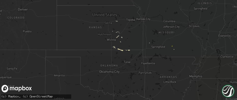
Hail Map on May 30, 2026
The weather event on May 30, 2026 includes Hail, Wind, and Tornado maps. 12 states and 583 cities were impacted and suffered possible damage. The total estimated number of properties impacted is 30,134.
Hail
Wind
Tornado
30,134
Estimated number of impacted properties by a 1.00" hail or larger898
Estimated number of impacted properties by a 1.75" hail or larger503
Estimated number of impacted properties by a 2.50" hail or largerStates Impacted by Hail Map on May 30, 2026
Storm reports
Texas
| Date | Description |
|---|---|
| 05/30/20265:00 PM CDT | A local report indicates 1.00 inch wind near Northfield |
Colorado
| Date | Description |
|---|---|
| 05/30/20266:59 PM CDT | Private weather station. |
| 05/30/20266:40 PM CDT | A local report indicates 1.00 inch wind near 3 W Akron |
| 05/30/20266:00 PM CDT | Storm chaser measure 1.56 inch hail. |
| 05/30/20265:15 PM CDT | A local report indicates 1.50 inch wind near Akron |
| 05/29/20267:46 PM CDT | A local report indicates 1.00 inch wind near 10 SSE Holyoke |
| 05/29/20267:39 PM CDT | Mesonet station up469. |
| 05/29/20267:09 PM CDT | Tornado reported nw of wauneta... Co. Ongoing as of time of report. |
| 05/29/20267:08 PM CDT | A local report indicates a tornado near 9 SSE Wages |
| 05/29/20267:05 PM CDT | Near us highway 6 and county road 21. |
| 05/29/20267:00 PM CDT | Multiple reports from trained spotters and storm chasers of reporting a funnel cloud with a dust swirl at the ground. |
Kansas
| Date | Description |
|---|---|
| 05/30/20266:55 PM CDT | 50 to 60 mph winds with intense t-storm. |
| 05/30/20266:55 PM CDT | Gusts near 60 mph. |
| 05/30/20266:37 PM CDT | A local report indicates 1.00 inch wind near Hoisington |
| 05/30/20266:35 PM CDT | Gusts 50 to 60 mph with pea hail. |
| 05/30/20266:30 PM CDT | Report from social media |
| 05/30/20266:18 PM CDT | Knrn measured 53 knot gust. |
| 05/30/20266:17 PM CDT | Davis station; up north. |
| 05/30/20266:07 PM CDT | Cocorahs report; picked up one stone that was 1 inch in diameter. Most stones were 1/2 inch in diameter. Not very many stones fell in total. |
| 05/30/20266:05 PM CDT | A local report indicates 60 MPH wind near 4 E Hutchinson |
| 05/30/20265:57 PM CDT | Hutchinson regional airport |
| 05/30/20265:56 PM CDT | Renner shop; davis station. |
| 05/30/20265:49 PM CDT | Trained spotter reports half dollar sized hail. |
| 05/30/20265:49 PM CDT | Trained spotter estimates 60 mph wind gusts. |
| 05/30/20265:45 PM CDT | Two to three inch diameter branches snapped. Received via facebook. |
| 05/30/20265:45 PM CDT | Personal wx station. |
| 05/30/20265:01 PM CDT | Personal ambient weather network. |
| 05/30/20264:53 PM CDT | Storm chaser reports minor damage to gas station canopy. |
| 05/30/20264:44 PM CDT | Time estimated from radar. |
| 05/30/20264:33 PM CDT | A local report indicates 1.00 inch wind near 3 N Zenda |
| 05/30/20264:23 PM CDT | Reports of limbs down... Estimated 60-70+ mph gusts. |
| 05/30/20264:20 PM CDT | Ham radio spotter reported quarter to half dollar size hail. |
| 05/30/20264:08 PM CDT | Report from mping: quarter |
| 05/30/20263:48 PM CDT | Report from mping: quarter |
| 05/30/20263:20 PM CDT | Multiple 4+ in limbs down... Gusts estimated 70+ mph. |
| 05/30/20263:15 PM CDT | Public reported on social media dime to half dollar size hail. Pictures were included in the post. |
| 05/30/20263:15 PM CDT | Occasional gusts to 70 mph and pea-sized hail. |
| 05/30/20263:10 PM CDT | A local report indicates 1.25 inch wind near Fall River |
| 05/30/20263:05 PM CDT | A local report indicates 1.00 inch wind near Fall River |
| 05/29/202610:27 PM CDT | A local report indicates 1.00 inch wind near Ellsworth |
| 05/29/202610:15 PM CDT | Delayed report. Relayed via kvoe radio. Time estimated from radar data. |
| 05/29/202610:08 PM CDT | Mping report. |
| 05/29/20268:35 PM CDT | A local report indicates 1.00 inch wind near Mount Hope |
| 05/29/20268:25 PM CDT | A local report indicates 1.00 inch wind near 5 SSE Newton |
| 05/29/20268:05 PM CDT | A local report indicates 1.25 inch wind near Sedgwick |
| 05/29/20267:41 PM CDT | Report from mping: ping pong ball |
| 05/29/20267:41 PM CDT | Occurred with half-dollar size hail. Delayed report. |
| 05/29/20267:40 PM CDT | A local report indicates 1.25 inch wind near Andale |
| 05/29/20267:40 PM CDT | 55 to 65 mph winds with 1.5 in hail. |
| 05/29/20267:40 PM CDT | 55 to 65 mph winds along with the hail. |
| 05/29/20267:38 PM CDT | Report from mping: half dollar |
| 05/29/20267:38 PM CDT | A local report indicates 1.00 inch wind near 6 W Andale |
| 05/29/20267:37 PM CDT | Report from mping: quarter |
| 05/29/20267:15 PM CDT | A local report indicates 1.00 inch wind near 1 NNE Mt Vernon |
Nebraska
| Date | Description |
|---|---|
| 05/30/20266:54 PM CDT | A local report indicates 1.00 inch wind near 2 W Dickens |
| 05/30/20266:53 PM CDT | Awn; klink_weather. |
| 05/30/20266:52 PM CDT | 12 inch tree limb down...time estimated from radar. |
| 05/30/20266:51 PM CDT | A local report indicates 1.25 inch wind near 2 NNW Cambridge |
| 05/30/20266:47 PM CDT | A local report indicates 1.25 inch wind near 2 S Wallace |
| 05/30/20266:45 PM CDT | Hail up to quarter size. |
| 05/30/20266:45 PM CDT | Unofficial personal weather station. |
| 05/30/20266:45 PM CDT | A local report indicates 1.25 inch wind near 1 E Cambridge |
| 05/30/20266:42 PM CDT | A local report indicates 1.75 inch wind near 1 W Elsie |
| 05/30/20266:39 PM CDT | Unofficial personal weather station. |
| 05/30/20266:39 PM CDT | Unofficial weather station. |
| 05/30/20266:34 PM CDT | Delayed report via facebook photo of hail southwest of beaver city. Time and location details estimated from radar. |
| 05/30/20266:30 PM CDT | Mesonet station up261. |
| 05/30/20266:27 PM CDT | A local report indicates 72 MPH wind near Kingsley Dam |
| 05/30/20266:22 PM CDT | A local report indicates 2.75 inch wind near 10 S Wallace |
| 05/30/20266:21 PM CDT | A local report indicates 2.00 inch wind near 10 S Wallace |
| 05/30/20266:15 PM CDT | A local report indicates 64 MPH wind near 3 WSW Ogallala |
| 05/30/20266:04 PM CDT | A local report indicates 1.00 inch wind near 4 N Hayes Center |
| 05/30/20266:02 PM CDT | Picture of quarter-sized hail in barley... Ne. Time estimated from radar. |
| 05/30/20265:55 PM CDT | Corrects previous tornado report from 9 sse bushnell. Video confirmation of ground circulation being tilted and stretched into thunderstorm updraft. Tiny condensation f |
| 05/30/20265:55 PM CDT | Video confirmation of ground circulation being tilted and stretched into thunderstorm updraft. Tiny condensation funnel attached to cloud base above the ground circulat |
| 05/30/20265:53 PM CDT | Corrects previous hail report from 6.3 se bushnell. Delayed report of baseball sized hail approximately 6.3 miles southeast of bushnell. Time was estimated from radar r |
| 05/30/20265:47 PM CDT | A local report indicates 1.00 inch wind near 4 E Lamar |
| 05/30/20265:33 PM CDT | Delayed report of baseball sized hail approximately 6.3 miles southeast of bushnell. Time was estimated from radar reflectivity. Multiple windows were destroyed. |
| 05/30/20265:25 PM CDT | Corrects previous tornado report from 10 sse bushnell. Kimball county em reported an ongoing tornado. Was also indicated via radar imagery. No damage has been reported. |
| 05/30/20265:25 PM CDT | Kimball county em reported an ongoing tornado with debris. Was also indicated via radar imagery. |
| 05/30/20265:00 PM CDT | Kimball county em reported golf ball sized hail within accumulating hail... Leading to localized flash flooding in rural areas of kimball county. |
| 05/30/20263:37 PM CDT | Media received report of quarter-sized hail at chadron state park. |
| 05/29/202610:16 PM CDT | Trained spotter report of hail up to 1 inch in diameter and wind gusts estimated at 55 mph. |
| 05/29/20269:45 PM CDT | Delayed report of around 2.5 inches of precipitation throughout the duration of the storm event near bushnell. |
| 05/29/20268:56 PM CDT | A local report indicates 60 MPH wind near 2 NNE Chester |
| 05/29/20268:34 PM CDT | A local report indicates 73 MPH wind near 4 ENE Norman |
| 05/29/20268:30 PM CDT | Power pole down along highway 74 about 5 miles east of minden. |
| 05/29/20268:29 PM CDT | A local report indicates 63 MPH wind near 2 N Holstein |
| 05/29/20268:29 PM CDT | A local report indicates 70 MPH wind near 10 SW Mason City |
| 05/29/20268:26 PM CDT | A local report indicates 68 MPH wind near 2 SE Holstein |
| 05/29/20268:26 PM CDT | Power lines snapped north of town. Power lost in holstein. The fire department reported at tree was on fire as well. |
| 05/29/20268:19 PM CDT | Delayed report. Spotter reports a rainfall total of 0.18 along with some pea size hail as the storms rolled through. Also reports very strong winds estimated to be 70 m |
| 05/29/20268:17 PM CDT | A local report indicates 59 MPH wind near 4 NNW Bostwick |
| 05/29/20268:17 PM CDT | A local report indicates 77 MPH wind near 4 NNW Sumner |
| 05/29/20268:15 PM CDT | A local report indicates 70 MPH wind near 4 SE Eddyville |
| 05/29/20268:15 PM CDT | A local report indicates 62 MPH wind near 5 ENE Lewellen |
| 05/29/20268:15 PM CDT | A local report indicates 63 MPH wind near 4 NNW Sumner |
| 05/29/20268:09 PM CDT | A local report indicates 61 MPH wind near 4 SE Eddyville |
| 05/29/20268:08 PM CDT | Corrects previous tstm wnd gst report from 4 se eddyville. |
| 05/29/20268:07 PM CDT | Unofficial personal weather station. |
| 05/29/20268:07 PM CDT | A local report indicates 61 MPH wind near 4 SE Big Springs |
| 05/29/20268:06 PM CDT | A local report indicates 64 MPH wind near 3 W Sumner |
| 05/29/20268:00 PM CDT | A local report indicates 68 MPH wind near 4 N Lexington |
| 05/29/20267:58 PM CDT | A local report indicates 1.50 inch wind near Brady |
| 05/29/20267:56 PM CDT | A local report indicates 3.50 inch wind near 4 N Wellfleet |
| 05/29/20267:56 PM CDT | A local report indicates 70 MPH wind near 5 SW Whitman |
| 05/29/20267:55 PM CDT | A local report indicates 1.00 inch wind near Maxwell |
| 05/29/20267:53 PM CDT | A local report indicates 2.75 inch wind near 5 N Wellfleet |
| 05/29/20267:52 PM CDT | Unofficial personal weather station. |
| 05/29/20267:51 PM CDT | A local report indicates 75 MPH wind near 3 WNW Lexington |
| 05/29/20267:50 PM CDT | Local media photos depict quite a bit of tree damage and a leaning power pole in lexington with power outages reported in the area. |
| 05/29/20267:48 PM CDT | A local report indicates 3.00 inch wind near 4 NW Wellfleet |
| 05/29/20267:46 PM CDT | A local report indicates 79 MPH wind near Lexington Airport |
| 05/29/20267:45 PM CDT | [landspout] |
| 05/29/20267:41 PM CDT | Unofficial personal weather station. |
| 05/29/20267:40 PM CDT | A local report indicates 1.75 inch wind near 6 NW Wellfleet |
| 05/29/20267:35 PM CDT | A local report indicates 2.25 inch wind near 5 N Wellfleet |
| 05/29/20267:34 PM CDT | A local report indicates 1.25 inch wind near 7 NW Wellfleet |
| 05/29/20267:33 PM CDT | A local report indicates 1.00 inch wind near 6 NW Wellfleet |
| 05/29/20267:32 PM CDT | Unofficial personal weather station. |
| 05/29/20267:29 PM CDT | Unofficial personal weather station. |
| 05/29/20267:28 PM CDT | Storm spotter reported tornado via twitter. |
| 05/29/20267:26 PM CDT | A local report indicates 1.00 inch wind near 5 N Wellfleet |
| 05/29/20267:18 PM CDT | Awos station k1iw 7 se sidney. |
| 05/29/20267:17 PM CDT | Mesonet station up252 8.1 w lodgepole |
| 05/29/20267:13 PM CDT | A local report indicates 60 MPH wind near 2 W Franklin |
| 05/29/20267:11 PM CDT | A local report indicates 71 MPH wind near 2 SSW Sidney |
| 05/29/20267:09 PM CDT | Golf asos. |
| 05/29/20267:08 PM CDT | A local report indicates 61 MPH wind near 3 S Stockville |
Arkansas
| Date | Description |
|---|---|
| 05/30/20263:20 PM CDT | Co-op observer estimated winds at 60 mph. |
| 05/30/20263:16 PM CDT | Large hardwood tree was blown down onto a house. The house sustained major structural damage. |
| 05/30/20263:14 PM CDT | Large hardwood tree was blown down. |
| 05/30/20262:52 PM CDT | Multiple trees uprooted. |
South Dakota
| Date | Description |
|---|---|
| 05/30/20266:00 PM CDT | Tweet sent by local broadcast media and tagged nws. |
| 05/30/20266:00 PM CDT | Tweet sent by local broadcast media and tagged nws. |
Georgia
| Date | Description |
|---|---|
| 05/30/20266:47 PM CDT | Trees down on 1500 block on rosewood drive. Damage likely caused by outflow winds. Time estimated based on radar. |
| 05/30/20266:32 PM CDT | One tree down near the intersection of east park ave and drayton street. Time estimated based on radar. |
Missouri
| Date | Description |
|---|---|
| 05/30/20266:00 PM CDT | 3 to 4 inch limbs down 3.2 miles north of mile marker 61 of interstate 44 in bois darc. |
| 05/30/20265:54 PM CDT | Quarter sized hail in republic. |
| 05/30/20265:41 PM CDT | Tree down at intersection of county rd 2100 and highway n. Time estimated from radar. |
| 05/30/20265:35 PM CDT | Multiple trees uprooted along farm road 23 and 2. |
| 05/30/20265:30 PM CDT | Photo of quarter sized hail on prospect and wolfe rd in aurora. Time estimated from radar. |
| 05/30/20264:10 PM CDT | Report of extensive damage to kennel... Well... And barn at county road 120 and sumac ln southeast of jasper. |
| 05/29/20268:35 PM CDT | Liberty utilities employee reported 225 customers without power in the branson and reeds spring area due to downed trees and thunderstorm wind. |
| 05/29/20268:00 PM CDT | Several trees down. |
| 05/29/20267:56 PM CDT | Public sent in a photo of a person holding a hail stone around the size of a quarter. |
| 05/29/20267:03 PM CDT | Trees down. Widespread two mile wide band of tree damage from the lawrence and barry county lines. |
| 05/29/20267:00 PM CDT | Trees down in and around this area. Two mile wide band of tree damage from lawrence and barry county lines. |
Cities Impacted by Hail Map on May 30, 2026
- Lockwood, MO
- Oxford, KS
- Winfield, KS
- El Dorado, KS
- Arkansas City, KS
- Eureka, KS
- Junction City, KS
- Cassoday, KS
- Chapman, KS
- Maple City, KS
- Dexter, KS
- Cedar Vale, KS
- Hillsboro, KS
- Pawhuska, OK
- Latham, KS
- Florence, KS
- Cedar Point, KS
- Wann, OK
- Copan, OK
- Cabool, MO
- Houston, MO
- Willow Springs, MO
- Mountain View, MO
- Pomona, MO
- S Coffeyville, OK
- Bartlett, KS
- Deerfield, MO
- Leslie, AR
- Moundville, MO
- Bronaugh, MO
- Yates Center, KS
- Fall River, KS
- Chetopa, KS
- Clinton, AR
- Columbus, KS
- Nevada, MO
- Harrison, NE
- Jasper, AR
- Fredonia, KS
- Danville, AR
- Bee Branch, AR
- Walker, MO
- Mindenmines, MO
- Asbury, MO
- Freedom, OK
- Choctaw, AR
- Omaha, AR
- Alpena, AR
- Green Forest, AR
- Richards, MO
- Chanute, KS
- Buffalo, KS
- Harrison, AR
- Benedict, KS
- Jetmore, KS
- Liberal, MO
- Jasper, MO
- Oronogo, MO
- Torrington, WY
- Vendor, AR
- Coldwater, KS
- Edgemont, SD
- Chadron, NE
- Humboldt, KS
- Erie, KS
- Rover, AR
- Dodge City, KS
- Wright, KS
- Damascus, AR
- Lamar, MO
- Sheldon, MO
- Mount Judea, AR
- Ness City, KS
- Hanston, KS
- Hot Springs, SD
- Custer, SD
- Savonburg, KS
- Van Tassell, WY
- Hulett, WY
- Jay Em, WY
- Quitman, AR
- Benton, AR
- Lusk, WY
- Elsmore, KS
- Hollister, MO
- Kirbyville, MO
- Bazine, KS
- Western Grove, AR
- Everton, AR
- Dardanelle, AR
- Sharon, KS
- Nunn, CO
- Attica, KS
- Saint Paul, KS
- Galesburg, KS
- Stark, KS
- Brownell, KS
- Marshall, AR
- Uniontown, KS
- Fort Scott, KS
- Arma, KS
- Girard, KS
- Pittsburg, KS
- Carthage, MO
- Buffalo, SD
- Alzada, MT
- Cedarcreek, MO
- Alexander, KS
- Spearville, KS
- Medicine Lodge, KS
- Zenda, KS
- Hepler, KS
- Walnut, KS
- Spivey, KS
- Nashville, KS
- Bushnell, NE
- Isabel, KS
- Witts Springs, AR
- Manchester, OK
- Wakita, OK
- Rozel, KS
- Burdett, KS
- La Salle, CO
- Kersey, CO
- Larned, KS
- Lead, SD
- Kingman, KS
- Murdock, KS
- McCracken, KS
- Medford, OK
- Bluff City, KS
- Spearfish, SD
- Cunningham, KS
- Harper, KS
- Morrilton, AR
- Arcadia, KS
- Nekoma, KS
- Atkins, AR
- Pottsville, AR
- Anthony, KS
- Grover, CO
- Pretty Prairie, KS
- Cheney, KS
- Hays, KS
- Capitol, MT
- Rush Center, KS
- Bryant, AR
- Alexander, AR
- Briggsdale, CO
- Avilla, MO
- Reeds, MO
- Hermosa, SD
- Keystone, SD
- Belle Fourche, SD
- Ellis, KS
- Golden City, MO
- Pine Bluffs, WY
- Wray, CO
- Haigler, NE
- Argonia, KS
- Conway Springs, KS
- Farlington, KS
- Russellville, AR
- Kimball, NE
- Hay Springs, NE
- Turon, KS
- Franklin, KS
- Arlington, KS
- Carpenter, WY
- Caldwell, KS
- Freeport, KS
- Sarcoxie, MO
- Danville, KS
- Norwich, KS
- Greenfield, MO
- South Greenfield, MO
- Lamar, AR
- Clarksville, AR
- Saint Onge, SD
- Cherryvale, KS
- Wakeeney, KS
- Plainville, KS
- Milan, KS
- Viola, KS
- Milton, KS
- Hill City, SD
- La Russell, MO
- Everton, MO
- La Crosse, KS
- Bison, KS
- Albert, KS
- Otis, KS
- Pawnee Rock, KS
- Pringle, SD
- Hill City, KS
- Hagarville, AR
- Palisade, NE
- Miller, MO
- Pine Ridge, SD
- Rapid City, SD
- Champion, NE
- Morland, KS
- Aurora, MO
- Crane, MO
- Hayes Center, NE
- Bauxite, AR
- Paducah, TX
- Harrisburg, NE
- Mount Vernon, MO
- Marionville, MO
- Billings, MO
- Penokee, KS
- Ash Grove, MO
- Garden Plain, KS
- Oglala, SD
- Imperial, NE
- Haven, KS
- Andale, KS
- Colwich, KS
- Mount Hope, KS
- Lenora, KS
- Norton, KS
- Bois D Arc, MO
- Iraan, TX
- Holyoke, CO
- Republic, MO
- Sheridan, AR
- Oelrichs, SD
- Bogue, KS
- Ramah, CO
- Stotts City, MO
- Deadwood, SD
- Sheffield, TX
- Black Hawk, SD
- Walnut Grove, MO
- Olmitz, KS
- Hoisington, KS
- Agate, CO
- Inman, KS
- Springfield, MO
- Childress, TX
- Hays, MT
- Whitewood, SD
- Sturgis, SD
- Russell, KS
- Paradise, KS
- Stockton, KS
- Brookline, MO
- Willard, MO
- Halltown, MO
- Hutchinson, KS
- Burrton, KS
- Buhler, KS
- Halstead, KS
- Sedgwick, KS
- Bentley, KS
- Valley Center, KS
- Newton, KS
- Wilsonville, NE
- Cambridge, NE
- Hendley, NE
- Wallace, NE
- Elsie, NE
- Dickens, NE
- Great Bend, KS
- Lewellen, NE
- Arthur, NE
- Indianola, NE
- Bartley, NE
- Lemoyne, NE
- Glade, KS
- Pierce City, MO
- Monett, MO
- Maywood, NE
- Grant, NE
- Clayton, KS
- Verona, MO
- Phillipsburg, KS
- Bunker Hill, KS
- Freistatt, MO
- Nisland, SD
- Akron, CO
- Camp Crook, SD
- Fort Stockton, TX
- Beaver City, NE
- Ogallala, NE
- Keystone, NE
- Dorrance, KS
- Dryden, TX
- Grapevine, AR
- White Hall, AR
- Neosho, MO
- Brule, NE
- Paxton, NE
- Sutherland, NE
- Yuma, CO
- Wellfleet, NE
- Huntsville, AR
- Arapahoe, NE
- Holbrook, NE
- Claflin, KS
- Lucas, KS
- Moorefield, NE
- Stockville, NE
- Eustis, NE
- Tryon, NE
- Sylvan Grove, KS
- Wilson, KS
- Gorham, KS
- Pfeifer, KS
- Kensington, KS
- Riverton, NE
- Bloomington, NE
- Agra, KS
- Franklin, NE
- Naponee, NE
- Madrid, NE
- Hunter, KS
- Elwood, NE
- Mullen, NE
- Hyannis, NE
- Whitman, NE
- Decker, MT
- Ismay, MT
- Goddard, KS
- North Platte, NE
- Partridge, KS
- Downs, KS
- Galena, MO
- Haxtun, CO
- Gaylord, KS
- Rogers, AR
- Hindsville, AR
- Bushton, KS
- North Newton, KS
- Peabody, KS
- Walton, KS
- Lexington, NE
- Curtis, NE
- Fallon, MT
- Manderson, SD
- Ponce De Leon, MO
- Highlandville, MO
- Spokane, MO
- Abbyville, KS
- Rushville, NE
- Esbon, KS
- Lebanon, KS
- Holyrood, KS
- Lorraine, KS
- Oshkosh, NE
- Maxwell, NE
- Farnam, NE
- Smithfield, NE
- Maize, KS
- Bertrand, NE
- Overton, NE
- Cozad, NE
- Seneca, NE
- Brady, NE
- Gothenburg, NE
- Willow Island, NE
- Callaway, NE
- Oconto, NE
- Eddyville, NE
- Sumner, NE
- Arnold, NE
- Scenic, SD
- Kyle, SD
- Fordyce, AR
- Garfield, AR
- Mankato, KS
- Reeds Spring, MO
- Miller, NE
- Merriman, NE
- Campbell, NE
- Upland, NE
- Holstein, NE
- Burr Oak, KS
- Guide Rock, NE
- Red Cloud, NE
- Burns, KS
- Bearden, AR
- Eureka Springs, AR
- Hershey, NE
- Amity, AR
- Hampton, AR
- Caputa, SD
- Belfield, ND
- Ellsworth, NE
- Chestnutridge, MO
- Batesland, SD
- Thornton, AR
- Bentonville, AR
- Valentine, NE
- Thedford, NE
- Stapleton, NE
- Whitewater, KS
- Broken Bow, NE
- Mason City, NE
- Manhattan, KS
- Alta Vista, KS
- Kissee Mills, MO
- Birney, MT
- Medora, ND
- Wichita, KS
- Minden, NE
- Alliance, NE
- Taneyville, MO
- Forsyth, MO
- Ridgedale, MO
- Roseland, NE
- Bladen, NE
- Branson, MO
- Walnut Shade, MO
- Powersite, MO
- Rockaway Beach, MO
- Benton, KS
- Olsburg, KS
- Bradleyville, MO
- Greenwich, KS
- Kechi, KS
- Jersey, AR
- Banks, AR
- Belleville, KS
- New Underwood, SD
- Ansley, NE
- Andover, KS
- Waldo, KS
- Wall, SD
- Loup City, NE
- Litchfield, NE
- Geneseo, KS
- Lyons, KS
- Chester, NE
- Hebron, NE
- Hubbell, NE
- Comstock, NE
- Otter, MT
- Potwin, KS
- Arcadia, NE
- Towanda, KS
- Lindsay, MT
- Luray, KS
- Augusta, KS
- Juniata, NE
- Kenesaw, NE
- Blue Hill, NE
- Glendive, MT
- Ord, NE
- Ellsworth, KS
- Frankfort, KS
- Circle, MT
- Martin, SD
- Cottonwood Falls, KS
- Osborne, KS
- Matfield Green, KS
- Onaga, KS
- Havensville, KS
- Elyria, NE
- Strong City, KS
- Emporia, KS
- Amherst, NE
- Pleasanton, NE
- Wanblee, SD
- Rosalia, KS
- Soldier, KS
- Dorchester, NE
- Leon, KS
- Burwell, NE
- Halsey, NE
- Dunning, NE
- Kanopolis, KS
- Olpe, KS
- Council Grove, KS
- Allen, KS
- Interior, SD
- Seward, NE
- Milford, NE
- Beaver Crossing, NE
- Madison, KS
- Filley, NE
- Utica, NE
- Waco, NE
- Gresham, NE
- Martell, NE
- Roca, NE
- Hickman, NE
- Sterling, NE
- Natoma, KS
- Ainsworth, NE
- Hartford, KS
- Malcolm, NE
- Brookville, KS
- Pleasant Dale, NE
- Quinn, SD
- Hamilton, KS
- Neosho Rapids, KS
- Chambers, NE
- Lincoln, KS
- Murdo, SD
- Philip, SD
- Draper, SD
- Faith, SD
- Midland, SD
- Waverly, KS
- Burlington, KS
- Elmdale, KS
- Le Roy, KS
- Colony, KS
- Piqua, KS
- Milesville, SD
- Fort Pierre, SD
- Williamsburg, KS
- Richmond, KS
- Garnett, KS
- Westphalia, KS
- Salina, KS
- Omaha, NE
- Mineola, IA
- Silver City, IA
- Stanton, NE
- Clarkson, NE
- Neosho Falls, KS
- Blair, NE
- Presho, SD
- Welda, KS
- Kennebec, SD
- Fort Calhoun, NE
- Vivian, SD
- Pilger, NE
- Assaria, KS
- New Cambria, KS
- Hayes, SD
- Reading, KS
- Kirwin, KS
- Cedar, KS
- Abilene, KS
- Solomon, KS
- Mound City, MO
- Melvern, KS
- Admire, KS
- Eagle Butte, SD
- Blue Mound, KS
- Centerville, KS
- Quenemo, KS
- Pomona, KS
- Osage City, KS
- Woodbine, KS
- Dwight, KS
- Bedford, IA
- Lyndon, KS
- Ottawa, KS
- Herington, KS
- White City, KS
- Alma, KS
- Hope, KS
- Wellsville, KS
- Clinton, MO
- Rantoul, KS
- Paola, KS
- Paxico, KS
- Parker, KS
- Lane, KS
- Greeley, KS
- Osawatomie, KS
- Spring Hill, KS
- McFarland, KS
- Drexel, MO
- Amsterdam, MO
- Blairstown, MO
- Chilhowee, MO
- Warrensburg, MO
- Leeton, MO
- La Monte, MO
- Calhoun, MO
- Sweet Springs, MO
- Houstonia, MO
- Hughesville, MO
- Cole Camp, MO
- Lincoln, MO
- Marshall, MO
- Greenbrier, AR