Hail Map on June 7, 2026
The weather event on June 7, 2026 includes Wind, Hail, and Tornado maps. 13 states and 418 cities were impacted and suffered possible damage. The total estimated number of properties impacted is 12,629.
Wind
Hail
Tornado
12,629
Estimated number of impacted properties by a 1.00" hail or larger6,225
Estimated number of impacted properties by a 1.75" hail or larger668
Estimated number of impacted properties by a 2.50" hail or largerStates Impacted by Hail Map on June 7, 2026
Storm reports
Texas
| Date | Description |
|---|---|
| 06/06/20267:38 PM CDT | Sheet metal wrapped around utility poles. Time estimated from radar. |
South Dakota
| Date | Description |
|---|---|
| 06/07/20266:56 PM CDT | A local report indicates 62 MPH wind near 4 N Ludlow |
| 06/07/20266:51 PM CDT | Easily 2 inch stones with several that appear to be larger. |
| 06/07/20266:45 PM CDT | Sustained 50-55 mph |
| 06/07/20266:40 PM CDT | A local report indicates 1.50 inch wind near 8 W Redig |
| 06/07/20266:40 PM CDT | A local report indicates 70 MPH wind near 8 W Redig |
| 06/07/20266:40 PM CDT | A local report indicates 68 MPH wind near 1 ESE Ladner |
| 06/07/20266:30 PM CDT | A local report indicates 59 MPH wind near 17 W Castle Rock |
| 06/07/20266:25 PM CDT | A local report indicates 61 MPH wind near 13 NW Belle Fourche |
| 06/07/20266:21 PM CDT | A local report indicates 60 MPH wind near 13 WNW Ladner |
| 06/07/20265:56 PM CDT | A local report indicates 62 MPH wind near 8 NW Colony |
| 06/07/20262:40 AM CDT | Estimated gusts up to 60 mph. |
| 06/07/20262:05 AM CDT | Estimated between 50 and 60 mph. |
| 06/07/20261:55 AM CDT | Mesonet station bwls2 bowdle |
| 06/07/20261:40 AM CDT | Mesonet station 313 selby 5se |
| 06/07/20261:04 AM CDT | Mesonet station 50 herreid |
| 06/07/20261:00 AM CDT | Mesonet station grrs2 bullhead 10 s. Time estimated by radar. |
| 06/07/20261:00 AM CDT | Wind gusts reported along with some smaller tree branches down. |
| 06/07/202612:15 AM CDT | Mesonet station tims2 timber lake |
| 06/07/202612:14 AM CDT | Mesonet station 293 timber lake |
| 06/06/202610:27 PM CDT | A local report indicates 64 MPH wind near 6 W Cottonwood |
| 06/06/20267:55 PM CDT | A local report indicates 60 MPH wind near 1 WSW Prairie City |
| 06/06/20267:31 PM CDT | A lot of hail... Covered the ground. |
| 06/06/20267:29 PM CDT | A few stones that size. Most were nickle to quarter size stones. |
| 06/06/20267:29 PM CDT | A local report indicates 58 MPH wind near 13 SSW Reva |
| 06/06/20267:28 PM CDT | A local report indicates 58 MPH wind near 4 WSW Reva |
| 06/06/20267:19 PM CDT | A local report indicates 58 MPH wind near 13 SSW Reva |
| 06/06/20267:05 PM CDT | At least tennis ball size. Winds only 30-40 mph. |
| 06/06/20267:00 PM CDT | This was measured after some melting took place. |
Oklahoma
| Date | Description |
|---|---|
| 06/07/20266:29 AM CDT | Measured gust on the south side of afton in the 60 to 70 mph range. |
| 06/07/20266:20 AM CDT | A local report indicates 60 MPH wind near Afton |
Arkansas
| Date | Description |
|---|---|
| 06/07/20263:05 PM CDT | Trained storm spotter reported brief rain wrapped tornado. |
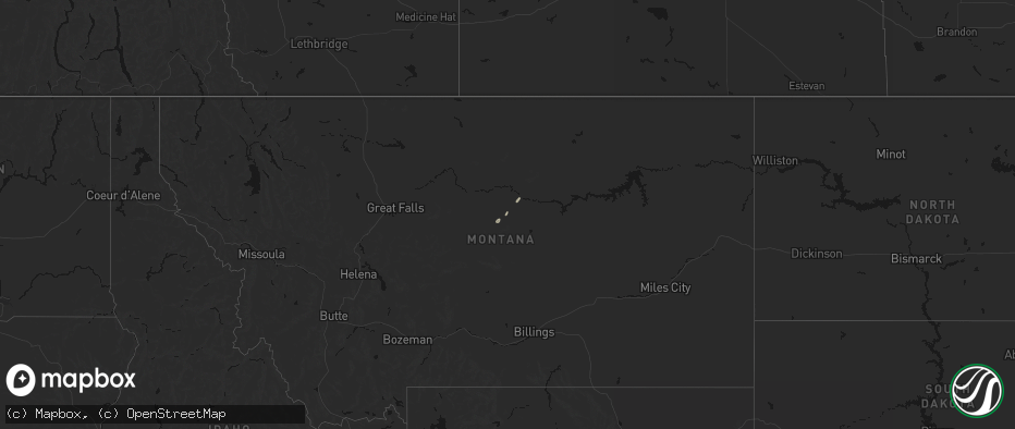
Montana
| Date | Description |
|---|---|
| 06/07/20266:33 PM CDT | A local report indicates 66 MPH wind near 11 SSE Billings |
| 06/07/20266:00 PM CDT | Wofm8 mesonet observation site. |
| 06/07/20265:58 PM CDT | A local report indicates 3.00 inch wind near 9 N Belltower |
| 06/07/20265:49 PM CDT | A local report indicates 2.50 inch wind near 3 W Alzada |
| 06/07/20265:12 PM CDT | A local report indicates 3.00 inch wind near 16 ESE Powderville |
| 06/07/20264:30 PM CDT | A local report indicates 1.75 inch wind near 2 SW Olive |
| 06/07/20264:30 PM CDT | A local report indicates 1.75 inch wind near 6 N Epsie |
| 06/07/20264:24 PM CDT | A local report indicates 1.25 inch wind near 1 NNW Olive |
| 06/06/20268:12 PM CDT | Mtcom mesonet observation site. |
| 06/06/20268:00 PM CDT | Corrects previous tstm wnd gst report from 6 s comertown. Mtcom mesonet observation site. |
| 06/06/20268:00 PM CDT | Mesonet station mtbvr 3.8 ne hodges |
| 06/06/20267:15 PM CDT | Asos station kbhk baker. |
Nebraska
| Date | Description |
|---|---|
| 06/06/20269:28 PM CDT | Personal weather station. |
| 06/06/20269:07 PM CDT | Personal weather station reported gust of 78.1 mph. |
| 06/06/20269:04 PM CDT | Personal weather station. |
| 06/06/20267:30 PM CDT | Personal weather station. |
| 06/06/20267:21 PM CDT | 62 mph gust recorded at kaia awos. |
Wyoming
| Date | Description |
|---|---|
| 06/07/20266:40 PM CDT | Mesonet station pc377 scenic dr |
| 06/07/20266:40 PM CDT | Mesonet station pc577 midwest |
| 06/07/20266:30 PM CDT | Mesonet station pc549 tisdale mtn |
| 06/07/20266:26 PM CDT | Mesonet station wy63 i-25 tisdale divide |
| 06/07/20265:52 PM CDT | A local report indicates 60 MPH wind near 13 NNE Wright |
| 06/07/20265:14 PM CDT | 1 inch was the largest... Most was smaller |
| 06/07/20265:01 PM CDT | Asos station krks rock springs airport |
| 06/07/20264:36 PM CDT | Mesonet station ktmh i-25 twenty mile hill |
| 06/07/20264:07 PM CDT | [landspout] delayed public report found of facebook of a landspout between burns and hillsdale... Wy. Location estimated on radar velocity and reflectivity at that tim |
| 06/07/20262:53 PM CDT | Asos station kwrl worland airport |
| 06/06/202610:02 PM CDT | Mesonet station kbit i-80 bitter creek |
| 06/06/20268:45 PM CDT | A local report indicates 65 MPH wind near 17 NNW New Haven |
| 06/06/20268:41 PM CDT | A local report indicates 58 MPH wind near 17 NNW New Haven |
| 06/06/20268:15 PM CDT | Most of the hailstones were smaller |
| 06/06/20268:07 PM CDT | A local report indicates 69 MPH wind near 5 NNW Dwtn Gillette |
| 06/06/20268:02 PM CDT | Mesonet station wy55 2.9 n banner |
| 06/06/20267:56 PM CDT | Mesonet station wy3 i-90 indian creek rd |
| 06/06/20267:52 PM CDT | Asos station kshr sheridan. |
| 06/06/20267:51 PM CDT | A local report indicates 68 MPH wind near 1 NE Echeta |
Missouri
| Date | Description |
|---|---|
| 06/07/20266:40 PM CDT | Tree debris from a ef0 tornado was visible along farm road 131 southeast of battlefield... Mo. Eyewitness account depicted the tornado as it crossed plainview road at j |
| 06/07/20265:27 PM CDT | Reports and images of wind damage... Including power outages... Tree damage... Tree uprooted... And buildings with roof damage. Damage appears roughly 1-2 blocks wide r |
| 06/07/20266:45 AM CDT | Report of a downed tree branch that resulted in damage to parked vehicles. Time estimated from radar. |
| 06/07/20265:17 AM CDT | Mping report of power poles down or broken. |
| 06/06/20267:50 PM CDT | Radar confirmed tornado. Trees down on road. |
| 06/06/20267:03 PM CDT | Relayed report of thunderstorm damage in the shire circle road area... Between spokane and highlandville. Potential tornado damage to be surveyed. Time estimated from r |
North Dakota
| Date | Description |
|---|---|
| 06/07/20266:42 PM CDT | Reported at medora campground. Hail lasted 6 minutes. |
| 06/07/20266:33 PM CDT | A local report indicates 2.00 inch wind near 4 WNW Medora |
| 06/07/20266:30 PM CDT | Relayed through broadcast media. |
| 06/07/20266:20 PM CDT | Very large hail reported southeast of sentinel butte. Largest stones were tennis ball to baseball size. |
| 06/07/20261:25 AM CDT | Ndawn station wind gust to 59 mph and lasted 5 to 10 minutes. |
| 06/07/20261:10 AM CDT | Mesonet station 329519 5 w wishek |
| 06/07/202612:00 AM CDT | Personal weather station measurement. |
| 06/06/202611:15 PM CDT | Photo relayed through social media of a large tree knocked down and on top of a porch. Time estimated from radar. |
| 06/06/202611:15 PM CDT | Bottineau awos gust to 75 mph. |
| 06/06/202610:53 PM CDT | Measured wind gust at private weather station. |
| 06/06/202610:32 PM CDT | 10 meter measured wind gust at ndawn station wing 8n. |
| 06/06/202610:27 PM CDT | Awos station k1an 2 wnw balfour. |
| 06/06/202610:26 PM CDT | Measured 10 meter wind gust at skogmo 3 n. |
| 06/06/202610:20 PM CDT | Photos relayed through social media show multiple trees broken and a few tin roof panels pulled up. Time estimated from radar. |
| 06/06/202610:06 PM CDT | Asos station kbis bismarck airport. |
| 06/06/202610:06 PM CDT | 10 meter measured wind gust at ndawn station sawyer 7 s. |
| 06/06/20269:57 PM CDT | Measured wind gust at nddot station. Time estimated from radar. |
| 06/06/20269:52 PM CDT | 86mph 10m measured at ndawn 3 n max. |
| 06/06/20269:50 PM CDT | Measured wind gust at private weather station. |
| 06/06/20269:50 PM CDT | 98mph gust at 10m... Ndawn 13nw garrison. |
| 06/06/20269:49 PM CDT | 93mph measured gust at 10m at ndawn... 13nw garrison. |
| 06/06/20269:44 PM CDT | 10 meter measured wind gust at ndawn station 13 miles northwest of garrison. |
| 06/06/20269:40 PM CDT | Photos relayed through social media from douglas bay area. Campers flipped... Small outbuildings knocked over... And farm outbuilding with moderate loss of roof panels. |
| 06/06/20269:40 PM CDT | Photos relayed through social media. Farmstead approximately 14 miles west of garrison has outbuilding with significant damage to walls and roof... As well as dented gr |
| 06/06/20269:37 PM CDT | Estimated location of tornado. A white rope tornado came down and was on the ground for about 3 minutes... Kicking up dust. |
| 06/06/20269:35 PM CDT | Power out in the city of dickinson... With multiple power lines down and a report of at least one tree on a house. |
| 06/06/20269:30 PM CDT | Photos relayed from broadcast media of camper damage at legacy north campground next to beulah bay. One camper was completely overturned. Time estimated from radar. |
| 06/06/20269:28 PM CDT | Ndawn |
| 06/06/20269:22 PM CDT | 79mph 10m measured gust 3w of hazen. |
| 06/06/20269:21 PM CDT | Ndawn |
| 06/06/20269:21 PM CDT | Ndawn |
| 06/06/20269:20 PM CDT | Relayed through social media. Large cottonwood tree blown down over roadway. |
| 06/06/20269:20 PM CDT | Private weather station. |
| 06/06/20269:15 PM CDT | 64 mph wind gust measured 5n of halliday at 10m by ndawn station. |
| 06/06/20269:14 PM CDT | Ndawn |
| 06/06/20269:04 PM CDT | Ndawn |
| 06/06/20268:55 PM CDT | A local report indicates 69 MPH wind near 2 W Glen Ullin |
| 06/06/20268:55 PM CDT | Multiple photos of tree damage across glen ullin. Time estimated from radar. |
| 06/06/20268:51 PM CDT | 3 meter measured wind gust at ndawn station 2 nne hirschville. |
| 06/06/20268:51 PM CDT | 10 meter measured wind gust at ndawn station noonan 9s. |
| 06/06/20268:50 PM CDT | Public submitted video footage of a brief dusty tornado southeast of bowbells. Report location is where damage was reported... With a grain bin knocked over and the top |
| 06/06/20268:45 PM CDT | 10 meter measured wind gust at ndawn 4 sw. |
| 06/06/20268:40 PM CDT | Trained weather spotter reported wind damage in the city of hebron. Power out in the city of hebron. Numerous branches and trees down... With lots of debris around town |
| 06/06/20268:40 PM CDT | 10 meter measured wind gust at ndawn station 6 nw taylor. |
| 06/06/20268:38 PM CDT | Ndawn |
| 06/06/20268:36 PM CDT | Numerous photos relayed through stark county emergency management of damage photos across the city of dickinson. Trees down... Fences down... Minor roof damage... Other |
| 06/06/20268:35 PM CDT | Report relayed through emergency management. Photo of a 80x200 storage building with structure damage consistent with winds around 90 mph. Time estimated from radar. |
| 06/06/20268:35 PM CDT | Measured winds using wind sensor. |
| 06/06/20268:35 PM CDT | 3 meter measured gust at ndawn station 7 s crosby. |
| 06/06/20268:34 PM CDT | 3 meter measured wind gust at ndawn 7 s crosby. |
| 06/06/20268:32 PM CDT | Wind gust measured at the dickinson airport. |
| 06/06/20268:31 PM CDT | 10 meter measured wind gust at ndawn station elgin 10nw. |
| 06/06/20268:25 PM CDT | Relayed through social media. Time estimated from radar. |
| 06/06/20268:19 PM CDT | Ndawn |
| 06/06/20268:15 PM CDT | Estimated 70 to 80 mph winds. Dime to quarter sized hail accompanied the very strong winds. |
| 06/06/20268:13 PM CDT | 10 meter measured wind gust at ndawn station 1 n mott. |
| 06/06/20268:07 PM CDT | Thunderstorm wind gusts in mott. |
| 06/06/20268:06 PM CDT | Ndawn |
| 06/06/20268:05 PM CDT | . |
| 06/06/20268:05 PM CDT | A local report indicates 60 MPH wind near Regent |
| 06/06/20268:04 PM CDT | 10 meter measured wind gust at ndawn station 4 n halliday. |
| 06/06/20268:04 PM CDT | In the city of williston. Hail ongoing. |
| 06/06/20267:58 PM CDT | 10 meter measured wind gust at ndawn station 5 w new england. |
| 06/06/20267:50 PM CDT | Local media reported severe hail around 7:50 pm cdt. |
| 06/06/20267:40 PM CDT | Relayed from broadcast media. Time estimated from radar. |
| 06/06/20267:39 PM CDT | Ndawn |
| 06/06/20267:37 PM CDT | Mountrail county emergency manager reported 3 campers turned over in white earth bay. Lots of properties in the same area with south facing hail damage to siding and wi |
| 06/06/20267:30 PM CDT | A local report indicates 1.50 inch wind near 8 E Fairfield |
| 06/06/20267:15 PM CDT | Thunderstorm wind gust at the bowman airport. |
| 06/06/20267:07 PM CDT | Hail lasted 3 minutes. |
| 06/06/20267:03 PM CDT | Ndawn |
Cities Impacted by Hail Map on June 7, 2026
- Roy, MT
- Hilger, MT
- Wickes, AR
- Grannis, AR
- Cove, AR
- Vandervoort, AR
- Owatonna, MN
- Ten Sleep, WY
- Manderson, WY
- Bonfield, IL
- Wilmington, IL
- Kankakee, IL
- Essex, IL
- Big Timber, MT
- Broadview, MT
- Lavina, MT
- Rapelje, MT
- Ryegate, MT
- Otter, MT
- Manteno, IL
- Reed Point, MT
- Bourbonnais, IL
- Dassel, MN
- Broadus, MT
- Olive, MT
- Hughesville, MO
- Sedalia, MO
- Marseilles, IL
- Sheridan, WY
- Decker, MT
- Birney, MT
- Biddle, MT
- Boyes, MT
- Moorcroft, WY
- Hulett, WY
- Alzada, MT
- Weston, WY
- Columbus, MT
- Wisner, NE
- Ekalaka, MT
- Hammond, MT
- Glenwood, MN
- Starbuck, MN
- West Plains, MO
- Moody, MO
- Billings, MT
- Lowry, MN
- Fairfield, ND
- Grassy Butte, ND
- Huntley, MT
- Musselshell, MT
- Roundup, MT
- Belle Fourche, SD
- Sentinel Butte, ND
- Beach, ND
- Buffalo, SD
- Elbow Lake, MN
- Ashby, MN
- Koshkonong, MO
- Lodge Grass, MT
- Killdeer, ND
- Camp Crook, SD
- Watford City, ND
- Medora, ND
- Wibaux, MT
- Peace Valley, MO
- Poplar, MT
- Fort Peck, MT
- Nashua, MT
- Frazer, MT
- Wolf Point, MT
- Peerless, MT
- Larslan, MT
- Savage, MT
- Brockton, MT
- Kaycee, WY
- Belfield, ND
- Arnegard, ND
- Sidney, MT
- Keene, ND
- Piggott, AR
- Crow Agency, MT
- Saint Xavier, MT
- Crane, MT
- Newell, SD
- Ludlow, SD
- Cartwright, ND
- Alexander, ND
- Hardin, MT
- Campbell, MO
- Saint Francis, AR
- Glendive, MT
- Reva, SD
- Highlandville, MO
- Baker, MT
- Rhame, ND
- Bowman, ND
- Williston, ND
- Dickinson, ND
- Reserve, MT
- New Town, ND
- Bloomfield, MT
- Medicine Lake, MT
- Springfield, MO
- Stanley, ND
- Ralph, SD
- Scranton, ND
- Amidon, ND
- Antelope, MT
- Plentywood, MT
- Manning, ND
- Reeder, ND
- Grenora, ND
- Mandaree, ND
- Prairie City, SD
- Lodgepole, SD
- Bison, SD
- Zahl, ND
- Epping, ND
- Gurley, NE
- Lemmon, SD
- Palermo, ND
- Halliday, ND
- Fortuna, ND
- Alamo, ND
- Ambrose, ND
- Westby, MT
- Ross, ND
- Regent, ND
- Tioga, ND
- Powers Lake, ND
- Hettinger, ND
- South Heart, ND
- New England, ND
- Mott, ND
- Homestead, MT
- Dagmar, MT
- Roseglen, ND
- Richardton, ND
- Dix, NE
- Dodge, ND
- Parshall, ND
- Potter, NE
- Kimball, NE
- Sherwood, ND
- White Earth, ND
- Wildrose, ND
- Mohall, ND
- Noonan, ND
- Mcgregor, ND
- Crosby, ND
- Donnybrook, ND
- Plaza, ND
- Flaxton, ND
- Columbus, ND
- Portal, ND
- Ray, ND
- Berthold, ND
- Kenmare, ND
- Tolley, ND
- Bowbells, ND
- Lignite, ND
- Carpio, ND
- Gladstone, ND
- Taylor, ND
- Makoti, ND
- Ryder, ND
- Zap, ND
- Garrison, ND
- Hebron, ND
- Golden Valley, ND
- Lansford, ND
- Lefor, ND
- Beulah, ND
- Dunn Center, ND
- Padroni, CO
- Selfridge, ND
- Des Lacs, ND
- Elgin, ND
- New Leipzig, ND
- Glen Ullin, ND
- Sparta, MO
- Seymour, MO
- Sidney, NE
- Clearmont, WY
- Peetz, CO
- Arvada, WY
- Ava, MO
- Burlington, ND
- New Salem, ND
- Hazen, ND
- Minot, ND
- Almont, ND
- Stanton, ND
- Douglas, ND
- Glenburn, ND
- Flasher, ND
- Carson, ND
- Raleigh, ND
- Center, ND
- Dalton, NE
- Broadwater, NE
- Riverdale, ND
- Underwood, ND
- Coleharbor, ND
- Turtle Lake, ND
- Norwich, ND
- Ruso, ND
- Washburn, ND
- Solen, ND
- Maxbass, ND
- Mandan, ND
- Sawyer, ND
- Deering, ND
- Max, ND
- Antler, ND
- Shields, ND
- Surrey, ND
- Velva, ND
- Saint Anthony, ND
- Benedict, ND
- Westhope, ND
- Minot Afb, ND
- Union Center, SD
- Sturgis, SD
- Rapid City, SD
- Fort Yates, ND
- Balfour, ND
- Cannon Ball, ND
- Linton, ND
- Kramer, ND
- Mcclusky, ND
- Granville, ND
- Newburg, ND
- Sterling, ND
- Baldwin, ND
- Moffit, ND
- Bismarck, ND
- Regan, ND
- Souris, ND
- Voltaire, ND
- Wilton, ND
- Towner, ND
- Butte, ND
- Menoken, ND
- Karlsruhe, ND
- Upham, ND
- Bantry, ND
- Mercer, ND
- Hazelton, ND
- Wing, ND
- Mud Butte, SD
- New Underwood, SD
- Faith, SD
- Meadow, SD
- Drake, ND
- Bottineau, ND
- Rugby, ND
- Denhoff, ND
- Willow City, ND
- Anamoose, ND
- Bridgeport, NE
- Dunseith, ND
- Martin, ND
- Driscoll, ND
- Tuttle, ND
- Goodrich, ND
- Balta, ND
- Hurdsfield, ND
- Harvey, ND
- Esmond, ND
- Rolette, ND
- Saint John, ND
- Belcourt, ND
- Rolla, ND
- Dupree, SD
- Maddock, ND
- Kansas, OK
- Watts, OK
- McIntosh, SD
- Colcord, OK
- Timber Lake, SD
- Glencross, SD
- McLaughlin, SD
- Isabel, SD
- Trail City, SD
- Braddock, ND
- Kintyre, ND
- Selby, SD
- Bayard, NE
- Angora, NE
- Lenapah, OK
- Wann, OK
- Parsons, KS
- Cherokee, KS
- Pittsburg, KS
- Hoven, SD
- S Coffeyville, OK
- Welch, OK
- Java, SD
- Chetopa, KS
- Scammon, KS
- McCune, KS
- West Mineral, KS
- Weir, KS
- Columbus, KS
- Bowdle, SD
- Coffeyville, KS
- Liberty, KS
- Thayer, KS
- Chanute, KS
- Independence, KS
- Galena, KS
- Erie, KS
- Galesburg, KS
- Oshkosh, NE
- Pollock, SD
- Wakpala, SD
- Mobridge, SD
- Glenham, SD
- Little Eagle, SD
- Herreid, SD
- Mound City, SD
- Saint Paul, KS
- Venango, NE
- Amherst, CO
- Greenfield, MO
- Grant, NE
- Lewellen, NE
- Miami, OK
- Neosho, MO
- Joplin, MO
- Edna, KS
- Mound Valley, KS
- Arthur, NE
- Quapaw, OK
- Picher, OK
- Altamont, KS
- Oswego, KS
- Baxter Springs, KS
- Diamond, MO
- Madrid, NE
- Bartlett, KS
- Elsie, NE
- Wallace, NE
- Big Springs, NE
- Goodman, MO
- Brule, NE
- Wyandotte, OK
- Granby, MO
- Stella, MO
- Rocky Comfort, MO
- Fairview, MO
- Ogallala, NE
- Dickens, NE
- Bluejacket, OK
- Dearing, KS
- Caney, KS
- Wheaton, MO
- Purdy, MO
- Exeter, MO
- Afton, OK
- Waubun, MN
- North Platte, NE
- Paxton, NE
- Arnold, NE
- Stapleton, NE
- Brady, NE
- South West City, MO
- Wolfforth, TX
- Lubbock, TX
- Ellsworth, NE
- Alliance, NE
- Jamestown, ND
- Jud, ND
- Pingree, ND
- Ellendale, ND
- Streeter, ND
- Lehr, ND
- Bowdon, ND
- Fessenden, ND
- Cathay, ND
- Roscoe, SD
- Medina, ND
- Forbes, ND
- Steele, ND
- Robinson, ND
- Hosmer, SD
- Montpelier, ND
- Ashley, ND
- Carrington, ND
- Sykeston, ND
- Tappen, ND
- Hague, ND
- Chaseley, ND
- Cleveland, ND
- Woodworth, ND
- Eagle Butte, SD
- Dawson, ND
- Eureka, SD
- Wishek, ND
- Buchanan, ND
- Strasburg, ND
- Long Lake, SD
- Pettibone, ND
- Gackle, ND
- Fredonia, ND
- Leola, SD
- Edgeley, ND
- Zeeland, ND
- Ipswich, SD
- Kulm, ND
- Napoleon, ND
- Whitehorse, SD
- Akaska, SD
- Tolstoy, SD
- Quinn, SD
- Kadoka, SD