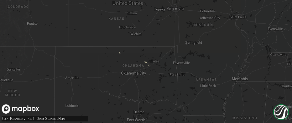
Hail Map on June 24, 2026
The weather event on June 24, 2026 includes Hail and Wind maps. 16 states and 243 cities were impacted and suffered possible damage. The total estimated number of properties impacted is 62,036.
Hail
Wind
62,036
Estimated number of impacted properties by a 1.00" hail or larger7,036
Estimated number of impacted properties by a 1.75" hail or larger6,554
Estimated number of impacted properties by a 2.50" hail or largerStates Impacted by Hail Map on June 24, 2026
Storm reports
Alabama
| Date | Description |
|---|---|
| 06/24/20265:00 PM CDT | Report with a photo of a large tree limb blocking part of the road just north of al 181 and al 104. |
| 06/24/20264:35 PM CDT | Report with a photo of a large tree blocking the road at cottage hill rd and ashwood dr. |
| 06/24/20264:25 PM CDT | Report of power lines down in the road at airport blvd and alverson rd. Widespread power outages across west mobile. |
| 06/24/20264:20 PM CDT | Nws employee relayed a tree blocking the road just east of the roundabout at dawes rd and dawes lane n. |
Utah
| Date | Description |
|---|---|
| 06/24/20265:15 PM CDT | Mesonet station vrh vernon hill. |
| 06/24/20264:28 PM CDT | Wendover awos |
| 06/24/20263:00 PM CDT | Blackrock mesonet site |
Illinois
| Date | Description |
|---|---|
| 06/24/20265:42 PM CDT | Quarter size hail near byron. Relayed via amateur radio. Time estimated by radar. |
| 06/24/20265:41 PM CDT | Public report of 1.5 inch hail near huntly. Relayed via mping. |
| 06/24/20264:07 PM CDT | Power lines down in front yard. |
Arizona
| Date | Description |
|---|---|
| 06/24/20264:50 PM CDT | Half-dollar sized hail reported by fort huachuca. |
Wisconsin
| Date | Description |
|---|---|
| 06/24/20265:37 PM CDT | Report from mping: quarter |
| 06/24/20265:25 PM CDT | A local report indicates 1.75 inch wind near Pulaski |
| 06/24/20264:56 PM CDT | Report from mping: half dollar |
| 06/24/20264:39 PM CDT | Report from mping: quarter |
| 06/24/20263:46 PM CDT | A local report indicates 1.25 inch wind near 2 SE Milton |
| 06/24/20263:34 PM CDT | Report from mping: half dollar |
| 06/24/20263:22 PM CDT | Tree down at lake rd and sidie hollow rd. |
| 06/24/20263:00 PM CDT | Power lines reported down south of belmont. |
| 06/24/20262:45 PM CDT | Report via social media with picture for reference. |
| 06/24/20262:43 PM CDT | Report from mping: quarter |
| 06/24/20261:40 PM CDT | A local report indicates 1.25 inch wind near Longwood |
| 06/24/202612:50 PM CDT | Report via social media photo. Location and time approximate. |
Michigan
| Date | Description |
|---|---|
| 06/24/20264:30 PM CDT | Report from social media of 1 inch hail in gaastra. Included pictures confirming size. |
| 06/24/20264:25 PM CDT | Estimated hail the size of quarters reported from local gas station. |
| 06/24/20262:46 PM CDT | Image from social media of a hail stone the size of a quarter at bond falls. |
Mississippi
| Date | Description |
|---|---|
| 06/24/20263:35 PM CDT | Trees reported down on old biloxi road. |
| 06/24/20263:25 PM CDT | Trees reported down on north carr bridge rd. |
| 06/24/20263:10 PM CDT | Tree down on a power line on go go road in the silver hill area. |
| 06/24/20262:40 PM CDT | Tree down on a power line in millard. |
Wyoming
| Date | Description |
|---|---|
| 06/24/20264:06 PM CDT | [landspout] ef-u. |
Colorado
| Date | Description |
|---|---|
| 06/24/20265:41 PM CDT | Report from mping: hen egg |
| 06/24/20265:33 PM CDT | A local report indicates 1.00 inch wind near 3 NNW Cokedale |
| 06/24/20265:31 PM CDT | A local report indicates 2.50 inch wind near 4 N Adena School |
| 06/24/20265:18 PM CDT | A local report indicates 1.75 inch wind near 2 NNE Fort Morgan |
| 06/24/20265:15 PM CDT | A local report indicates 1.75 inch wind near 1 NNE Log Lane Village |
| 06/24/20265:14 PM CDT | Report from mping: golf ball |
| 06/24/20265:09 PM CDT | Corrects time of previous hail report from 1 nne log lane village. Time estimated from radar. |
Florida
| Date | Description |
|---|---|
| 06/24/20265:11 PM CDT | Awos station kocf ocala airport - jim taylor fld measured a peak wind of 59 mph due to a downburst. |
| 06/24/20264:25 PM CDT | The mesonet station wn4mdn fort pierce measured a peak wind gust of 58mph/50kt from the northeast at 5:25 pm. |
| 06/24/20262:08 PM CDT | A tree was blown down and blocked the intersection at the 100 block of saratoga blvd e in royal palm beach. |
| 06/24/20262:01 PM CDT | Tree was blown down near intersection of erica blvd just south of southern blvd and 441 area. |
| 06/24/20261:51 PM CDT | Pea to quarter size hail fell around the mall at wellington green. |
Cities Impacted by Hail Map on June 24, 2026
- Carmen, OK
- Yale, OK
- Jennings, OK
- Drumright, OK
- Bristow, OK
- Okemah, OK
- Okmulgee, OK
- Henryetta, OK
- Council Hill, OK
- Morris, OK
- Checotah, OK
- Eufaula, OK
- Oak Hill, FL
- Edgewater, FL
- Opa Locka, FL
- Gordon, WI
- Orlando, FL
- Hialeah, FL
- Minong, WI
- Titusville, FL
- Cocoa, FL
- Webster, FL
- Greenwood, WI
- Kissimmee, FL
- Boca Raton, FL
- Pompano Beach, FL
- Deerfield Beach, FL
- Boynton Beach, FL
- Owen, WI
- Withee, WI
- Lake Worth, FL
- Loxahatchee, FL
- West Palm Beach, FL
- Saint Cloud, FL
- Thorp, WI
- Wellington, FL
- Medford, WI
- Raton, NM
- Loyal, WI
- Glen Flora, WI
- Floral City, FL
- Rib Lake, WI
- Westboro, WI
- Spencer, WI
- Brooksville, FL
- Caledonia, MN
- Hokah, MN
- Delray Beach, FL
- Houston, MN
- La Crescent, MN
- Inverness, FL
- Gilman, WI
- Bruce Crossing, MI
- Perkinston, MS
- Brownsville, MN
- Marshfield, WI
- Stoddard, WI
- Poplarville, MS
- Trout Creek, MI
- Lublin, WI
- Ogema, WI
- Carriere, MS
- Capitan, NM
- Cuba City, WI
- Platteville, WI
- Shullsburg, WI
- Tomahawk, WI
- Miami, FL
- Merrill, WI
- La Crosse, WI
- Genoa, WI
- Darlington, WI
- Belleville, WI
- Oregon, WI
- Brooklyn, WI
- Saucier, MS
- Viroqua, WI
- De Soto, WI
- Arpin, WI
- Wisconsin Rapids, WI
- Vesper, WI
- Biloxi, MS
- Evansville, WI
- White Lake, WI
- Townsend, WI
- Trinidad, CO
- Boncarbo, CO
- Las Vegas, NM
- Moriarty, NM
- McHenry, MS
- Lake Wales, FL
- Milladore, WI
- Babson Park, FL
- Frostproof, FL
- Fort Meade, FL
- Mountain, WI
- Vancleave, MS
- De Pere, WI
- Green Bay, WI
- Warren, IL
- Gratiot, WI
- Rudolph, WI
- Stevens Point, WI
- Guadalupita, NM
- Ocate, NM
- Janesville, WI
- Milton, WI
- McGregor, IA
- Monona, IA
- Iron River, MI
- Umatilla, FL
- Fort Huachuca, AZ
- Amite, LA
- Immokalee, FL
- Independence, LA
- Clewiston, FL
- Eustis, FL
- Edgerton, WI
- Vero Beach, FL
- Whitewater, WI
- Delavan, WI
- Necedah, WI
- Nekoosa, WI
- Neopit, WI
- Altoona, FL
- Tickfaw, LA
- Slidell, LA
- Winslow, IL
- Avalon, WI
- Bagley, WI
- Prairie Du Chien, WI
- Keshena, WI
- Aguilar, CO
- Fort Pierce, FL
- Sebring, FL
- Hammond, LA
- Bancroft, WI
- Loranger, LA
- Dunnellon, FL
- Lehigh Acres, FL
- Labelle, FL
- Long Lake, WI
- Avon Park, FL
- Arkdale, WI
- Briggsdale, CO
- Orchard, CO
- New Raymer, CO
- Gillett, WI
- Weldona, CO
- Curtiss, WI
- Colby, WI
- Corona, NM
- Caspian, MI
- Bloomington, WI
- Lake Placid, FL
- Okeechobee, FL
- Gaastra, MI
- Plainfield, WI
- Almond, WI
- Robert, LA
- Ponchatoula, LA
- Fort Morgan, CO
- Foster City, MI
- Wautoma, WI
- Wild Rose, WI
- Shawano, WI
- Bonduel, WI
- Hancock, WI
- Ocala, FL
- Patch Grove, WI
- Cecil, WI
- Unity, WI
- Freeport, IL
- Hillview, IL
- Merino, CO
- Snyder, CO
- Stoneham, CO
- Daphne, AL
- Patterson, IL
- Moore Haven, FL
- Claunch, NM
- Lancaster, WI
- Log Lane Village, CO
- Atoka, OK
- Krakow, WI
- Pulaski, WI
- Wiggins, CO
- Atwood, CO
- Roodhouse, IL
- White Hall, IL
- Carrollton, IL
- Ridott, IL
- Sagola, MI
- Waupaca, WI
- Salem, MO
- Bunker, MO
- Iron Mountain, MI
- Watrous, NM
- Valmora, NM
- Wagon Mound, NM
- Seymour, WI
- Rockbridge, IL
- Weston, CO
- Douglas, WY
- Winnebago, IL
- Pecatonica, IL
- Neshkoro, WI
- Berlin, WI
- Redgranite, WI
- Robertsdale, AL
- Otis, CO
- Akron, CO
- Sterling, CO
- Hillrose, CO
- Sierra Vista, AZ
- Hereford, AZ
- Elgin, AZ
- Vail, AZ
- Carlsbad, NM
- Huntley, IL
- Lake In The Hills, IL
- Crystal Lake, IL
- Algonquin, IL
- Byron, IL
- Leaf River, IL
- Seminole, AL
- Oneida, WI
- Brush, CO
- Coloma, WI
- Stratford, WI
- Vaughn, NM
- Medora, IL
- Abbotsford, WI
- Green Lake, WI
- Greenfield, IL
- Ellington, MO
- Wrights, IL
- Stockton, UT
- Woodstock, IL
- Dundee, IL
- Carpentersville, IL
- Guernsey, WY
- Wheatland, WY