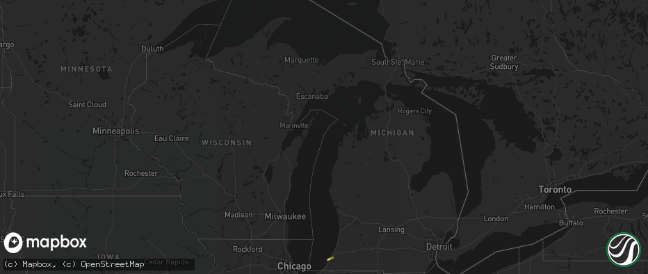
Hail Map in Michigan on May 4, 2026
The weather event in Michigan on May 4, 2026 includes Hail and Wind maps. 9 states and 359 cities were impacted and suffered possible damage. The total estimated number of properties impacted is 6,216.
Hail
Wind
6,216
Estimated number of impacted properties by a 1.00" hail or larger0
Estimated number of impacted properties by a 1.75" hail or larger0
Estimated number of impacted properties by a 2.50" hail or largerStorm reports in Michigan
Michigan
| Date | Description |
|---|---|
| 05/04/20266:59 PM CDT | Media reported a large tree limb fell onto a home... Causing damage to the roof. |
| 05/04/20266:52 PM CDT | Report of a large tree limb down near 14 mile rd and schoenherr rd. |
| 05/04/20266:16 PM CDT | A local report indicates 1.00 inch wind near Sodus |
| 05/04/20266:15 PM CDT | Photo on facebook of penny to quarter size hail. Time estimated via radar. |
| 05/04/20266:05 PM CDT | Spotter reports quarter size hail in stevensville just after 7 pm edt. |
| 05/03/20267:32 PM CDT | Report of minor roof damage to mobile homes. |
| 05/03/20267:10 PM CDT | Media reported a large tree limb fell onto a home... Causing damage to the roof. |
All States Impacted by Hail Map on May 4, 2026
Cities Impacted by Hail Map on May 4, 2026
- Belleville, IL
- Millstadt, IL
- Freeburg, IL
- Mascoutah, IL
- Okawville, IL
- Addieville, IL
- New Baden, IL
- Termo, CA
- Aledo, IL
- Seaton, IL
- Alexis, IL
- Sherrard, IL
- New Windsor, IL
- Mediapolis, IA
- Burlington, IA
- Lynn Center, IL
- Oquawka, IL
- Hazel Crest, IL
- Homewood, IL
- Oakville, IA
- Sperry, IA
- Keithsburg, IL
- Dorsey, IL
- Moro, IL
- Bethalto, IL
- Edwardsville, IL
- Little York, IL
- Godfrey, IL
- Cottage Hills, IL
- Alton, IL
- Keosauqua, IA
- Andover, IL
- Cambridge, IL
- Hartford, IL
- Birmingham, IA
- Stockport, IA
- North Henderson, IL
- Peru, IL
- La Salle, IL
- Worden, IL
- Wyanet, IL
- Buda, IL
- Annawan, IL
- Tiskilwa, IL
- Osco, IL
- Toulon, IL
- Bradford, IL
- Galva, IL
- Neponset, IL
- Mineral, IL
- Sheffield, IL
- Geneseo, IL
- Atkinson, IL
- Kewanee, IL
- Princeton, IL
- Orion, IL
- Morris, IL
- Gillespie, IL
- Bonaparte, IA
- Stevensville, MI
- Litchfield, IL
- Carlinville, IL
- Staunton, IL
- Alhambra, IL
- New Douglas, IL
- Livingston, IL
- Sorento, IL
- Mark, IL
- Hennepin, IL
- Putnam, IL
- Spring Valley, IL
- Bureau, IL
- Depue, IL
- Granville, IL
- Hillsboro, IL
- Butler, IL
- Mount Olive, IL
- Winfield, IA
- Hillsboro, IA
- Douds, IA
- Utica, IL
- Bunker Hill, IL
- Wilsonville, IL
- Morning Sun, IA
- Saint Joseph, MI
- Sodus, MI
- Benton Harbor, MI
- Greenville, IL
- Pocahontas, IL
- McNabb, IL
- Oglesby, IL
- Tonica, IL
- Standard, IL
- Ottawa, IL
- Cedar Point, IL
- Lostant, IL
- Dalzell, IL
- Channahon, IL
- Fillmore, IL
- Irving, IL
- Taylor Springs, IL
- Coffeen, IL
- Minooka, IL
- Highland, IL
- Milton, IA
- Yarmouth, IA
- Grand Ridge, IL
- Wedron, IL
- Serena, IL
- Leonore, IL
- Streator, IL
- Marseilles, IL
- Sheridan, IL
- Bingham, IL
- Elwood, IL
- Wilmington, IL
- Ramsey, IL
- Farmington, IA
- Lewis, KS
- West Point, IA
- Donnellson, IA
- Smithboro, IL
- Mulberry Grove, IL
- Saint Paul, IA
- Monmouth, IL
- Gerlaw, IL
- Galesburg, IL
- Carrollton, MO
- Seneca, IL
- Newark, IL
- Verona, IL
- Kinsman, IL
- Mazon, IL
- Ransom, IL
- Vandalia, IL
- Shobonier, IL
- Bogard, MO
- Danville, IA
- Manhattan, IL
- Fort Madison, IA
- Denmark, IA
- Wever, IA
- Bosworth, MO
- West Burlington, IA
- Saint Peter, IL
- Kinmundy, IL
- Lomax, IL
- Alma, IL
- Roseville, IL
- Dallas City, IL
- La Harpe, IL
- Blandinsville, IL
- Farina, IL
- Louisville, IL
- Edgewood, IL
- Blackstone, IL
- Carthage, IL
- Middletown, IA
- Mason, IL
- Niota, IL
- Sciota, IL
- Tennessee, IL
- Plymouth, IL
- Dwight, IL
- Ingraham, IL
- Bethany, IL
- Lovington, IL
- Dalton City, IL
- Sullivan, IL
- Atlanta, MO
- Macomb, IL
- Minonk, IL
- Moweaqua, IL
- Buffalo, IL
- Colchester, IL
- Odell, IL
- Mechanicsburg, IL
- Macon, MO
- Anabel, MO
- Clarence, MO
- Findlay, IL
- Cornell, IL
- Forrest, IL
- Mount Auburn, IL
- Blue Mound, IL
- Chenoa, IL
- Flanagan, IL
- Decatur, IL
- Niantic, IL
- Pontiac, IL
- Adair, IL
- Fairbury, IL
- Maywood, MO
- Macon, IL
- Palmyra, MO
- Industry, IL
- Littleton, IL
- Chatsworth, IL
- Vermont, IL
- Rushville, IL
- New Cambria, MO
- Topeka, IL
- Havana, IL
- Ipava, IL
- Table Grove, IL
- Callao, MO
- Payson, IL
- Quincy, IL
- Forest City, IL
- Bevier, MO
- Mason City, IL
- Easton, IL
- Shidler, OK
- Camp Point, IL
- Winfield, KS
- Kaw City, OK
- Brookfield, MO
- Bath, IL
- Astoria, IL
- Bucklin, MO
- Shelbina, MO
- Mount Sterling, IL
- San Jose, IL
- Excello, MO
- Arkansas City, KS
- Clayton, IL
- Manito, IL
- Timewell, IL
- Lentner, MO
- Emden, IL
- New Holland, IL
- Lincoln, IL
- Hartsburg, IL
- Oxford, KS
- Kilbourne, IL
- Virginia, IL
- Beardstown, IL
- Frederick, IL
- Huntsville, MO
- Versailles, IL
- Dexter, KS
- Jacksonville, MO
- Clifton Hill, MO
- Hunnewell, MO
- Paris, MO
- Chandlerville, IL
- Cairo, MO
- Oakford, IL
- Petersburg, IL
- Monroe City, MO
- Udall, KS
- Meredosia, IL
- Arenzville, IL
- Maple City, KS
- Atlanta, IL
- Greenview, IL
- White City, KS
- Madison, MO
- Salisbury, MO
- Cedar Vale, KS
- Athens, IL
- Beason, IL
- Jacksonville, IL
- Ashland, IL
- Concord, IL
- Chestnut, IL
- Kenney, IL
- Pleasant Plains, IL
- Chapin, IL
- Council Grove, KS
- Holliday, MO
- Griggsville, IL
- New Salem, IL
- Sedan, KS
- Pawhuska, OK
- Dwight, KS
- Cantrall, IL
- Sherman, IL
- Springfield, IL
- Alexander, IL
- Pittsfield, IL
- Williamsville, IL
- Clinton, IL
- New London, MO
- Center, MO
- Hannibal, MO
- Pleasant Hill, IL
- New Berlin, IL
- Moberly, MO
- Winchester, IL
- New Ross, IN
- Pearl, IL
- Perry, MO
- Riverton, IL
- Waverly, IL
- Franklin, IL
- Lenapah, OK
- Wann, OK
- Nebo, IL
- Copan, OK
- Kampsville, IL
- Lebanon, IN
- Pittsboro, IN
- Boody, IL
- Virden, IL
- White Hall, IL
- Vinita, OK
- Modesto, IL
- Brownsburg, IN
- Zionsville, IN
- Whitestown, IN
- Indianapolis, IN
- Girard, IL
- Welch, OK
- Delaware, OK
- Bluejacket, OK
- Park, KS
- Quinter, KS
- Morland, KS
- Wakeeney, KS
- Collyer, KS
- Penokee, KS
- Emporia, KS
- Neosho Rapids, KS
- Hartford, KS
- Reading, KS
- Osage City, KS
- Lebo, KS
- Mount Hope, KS
- Nokomis, IL
- Afton, OK
- Fairland, OK
- Burlington, KS
- Melvern, KS
- Waverly, KS
- Maize, KS
- Valley Center, KS
- Colwich, KS
- Shelbyville, IL
- Andale, KS
- Pana, IL
- Goddard, KS
- Mode, IL
- Wichita, KS
- Stewardson, IL
- Grove, OK
- Wyandotte, OK
- Walshville, IL
- Andover, KS
- Augusta, KS
- Bella Vista, AR
- Eureka, KS
- Pelsor, AR
- De Witt, MO
- Atalissa, IA
- West Liberty, IA
- West Branch, IA
- Strong City, KS
- Cottonwood Falls, KS


