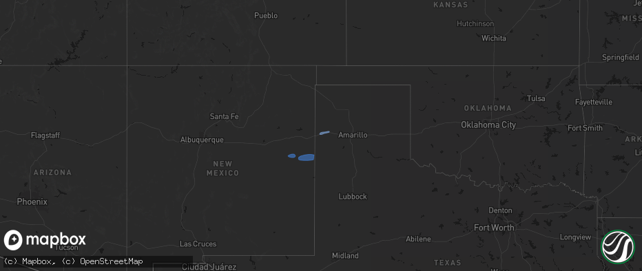
Hail Map on May 14, 2026
The weather event on May 14, 2026 includes Hail and Wind maps. 8 states and 78 cities were impacted and suffered possible damage. The total estimated number of properties impacted is 7,100.
Hail
Wind
7,100
Estimated number of impacted properties by a 1.00" hail or larger0
Estimated number of impacted properties by a 1.75" hail or larger0
Estimated number of impacted properties by a 2.50" hail or largerStates Impacted by Hail Map on May 14, 2026
Storm reports
New Mexico
| Date | Description |
|---|---|
| 05/14/20266:30 PM CDT | Mesonet station fw9688 jal measured a 59 mph wind gust associated with a convective downburst. |
| 05/14/20265:53 PM CDT | Asos station kcnm carlsbad measured a 58 mph wind gust associated with a convective downburst. |
| 05/14/20265:04 PM CDT | Asos station kcao clayton muni airpark. Dry microburst from a high based thunderstorm. |
| 05/13/202611:20 PM CDT | Heatburst induced wind gust from nearby collapsing showers. Wind gust was measured by a nasa davis vantage pro 2 weather station at fort sumner municipal airport. |
Kansas
| Date | Description |
|---|---|
| 05/14/20266:28 PM CDT | Report was from a public weather station |
| 05/14/20265:04 PM CDT | A local report indicates 60 MPH wind near 4 SE Iuka |
| 05/14/20265:04 PM CDT | A power pole was snapped on highway 54 on the east side of pratt. |
| 05/14/20264:45 PM CDT | Report was from a private weather station kksashla4. |
| 05/13/20267:45 PM CDT | A local report indicates 1.00 inch wind near Culver |
| 05/13/20267:44 PM CDT | A local report indicates 1.25 inch wind near 1 N Culver |
| 05/13/20267:37 PM CDT | Delayed report of wind damage. Multiple tree branches up to 6 inches in diameter broken off trees in norwich. |
| 05/13/20267:30 PM CDT | Mesonet station dw9907 bloom. |
| 05/13/20267:30 PM CDT | A local report indicates 1.25 inch wind near Clay Center |
| 05/13/20267:30 PM CDT | A local report indicates 1.50 inch wind near 1 NNW Clay Center |
| 05/13/20267:29 PM CDT | Corrects previous non-tstm wnd gst report from 2 nnw anthony. Storm chaser estimated 60 mph winds that shook the vehicle pretty hard. |
| 05/13/20267:21 PM CDT | Corrects time for previous tstm wnd gst report from 3 w clay center. Delayed social media report. Time estimated radar. |
| 05/13/20267:05 PM CDT | Spotter reported a couple of hailstones to quarter-size in the storm. |
| 05/13/20267:03 PM CDT | Delayed social media report. Time estimated radar. |
Colorado
| Date | Description |
|---|---|
| 05/14/20264:30 PM CDT | Awos station k2v5 2 nw wray. |
| 05/14/20263:55 PM CDT | Trained spotter reported: live tree branch roughly 6 inches in diameter broke off. |
Texas
| Date | Description |
|---|---|
| 05/14/20266:57 PM CDT | West texas mesonet. |
| 05/14/20266:35 PM CDT | Awos station ke01 monahans awos measured a 60 mph wind gust associated with a convective downburst. |
| 05/14/20266:17 PM CDT | West texas mesonet. |
| 05/14/20266:14 PM CDT | 68 mph gust measured at the wt mesonet site 9 miles nne of sunray... Tx. |
| 05/14/20266:01 PM CDT | Wind gust of 61 mph measured at the wt mesonet site 1 mile ene of mclean... Tx. |
| 05/14/20265:45 PM CDT | 5 power poles and an outbuilding blown down. |
| 05/14/20265:42 PM CDT | West texas mesonet. |
| 05/14/20265:31 PM CDT | Wind gust of 69 mph measured at the wt mesonet site 2 miles wnw of lake mcclellan. Severe gusts lasted from 5:31 to 5:33 pm. |
| 05/14/20265:28 PM CDT | Wind gust of 59 mph measured at wt mesonet site 2 miles ese of pampa... Tx. |
| 05/14/20265:28 PM CDT | Wind gust of 59 mph measured at wt mesonet site 2 miles ese of pampa... Tx. |
| 05/14/20265:24 PM CDT | Wind gust of 58 mph measured at the wt mesonet site in goodnight... Tx. |
| 05/14/20265:12 PM CDT | Wind gust of 63 mph recorded at the wt mesonet site 2 miles nw of hereford. Severe gusts lasted from 5:05 to 5:15 pm. |
| 05/14/20265:11 PM CDT | West texas mesonet. Substantial dust foot evident on nearby webcams. |
| 05/14/20265:11 PM CDT | West texas mesonet. |
| 05/14/20265:08 PM CDT | West texas mesonet. Zero-mile visibility from blowing dust in dimmitt. |
| 05/14/20265:07 PM CDT | Wind gust of 61 mph recorded at the wt mesonet site 2 miles nw of hereford. Severe gusts lasted from 5:05 to 5:07 pm. |
| 05/14/20265:02 PM CDT | Wind gust of 60 mph measured at the wt mesonet site 12 miles sw of claude... Tx. |
| 05/14/20264:42 PM CDT | West texas mesonet. |
| 05/14/20264:42 PM CDT | Broadcast media relayed a photo in slack of a wooden light pole that snapped at the baseball and softball fields on the south side of friona. Time estimated from radar |
| 05/14/20264:37 PM CDT | West texas mesonet. Near-zero visibility from blowing dust. |
| 05/14/20264:36 PM CDT | Mesonet station 159 orla 20wsw measured a 60 mph wind gust associated with a convective downburst. |
| 05/14/20264:28 PM CDT | 60 mph wind gust observed at wt mesonet site 11 miles wnw of bootleg... Tx at 4:17 pm. Maximum wind gust of 64 mph recorded at 4:28 pm. The last wind gust occurred at 4 |
| 05/14/20264:23 PM CDT | Corrected source. West texas mesonet. |
| 05/14/20264:23 PM CDT | West texas mesonet. |
| 05/14/20264:17 PM CDT | 60 mph wind gust observed at wt mesonet site 11 miles wnw of bootleg... Tx. |
| 05/14/20263:36 PM CDT | 59 mph wind gust measured at 6 wsw adrian west texas mesonet site. |
| 05/13/20268:45 PM CDT | Media viewer sent in video and pictures of front porch blowing off. |
| 05/13/20267:59 PM CDT | Mesonet station 15 seagraves 1sw measured a 59 mph wind gust associated with a convective downburst. |
| 05/13/20267:17 PM CDT | West texas mesonet. |
| 05/13/20267:16 PM CDT | West texas mesonet. |
Cities Impacted by Hail Map on May 14, 2026
- Olivet, SD
- House, NM
- Mcalister, NM
- Melrose, NM
- Vega, TX
- Adrian, TX
- Clovis, NM
- Texico, NM
- Wray, CO
- Bovina, TX
- Farwell, TX
- Friona, TX
- Levelland, TX
- Sundown, TX
- Haviland, KS
- Pratt, KS
- Saint Francis, KS
- Haigler, NE
- Cunningham, KS
- Turon, KS
- Iuka, KS
- Claude, TX
- Canyon, TX
- Hereford, TX
- Dimmitt, TX
- Hart, TX
- Happy, TX
- Tulia, TX
- Nazareth, TX
- Shallowater, TX
- Lubbock, TX
- Pampa, TX
- Groom, TX
- Panhandle, TX
- Clarendon, TX
- Mclean, TX
- Bird City, KS
- McDonald, KS
- Miami, TX
- Kress, TX
- Wheeler, TX
- Canadian, TX
- Mobeetie, TX
- Shamrock, TX
- Clay Center, KS
- Ellsworth, KS
- Childress, TX
- Beverly, KS
- Lincoln, KS
- Anthony, KS
- Quanah, TX
- Brookville, KS
- Tescott, KS
- Salina, KS
- Leonardville, KS
- Green, KS
- Bennington, KS
- Lindsborg, KS
- Freeport, KS
- Danville, KS
- Harper, KS
- Monroe City, MO
- Taylor, MO
- Hannibal, MO
- Palmyra, MO
- Hull, IL
- New London, MO
- Quincy, IL
- Liberty, IL
- Plainville, IL
- Payson, IL
- Roodhouse, IL
- Center, MO
- Kinderhook, IL
- Copeland, KS
- Ensign, KS
- Montezuma, KS
- Minneola, KS