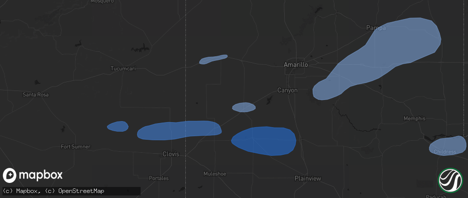
Hail Map in Hereford, TX on May 14, 2026
The weather event in Hereford, TX on May 14, 2026 includes Hail and Wind maps. 8 states and 78 cities were impacted and suffered possible damage. The total estimated number of properties impacted is 0.
Hail
Wind
0
Estimated number of impacted properties by a 1.00" hail or larger0
Estimated number of impacted properties by a 1.75" hail or larger0
Estimated number of impacted properties by a 2.50" hail or largerStorm reports in Hereford, TX
Hereford, TX
| Date | Description |
|---|---|
| 05/14/20265:12 PM CDT | Wind gust of 63 mph recorded at the wt mesonet site 2 miles nw of hereford. Severe gusts lasted from 5:05 to 5:15 pm. |
| 05/14/20265:07 PM CDT | Wind gust of 61 mph recorded at the wt mesonet site 2 miles nw of hereford. Severe gusts lasted from 5:05 to 5:07 pm. |
| 05/14/20264:28 PM CDT | 60 mph wind gust observed at wt mesonet site 11 miles wnw of bootleg... Tx at 4:17 pm. Maximum wind gust of 64 mph recorded at 4:28 pm. The last wind gust occurred at 4 |
| 05/14/20264:17 PM CDT | 60 mph wind gust observed at wt mesonet site 11 miles wnw of bootleg... Tx. |
All States Impacted by Hail Map on May 14, 2026
All Cities Impacted by Hail Map on May 14, 2026
- Olivet, SD
- House, NM
- Mcalister, NM
- Melrose, NM
- Vega, TX
- Adrian, TX
- Clovis, NM
- Texico, NM
- Wray, CO
- Bovina, TX
- Farwell, TX
- Friona, TX
- Levelland, TX
- Sundown, TX
- Haviland, KS
- Pratt, KS
- Saint Francis, KS
- Haigler, NE
- Cunningham, KS
- Turon, KS
- Iuka, KS
- Claude, TX
- Canyon, TX
- Hereford, TX
- Dimmitt, TX
- Hart, TX
- Happy, TX
- Tulia, TX
- Nazareth, TX
- Shallowater, TX
- Lubbock, TX
- Pampa, TX
- Groom, TX
- Panhandle, TX
- Clarendon, TX
- Mclean, TX
- Bird City, KS
- McDonald, KS
- Miami, TX
- Kress, TX
- Wheeler, TX
- Canadian, TX
- Mobeetie, TX
- Shamrock, TX
- Clay Center, KS
- Ellsworth, KS
- Childress, TX
- Beverly, KS
- Lincoln, KS
- Anthony, KS
- Quanah, TX
- Brookville, KS
- Tescott, KS
- Salina, KS
- Leonardville, KS
- Green, KS
- Bennington, KS
- Lindsborg, KS
- Freeport, KS
- Danville, KS
- Harper, KS
- Monroe City, MO
- Taylor, MO
- Hannibal, MO
- Palmyra, MO
- Hull, IL
- New London, MO
- Quincy, IL
- Liberty, IL
- Plainville, IL
- Payson, IL
- Roodhouse, IL
- Center, MO
- Kinderhook, IL
- Copeland, KS
- Ensign, KS
- Montezuma, KS
- Minneola, KS


