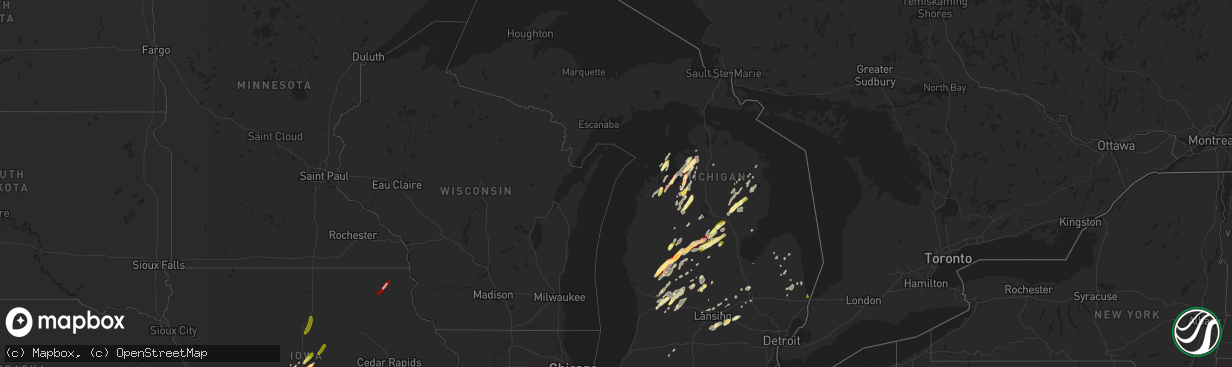
Hail Map in Michigan on May 20, 2013
The weather event in Michigan on May 20, 2013 includes Hail and Wind maps. 14 states and 962 cities were impacted and suffered possible damage. The total estimated number of properties impacted is 41,423.
Hail
Wind
41,423
Estimated number of impacted properties by a 1.00" hail or larger19,961
Estimated number of impacted properties by a 1.75" hail or larger0
Estimated number of impacted properties by a 2.50" hail or largerStorm reports in Michigan
Michigan
| Date | Description |
|---|---|
| 05/20/20136:17 PM CDT | Wires and powerlines downed |
| 05/20/20136:12 PM CDT | Downed power lines. Radar estimated time. |
| 05/20/20136:03 PM CDT | Power lines down |
| 05/20/20136:01 PM CDT | Tree down across the road at rich road and murphy lake road |
| 05/20/20136:00 PM CDT | Trees downed at fenton and lakeside landing roads |
| 05/20/20135:55 PM CDT | 12 inch diameter trees downed at sharp and grand blanc roads |
| 05/20/20135:54 PM CDT | 8 inch diameter tree limb down. |
| 05/20/20135:52 PM CDT | Branches on power lines north of town. Tree debris was seen all along u.s. 127 from dewitt to st. Johns. |
| 05/20/20135:46 PM CDT | Trees down at fischer and faussett roads |
| 05/20/20135:42 PM CDT | Large tree limbs downed |
| 05/20/20135:38 PM CDT | 15 inch tree limbs downed at pasadena and i-75 |
| 05/20/20135:33 PM CDT | Trees down at owosso and hayner roads |
| 05/20/20135:20 PM CDT | Ingham co dispatch stated that trees and power lines were reported down |
| 05/20/20135:12 PM CDT | Trees and power lines down. Radar estimated time. |
| 05/20/20135:07 PM CDT | Downed power lines. Radar estimated time. |
| 05/20/20135:03 PM CDT | Downed power line. Radar estimated time. |
| 05/20/20134:59 PM CDT | Trees down. |
| 05/20/20134:56 PM CDT | Power lines and trees down. Radar estimated time. |
| 05/20/20134:53 PM CDT | Snapped powerline in northern tuscola county |
| 05/20/20134:52 PM CDT | Barn blown down. Radar estimated time. |
| 05/20/20134:50 PM CDT | Power lines down. |
| 05/20/20134:30 PM CDT | Metal panel roof blown off of a car wash near the intersection of warwick drive and wright ave. |
| 05/20/20134:30 PM CDT | Clinton co dispatch and em reported power lines and several tree limbs were down in the southwest portion of the county.tree limbs were 10 to 12 inches in diameter. |
| 05/20/20134:25 PM CDT | Ham radio operator reported pea size hail along with measured thunderstorm wind gusts |
| 05/20/20134:15 PM CDT | Numerous power lines down. |
| 05/20/20134:10 PM CDT | Power poles down just east of alma on lincoln road. One person is trapped in their vehicle due to down lines. Verified by alma police dept |
| 05/20/20134:10 PM CDT | Numerous trees and wires down. |
| 05/20/20134:10 PM CDT | Utility trailers blown onto their sides along m-46.several power poles broken. Spotter also noted large tree limbs down |
| 05/20/20134:07 PM CDT | Trees down. |
| 05/20/20134:05 PM CDT | Trees down |
| 05/20/20133:57 PM CDT | Roof reported blown off a house |
| 05/20/20133:56 PM CDT | Power lines and trees down. Radar estimated time. |
| 05/20/20133:53 PM CDT | Trees down |
| 05/20/20133:50 PM CDT | Spotter reported large trees and power lines down. Trees were one to one and a half foot in diameter. |
| 05/20/20133:30 PM CDT | A local report indicates 1.00 inch wind near 4 E BEAVERTON |
| 05/20/20133:30 PM CDT | 14 inch diameter trees down around albright shores |
| 05/20/20133:30 PM CDT | Semi trailer blown over |
| 05/20/20133:20 PM CDT | Spotter reported several 5-6 inch tree limbs down |
| 05/20/20133:20 PM CDT | Numerous trees down. |
| 05/20/20133:15 PM CDT | Ionia co central dispatch stated that they had various reports of trees and limbs down in the belding and orleans areas |
| 05/20/20132:37 PM CDT | Power poles snapped in half in a field |
| 05/20/20132:36 PM CDT | Mecosta co. Dispatch stated a downed tree has brought down two power lines near 8 mile road and us 131 |
| 05/20/20132:20 PM CDT | A local report indicates 1.00 inch wind near 1 NE GRAND RAPIDS |
| 05/20/20132:20 PM CDT | Information relayed from the public via wood tv |
| 05/20/20132:16 PM CDT | Ping pong ball sized hail |
| 05/20/20132:15 PM CDT | A local report indicates 1.00 inch wind near HARRISON |
| 05/20/20132:10 PM CDT | Reported at walloon lake country club. 40 trees uprooted. Wind speed estimated at 70 mph. |
| 05/20/20132:10 PM CDT | Trees down. |
| 05/20/20132:10 PM CDT | Power lines down. |
| 05/20/20132:00 PM CDT | Tree down in mancelona. |
| 05/20/20131:55 PM CDT | A local report indicates 1.00 inch wind near 3 ESE BELLAIRE |
| 05/20/20131:51 PM CDT | A local report indicates 1.75 inch wind near 4 SE KALKASKA |
| 05/20/20131:45 PM CDT | At hardy dam. |
| 05/20/20131:28 PM CDT | Relayed by wzzm13. Measured one and six tenths diameter hail. |
| 05/20/20131:23 PM CDT | Multiple trees down |
| 05/20/20131:23 PM CDT | Tree down in kewadin. |
| 05/20/20131:08 PM CDT | A local report indicates 1.00 inch wind near 3 S NORTHPORT |
| 05/20/201312:51 PM CDT | A local report indicates 1.00 inch wind near 3 W TRAVERSE CITY |
| 05/19/20137:35 PM CDT | Slightly larger than quarters. |
All States Impacted by Hail Map on May 20, 2013
Cities Impacted by Hail Map on May 20, 2013
- Higbee, MO
- Madison, MO
- Clark, MO
- Moberly, MO
- Hampton, FL
- Gainesville, FL
- Waldo, FL
- Starke, FL
- Bowie, TX
- Chelsea, OK
- Caney, KS
- Copan, OK
- Howard City, MI
- Novinger, MO
- Greentop, MO
- Kirksville, MO
- Grand Rapids, MI
- Belding, MI
- Greenville, MI
- Ada, MI
- Lowell, MI
- Sedan, KS
- Perry, MO
- Stoutsville, MO
- Santa Fe, MO
- Fair Play, MO
- Fayette, MO
- Westville, OK
- Proctor, OK
- Crocker, MO
- Richland, MO
- Meeker, OK
- Mustang, OK
- Bethany, OK
- Choctaw, OK
- Mcloud, OK
- Wheatland, OK
- Harrah, OK
- Newalla, OK
- Oklahoma City, OK
- Jones, OK
- Newcastle, OK
- Wellston, OK
- Norman, OK
- Spencer, OK
- Bradenton, FL
- Talala, OK
- Ninnekah, OK
- Chickasha, OK
- Sullivan, MO
- Leslie, MO
- Beaufort, MO
- Harrisonville, MO
- Garden City, MO
- Ada, OK
- Lebanon, MO
- Windyville, MO
- Tunas, MO
- Eldridge, MO
- Port Charlotte, FL
- Venice, FL
- North Port, FL
- Williamsburg, MI
- Rapid City, MI
- Elk Rapids, MI
- Kewadin, MI
- Madill, OK
- Haslett, MI
- Owensville, MO
- Muenster, TX
- Saint Jo, TX
- Bland, MO
- Belle, MO
- Marlow, OK
- Rush Springs, OK
- Park Hill, OK
- Tahlequah, OK
- Carbon, TX
- Eastland, TX
- Rising Star, TX
- Cisco, TX
- Bartlesville, OK
- Wichita Falls, TX
- Maxwell, IA
- Cambridge, IA
- Bourbon, MO
- Gerald, MO
- New Haven, MO
- Rosebud, MO
- Saint James, MO
- Washington, MO
- Rolla, MO
- Cuba, MO
- Marthasville, MO
- Union, MO
- Vichy, MO
- Dansville, MI
- Williamston, MI
- Webberville, MI
- Newaygo, MI
- Mecosta, MI
- Barryton, MI
- Morley, MI
- White Cloud, MI
- Rodney, MI
- Big Rapids, MI
- Evart, MI
- Stanwood, MI
- Vinita, OK
- Queen City, MO
- Green Castle, MO
- Early, TX
- Purmela, TX
- Hamilton, TX
- Pottsville, TX
- Mullin, TX
- Gatesville, TX
- Brownwood, TX
- Sidney, TX
- Comanche, TX
- Goldthwaite, TX
- Jonesboro, TX
- Zephyr, TX
- May, TX
- Evant, TX
- Gustine, TX
- Blanket, TX
- Priddy, TX
- Sturgeon, MO
- Saint George, SC
- Bowman, SC
- Chico, TX
- Jacksboro, TX
- Northport, MI
- Foster, OK
- Elmore City, OK
- Laingsburg, MI
- Swoope, VA
- Rockford, MI
- Sasakwa, OK
- Rich Hill, MO
- Butler, MO
- Osceola, MO
- Deepwater, MO
- Rockville, MO
- Hume, MO
- Montrose, MO
- Appleton City, MO
- Clinton, MO
- Stonewall, OK
- Boyne City, MI
- Traverse City, MI
- Interlochen, MI
- Pawhuska, OK
- Duncan, OK
- Afton, IA
- Creston, IA
- Lorimor, IA
- Shannon City, IA
- Winterset, IA
- Macksburg, IA
- Comanche, OK
- Skiatook, OK
- Barnsdall, OK
- Ramona, OK
- Centralia, MO
- Beaverton, MI
- Edmore, MI
- Stratford, OK
- Lachine, MI
- De Leon, TX
- Bois D Arc, MO
- Fulton, MO
- Lutz, FL
- Dade City, FL
- Land O'Lakes, FL
- Wesley Chapel, FL
- San Antonio, FL
- Mason, MI
- Deland, FL
- Slater, MO
- Glasgow, MO
- Pilot Grove, MO
- Sedalia, MO
- Hughesville, MO
- New Franklin, MO
- Sweet Springs, MO
- Houstonia, MO
- Blackwater, MO
- Franklin, MO
- La Monte, MO
- Arrow Rock, MO
- Smithton, MO
- Gilliam, MO
- Nelson, MO
- Marshall, MO
- Davenport, FL
- Kissimmee, FL
- Lueders, TX
- Albany, TX
- Franklin, NC
- Sylva, NC
- Suttons Bay, MI
- Coffeyville, KS
- Springer, OK
- Ardmore, OK
- Brookfield, MO
- New Boston, MO
- Aurora, MO
- Marionville, MO
- Verona, MO
- Miami, OK
- Wyandotte, OK
- Clarksville, MI
- Saranac, MI
- Alto, MI
- Vienna, MO
- Dixon, MO
- Columbia, MO
- Auxvasse, MO
- Croswell, MI
- Welch, OK
- Holdenville, OK
- Rose City, MI
- West Branch, MI
- South Branch, MI
- Lupton, MI
- Fair Grove, MO
- Pleasant Hope, MO
- Springfield, MO
- Curran, MI
- Hubbard Lake, MI
- Barton City, MI
- Cement, OK
- Alex, OK
- Blanchard, OK
- Wapanucka, OK
- Milburn, OK
- Tupelo, OK
- Iberia, MO
- Saint Elizabeth, MO
- Tuscumbia, MO
- Flushing, MI
- Montrose, MI
- Mexico, MO
- Eufaula, OK
- Independence, KS
- De Leon Springs, FL
- Wilson, OK
- Severy, KS
- Howard, KS
- Fall River, KS
- Piedmont, KS
- Gladwin, MI
- Alger, MI
- Glencoe, OK
- Stillwater, OK
- Windermere, FL
- Orlando, FL
- Winter Garden, FL
- Hawthorne, FL
- Granby, MO
- Pierce City, MO
- Carthage, MO
- Sarcoxie, MO
- Nocona, TX
- Cullowhee, NC
- Decker, MI
- Apopka, FL
- Altamonte Springs, FL
- Ocoee, FL
- Lake Mary, FL
- Longwood, FL
- Brinktown, MO
- Brumley, MO
- Meta, MO
- Newburg, MO
- Argyle, MO
- Stoutland, MO
- Long Lane, MO
- Montreal, MO
- Buffalo, MO
- Ubly, MI
- East Jordan, MI
- Boyne Falls, MI
- Kalkaska, MI
- Fife Lake, MI
- Belmont, MI
- Wynnewood, OK
- Edmond, OK
- Parrish, FL
- Myakka City, FL
- Lamar, MO
- Liberal, MO
- Fort Gibson, OK
- Hulbert, OK
- Reed City, MI
- Paris, MI
- Hersey, MI
- Mound City, KS
- Blairstown, MO
- Adrian, MO
- Warrensburg, MO
- Foster, MO
- Creighton, MO
- La Cygne, KS
- Centerview, MO
- Chilhowee, MO
- Amsterdam, MO
- Amoret, MO
- Archie, MO
- Holden, MO
- Pleasanton, KS
- Leon, OK
- Coalgate, OK
- Republic, MO
- Westphalia, KS
- Garnett, KS
- Welda, KS
- Braggs, OK
- Muskogee, OK
- Morriston, FL
- Inglis, FL
- Bronson, FL
- Sumner, MI
- Van Meter, IA
- Waukee, IA
- Dallas Center, IA
- Adel, IA
- De Soto, IA
- Breckenridge, TX
- Moran, KS
- La Harpe, KS
- Yates Center, KS
- Toronto, KS
- Piqua, KS
- Buffalo, KS
- Iola, KS
- Bronson, KS
- Fredonia, KS
- Humboldt, KS
- Kingston, OK
- Willard, MO
- Archer, FL
- Micanopy, FL
- Tishomingo, OK
- Mill Creek, OK
- Concordia, MO
- Fort McCoy, FL
- Jefferson City, MO
- Centertown, MO
- Hartsburg, MO
- Polk City, IA
- Slater, IA
- Alleman, IA
- Huxley, IA
- Lincoln, AR
- Summers, AR
- Ochelata, OK
- Wright City, MO
- Paoli, OK
- Byars, OK
- Maysville, OK
- Pauls Valley, OK
- Lindsay, OK
- Wayne, OK
- Calhoun, MO
- Earleton, FL
- Knob Noster, MO
- Whiteman Air Force Base, MO
- Sparta, MI
- Sand Lake, MI
- Cedar Springs, MI
- Comstock Park, MI
- Ringgold, TX
- Big Cabin, OK
- Elk City, KS
- Riverdale, MI
- Elwell, MI
- Henrietta, TX
- South Boardman, MI
- Au Gres, MI
- Turner, MI
- Owosso, MI
- Corunna, MI
- Carson City, MI
- Perrinton, MI
- Hubbardston, MI
- Middleton, MI
- Prescott, KS
- Urich, MO
- East Lynne, MO
- Blue Mound, KS
- Otterville, MO
- Holliday, MO
- Bunceton, MO
- Paola, KS
- Fontana, KS
- Peculiar, MO
- Pleasant Hill, MO
- Paris, MO
- Centerville, KS
- Louisburg, KS
- Dalton, MO
- Parker, KS
- Boonville, MO
- Drexel, MO
- Colony, KS
- Salisbury, MO
- Leeton, MO
- Grenola, KS
- Freeman, MO
- Kincaid, KS
- Kingsville, MO
- Keytesville, MO
- Cleveland, MO
- Flint, MI
- Burton, MI
- Melvin, MI
- Peck, MI
- Yale, MI
- Brown City, MI
- Baring, MO
- Rutledge, MO
- Memphis, MO
- Edina, MO
- Nevada, IA
- Arbela, MO
- Luray, MO
- Cherryvale, KS
- Liberty, KS
- Bowling Green, FL
- Fort Meade, FL
- Ringling, OK
- Ankeny, IA
- Bondurant, IA
- Des Moines, IA
- Geronimo, OK
- Walters, OK
- Waurika, OK
- Holliday, TX
- Byers, TX
- Randlett, OK
- Temple, OK
- Sheppard Afb, TX
- Ryan, OK
- Healdton, OK
- Montague, TX
- Iowa Park, TX
- Terral, OK
- Petrolia, TX
- Lone Grove, OK
- Bellevue, TX
- Burneyville, OK
- Miami, MO
- Hillman, MI
- Tampa, FL
- Smoaks, SC
- Walterboro, SC
- Reevesville, SC
- Mio, MI
- Fairview, MI
- Orange City, FL
- Sheridan, MI
- Fenwick, MI
- Wolverine, MI
- Lexington, OK
- Rocheport, MO
- Eagle, MI
- Grand Ledge, MI
- Elmira, MI
- Collinsville, OK
- Thompson, MO
- Lohman, MO
- Russellville, MO
- Elkhart, IA
- Ranger, TX
- Caddo, TX
- Strawn, TX
- Comins, MI
- Owendale, MI
- Staunton, VA
- Ocala, FL
- Wooldridge, MO
- Umatilla, FL
- Leesburg, FL
- Ocklawaha, FL
- Meigs, GA
- Oologah, OK
- Siloam Springs, AR
- Saint Johns, MI
- Half Way, MO
- Grimes, IA
- Earlham, IA
- Clive, IA
- Johnston, IA
- Booneville, IA
- West Des Moines, IA
- Urbandale, IA
- Collins, IA
- Granger, IA
- Lenox, IA
- Colo, IA
- Diagonal, IA
- Williamstown, MO
- Newark, MO
- Kahoka, MO
- La Belle, MO
- Knox City, MO
- Watts, OK
- Checotah, OK
- Henryetta, OK
- Oktaha, OK
- Howell, MI
- Fowlerville, MI
- Hallsville, MO
- Prairie Grove, AR
- Fayetteville, AR
- Tustin, MI
- Fairland, OK
- Herron, MI
- Bluejacket, OK
- Stigler, OK
- Grawn, MI
- Mead, OK
- Cherokee, KS
- McCune, KS
- Valrico, FL
- Dover, FL
- Brandon, FL
- Seffner, FL
- Citra, FL
- Homosassa, FL
- Brooksville, FL
- Leslie, AR
- Harrisburg, MO
- Terlton, OK
- Cleveland, OK
- Pierson, FL
- Belle Glade, FL
- Vicksburg, MI
- Lake City, FL
- Clio, MI
- Everton, MO
- Miller, MO
- Jennings, OK
- Vera, OK
- Delaware, OK
- Claremore, OK
- Hominy, OK
- Prue, OK
- Yale, OK
- Osage, OK
- Sperry, OK
- Tulsa, OK
- Owasso, OK
- Maramec, OK
- Nowata, OK
- Cookson, OK
- Arcadia, FL
- Mannsville, OK
- Sulphur, OK
- Walnut Grove, MO
- Aldrich, MO
- Chandler, OK
- Davenport, OK
- Stroud, OK
- Eustis, FL
- Purdy, MO
- Monett, MO
- Lenapah, OK
- Lake, MI
- Farwell, MI
- Sears, MI
- Jasper, MO
- Oronogo, MO
- Hermann, MO
- Billings, MO
- Mount Vernon, MO
- Washburn, MO
- Faxon, OK
- Roff, OK
- Stilwell, OK
- Tyro, KS
- Wann, OK
- Lake City, MI
- Wheaton, MO
- Clare, MI
- Harrison, MI
- Chippewa Lake, MI
- Ames, IA
- Allen, OK
- Anthony, FL
- Silver Springs, FL
- Meridian, OK
- Erie, KS
- Stark, KS
- Shelbina, MO
- Conway, MO
- Grovespring, MO
- Niangua, MO
- Kingdom City, MO
- Stuart, OK
- S Coffeyville, OK
- Oswego, KS
- Perrin, TX
- Goshen, VA
- Grandville, MI
- Byron Center, MI
- Wyoming, MI
- Tuttle, OK
- Thonotosassa, FL
- Saint Patrick, MO
- Lewistown, MO
- Vermilion, OH
- Inverness, FL
- Lecanto, FL
- Mount Pleasant, MI
- Weidman, MI
- Remus, MI
- Sand Springs, OK
- Metter, GA
- Wynona, OK
- Fairfax, OK
- Pawnee, OK
- Bellaire, MI
- Alden, MI
- Mancelona, MI
- Mindenmines, MO
- Windsor, MO
- Graham, TX
- Graford, TX
- Bryson, TX
- Bolivar, MO
- Morrisville, MO
- Sylvania, GA
- Cyril, OK
- Apache, OK
- Bradley, OK
- Purcell, OK
- Fletcher, OK
- Anadarko, OK
- Brashear, MO
- Hurdland, MO
- Asbury, MO
- Columbus, KS
- Pittsburg, KS
- Weir, KS
- Scammon, KS
- Alden, IA
- Dows, IA
- Popejoy, IA
- Hampton, IA
- Latimer, IA
- McBain, MI
- Marion, MI
- Exeter, MO
- Rogers City, MI
- West Augusta, VA
- Lane, KS
- Yukon, OK
- Vestaburg, MI
- Chanute, KS
- Jamestown, MO
- Fort White, FL
- Ithaca, MI
- Fowler, MI
- Statesboro, GA
- High Springs, FL
- Green Ridge, MO
- Durant, OK
- Versailles, IL
- Chambersburg, IL
- Mcalester, OK
- Stark City, MO
- Altamont, KS
- Edna, KS
- Parsons, KS
- Mound Valley, KS
- Lawton, OK
- Humansville, MO
- Central Lake, MI
- Tiger, GA
- Clayton, GA
- Neodesha, KS
- Naples, FL
- Highlands, NC
- Cashiers, NC
- Abilene, TX
- Sanderson, FL
- Stockton, MO
- Petoskey, MI
- Dustin, OK
- Berger, MO
- Marlette, MI
- Lockwood, MO
- Jerico Springs, MO
- Foristell, MO
- Mingo, IA
- Grant, MI
- Pierson, MI
- Kent City, MI
- Sorrento, FL
- Sanford, FL
- Lake Toxaway, NC
- Stotts City, MO
- Kelley, IA
- Madrid, IA
- Lorain, OH
- Ashland, MO
- Greenville, VA
- Caledonia, MI
- Atoka, OK
- Lane, OK
- Six Lakes, MI
- Wauchula, FL
- Bartow, FL
- Uniontown, KS
- Ash Grove, MO
- Alexandria, MO
- Novelty, MO
- Wentworth, MO
- Scotland, TX
- Porum, OK
- Register, GA
- Chattanooga, OK
- Jermyn, TX
- Dewitt, MI
- Lansing, MI
- Manton, MI
- Houghton Lake, MI
- Stella, MO
- Neosho, MO
- Mount Dora, FL
- Mountain Rest, SC
- Wanette, OK
- Canadian, OK
- Lebanon, OK
- Marietta, OK
- Greenfield, MO
- Dadeville, MO
- Linn, MO
- Trufant, MI
- Hartville, MO
- Falcon, MO
- Decorah, IA
- Ossian, IA
- Spring Hill, FL
- Girard, KS
- Cassville, MO
- Roosevelt, OK
- Hale, MI
- Armstrong, MO
- Reeds, MO
- Hudsonville, MI
- Bath, MI
- Ulman, MO
- Havana, KS
- Peru, KS
- Cedar Vale, KS
- Balsam Grove, NC
- Rosman, NC
- Houghton Lake Heights, MI
- Asher, OK
- Konawa, OK
- Dahlonega, GA
- Centrahoma, OK
- Middlebrook, VA
- Fairgrove, MI
- Capac, MI
- Bucyrus, KS
- Diamond, MO
- Camilla, GA
- Doerun, GA
- Sale City, GA
- Depew, OK
- Thayer, KS
- Dunnellon, FL
- Fort Scott, KS
- Zephyrhills, FL
- Gainesville, TX
- Coleman, OK
- Overbrook, OK
- Davis, OK
- Seneca, MO
- Calmar, IA
- Welling, OK
- Council Hill, OK
- Warner, OK
- Clifton, TX
- Valley Mills, TX
- Marceline, MO
- North Star, MI
- McRae Helena, GA
- Weleetka, OK
- Altoona, KS
- Williston, FL
- Osawatomie, KS
- Gorin, MO
- Stanton, MI
- Spiro, OK
- Pocola, OK
- Cameron, OK
- Kenefic, OK
- Sparks, OK
- Scotts, MI
- Swartz Creek, MI
- Cass City, MI
- Carnegie, OK
- Mountain View, OK
- Alpena, MI
- Brighton, MO
- Altoona, IA
- Monroe City, MO
- Benedict, KS
- Arcola, MO
- Kirkman, IA
- Ionia, MI
- Grand Island, FL
- Roseville, IL
- Smithshire, IL
- Swaledale, IA
- New Bloomfield, MO
- Bowling Green, MO
- Cushing, OK
- Glennie, MI
- Englewood, FL
- Mulberry, KS
- Bronaugh, MO
- Sandusky, MI
- Snover, MI
- Dewey, OK
- Niotaze, KS
- Dearing, KS
- Galesburg, KS
- Montgomery City, MO
- Williamsburg, MO
- Hector, AR
- Pelsor, AR
- Gaines, MI
- Alma, MI
- Collins, MO
- Vanderbilt, MI
- Gaylord, MI
- Ona, FL
- Higginsville, MO
- Hunnewell, MO
- Mapleton, KS
- Odessa, MO
- Lakeview, MI
- Blanchard, MI
- Coral, MI
- Lincoln, MO
- Woodward, IA
- Oakford, IL
- Bristow, OK
- Riverview, FL
- Onondaga, MI
- Eaton Rapids, MI
- Ruth, MI
- Minden City, MI
- Flemington, MO
- Wheatland, MO
- Holts Summit, MO
- Wetumka, OK
- Colcord, OK
- Bunch, OK
- Sunset, TX
- Tussy, OK
- Hennepin, OK
- Ratliff City, OK
- Shawnee, OK
- Antlers, OK
- Caddo, OK
- Caney, OK
- Moyers, OK
- Finley, OK
- Washington, OK
- Clever, MO
- Crane, MO
- Galena, MO
- Dunnegan, MO
- Center, MO
- Labadie, MO
- Saint Clair, MO
- Augusta, MO
- Saint Charles, MO
- Saint Peters, MO
- Litchfield, IL
- Dorsey, IL
- Staunton, IL
- Gillespie, IL
- Wilsonville, IL
- Bunker Hill, IL
- Benld, IL
- Shipman, IL
- Mount Olive, IL
- Liberty, IL
- Barry, IL
- Kinderhook, IL
- Plainville, IL
- Rabun Gap, GA
- Fort Atkinson, IA
- West Union, IA
- Mount Vernon, IL
- Sesser, IL
- Mulkeytown, IL
- Tamaroa, IL
- Du Quoin, IL
- Pinckneyville, IL
- Dana, IL
- Minonk, IL
- Benson, IL
- Rutland, IL
- Port Huron, MI
- Fort Gratiot, MI
- Marseilles, IL
- Ottawa, IL
- Grand Ridge, IL
- Manteno, IL
- Bourbonnais, IL
- Peotone, IL
- Manhattan, IL
- Wilmington, IL
- Frankfort, IL
- Monee, IL
- Chicago Ridge, IL
- Alsip, IL
- Orland Park, IL
- Chicago, IL
- Midlothian, IL
- Palos Park, IL
- Palos Heights, IL
- Worth, IL
- Oak Lawn, IL
- Crestwood, IL
- Oak Forest, IL
- Robbins, IL
- Tinley Park, IL
- Thawville, IL
- Gilman, IL
- Onarga, IL
- Zearing, IA
- Union, IA
- New Providence, IA
- Clemons, IA
- Saint Anthony, IA
- Williams, IA
- Saint Charles, IA
- Prole, IA
- Peru, IA
- Norwalk, IA
- Martensdale, IA
- Bevington, IA
- Ozark, AR
- Mulberry, AR
- Ozone, AR
- Altus, AR
- Hagarville, AR
- Lamar, AR
- Hartman, AR
- Clarksville, AR