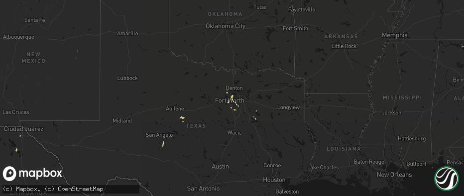
Hail Map on May 25, 2026
The weather event on May 25, 2026 includes Hail, Wind, and Tornado maps. 14 states and 164 cities were impacted and suffered possible damage. The total estimated number of properties impacted is 11,514.
Hail
Wind
Tornado
11,514
Estimated number of impacted properties by a 1.00" hail or larger0
Estimated number of impacted properties by a 1.75" hail or larger0
Estimated number of impacted properties by a 2.50" hail or largerStates Impacted by Hail Map on May 25, 2026
Storm reports
Florida
| Date | Description |
|---|---|
| 05/25/20266:15 PM CDT | Trees down near new hope and highway 179a. |
| 05/25/20264:07 PM CDT | Reports of multiple trees and power lines down in villa tasso. Possible tornado. Time estimated by radar. |
| 05/25/20264:07 PM CDT | Damage in villa tasso is consistent with a tornado. Rating will likely be determined on wednesday. Brief tds on radar as well. |
| 05/25/202611:48 AM CDT | There were a couple of trees down but no other damage reported in gadsden county. |
Alabama
| Date | Description |
|---|---|
| 05/24/20267:48 PM CDT | Home reported collapsed. Trees down in the area. |
| 05/24/20267:35 PM CDT | Houston county ema reported some homes with roof damage and some trees on vehicles near old webb road... Peacock road... And watson bridge road. |
| 05/24/20267:30 PM CDT | Tornado hit the wdhn tv station in webb. |
New Mexico
| Date | Description |
|---|---|
| 05/25/20265:35 PM CDT | Mesonet station wsm03 wsmr main post. |
| 05/25/20265:30 PM CDT | Downed tree at wsmr hq. |
| 05/25/20262:46 PM CDT | Asos station ksaf santa fe muni airport. |
| 05/25/202612:40 AM CDT | Half dollar size hail reported approximately 3 blocks away from the fire department. |
Wyoming
| Date | Description |
|---|---|
| 05/25/20261:00 PM CDT | Mesonet station bpyw4 snider basin. Time estimated. |
Idaho
| Date | Description |
|---|---|
| 05/25/20266:58 PM CDT | Idaho power site w3t8. |
| 05/25/20266:45 PM CDT | Idaho power site w3t2. |
| 05/25/20265:28 PM CDT | Crestline raws. |
| 05/25/20265:15 PM CDT | Large trees down along river greenbelt. |
| 05/25/20265:10 PM CDT | Alaska airlines cargo roof blew off at boise airport... At least one downed wire. |
| 05/25/20264:45 PM CDT | Mesonet station 2996 d3 - hammett hill. |
| 05/25/20263:55 PM CDT | Mesonet station dvi11593 wendell. |
| 05/24/20267:40 PM CDT | Idaho power site w3t7. |
| 05/24/20267:00 PM CDT | Several trees down in ponderosa state park blocking the roads. Via social media. Time estimated. |
Nebraska
| Date | Description |
|---|---|
| 05/24/202610:15 PM CDT | Public report. Lots of hail with biggest one being just over 1 inch. |
| 05/24/20269:29 PM CDT | A local report indicates 61 MPH wind near 1 NE Neligh |
| 05/24/20269:19 PM CDT | A local report indicates 1.00 inch wind near Oakdale |
Texas
| Date | Description |
|---|---|
| 05/25/20265:00 PM CDT | Media reported quarter size hail in dawson. |
| 05/25/20264:20 PM CDT | Report from mping: quarter 1.00 in. |
| 05/25/20263:52 PM CDT | Report from mping quarter 1.00 in. |
Georgia
| Date | Description |
|---|---|
| 05/25/20263:38 PM CDT | Several tree limbs down and 1-2 trees down near the intersection of magnolia road and red dog farm road. |
| 05/25/20263:10 PM CDT | At least 1 tree down at a residence. Nearest intersection is adams road and ga 27. |
| 05/25/20261:20 PM CDT | Tree and large limbs reported down. Time estimated by radar. |
Cities Impacted by Hail Map on May 25, 2026
- Cross Plains, TX
- Baird, TX
- Coleman, TX
- Clyde, TX
- Vega, TX
- Wildorado, TX
- Vancourt, TX
- Venus, TX
- Kerens, TX
- Alvarado, TX
- Christoval, TX
- Eldorado, TX
- Midlothian, TX
- Winslow, AZ
- Burleson, TX
- Grand Prairie, TX
- Cedar Hill, TX
- Mabank, TX
- Colleyville, TX
- Fort Worth, TX
- Cleburne, TX
- Newark, TX
- Southlake, TX
- Keller, TX
- North Richland Hills, TX
- Arlington, TX
- Haslet, TX
- Rhome, TX
- Cochran, GA
- Kathleen, GA
- Hawkinsville, GA
- Jeffersonville, GA
- Bonaire, GA
- Dry Branch, GA
- Haltom City, TX
- Hurst, TX
- Ennis, TX
- Waxahachie, TX
- Red Oak, TX
- Niceville, FL
- Italy, TX
- Oakwood, TX
- Bremond, TX
- Heber, AZ
- Buffalo, TX
- Mexia, TX
- Wortham, TX
- Argyle, TX
- Sedona, AZ
- Mayer, AZ
- Euless, TX
- Calvert, TX
- Dallas, TX
- Duncanville, TX
- Purdon, TX
- Dawson, TX
- Blooming Grove, TX
- Franklin, TX
- Jewett, TX
- Lamar, CO
- Freeport, FL
- Santa Teresa, NM
- Anthony, NM
- Hubbard, TX
- Defuniak Springs, FL
- Marquez, TX
- Springfield, CO
- La Mesa, NM
- Grapevine, TX
- Malone, TX
- Mansfield, TX
- Whitney, TX
- Nemo, TX
- Justin, TX
- Garden City, ID
- Horseshoe Bend, ID
- Boise, ID
- Penelope, TX
- Blum, TX
- Valley Mills, TX
- Normangee, TX
- Clifton, TX
- Kim, CO
- Fairfield, TX
- Au Train, MI
- Sweet, ID
- Banks, ID
- Cascade, ID
- Munising, MI
- Jacksboro, TX
- Marble Falls, TX
- Tennessee Colony, TX
- Stuart, NE
- Lovelady, TX
- Palestine, TX
- Junction, TX
- Crockett, TX
- Ola, ID
- Midway, TX
- Holly, CO
- Iola, TX
- Ewing, NE
- Anderson, TX
- Bedias, TX
- Jefferson, SD
- Everly, IA
- Hartley, IA
- Roswell, NM
- Cowarts, AL
- Webb, AL
- Headland, AL
- North Sioux City, SD
- Milford, IA
- Newville, AL
- Sioux City, IA
- Paige, TX
- Florien, LA
- Flint, TX
- Dothan, AL
- Kennard, TX
- Wells, TX
- Finland, MN
- Gallup, NM
- Lawton, IA
- Hemphill, TX
- Alto, TX
- Silver Bay, MN
- Oakdale, NE
- Neligh, NE
- Grant, NE
- Tilden, NE
- Meadow Grove, NE
- Pollok, TX
- Madrid, NE
- Clearwater, NE
- Paxton, NE
- Elsie, NE
- Atkinson, NE
- Lovington, NM
- Emmet, NE
- Estherville, IA
- Bingham Lake, MN
- Mountain Lake, MN
- Kermit, TX
- Dolliver, IA
- Manson, IA
- Ceylon, MN
- Fairmont, MN
- Welcome, MN
- Granada, MN
- Truman, MN
- Springfield, MN
- Sleepy Eye, MN
- Redwood Falls, MN
- Morgan, MN
- Renville, MN
- Burt, IA
- Lone Rock, IA
- Franklin, MN
- Fairfax, MN
- Prinsburg, MN
- Raymond, MN
- Sacred Heart, MN
- Fort Davis, TX