Hail Map on May 27, 2026
The weather event on May 27, 2026 includes Wind and Hail maps. 9 states and 179 cities were impacted and suffered possible damage. The total estimated number of properties impacted is 45,235.
Wind
Hail
45,235
Estimated number of impacted properties by a 1.00" hail or larger18,078
Estimated number of impacted properties by a 1.75" hail or larger0
Estimated number of impacted properties by a 2.50" hail or largerStates Impacted by Hail Map on May 27, 2026
Storm reports
Minnesota
| Date | Description |
|---|---|
| 05/27/20265:05 PM CDT | Numerous reports of a brief high-based landspout. Additional public photos on social media. |
Oklahoma
| Date | Description |
|---|---|
| 05/27/20266:45 PM CDT | Video relayed by nws fort worth of a possible tornado near the intersection of us hwy 70 and hwy 271 just to the southwest of hugo. Time estimated by radar. |
Texas
| Date | Description |
|---|---|
| 05/27/202610:15 AM CDT | At 1015 am... A spacex employee reported a 61 mph thunderstorm wind gust at starbase. |
| 05/27/202610:15 AM CDT | A local report indicates 61 MPH wind near 6 SSW South Padre Islan |
| 05/27/202610:06 AM CDT | Brazos santiago buoy. |
| 05/27/202610:06 AM CDT | Brazos santiago buoy reported a thunderstorm wind gust of 65 mph. |
| 05/27/20269:32 AM CDT | At 9:32 am... Asos/awos site at port isabel-cameron county airport measured a wind gust of 61 mph associated with a thunderstorm. |
Montana
| Date | Description |
|---|---|
| 05/27/20263:00 AM CDT | Mesonet station gw6973 choteau. |
| 05/27/20262:55 AM CDT | Mesonet station gw6973 choteau. |
| 05/27/20262:50 AM CDT | Mesonet station gw6973 choteau. |
| 05/27/20262:20 AM CDT | Augusta n montana mesonet reported a 60 mph wind gust. |
West Virginia
| Date | Description |
|---|---|
| 05/27/20264:35 PM CDT | Tree down partially blocking tallmansville rd in the vicinity of tallmansville baptist church near goodwin rd and preacher tenney rd. Time estimated by radar. |
| 05/27/20264:35 PM CDT | A large tree was blown down by thunderstorm winds onto an unoccupied vehicle along mike stuart road. |
| 05/27/20264:30 PM CDT | Tree is down on highland trail near alderson... Wv... Blocking one lane. Time is estimated from radar. |
| 05/27/20264:29 PM CDT | Tree in roadway at 270 poca rd. Time estimated from radar. |
| 05/27/20264:15 PM CDT | Trees down along route 219. |
| 05/27/20264:11 PM CDT | Tree damage resulting in approximately 100 customers without power. Time is estimated by radar. |
| 05/27/20264:06 PM CDT | Tree down on powerlines along haw run rd at alpin ridge rd. Time estimated by radar. |
| 05/27/20263:55 PM CDT | Tree in roadway on cr-40/4 |
| 05/27/20263:37 PM CDT | Tree down in the 2300 block of baier ridge road near bar ridge road time estimated via radar. |
| 05/27/20263:35 PM CDT | Several trees down along valley chapel road reported through social media. Time estimated by radar. |
| 05/27/20263:32 PM CDT | Received pictures via social media of various large hardwood trees down along left freemans creek road... Churchville road... And freemans creek road. Time estimated vi |
| 05/27/20263:27 PM CDT | Pictures on social media of a large tree down blocking the entire road in the 3800 block of ten mile creek rd. |
| 05/27/20263:24 PM CDT | Pictures on social media of a tree down blocking part of bear wallow rd near thomas ridge rd. Time estimated by radar. |
| 05/27/20262:47 PM CDT | Tree down at the 600 blk of trouser leg rd near benedum hollow rd. Time estimated via radar. |
| 05/27/20262:46 PM CDT | Power lines and tree down in the 2900 block of gregorys run rd outside of clarksburg. No power in the area. Time estimated via radar. |
| 05/27/20262:36 PM CDT | Tree down blocking sycamore fork rd near the doddridge county line. Time estimated by radar. |
| 05/27/20262:29 PM CDT | Tree down near bates run rd... Blocking both lanes of traffic... Very hard to see due to weather conditions... There are busses being blocked by the tree as well |
| 05/27/20262:27 PM CDT | Power line down on shortline hwy. |
| 05/27/20262:27 PM CDT | Tree blocking mannington road. |
| 05/27/20262:18 PM CDT | Tree down on lines near richwood run rd. Timing based on radar. |
| 05/27/20262:12 PM CDT | Trees and lines down along ashford-nellis rd at casey fork. Tree is blocking the roadway. Time estimated from radar. |
| 05/27/20262:12 PM CDT | Tree down in the 4300 block of ashford-nellis rd near ashford... Wv. Time estimated via radar. |
| 05/27/20262:04 PM CDT | Tree down on middle horse creek rd in julian. Time estimated by radar. |
Idaho
| Date | Description |
|---|---|
| 05/27/20265:15 PM CDT | Inl sand dunes. |
Indiana
| Date | Description |
|---|---|
| 05/27/202611:56 AM CDT | 700 e south of us 52 flooded and an 8-inch diameter limb down in the same area with 2.2 inches of rain. Time very roughly estimated from radar. |
Ohio
| Date | Description |
|---|---|
| 05/27/202611:02 AM CDT | 5-6 inch branches down on pleasantville road. Time estimated from radar. |
| 05/27/202610:37 AM CDT | Trees reported down on stemen road. Time estimated from radar. |
Virginia
| Date | Description |
|---|---|
| 05/27/20266:55 PM CDT | Multiple trees down along airlie road due to thunderstorm winds. |
| 05/27/20266:52 PM CDT | Quarter size hail reported in gainesville. |
| 05/27/20266:52 PM CDT | A large tree was blown down by thunderstorm winds along stonewall road. |
| 05/27/20266:45 PM CDT | A large tree was blown down onto a power line along mt. Athos road... Causing the power line to break. |
| 05/27/20266:41 PM CDT | Social media photo and video of hail was estimated to be around 1.75 inches in the madison virginia area. |
| 05/27/20266:41 PM CDT | One-inch diameter hail was observed along izaak walton road. |
| 05/27/20266:40 PM CDT | Numerous trees down in the vicinity of new wright shop road and riverview road... Several had fallen on powerlines or blocked roadways est. 3500 customers lost power in |
| 05/27/20266:39 PM CDT | Tree downed and blocking the entire road near the intersection of old wright shop road and maple drive. |
| 05/27/20266:39 PM CDT | A tree fell onto a home on old wright shop road near maple drive... Causing significant damage to the structure. Time estimated from radar. |
| 05/27/20266:15 PM CDT | Tree down on crestwood dr in richmond. |
| 05/27/20266:00 PM CDT | Multiple reports of trees down in the west end area of henrico county. Time estimated from radar. |
| 05/27/20266:00 PM CDT | A large tree was blown down by thunderstorm winds in the town of buchanan. |
| 05/27/20265:30 PM CDT | Vdem called in reports of multiple trees down in botetourt county off ball park road near craig creek where front loaders were needed to remove the amount of trees that |
| 05/27/20265:30 PM CDT | At least two large trees were blown down by thunderstorm winds in the community of eagle rock... Including one tree down along craig creek road. |
| 05/27/20265:28 PM CDT | At least two trees were blown down along the s constitution highway by thunderstorm winds. |
| 05/27/20265:24 PM CDT | Tree fallen across booker t washington highway near rocky mount... Va. Time is estimated from radar. |
| 05/27/20265:15 PM CDT | Tree fallen across iron ridge road near rocky mount... Va. Time is estimated from radar. |
| 05/27/20264:39 PM CDT | Thunderstorm winds blew down a large oak tree near the intersection of muse field road and ledbetter road. |
| 05/27/20264:30 PM CDT | A large tree was blown down by thunderstorm winds across j s holland road... Blocking both lanes of the road. |
| 05/27/20263:26 PM CDT | Tree down on us route 58 in turbeville. |
| 05/27/20262:51 PM CDT | Tree across the road on newbill school road. |
| 05/27/20262:31 PM CDT | 2 trees knocked down in the lake monticello area. Time estimated from radar. |
| 05/27/20262:18 PM CDT | Tree down on hoecake road in lancaster county. Time estimated from radar. |
| 05/27/20262:05 PM CDT | Tree down on house off of whays creek road in northumberland county. |
| 05/27/20262:00 PM CDT | Large tree branches reported across the roadway in the area of a restaurant pm dupont highway. Time radar-estimated. |
| 05/27/20262:00 PM CDT | Tree down on fontaine avenue extension. |
| 05/27/20261:56 PM CDT | Tree down in 1980 block of old mill road. |
| 05/27/20261:55 PM CDT | *** 2 inj *** corrects previous tstm wnd dmg report from 1 ssw burgess. Tree downed onto a vehicle with injuries reported on dupont memorial highway in heathsville. Tim |
| 05/27/20261:45 PM CDT | Trees and power lines downed at dodlyt road and northumberland highway. Time radar-estimated. |
| 05/27/20261:42 PM CDT | Multiple trees downed on ridge road at deer gap. Time radar-estimated. |
| 05/27/20261:36 PM CDT | Tree down on kings mill road in westmoreland county. Time estimated from radar. |
| 05/27/20261:36 PM CDT | Tree down on mulberry road in richmond county. Time estimated from radar. |
| 05/27/20261:29 PM CDT | Tree down on kellys lane in richmond county. Time estimated from radar. |
| 05/27/20261:24 PM CDT | Tree down on menokin road in richmond county. Time estimated from radar. |
| 05/27/20261:20 PM CDT | Tree down on newland road. |
| 05/27/20261:15 PM CDT | Tree downed by thunderstorm winds near the intersection of liberty road and smith mountain road... And blocked the roadway. |
| 05/27/20261:10 PM CDT | Multiple trees down along tidewater trail near occupacia road and hunters hill road. Time estimated from radar. |
| 05/27/202612:45 PM CDT | Tree downed onto newland road. |
| 05/27/202612:08 PM CDT | There was a call for trees blown down in the 1700 block of va-3 william street. |
| 05/27/202612:05 PM CDT | There was a call for trees blown down onto wires near the intersection of va-649 mill pond road and todds tavern drive. |
| 05/27/202611:50 AM CDT | There was a report of tree damage near the intersection of woodlot court and millrace road. |
| 05/27/202611:30 AM CDT | There was a call for trees down near the intersection of elys frd road and yellow bottom road. |
| 05/26/20268:09 PM CDT | Large tree fallen across the roadway near the intersection of harrison street and lynn street near brookneal... Va. Time is estimated by radar. |
| 05/26/20268:01 PM CDT | Tree knocked down along raccoon crossing rd in the vicinity of cary shop rd. Time estimated from radar. |
| 05/26/20268:00 PM CDT | Wire down on us 360 just south of burkeville. Time estimated from radar. |
| 05/26/20267:58 PM CDT | Tree down on us 360 near virso rd in prince edward county. Time estimated from radar. |
| 05/26/20267:56 PM CDT | Quarter sized hail reported at the intersection of us 360 and cheatham rd in prince edward county. |
| 05/26/20267:08 PM CDT | A large tree was blown down by thunderstorm winds near the intersection of morning star road and s fork road. |
| 05/26/20267:01 PM CDT | A large tree was blown down by thunderstorm winds along walton drive. |
| 05/26/20267:00 PM CDT | Tree down on toddsbury road in lynchburg... Va... Blocking all lanes of traffic. Time is estimated from radar. |
| 05/26/20267:00 PM CDT | Power line down near the intersection of police tower road and richmond highway near appomattox... Va. Time is estimated from radar. |
| 05/26/20267:00 PM CDT | Several reports of trees down throughout fauquier county. |
Oregon
| Date | Description |
|---|---|
| 05/27/20266:45 PM CDT | Odot road camera shows hail covering highway 140 at bly mountain at a depth estimated as >1 inch. |
| 05/27/20266:22 PM CDT | Odot cams show hail covering highway 140 at bly... Or... Estimated depth of >1 inch. |
| 05/27/20266:14 PM CDT | Gust reported by odot weather station. |
| 05/27/20265:45 PM CDT | Odot webcams show hail covering highway 140 estimated approx 1 inch deep. |
| 05/27/20264:43 PM CDT | Mesonet station rlfo3 riddle mountain. |
| 05/27/20264:30 PM CDT | Asos station kreo rome. |
North Carolina
| Date | Description |
|---|---|
| 05/27/20266:21 PM CDT | Numerous reports of trees down from littleton... Halifax and into the scotland neck area. |
| 05/27/20266:03 PM CDT | Several trees and power lines down across the city of gastonia. |
| 05/27/20265:38 PM CDT | Tree down on a powerline near the hollister area co-located with nearly 400 power outages. |
| 05/27/20265:30 PM CDT | Update to previous tstm wnd dmg report from 4 n centerville. Damage reported to one occupancy... Resident accounted for with no injuries. Local fire department actively |
| 05/27/20265:30 PM CDT | Several trees down... Power lines down and damage to nearby farm between the inex and 3200 block of nc-58. |
| 05/27/20265:28 PM CDT | Halifax county em reported numerous trees down in western and central halifax county. |
| 05/27/20265:24 PM CDT | Report of power outage caused by fallen trees or limbs damaging equipment from duke energy. |
| 05/27/20263:38 PM CDT | Thunderstorm winds blew one to two trees down in the 200 block of nc hwy 62s. Time estimated by radar. Report shared by spotter looking at county damage report app. |
| 05/27/20263:25 PM CDT | Trees down on campground rd at mocksville hwy. |
| 05/27/20263:20 PM CDT | Trees down on pioneer road. |
| 05/27/20263:18 PM CDT | Thunderstorm winds blew one to two trees down in the 7200 block of park springs rd. Time estimated by radar. Report shared by spotter looking at county damage report ap |
| 05/27/20263:10 PM CDT | Corrects previous tstm wnd dmg report from 2 sse union grove. Trees down on pioneer road. |
| 05/27/20263:10 PM CDT | Thunderstorm winds blew one to two trees down in 1000 block holland rd. Time estimated by radar. Report shared by spotter looking at county damage report app. |
| 05/27/20263:10 PM CDT | Trees down at eupeptic springs rd and jennings rd. |
| 05/27/20263:10 PM CDT | Trees down on west memorial highway and myers mill road. |
| 05/27/20262:56 PM CDT | Tree down on perkinson road near the nc/va state line. |
| 05/27/20262:44 PM CDT | Tree down near the intersection of park road and tolbert street. |
| 05/27/20262:30 PM CDT | Wind gusts moved patio furniture from household out into the yard and snapped several branches around the area as thunderstorms moved through. Report received via socia |
| 05/26/20268:05 PM CDT | Couple trees down in the area around the intersection between dycus road and camelot lane. |
| 05/26/20267:50 PM CDT | Tree down blocking one lane of the 800 block of putnam glendon rd. |
| 05/26/20267:40 PM CDT | Tree down on bonlee carbonton rd and lucian hilliard rd. |
| 05/26/20267:36 PM CDT | Tree down on 100 block of jesse phillips rd blocking both lanes of travel. |
| 05/26/20267:35 PM CDT | Tree down on powerlines on the 200 block of everette dowdy rd. |
| 05/26/20267:33 PM CDT | Tree down blocking the road near the intersection of siler city glendon rd and nc 902. |
Delaware
| Date | Description |
|---|---|
| 05/27/202610:30 AM CDT | Corrects previous tstm wnd dmg report from hartly. Picture on social media showed some large tree limbs snapped off in hartly. Time estimated from radar. |
| 05/27/202610:20 AM CDT | Picture on social media showed some large tree limbs snapped off in hartly. Time estimated from radar. |
Wisconsin
| Date | Description |
|---|---|
| 05/27/20266:58 PM CDT | Photo confirmed. |
| 05/27/20266:56 PM CDT | 1 tree blown down. |
| 05/27/20266:51 PM CDT | 1 tree blown down. |
| 05/27/20266:46 PM CDT | 1 tree blown down. |
| 05/27/20265:53 PM CDT | A local report indicates 1.00 inch wind near 4 SE Loyal |
| 05/27/20265:38 PM CDT | A local report indicates 1.00 inch wind near 3 W Plover |
| 05/27/20264:51 PM CDT | Report from mping: half dollar |
| 05/27/20264:50 PM CDT | Report from mping: half dollar |
| 05/27/20264:50 PM CDT | Several trees down at river park in mosinee. Time estimated by radar. Report from wsaw-tv. |
| 05/27/20264:49 PM CDT | Report from mping: half dollar |
| 05/27/20264:48 PM CDT | Report from mping: half dollar |
| 05/27/20264:46 PM CDT | Report from mping: half dollar |
| 05/27/20264:37 PM CDT | Report from mping: hen egg |
| 05/27/20264:34 PM CDT | Report from mping: ping pong ball |
| 05/27/20264:25 PM CDT | A local report indicates 1.00 inch wind near 1 SW Schofield |
| 05/27/20264:20 PM CDT | A local report indicates 1.50 inch wind near 1 E Wausau |
| 05/27/20264:19 PM CDT | Quarter size hail at the wausau downtown airport. |
| 05/27/20264:19 PM CDT | A local report indicates 1.00 inch wind near 3 NW Rib Mountain State |
| 05/27/20264:18 PM CDT | A local report indicates 1.75 inch wind near 1 ESE Rib Mountain Stat |
| 05/27/20264:17 PM CDT | Report from mping: half dollar |
| 05/27/20264:16 PM CDT | A local report indicates 1.00 inch wind near 2 N Wausau |
| 05/27/20264:16 PM CDT | Several trees down in the city of wausau. Vehicle windows were smashed by large hail. |
| 05/27/20264:16 PM CDT | Reported at wsaw-tv. |
| 05/27/20264:15 PM CDT | A local report indicates 1.00 inch wind near 3 NW Rib Mountain State |
| 05/27/20264:13 PM CDT | A local report indicates 1.00 inch wind near 1 N Wausau |
| 05/27/20264:12 PM CDT | A local report indicates 1.00 inch wind near 1 WSW Wausau |
| 05/26/20268:41 PM CDT | Report of a tree down across county highway y north of mazomanie. Time estimated from radar. |
| 05/26/20268:27 PM CDT | Reports of a few trees and powerlines down near sauk city. Time estimated from radar. |
| 05/26/20268:02 PM CDT | A local report indicates 1.00 inch wind near Black River Falls |
| 05/26/20268:00 PM CDT | Reports of trees and powerlines down. Time estimated from radar. |
| 05/26/20267:40 PM CDT | Reports of a few trees down in northwestern columbia county. Time estimated from radar. |
| 05/26/20267:16 PM CDT | A local report indicates 1.00 inch wind near 1 W Oxford |
| 05/26/20267:15 PM CDT | A local report indicates 60 MPH wind near 1 W Oxford |
| 05/26/20267:15 PM CDT | Reports of trees and powerlines down near oxford. Time estimated from radar. |
Cities Impacted by Hail Map on May 27, 2026
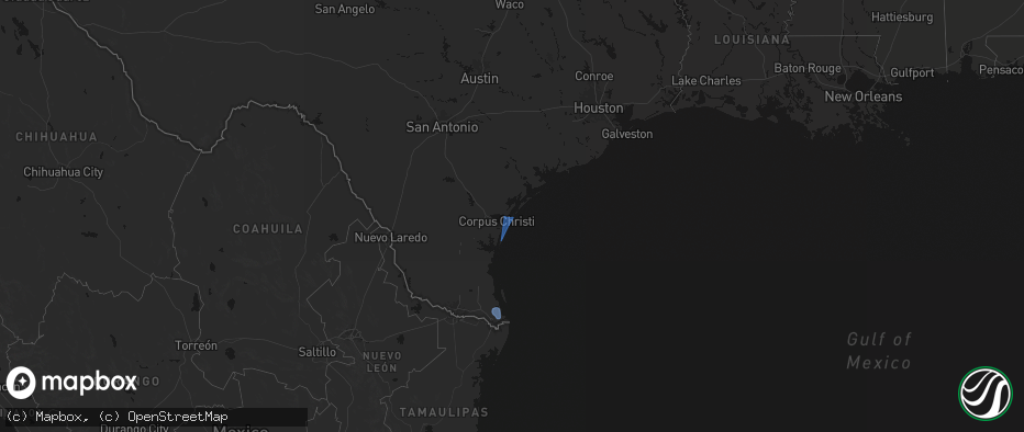
- Ingleside, TX
- Corpus Christi, TX
- Port Aransas, TX
- Los Fresnos, TX
- Port Isabel, TX
- Loretto, VA
- Montross, VA
- Champlain, VA
- Hustle, VA
- Colonial Beach, VA
- Caret, VA
- Warsaw, VA
- Kinsale, VA
- Callao, VA
- Hague, VA
- Farnham, VA
- Middlebourne, WV
- New Martinsville, WV
- Pine Grove, WV
- Reader, WV
- Porters Falls, WV
- Burgess, VA
- Reedville, VA
- Heathsville, VA
- Sistersville, WV
- Jacksonburg, WV
- Smithfield, WV
- Charlottesville, VA
- Cascade, VA
- Pelham, NC
- Big Springs, WV
- Coxs Mills, WV
- Auburn, WV
- Berea, WV
- West Union, WV
- Ola, ID
- Ruffin, NC
- Troy, WV
- Linn, WV
- Alum Bridge, WV
- Gleason, WI
- Merrill, WI
- Glenville, WV
- Deerbrook, WI
- Montrose, WV
- Philippi, WV
- Parsons, WV
- Antigo, WI
- Wausau, WI
- Athens, WI
- Weston, WV
- Schofield, WI
- Cascade, ID
- Faber, VA
- Indian Valley, ID
- Spencer, WV
- Rothschild, WI
- North Garden, VA
- Scottsville, VA
- Esmont, VA
- Schuyler, VA
- Mosinee, WI
- Marathon, WI
- Lovingston, VA
- Arnoldsburg, WV
- Alderson, WV
- Ringle, WI
- Keene, VA
- Council, ID
- Mccall, ID
- Edgar, WI
- Shipman, VA
- Wingina, VA
- Warrenton, NC
- Norlina, NC
- Junction City, WI
- Stevens Point, WI
- Covington, VA
- Stratford, WI
- New Meadows, ID
- Macon, NC
- Amherst, VA
- Norwood, VA
- Gladstone, VA
- Arrington, VA
- Plover, WI
- Littleton, NC
- Auburndale, WI
- Eagle Rock, VA
- Lakeview, OR
- Buckingham, VA
- Roanoke Rapids, NC
- Halifax, NC
- Wisconsin Rapids, WI
- Loyal, WI
- Chili, WI
- Spencer, WI
- Granton, WI
- Arpin, WI
- Marshfield, WI
- Milladore, WI
- Enfield, NC
- Bancroft, WI
- Bedford, VA
- Big Island, VA
- Bonanza, OR
- Coleman Falls, VA
- Lynchburg, VA
- Monroe, VA
- Greenwood, WI
- Bly, OR
- Goode, VA
- Owen, WI
- Sprague River, OR
- Beatty, OR
- Chiloquin, OR
- Madison Heights, VA
- Pittsville, WI
- Fall Creek, WI
- Hancock, WI
- Forest, VA
- Neillsville, WI
- Concord, VA
- Coloma, WI
- Appomattox, VA
- Friendship, WI
- Augusta, WI
- Warrenton, VA
- The Plains, VA
- Dairy, OR
- Klamath Falls, OR
- Westfield, WI
- Oxford, WI
- Grand Marsh, WI
- Spout Spring, VA
- Wisconsin Dells, WI
- Bennett, NC
- Seagrove, NC
- Pamplin, VA
- Briggsville, WI
- Portage, WI
- Endeavor, WI
- Baraboo, WI
- Keno, OR
- Ashland, OR
- Prospect, VA
- Hampden Sydney, VA
- Farmville, VA
- Meherrin, VA
- Green Bay, VA
- Burkeville, VA
- Black River Falls, WI
- Victoria, VA
- Polebridge, MT
- Hixton, WI
- Keysville, VA
- Victor, MT
- Merrimac, WI
- Crewe, VA
- Prairie Du Sac, WI
- Lenore, WV
- Dingess, WV
- Elk City, ID
- Kenbridge, VA
- Dundas, VA
- Blackstone, VA
- Marshall, VA
- Nokesville, VA
- Catlett, VA
- Trementina, NM
- Las Vegas, NM
- Ocate, NM
- Crowell, TX
- Seymour, TX
- Bonner, MT
- Boulder, MT
- Choteau, MT
- Fairfield, MT
- Dutton, MT