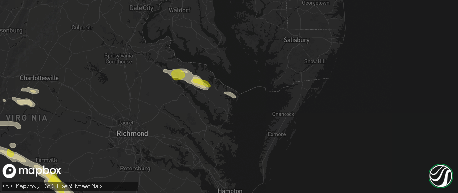
Hail Map in Burgess, VA on May 27, 2026
The weather event in Burgess, VA on May 27, 2026 includes Wind and Hail maps. 9 states and 179 cities were impacted and suffered possible damage. The total estimated number of properties impacted is 0.
Wind
Hail
0
Estimated number of impacted properties by a 1.00" hail or larger0
Estimated number of impacted properties by a 1.75" hail or larger0
Estimated number of impacted properties by a 2.50" hail or largerStorm reports in Burgess, VA
Burgess, VA
| Date | Description |
|---|---|
| 05/27/20262:00 PM CDT | Large tree branches reported across the roadway in the area of a restaurant pm dupont highway. Time radar-estimated. |
| 05/27/20261:55 PM CDT | *** 2 inj *** corrects previous tstm wnd dmg report from 1 ssw burgess. Tree downed onto a vehicle with injuries reported on dupont memorial highway in heathsville. Tim |
All States Impacted by Hail Map on May 27, 2026
All Cities Impacted by Hail Map on May 27, 2026
- Ingleside, TX
- Corpus Christi, TX
- Port Aransas, TX
- Los Fresnos, TX
- Port Isabel, TX
- Loretto, VA
- Montross, VA
- Champlain, VA
- Hustle, VA
- Colonial Beach, VA
- Caret, VA
- Warsaw, VA
- Kinsale, VA
- Callao, VA
- Hague, VA
- Farnham, VA
- Middlebourne, WV
- New Martinsville, WV
- Pine Grove, WV
- Reader, WV
- Porters Falls, WV
- Burgess, VA
- Reedville, VA
- Heathsville, VA
- Sistersville, WV
- Jacksonburg, WV
- Smithfield, WV
- Charlottesville, VA
- Cascade, VA
- Pelham, NC
- Big Springs, WV
- Coxs Mills, WV
- Auburn, WV
- Berea, WV
- West Union, WV
- Ola, ID
- Ruffin, NC
- Troy, WV
- Linn, WV
- Alum Bridge, WV
- Gleason, WI
- Merrill, WI
- Glenville, WV
- Deerbrook, WI
- Montrose, WV
- Philippi, WV
- Parsons, WV
- Antigo, WI
- Wausau, WI
- Athens, WI
- Weston, WV
- Schofield, WI
- Cascade, ID
- Faber, VA
- Indian Valley, ID
- Spencer, WV
- Rothschild, WI
- North Garden, VA
- Scottsville, VA
- Esmont, VA
- Schuyler, VA
- Mosinee, WI
- Marathon, WI
- Lovingston, VA
- Arnoldsburg, WV
- Alderson, WV
- Ringle, WI
- Keene, VA
- Council, ID
- Mccall, ID
- Edgar, WI
- Shipman, VA
- Wingina, VA
- Warrenton, NC
- Norlina, NC
- Junction City, WI
- Stevens Point, WI
- Covington, VA
- Stratford, WI
- New Meadows, ID
- Macon, NC
- Amherst, VA
- Norwood, VA
- Gladstone, VA
- Arrington, VA
- Plover, WI
- Littleton, NC
- Auburndale, WI
- Eagle Rock, VA
- Lakeview, OR
- Buckingham, VA
- Roanoke Rapids, NC
- Halifax, NC
- Wisconsin Rapids, WI
- Loyal, WI
- Chili, WI
- Spencer, WI
- Granton, WI
- Arpin, WI
- Marshfield, WI
- Milladore, WI
- Enfield, NC
- Bancroft, WI
- Bedford, VA
- Big Island, VA
- Bonanza, OR
- Coleman Falls, VA
- Lynchburg, VA
- Monroe, VA
- Greenwood, WI
- Bly, OR
- Goode, VA
- Owen, WI
- Sprague River, OR
- Beatty, OR
- Chiloquin, OR
- Madison Heights, VA
- Pittsville, WI
- Fall Creek, WI
- Hancock, WI
- Forest, VA
- Neillsville, WI
- Concord, VA
- Coloma, WI
- Appomattox, VA
- Friendship, WI
- Augusta, WI
- Warrenton, VA
- The Plains, VA
- Dairy, OR
- Klamath Falls, OR
- Westfield, WI
- Oxford, WI
- Grand Marsh, WI
- Spout Spring, VA
- Wisconsin Dells, WI
- Bennett, NC
- Seagrove, NC
- Pamplin, VA
- Briggsville, WI
- Portage, WI
- Endeavor, WI
- Baraboo, WI
- Keno, OR
- Ashland, OR
- Prospect, VA
- Hampden Sydney, VA
- Farmville, VA
- Meherrin, VA
- Green Bay, VA
- Burkeville, VA
- Black River Falls, WI
- Victoria, VA
- Polebridge, MT
- Hixton, WI
- Keysville, VA
- Victor, MT
- Merrimac, WI
- Crewe, VA
- Prairie Du Sac, WI
- Lenore, WV
- Dingess, WV
- Elk City, ID
- Kenbridge, VA
- Dundas, VA
- Blackstone, VA
- Marshall, VA
- Nokesville, VA
- Catlett, VA
- Trementina, NM
- Las Vegas, NM
- Ocate, NM
- Crowell, TX
- Seymour, TX
- Bonner, MT
- Boulder, MT
- Choteau, MT
- Fairfield, MT
- Dutton, MT


