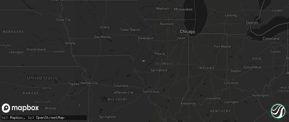
Hail Map on June 9, 2026
The weather event on June 9, 2026 includes Tornado, Hail, and Wind maps. 22 states and 1,173 cities were impacted and suffered possible damage. The total estimated number of properties impacted is 35,077.
Tornado
Hail
Wind
35,077
Estimated number of impacted properties by a 1.00" hail or larger1,407
Estimated number of impacted properties by a 1.75" hail or larger110
Estimated number of impacted properties by a 2.50" hail or largerStates Impacted by Hail Map on June 9, 2026
Storm reports
New York
| Date | Description |
|---|---|
| 06/09/20266:55 PM CDT | Multiple trees down in the area. |
| 06/09/20266:52 PM CDT | Trees and wires reported down along hart... Maple and greely streets in hornell. Possible tree down on a house on church street. Time estimated by radar. |
Indiana
| Date | Description |
|---|---|
| 06/09/20266:07 PM CDT | Thunderstorm winds downed a tree. Time estimated from radar. |
| 06/09/20265:39 PM CDT | Klaf airport asos. |
| 06/08/20268:45 PM CDT | Thunderstorm winds downed numerous trees across central and southern johnson county into franklin area. Possible tornado. Time estiamted from radar. |
| 06/08/20268:40 PM CDT | Thunderstorm winds downed tree. Time estimated from radar. |
| 06/08/20268:36 PM CDT | Tree down across a road. Time estimated from radar. |
| 06/08/20268:27 PM CDT | Kmqj - indianapolis regional airport. |
| 06/08/20268:25 PM CDT | Thunderstorm winds downed trees and pwr lines on in-44 near cope road and old moore road. Possible tornado. Time estd from radar. |
| 06/08/20268:25 PM CDT | Thunderstorm winds downed trees and pwr lines on in-44 near cope road and old moore road. Time estimated from radar. |
| 06/08/20268:05 PM CDT | Large limb down across 100 north in avon east of dan jones. |
| 06/08/20267:56 PM CDT | Large branch snapped blocking rooker road. |
| 06/08/20267:42 PM CDT | Thunderstorm winds downed tree near bowling green. Time estimated from radar. |
| 06/08/20267:27 PM CDT | Large trees limbs down. Minor flooding on roadway. |
| 06/08/20267:04 PM CDT | Sporadic tree damage. |
North Dakota
| Date | Description |
|---|---|
| 06/09/20266:49 PM CDT | Social media reports of downed tree branches in minot from strong winds. |
| 06/09/20266:49 PM CDT | 72mph 10m gust measured at 7s sawyer ndawn. |
| 06/09/20266:48 PM CDT | 60mph at 10m 4s minot ndawn. |
| 06/09/20266:45 PM CDT | 2 in reported near alamo from williams county em. |
| 06/09/20266:40 PM CDT | Emergency manger reported 3 inch hail 6:40pm in fortuna. |
| 06/09/20266:36 PM CDT | Mostly smaller hail... But a few as large as golf balls. |
| 06/09/20266:29 PM CDT | Awos station k1dn 1 s max. |
| 06/09/20266:19 PM CDT | Em called and report sheets of rain and pea size hail and 60 mph winds. |
| 06/09/20266:16 PM CDT | A local report indicates 75 MPH wind near 3 SSE Garrison |
| 06/09/20266:13 PM CDT | 58mph gust 13nw garrison ndawn. |
| 06/09/20266:11 PM CDT | Measured wind gust on private weather station. |
| 06/09/20266:03 PM CDT | Quarter-inch hail reported by williams county em. |
| 06/09/20265:42 PM CDT | 62mph at 10m at 5n halliday ndawn. |
| 06/09/20265:35 PM CDT | A local report indicates 1.50 inch wind near Beulah |
| 06/09/20265:30 PM CDT | Social media report of quarter size hail at 530 pm in beulah. |
| 06/09/20265:16 PM CDT | Broadcast media reported golf ball size hail in richardton. |
| 06/09/20265:16 PM CDT | Quarter-sized measured from bottle cap in beulah. |
| 06/09/20265:15 PM CDT | Quarter-inch hail reported in beulah at 5:15 from social media. |
| 06/09/20265:10 PM CDT | Half-dollar sized hail. |
| 06/09/20265:02 PM CDT | A local report indicates 1.00 inch wind near Hebron |
| 06/09/20265:00 PM CDT | Corrects previous report for the city of richardton. Broadcast media relayed report of golf ball sized hail. Started as marble size before increasing in size... And las |
| 06/09/20264:57 PM CDT | 59mph at 10m hebron 7s ndawn. |
| 06/09/202611:23 AM CDT | 10 m wind gust at ndawn site streeter 6 nw. |
| 06/09/20261:43 AM CDT | A local report indicates 60 MPH wind near 3 NNW Fargo |
| 06/09/20261:10 AM CDT | Ndawn site reporting at 10 ft. |
| 06/09/20261:06 AM CDT | Ndawn site reporting at 33 ft. |
| 06/09/20261:05 AM CDT | A local report indicates 59 MPH wind near 3 N Mcleod |
| 06/09/202612:42 AM CDT | Weather underground station report. |
| 06/09/202612:29 AM CDT | Weather underground station report. |
| 06/09/202612:15 AM CDT | Several large branches down - branches are about the size of a baseball bat in diameter. |
| 06/09/202612:07 AM CDT | 6 inch in diameter tree branch broken. Radar estimated time. Report relayed via social media. |
| 06/09/202612:01 AM CDT | 10 m wind gust at ndawn site marion 2 s. |
| 06/08/202611:53 PM CDT | Quarter size hail falling at time of report. Power outage also reported. |
| 06/08/202611:51 PM CDT | Asos station kjms jamestown airport. |
| 06/08/202611:40 PM CDT | Several large cottonwood trees down... Structural damage to house including gutter... Siding... And sofitt. |
| 06/08/202611:35 PM CDT | 10 m gust at ndawn station ellendale 4 ne. Gusts of this magnitude lasted for 10 minutes. |
| 06/08/202611:23 PM CDT | Corrects time of previous tstm wnd gst report from 7 nw streeter. 10 m wind gust at ndawn site streeter 6 nw. |
| 06/08/202611:10 PM CDT | Several large trees down - all laying to the northeast. |
| 06/08/202610:19 PM CDT | A local report indicates 58 MPH wind near 3 W Devils Lake |
| 06/08/202610:17 PM CDT | Corrects previous tstm wnd gst report from 1 n webster. Ndawn site reporting at 33 ft. |
| 06/08/20269:50 PM CDT | Gust at 10 ft. |
| 06/08/20269:41 PM CDT | Ndawn site at 33 ft. |
| 06/08/20269:34 PM CDT | Personal weather station. |
| 06/08/20269:30 PM CDT | Public report of 1nw of fessenden of estimated 60 mph. |
| 06/08/20269:19 PM CDT | Storm chasers reported 60 mph winds. |
| 06/08/20269:16 PM CDT | Awos station k5h4 harvey nd awos. Time estimated from radar. |
| 06/08/20268:47 PM CDT | Mesonet station ts633 long lake nwr. |
| 06/08/20268:42 PM CDT | 60mph at 10m... 5nw steele ndawn. |
| 06/08/20268:17 PM CDT | 63mph gust recorded at 3m at 1n bowbells ndawn. |
| 06/08/20267:59 PM CDT | Measured wind gust at private weather station. |
| 06/08/20267:53 PM CDT | 58mph gust recorded at 3m at ndawn 1se portal. |
| 06/08/20267:49 PM CDT | Measured wind gust at westhope nddot site. Time estimated from radar. |
| 06/08/20267:46 PM CDT | Mesonet station jcsn8 j. Clark salyer. |
| 06/08/20267:38 PM CDT | 62mph gust recorded at 3m ndawn 14w of bottineau. |
| 06/08/20267:25 PM CDT | Report from emergency manager of ping pong ball sized hail. |
| 06/08/20267:25 PM CDT | Photos relayed from fire department of damage to a homestead. Main area of damage is to a barn on the property... With roof panels ripped off and some collapse of wood |
| 06/08/20267:21 PM CDT | Tornado reported via social media by a storm chaser at 7:21 pm. |
| 06/08/20267:19 PM CDT | 68mph gust reported from 3sw bantry ndawn at 10m. |
| 06/08/20267:14 PM CDT | Delayed media report of golf ball size 6 south of noonan. |
| 06/08/20267:03 PM CDT | Spotter estimated winds of 60 to 70 mph as gust front moved into velva. |
| 06/08/20267:01 PM CDT | 59mph gust recorded at 3m at 3s genoa ndawn. |
| 06/08/20267:00 PM CDT | Ward county emergency manager relayed damage reports from the town of sawyer. Power was out... Numerous trees down on roads... And a large tree fell onto a house and ma |
Wisconsin
| Date | Description |
|---|---|
| 06/09/20266:54 AM CDT | Numerous trees and power lines down around neillsville. Many power outages. |
| 06/09/20266:30 AM CDT | Numerous trees and power lines reported down in greenwood... Owen... And abbotsford areas. Many without power. |
| 06/09/20265:41 AM CDT | Delayed report relayed from dispatch... Time estimated from radar. Tree down. |
| 06/09/20265:25 AM CDT | Delayed report relayed from dispatch... Time estimated from radar. Tree down. |
Idaho
| Date | Description |
|---|---|
| 06/09/20264:50 PM CDT | Public photos on social media show hail up to half dollar size. Time estimated from radar. |
New Mexico
| Date | Description |
|---|---|
| 06/09/20263:49 PM CDT | Mesonet station wdrn5 lama 4 nw |
| 06/09/20263:45 PM CDT | Pea sized hail as well. |
Alabama
| Date | Description |
|---|---|
| 06/09/20266:59 PM CDT | A 4 foot diameter tree was uprooted on cr 771 in ider. |
| 06/09/20266:59 PM CDT | Corrects previous tstm wnd dmg report from 4 wnw ider. A tree was knocked down on cr 346 near cr 78. |
| 06/09/20266:58 PM CDT | A tree was knocked down at 200 cr 771. |
| 06/09/20266:58 PM CDT | A tree was knocked down onto a home at 2000 cr 47. |
| 06/09/20266:58 PM CDT | Corrects previous tstm wnd dmg report from 2 w ider. A tree was knocked down onto a home at 2000 cr 147. |
| 06/08/20267:08 PM CDT | A large tree was knocked down at 721 cr 330 in pisgah. Also the roadway was flooded but unknown depth. |
| 06/08/20267:08 PM CDT | Several trees were knocked down on cr 147 in ider. |
| 06/08/20267:08 PM CDT | A tree was knocked down on cr 346 near cr 78. |
Oklahoma
| Date | Description |
|---|---|
| 06/09/20261:10 AM CDT | A local report indicates 75 MPH wind near 1 SSW Beaver |
| 06/09/202612:15 AM CDT | A local report indicates 58 MPH wind near 2 ENE Goodwell |
| 06/08/202611:55 PM CDT | A local report indicates 61 MPH wind near 1 WSW Hooker |
| 06/08/202611:55 PM CDT | An apparently dead tree was blown down and caused damage to the metal awning of a house. |
Minnesota
| Date | Description |
|---|---|
| 06/09/20264:30 AM CDT | Photo of a few trees down. Observer also reported power outages in the area. |
| 06/09/20263:36 AM CDT | Delayed report relayed from dispatch... Time estimated from radar. Tree down. |
| 06/09/20263:32 AM CDT | Delayed report relayed from dispatch... Time estimated from radar. Tree down. |
| 06/09/20263:30 AM CDT | Delayed report relayed from dispatch... Time estimated from radar. Several trees and powerlines down in forest city. |
| 06/09/20263:30 AM CDT | A local report indicates 1.00 inch wind near 3 NE Two Inlets |
| 06/09/20263:24 AM CDT | Delayed report... Time estimated from radar. Many trees down in centerville. Radar showed surge of outbound velocity matching up with downburst winds. |
| 06/09/20263:22 AM CDT | Delayed report... Time estimated from radar. Large branches and trees down. |
| 06/09/20263:13 AM CDT | Large tree snapped at base. Photo in nwschat. Time is estimated from radar and is the time in which power went out at house in neighborhood. |
| 06/09/20263:07 AM CDT | Delayed report relayed from dispatch... Time estimated from radar. Several trees down in town. |
| 06/09/20263:03 AM CDT | Delayed report... Time estimated from radar. Several trees down along hwy 39 in ostego. |
| 06/09/20263:01 AM CDT | Delayed report relayed from dispatch... Time estimated from radar. Trees down. |
| 06/09/20263:00 AM CDT | Corrects time on previous tstm wnd dmg report from st. Michael. Delayed report... Time estimated from radar. Trees and tree branches down. |
| 06/09/20262:54 AM CDT | Delayed report relayed from dispatch... Time estimated from radar. Large tree down on a house. |
| 06/09/20262:50 AM CDT | Ndawn site reporting at 10 ft. |
| 06/09/20262:50 AM CDT | Trees down on houses... Large limbs down everywhere and a roof got ripped off of a trailer house in the trailer court. Quite widespread damage throughout town. |
| 06/09/20262:48 AM CDT | Delayed report relayed from dispatch... Time estimated from radar. Trees down. |
| 06/09/20262:40 AM CDT | Corrects previous tstm wnd dmg report from fertile. Social media report of multiple trees down in the fertile area. |
| 06/09/20262:40 AM CDT | Social media report of multiple trees down in the fertile area. |
| 06/09/20262:36 AM CDT | Delayed report relayed from dispatch... Time estimated from radar. Trees down. |
| 06/09/20262:28 AM CDT | Delayed report relayed from dispatch... Time estimated from radar. Trees and powerlines down. |
| 06/09/20262:28 AM CDT | Delayed report relayed from dispatch... Time estimated from radar. Dozens of trees down near leaf valley mn. |
| 06/09/20262:26 AM CDT | Delayed report relayed from dispatch... Time estimated from radar. Trees and powerlines down. |
| 06/09/20262:25 AM CDT | Delayed report relayed from dispatch... Time estimated from radar. Many trees down across douglas county. |
| 06/09/20262:22 AM CDT | Delayed report of several large branches downed north of garfield. Relayed via media. |
| 06/09/20262:21 AM CDT | Delayed report of over a dozen mature trees knocked down in west alexandria. Relayed via broadcast media. |
| 06/09/20262:19 AM CDT | Asos station kaxn alexandria mn asos. |
| 06/09/20262:15 AM CDT | Lots of trees down around town... At least one camper heavily damaged... A few grain bins punched in or thrown around... Multiple car train derailment. |
| 06/09/20262:15 AM CDT | Awos station kghw glenwood ap. |
| 06/09/20262:07 AM CDT | Delayed report. Brief ef-u tornado confirmed via social media video. No reports of damage in the area. |
| 06/09/20262:07 AM CDT | Delayed report relayed from dispatch... Time estimated from radar. Trees and powerlines down. |
| 06/09/20262:03 AM CDT | Delayed report relayed from dispatch... Time estimated from radar. |
| 06/09/20262:02 AM CDT | Delayed report relayed from dispatch... Time estimated from radar. Roof damage to a shed. |
| 06/09/20262:01 AM CDT | Delayed report relayed from dispatch... Time estimated from radar. Trees and powerlines down. |
| 06/09/20262:00 AM CDT | Several large branches down along the roads. |
| 06/09/20262:00 AM CDT | Delayed report relayed from dispatch... Time estimated from radar. Roof partially blown off an apartment building. |
| 06/09/20262:00 AM CDT | Awos station kmox morris ap. |
| 06/09/20262:00 AM CDT | Delayed report... Time estimated from radar. Trees and tree branches down. |
| 06/09/20261:59 AM CDT | Delayed report relayed from dispatch... Time estimated from radar. Large branch down in willmar. |
| 06/09/20261:58 AM CDT | Delayed report relayed from dispatch... Time estimated from radar. Trees and powerlines down in morris. |
| 06/09/20261:58 AM CDT | Delayed report relayed from dispatch... Time estimated from radar. Trees and powerlines down in cyrus. |
| 06/09/20261:50 AM CDT | Ndawn reporting site at 10 ft. |
| 06/09/20261:45 AM CDT | A local report indicates 62 MPH wind near 3 SSE Dilworth |
| 06/09/20261:45 AM CDT | Awos station kbbb benson ap. |
| 06/09/20261:45 AM CDT | Delayed report relayed from dispatch... Time estimated from radar. Trees and powerlines down. |
| 06/09/20261:44 AM CDT | 72.4 mph gust on an anemometer. Visibility dropped considerably with blowing dust/dirt on the gust front with the initial surge. |
| 06/09/20261:40 AM CDT | Delayed report relayed from dispatch... Time estimated from radar. Trees and powerlines down. |
| 06/09/20261:40 AM CDT | Delayed report relayed from dispatch... Time estimated from radar. Trees down. |
| 06/09/20261:34 AM CDT | Delayed report relayed from dispatch... Time estimated from radar. Trees and powerlines down. |
| 06/09/20261:29 AM CDT | Delayed report relayed from dispatch... Time estimated from radar. Trees and powerlines down in appleton. |
| 06/09/20261:25 AM CDT | Delayed report relayed from dispatch... Time estimated from radar. Trees down. |
| 06/09/20261:23 AM CDT | Large pine tree snapped at base of trunk and other tree damage. Time estimated by radar. |
| 06/09/20261:15 AM CDT | Mesonet station av840 madison. |
| 06/09/20261:15 AM CDT | Awos station kdxx madison ap. |
| 06/09/20261:15 AM CDT | Delayed report relayed from dispatch... Time estimated from radar. Trees and powerlines down in madison. |
| 06/09/20261:14 AM CDT | Delayed report relayed from dispatch... Time estimated from radar. Partial roof damage to a building on south side of town. Small utility shed also damaged. |
| 06/09/20261:12 AM CDT | Delayed report relayed from dispatch... Time estimated from radar. Trees and powerlines down in dawson. |
Nebraska
| Date | Description |
|---|---|
| 06/09/20266:58 PM CDT | A local report indicates 58 MPH wind near 5 SSE Wilcox |
| 06/09/20266:58 PM CDT | A local report indicates 69 MPH wind near Holdrege Airport |
| 06/09/20266:52 PM CDT | A local report indicates 63 MPH wind near 5 SW Ragan |
| 06/09/20266:48 PM CDT | Report via facebook of significant outbuilding damage on the southeast corner of hwy 183 and hwy 4. Nearby pivot also over turned. |
| 06/09/20266:48 PM CDT | A local report indicates 1.50 inch wind near 4 W Ragan |
| 06/09/20266:45 PM CDT | Received photo via email of overturned pivots and snapped power poles. Location and time estimated. |
| 06/09/20266:44 PM CDT | A local report indicates 69 MPH wind near 6 W Huntley |
| 06/09/20266:44 PM CDT | A local report indicates 75 MPH wind near 6 NW Orleans |
| 06/09/20266:40 PM CDT | A local report indicates 69 MPH wind near 3 NNW Alma |
| 06/09/20266:37 PM CDT | A local report indicates 61 MPH wind near 2 WNW Orleans |
| 06/09/20266:36 PM CDT | A local report indicates 63 MPH wind near 2 ESE Stamford |
| 06/09/20266:36 PM CDT | A local report indicates 64 MPH wind near 2 NE Stamford |
| 06/09/20266:35 PM CDT | A local report indicates 60 MPH wind near Stamford |
| 06/09/20266:35 PM CDT | A local report indicates 65 MPH wind near 7 SW Alma |
| 06/09/20266:35 PM CDT | Personal weather station. |
| 06/09/20266:33 PM CDT | A local report indicates 63 MPH wind near 3 S Stamford |
| 06/09/20265:53 PM CDT | A local report indicates 73 MPH wind near 5 W Chadron |
| 06/09/20265:53 PM CDT | A local report indicates 72 MPH wind near 5 W Chadron |
| 06/08/202610:51 PM CDT | Nebraska mesonet site. |
| 06/08/202610:46 PM CDT | Nebraska mesonet site. |
| 06/08/202610:42 PM CDT | Nebraska mesonet site. |
| 06/08/202610:38 PM CDT | Personal weather station. |
| 06/08/202610:04 PM CDT | Personal weather station. |
| 06/08/202610:01 PM CDT | Personal weather station. |
| 06/08/20269:35 PM CDT | Several trees down in david city. Estimated 60 mph winds. Time estimated from radar. |
| 06/08/20269:20 PM CDT | A local report indicates 60 MPH wind near Halsey |
| 06/08/20269:12 PM CDT | 5 in tree branch broke off. |
| 06/08/20269:08 PM CDT | A local report indicates 67 MPH wind near 4 WNW Elgin |
| 06/08/20269:03 PM CDT | Observer estimated wind gust up to 60 mph. |
| 06/08/20269:01 PM CDT | Personal weather station. |
| 06/08/20269:00 PM CDT | Personal weather station. |
| 06/08/20268:57 PM CDT | Personal weather station. |
| 06/08/20268:55 PM CDT | Spotter estimated 60 mph wind gusts with a kayak blown across the yard. |
| 06/08/20268:52 PM CDT | A local report indicates 63 MPH wind near 4 NW Albion |
| 06/08/20268:45 PM CDT | Personal weather station. |
| 06/08/20268:45 PM CDT | A local report indicates 63 MPH wind near 4 N Hampton |
| 06/08/20268:41 PM CDT | A local report indicates 1.75 inch wind near 13 N Tryon |
| 06/08/20268:35 PM CDT | A local report indicates 74 MPH wind near Grand Island Airport |
| 06/08/20268:30 PM CDT | A local report indicates 62 MPH wind near 7 NNE Wolbach |
| 06/08/20268:30 PM CDT | Nickel to quarter sized from social media picture. |
| 06/08/20268:20 PM CDT | 2 large trees down and a power pole snapped in trumbull. Time estimated from radar. |
| 06/08/20268:15 PM CDT | Personal weather station. |
| 06/08/20268:15 PM CDT | A local report indicates 66 MPH wind near 1 SE Grand Island |
| 06/08/20268:15 PM CDT | Personal weather station. |
| 06/08/20268:15 PM CDT | A local report indicates 68 MPH wind near 2 SW Grand Island |
| 06/08/20268:12 PM CDT | A local report indicates 59 MPH wind near 3 S Grand Island |
| 06/08/20268:12 PM CDT | A local report indicates 62 MPH wind near 3 SW Grand Island |
| 06/08/20268:10 PM CDT | A local report indicates 64 MPH wind near 5 ESE Alda |
| 06/08/20268:10 PM CDT | Golf ball to baseball sized reported via picture from social media. |
| 06/08/20268:10 PM CDT | A local report indicates 60 MPH wind near 1 ESE Doniphan |
| 06/08/20268:07 PM CDT | Image sent in of a blown over pivot. |
| 06/08/20268:06 PM CDT | A local report indicates 58 MPH wind near 3 ESE Cairo |
| 06/08/20268:05 PM CDT | A local report indicates 59 MPH wind near 1 S Trumbull |
| 06/08/20268:05 PM CDT | Corrects previous non-tstm wnd gst report from 6 se cairo. Nebraska mesonet. 2-meter wind gusts. |
| 06/08/20268:00 PM CDT | Nebraska mesonet. 2-meter wind gust. |
| 06/08/20267:57 PM CDT | A local report indicates 66 MPH wind near 5 SE Wood River |
| 06/08/20267:55 PM CDT | A local report indicates 63 MPH wind near Grand Island Airport |
| 06/08/20267:54 PM CDT | Report from mping: quarter |
| 06/08/20267:48 PM CDT | A local report indicates 67 MPH wind near 2 WSW Grand Island |
| 06/08/20267:47 PM CDT | A local report indicates 64 MPH wind near 3 SW Grand Island |
| 06/08/20267:47 PM CDT | Corrects previous non-tstm wnd gst report from 2 sse prosser. Mesonet station up080 prosser 2.2s |
| 06/08/20267:45 PM CDT | Knesumne17. |
| 06/08/20267:45 PM CDT | Personal weather station. |
| 06/08/20267:45 PM CDT | A local report indicates 66 MPH wind near 5 SW Cairo |
| 06/08/20267:45 PM CDT | A local report indicates 72 MPH wind near 2 W Doniphan |
| 06/08/20267:45 PM CDT | A local report indicates 59 MPH wind near Hastings Airport |
| 06/08/20267:45 PM CDT | A local report indicates 61 MPH wind near 1 SSW Sumner |
| 06/08/20267:42 PM CDT | A local report indicates 72 MPH wind near 3 WSW Wood River |
| 06/08/20267:42 PM CDT | Image sent in of a metal roof partially torn off of a building. |
| 06/08/20267:41 PM CDT | A local report indicates 58 MPH wind near 7 WSW Cairo |
| 06/08/20267:40 PM CDT | Image sent in of a collapsed metal carport as well as large tree branches knocked down up to a foot in diameter. |
| 06/08/20267:39 PM CDT | Personal weather station. |
| 06/08/20267:39 PM CDT | A local report indicates 70 MPH wind near 1 NNW Riverdale |
| 06/08/20267:38 PM CDT | A local report indicates 69 MPH wind near Prosser |
| 06/08/20267:38 PM CDT | A local report indicates 73 MPH wind near 5 ESE Prosser |
| 06/08/20267:37 PM CDT | A local report indicates 61 MPH wind near 2 SSE Prosser |
| 06/08/20267:36 PM CDT | Personal weather station. |
| 06/08/20267:36 PM CDT | A local report indicates 61 MPH wind near 6 NE Kearney |
| 06/08/20267:35 PM CDT | A local report indicates 64 MPH wind near Wood River |
| 06/08/20267:35 PM CDT | A local report indicates 59 MPH wind near 6 ENE Kearney |
| 06/08/20267:33 PM CDT | Personal weather station. |
| 06/08/20267:33 PM CDT | A local report indicates 67 MPH wind near 2 N Holstein |
| 06/08/20267:31 PM CDT | A local report indicates 59 MPH wind near 4 N Kearney |
| 06/08/20267:30 PM CDT | Power line down across road. Time est. From other area reports. |
| 06/08/20267:30 PM CDT | Personal weather station. |
| 06/08/20267:30 PM CDT | Outbuilding damage at farmstead...debris blown out into nearby field. |
| 06/08/20267:30 PM CDT | Personal weather station. |
| 06/08/20267:30 PM CDT | A local report indicates 67 MPH wind near 3 NNE Kearney |
| 06/08/20267:30 PM CDT | Several large trees and power poles knocked down around the el charman lake. |
| 06/08/20267:30 PM CDT | A local report indicates 84 MPH wind near 3 ENE Heartwell |
| 06/08/20267:30 PM CDT | A local report indicates 58 MPH wind near 3 W Gibbon |
| 06/08/20267:29 PM CDT | A local report indicates 59 MPH wind near 2 SSW Riverdale |
| 06/08/20267:28 PM CDT | A local report indicates 72 MPH wind near 3 ENE Heartwell |
| 06/08/20267:28 PM CDT | Outflow from thunderstorms. Caused blowing dust. |
| 06/08/20267:28 PM CDT | A local report indicates 67 MPH wind near 2 NNE Norman |
| 06/08/20267:28 PM CDT | A local report indicates 81 MPH wind near 4 N Heartwell |
| 06/08/20267:27 PM CDT | A local report indicates 76 MPH wind near 3 NE Norman |
| 06/08/20267:27 PM CDT | A local report indicates 61 MPH wind near 4 SSW Shelton |
| 06/08/20267:26 PM CDT | A local report indicates 62 MPH wind near 2 NE Odessa |
| 06/08/20267:26 PM CDT | Personal weather station. |
| 06/08/20267:25 PM CDT | A local report indicates 67 MPH wind near 6 SSW Gibbon |
| 06/08/20267:24 PM CDT | A local report indicates 85 MPH wind near 1 W Heartwell |
| 06/08/20267:23 PM CDT | A local report indicates 65 MPH wind near 3 ESE Kearney |
| 06/08/20267:22 PM CDT | A local report indicates 78 MPH wind near 7 SSW Gibbon |
| 06/08/20267:22 PM CDT | A local report indicates 70 MPH wind near Kearney Airport |
| 06/08/20267:20 PM CDT | Tree damage in kearney. From facebook. |
| 06/08/20267:20 PM CDT | Corrects previous non-tstm wnd gst report from 5 ne axtell. Nebraska mesonet. 2-meter wind gusts. |
| 06/08/20267:20 PM CDT | A local report indicates 66 MPH wind near 1 SSW Minden |
| 06/08/20267:20 PM CDT | Personal weather station. |
| 06/08/20267:20 PM CDT | Personal weather station. |
| 06/08/20267:20 PM CDT | A local report indicates 74 MPH wind near 5 NNE Minden |
| 06/08/20267:20 PM CDT | A local report indicates 58 MPH wind near 7 N Loomis |
| 06/08/20267:20 PM CDT | A local report indicates 60 MPH wind near 2 NW Kearney |
| 06/08/20267:20 PM CDT | A local report indicates 77 MPH wind near 6 ESE Kearney |
| 06/08/20267:19 PM CDT | A local report indicates 58 MPH wind near 5 N Axtell |
| 06/08/20267:19 PM CDT | Reports of tree damage and some structural damage at el charman lake. |
| 06/08/20267:18 PM CDT | A local report indicates 68 MPH wind near 5 NE Axtell |
| 06/08/20267:16 PM CDT | Personal weather station. |
| 06/08/20267:16 PM CDT | A local report indicates 68 MPH wind near 8 N Funk |
| 06/08/20267:15 PM CDT | Personal weather station. |
| 06/08/20267:15 PM CDT | A local report indicates 72 MPH wind near 4 WSW Minden |
| 06/08/20267:15 PM CDT | Report of snapped tree branches up to a foot and a half in diameter. |
| 06/08/20267:15 PM CDT | Personal weather station. |
| 06/08/20267:15 PM CDT | A local report indicates 76 MPH wind near 1 E Odessa |
| 06/08/20267:15 PM CDT | A local report indicates 66 MPH wind near 6 NNW Minden |
| 06/08/20267:15 PM CDT | A local report indicates 62 MPH wind near 6 N Holdrege |
| 06/08/20267:15 PM CDT | A local report indicates 68 MPH wind near 5 SSW Kearney |
| 06/08/20267:15 PM CDT | A local report indicates 65 MPH wind near 6 SSW Minden |
| 06/08/20267:15 PM CDT | A local report indicates 80 MPH wind near 3 NNE Hildreth |
| 06/08/20267:14 PM CDT | A local report indicates 69 MPH wind near 1 N Minden |
| 06/08/20267:14 PM CDT | Personal weather station. |
| 06/08/20267:14 PM CDT | Tree damage reported via social media. |
| 06/08/20267:13 PM CDT | Personal weather station. |
| 06/08/20267:13 PM CDT | A local report indicates 79 MPH wind near 3 ENE Axtell |
| 06/08/20267:11 PM CDT | A local report indicates 63 MPH wind near 7 S Kearney |
| 06/08/20267:11 PM CDT | A local report indicates 75 MPH wind near 4 NW Axtell |
| 06/08/20267:11 PM CDT | Personal weather station. |
| 06/08/20267:09 PM CDT | Personal weather station. |
| 06/08/20267:09 PM CDT | A local report indicates 74 MPH wind near 1 W Hildreth |
| 06/08/20267:08 PM CDT | A local report indicates 80 MPH wind near 2 ESE Axtell |
| 06/08/20267:06 PM CDT | A local report indicates 71 MPH wind near 1 SW Axtell |
| 06/08/20267:06 PM CDT | Personal weather station. |
| 06/08/20267:05 PM CDT | Personal weather station. |
| 06/08/20267:05 PM CDT | A local report indicates 59 MPH wind near 5 N Funk |
| 06/08/20267:05 PM CDT | A local report indicates 58 MPH wind near 4 SW Axtell |
| 06/08/20267:04 PM CDT | Trees downed onto railroad track. Received via x post. |
| 06/08/20267:03 PM CDT | Additional reports of a roof blow off of a train utility building... Numerous pivots overturn... Downed power poles and large tree branches down around town. |
| 06/08/20267:02 PM CDT | Damaged outbuilding and sign in funk. Overturned pivots nearby. |
| 06/08/20267:01 PM CDT | A local report indicates 69 MPH wind near Wilcox |
| 06/08/20267:00 PM CDT | A local report indicates 60 MPH wind near 3 S Wilcox |
| 06/08/20267:00 PM CDT | A local report indicates 62 MPH wind near 2 NNW Wilcox |
| 06/08/20267:00 PM CDT | A local report indicates 61 MPH wind near 3 N Wilcox |
| 06/08/20267:00 PM CDT | A local report indicates 70 MPH wind near 1 NE Holdrege |
| 06/08/20267:00 PM CDT | Personal weather station. |
| 06/08/20267:00 PM CDT | A local report indicates 59 MPH wind near 4 E Ragan |
| 06/08/20267:00 PM CDT | Personal weather station. |
Wyoming
| Date | Description |
|---|---|
| 06/09/20266:22 PM CDT | Mesonet station ktmh i-25 twenty mile hill |
| 06/09/20266:00 PM CDT | Asos station kcpr casper airport |
| 06/09/20265:52 PM CDT | Mesonet station kpat wy220 pathfinder |
Kansas
| Date | Description |
|---|---|
| 06/09/20266:47 PM CDT | A local report indicates 65 MPH wind near 3 SW Burdett |
| 06/09/20266:44 PM CDT | Associated with light showers. |
| 06/09/20266:39 PM CDT | Davis weatherlink station. |
| 06/09/20266:35 PM CDT | Mesonet station up856 0.8 e yocemento |
| 06/09/20266:32 PM CDT | Davis weatherlink station. |
| 06/09/20266:31 PM CDT | Davis weatherlink station. |
| 06/09/20266:30 PM CDT | Report of 1 inch hail in norton. |
| 06/09/20266:29 PM CDT | A local report indicates 64 MPH wind near 4 ESE Long Island |
| 06/09/20266:29 PM CDT | Davis weatherlink station. |
| 06/09/20266:28 PM CDT | Social media report with video of estimated 60-70 mph winds gusts in ellis. |
| 06/09/20266:27 PM CDT | A local report indicates 60 MPH wind near 1 S Long Island |
| 06/09/20266:27 PM CDT | A local report indicates 63 MPH wind near 2 NNW Long Island |
| 06/09/20266:20 PM CDT | A local report indicates 60 MPH wind near Prairie View |
| 06/09/20266:15 PM CDT | Kansas state mesonet. |
| 06/09/20265:35 PM CDT | Davis weatherlink station. |
| 06/09/20265:30 PM CDT | Kansas state mesonet. |
| 06/09/20265:20 PM CDT | Picture relayed via social media of multiple large branches of a healthy tree broken. |
| 06/09/20265:15 PM CDT | Asos station kgck garden city. |
| 06/09/20265:15 PM CDT | Id: wunderground_kksbrews5. |
| 06/09/20265:00 PM CDT | Id: wunderground_kksbrews5. |
| 06/09/20264:55 PM CDT | Ambient weather network station. |
| 06/09/20264:54 PM CDT | Asos station kgck garden city. |
| 06/09/20264:51 PM CDT | From personal weather station. |
| 06/09/20263:58 PM CDT | A local report indicates 1.00 inch wind near 4 NW Cave |
| 06/09/20261:55 AM CDT | Mesoscale convective vortex winds. |
| 06/09/20261:05 AM CDT | Mesonet station ur350 kismws... Mesoscale convective vortex winds. |
| 06/09/20261:04 AM CDT | Mesonet station up407 0.6 sw hayne |
| 06/09/202612:57 AM CDT | Mesonet station up352 2.7 sw liberal |
| 06/09/202612:56 AM CDT | Awos station klbl liberal... Mesoscale convective vortex winds. |
| 06/08/202611:10 PM CDT | Mesonet station ur445 3.2 e new cambria |
| 06/08/202610:24 PM CDT | Semi flipped over on i-70 at mile marker 204. |
| 06/08/202610:00 PM CDT | Krsl asos measured 70 mph. |
| 06/08/20269:56 PM CDT | Estimated about 60 mph. |
| 06/08/20268:15 PM CDT | Kksosbor70. |
| 06/08/20268:15 PM CDT | A local report indicates 61 MPH wind near 5 SW Downs |
| 06/08/20267:52 PM CDT | Social media report of power poles broken in western hodgeman county at the intersection of v road and 202 road. Time estimated from radar. |
| 06/08/20267:44 PM CDT | Associated with light showers in the area. |
| 06/08/20267:41 PM CDT | Measured on a personal weather station. |
| 06/08/20267:41 PM CDT | Asos station kddc dodge city regional airport. |
| 06/08/20267:26 PM CDT | Measured on a personal weather station. |
| 06/08/20267:26 PM CDT | Estimated about 60 mph... Not much more. |
| 06/08/20267:25 PM CDT | Measured at the great bend airport. |
Tennessee
| Date | Description |
|---|---|
| 06/09/20266:18 PM CDT | A tree has fallen on a home. Estimated to be 80 feet tall and 3.5 feet in diameter. Relayed via amateur radio. |
| 06/09/20265:35 PM CDT | Multiple trees down in the stone east neighborhood... With possible shingles coming off of homes. |
| 06/09/20265:22 PM CDT | Corrects previous tstm wnd dmg report from 4 nnw walterhill. Public reports thunderstorm wind damage. Fence down... Trees down... Lightweight furniture strewn about. Al |
| 06/09/20265:22 PM CDT | Public reports thunderstorm wind damage. Fence down... Trees down... Lightweight furniture strewn about. |
| 06/09/20265:15 PM CDT | Split trees on property... Estimated 60 mph winds. Relayed via amateur radio. |
| 06/09/20265:12 PM CDT | Awning from gils food mart in smyrna collapsed. Time estimated from radar. |
| 06/09/20265:12 PM CDT | Corrects previous non-tstm wnd dmg report from 4 ese nolensville. Tree on powerline on rocky fork road. Time estimated via radar. |
| 06/09/20265:07 PM CDT | Off-duty nws employee reports neighbors dogwood tree splits in half during strong winds. Estimated 60 mph wind gust. |
| 06/09/20264:56 PM CDT | Tree on fence in charlie daniels park. Time estimated from radar. |
| 06/09/20264:56 PM CDT | Corrects previous tstm wnd dmg report from 2 s belinda city. A tree has fallen on a home. Estimated to be 80 feet tall and 3.5 feet in diameter. Relayed via amateur rad |
| 06/09/20264:56 PM CDT | Tree down on central pike close to mount juliet road. Time estimated. |
| 06/09/20264:56 PM CDT | Public reports multiple trees down on logue road. |
| 06/09/20263:59 PM CDT | Delayed report of 1 inch hail nw of coopertown. |
Michigan
| Date | Description |
|---|---|
| 06/09/202612:19 PM CDT | Spotter relayed video of a brief small tornado in a farm field near lake and marshall roads. |
| 06/09/202612:14 PM CDT | Reports of 30 to 40 homes with damage- roof and siding damage as well as a number of campers overturned in the freeland area. |
Texas
| Date | Description |
|---|---|
| 06/09/20265:56 PM CDT | 63 mph wind gust measured at wt mesonet station 11 miles sw of romero. Gusts above 58 mph lasted from 5:56 to 6:00 pm. |
| 06/08/20269:25 PM CDT | 58 mph wind gust measured at wt mesonet station 11 miles ssw of romero. Gusts at or above 58 mph lasted from 9:25 to 9:26 pm. |
South Dakota
| Date | Description |
|---|---|
| 06/09/202611:48 AM CDT | 1 tree down. Report via social media. Time estimated via radar. |
| 06/09/202611:32 AM CDT | Several trees down in town... Particularly on north washington street and 15th avenue northeast. |
| 06/09/20261:36 AM CDT | The kingsbury county em reported 3 overturned campers in martens campground near lake thompson. |
| 06/09/20261:35 AM CDT | Significant tree damage along 465th avenue. |
| 06/09/20261:34 AM CDT | Kingsbury county reported multiple trees uprooted and branches down in both de smet and arlington. |
| 06/09/20261:30 AM CDT | Kingsbury county em reported downed powerlines in lake preston. |
| 06/09/20261:12 AM CDT | 60-80 mph gusts. |
| 06/09/20261:12 AM CDT | 60 to 80 mph wind gust. |
| 06/09/20261:12 AM CDT | Lots of branches down. A few trees split and fell. |
| 06/09/202612:59 AM CDT | Mesonet station 291 altamont 4n |
| 06/09/202612:49 AM CDT | Time estimated by radar. |
| 06/09/202612:49 AM CDT | Multiple trees uprooted. |
| 06/09/202612:48 AM CDT | Photo sent of a tree down in clear lake. Time estimated by radar. |
| 06/09/202612:45 AM CDT | Trained spotter sent photos of trees down at 470th ave and south dakota highway 22. Time estimated by radar. |
| 06/09/202612:45 AM CDT | A personal weather station just northeast of volga recorded a wind gust of 68 mph. |
| 06/09/202612:45 AM CDT | Trained spotter reports roofing and siding damage to a home in bemis due to wind. Time estimated by radar. |
| 06/09/202612:44 AM CDT | Trained spotter sent photos and video of multiple large trees snapped or uprooted at and near the intersection of 179th street and 468th ave. Part of 179th street appea |
| 06/09/202612:36 AM CDT | A local report indicates 70 MPH wind near 2 SW Stone Bridge |
| 06/09/202612:34 AM CDT | Mesonet station mrls2 hillhead 3 wsw. |
| 06/09/202612:34 AM CDT | Image relayed via facebook of multiple trees being uprooted. |
| 06/09/202612:33 AM CDT | Trained spotter reports multiple irrigation pivots damaged due to wind. Time estimated by radar. |
| 06/09/202612:30 AM CDT | Mesonet station fw0832 estelline. |
| 06/09/202612:29 AM CDT | An sddot just south of arlington recorded a 72 mph wind gust. |
| 06/09/202612:25 AM CDT | A personal weather station just south of badger recorded a 68 mph wind gust. |
| 06/09/202612:18 AM CDT | Received a social media report of quarter sized hail in aurora. Time estimated via radar. |
| 06/09/202612:15 AM CDT | Mesonet station btms2 britton 7e |
| 06/09/202612:15 AM CDT | Corrects previous tstm wnd dmg report from lake preston. Kingsbury county em reported downed powerlines in lake preston. |
| 06/09/202612:14 AM CDT | A sddot site near arlington recorded a 68 mph wind gust. |
| 06/09/202612:13 AM CDT | Corrects previous tstm wnd dmg report from 5 wsw lake preston. The kingsbury county em reported 3 overturned campers in martens campground near lake thompson. |
| 06/09/202612:13 AM CDT | Personal weather station at lake henry campground. |
| 06/09/202612:10 AM CDT | An sddot site near alpena recorded a wind gust of 63 mph. |
| 06/09/202612:09 AM CDT | An sddot site near arlington recorded a 66 mph wind gust. |
| 06/09/202612:07 AM CDT | Corrects previous tstm wnd gst report from 4 s arlington. An sddot site near arlington recorded a 66 mph wind gust. |
| 06/09/202612:06 AM CDT | A local report indicates a tornado near Henry |
| 06/09/202612:05 AM CDT | Corrects previous tstm wnd dmg report from de smet. Kingsbury county reported multiple trees uprooted and branches down in de smet. |
| 06/08/202611:50 PM CDT | Mesonet station gots2 groton 9 nne |
| 06/08/202611:34 PM CDT | Roof damage from winds to a large barn... Report relayed via slack. Time estimated by radar. |
| 06/08/202611:33 PM CDT | Photo and video of trees that have fallen down from the wind onto a home and another one onto a car. Time estimated by radar. |
| 06/08/202611:33 PM CDT | Report via social media. Time estimated by radar. |
| 06/08/202611:32 PM CDT | Asos station kabr aberdeen rgnl ap. |
| 06/08/202611:31 PM CDT | An sddot site west of plankinton recorded a 67 mph wind gust. |
| 06/08/202611:30 PM CDT | Photo of machine shed roof damage and door blown in relayed via slack. |
| 06/08/202611:28 PM CDT | A personal weather station just north of mitchell recorded a 67 mph wind gust. |
| 06/08/202611:27 PM CDT | A local report indicates 78 MPH wind near 2 WNW Richmond Lake Rec |
| 06/08/202611:19 PM CDT | A personal weather station northeast of platte recorded a 76 mph wind gust. |
| 06/08/202611:19 PM CDT | A personal weather station northwest of ethan recorded a 64 mph wind gusts. |
| 06/08/202611:15 PM CDT | A local report indicates 70 MPH wind near 1 NE Mina |
| 06/08/202611:15 PM CDT | A local report indicates 70 MPH wind near 3 NE Redfield |
| 06/08/202611:15 PM CDT | Mesonet station awms2 aberdeen 10wsw |
| 06/08/202611:15 PM CDT | Awos station k1d8 redfield muni ap. |
| 06/08/202611:14 PM CDT | Mesonet station 175 mellette |
| 06/08/202611:12 PM CDT | A personal weather station near platte recorded a 67 mph wind gust. |
| 06/08/202611:09 PM CDT | The fort randall dam recorded a 65 mph wind gust. |
| 06/08/202611:06 PM CDT | A personal weather station near armour reported a 73 mph wind gust. |
| 06/08/202611:05 PM CDT | Mesonet station 315 cresbard |
| 06/08/202611:01 PM CDT | A personal weather station near herrick recorded a wind gust of 65 mph. |
| 06/08/202610:56 PM CDT | A personal weather station near lake andes recorded a 59 mph wind gust. |
| 06/08/202610:55 PM CDT | Corrects previous tstm wnd gst report from 6 nne herrick. A personal weather station near herrick recorded a wind gust of 65 mph. |
| 06/08/202610:54 PM CDT | Mesonet station rhus2 danforth 5 e... Time estimated from radar. |
| 06/08/202610:50 PM CDT | Mesonet station rhms2 rockham 6sse |
| 06/08/202610:49 PM CDT | Mesonet station 158 miranda |
| 06/08/202610:45 PM CDT | Mesonet station wgms2 wessington 3w |
| 06/08/202610:44 PM CDT | Mesonet station rhus2 danforth 5 e. Time estimated. |
| 06/08/202610:44 PM CDT | A local report indicates 77 MPH wind near Faulkton |
| 06/08/202610:43 PM CDT | A personal weather station near fairfax recorded a 60 mph wind gust. |
| 06/08/202610:43 PM CDT | A personal weather station near fairfax recorded a 72.9 mph wind gust. |
| 06/08/202610:43 PM CDT | A personal weather station near bonesteel recorded a 58 mph wind gusts. |
| 06/08/202610:38 PM CDT | A personal weather station near fairfax recorded a 69 mph wind gust. |
| 06/08/202610:32 PM CDT | Report also included some small hail. |
| 06/08/202610:31 PM CDT | Winds close to 60mph from the outflow boundary that passed before the storm came in. Radar estimated time: 10:31pm. |
| 06/08/202610:25 PM CDT | Mesonet station 312 ree heights |
| 06/08/202610:13 PM CDT | Mesonet station 183 macs corner |
| 06/08/202610:05 PM CDT | Mesonet station lbms2 lower brule 2wnw |
| 06/08/20269:45 PM CDT | Report also includes some pea sized hail. |
| 06/08/20269:35 PM CDT | Mesonet station pims2 pierre 17e |
| 06/08/20269:30 PM CDT | A local report indicates 65 MPH wind near 4 WSW Blunt |
| 06/08/20269:12 PM CDT | A local report indicates 1.00 inch wind near Fort Pierre |
| 06/08/20268:44 PM CDT | A local report indicates 60 MPH wind near 2 N White River |
| 06/08/20268:05 PM CDT | Pea to nickel size hail. |
| 06/08/20267:41 PM CDT | A local report indicates 60 MPH wind near 5 ENE Martin |
| 06/08/20267:35 PM CDT | A local report indicates 66 MPH wind near 4 ENE Martin |
| 06/08/20267:30 PM CDT | A local report indicates 64 MPH wind near 4 ENE Martin |
| 06/08/20267:15 PM CDT | A local report indicates 66 MPH wind near 10 WSW Ottumwa |
| 06/08/20267:08 PM CDT | A local report indicates 1.00 inch wind near 14 N Philip |
Colorado
| Date | Description |
|---|---|
| 06/09/20264:58 PM CDT | Awos station ktad trinidad airport. |
| 06/09/20264:56 PM CDT | Asos station kspd 8 s springfield. |
| 06/09/20264:21 PM CDT | Mesonet station co031 025n033 aguilar. |
| 06/09/20263:34 PM CDT | Awos station kpub pueblo airport. |
| 06/09/20263:23 PM CDT | Pueblo asos. |
| 06/08/20269:37 PM CDT | Asos station kgjt grand junction rgnl ap. |
Illinois
| Date | Description |
|---|---|
| 06/09/20266:27 PM CDT | [delayed report] - several trees blown down and corn damaged by thunderstorm winds. Time estimated by radar. |
Kentucky
| Date | Description |
|---|---|
| 06/09/20262:59 PM CDT | Emergency management reported multiple trees down and power poles snapped between 4500-5000 bowling green rd. Southeast of morgantown. |
Cities Impacted by Hail Map on June 9, 2026
- La Harpe, KS
- Wildrose, ND
- Ray, ND
- Tioga, ND
- Mcgregor, ND
- Plymouth, IL
- Colchester, IL
- Industry, IL
- Macomb, IL
- Bardwell, KY
- Freeland, MI
- Wickliffe, KY
- Paris, TN
- Gleason, TN
- Springville, TN
- Springfield, TN
- Greenbrier, TN
- Puryear, TN
- Cottage Grove, TN
- Neelyville, MO
- Southgate, MI
- Wyandotte, MI
- White House, TN
- McKenzie, TN
- Arlington, KY
- Concord, GA
- Cross Plains, TN
- Fancy Farm, KY
- Mayfield, KY
- Williamson, GA
- Tiptonville, TN
- Goodlettsville, TN
- Franklin, KY
- Big Sandy, TN
- Luverne, AL
- Hendersonville, TN
- Cottontown, TN
- Wingo, KY
- Auburn, KY
- Russellville, KY
- Cumberland City, TN
- Erin, TN
- Morgantown, KY
- Sedalia, KY
- Beaver Dam, KY
- Farmington, KY
- Indian Mound, TN
- Oakland, KY
- Bowling Green, KY
- Santa Rosa, NM
- Murray, KY
- Kirksey, KY
- Palmyra, TN
- Pueblo, CO
- Clarksville, TN
- Woodlawn, TN
- Henry, TN
- Greenville, AL
- Cheyenne Wells, CO
- Conchas Dam, NM
- Garita, NM
- Boone, CO
- Arapahoe, CO
- Ulysses, KS
- Trementina, NM
- Satanta, KS
- Cuervo, NM
- Chapmansboro, TN
- Cedar Hill, TN
- Lineville, AL
- Guthrie, KY
- Trenton, KY
- Elkton, KY
- Moscow, KS
- Pleasant View, TN
- Ashland City, TN
- Adams, TN
- Joelton, TN
- Trenton, UT
- Adairville, KY
- Olmstead, KY
- Richardton, ND
- Garden City, KS
- Felt, OK
- Allensville, KY
- Mosquero, NM
- Clarkston, UT
- Cornish, UT
- Hebron, ND
- Beulah, ND
- New England, ND
- Richmond, UT
- Dighton, KS
- Dresden, TN
- Sterling, CO
- Healy, KS
- Zap, ND
- Cimarron, KS
- Sublette, KS
- Hugoton, KS
- Edgemont, SD
- Johnson, KS
- Sidney, NE
- Lemmon, SD
- Old Hickory, TN
- Hermitage, TN
- Madison, TN
- Nashville, TN
- Mount Juliet, TN
- Williston, ND
- Mott, ND
- Zahl, ND
- Lefor, ND
- Regent, ND
- Antioch, TN
- Smyrna, TN
- La Vergne, TN
- Lebanon, TN
- Murfreesboro, TN
- Ingalls, KS
- Montezuma, KS
- Copeland, KS
- Beeler, KS
- Taylor, ND
- Utica, KS
- Keldron, SD
- Alamo, ND
- Richfield, KS
- Charleston, IL
- Goodland, KS
- Edson, KS
- Brewster, KS
- Colby, KS
- McDonald, KS
- Lascassas, TN
- Watertown, TN
- Milton, TN
- Oberlin, KS
- Elgin, ND
- Ashmore, IL
- Selfridge, ND
- Arnold, KS
- Ransom, KS
- Scott City, KS
- West Lafayette, IN
- Otterbein, IN
- Readyville, TN
- Christiana, TN
- Auburntown, TN
- Woodbury, TN
- Penokee, KS
- Morland, KS
- Hazen, ND
- Glen Ullin, ND
- Westpoint, IN
- Macedonia, IL
- McLeansboro, IL
- New Leipzig, ND
- Paris, IL
- Lafayette, IN
- Bradyville, TN
- Beechgrove, TN
- Ensign, KS
- Dodge City, KS
- Jetmore, KS
- Lenora, KS
- Kansas, IL
- Hill City, KS
- Hemingford, NE
- Marsland, NE
- Halliday, ND
- Manchester, TN
- Morrison, TN
- Stanton, ND
- Prairie View, KS
- Logan, KS
- Almena, KS
- Wheatfield, IN
- Oshkosh, NE
- Golden Valley, ND
- Killdeer, ND
- Toledo, IL
- Greenup, IL
- Bogue, KS
- Roseglen, ND
- Lafayette, AL
- Norton, KS
- Brownell, KS
- Phillipsburg, KS
- Underwood, ND
- Riverdale, ND
- Coleharbor, ND
- Garrison, ND
- Alexander, KS
- Rush Center, KS
- Nekoma, KS
- La Crosse, KS
- Long Island, KS
- Douglas, ND
- Ryder, ND
- Max, ND
- Carson, ND
- Fortuna, ND
- Casey, IL
- Martinsville, IL
- Hanston, KS
- Burdett, KS
- Plaza, ND
- Marshall, IL
- Parshall, ND
- Dodge, ND
- Beaver City, NE
- Orleans, NE
- Stamford, NE
- Alma, NE
- Bison, KS
- Oxford, NE
- Channing, TX
- Adrian, TX
- Hartley, TX
- Watauga, SD
- Brownsburg, IN
- Danville, IN
- Pittsboro, IN
- McIntosh, SD
- Makoti, ND
- Larned, KS
- Minot, ND
- Lewellen, NE
- Big Springs, NE
- Dennison, IL
- Ellis, KS
- Hays, KS
- Atlanta, NE
- Holdrege, NE
- Republican City, NE
- Des Lacs, ND
- Berthold, ND
- Crosby, ND
- Raleigh, ND
- Shields, ND
- Rozel, KS
- West Terre Haute, IN
- Bloomingdale, IN
- Ambrose, ND
- Noonan, ND
- Terre Haute, IN
- Brazil, IN
- Staunton, IN
- Centerpoint, IN
- Knightsville, IN
- Hildreth, NE
- West Union, IL
- Axtell, NE
- Wilcox, NE
- Otis, KS
- Philip, SD
- Midland, SD
- Arthur, NE
- Lemoyne, NE
- Funk, NE
- Naponee, NE
- Henagar, AL
- Victoria, KS
- Catharine, KS
- Plainville, KS
- Columbus, ND
- Kearney, NE
- Elm Creek, NE
- Riverdale, NE
- Upland, NE
- Minden, NE
- Campbell, NE
- Odessa, NE
- Heartwell, NE
- Flasher, ND
- Farmersburg, IN
- Milesville, SD
- Ross, ND
- Stanley, ND
- Grenora, ND
- Shelburn, IN
- New Town, ND
- Pleasanton, NE
- Gibbon, NE
- Holstein, NE
- Kenesaw, NE
- Juniata, NE
- Shelton, NE
- Roseland, NE
- Bladen, NE
- Merriman, NE
- Gordon, NE
- Ellsworth, NE
- Pawnee Rock, KS
- Solen, ND
- Kingston, GA
- Plains, KS
- Reelsville, IN
- Cartersville, GA
- McLaughlin, SD
- Fairbanks, IN
- Greencastle, IN
- Jasonville, IN
- Lewis, IN
- Plentywood, MT
- Walker, SD
- Wood River, NE
- Doniphan, NE
- Wright, KS
- Spearville, KS
- Great Bend, KS
- Hudson, KS
- Ellinwood, KS
- St John, KS
- Claflin, KS
- Raymond, KS
- Hastings, NE
- Benedict, ND
- Ruso, ND
- Sawyer, ND
- Trumbull, NE
- Alda, NE
- Granville, ND
- Norwich, ND
- Velva, ND
- Palermo, ND
- Sullivan, IN
- Merom, IN
- Sutherland, NE
- Tryon, NE
- Antelope, MT
- Portal, ND
- Clay City, IN
- Wanblee, SD
- Saint Anthony, ND
- North Platte, NE
- Bowling Green, IN
- Glenburn, ND
- Surrey, ND
- Bantry, ND
- Deering, ND
- Upham, ND
- Westhope, ND
- Newburg, ND
- Lansford, ND
- Maxbass, ND
- Souris, ND
- Kramer, ND
- Towner, ND
- Mcclusky, ND
- Fort Pierre, SD
- Hayes, SD
- Fort Yates, ND
- Willow City, ND
- Kenmare, ND
- Donnybrook, ND
- Wakpala, SD
- Drake, ND
- Minneola, KS
- Coalmont, IN
- Hymera, IN
- Mullen, NE
- Grand Island, NE
- Phillips, NE
- Giltner, NE
- Aurora, NE
- Hampton, NE
- Marquette, NE
- Chapman, NE
- Hordville, NE
- Central City, NE
- Gladstone, ND
- Polk, NE
- Powers Lake, ND
- Beloit, KS
- Clarks, NE
- Scotia, NE
- Wolbach, NE
- Rugby, ND
- Worthington, IN
- Coal City, IN
- Ansley, NE
- Mason City, NE
- Saint Paul, NE
- Stapleton, NE
- Cedar Rapids, NE
- Westerville, NE
- Arcadia, NE
- Comstock, NE
- Ord, NE
- Ford, KS
- Bushton, KS
- Chase, KS
- Stromsburg, NE
- Indianapolis, IN
- Pendleton, IN
- Mccordsville, IN
- Fortville, IN
- Greenfield, IN
- Broken Bow, NE
- Lignite, ND
- Strasburg, ND
- Cory, IN
- Greeley, NE
- Denhoff, ND
- Goodrich, ND
- Saint Francis, SD
- Linton, ND
- Moffit, ND
- Hazelton, ND
- Bowbells, ND
- Flaxton, ND
- Osceola, NE
- Seneca, NE
- Thedford, NE
- Arnold, NE
- Halsey, NE
- Dunning, NE
- Driscoll, ND
- Wing, ND
- Fullerton, NE
- Martin, ND
- Spalding, NE
- Broadus, MT
- Alzada, MT
- Linton, IN
- Lyons, IN
- Pierre, SD
- Elyria, NE
- Bradshaw, NE
- York, NE
- Shelby, NE
- Benedict, NE
- Ulysses, NE
- Rising City, NE
- Gresham, NE
- Waco, NE
- Surprise, NE
- Balta, ND
- Sargent, NE
- Harvey, ND
- Battle Creek, NE
- Pollock, SD
- Belcourt, ND
- Burwell, NE
- Vivian, SD
- Rolette, ND
- Switz City, IN
- Presho, SD
- Purdum, NE
- David City, NE
- McCool Junction, NE
- Henderson, NE
- Hurdsfield, ND
- Chaseley, ND
- Herreid, SD
- Tucumcari, NM
- Madison, NE
- Meadow Grove, NE
- Saint John, ND
- Newberry, IN
- Rolla, ND
- Mylo, ND
- Carlisle, IN
- Tilden, NE
- Onida, SD
- Taylor, NE
- Saint Edward, NE
- Newman Grove, NE
- Albion, NE
- Petersburg, NE
- Brainard, NE
- Elgin, NE
- Bellwood, NE
- Clearwater, NE
- Oakdale, NE
- Harrold, SD
- Blunt, SD
- Chambers, NE
- Amelia, NE
- Brewster, NE
- Hoisington, KS
- Bisbee, ND
- Mound City, SD
- Esmond, ND
- Ashland, KS
- Plainview, NE
- San Jon, NM
- Norfolk, NE
- York, ND
- Perth, ND
- Bruno, NE
- Weston, NE
- Prague, NE
- Abie, NE
- Linwood, NE
- Malmo, NE
- Maddock, ND
- Holabird, SD
- Leeds, ND
- Minnewaukan, ND
- Pettibone, ND
- Robinson, ND
- Woodworth, ND
- Highmore, SD
- Ree Heights, SD
- Miller, SD
- Hoskins, NE
- Atkinson, NE
- Bassett, NE
- Stuart, NE
- Bunker Hill, KS
- Rocklake, ND
- Protection, KS
- Lower Brule, SD
- Emmet, NE
- Newport, NE
- Reliance, SD
- Wilson, KS
- Dorrance, KS
- Ainsworth, NE
- Utica, NE
- Pierce, NE
- Long Pine, NE
- Bard, NM
- Cando, ND
- Coldwater, KS
- Bee, NE
- Seward, NE
- Westphalia, IN
- Sandborn, IN
- Oberon, ND
- Churchs Ferry, ND
- Starkweather, ND
- Webster, ND
- Penn, ND
- Devils Lake, ND
- Fort Totten, ND
- Sheyenne, ND
- Fessenden, ND
- New Rockford, ND
- Cathay, ND
- Saint Michael, ND
- Russell, KS
- Sylvan Grove, KS
- Ellsworth, KS
- Lincoln, KS
- Fort Thompson, SD
- Gann Valley, SD
- Chamberlain, SD
- Stephan, SD
- Valparaiso, NE
- Raymond, NE
- Ceresco, NE
- Spencer, NE
- Ashley, ND
- Oacoma, SD
- Dwight, NE
- Warwick, ND
- Crary, ND
- Wahoo, NE
- Munich, ND
- Edmore, ND
- Naper, NE
- Mills, NE
- Wessington Springs, SD
- Saint Lawrence, SD
- Wessington, SD
- Brookville, KS
- Kanopolis, KS
- Langdon, ND
- Calvin, ND
- Wagner, SD
- Bristow, NE
- Pukwana, SD
- Wishek, ND
- Fairfax, SD
- Orient, SD
- Correctionville, IA
- Moville, IA
- Faulkton, SD
- Seneca, SD
- Scotland, SD
- Streeter, ND
- Ithaca, NE
- Mead, NE
- Butte, NE
- Lynch, NE
- Oneill, NE
- Bonesteel, SD
- Adams, ND
- Nekoma, ND
- Brocket, ND
- Osnabrock, ND
- Hampden, ND
- Alsen, ND
- Fairdale, ND
- Lakota, ND
- Lawton, ND
- Tulare, SD
- Roscoe, SD
- Rockham, SD
- Cresbard, SD
- Ipswich, SD
- Geddes, SD
- Armour, SD
- Platte, SD
- Saint Charles, SD
- Burke, SD
- Pickstown, SD
- Lake Andes, SD
- Beverly, KS
- Freeman, SD
- Kingsley, IA
- Pierson, IA
- Menno, SD
- Olivet, SD
- Wales, ND
- Carrington, ND
- Grace City, ND
- Yutan, NE
- Gackle, ND
- Delmont, SD
- Mansfield, SD
- Kimball, SD
- Wolsey, SD
- Aberdeen, SD
- Alpena, SD
- Northville, SD
- Virgil, SD
- Westport, SD
- Ashton, SD
- Hitchcock, SD
- Mellette, SD
- Redfield, SD
- Walhalla, ND
- Crystal, ND
- Mountain, ND
- Hensel, ND
- Milton, ND
- Edinburg, ND
- Cavalier, ND
- Neche, ND
- Hoople, ND
- Tolna, ND
- Mchenry, ND
- Glenfield, ND
- Bridgewater, SD
- Marion, SD
- Parkston, SD
- Kensal, ND
- Harrison, SD
- Herrick, SD
- Corsica, SD
- Leola, SD
- Warner, SD
- Elnora, IN
- Forbes, ND
- Fredonia, ND
- Dimock, SD
- Ethan, SD
- Pingree, ND
- Emery, SD
- Alexandria, SD
- Cherokee, IA
- Aurelia, IA
- Canistota, SD
- Mitchell, SD
- Fulton, SD
- Jud, ND
- Ellendale, ND
- Alta, IA
- Courtenay, ND
- Huron, SD
- Pekin, ND
- Barnard, SD
- Frederick, SD
- Bath, SD
- Columbia, SD
- Hecla, SD
- Woonsocket, SD
- Oakes, ND
- Stratford, SD
- Groton, SD
- Houghton, SD
- Claremont, SD
- Brentford, SD
- Frankfort, SD
- Turton, SD
- Conde, SD
- Doland, SD
- Ferney, SD
- Yale, SD
- Andover, SD
- Bristol, SD
- Webster, SD
- Britton, SD
- Clark, SD
- Raymond, SD
- Roslyn, SD
- De Smet, SD
- Carpenter, SD
- Forman, ND
- Willow Lake, SD
- Artesian, SD
- Pierpont, SD
- Iroquois, SD
- Cavour, SD
- Amherst, SD
- Garden City, SD
- Cogswell, ND
- Bradley, SD
- Langford, SD
- New Holland, SD
- White Lake, SD
- Stickney, SD
- Plankinton, SD
- Letcher, SD
- Mount Vernon, SD
- Tripp, SD
- Wallace, SD
- Henry, SD
- Spencer, SD
- Salem, SD
- Winfred, SD
- Fedora, SD
- Carthage, SD
- Oldham, SD
- Canova, SD
- Howard, SD
- Jamestown, ND
- Edgeley, ND
- Berlin, ND
- Montpelier, ND
- Buchanan, ND
- Lake Preston, SD
- Vienna, SD
- Bryant, SD
- Erwin, SD
- Fullerton, ND
- Kathryn, ND
- Spiritwood, ND
- Fort Ransom, ND
- Wimbledon, ND
- Lamoure, ND
- Litchville, ND
- Sanborn, ND
- Dickey, ND
- Stirum, ND
- Gwinner, ND
- Verona, ND
- Ypsilanti, ND
- Marion, ND
- Florence, SD
- Waubay, SD
- Watertown, SD
- Colman, SD
- Rutland, SD
- Michigan, ND
- Valley City, ND
- Nome, ND
- Buffalo, ND
- Cooperstown, ND
- Pillsbury, ND
- Oriska, ND
- Fingal, ND
- Milnor, ND
- Lisbon, ND
- Hannaford, ND
- Rogers, ND
- Tower City, ND
- Clifford, ND
- Luverne, ND
- Galesburg, ND
- Ayr, ND
- Hope, ND
- Dazey, ND
- Enderlin, ND
- Page, ND
- Sheldon, ND
- Havana, ND
- Eden, SD
- Lake City, SD
- Sisseton, SD
- Peever, SD
- Veblen, SD
- Grenville, SD
- Hayti, SD
- Hazel, SD
- South Shore, SD
- Ortley, SD
- Summit, SD
- Lake Norden, SD
- Ramona, SD
- Madison, SD
- Tyler, MN
- Ruthton, MN
- Pipestone, MN
- Aurora, SD
- Sinai, SD
- Wentworth, SD
- Brookings, SD
- Bruce, SD
- Estelline, SD
- Nunda, SD
- Clear Lake, SD
- Castlewood, SD
- Volga, SD
- Arlington, SD
- Badger, SD
- Leonard, ND
- Cayuga, ND
- Lidgerwood, ND
- Wheatland, ND
- Rutland, ND
- Erie, ND
- Claire City, SD
- Mcleod, ND
- Absaraka, ND
- Russell, MN
- Arco, MN
- Lynd, MN
- Lake Benton, MN
- Slayton, MN
- Kranzburg, SD
- Goodwin, SD
- Strandburg, SD
- Twin Brooks, SD
- Stockholm, SD
- Marvin, SD
- Wilmot, SD
- Corona, SD
- Hankinson, ND
- Arthur, ND
- Mapleton, ND
- Amenia, ND
- Mantador, ND
- Kindred, ND
- Wyndmere, ND
- Mooreton, ND
- Walcott, ND
- Browns Valley, MN
- Casselton, ND
- Davenport, ND
- New Effington, SD
- Barney, ND
- Hunter, ND
- Milroy, MN
- Vesta, MN
- Lone Rock, IA
- Whittemore, IA
- Canby, MN
- Ivanhoe, MN
- Porter, MN
- Tracy, MN
- Minneota, MN
- Garvin, MN
- Toronto, SD
- Madison, MN
- Astoria, SD
- Marietta, MN
- Gary, SD
- Brandt, SD
- Revillo, SD
- Clinton, MN
- Dumont, MN
- Beardsley, MN
- Graceville, MN
- Barry, MN
- Ortonville, MN
- Bellingham, MN
- Big Stone City, SD
- Milbank, SD
- Labolt, SD
- Rosholt, SD
- Odessa, MN
- Wheaton, MN
- Hendricks, MN
- Boyd, MN
- Dawson, MN
- Clarkfield, MN
- Taunton, MN
- Fairmount, ND
- Correll, MN
- Appleton, MN
- Montevideo, MN
- Chokio, MN
- Milan, MN
- Watson, MN
- Alberta, MN
- Donnelly, MN
- Tintah, MN
- Abercrombie, ND
- Wahpeton, ND
- Colfax, ND
- Christine, ND
- Campbell, MN
- Kent, MN
- Holloway, MN
- Morris, MN
- Norcross, MN
- Breckenridge, MN
- Wolverton, MN
- Herman, MN
- Wabasso, MN
- Springfield, MN
- Comfrey, MN
- Marshall, MN
- Belview, MN
- Darfur, MN
- Butterfield, MN
- Redwood Falls, MN
- Sanborn, MN
- Echo, MN
- White, SD
- Morgan, MN
- Clements, MN
- Bancroft, IA
- Burt, IA
- Stephen, MN
- Sleepy Eye, MN
- Barrett, MN
- Comstock, MN
- Nashua, MN
- Fergus Falls, MN
- Murdock, MN
- Moorhead, MN
- Danvers, MN
- Wendell, MN
- Clara City, MN
- Raymond, MN
- Hoffman, MN
- Rothsay, MN
- Clontarf, MN
- Barnesville, MN
- Benson, MN
- Maynard, MN
- Elbow Lake, MN
- Starbuck, MN
- Foxhome, MN
- Hancock, MN
- Kerkhoven, MN
- Horace, ND
- Sabin, MN
- Cyrus, MN
- Morton, MN
- Fairfax, MN
- Renville, MN
- Danube, MN
- Vernon Center, MN
- Garden City, MN
- Nicollet, MN
- Gibbon, MN
- Hector, MN
- Buffalo Lake, MN
- Mapleton, MN
- Lake Crystal, MN
- Mankato, MN
- Olivia, MN
- Bird Island, MN
- Ghent, MN
- Brownton, MN
- Gaylord, MN
- Winthrop, MN
- Buxton, ND
- Pelican Rapids, MN
- Sunburg, MN
- Pemberton, MN
- Janesville, MN
- Kensington, MN
- Reynolds, ND
- Farwell, MN
- Stewart, MN
- Lowry, MN
- Elysian, MN
- Madison Lake, MN
- New Prague, MN
- Montgomery, MN
- Ashby, MN
- Evansville, MN
- Jordan, MN
- Flandreau, SD
- Rochert, MN
- Savage, MN
- Elko New Market, MN
- Prior Lake, MN
- Shakopee, MN
- Lonsdale, MN
- Lakeville, MN
- Strathcona, MN
- Detroit Lakes, MN
- Avon, MN
- Sauk Rapids, MN
- Wadena, MN
- Callaway, MN
- Burnsville, MN
- Minneapolis, MN
- Saint Paul, MN
- Holdingford, MN
- Albany, MN
- Park Rapids, MN
- Fosston, MN
- Milaca, MN
- Foreston, MN
- Oak Park, MN
- Bowlus, MN
- Pierz, MN
- Royalton, MN
- Sartell, MN
- Osage, MN
- Rice, MN
- Hillman, MN
- Ogilvie, MN
- Ponsford, MN
- Rush City, MN
- Solway, MN
- Pequot Lakes, MN
- Shevlin, MN
- Laporte, MN
- Mora, MN
- Bemidji, MN
- Grantsburg, WI
- Pine City, MN
- Almena, WI
- Clayton, WI
- Dallas, WI
- Barron, WI
- Durand, WI
- Blackduck, MN
- Chippewa Falls, WI
- Bloomer, WI
- Ponemah, MN
- Kelliher, MN
- Kellogg, MN
- Wabasha, MN
- Alma, WI
- Mondovi, WI
- Jim Falls, WI
- Waskish, MN
- Eleva, WI
- Cornell, WI
- Cadott, WI
- Arcadia, WI
- Cochrane, WI
- Turtle Lake, WI
- Eau Claire, WI
- Fall Creek, WI
- Independence, WI
- Strum, WI
- Gilman, WI
- Woodville, WI
- Glenwood City, WI
- Augusta, WI
- Osseo, WI
- Whitehall, WI
- Fairchild, WI
- Boyd, WI
- Boyceville, WI
- Downing, WI
- Blair, WI
- Ettrick, WI
- Taylor, WI
- Willard, WI
- Stanley, WI
- Thorp, WI
- Greenwood, WI
- Hixton, WI
- Merrillan, WI
- Humbird, WI
- Owen, WI
- Loyal, WI
- Mankato, KS
- Black River Falls, WI
- Alma Center, WI
- Neillsville, WI
- Withee, WI
- Spencer, WI
- Dorchester, WI
- Curtiss, WI
- Medford, WI
- Colby, WI
- Abbotsford, WI
- Stetsonville, WI
- Unity, WI
- Edgar, WI
- Stratford, WI
- Athens, WI
- Fargo, ND
- Argusville, ND
- West Fargo, ND
- Georgetown, MN
- Felton, MN
- Dilworth, MN
- Glyndon, MN
- Dalton, MN
- Elizabeth, MN
- Harwood, ND
- Glenwood, MN
- Pennock, MN
- Willmar, MN
- Erhard, MN
- Twin Valley, MN
- Hitterdal, MN
- Underwood, MN
- Ulen, MN
- Hawley, MN
- Lake Park, MN
- Ada, MN
- Borup, MN
- West Union, MN
- Brooten, MN
- Vining, MN
- Frazee, MN
- Ottertail, MN
- Dent, MN
- Osakis, MN
- Sauk Centre, MN
- Henning, MN
- Miltona, MN
- Carlos, MN
- Long Prairie, MN
- Brandon, MN
- Battle Lake, MN
- Alexandria, MN
- Richville, MN
- Vergas, MN
- Audubon, MN
- Villard, MN
- Eagle Bend, MN
- Parkers Prairie, MN
- Clitherall, MN
- Perham, MN
- Nelson, MN
- Garfield, MN
- Fertile, MN
- New York Mills, MN
- Bluffton, MN
- Mahnomen, MN
- Motley, MN
- Menahga, MN
- Browerville, MN
- Ogema, MN
- Waubun, MN
- Bertha, MN
- Clarissa, MN
- Pine River, MN
- Verndale, MN
- Gary, MN
- Deer Creek, MN
- Sebeka, MN
- Hewitt, MN
- Staples, MN
- Aldrich, MN
- White Earth, MN
- Naytahwaush, MN
- Bejou, MN
- Bagley, MN
- Ravenna, NE
- Cairo, NE
- Dannebrog, NE
- Boelus, NE
- Silver Creek, NE
- Palmer, NE
- Rockville, NE
- Archer, NE
- Saint Libory, NE
- Ayr, NE
- Harvard, NE
- Amherst, NE
- Hazard, NE
- Randolph, NE
- Island Park, ID