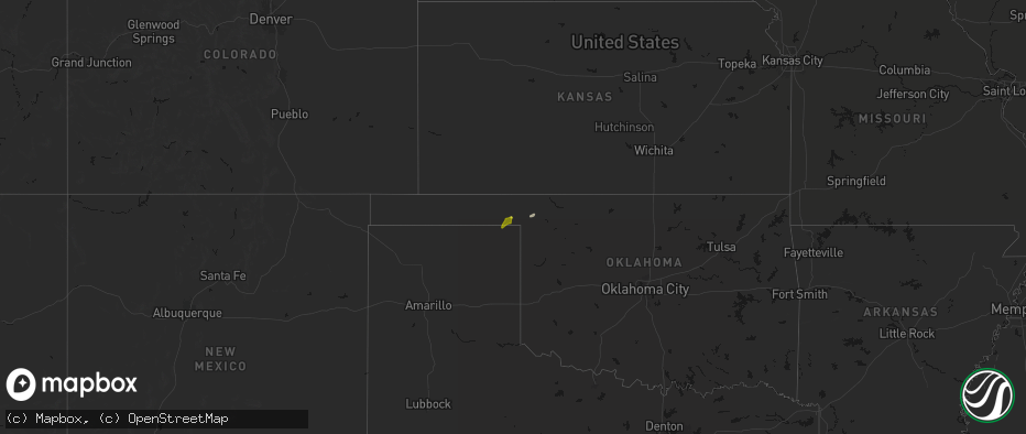
Hail Map on June 12, 2026
The weather event on June 12, 2026 includes Hail and Wind maps. 21 states and 395 cities were impacted and suffered possible damage. The total estimated number of properties impacted is 6,532.
Hail
Wind
6,532
Estimated number of impacted properties by a 1.00" hail or larger62
Estimated number of impacted properties by a 1.75" hail or larger0
Estimated number of impacted properties by a 2.50" hail or largerStates Impacted by Hail Map on June 12, 2026
Storm reports
Georgia
| Date | Description |
|---|---|
| 06/12/20265:32 PM CDT | Public reported downed trees along 5 chop road. |
| 06/12/20265:15 PM CDT | Public reported a tree down near the intersection of rolling hills rd and walter mcglammery rd. |
| 06/12/20265:15 PM CDT | A 911 call center reported a tree down along hwy 67 near barn rd. |
Montana
| Date | Description |
|---|---|
| 06/12/20266:40 PM CDT | Awos station k1cm charlie. 63 mph thunderstorm wind gust. |
| 06/12/20263:25 PM CDT | Hail around quarter size fell this afternoon. Some tree damage. |
Connecticut
| Date | Description |
|---|---|
| 06/12/20266:02 PM CDT | Tree limbs down causing a power outage near kramer ave. |
| 06/12/20265:56 PM CDT | Trees down in wires on ct-262 and echo lake rd with all lanes closed. |
| 06/12/20265:54 PM CDT | Large tree and large tree limbs down near main st. In watertown. Report from facebook. |
| 06/12/20265:42 PM CDT | Report of branch/tree down on w churchill rd. |
New York
| Date | Description |
|---|---|
| 06/12/20266:03 PM CDT | Tree snapped in on 73rd place near metropolitan avenue. |
| 06/12/20262:30 PM CDT | Three reports from various sources from broadcast media to county call center indicate an isolated area of town had trees down and a roof on a salt shed that had an ope |
Missouri
| Date | Description |
|---|---|
| 06/12/20269:28 AM CDT | Hail to the size of golf balls damaged several windows of a residence and stripped leaves and limbs from multiple trees. Time estimated from radar. |
| 06/12/20267:24 AM CDT | Social media report. Time estimated from radar. |
Pennsylvania
| Date | Description |
|---|---|
| 06/12/20262:41 PM CDT | Trees down. |
| 06/12/20262:37 PM CDT | Corrects previous tstm wnd dmg report from montrose. Trees down blocking roads in several locations. |
Virginia
| Date | Description |
|---|---|
| 06/12/20266:55 PM CDT | Large tree branch down in reedville in northumberland county... Va. |
| 06/12/20266:30 PM CDT | Large tree downed at intersection of weems rd and christ church rd. |
| 06/12/20266:20 PM CDT | Large trees downed on wharf rd and essex mill at tidewater rd. |
| 06/12/20266:12 PM CDT | Tree down near lomand dr and urbanna road. |
| 06/12/20266:09 PM CDT | Large tree downed by thunderstorm winds on bateman ridge road. Report on social media. |
| 06/12/20266:04 PM CDT | Tree down at vale road and vale station road. |
| 06/12/20266:02 PM CDT | Tree down at alder woods drive and joseph seiwick drive. |
| 06/12/20265:56 PM CDT | Multiple reports of trees and powerlines down in far western louisa county... Particularly near troy. There is also a large cluster of power outages. |
| 06/12/20265:53 PM CDT | A local report indicates 67 MPH wind near Dulles Intl Airport |
| 06/12/20265:52 PM CDT | Trees reported down along thomas jefferson parkway. |
| 06/12/20265:45 PM CDT | Trees downed on scotchtown rd south of chiswell ln. |
| 06/12/20265:40 PM CDT | Outflow from thunderstorm blew down two tents at a local church. A number of injuries were reported... Some critical. |
| 06/12/20265:40 PM CDT | *** 1 fatal... 23 inj *** corrects previous tstm wnd dmg report from 2 s moneta. Outflow from thunderstorm blew down one tent at a local church. One fatality and 23 inj |
| 06/12/20265:40 PM CDT | Virginia tech mesonet in middleburg |
| 06/12/20265:36 PM CDT | Several trees down along route 50 near middleburg. |
| 06/12/20265:35 PM CDT | Trees downed at south church ln. Time radar-estimated. |
| 06/12/20265:32 PM CDT | Outflow winds from thunderstorms blew a tree down in the 200 block of sample road. The tree completely blocked the road. |
| 06/12/20265:29 PM CDT | Tree downed by thunderstorm winds onto a power line on 15th street ne. |
| 06/12/20265:29 PM CDT | Large tree downed by thunderstorm winds... Blocking the entire road... And hit a nearby power pole. |
| 06/12/20265:26 PM CDT | Power line downed by thunderstorm winds caught a nearby tree on fire on hollyhock road nw. |
| 06/12/20265:25 PM CDT | Large tree branches downed onto ladysmith road at us-1. Time radar-estimated. |
| 06/12/20265:20 PM CDT | Trees downed along i-95 at mile marker 113 southbound. |
| 06/12/20265:19 PM CDT | Several trees were downed by thunderstorm winds in the town of draper. |
| 06/12/20265:18 PM CDT | A few trees were downed by thunderstorm winds in the town of pulaski. |
| 06/12/20265:18 PM CDT | Tree downed by thunderstorm winds onto a power line. |
| 06/12/20265:15 PM CDT | Lightning struck a tree... Which then fell onto a power line near meadow view apartments. |
| 06/12/20265:15 PM CDT | Tree downed by thunderstorm winds and then fell onto a power line. |
| 06/12/20265:12 PM CDT | Tree downed by thunderstorm winds on interstate 81 near mile marker 136.1. |
| 06/12/20265:10 PM CDT | One tree down due to thunderstorm winds at the intersection of misty hill lane and rockfish road. |
| 06/12/20265:09 PM CDT | Large tree down at endless caverns road. |
| 06/12/20265:06 PM CDT | One tree down due to thunderstorm winds at the intersection of lyndhurst road and schages lane. |
| 06/12/20265:05 PM CDT | One tree down due to thunderstorm winds at the intersection of china clay road and patton farm road. |
| 06/12/20265:05 PM CDT | One tree down due to thunderstorm winds along the 900 block of howardsville turnpike. |
| 06/12/20265:04 PM CDT | One tree down due to thunderstorm winds along hall school road. |
| 06/12/20265:04 PM CDT | Tree down at route 29 and carpenters mill road. |
| 06/12/20265:00 PM CDT | A few trees and power lines reported down across stuarts draft area. |
| 06/12/20265:00 PM CDT | Trees down in bumpass. Time estimated from radar. |
| 06/12/20264:55 PM CDT | Multiple trees and branches down near cee cee turner trail and broadway. |
| 06/12/20264:50 PM CDT | Multiple reports of trees down across southern madison co. |
| 06/12/20264:40 PM CDT | Reports of multiple trees down across the area in spotsylvania co. |
| 06/12/20264:37 PM CDT | Multiple trees down near woodstock at w high street and s lee street. |
| 06/12/20264:30 PM CDT | Large tree branch downed by thunderstorm winds... And brought down a power line which landed across the road. |
| 06/12/20264:29 PM CDT | Tree down and covering both lanes on big stoney creek road in ripplemead. |
| 06/12/20264:28 PM CDT | Tree down near brown farms road. |
| 06/12/20264:28 PM CDT | Trees down near sherman road in woodstock. |
| 06/12/20264:28 PM CDT | Reports of multiple trees down across the area in spotsylvania co. |
| 06/12/20264:15 PM CDT | Multiple trees downed onto woodford road in woodford. Time radar-estimated. |
| 06/12/20264:07 PM CDT | Multiple reports of fallen trees near winchester street in city of fredericksburg. |
| 06/12/20264:06 PM CDT | Multiple reports of trees and power lines down near linden ave in the city of fredericksburg. |
| 06/12/20263:45 PM CDT | Tree reported on roadway near hazel grove. |
| 06/12/20263:45 PM CDT | A large tree was down along ingleside drive and washington street. |
| 06/12/20263:43 PM CDT | A local report indicates 1.00 inch wind near 1 SW Woolsey |
| 06/12/20263:30 PM CDT | Power outages due to storm damage. Time estimated based on radar. |
| 06/12/20263:25 PM CDT | Tree down reported at richards ferry road and beach road. |
| 06/12/20263:20 PM CDT | Tree down reported near bear wallow road. |
| 06/12/20263:02 PM CDT | Tree down reported at cabin branch road and cliff mills road. |
| 06/12/20262:33 PM CDT | Dispatch reported numerous downed trees. |
| 06/11/20269:00 PM CDT | Multiple trees down in new church in accomack county. Time estimated from radar. |
| 06/11/20268:30 PM CDT | Multiple trees down near the intersection of horsey rd and neal park road and near arcadia high school. Time estimated from radar. |
| 06/11/20268:30 PM CDT | Asos station kwal wallops island. |
| 06/11/20268:12 PM CDT | Trees and powerlines down. |
| 06/11/20268:09 PM CDT | Measured via handheld anemometer. |
| 06/11/20267:38 PM CDT | Power lines down. |
Alabama
| Date | Description |
|---|---|
| 06/12/20261:20 PM CDT | A tree was knocked down into the roadway at 7500 al highway 71. Time estimated by radar. |
| 06/12/202611:02 AM CDT | A tree was knocked down into the roadway at 2300 cr 103. Time estimated by radar. |
| 06/12/202610:41 AM CDT | A tree was knocked down into the roadway at 957 cr 177. Time estimated by radar. |
New Jersey
| Date | Description |
|---|---|
| 06/12/20265:40 PM CDT | Several trees reported down across the city. |
| 06/12/20265:40 PM CDT | Multiple reports and photos of large trees down on poplar and fairmount avenue near summit avenue. Several on homes causing damage. |
| 06/12/20265:40 PM CDT | Tree down on prospect ave and arlington blvd. There are also power lines done in the same area. |
| 06/12/20265:20 PM CDT | Tree down onto a home on forest ave. |
| 06/12/20265:20 PM CDT | Large tree down blocking summit avenue. |
| 06/12/20265:19 PM CDT | Trees uprooted reported by mping. |
| 06/12/20263:50 PM CDT | Tree down at sooy place road and south park road in tabernacle. Time estimated from radar. |
| 06/12/20263:46 PM CDT | Wires down near big hill road in southampton township. Time estimated from radar. |
| 06/12/20263:28 PM CDT | Multiple trees down on branin road in medford. Time estimated from radar. |
| 06/12/20263:21 PM CDT | Trees down in raritan township. Time estimated from radar. |
| 06/12/20263:21 PM CDT | Trees down in readington township. Time estimated from radar. |
| 06/12/20263:21 PM CDT | Corrects previous tstm wnd dmg report from 2 sse raritan twp. Trees down in raritan township. Time estimated from radar. |
Maine
| Date | Description |
|---|---|
| 06/12/20266:45 PM CDT | Fire department reports large trees down... A 14 in diameter tree... And a 2 ft diameter tree. |
| 06/12/20266:45 PM CDT | Fire department reports trees down on quarry road with 3-8 in diameter. |
West Virginia
| Date | Description |
|---|---|
| 06/12/20264:15 PM CDT | Several trees downed on route 20 near pump house road. |
| 06/12/20263:56 PM CDT | 643 customers without power from storm damage. Time estimated based on radar. |
| 06/12/20263:55 PM CDT | Tree downed by thunderstorm winds in the 500 block of pocahontas avenue... And blocked the entire roadway. |
| 06/12/20263:55 PM CDT | Tree down. Time estimated based on radar. |
| 06/12/20263:55 PM CDT | Tree down... Wires down. Time estimated based on radar. |
| 06/12/20263:53 PM CDT | Tree downed by thunderstorm winds in the 10500 block of highland trail... Near the intersection of grandview drive and hillcrest drive. |
| 06/12/20263:51 PM CDT | Tree on power lines on cr-84 |
| 06/12/20263:45 PM CDT | Tree downed by thunderstorm winds in the 300 block of goheen street... And landed across the roadway. |
| 06/12/20263:43 PM CDT | Tree down at the intersection of renick avenue... And chesapeake street & walnut hill in greenbrier county west virginia. |
| 06/12/20263:40 PM CDT | Large limbs down. |
| 06/12/20263:40 PM CDT | Tree down at the intersection of sam anderson road and dyer lane in greenbrier county west virginia. |
| 06/12/20263:21 PM CDT | A tree fell on a house |
| 06/12/20263:10 PM CDT | Several trees down... Likely one large tree brought all of them down. Time estimated based on radar. |
| 06/12/20262:56 PM CDT | Tree down across white oak road. Time is estimated by radar. |
| 06/12/20262:55 PM CDT | Over 260 customers without power with tree damage as the cause. |
| 06/12/20262:48 PM CDT | Several areas of power outages due to tree/line damage. Time estimated based on radar. |
| 06/12/20262:35 PM CDT | Picture provided. Time estimated from radar. |
| 06/12/20262:25 PM CDT | Power outages due to tree damage. Time estimated based on radar. |
| 06/12/20262:20 PM CDT | Multiple tree contacts and several dozen customers without power. |
| 06/12/20262:10 PM CDT | Power outages due to tree damage. Time estimated based on radar. |
| 06/12/20261:50 PM CDT | Tree down blocking price hollow rd near ashford nellis rd. Time estimated from radar. |
| 06/12/20261:30 PM CDT | Tree and lines down on loghouse rd off of short creek rd. Time estimated from radar. |
North Carolina
| Date | Description |
|---|---|
| 06/12/20266:24 PM CDT | Corrects time of previous tstm wnd dmg report from 2 e white plains. Thunderstorm winds blew a tree down between the 1500 and 1600 blocks of sheep farm road. Tree block |
| 06/12/20266:17 PM CDT | Thunderstorm winds blew a tree down in the 3100 block of westfield road. The tree blocked both lanes. |
| 06/12/20266:17 PM CDT | Thunderstorm winds blew a tree down in the 100 block of gilda drive. |
| 06/12/20266:15 PM CDT | Thunderstorm winds blew a tree down near the intersection of massey road and st marie trail. The tree fell on a powerline and a truck with occupants. None of the occupa |
| 06/12/20266:14 PM CDT | Tree downed by thunderstorm winds and landed on a power line. |
| 06/12/20266:12 PM CDT | Tree downed by thunderstorm winds and landed in the roadway on arlington street. |
| 06/12/20266:12 PM CDT | Tree downed by thunderstorm winds on a power line... And the tree caught fire and is blocking the roadway. |
| 06/12/20266:12 PM CDT | Thunderstorm winds blew a tree down in the 100 block of bridgeport road. |
| 06/12/20266:09 PM CDT | Tree downed by thunderstorm winds and landed on a car near the walmart in mount airy. |
| 06/12/20266:09 PM CDT | Several trees downed by thunderstorm winds on s andy griffith parkway... Near the railroad crossing. |
| 06/12/20266:07 PM CDT | Thunderstorm winds blew a tree down in the 1500 block of edgewood drive. |
| 06/12/20266:07 PM CDT | Thunderstorm winds blew a tree down in the 600 block of south andy griffith parkway. |
| 06/12/20266:06 PM CDT | Thunderstorm winds blew a tree down in the 100 block of mountain view road. |
| 06/12/20266:02 PM CDT | A local report indicates 1.25 inch wind near 3 SSW Mountain Home |
| 06/12/20265:56 PM CDT | Multiple trees down on road. |
| 06/12/20265:39 PM CDT | Multiple trees on road and powerlines down. |
| 06/12/20265:24 PM CDT | Thunderstorm winds blew a tree down between the 1500 and 1600 blocks of sheep farm road. The tree blocked both lanes of travel. |
Vermont
| Date | Description |
|---|---|
| 06/12/20264:10 PM CDT | Tree down on osgood hill rd. Time estimated by radar. |
Oklahoma
| Date | Description |
|---|---|
| 06/12/20261:15 AM CDT | Mesonet station mayr may ranch. |
| 06/11/20269:35 PM CDT | Thunderstorm wind gust of 59 mph measured at 11 miles northeast of eva... Ok at 9:35 pm. |
| 06/11/20269:10 PM CDT | Thunderstorm wind gust of 96 mph measured at the oklahoma mesonet site 11 miles ne of eva. |
| 06/11/20269:10 PM CDT | Thunderstorm wind gust of 96 mph measured at the oklahoma mesonet site 11 miles ne of eva. Gusted to 70 mph at 9:20 pm and 58 mph at 9:25 pm. |
Kansas
| Date | Description |
|---|---|
| 06/12/202612:45 AM CDT | A local report indicates 61 MPH wind near 3 W Bloom |
| 06/12/202612:25 AM CDT | A local report indicates 64 MPH wind near 3 ENE Dodge City |
| 06/12/202612:00 AM CDT | A local report indicates 58 MPH wind near 3 ENE Dodge City |
| 06/11/202611:59 PM CDT | Asos station kddc dodge city regional airport. |
| 06/11/20269:05 PM CDT | Social media report of dime sized hail with a few golf ball sized as well. |
| 06/11/20268:22 PM CDT | A local report indicates 1.00 inch wind near 10 WSW Richfield |
| 06/11/20268:14 PM CDT | A local report indicates 1.00 inch wind near Elkhart |
| 06/11/20268:07 PM CDT | A local report indicates 1.75 inch wind near Elkhart |
New Mexico
| Date | Description |
|---|---|
| 06/11/20269:15 PM CDT | Mesonet station 68nmc rosebud 7nw. |
| 06/11/20269:07 PM CDT | Thunderstorm wind damage as well blowing off the roof of their barn. |
| 06/11/20269:07 PM CDT | Thunderstorm wind damage as well blowing off the roof of their barn. |
| 06/11/20269:07 PM CDT | Thunderstorm wind damage blowing off the roof of their barn. |
| 06/11/20268:22 PM CDT | A local report indicates 1.25 inch wind near 7 WSW Roy |
Maryland
| Date | Description |
|---|---|
| 06/12/20266:38 PM CDT | One tree down along waveland farm road near governor ritchie highway. |
| 06/12/20263:30 PM CDT | Trained spotter reported downed tree blocking road at ormond road and counselman road. |
| 06/11/20268:45 PM CDT | Damaged transformer on e church st in salisbury... Md. Time estimated from radar. |
| 06/11/20268:04 PM CDT | A local report indicates 75 MPH wind near 3 S Cape St. Claire |
| 06/11/20268:03 PM CDT | A local report indicates 70 MPH wind near 3 S Cape St. Claire |
| 06/11/20267:52 PM CDT | Widespread reports of trees and wires down across the northern portion of kent island. Time estimated from radar. |
| 06/11/20267:44 PM CDT | A local report indicates 83 MPH wind near 1 SE Parole |
| 06/11/20267:44 PM CDT | Bay bridge wxflow site. |
| 06/11/20267:44 PM CDT | A local report indicates 63 MPH wind near 1 SE Parole |
| 06/11/20267:42 PM CDT | Multiple reports of trees down near huntingtown... Md due to thunderstorms. |
| 06/11/20267:42 PM CDT | Multiple reports of trees down near prince frederick... Md due to thunderstorms. |
| 06/11/20267:42 PM CDT | Multiple trees down along generals highway. |
| 06/11/20267:42 PM CDT | Tree down at german chapel rd and solomons island road. |
| 06/11/20267:42 PM CDT | Tree down in 400 block along halsey road. |
| 06/11/20267:40 PM CDT | A local report indicates 58 MPH wind near 2 SSE Arnold |
| 06/11/20267:39 PM CDT | Tree down riverside road and winchester road. |
Texas
| Date | Description |
|---|---|
| 06/11/202610:29 PM CDT | Thunderstorm wind gust of 61 mph measured at the wt mesonet station 12 miles sw of dalhart. |
| 06/11/202610:20 PM CDT | 61 mph thunderstorm wind gust measured at the wt mesonet station 11 miles ssw of romero. Peak wind of 61 mph at 10:22 pm. |
South Carolina
| Date | Description |
|---|---|
| 06/12/20263:36 PM CDT | A 911 call center reported a tree down along wading point blvd. |
| 06/12/20263:36 PM CDT | A 911 call center reported a tree down along copperhead rd. |
Arkansas
| Date | Description |
|---|---|
| 06/12/20265:58 PM CDT | Large limb blown down onto the roof of a home. |
| 06/12/20265:37 PM CDT | [landspout] broadcast media shared picture of possible landspout. Time estimated from radar. |
| 06/12/20267:31 AM CDT | Department of transportation reported 1 downed tree blocking us 278 in howard county 2 miles southeast of dierks. Winds estimated 50 mph. |
| 06/12/20267:25 AM CDT | Department of transportation reported 1 downed tree blocking ar 24 in sevier county 1 mile west if lockesburg. Winds estimated 50 mph. |
| 06/12/20267:15 AM CDT | Department of transportation reported 1 downed tree blocking us 70 in sevier county 2 miles west of dequeen. Winds estimated 50 mph. |
Cities Impacted by Hail Map on June 12, 2026
- Kenton, TN
- Trimble, TN
- Friendship, TN
- Booker, TX
- Perryton, TX
- Follett, TX
- Laverne, OK
- Balko, OK
- Lexington, TN
- Brighton, TN
- Covington, TN
- May, OK
- Buffalo, OK
- Lamar, OK
- Mcalester, OK
- Green Pond, SC
- Yemassee, SC
- Nellis, WV
- Ridgeview, WV
- Costa, WV
- Peytona, WV
- Ashford, WV
- Winifrede, WV
- Cabin Creek, WV
- Hernshaw, WV
- Julian, WV
- Comfort, WV
- Round O, SC
- Harrogate, TN
- Eskdale, WV
- Ewing, VA
- Mount Nebo, WV
- Summersville, WV
- Tazewell, TN
- Cloudcroft, NM
- Madison, VA
- Banco, VA
- Reva, VA
- Ludowici, GA
- Summerville, SC
- Ladson, SC
- Mount Hope, WV
- Haywood, VA
- Van Horn, TX
- Fairfield, MT
- Renick, WV
- Arcadia, FL
- Fredericksburg, VA
- Scarbro, WV
- Meadow Bridge, WV
- Grassy Meadows, WV
- Richardsville, VA
- Huger, SC
- Frenchtown, NJ
- Flemington, NJ
- Pittstown, NJ
- Haymarket, VA
- Broad Run, VA
- Spring Dale, WV
- Fort Stockton, TX
- Fort Shaw, MT
- Swiss, WV
- Belva, WV
- The Plains, VA
- Jewell Ridge, VA
- Raysal, WV
- Spotsylvania, VA
- Alpine, TX
- Ronceverte, WV
- Lewisburg, WV
- Caldwell, WV
- Alderson, WV
- Poplar Grove, AR
- Gainesville, VA
- Catharpin, VA
- Moro, AR
- Weed, NM
- Deerfield, VA
- Manassas, VA
- Centreville, VA
- Chantilly, VA
- Vaughn, MT
- Middleburg, VA
- Stanardsville, VA
- West Cornwall, CT
- Sharon, CT
- Locust Grove, VA
- Stafford, VA
- Sun River, MT
- Power, MT
- Great Falls, MT
- Punta Gorda, FL
- Sebring, FL
- Welch, WV
- Hillsboro, WV
- Sacramento, NM
- Zolfo Springs, FL
- Marvell, AR
- Nassau, NY
- Old Chatham, NY
- Malden Bridge, NY
- Nanjemoy, MD
- West Augusta, VA
- Lake Wales, FL
- Dundee, FL
- Culpeper, VA
- Hood, VA
- Oakpark, VA
- Brightwood, VA
- Pratts, VA
- Aroda, VA
- Fayette, AL
- Brainard, NY
- Greenville, VA
- Stuarts Draft, VA
- Milford, VA
- Hustle, VA
- Elkton, VA
- Dyke, VA
- Northport, AL
- Orange, VA
- Radiant, VA
- Locust Dale, VA
- Haines City, FL
- Kissimmee, FL
- Manahawkin, NJ
- Staffordsville, VA
- Ruckersville, VA
- Barboursville, VA
- Rochelle, VA
- Marathon, TX
- Alamogordo, NM
- Brooklet, GA
- Champlain, VA
- South Kent, CT
- Kent, CT
- Wingdale, NY
- Charlottesville, VA
- Jesup, GA
- Lakeville, CT
- Bedford, VA
- Raton, NM
- Somerset, VA
- Trinidad, CO
- Statesboro, GA
- Thaxton, VA
- North Garden, VA
- Belt, MT
- Upperville, VA
- Hiwassee, VA
- Draper, VA
- Tappahannock, VA
- Salisbury, CT
- Falls Village, CT
- Keswick, VA
- Pulaski, VA
- Marshall, VA
- Franklin Lakes, NJ
- Oakland, NJ
- Maywood, NJ
- Lodi, NJ
- Paramus, NJ
- Saddle Brook, NJ
- Fair Lawn, NJ
- Rochelle Park, NJ
- Gaylordsville, CT
- New Milford, CT
- Woodbury, CT
- Bethlehem, CT
- Nutley, NJ
- Glen Ridge, NJ
- Bloomfield, NJ
- Montclair, NJ
- Horse Shoe, NC
- Mills River, NC
- Harmony, ME
- Lowry, VA
- Goode, VA
- Montpelier, VA
- Thomaston, CT
- Watertown, CT
- Madison Heights, VA
- Amherst, VA
- Cottondale, AL
- Tuscaloosa, AL
- Forest, VA
- Ashland, VA
- Secaucus, NJ
- East Rutherford, NJ
- North Bergen, NJ
- Lyndhurst, NJ
- West New York, NJ
- Weehawken, NJ
- Carlstadt, NJ
- Union City, NJ
- Clifton, NJ
- Moneta, VA
- Vinton, VA
- Herndon, VA
- Leesburg, VA
- Aldie, VA
- Sterling, VA
- Reston, VA
- Ashburn, VA
- Bluemont, VA
- Oakton, VA
- Fairfax, VA
- Round Hill, VA
- Hendersonville, NC
- Middlebury, CT
- Waterbury, CT
- Oakville, CT
- Ocate, NM
- Lynchburg, VA
- Vienna, VA
- Springfield, VA
- Falls Church, VA
- Annandale, VA
- Alexandria, VA
- Arlington, VA
- Mill Spring, NC
- Sylvania, GA
- Lancaster, VA
- Heathsville, VA
- Concord, VA
- Baxley, GA
- Wagon Mound, NM
- Glen Allen, VA
- Rockville, VA
- La Plata, MD
- Fort Washington, MD
- Brandywine, MD
- Clinton, MD
- Accokeek, MD
- Waldorf, MD
- White Plains, MD
- Pomfret, MD
- Stanford, MT
- Geyser, MT
- Burgess, VA
- Capulin, NM
- Flat Rock, NC
- Saluda, NC
- Etowah, NC
- Pisgah Forest, NC
- Marietta, SC
- Zirconia, NC
- Des Moines, NM
- Annapolis, MD
- Crownsville, MD
- Arnold, MD
- Solano, NM
- Grenville, NM
- Boise City, OK
- Ruston, LA
- Amelia Court House, VA
- Ford, VA
- Roy, NM
- Severna Park, MD
- Edgewater, MD
- Davidsonville, MD
- Grambling, LA
- Campo, CO
- Temperanceville, VA
- Stevensville, MD
- Gambrills, MD
- Elkhart, KS
- Chester, MD
- Clayton, NM
- Keyes, OK
- Wallops Island, VA
- Horntown, VA
- Oak Hall, VA
- Atlantic, VA
- New Church, VA
- Tribune, KS
- Goodwell, OK
- Texhoma, OK
- Richfield, KS
- Walsh, CO
- Dalhart, TX
- Moriarty, NM
- Roxobel, NC
- Scotland Neck, NC
- Rolla, KS
- Guymon, OK
- Stratford, TX
- Mosquero, NM
- Aulander, NC
- Kelford, NC
- Edgewood, NM
- Hooker, OK
- Gruver, TX
- Texhoma, TX
- Amistad, NM
- Sedan, NM
- Texline, TX
- Tijeras, NM
- Stanley, NM
- Rich Square, NC
- Colerain, NC
- Ahoskie, NC
- Weskan, KS
- Sharon Springs, KS
- Spearman, TX
- Hardesty, OK
- Conchas Dam, NM
- South Mills, NC
- Nara Visa, NM
- Turpin, OK
- Sunray, TX
- Beaver, OK
- Moyock, NC
- Stinnett, TX
- Morse, TX
- Hartley, TX
- Logan, NM
- Channing, TX
- Las Vegas, NM
- Maple, NC
- Currituck, NC
- Trementina, NM
- Shawboro, NC
- Barco, NC
- Wallace, KS
- Winona, KS
- Edson, KS
- Coinjock, NC
- Plymouth, NC
- Vega, TX
- Adrian, TX
- Plains, KS
- Colby, KS
- Monument, KS
- Levant, KS
- Vaughn, NM
- Nags Head, NC
- Manteo, NC
- Manns Harbor, NC
- Kitty Hawk, NC
- Miami, TX
- Dumas, TX
- Gate, OK
- Meade, KS
- Oakley, KS
- Kill Devil Hills, NC
- Scott City, KS
- Forgan, OK
- Grinnell, KS
- Masterson, TX
- Amarillo, TX
- Rosston, OK
- Healy, KS
- Canadian, TX
- Wanchese, NC
- Dodge City, KS
- Protection, KS
- Fowler, KS
- Ashland, KS
- Coldwater, KS
- Spearville, KS
- Ensign, KS
- Englewood, KS
- Minneola, KS
- Ford, KS
- Wright, KS
- Higgins, TX
- Fritch, TX
- Panhandle, TX
- Borger, TX
- Skellytown, TX
- Grainfield, KS
- Gove, KS
- Park, KS
- Freedom, OK
- Mooreland, OK
- Lake City, KS
- Alva, OK
- Wilmore, KS
- Pampa, TX
- White Deer, TX
- Waynoka, OK
- Hardtner, KS
- Tucumcari, NM
- Burlington, OK
- Cherokee, OK
- Chester, OK
- Dacoma, OK
- Leedey, OK
- Butler, OK
- Aline, OK
- Fairview, OK
- Cleo Springs, OK
- Carmen, OK
- Helena, OK