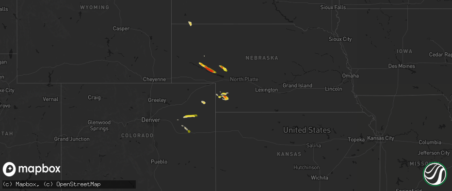
Hail Map on June 21, 2026
The weather event on June 21, 2026 includes Wind, Hail, and Tornado maps. 12 states and 281 cities were impacted and suffered possible damage. The total estimated number of properties impacted is 12,191.
Wind
Hail
Tornado
12,191
Estimated number of impacted properties by a 1.00" hail or larger2,046
Estimated number of impacted properties by a 1.75" hail or larger801
Estimated number of impacted properties by a 2.50" hail or largerStates Impacted by Hail Map on June 21, 2026
Storm reports
Oklahoma
| Date | Description |
|---|---|
| 06/20/20268:13 PM CDT | Report from mping: ping pong ball |
| 06/20/20267:55 PM CDT | A local report indicates 1.75 inch wind near 3 SW Tangier |
| 06/20/20267:41 PM CDT | A local report indicates 1.25 inch wind near 1 NE Tangier |
| 06/20/20267:35 PM CDT | A local report indicates 1.00 inch wind near 1 NE Tangier |
Colorado
| Date | Description |
|---|---|
| 06/21/20266:00 PM CDT | Wu station kcocheye2 reported a 60 mph gust. |
| 06/21/20264:15 PM CDT | Davis weatherlink site: osmus farm reported 64 mph gust. |
| 06/21/20263:55 PM CDT | Awos station k2v5 2 nw wray. |
| 06/21/20263:51 PM CDT | Davis weatherlink station: p&k farms reported a 61 mph gust. |
| 06/21/20263:51 PM CDT | Trained spotter reports 2-3 inch tree limbs down with pictures. Time estimated from radar. |
| 06/21/20262:44 PM CDT | [landspout] |
| 06/21/20262:30 PM CDT | [landspout] |
| 06/20/20269:35 PM CDT | A local report indicates 2.00 inch wind near 3 ENE Highland Center |
| 06/20/20268:43 PM CDT | A local report indicates 2.75 inch wind near 1 SW St Petersburg |
| 06/20/20268:30 PM CDT | A local report indicates 1.75 inch wind near 4 SE Reiradon Hill |
| 06/20/20268:30 PM CDT | A local report indicates 1.00 inch wind near 5 SSE Reiradon Hill |
Florida
| Date | Description |
|---|---|
| 06/21/20262:45 PM CDT | A tree fell along ratliff road. A photo was shared via social media. Time was estimated by radar. |
Georgia
| Date | Description |
|---|---|
| 06/21/20262:15 PM CDT | A pine tree fell across city blvd between seminole trail and baltimore circle. Radar estimated time. |
Kansas
| Date | Description |
|---|---|
| 06/21/20266:58 PM CDT | Ktrb measured 61 mph wind gust. |
| 06/21/20265:49 PM CDT | Text message report with picture of quarter sized hail in levant. |
| 06/21/20265:12 PM CDT | Possible weak tds: a potential weak tds may have been observed off gld radar. |
| 06/20/20269:44 PM CDT | Davis weatherlink - personal weather station. |
| 06/20/20269:44 PM CDT | Davis weatherlink personal weather station. |
| 06/20/20269:44 PM CDT | Davis weatherlink - personal weather station. |
| 06/20/20269:42 PM CDT | Davis weatherlink - personal weather station. |
| 06/20/20269:27 PM CDT | Periodic wind gusts of 60 mph reported from spotter. |
| 06/20/20269:24 PM CDT | Davis weatherlink personal station. |
| 06/20/20269:00 PM CDT | Ksdot |
| 06/20/20268:54 PM CDT | Weather underground station - kksingal27. |
| 06/20/20268:54 PM CDT | Spotter reported 65-70 mph gusts north of sublette. |
| 06/20/20268:50 PM CDT | Ambient weather network - personal weather station. |
| 06/20/20268:48 PM CDT | A local report indicates 65 MPH wind near 1 SW Garden City |
| 06/20/20268:43 PM CDT | Ambient weather network - personal weather station. |
| 06/20/20268:43 PM CDT | Ambient weather network - personal station. |
| 06/20/20268:40 PM CDT | Asos station kgck garden city. |
| 06/20/20268:35 PM CDT | Awos station kuls ulysses. |
| 06/20/20268:27 PM CDT | Storm chaser reported 60 mph gusts on the north side of garden city via social media. |
| 06/20/20268:27 PM CDT | Storm chaser reported quarter size hail via spotter network. |
| 06/20/20268:26 PM CDT | Davis weatherlink - personal weather station. |
| 06/20/20268:25 PM CDT | Weather underground site - kksgarde143. |
| 06/20/20268:21 PM CDT | Davis weatherlink personal weather station. |
| 06/20/20268:20 PM CDT | Davis weatherlink personal weather station. |
| 06/20/20268:20 PM CDT | Ksdot |
| 06/20/20268:14 PM CDT | Personal weather station - ambient weather network. |
| 06/20/20268:12 PM CDT | Social media post. |
| 06/20/20268:04 PM CDT | Davis weatherlink personal station. |
| 06/20/20267:55 PM CDT | Awos station ktqk scott city. |
| 06/20/20267:52 PM CDT | Wunderground personal weather station - kksscott62. |
| 06/20/20267:35 PM CDT | Ksdot |
| 06/20/20267:35 PM CDT | Report from mping: quarter |
| 06/20/20267:30 PM CDT | Ksdot via synoptic api - k5sct. |
| 06/20/20267:23 PM CDT | Ambient weather station report. |
| 06/20/20267:10 PM CDT | Kansas mesonet observed - 10m wind. |
| 06/20/20267:05 PM CDT | Davis weather: station 5.5m e tribune ks reported a 63 mph gust. |
Indiana
| Date | Description |
|---|---|
| 06/21/20266:55 PM CDT | Large tree branches snapped. |
| 06/21/20266:55 PM CDT | Large tree limb over the road. |
| 06/21/20266:54 PM CDT | Corrects previous non-tstm wnd dmg report from 3 e west boggs lake. Approximate location and time. Time is estimated from radar. Ema reports tree and carport damage in |
| 06/21/20266:40 PM CDT | Several tree limbs snapped. |
| 06/21/20266:10 PM CDT | Powerlines over the road. Time estimated from radar. |
| 06/21/20266:05 PM CDT | A local report indicates 70 MPH wind near 1 W Greencastle |
| 06/21/20265:50 PM CDT | Law enforcement in sullivan county reports many trees and power lines are down...multiple vehicles damaged and several houses damaged. |
| 06/21/20265:19 PM CDT | Corrects previous tstm wnd dmg report from sullivan. Several tree limbs blown down accompanied by approximately 70 mph winds. |
| 06/21/20265:19 PM CDT | A local report indicates 70 MPH wind near Sullivan |
| 06/21/20265:13 PM CDT | Tree branch and shingles blown off by thunderstorm winds. |
| 06/20/20269:28 PM CDT | Brief touchdown reported in dayville. |
| 06/20/20269:20 PM CDT | Report of apartments damaged with people stuck inside. |
| 06/20/20269:17 PM CDT | Large power flash east of downtown evansville... In posted on x from evansville traffic cam. |
| 06/20/20269:15 PM CDT | Brief tornado reported near epworth road and lloyd expy near deaconess gateway. |
| 06/20/20268:20 PM CDT | Corrects previous tstm wnd dmg report from 2 e holland. Time estimated by radar: power lines down across the road near the intersection of west 900 south and south 500 |
| 06/20/20268:20 PM CDT | Time estimated by radar: power lines down across the road. |
| 06/20/20268:19 PM CDT | Reported near i-64 and us 231. |
| 06/20/20268:16 PM CDT | Tornado reported on the ground near dale... In. Public and chaser report relayed via em. |
| 06/20/20268:09 PM CDT | Corrects previous tornado report from 8 nw dale. Tornado reported on the ground near dale... In. Public and chaser report relayed via em. |
| 06/20/20268:05 PM CDT | Large tree limbs snapped. Time estimated from radar. |
| 06/20/20267:55 PM CDT | Rope tornado on the ground from em. |
| 06/20/20267:39 PM CDT | Multiple trees and powerlines down in lynnville. Possible tornado. |
| 06/20/20267:35 PM CDT | Large tree limb downed on cody road. |
| 06/20/20267:30 PM CDT | Photo from x showing a tornado ne of fort branch... In. |
| 06/20/20267:25 PM CDT | Tornado reported near cr 350s and cr 100e. |
| 06/20/20267:15 PM CDT | Power pole down and damage to roof on structure... Report received via amateur radio skywarn net in orange county. Located near the intersection of cody road and hollac |
| 06/20/20267:09 PM CDT | Tornado reported on the ground from 41 between owensville and ft. Branch. |
Wyoming
| Date | Description |
|---|---|
| 06/21/20264:11 PM CDT | Asos station kriw riverton airport |
Nebraska
| Date | Description |
|---|---|
| 06/21/20264:20 PM CDT | Report from mping: ping pong ball |
| 06/21/20264:20 PM CDT | Spotter network: report of 1.00 inch hail. |
| 06/21/20264:10 PM CDT | Personal weather station. |
| 06/21/20264:05 PM CDT | Social media report of pictured 3.2 inch hail measured with calipers. |
| 06/21/20264:02 PM CDT | Personal weather station. |
| 06/21/20263:53 PM CDT | Corrects previous hail report from 12 nnw max. Spotter network report: measured with calipers 3 inch hail. |
| 06/21/20263:53 PM CDT | Spotter network report: measured with calipers 3 inch hail. |
| 06/21/20263:52 PM CDT | Report from mping: hen egg+ |
| 06/21/20263:43 PM CDT | Report from mping: tennis ball |
| 06/21/20263:14 PM CDT | Mping report. |
| 06/21/20263:14 PM CDT | Report from mping: half dollar |
| 06/21/20262:54 PM CDT | A local report indicates 1.00 inch wind near 6 N Lewellen |
| 06/21/20262:43 PM CDT | Mping report. |
| 06/21/20261:59 PM CDT | Report via mping. |
| 06/20/20267:36 PM CDT | Personal weather station. |
| 06/20/20267:31 PM CDT | Personal weather station. |
| 06/20/20267:28 PM CDT | Mesonet station. |
| 06/20/20267:28 PM CDT | A local report indicates 1.00 inch wind near 1 WSW Kingsley Dam |
Illinois
| Date | Description |
|---|---|
| 06/21/20266:21 PM CDT | Report of tornado briefly on the ground. |
| 06/21/20266:21 PM CDT | An officer was blown off the road on highway 51 north of sandoval. |
| 06/21/20266:08 PM CDT | A local report indicates 1.00 inch wind near 1 SE Xenia |
| 06/21/20266:03 PM CDT | A local report indicates 60 MPH wind near 2 WNW Xenia |
| 06/21/20265:30 PM CDT | Collapsed barn. Possible tornado. |
| 06/21/20265:26 PM CDT | Fox 2 storm runner caught brief touchdown about 1 mile north of vernon just east of hwy 51. |
| 06/21/20265:24 PM CDT | A local report indicates 1.00 inch wind near 2 SSW Flat Rock |
| 06/21/20265:11 PM CDT | Tornado reported near tolle lane and austin road per fire department. |
| 06/21/20265:11 PM CDT | Corrects previous funnel cloud report from 3 w saint paul. Report of funnel cloud from fox 2 storm runner broadcast. Funnel reportedly touched ground briefly. |
| 06/21/20265:09 PM CDT | Photo submission of tornado on facebook by texico. |
| 06/21/20265:07 PM CDT | Extensive tree and power line damage. Some roof and structural damage. Possible tornado. |
| 06/21/20264:45 PM CDT | Tds observed on radar. |
| 06/21/20264:41 PM CDT | A local report indicates a tornado near 2 NW Oskaloosa |
| 06/21/20264:38 PM CDT | Corrects previous tornado report from 2 e alma. Emergency manager reported a funnel. Passed along a report from firemen saying tornado on the ground headed east toward |
| 06/21/20264:38 PM CDT | Emergency manager reported a funnel. Passed along a report from firemen saying tornado on the ground headed east toward forbes state park. |
| 06/21/20264:32 PM CDT | Corrects previous tornado report from 2 n oblong. Several downed power lines off 1250 n... Between 200 e and 300 e. |
| 06/21/20264:20 PM CDT | Multiple large softwood tree limbs snapped. |
| 06/21/20264:14 PM CDT | Large tds on radar. |
| 06/21/20264:09 PM CDT | Power lines down and part of barn roof peeled back. Possible tornado. |
| 06/21/20264:06 PM CDT | Semi flipped over on interstate 57 at neoga. |
| 06/21/20264:03 PM CDT | Large trees down. Possible tornado. |
| 06/21/20264:01 PM CDT | Multiple trees down... Multiple branches strewn about... And power lines down along cr 1900n near n 1300e. |
| 06/21/20263:53 PM CDT | Report of a tornado touchdown near pittsburgh and vernon. |
| 06/21/20263:47 PM CDT | A local report indicates a tornado near 3 W Ingraham |
| 06/21/20263:43 PM CDT | Areal drone footage shared via broadcast met. Time estimated by radar. |
| 06/21/20263:43 PM CDT | Photo of debris strewn in field about one-half mile east of town. Possible tornado. |
| 06/21/20263:40 PM CDT | Tree limbs down on a home. |
| 06/21/20263:35 PM CDT | Received video confirmation of a landspout. |
| 06/21/20263:34 PM CDT | A local report indicates a tornado near Louisville |
| 06/20/20269:00 PM CDT | Brief tornado about 5 miles northeast of enfield. |
| 06/20/20268:07 PM CDT | Very brief touchdown just east of tower hill. |
| 06/20/20268:03 PM CDT | Tornado reported northeast of belle prairie city. |
| 06/20/20267:42 PM CDT | Tornado on the ground south of wayne city... Il from photo report on x. |
| 06/20/20267:41 PM CDT | Brief tornado spotted south of wayne city. |
| 06/20/20267:41 PM CDT | Tornado on the ground from a trained spotter. |
| 06/20/20267:32 PM CDT | Several downed power lines off 1250 n... Between 200 e and 300 e. |
| 06/20/20267:28 PM CDT | Social media report of a tornado north of toms prairie. This tornado was also spotted from merriam. |
| 06/20/20267:27 PM CDT | A local report indicates a tornado near 2 WSW Edinburg |
Cities Impacted by Hail Map on June 21, 2026
- Saint Clair, MO
- Robertsville, MO
- Anna, IL
- Jonesboro, IL
- Cobden, IL
- Broadwater, NE
- Lisco, NE
- Interlachen, FL
- Oshkosh, NE
- Genoa, CO
- Woodrow, CO
- Lewellen, NE
- Lindon, CO
- Akron, CO
- Imperial, NE
- Arthur, NE
- Champion, NE
- Zolfo Springs, FL
- Gallion, AL
- Enders, NE
- Yuma, CO
- Arriba, CO
- Oelrichs, SD
- Chadron, NE
- Wauneta, NE
- Louisville, IL
- Benkelman, NE
- Cope, CO
- Eckley, CO
- Wray, CO
- Anton, CO
- Quincy, FL
- Gretna, FL
- Chattahoochee, FL
- Flagler, CO
- Joes, CO
- Lake Wales, FL
- Palisade, NE
- Ogallala, NE
- Haigler, NE
- Lake Placid, FL
- Keystone, NE
- Melbourne, FL
- Stratton, NE
- Max, NE
- Shobonier, IL
- Vandalia, IL
- Ingraham, IL
- Newton, IL
- Hay Springs, NE
- Paxton, NE
- Saint Peter, IL
- Farina, IL
- Kinmundy, IL
- Kirk, CO
- Patoka, IL
- Alma, IL
- Okeechobee, FL
- Vernon, IL
- Willow Hill, IL
- Elsie, NE
- Oblong, IL
- Saint Francis, KS
- Seibert, CO
- Sutherland, NE
- Parks, NE
- Vona, CO
- Xenia, IL
- Annapolis, IL
- West York, IL
- Brownstown, IL
- Yale, IL
- Wallace, NE
- Hutsonville, IL
- Kit Carson, CO
- Mason, IL
- Dix, IL
- Mount Vernon, IL
- Merriman, NE
- Rushville, NE
- West Liberty, IL
- Dundas, IL
- Elk City, KS
- Longton, KS
- Sedan, KS
- Kell, IL
- Edgewood, IL
- Texico, IL
- Woodlawn, IL
- Stratton, CO
- Robinson, IL
- Palestine, IL
- West Union, IL
- Bird City, KS
- Merom, IN
- Fairbanks, IN
- Sullivan, IN
- Farmersburg, IN
- Shelburn, IN
- McDonald, KS
- Edson, KS
- Bluford, IL
- Flora, IL
- Dickens, NE
- Sumner, IL
- Claremont, IL
- Olney, IL
- Greenville, IL
- Gordon, NE
- Bingham, NE
- Carlisle, IN
- Colby, KS
- Cheyenne Wells, CO
- Keenes, IL
- Wellfleet, NE
- Ellsworth, NE
- Flat Rock, IL
- Bridgeport, IL
- Coalmont, IN
- Hymera, IN
- Clay City, IN
- Lewis, IN
- Jasonville, IN
- Dugger, IN
- Linton, IN
- Worthington, IN
- Coal City, IN
- Switz City, IN
- Lyons, IN
- Sims, IL
- Hoffman, IL
- Centralia, IL
- Salem, IL
- Iuka, IL
- Trenton, IL
- Aviston, IL
- Independence, KS
- Coffeyville, KS
- Fellsmere, FL
- Levant, KS
- Temple, NH
- Vero Beach, FL
- Carlyle, IL
- Wayne City, IL
- Breese, IL
- Goodland, KS
- Oaktown, IN
- Brewster, KS
- Arapahoe, CO
- Odin, IL
- Sandoval, IL
- Freedom, IN
- Geff, IL
- Lawrenceville, IL
- Ashby, NE
- Winona, KS
- Spencer, IN
- Johnsonville, IL
- Bicknell, IN
- Edwardsport, IN
- Keyesport, IL
- Liberty, KS
- Sharon Springs, KS
- Weskan, KS
- Bloomfield, IN
- Eads, CO
- Sheridan Lake, CO
- Fairfield, IL
- Wallace, KS
- Monument, KS
- Oakley, KS
- Tribune, KS
- Vincennes, IN
- Wheatland, IN
- Saint Francisville, IL
- Leoti, KS
- Holly, CO
- Lemoyne, NE
- Odon, IN
- Montgomery, IN
- Loogootee, IN
- Cannelburg, IN
- Crane, IN
- Shoals, IN
- Williams, IN
- Washington, IN
- Monroe City, IN
- Half Way, MO
- Bolivar, MO
- Cisne, IL
- Sugar City, CO
- Fargo, OK
- Du Quoin, IL
- Tamaroa, IL
- Scott City, KS
- Marienthal, KS
- Owensville, IN
- Fort Branch, IN
- Mitchell, IN
- West Baden Springs, IN
- Snyder, CO
- Fort Supply, OK
- Woodward, OK
- Plainville, IN
- Fort Morgan, CO
- Buffalo, MO
- Syracuse, KS
- Princeton, IN
- Oakland City, IN
- Francisco, IN
- Haubstadt, IN
- Brule, NE
- Ragsdale, IN
- Coolidge, KS
- Thedford, NE
- Elberfeld, IN
- Lynnville, IN
- Healy, KS
- Stockton, MO
- Ellery, IL
- Campbellsburg, IN
- Orleans, IN
- Paoli, IN
- Edinburg, IL
- Kendall, KS
- Lakin, KS
- Spurgeon, IN
- Patoka, IN
- Petersburg, IN
- Deerfield, KS
- Dighton, KS
- Sterling, CO
- Sharon, OK
- Cynthiana, IN
- Holcomb, KS
- Garden City, KS
- Barnhill, IL
- Fleming, CO
- Lamar, CO
- Madrid, NE
- Mount Carmel, IL
- Dale, IN
- Enfield, IL
- Springerton, IL
- Morrisville, MO
- McLeansboro, IL
- Burnt Prairie, IL
- Haxtun, CO
- Copeland, KS
- Ulysses, KS
- Johnson, KS
- Sublette, KS
- Satanta, KS
- Pierceville, KS
- Cimarron, KS
- Ingalls, KS
- Montezuma, KS
- Granada, CO
- Carmi, IL
- Saint Croix, IN
- Branchville, IN
- Leopold, IN
- Otis, CO
- Kismet, KS
- Meade, KS
- Moscow, KS
- Plains, KS
- Ensign, KS
- English, IN
- Cabool, MO
- Leavenworth, IN
- Evansville, IN
- Newburgh, IN
- Manter, KS
- Brush, CO
- Willow Springs, MO
- Hartville, MO
- Niangua, MO
- Battletown, KY
- Mansfield, MO
- Boonville, IN