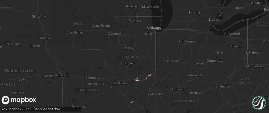
Hail Map in Illinois on June 21, 2026
The weather event in Illinois on June 21, 2026 includes Wind, Hail, and Tornado maps. 12 states and 340 cities were impacted and suffered possible damage. The total estimated number of properties impacted is 1,440.
Wind
Hail
Tornado
1,440
Estimated number of impacted properties by a 1.00" hail or larger0
Estimated number of impacted properties by a 1.75" hail or larger0
Estimated number of impacted properties by a 2.50" hail or largerStorm reports in Illinois
Illinois
| Date | Description |
|---|---|
| 06/21/20266:41 PM CDT | Damage to a structure on meacham road. |
| 06/21/20266:21 PM CDT | Report of tornado briefly on the ground. |
| 06/21/20266:21 PM CDT | An officer was blown off the road on highway 51 north of sandoval. |
| 06/21/20266:08 PM CDT | A local report indicates 1.00 inch wind near 1 SE Xenia |
| 06/21/20266:03 PM CDT | A local report indicates 60 MPH wind near 2 WNW Xenia |
| 06/21/20265:30 PM CDT | Collapsed barn. Possible tornado. |
| 06/21/20265:26 PM CDT | Fox 2 storm runner caught brief touchdown about 1 mile north of vernon just east of hwy 51. |
| 06/21/20265:24 PM CDT | A local report indicates 1.00 inch wind near 2 SSW Flat Rock |
| 06/21/20265:22 PM CDT | Corrects previous tornado report from 1 w saint peter. Brief tornado touchdown spotted from this location. Circulation went south of here. |
| 06/21/20265:11 PM CDT | Tornado reported near tolle lane and austin road per fire department. |
| 06/21/20265:11 PM CDT | 2 cabins were damaged by fallen tree limbs and 1 fallen tree. |
| 06/21/20265:11 PM CDT | Corrects previous funnel cloud report from 3 w saint paul. Report of funnel cloud from fox 2 storm runner broadcast. Funnel reportedly touched ground briefly. |
| 06/21/20265:09 PM CDT | Photo submission of tornado on facebook by texico. |
| 06/21/20265:07 PM CDT | Extensive tree and power line damage. Some roof and structural damage. Possible tornado. |
| 06/21/20264:45 PM CDT | Tds observed on radar. |
| 06/21/20264:41 PM CDT | A local report indicates a tornado near 2 NW Oskaloosa |
| 06/21/20264:38 PM CDT | Emergency manager reported a funnel. Passed along a report from firemen saying tornado on the ground headed east toward forbes state park. |
| 06/21/20264:38 PM CDT | Corrects previous tornado report from 2 e alma. Emergency manager reported a funnel. Passed along a report from firemen saying tornado on the ground headed east toward |
| 06/21/20264:32 PM CDT | Corrects previous tornado report from 2 n oblong. Several downed power lines off 1250 n... Between 200 e and 300 e. |
| 06/21/20264:20 PM CDT | Multiple large softwood tree limbs snapped. |
| 06/21/20264:14 PM CDT | Large tds on radar. |
| 06/21/20264:09 PM CDT | Power lines down and part of barn roof peeled back. Possible tornado. |
| 06/21/20264:06 PM CDT | Semi flipped over on interstate 57 at neoga. |
| 06/21/20264:03 PM CDT | Large trees down. Possible tornado. |
| 06/21/20264:01 PM CDT | Multiple trees down... Multiple branches strewn about... And power lines down along cr 1900n near n 1300e. |
| 06/21/20263:53 PM CDT | Report of a tornado touchdown near pittsburgh and vernon. |
| 06/21/20263:47 PM CDT | A local report indicates a tornado near 3 W Ingraham |
| 06/21/20263:43 PM CDT | Areal drone footage shared via broadcast met. Time estimated by radar. |
| 06/21/20263:43 PM CDT | Photo of debris strewn in field about one-half mile east of town. Possible tornado. |
| 06/21/20263:40 PM CDT | Tree limbs down on a home. |
| 06/21/20263:35 PM CDT | Received video confirmation of a landspout. |
| 06/21/20263:34 PM CDT | A local report indicates a tornado near Louisville |
| 06/20/20269:00 PM CDT | Brief tornado about 5 miles northeast of enfield. |
| 06/20/20268:07 PM CDT | Very brief touchdown just east of tower hill. |
| 06/20/20268:03 PM CDT | Tornado reported northeast of belle prairie city. |
| 06/20/20267:42 PM CDT | Tornado on the ground south of wayne city... Il from photo report on x. |
| 06/20/20267:41 PM CDT | Brief tornado spotted south of wayne city. |
| 06/20/20267:41 PM CDT | Tornado on the ground from a trained spotter. |
| 06/20/20267:32 PM CDT | Several downed power lines off 1250 n... Between 200 e and 300 e. |
| 06/20/20267:28 PM CDT | Social media report of a tornado north of toms prairie. This tornado was also spotted from merriam. |
| 06/20/20267:27 PM CDT | A local report indicates a tornado near 2 WSW Edinburg |
All States Impacted by Hail Map on June 21, 2026
Cities Impacted by Hail Map on June 21, 2026
- Saint Clair, MO
- Robertsville, MO
- Anna, IL
- Jonesboro, IL
- Cobden, IL
- Broadwater, NE
- Lisco, NE
- Interlachen, FL
- Oshkosh, NE
- Genoa, CO
- Woodrow, CO
- Lewellen, NE
- Lindon, CO
- Akron, CO
- Imperial, NE
- Arthur, NE
- Champion, NE
- Zolfo Springs, FL
- Gallion, AL
- Enders, NE
- Yuma, CO
- Arriba, CO
- Oelrichs, SD
- Chadron, NE
- Wauneta, NE
- Louisville, IL
- Benkelman, NE
- Cope, CO
- Eckley, CO
- Wray, CO
- Anton, CO
- Quincy, FL
- Gretna, FL
- Chattahoochee, FL
- Flagler, CO
- Joes, CO
- Lake Wales, FL
- Palisade, NE
- Ogallala, NE
- Haigler, NE
- Lake Placid, FL
- Keystone, NE
- Melbourne, FL
- Stratton, NE
- Max, NE
- Shobonier, IL
- Vandalia, IL
- Ingraham, IL
- Newton, IL
- Hay Springs, NE
- Paxton, NE
- Saint Peter, IL
- Farina, IL
- Kinmundy, IL
- Kirk, CO
- Patoka, IL
- Alma, IL
- Okeechobee, FL
- Vernon, IL
- Willow Hill, IL
- Elsie, NE
- Oblong, IL
- Saint Francis, KS
- Seibert, CO
- Sutherland, NE
- Parks, NE
- Vona, CO
- Xenia, IL
- Annapolis, IL
- West York, IL
- Brownstown, IL
- Yale, IL
- Wallace, NE
- Hutsonville, IL
- Kit Carson, CO
- Mason, IL
- Dix, IL
- Mount Vernon, IL
- Merriman, NE
- Rushville, NE
- West Liberty, IL
- Dundas, IL
- Elk City, KS
- Longton, KS
- Sedan, KS
- Kell, IL
- Edgewood, IL
- Texico, IL
- Woodlawn, IL
- Stratton, CO
- Robinson, IL
- Palestine, IL
- West Union, IL
- Bird City, KS
- Merom, IN
- Fairbanks, IN
- Sullivan, IN
- Farmersburg, IN
- Shelburn, IN
- McDonald, KS
- Edson, KS
- Bluford, IL
- Flora, IL
- Dickens, NE
- Sumner, IL
- Claremont, IL
- Olney, IL
- Greenville, IL
- Gordon, NE
- Bingham, NE
- Carlisle, IN
- Colby, KS
- Cheyenne Wells, CO
- Keenes, IL
- Wellfleet, NE
- Ellsworth, NE
- Flat Rock, IL
- Bridgeport, IL
- Coalmont, IN
- Hymera, IN
- Clay City, IN
- Lewis, IN
- Jasonville, IN
- Dugger, IN
- Linton, IN
- Worthington, IN
- Coal City, IN
- Switz City, IN
- Lyons, IN
- Sims, IL
- Hoffman, IL
- Centralia, IL
- Salem, IL
- Iuka, IL
- Trenton, IL
- Aviston, IL
- Independence, KS
- Coffeyville, KS
- Fellsmere, FL
- Levant, KS
- Temple, NH
- Vero Beach, FL
- Carlyle, IL
- Wayne City, IL
- Breese, IL
- Goodland, KS
- Oaktown, IN
- Brewster, KS
- Arapahoe, CO
- Odin, IL
- Sandoval, IL
- Freedom, IN
- Geff, IL
- Lawrenceville, IL
- Ashby, NE
- Winona, KS
- Spencer, IN
- Johnsonville, IL
- Bicknell, IN
- Edwardsport, IN
- Keyesport, IL
- Liberty, KS
- Sharon Springs, KS
- Weskan, KS
- Bloomfield, IN
- Eads, CO
- Sheridan Lake, CO
- Fairfield, IL
- Wallace, KS
- Monument, KS
- Oakley, KS
- Tribune, KS
- Vincennes, IN
- Wheatland, IN
- Saint Francisville, IL
- Leoti, KS
- Holly, CO
- Lemoyne, NE
- Odon, IN
- Montgomery, IN
- Loogootee, IN
- Cannelburg, IN
- Crane, IN
- Shoals, IN
- Williams, IN
- Washington, IN
- Monroe City, IN
- Half Way, MO
- Bolivar, MO
- Cisne, IL
- Sugar City, CO
- Fargo, OK
- Du Quoin, IL
- Tamaroa, IL
- Scott City, KS
- Marienthal, KS
- Owensville, IN
- Fort Branch, IN
- Mitchell, IN
- West Baden Springs, IN
- Snyder, CO
- Fort Supply, OK
- Woodward, OK
- Plainville, IN
- Fort Morgan, CO
- Buffalo, MO
- Syracuse, KS
- Princeton, IN
- Oakland City, IN
- Francisco, IN
- Haubstadt, IN
- Brule, NE
- Ragsdale, IN
- Coolidge, KS
- Thedford, NE
- Elberfeld, IN
- Lynnville, IN
- Healy, KS
- Stockton, MO
- Ellery, IL
- Campbellsburg, IN
- Orleans, IN
- Paoli, IN
- Edinburg, IL
- Kendall, KS
- Lakin, KS
- Spurgeon, IN
- Patoka, IN
- Petersburg, IN
- Deerfield, KS
- Dighton, KS
- Sterling, CO
- Sharon, OK
- Cynthiana, IN
- Holcomb, KS
- Garden City, KS
- Barnhill, IL
- Fleming, CO
- Lamar, CO
- Madrid, NE
- Mount Carmel, IL
- Dale, IN
- Enfield, IL
- Springerton, IL
- Morrisville, MO
- McLeansboro, IL
- Burnt Prairie, IL
- Haxtun, CO
- Copeland, KS
- Ulysses, KS
- Johnson, KS
- Sublette, KS
- Satanta, KS
- Pierceville, KS
- Cimarron, KS
- Ingalls, KS
- Montezuma, KS
- Granada, CO
- Carmi, IL
- Saint Croix, IN
- Branchville, IN
- Leopold, IN
- Otis, CO
- Kismet, KS
- Meade, KS
- Moscow, KS
- Plains, KS
- Ensign, KS
- English, IN
- Cabool, MO
- Leavenworth, IN
- Evansville, IN
- Newburgh, IN
- Manter, KS
- Brush, CO
- Willow Springs, MO
- Hartville, MO
- Niangua, MO
- Battletown, KY
- Mansfield, MO
- Boonville, IN
- Holyoke, CO
- Liberal, KS
- Fowler, KS
- Kingman, KS
- Chrisney, IN
- Richland, IN
- Rockport, IN
- Cunningham, KS
- Corydon, IN
- Central, IN
- Mauckport, IN
- Pratt, KS
- Isabel, KS
- Hugoton, KS
- Turpin, OK
- Minneola, KS
- Tyrone, OK
- Dodge City, KS
- Englewood, KS
- Ford, KS
- Forgan, OK
- Coats, KS
- Sawyer, KS
- Mountain View, MO
- Ward, CO
- Haviland, KS
- Laconia, IN
- Grandview, IN
- Bucklin, KS
- Wiley, CO
- McClave, CO
- Jamestown, CO
- Boulder, CO
- Spivey, KS
- Murdock, KS
- Birch Tree, MO
- Nashville, KS
- Ashland, KS
- Wilmore, KS
- Laverne, OK
- Beaver, OK
- Buffalo, OK
- Rosston, OK
- Gate, OK
- Hooker, OK
- Protection, KS
- Mullinville, KS
- Chandler, IN
- Medicine Lodge, KS
- Rocky Ford, CO
- La Junta, CO
- Zenda, KS
- Harper, KS
- Coldwater, KS
- Hasty, CO
- Nederland, CO
- Bruceville, IN
- Rome, IN
- Cannelton, IN


