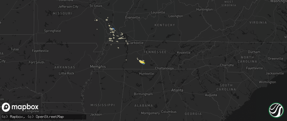
Hail Map on June 1, 2026
The weather event on June 1, 2026 includes Wind and Hail maps. 23 states and 861 cities were impacted and suffered possible damage. The total estimated number of properties impacted is 206,564.
Wind
Hail
206,564
Estimated number of impacted properties by a 1.00" hail or larger33,066
Estimated number of impacted properties by a 1.75" hail or larger199
Estimated number of impacted properties by a 2.50" hail or largerStates Impacted by Hail Map on June 1, 2026
Storm reports
Montana
| Date | Description |
|---|---|
| 05/31/20269:30 PM CDT | Mesonet station mtsoo 16.0 sw bainville |
South Carolina
| Date | Description |
|---|---|
| 06/01/20265:16 PM CDT | Numerous downed trees across the city. Time estimated from radar. |
| 06/01/20265:03 PM CDT | Trees down in the 3600 block of williamson rd. |
| 06/01/20264:56 PM CDT | Trees down in the 900 block of daves road. |
| 06/01/20262:24 PM CDT | Tree down at intersection of sitton shoals rd and sitton mill rd. Time estimated from radar. |
| 06/01/20262:16 PM CDT | Tree down on road. |
| 06/01/20262:14 PM CDT | Tree down on return church rd at oak creek rd. Time estimated. |
| 06/01/20262:12 PM CDT | Tree down at intersection of engelhard dr and n strawberry farm rd. Time estimated from radar. |
| 06/01/20262:12 PM CDT | Quarter size hail. Time estimated from radar. |
| 06/01/20262:12 PM CDT | Tree down on home. |
| 05/31/202610:50 PM CDT | Amateur radio operator relayed report of fallen tree downing power lines along hatchaway bridge rd at fox pond rd. |
| 05/31/202610:40 PM CDT | Aiken county em passed along a report from 911 dispatch of a tree blocking the roadway at the intersection of arcola st and south dixie rd. |
Colorado
| Date | Description |
|---|---|
| 06/01/20266:40 PM CDT | A local report indicates 1.00 inch wind near Limon |
| 06/01/20266:05 PM CDT | Estimated report of 1 inch hail 6 north of burlington. |
| 06/01/20265:56 PM CDT | A local report indicates 1.50 inch wind near 2 W Matheson |
| 06/01/20265:54 PM CDT | Report from mping: quarter |
| 06/01/20265:39 PM CDT | Report from mping: half dollar |
| 06/01/20265:36 PM CDT | Pea to quarter size hail reported by trained spotter. |
| 06/01/20265:36 PM CDT | A local report indicates 1.00 inch wind near 2 NNE Monument |
| 06/01/20265:35 PM CDT | Report from mping: quarter |
| 06/01/20265:34 PM CDT | Report from social media with image of measured hail stone. |
| 06/01/20265:30 PM CDT | A local report indicates 1.50 inch wind near Palmer Lake |
| 06/01/20265:30 PM CDT | Report from mping: quarter |
| 06/01/20265:21 PM CDT | Report from mping: hen egg |
| 06/01/20265:13 PM CDT | Report from mping: quarter |
| 06/01/20264:38 PM CDT | A local report indicates 1.00 inch wind near 1 N Natural Fort |
| 06/01/20264:34 PM CDT | A local report indicates 1.50 inch wind near 3 NW Strasburg |
| 06/01/20264:12 PM CDT | Report from mping: golf ball |
| 06/01/20264:10 PM CDT | A local report indicates 2.00 inch wind near 1 SSE Bennett |
| 06/01/20264:08 PM CDT | Report from mping: ping pong ball |
| 06/01/20264:03 PM CDT | A local report indicates 1.75 inch wind near 3 W Bennett |
| 06/01/20264:02 PM CDT | Report from mping: half dollar |
| 06/01/20263:48 PM CDT | Report from mping: quarter |
| 06/01/20263:41 PM CDT | Report from mping: quarter |
| 06/01/20263:34 PM CDT | A local report indicates 1.00 inch wind near 4 E Buckley AFB |
| 06/01/20263:32 PM CDT | Report from mping: quarter |
| 06/01/20263:05 PM CDT | Report from mping: half dollar |
| 06/01/20262:40 PM CDT | Report from mping: quarter |
| 06/01/20262:34 PM CDT | Report from mping: half dollar |
| 06/01/20262:33 PM CDT | Report from mping: quarter |
| 06/01/20262:31 PM CDT | A local report indicates 1.50 inch wind near 2 SE Chatfield Reservoi |
| 06/01/20262:28 PM CDT | Report from mping: half dollar |
| 06/01/20262:23 PM CDT | Report from mping: quarter |
| 06/01/20262:22 PM CDT | A local report indicates 1.75 inch wind near 4 E Denver |
| 06/01/20262:19 PM CDT | Report from mping: quarter |
| 06/01/20262:15 PM CDT | A local report indicates 1.00 inch wind near 6 SW Black Forest |
| 06/01/20262:15 PM CDT | Most hail was smaller. |
| 06/01/20262:14 PM CDT | A local report indicates 1.50 inch wind near 1 SE Denver |
| 06/01/20262:12 PM CDT | A local report indicates 1.00 inch wind near 4 SW Black Forest |
| 06/01/20262:11 PM CDT | Report from mping: quarter |
| 06/01/20262:11 PM CDT | Report from mping: quarter |
| 06/01/20262:10 PM CDT | A local report indicates 1.00 inch wind near 2 W Denver |
| 06/01/20262:10 PM CDT | A local report indicates 1.75 inch wind near 1 NW Denver |
| 06/01/20262:08 PM CDT | A local report indicates 1.00 inch wind near 6 ESE Falcon |
| 06/01/20262:07 PM CDT | A local report indicates 1.00 inch wind near Denver |
| 06/01/20262:05 PM CDT | A local report indicates 1.00 inch wind near 1 E Edgewater |
| 06/01/20262:05 PM CDT | A local report indicates 1.00 inch wind near 5 SW Black Forest |
| 05/31/20267:43 PM CDT | Weatherlink. |
| 05/31/20267:28 PM CDT | Mesonet station co048 us 385 holyoke. |
| 05/31/20267:14 PM CDT | Semi blown over at the intersection of cr u and hwy 34. No information regarding injuries. |
| 05/31/20267:07 PM CDT | Report from mping: quarter |
Tennessee
| Date | Description |
|---|---|
| 06/01/20262:00 PM CDT | Viewer photo of a large tree down on a metal fence around 3:00 p.m. |
| 06/01/202612:45 PM CDT | Multiple trees down within the flintville community. |
| 06/01/202612:42 PM CDT | Large tree uprooted at the corner of deer trace road and lovers lane. |
| 06/01/202612:42 PM CDT | Trees down on pleasant ridge road. Power poles are broken due to the trees falling on them. |
| 06/01/202611:46 AM CDT | Trees were knocked down onto a barn on collins lane. |
| 06/01/202611:46 AM CDT | Corrects previous tstm wnd dmg report from 2 nw huntland. Trees down on pleasant ridge road. Power poles are broken due to the trees falling on them. |
| 06/01/202611:45 AM CDT | Large trees down on 300 block of shady grove rd. |
| 06/01/202611:45 AM CDT | A large tree branch fell on a car. |
| 06/01/202611:43 AM CDT | Corrects previous tstm wnd dmg report from 5 nw huntland. Large trees down on 300 block of shady grove rd. |
| 06/01/202611:43 AM CDT | Corrects previous tstm wnd dmg report from 9 w huntland. Multiple trees down within the flintville community. |
| 06/01/202611:41 AM CDT | Large tree was knocked down blocking the roadway at the intersection of shady grove road and arnold hollow road. |
| 06/01/202611:40 AM CDT | Social media photos indicated heavy tree damage near the intersection of shady grove road and arnold hollow road. |
| 06/01/202611:27 AM CDT | Corrects previous tstm wnd dmg report from 3 nnw fayetteville. Large tree uprooted at the corner of deer trace road and lovers lane. |
| 06/01/202611:23 AM CDT | A social media photo indicated heavy tree damage near the intersection of gimlet creek road and hamestring road. |
| 06/01/202611:15 AM CDT | Tree down at intersection of beech creek rd and morrison creek rd. Time is radar estimated. |
| 06/01/202611:02 AM CDT | Tree fallen on home on south mill street in linden. Time is radar estimated. |
| 06/01/20269:40 AM CDT | Multiple trees down on tn 54 near greenfield. |
Mississippi
| Date | Description |
|---|---|
| 06/01/20266:45 PM CDT | Ping pong ball size hail on east bethel road. Time is radar estimated. |
| 06/01/20266:44 PM CDT | Reports of nickel to ping pong ball size hail in olive branch. |
| 06/01/20266:23 PM CDT | A local report indicates 1.00 inch wind near 1 NNW Goshen Springs |
| 06/01/20266:14 PM CDT | Madison pd reported several trees down near the lost rabbit community and along rice road. |
| 06/01/20265:50 PM CDT | A few trees down off abner bryant road along with a shed damaged. |
| 06/01/20264:30 PM CDT | A few trees down in the county. |
| 06/01/20262:34 PM CDT | Several trees blown down reported by red cross. |
| 06/01/20262:12 PM CDT | Tree down along hwy 12 at caldwell rd. |
| 06/01/20261:50 PM CDT | Corrects previous tstm wnd dmg report from 1 s flint hill. Several trees blown down reported by red cross. |
| 06/01/202612:33 PM CDT | Trees down in ratliff community. |
| 06/01/202612:17 PM CDT | A local report indicates 1.00 inch wind near Kirkville |
| 05/31/202610:32 PM CDT | 4 trees down on carlton drive just south of arkabutla lake. Time is radar estimated. |
| 05/31/202610:12 PM CDT | Multiple trees down on star landing road and goodman roads in walls. Time is radar estimated. |
| 05/31/20268:19 PM CDT | A local report indicates 1.00 inch wind near 1 ENE Arkabutla |
| 05/31/20267:57 PM CDT | Multiple trees down near fog road. Time is radar estimated. |
| 05/31/20267:40 PM CDT | Trees and powerlines were blown down in raymond. |
| 05/31/20267:28 PM CDT | Trees were blow down on county road 118... 119... And 581. |
| 05/31/20267:25 PM CDT | Several trees were blown down in the vicinity of mcdowell road. Lightning struck a large tree which caused it to fall onto a house on branch street. |
Texas
| Date | Description |
|---|---|
| 06/01/20266:24 PM CDT | Mostly pea to penny size hail with a few quarter size hailstones mixed in... At the intersection of tx highways 136 and 207. |
| 06/01/20266:20 PM CDT | Hailstones up to golf ball sized were reported 5 miles north of stinnett off of hwy 207. |
| 06/01/20265:48 PM CDT | Public estimated ping pong sized hail at grandview rv park west of stinnett at 5:48 pm. |
| 05/31/20267:50 PM CDT | A local report indicates 1.00 inch wind near 1 NNE Stinnett |
| 05/31/20267:32 PM CDT | A local report indicates 1.00 inch wind near Stinnett |
| 05/31/20267:22 PM CDT | A local report indicates 1.00 inch wind near Stinnett |
Missouri
| Date | Description |
|---|---|
| 06/01/20262:00 PM CDT | Report of golf ball sized hail at highway 76 and highway ee. Time estimated from radar. |
| 06/01/20267:36 AM CDT | Social media post of tree down with other tree limbs snapped off in northern cape girardeau county. |
Nebraska
| Date | Description |
|---|---|
| 06/01/20266:38 PM CDT | Report from mping: quarter |
| 06/01/20265:41 PM CDT | Upr site gust 61 mph. |
| 06/01/20262:34 AM CDT | A local report indicates 1.00 inch wind near 5 W Lincoln |
| 05/31/20267:43 PM CDT | A local report indicates 62 MPH wind near 2 NW Crescent Lake Nwr |
Florida
| Date | Description |
|---|---|
| 05/31/20267:54 PM CDT | Power lines down over roadway near greenwood. |
| 05/31/20267:47 PM CDT | Tree down over sr-273 near chipley. |
| 05/31/20267:18 PM CDT | Trees reported down on 8th ave in graceville. |
Wyoming
| Date | Description |
|---|---|
| 06/01/20265:16 PM CDT | A local report indicates 1.00 inch wind near 2 E Cheyenne |
| 06/01/20265:02 PM CDT | Report from mping: quarter |
| 06/01/20265:00 PM CDT | Report from mping: quarter |
| 06/01/20264:56 PM CDT | Report from mping: quarter |
| 06/01/20264:50 PM CDT | Trained spotter reports quarter sized hail along interstate 25. |
| 06/01/20264:02 PM CDT | Report of quarter size hail. |
| 06/01/20263:29 PM CDT | Emergency manager reports lots of quarter size hail. |
| 06/01/20263:26 PM CDT | Emergency manager reports quarter size hail. |
| 06/01/20262:58 PM CDT | Wydot sensor along interstate 25 gust 60 mph. |
| 06/01/20262:30 PM CDT | Trained spotter reports quarter size hail in wheatland as well as minor ponding of water on roads. |
| 06/01/20262:13 PM CDT | Trained spotter reports quarter size hail near wheatland reservoir number 1. |
Kansas
| Date | Description |
|---|---|
| 06/01/20266:39 PM CDT | Several trees down. |
| 06/01/20266:20 PM CDT | A local report indicates 80 MPH wind near 10 S Dighton |
| 06/01/20266:15 PM CDT | A local report indicates 1.00 inch wind near 10 S Dighton |
| 06/01/20266:10 PM CDT | Asos station kgld goodland. |
| 06/01/20266:07 PM CDT | A local report indicates 76 MPH wind near 3 SSE Dighton |
| 06/01/20265:41 PM CDT | A local report indicates 1.00 inch wind near 2 S Amy |
| 06/01/20265:36 PM CDT | Pea to quarter size hail. |
| 06/01/20265:35 PM CDT | Report from mping: quarter |
| 06/01/20265:35 PM CDT | Davis weather station. |
| 06/01/20265:20 PM CDT | Station k5coo. |
| 06/01/20265:00 PM CDT | A local report indicates 1.00 inch wind near 8 S Dighton |
| 06/01/20264:58 PM CDT | Nickel to quarter size hail reported. |
| 06/01/20267:48 AM CDT | Nickel to quarter size hail. |
| 06/01/20263:20 AM CDT | Davis weather station. |
| 06/01/20262:59 AM CDT | Davis weather station. |
| 06/01/20261:39 AM CDT | Large tree branch across roadway. |
| 06/01/20261:36 AM CDT | A local report indicates 59 MPH wind near 3.4 WNW Wellington |
| 06/01/20261:35 AM CDT | A local report indicates 60 MPH wind near 4 NE Caldwell |
| 06/01/20261:12 AM CDT | Winds were estimated between 60 and 70 mph. |
| 06/01/20261:11 AM CDT | 50 ft x 100 ft pole building was blown down. Time estimated from radar. |
| 06/01/20261:03 AM CDT | Numerous large tree branches and trees downed by strong winds in this general area. A barn roof was also blown off. Time estimated from radar. |
| 06/01/202612:51 AM CDT | A local report indicates 58 MPH wind near 1.7 SSE Kingman |
| 06/01/202612:23 AM CDT | Report from mping: quarter |
| 06/01/202612:15 AM CDT | Davis weather station. |
| 05/31/202611:43 PM CDT | A local report indicates 61 MPH wind near 3 S Pratt |
| 05/31/202611:36 PM CDT | A local report indicates 74 MPH wind near 2 NNW Macksville |
| 05/31/202611:33 PM CDT | A local report indicates 62 MPH wind near 4 ENE Cullison |
| 05/31/202611:00 PM CDT | A local report indicates 70 MPH wind near 2 NNW Macksville |
| 05/31/202610:54 PM CDT | Davis weather station. |
| 05/31/202610:51 PM CDT | A local report indicates 68 MPH wind near 3 ESE Belpre |
| 05/31/202610:51 PM CDT | A local report indicates 60 MPH wind near 3 E Zook |
| 05/31/202610:42 PM CDT | A local report indicates 58 MPH wind near 3 NW Centerview |
| 05/31/202610:22 PM CDT | A local report indicates 64 MPH wind near Greensburg |
| 05/31/202610:15 PM CDT | A local report indicates 59 MPH wind near 8 SSW Centerview |
| 05/31/202610:00 PM CDT | A local report indicates 67 MPH wind near 3 NNE Minneola |
| 05/31/20269:30 PM CDT | A local report indicates 59 MPH wind near 9 NW Bellefont |
| 05/31/20269:16 PM CDT | A local report indicates 63 MPH wind near 6 NE Fowler |
| 05/31/20269:16 PM CDT | Mesonet station up313 2.1 w minneola |
| 05/31/20269:15 PM CDT | Mesonet station dw9907 bloom. |
| 05/31/20269:15 PM CDT | A local report indicates 67 MPH wind near 4 N Minneola |
| 05/31/20269:09 PM CDT | A local report indicates 63 MPH wind near 4 N Minneola |
| 05/31/20268:52 PM CDT | Asos station kddc dodge city regional airport. |
| 05/31/20268:46 PM CDT | A local report indicates 59 MPH wind near 9 W Jetmore |
| 05/31/20268:30 PM CDT | A local report indicates 59 MPH wind near 3 W Wright |
| 05/31/20268:26 PM CDT | Corrects previous tstm wnd gst report from 3 e dodge city. Kddc asos. |
| 05/31/20268:23 PM CDT | A local report indicates 77 MPH wind near 2 NNE Dodge City |
| 05/31/20268:14 PM CDT | Davis weather station. |
| 05/31/20268:12 PM CDT | A local report indicates 1.00 inch wind near Ingalls |
| 05/31/20268:05 PM CDT | A local report indicates 58 MPH wind near 9 ESE Kalvesta |
| 05/31/20267:59 PM CDT | Ambient station - auston farms. |
| 05/31/20267:55 PM CDT | A local report indicates 64 MPH wind near 4 NE Cimarron |
| 05/31/20267:50 PM CDT | A local report indicates 1.50 inch wind near 10 W Richfield |
| 05/31/20267:45 PM CDT | Ambient station - rogers weather station. |
| 05/31/20267:45 PM CDT | A local report indicates 1.00 inch wind near 14 NW Jetmore |
| 05/31/20267:26 PM CDT | Kddc asos. |
| 05/31/20267:21 PM CDT | Asos station kgck garden city. |
| 05/31/20267:16 PM CDT | A local report indicates 61 MPH wind near 2 WNW Grigston |
| 05/31/20267:03 PM CDT | A local report indicates 1.75 inch wind near 8 SSW Beeler |
| 05/31/20267:00 PM CDT | Camper flipped over. Timed estimated. |
Iowa
| Date | Description |
|---|---|
| 06/01/20266:00 PM CDT | Several branches with one larger tree approx 8 inches in diameter down. Several shingles blown off roof. |
| 06/01/20266:00 PM CDT | Large pine tree down. |
| 06/01/20265:59 PM CDT | Power pole down. Blown to southwest. |
| 06/01/20265:58 PM CDT | Large 2ft diameter tree split. |
| 06/01/20265:50 PM CDT | Limbs and tree down. Window blown out. Time estimated from radar. |
| 06/01/20265:31 PM CDT | Mostly dime size but some hail stones as large as a quarter. |
| 06/01/20265:26 PM CDT | Strong winds caused tree damage blocking roads. Time estimated from radar. |
| 06/01/20265:25 PM CDT | Several trees and power lines down. Time estimated from radar and personal weather stations. |
Georgia
| Date | Description |
|---|---|
| 06/01/20266:54 PM CDT | Trees reported down over sr 39 at old river rd. |
| 06/01/20266:25 PM CDT | Several trees reported down around benevolence. |
| 06/01/20266:20 PM CDT | Public reports tree down near the intersection of highway 520 and wall street. |
| 06/01/20265:42 PM CDT | Ga power reports several customers without power in and around the midland community. |
| 06/01/20265:20 PM CDT | Public reports a large tree down along highway 27. |
| 06/01/20265:18 PM CDT | Numerous trees down near ga hwy 116 and lower blue springs rd. One tree fell into a roof. |
| 06/01/20265:18 PM CDT | Ga power shows several thousand customers across the county without power from south of pine mountain to hamilton and surrounding communities. |
| 06/01/20265:10 PM CDT | Public reports tree down along interstate 185 near mile marker 33. |
| 06/01/20265:10 PM CDT | Emergency manager reports tree down near the intersection of oak grove road and south thompson road. |
| 06/01/20264:49 PM CDT | Emergency manager reports tree down on a home along park avenue. No injuries reported. |
| 06/01/20264:44 PM CDT | *** 1 inj *** emergency manager reports tree down on a home along first avenue resulting in significant damage. Minor injuries to one occupant. |
| 06/01/20264:42 PM CDT | Emergency manager reports 40+ trees down across county from west point lake to lagrange and points southward. |
| 06/01/20264:42 PM CDT | Tree damage near west point road and bradfield drive with numerous large branches and few a trees down. Power lines were knocked down by falling tree which landed on a |
| 06/01/20264:40 PM CDT | Emergency manager reports tree down on a vehicle along north lake drive. No injuries reported. |
| 06/01/20263:56 PM CDT | 911 call center reported trees down near the intersection of lincolnton highway and welcome church road. |
| 06/01/20263:38 PM CDT | County official reported trees down on harpers ferry road. |
| 06/01/20263:30 PM CDT | County official reported trees down on william smith road. |
| 06/01/20263:16 PM CDT | Firefighter reported trees and powerlines down on montevideo road. |
| 06/01/20263:15 PM CDT | County official reported roof of a church was blown off. |
| 06/01/20263:07 PM CDT | Tree down in 4300 block of cokesbury hwy. |
| 06/01/20263:04 PM CDT | Firefighter reported trees and powerlines down on milford road. |
| 06/01/20263:04 PM CDT | Firefighter reported trees down on anderson highway. |
| 06/01/20263:00 PM CDT | Firefighter reported trees down on old 29 highway. |
| 06/01/20262:55 PM CDT | A severe thunderstorm produced a swath of 60-75 mph wind extending from just east of hartwell to far northeast elbert county. The damaging wind swath began near hart st |
| 06/01/20262:47 PM CDT | Numerous social media reports of downed and uprooted trees in reed creek. Time estimated from radar. |
| 05/31/20267:15 PM CDT | Tree reported down on s bridge rd in morgan. |
Arkansas
| Date | Description |
|---|---|
| 06/01/20266:42 PM CDT | A local report indicates 1.00 inch wind near 3 N Clinton Municipal A |
| 06/01/20266:01 PM CDT | Corrects previous tstm wnd dmg report from 1 ese rosie. Multiple trees blown down along arkansas 14 and the updated location is evident via power outage map. |
| 06/01/20266:01 PM CDT | Multiple trees blown down along arkansas 14. |
| 06/01/20265:30 PM CDT | An oak tree was uprooted and fell on a house. The roof sustained structural damage. |
| 05/31/20268:33 PM CDT | Powerlines down 2.2 miles west wrightsville. |
| 05/31/20268:30 PM CDT | Numerous trees down in the area with widespread power outages. Winds estimated to be in excess of 70 mph and possibly higher to the east. |
| 05/31/20268:09 PM CDT | Multiple trees down across russellville in addition to london and north of london. |
Illinois
| Date | Description |
|---|---|
| 06/01/20264:30 PM CDT | Relayed by wcia-tv. |
Oklahoma
| Date | Description |
|---|---|
| 06/01/20266:05 PM CDT | Report near 15th and lewis. Relayed by media. |
| 06/01/20262:28 AM CDT | A local report indicates 66 MPH wind near 2 NNW Ponca City |
| 06/01/20261:15 AM CDT | A local report indicates 58 MPH wind near 1 WSW Medford |
| 06/01/20261:10 AM CDT | A local report indicates 74 MPH wind near 1 SW Medford |
| 06/01/202612:10 AM CDT | A local report indicates 62 MPH wind near 3 WNW Hopeton |
| 05/31/202611:15 PM CDT | Freedom mesonet. |
| 05/31/202611:10 PM CDT | May ranch mesonet. |
Kentucky
| Date | Description |
|---|---|
| 06/01/20267:02 AM CDT | Multiple trees uprooted... Several large tree limbs snapped. Powerlines down. Radar and damage appear consistent with a microburst with peak winds 70-80 mph. |
Alabama
| Date | Description |
|---|---|
| 06/01/20266:59 PM CDT | Powerlines reported down in gordon. |
| 06/01/20266:50 PM CDT | Tree reported down on valley forge road. |
| 06/01/20266:50 PM CDT | Tree reported down on powerlines near national road home. |
| 06/01/20266:45 PM CDT | Tree reported down on cr 14 near midland city. |
| 06/01/20266:41 PM CDT | Multiple trees reported down in headland. |
| 06/01/20266:38 PM CDT | Numerous trees and power outages reported in dale county. |
| 06/01/20266:36 PM CDT | Multiple trees reported down on cr 57 near abbeville. |
| 06/01/20266:35 PM CDT | A few trees reported down in and around the opp community in covington county... Al. |
| 06/01/20266:24 PM CDT | Tree reported down on martin luther king jr ave in ozark. |
| 06/01/20266:20 PM CDT | Trees reported down north of enterprise in coffee county. |
| 06/01/20266:20 PM CDT | Numerous trees reported down across dale county. |
| 06/01/20266:00 PM CDT | Multiple trees and power lines down across the county. |
| 06/01/20265:54 PM CDT | Multiple trees and power lines down across the county... Including on highway 231. |
| 06/01/20265:53 PM CDT | Numerous trees were reported down along the alabama river in the eureka landing community in monroe county... Al.. |
| 06/01/20265:24 PM CDT | Trees down old seale highway and mt zion street. |
| 06/01/20265:21 PM CDT | Multiple trees and power lines down across the county... Including along highway 110... Highway 82... And highway 29. |
| 06/01/20265:15 PM CDT | Multiple trees and power lines down across the county... Especially in the fort deposit and letohatchee areas. |
| 06/01/20265:14 PM CDT | Tree down on power line and on fire cutrate road and opelika. |
| 06/01/20265:11 PM CDT | Trees down sandfort rd and woodland drive. |
| 06/01/20265:11 PM CDT | Trees down camp parkman rd. |
| 06/01/20265:04 PM CDT | Multiple trees and power lines down across primarily the southern half of montgomery county. |
| 06/01/20264:54 PM CDT | Multiple trees and power lines down across the county. |
| 06/01/20264:44 PM CDT | Trees down in various parts of the county. |
| 06/01/20264:42 PM CDT | Tree down on county road 27. |
| 06/01/20264:39 PM CDT | Tree down on mundy road and also a tree down on county road 23. |
| 06/01/20264:37 PM CDT | Trees and power lines down around tallassee. |
| 06/01/20264:30 PM CDT | Multiple trees down wetumpka. |
| 06/01/20264:27 PM CDT | Damage to porch overhang on andrew mills rd. |
| 06/01/20264:21 PM CDT | Multiple trees and power lines down across the county. |
| 06/01/20264:20 PM CDT | Two trees down with one lane blocked. |
| 06/01/20264:18 PM CDT | Multiple trees down around deatsville. |
| 06/01/20264:15 PM CDT | Tree on a house in dadeville. |
| 06/01/20264:15 PM CDT | Multiple trees and power lines down across the county... With the worst damage in northern portions of the county. |
| 06/01/20264:13 PM CDT | Trees down across parts of the county. |
| 06/01/20264:11 PM CDT | A tree fell through a home in titus. |
| 06/01/20264:06 PM CDT | Tree down on williams rd. |
| 06/01/20264:01 PM CDT | Tree down at cr 237... Cr 158 intersection. |
| 06/01/20264:00 PM CDT | Multiple trees and power lines down countywide. |
| 06/01/20263:56 PM CDT | Multiple trees down around wadley. |
| 06/01/20263:55 PM CDT | Tree down on power lines. |
| 06/01/20263:54 PM CDT | Multiple trees down around alexander city... Including one on a vehicle. |
| 06/01/20263:54 PM CDT | Multiple trees and power lines down countywide. |
| 06/01/20263:54 PM CDT | Several trees down across the county. |
| 06/01/20263:51 PM CDT | Trees down around woodland. |
| 06/01/20263:51 PM CDT | Multiple trees down around wedowee. |
| 06/01/20263:45 PM CDT | A local report indicates 1.00 inch wind near 2 ENE Hanover |
| 06/01/20263:39 PM CDT | Trees down in various parts of northern hale county... Some blocking roads. |
| 06/01/20263:39 PM CDT | Multiple trees and power lines down countywide. |
| 06/01/20263:35 PM CDT | Tree down on an unoccupied vehicle on school street. |
| 06/01/20263:35 PM CDT | Multiple trees and power lines down cedar creek road. |
| 06/01/20263:33 PM CDT | Trees down around ashland and lineville... Including country club road and also springhill rd. |
| 06/01/20263:33 PM CDT | Multiple trees down around millerville... Including on highway 148 and highway 9. |
| 06/01/20263:30 PM CDT | Multiple trees down south river road. |
| 06/01/20263:27 PM CDT | Multiple trees down around calera. |
| 06/01/20263:25 PM CDT | Trees down around montevallo. |
| 06/01/20263:25 PM CDT | Trees down around columbiana and wilsonville. |
| 06/01/20263:21 PM CDT | Tree down in aliceville. |
| 06/01/20263:21 PM CDT | Multiple trees and power lines down across the county. |
| 06/01/20263:16 PM CDT | Trees fell and crushed a camper and other trees fell across roadways in the alpine area. |
| 06/01/20263:15 PM CDT | Tree on a house heather lane. |
| 06/01/20263:15 PM CDT | Tree on a mobile home in woodstock. |
| 06/01/20263:15 PM CDT | Tree on a mobile home on peavine street. |
| 06/01/20263:12 PM CDT | Trees down in alabaster and helena. |
| 06/01/20263:12 PM CDT | Few snapped tress along cr 331. |
| 06/01/20263:09 PM CDT | Trees down south shades crest and bluff ridge rd. |
| 06/01/20263:09 PM CDT | Multiple trees down on morgan rd including on a vehicle near county road 13. |
| 06/01/20263:06 PM CDT | Tree down completely blocking road on w lacon road in falkville. |
| 06/01/20263:03 PM CDT | Multiple reports of downed trees in tuscaloosa county. |
| 06/01/20263:02 PM CDT | Multiple trees down around jacksonville and service station canopy damged. |
| 06/01/20263:00 PM CDT | Tree on a house avenue k in brighton. |
| 06/01/20263:00 PM CDT | Multiple trees down on peaceburg rd in weaver. |
| 06/01/20263:00 PM CDT | Tree down at sunny meadows dr and cahaba valley trace. |
| 06/01/20263:00 PM CDT | Tree fell on a mobile home. |
| 06/01/20263:00 PM CDT | Multiple trees down on choccolocco road in anniston. |
| 06/01/20263:00 PM CDT | Multiple trees down around talladega and lincoln. |
| 06/01/20263:00 PM CDT | Tree on a house howard street. |
| 06/01/20262:57 PM CDT | Multiple trees down around cropwell. |
| 06/01/20262:54 PM CDT | Trees down along lakeshore parkway and green springs. |
| 06/01/20262:54 PM CDT | Tree downed onto a house. |
| 06/01/20262:51 PM CDT | Rocky ridge road at lochridge road tree down with power pole and transformer down. |
| 06/01/20262:50 PM CDT | Trees down in vestavia hills. |
| 06/01/20262:49 PM CDT | Tree down blocking one lane at caldwell mill and camp horner road. |
| 06/01/20262:49 PM CDT | Multiple trees down graham drive. |
| 06/01/20262:45 PM CDT | Tree down in reform. Also a tree down in carrolton. |
| 06/01/20262:43 PM CDT | Tree down on prince road in falkville. |
| 06/01/20262:42 PM CDT | Tree down on valley rd near the pinnacle. |
| 06/01/20262:42 PM CDT | Tree down alliance rd. |
| 06/01/20262:39 PM CDT | Multiple trees down around odenville. |
| 06/01/20262:35 PM CDT | Large tree down on bankhead highway. |
| 06/01/20262:30 PM CDT | Multiple trees down around highway 231 and highway 144. |
| 06/01/20262:30 PM CDT | Tree blocking roadway highway 11 and frost hollow road. |
| 06/01/20262:30 PM CDT | Trees down pinson valley parkway. |
| 06/01/20262:30 PM CDT | Multiple trees down in pinson. |
| 06/01/20262:30 PM CDT | Trees down on lister ferry rd and also steele station rd. |
| 06/01/20262:29 PM CDT | Multiple trees were downed around fultondale... With several blocked roadways... Including kc dement ave... Stouts rd... And 34th st n. |
| 06/01/20262:25 PM CDT | Tree down valley grove rd. |
| 06/01/20262:25 PM CDT | Tree down in whitney. |
| 06/01/20262:25 PM CDT | Multiple trees down in gadsden. |
| 06/01/20262:25 PM CDT | Tree down sellers rd. |
| 06/01/20262:20 PM CDT | Tree down on coon creek road. |
| 06/01/20262:20 PM CDT | Multiple trees down around cordova and parrish. |
| 06/01/20262:15 PM CDT | Trees down in trafford. |
| 06/01/20262:15 PM CDT | Carport blown into roadway. Other trees down in the area. |
| 06/01/20262:15 PM CDT | Trees down on highway 179 and highway 77. |
| 06/01/20262:15 PM CDT | Tree fell on occupied vehicle. No injuries. |
| 06/01/20262:09 PM CDT | Tree down gun club road. |
| 06/01/20262:09 PM CDT | Tree down at highway 31 and county road 5 and along county road 9. |
| 06/01/20262:09 PM CDT | Tree down on tumlin gap rd. |
| 06/01/20262:05 PM CDT | Multiple trees and power lines down countywide. |
| 06/01/20262:04 PM CDT | Tree down on ripley road in carbon hill. |
| 06/01/20262:01 PM CDT | Tree downed onto power line on modaus road sw in decatur. |
| 06/01/20262:00 PM CDT | Tree on mobile home on highway 75. |
| 06/01/20262:00 PM CDT | Multiple trees down around jasper. |
| 06/01/20261:59 PM CDT | Multiple trees down burgett rd. |
| 06/01/20261:53 PM CDT | Trees and power lines down on mill creek rd and also on highway 5. |
| 06/01/20261:51 PM CDT | Multiple trees and powerlines down countywide. |
| 06/01/20261:48 PM CDT | Tree down on apple grove rd. |
| 06/01/20261:44 PM CDT | Tree down blocking part of frost rd. |
| 06/01/20261:39 PM CDT | Trees and power lines down along highway 278. |
| 06/01/20261:34 PM CDT | Tree down blocking the roadway at new bethel road and cypress drive. |
| 06/01/20261:34 PM CDT | Trees down across southbound lanes of hwy 157 in battleground. |
| 06/01/20261:26 PM CDT | Tree down across railroad tracks near this nucor tubular products trinity. |
| 06/01/20261:20 PM CDT | Tress down across parts of the county. |
| 06/01/20261:20 PM CDT | *** 2 inj *** 9 rvs reported to be totaled... Large trees down at little mountain mariana; 2 reported injuries. |
| 06/01/20261:20 PM CDT | Uprooted tree on single family residence on the 1300 block of murphy hill rd. |
| 06/01/20261:20 PM CDT | Tree down blocking burney mountain rd. |
| 06/01/20261:20 PM CDT | Golf ball size hail on the 1300 block of murphy hill rd. |
| 06/01/20261:18 PM CDT | Nws storm survey team estimated 80mph winds based on uprooted and snapped trees in this area. Antecedent rain loosened soils and weakened trees making them more suscept |
| 06/01/20261:18 PM CDT | Tree down blocking a lane in the road at vaughn bridge rd and bud weaver rd in hartselle. |
| 06/01/20261:17 PM CDT | Tree down on old highway 31 and lacon mtn blocking one lane. Time estimated from radar. |
| 06/01/20261:17 PM CDT | Tree down blocking the road way. |
| 06/01/20261:17 PM CDT | Tree down causing total blockage to road. |
| 06/01/20261:16 PM CDT | Tree down blocking right late... And partial blockage to the left lane. |
| 06/01/20261:15 PM CDT | Large tree down on pleasant country rd near intersection with s robinson rd. |
| 06/01/20261:15 PM CDT | Trees and power lines down along county highway 122 and also along highway 17. |
| 06/01/20261:12 PM CDT | Corrects previous tstm wnd dmg report from 6 wsw flint city. Tree down near intersection of eddy rd and kirby bridge rd... Blocking roadway. |
| 06/01/20261:12 PM CDT | Tree down on power lines near neel school rd and guyer brown private dr. Time estimated from radar. |
| 06/01/20261:12 PM CDT | Corrects previous tstm wnd dmg report from 2 nw hartselle. Tree down blocking a lane in the road at vaughn bridge rd and bud weaver rd in hartselle. |
| 06/01/20261:12 PM CDT | Corrects previous tstm wnd dmg report from 2 nne hartselle. Large tree across bethel rd ne near intersection of indian hills rd ne. |
| 06/01/20261:12 PM CDT | Corrects previous tstm wnd dmg report from 3 ne hartselle. Tree down on south bound lane of i-65... About a mile before 328 exit. |
| 06/01/20261:12 PM CDT | Tree down in the road... Blocking one lane near indian hills rd nw and roberts catfish ln in hartselle. Time estaimted from radar. |
| 06/01/20261:12 PM CDT | Corrects previous tstm wnd dmg report from 5 sw flint city. Tree down on iron man rd... Near intersection of wynn wallace rd. |
| 06/01/20261:12 PM CDT | Corrects previous tstm wnd dmg report from 2 w flint city. Tree down on 1100 block of bird spring rd. |
| 06/01/20261:12 PM CDT | Corrects previous tstm wnd dmg report from 3 sw falkville. Tree down blocking burney mountain rd. |
| 06/01/20261:12 PM CDT | Corrects previous tstm wnd dmg report from 6 w flint city. Tree fell and brought down powerlines on neel school rd... Near intersection of kirby bridge rd. |
| 06/01/20261:12 PM CDT | Large trees down with one on the road at barkley bridge rd and huckaby bridge road sw in hartselle. Report and photos from social media. Time estimated from radar. |
| 06/01/20261:12 PM CDT | Tree across the road in the crestline dr sw community in hartselle. Time estimated from radar. |
| 06/01/20261:12 PM CDT | Tree down in the road... Blocking one lane on blankenship rd. Time estimated from radar. |
| 06/01/20261:11 PM CDT | Trees down blocking both lanes of cr 35 and 76. |
| 06/01/20261:10 PM CDT | Tree down blocking roadway on 300 block of gilchrist rd... Powerlines down. |
| 06/01/20261:09 PM CDT | Power lines down across the roadway; 2600 block of n bethel rd. |
| 06/01/20261:08 PM CDT | Large tree across bethel rd ne near intersection of indian hills rd ne. |
| 06/01/20261:07 PM CDT | The hailstone was reported from kennamers cove relayed through broadcast media. |
| 06/01/20261:06 PM CDT | Tree down on iron man rd... Near intersection of wynn wallace rd. |
| 06/01/20261:06 PM CDT | Tree down blocking the roadway in the 300 block of tower street. |
| 06/01/20261:05 PM CDT | Trees down on a house in the 1600 block of runnymead avenue. |
| 06/01/20261:05 PM CDT | Trees down on a shed. |
| 06/01/20261:05 PM CDT | Tree down on south bound lane of i-65... About a mile before 328 exit. |
| 06/01/20261:04 PM CDT | Tree fall and complete blockage of road at intersection of old hwy 24 and n mountain dr. |
| 06/01/20261:03 PM CDT | Tree down on house and cars on 100 block of still meadow rd. |
| 06/01/20261:03 PM CDT | Trees down at the intersection of cr 49 and 515. |
| 06/01/20261:02 PM CDT | Tree down near intersection of eddy rd and kirby bridge rd... Blocking roadway. |
| 06/01/20261:02 PM CDT | Trees down at trademark drive at martin road. |
| 06/01/20261:02 PM CDT | Tree fell and brought down powerlines on neel school rd... Near intersection of kirby bridge rd. |
| 06/01/20261:00 PM CDT | Tree down on 1100 block of bird spring rd. |
| 06/01/20261:00 PM CDT | Large tree and powerlines down across both lanes of road in the 800 block of neel school rd. |
| 06/01/20261:00 PM CDT | Corrects previous tstm wnd dmg report from 3 nnw priceville. Tree down blocking the roadway at new bethel road and cypress drive. |
| 06/01/20261:00 PM CDT | Corrected lsr formatting. Trees and power lines down along highway 172 in hackleburg. |
| 06/01/20261:00 PM CDT | Corrected lsr formatting. Trees and powerlines down near shottsville on highway 19 and also on downs rd. |
| 06/01/202612:58 PM CDT | Tree down on power lines and trees uprooted near austin high school. Report and photos from social media. Time estimated from radar. |
| 06/01/202612:58 PM CDT | Corrects previous tstm wnd dmg report from 3 wsw decatur. Tree downed onto power line on modaus road sw in decatur. |
| 06/01/202612:58 PM CDT | Large tree down on 2400 block of red bank rd. |
| 06/01/202612:50 PM CDT | Metal hay barn destroyed at a farm on snake road at shaw road on the nw side of that intersection. Trees down also at this location. |
| 06/01/202612:50 PM CDT | Tree laying down on communication line. |
| 06/01/202612:49 PM CDT | A tree was knocked down at 7305 county line road. |
| 06/01/202612:48 PM CDT | A tree was knocked down on highway 157 at mm 54. |
| 06/01/202612:47 PM CDT | Tree down blocking both lanes near the intersection of cf 136 and 620. |
| 06/01/202612:43 PM CDT | Trees down blocking the road at hwy 157 at cr 235. |
| 06/01/202612:42 PM CDT | Tree down on a house in the 5500 block of cr 130. Trees also down on power lines. |
| 06/01/202612:41 PM CDT | A tree was knocked down at the intersection of poplar creek loop and county line road. |
| 06/01/202612:35 PM CDT | Corrects previous tstm wnd dmg report from 10 ese rogersville. Metal hay barn destroyed at a farm on snake road at shaw road on the nw side of that intersection. Trees |
| 06/01/202612:32 PM CDT | Tree down blocking one lane of hwy 64 near the intersection of cr 501. |
| 06/01/202612:30 PM CDT | Tree limb hanging and blocking road at intersection of cr 581 and cr 585. |
| 06/01/202612:30 PM CDT | A tree was knocked down at 14145 2nd street. |
| 06/01/202612:28 PM CDT | A tree was knocked down at the intersection of river road and skyview circle. |
| 06/01/202612:27 PM CDT | Tree down in the roadway blocking both lanes of traffic in the 3000 block of cr 25. |
| 06/01/202612:23 PM CDT | Trees down completely covering cr 15 and cr 112. |
| 06/01/202612:22 PM CDT | Power lines were knocked down at 20239 cox road. |
| 06/01/202612:22 PM CDT | Two trees down on cr 530 and 52. Caller is stuck between them. No injuries. |
| 06/01/202612:20 PM CDT | A tree was knocked down at the intersection of moody lane and cross lane. |
| 06/01/202612:19 PM CDT | Corrects previous tstm wnd dmg report from 6 w underwood-petersville. Trees down completely covering cr 15 and cr 112. |
| 06/01/202612:19 PM CDT | Tree down across the road blocking one lane... Pending removal by tractor. |
| 06/01/202612:18 PM CDT | A tree was knocked down at 22912 flanagan road. |
| 06/01/202612:18 PM CDT | Power lines down at the stop sign across from the store on 72. |
| 06/01/202612:17 PM CDT | Tree down at cr 52 at 156. |
| 06/01/202612:15 PM CDT | Corrects previous tstm wnd dmg report from 5 wsw anderson. Trees down blocking both lanes of cr 35 and 76. |
| 06/01/202612:15 PM CDT | Corrects previous tstm wnd dmg report from 1 ene anderson. Two trees down on cr 530 and 52. Caller is stuck between them. No injuries. |
| 06/01/202612:15 PM CDT | Corrects previous tstm wnd dmg report from 6 w rogersville. Tree limb hanging and blocking road at intersection of cr 581 and cr 585. |
| 06/01/202612:11 PM CDT | Tree fell on a house in the 13000 block of cr 47. Other trees down in the vicinity. |
| 06/01/202612:11 PM CDT | Corrects previous tstm wnd dmg report from 4 e killen. Power lines down at the stop sign across from the store on 72. |
| 06/01/202612:11 PM CDT | Corrects previous tstm wnd dmg report from 3 nne killen. Tree down in the roadway blocking both lanes of traffic in the 3000 block of cr 25. |
| 06/01/202612:10 PM CDT | Tree down on 200 block of county rd 507. |
| 06/01/202612:08 PM CDT | Tree down blocking both lanes of the intersection of cr 136 and 39. |
| 06/01/202612:07 PM CDT | Tree down blocking the road on cr 136 at nature change. |
| 06/01/202612:05 PM CDT | Corrects previous tstm wnd dmg report from 3 wnw anderson. Tree down on 200 block of county rd 507. |
| 06/01/202612:00 PM CDT | Corrects previous tstm wnd dmg report from 1 ne anderson. Tree down at cr 52 at 156. |
| 06/01/202611:55 AM CDT | Corrects previous tstm wnd dmg report from 8 w lexington. Tree down on a house in the 5500 block of cr 130. Trees also down on power lines. |
| 06/01/202611:55 AM CDT | Corrects previous tstm wnd dmg report from 3 n anderson. Trees down at the intersection of cr 49 and 515. |
| 06/01/202611:55 AM CDT | Corrects previous tstm wnd dmg report from 4 wnw lexington. Tree down blocking both lanes near the intersection of cr 136 and 620. |
| 06/01/202611:55 AM CDT | Corrects previous tstm wnd dmg report from 5 wnw lexington. Tree down blocking both lanes of the intersection of cr 136 and 39. |
| 06/01/202611:55 AM CDT | Corrects previous tstm wnd dmg report from 3 e lexington. Tree down blocking one lane of hwy 64 near the intersection of cr 501. |
| 05/31/20267:22 PM CDT | Reports of trees down blocking roads along with broken power poles and lines across the road between the yarbo and millry communities. Reports via the yarbo fire depart |
| 05/31/20267:12 PM CDT | Tree reported down in samson. |
Cities Impacted by Hail Map on June 1, 2026
- Sainte Genevieve, MO
- Calvert City, KY
- Burlington, CO
- Farmington, MO
- Saint Mary, MO
- Vergennes, IL
- Du Quoin, IL
- Gilbertsville, KY
- Benton, KY
- Idalia, CO
- Gorham, IL
- Murphysboro, IL
- Ava, IL
- Memphis, TN
- Kirksey, KY
- Mayfield, KY
- Dover, TN
- Symsonia, KY
- Utica, KS
- Ullin, IL
- Dongola, IL
- Kanorado, KS
- Smithland, KY
- Goodland, KS
- Grand Rivers, KY
- Marble Hill, MO
- Karnak, IL
- Grand Chain, IL
- Cypress, IL
- Hardin, KY
- Almo, KY
- Cobden, IL
- Anna, IL
- Olmsted, IL
- Vienna, IL
- Belknap, IL
- Dexter, KY
- La Center, KY
- Barlow, KY
- Metropolis, IL
- Mound City, IL
- Kevil, KY
- Wickliffe, KY
- Clinton, KY
- East Prairie, MO
- Charleston, MO
- Columbus, KY
- Bardwell, KY
- Cunningham, KY
- Arlington, KY
- Fancy Farm, KY
- Wingo, KY
- Hickory, KY
- Boaz, KY
- Farmington, KY
- Fulton, KY
- Sedalia, KY
- Union City, TN
- McKenzie, TN
- Gleason, TN
- Mount Pleasant, TN
- Columbia, TN
- Culleoka, TN
- Lynnville, TN
- Sherburn, MN
- Welcome, MN
- Lewisburg, TN
- Belfast, TN
- Cornersville, TN
- Petersburg, TN
- Pulaski, TN
- Ceylon, MN
- Fairmont, MN
- Decaturville, TN
- Waynesboro, TN
- Clifton, TN
- Dolliver, IA
- Linden, TN
- Armstrong, IA
- Corinth, MS
- Fayetteville, TN
- Ripley, MS
- Burnsville, MS
- Glen, MS
- Iuka, MS
- Ringsted, IA
- Kelso, TN
- Flintville, TN
- Mulberry, TN
- Frankewing, TN
- Ardmore, TN
- Dellrose, TN
- Prospect, TN
- Booneville, MS
- Rienzi, MS
- Belvidere, TN
- Huntland, TN
- Elora, TN
- Baldwyn, MS
- Goodspring, TN
- Minor Hill, TN
- Tishomingo, MS
- Taft, TN
- Savannah, TN
- Estillfork, AL
- Marietta, MS
- Ardmore, AL
- Killen, AL
- Florence, AL
- Elkmont, AL
- New Site, MS
- Dennis, MS
- Belmont, MS
- Blue Mountain, MS
- Guntown, MS
- Mantachie, MS
- Athens, AL
- Dumas, MS
- Gurley, AL
- Toney, AL
- Huntsville, AL
- Meridianville, AL
- Chalmette, LA
- Saltillo, MS
- Harvest, AL
- Madison, AL
- Amory, MS
- Golden, MS
- Red Bay, AL
- Paint Rock, AL
- Woodville, AL
- Scottsboro, AL
- Trinity, AL
- Moulton, AL
- Aberdeen, MS
- Russellville, AL
- Brownsboro, AL
- Fulton, MS
- Tremont, MS
- Decatur, AL
- Grant, AL
- Smithville, MS
- Hartselle, AL
- Houston, AL
- Somerville, AL
- Nettleton, MS
- Danville, AL
- Hamilton, AL
- Mount Hope, AL
- Greenwood Springs, MS
- Langston, AL
- Guntersville, AL
- Detroit, AL
- Logan, AL
- Cullman, AL
- Vinemont, AL
- Addison, AL
- Tupelo, MS
- Hamilton, MS
- Nauvoo, AL
- Beaverton, AL
- Falkville, AL
- Shannon, MS
- Union Grove, AL
- Arab, AL
- Vanzant, MO
- Albertville, AL
- Groveoak, AL
- Crane Hill, AL
- Arley, AL
- Caledonia, MS
- Haleyville, AL
- Winfield, AL
- Brilliant, AL
- Carbon Hill, AL
- Crossville, AL
- Colorado Springs, CO
- Hanceville, AL
- Lynn, AL
- Jasper, AL
- Double Springs, AL
- Altoona, AL
- Boaz, AL
- Geraldine, AL
- Denver, CO
- Blountsville, AL
- Fayette, AL
- Columbus, MS
- Vernon, AL
- Sulligent, AL
- Seneca, SC
- Walhalla, SC
- Eldridge, AL
- Oneonta, AL
- Horton, AL
- Bremen, AL
- Larkspur, CO
- Franktown, CO
- Gallant, AL
- Attalla, AL
- Steele, AL
- Cordova, AL
- Oldfield, MO
- Garrison, MO
- Millport, AL
- Parrish, AL
- Gadsden, AL
- West Plains, MO
- Berry, AL
- Oakman, AL
- Townley, AL
- Steens, MS
- Bankston, AL
- Rainbow City, AL
- Aurora, CO
- Commerce City, CO
- Dora, MO
- Wheatland, WY
- Drury, MO
- Littleton, CO
- Ethelsville, AL
- Northport, AL
- Quinton, AL
- Ashville, AL
- Bradleyville, MO
- Reform, AL
- Collinsville, AL
- Guernsey, WY
- Englewood, CO
- Wellington, AL
- Ohatchee, AL
- Fort Davis, TX
- Peyton, CO
- Brooksville, MS
- Lone Tree, CO
- Norwood, MO
- Caulfield, MO
- Pottersville, MO
- Elbert, CO
- Springfield, CO
- Talladega, AL
- Lincoln, AL
- Taneyville, MO
- Fort Laramie, WY
- Yoder, WY
- Lingle, WY
- Hartwell, GA
- Jacksonville, AL
- Alexandria, AL
- Weaver, AL
- Veteran, WY
- Torrington, WY
- Cedarcreek, MO
- Columbiana, AL
- Chelsea, AL
- Ava, MO
- Alpine, AL
- Heflin, AL
- Macon, MS
- Anniston, AL
- Watkins, CO
- Bennett, CO
- Moody, MO
- Aliceville, AL
- Wilsonville, AL
- Sylacauga, AL
- Menlo, IA
- Stuart, IA
- Goodwater, AL
- Centreville, AL
- Squires, MO
- Rueter, MO
- Mammoth Spring, AR
- Rockford, AL
- Alpine, TX
- Lodge Grass, MT
- Childersburg, AL
- Randolph, AL
- Lead Hill, AR
- Brixey, MO
- Strasburg, CO
- Scott City, KS
- Fort Morgan, CO
- Kellyton, AL
- West Blocton, AL
- Weogufka, AL
- Ackerman, MS
- Woodland, AL
- Roanoke, AL
- Boligee, AL
- Hardy, AR
- Deer Trail, CO
- Byers, CO
- Gainesville, MO
- Parker, CO
- Oil Trough, AR
- Healy, KS
- Woodrow, CO
- Edgemont, SD
- Louisville, MS
- Brookhaven, MS
- Billings, MT
- Williford, AR
- Five Points, AL
- Lamar, CO
- Harrison, AR
- Wesson, MS
- Lagrange, GA
- Montgomery, AL
- Ash Flat, AR
- Wiggins, CO
- Dighton, KS
- Woodland Park, CO
- Garryowen, MT
- Gallion, AL
- Forkland, AL
- West Point, GA
- Livingston, AL
- Alexander City, AL
- Ramer, AL
- Cherokee Village, AR
- Wellington, CO
- Laporte, CO
- Fort Collins, CO
- Carr, CO
- Cheyenne, WY
- Harrison, NE
- Morrill, NE
- Lance Creek, WY
- Big Flat, AR
- Harriet, AR
- Jefferson, IA
- Newark, AR
- Flippin, AR
- Lindon, CO
- Akron, CO
- Paton, IA
- Churdan, IA
- Pine Mountain, GA
- Panora, IA
- Clarendon, TX
- Claude, TX
- Kit Carson, CO
- Yellville, AR
- Everton, AR
- Saint Joe, AR
- De Kalb, MS
- Ruth, MS
- Tallulah, LA
- Onia, AR
- Marshall, AR
- Timbo, AR
- Philadelphia, MS
- Evening Shade, AR
- Newport, AR
- Holly, CO
- Granada, CO
- Noxapater, MS
- Dana, IA
- Horseshoe Bend, AR
- Valley Springs, AR
- Hattiesburg, MS
- Batesville, AR
- Bogue Chitto, MS
- Winona, KS
- Kendall, KS
- Chugwater, WY
- Saint Francis, KS
- Monument, CO
- Elizabeth, CO
- Gainestown, AL
- Byhalia, MS
- Sumrall, MS
- Cheyenne Wells, CO
- Sulphur Rock, AR
- Simla, CO
- Bethune, CO
- Tuckerman, AR
- Leslie, AR
- McCrory, AR
- Jamaica, IA
- Walnut Ridge, AR
- Madison, MS
- Ward, AL
- Pennington, AL
- Butler, AL
- Gilbert, AR
- Wallace, KS
- Fox, AR
- Walsh, CO
- Hurtsboro, AL
- Stinnett, TX
- Palmer Lake, CO
- Rosie, AR
- Midland, GA
- Busby, MT
- Brandon, MS
- Ridgeland, MS
- Smithdale, MS
- Morse, TX
- Thomasville, AL
- Compton, AR
- Marble Falls, AR
- Green Forest, AR
- Clinton, AR
- Tchula, MS
- Sweet Water, AL
- Olive Branch, MS
- Kiowa, CO
- Matheson, CO
- Alpena, AR
- Manter, KS
- Shirley, AR
- Tulsa, OK
- Pleasant Plains, AR
- Desha, AR
- Dennard, AR
- Thida, AR
- Alzada, MT
- Meadville, MS
- Holly Springs, MS
- Cusseta, GA
- Witts Springs, AR
- Hinton, OK
- Monument, KS
- Concord, AR
- Pine Hill, AL
- Lower Peach Tree, AL
- Edson, KS
- Jasper, AR
- Bradford, AR
- Floral, AR
- Ramah, CO
- Buffalo, SD
- Jackson, MS
- Belle Fourche, SD
- Nisland, SD
- Newell, SD
- Augusta, AR
- Mangham, LA
- Otis, CO
- Elkhart, KS
- Linden, AL
- Moorcroft, WY
- Wray, CO
- Tougaloo, MS
- Jonesboro, AR
- Lyman, NE
- Mitchell, NE
- Gering, NE
- Scottsbluff, NE
- Minatare, NE
- Angora, NE
- Bayard, NE
- Beeler, KS
- Garden City, KS
- Mount Judea, AR
- Tilly, AR
- Hector, AR
- Parthenon, AR
- Forsyth, MT
- Jackson, AL
- Rayville, LA
- Ness City, KS
- Bridgeport, NE
- Borger, TX
- Red Banks, MS
- Chunky, MS
- Hickory, MS
- Johnson, KS
- Newton, MS
- Lawrence, MS
- Louin, MS
- Pelsor, AR
- Rose Hill, MS
- Whitewood, SD
- Water Valley, MS
- Bruce, MS
- Drasco, AR
- Colby, KS
- Pangburn, AR
- Judsonia, AR
- Yuma, CO
- Bald Knob, AR
- Russell, AR
- Jetmore, KS
- Deer, AR
- Alicia, AR
- Vale, SD
- Cimarron, KS
- Banner, MS
- Frankville, AL
- Millry, AL
- Lamar, MS
- Mount Pleasant, AR
- Guion, AR
- Spring, TX
- Tomball, TX
- Dover, AR
- Pearl, MS
- Richland, MS
- Ida, AR
- Collierville, TN
- Eckley, CO
- Byram, MS
- Melbourne, AR
- Lindsay, MT
- Swifton, AR
- Cash, AR
- Wilburn, AR
- Raleigh, MS
- Marianna, FL
- Cottondale, FL
- Raymond, MS
- Bono, AR
- Pierceville, KS
- Pleasant Grove, AR
- Hagarville, AR
- Searcy, AR
- Bloomfield, MT
- Glendive, MT
- Ingalls, KS
- Lakeside, NE
- Oshkosh, NE
- Lake Cormorant, MS
- Senatobia, MS
- Richfield, KS
- Scotland, AR
- Marcella, AR
- Hernando, MS
- Nesbit, MS
- Ellsworth, NE
- Holyoke, CO
- Oakwood, OK
- Taloga, OK
- North Little Rock, AR
- Thomas, OK
- Carrollton, MS
- Holcomb, MS
- Jacksonville, AR
- Monroe, LA
- Sterlington, LA
- Mountain View, AR
- Jessieville, AR
- Champion, NE
- Haigler, NE
- Fay, OK
- Dodge City, KS
- Little Rock, AR
- Roland, AR
- Rolla, KS
- Sidney, AR
- Cave City, AR
- Little Rock Air Force Base, AR
- Cabot, AR
- Russellville, AR
- Coldwater, MS
- Clayton, LA
- Fisher, AR
- Hagerman, NM
- Sherwood, AR
- Wright, KS
- Putnam, OK
- Custer City, OK
- Indianola, MS
- Clarksville, AR
- Lamar, AR
- Sicily Island, LA
- Mountain Pine, AR
- Hot Springs Village, AR
- Batesville, MS
- Courtland, MS
- Alexander, AR
- Brickeys, AR
- Hughes, AR
- Gilmore, AR
- Scott, AR
- Benton, AR
- Montezuma, KS
- Harrisonburg, LA
- West Monroe, LA
- Marianna, AR
- Hensley, AR
- England, AR
- Spearville, KS
- Sheridan, AR
- Redfield, AR
- West Memphis, AR
- Leland, MS
- Ensign, KS
- Marion, AR
- Morland, KS
- Mabelvale, AR
- Hot Springs National Park, AR
- Wynne, AR
- Bauxite, AR
- Jefferson, AR
- White Hall, AR
- Minneola, KS
- Ford, KS
- Winona, MS
- McCarley, MS
- Tunica, MS
- McCracken, KS
- Brownell, KS
- Elsie, NE
- Hayes Center, NE
- Lisco, NE
- Sarah, MS
- Calhan, CO
- Fowler, KS
- Englewood, KS
- Limon, CO
- Widener, AR
- Heth, AR
- Mount Ida, AR
- Southaven, MS
- Vaiden, MS
- Coila, MS
- Royal, AR
- Grapevine, AR
- Hanston, KS
- Offerle, KS
- Bucklin, KS
- Ashland, KS
- Walls, MS
- Horn Lake, MS
- Proctor, AR
- Bazine, KS
- Meade, KS
- Edmondson, AR
- West, MS
- Forrest City, AR
- Cascilla, MS
- Story, AR
- Hugoton, KS
- Greensburg, KS
- Mullinville, KS
- Kinsley, KS
- Gate, OK
- Norman, AR
- Alexander, KS
- Caddo Gap, AR
- Bonnerdale, AR
- Rosston, OK
- El Dorado, AR
- Strong, AR
- Belzoni, MS
- Stapleton, NE
- Hollandale, MS
- Robinsonville, MS
- Burdett, KS
- Protection, KS
- Haviland, KS
- Overton, NE
- Benoit, MS
- Rozel, KS
- Larned, KS
- Ekalaka, MT
- Fountain Hill, AR
- Wilmar, AR
- Coldwater, KS
- Itta Bena, MS
- Greenville, MS
- Belpre, KS
- Lewis, KS
- Garfield, KS
- Hammond, MT
- Wilmore, KS
- Artesia, NM
- Brinkley, AR
- Hermitage, AR
- Buffalo, OK
- Macksville, KS
- Freedom, OK
- Mooreland, OK
- Pratt, KS
- Byers, KS
- St John, KS
- Alva, OK
- Coats, KS
- Louise, MS
- Silver City, MS
- Iuka, KS
- Sun City, KS
- Lake City, KS
- Sawyer, KS
- Medicine Lodge, KS
- Waynoka, OK
- Moro, AR
- Casscoe, AR
- Stuttgart, AR
- Roe, AR
- Inverness, MS
- Holly Grove, AR
- Decker, MT
- Fallon, MT
- Isola, MS
- Clarendon, AR
- Birney, MT
- Hardtner, KS
- Crocketts Bluff, AR
- Emerson, AR
- Stafford, KS
- Turon, KS
- Kiowa, KS
- Dacoma, OK
- Cherokee, OK
- Burlington, OK
- Isabel, KS
- Cunningham, KS
- Sharon, KS
- De Witt, AR
- Nashville, KS
- Hazelton, KS
- Carmen, OK
- Ethel, AR
- Spivey, KS
- Zenda, KS
- Attica, KS
- Waldron, KS
- Spearsville, LA
- Farmerville, LA
- Otter, MT
- Amorita, OK
- Kingman, KS
- Arlington, KS
- Harper, KS
- West Point, MS
- Snow Lake, AR
- Mellwood, AR
- Emelle, AL
- Crumrod, AR
- Carrollton, AL
- Pretty Prairie, KS
- Anthony, KS
- Goltry, OK
- Jet, OK
- Helena, OK
- Murdock, KS
- Manchester, OK
- Nash, OK
- Wakita, OK
- Kremlin, OK
- Bluff City, KS
- Enid, OK
- Pond Creek, OK
- Tichnor, AR
- Cleo Springs, OK
- Wolbach, NE
- Norwich, KS
- Cheney, KS
- Danville, KS
- Freeport, KS
- Medford, OK
- Argonia, KS
- Milton, KS
- Garden Plain, KS
- Haven, KS
- Conway Springs, KS
- Caldwell, KS
- Broadus, MT
- Gunnison, MS
- Ringwood, OK
- Tobias, NE
- Milligan, NE
- McGehee, AR
- Tillar, AR
- Minneapolis, KS
- Rosedale, MS
- Lamont, OK
- Almyra, AR
- Beulah, MS
- Exeter, NE
- Crete, NE
- Denton, NE
- Friend, NE
- Milan, KS
- Viola, KS
- Wellington, KS
- Mayfield, KS
- Clearwater, KS
- South Haven, KS
- Nardin, OK
- Braman, OK
- Deer Creek, OK
- Hunter, OK
- Geuda Springs, KS
- Blackwell, OK
- Lincoln, NE
- Martell, NE
- Fairmont, OK
- Douglas, OK
- Seward, NE
- Milford, NE
- Rohwer, AR
- Pleasant Dale, NE
- Waukomis, OK
- Billings, OK
- Preston, MS
- Beaver, IA
- Ogden, IA
- Grand Junction, IA
- Waverly, NE
- Yale, IA
- Bagley, IA
- Perry, OK
- Ceresco, NE
- Newkirk, OK
- Arkansas City, KS
- Ponca City, OK
- Tonkawa, OK
- Kaw City, OK
- Burbank, OK
- Red Rock, OK
- Marland, OK
- Fairfax, OK
- Garber, OK
- Ralston, OK
- Pawnee, OK
- Bellwood, NE
- Eagle, NE
- Alvo, NE
- Athens, LA
- Arcadia, LA
- Sutton, NE
- Greenwood, NE
- Henderson, NE
- Malcolm, NE
- Bastrop, LA
- Collinston, LA
- Ong, NE
- Woodward, OK
- Fort Supply, OK
- Raymond, NE
- Claremore, OK
- Davenport, NE
- Shickley, NE
- Edgar, NE
- Broken Arrow, OK
- Garland, NE
- Catoosa, OK
- Oak, NE
- Boynton, OK
- Owasso, OK
- Council Hill, OK
- Inola, OK
- Aline, OK
- Nowata, OK
- Checotah, OK
- Wagoner, OK
- Chouteau, OK
- Hulbert, OK
- Braggs, OK
- Muskogee, OK
- Pryor, OK
- Stanley, ND
- Powers Lake, ND
- Pana, IL
- Oconee, IL
- Elberton, GA