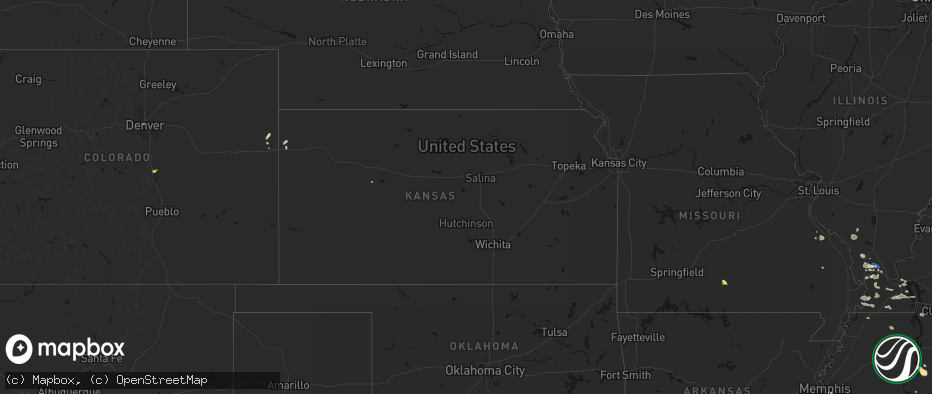
Hail Map in Kansas on June 1, 2026
The weather event in Kansas on June 1, 2026 includes Wind and Hail maps. 23 states and 861 cities were impacted and suffered possible damage. The total estimated number of properties impacted is 2,237.
Wind
Hail
2,237
Estimated number of impacted properties by a 1.00" hail or larger142
Estimated number of impacted properties by a 1.75" hail or larger0
Estimated number of impacted properties by a 2.50" hail or largerStorm reports in Kansas
Kansas
| Date | Description |
|---|---|
| 06/01/20266:39 PM CDT | Several trees down. |
| 06/01/20266:20 PM CDT | A local report indicates 80 MPH wind near 10 S Dighton |
| 06/01/20266:15 PM CDT | A local report indicates 1.00 inch wind near 10 S Dighton |
| 06/01/20266:10 PM CDT | Asos station kgld goodland. |
| 06/01/20266:07 PM CDT | A local report indicates 76 MPH wind near 3 SSE Dighton |
| 06/01/20265:41 PM CDT | A local report indicates 1.00 inch wind near 2 S Amy |
| 06/01/20265:36 PM CDT | Pea to quarter size hail. |
| 06/01/20265:35 PM CDT | Davis weather station. |
| 06/01/20265:35 PM CDT | Report from mping: quarter |
| 06/01/20265:20 PM CDT | Station k5coo. |
| 06/01/20265:00 PM CDT | A local report indicates 1.00 inch wind near 8 S Dighton |
| 06/01/20264:58 PM CDT | Nickel to quarter size hail reported. |
| 06/01/20267:48 AM CDT | Nickel to quarter size hail. |
| 06/01/20263:20 AM CDT | Davis weather station. |
| 06/01/20262:59 AM CDT | Davis weather station. |
| 06/01/20261:39 AM CDT | Large tree branch across roadway. |
| 06/01/20261:36 AM CDT | A local report indicates 59 MPH wind near 3.4 WNW Wellington |
| 06/01/20261:35 AM CDT | A local report indicates 60 MPH wind near 4 NE Caldwell |
| 06/01/20261:12 AM CDT | Winds were estimated between 60 and 70 mph. |
| 06/01/20261:11 AM CDT | 50 ft x 100 ft pole building was blown down. Time estimated from radar. |
| 06/01/20261:03 AM CDT | Numerous large tree branches and trees downed by strong winds in this general area. A barn roof was also blown off. Time estimated from radar. |
| 06/01/202612:51 AM CDT | A local report indicates 58 MPH wind near 1.7 SSE Kingman |
| 06/01/202612:23 AM CDT | Report from mping: quarter |
| 06/01/202612:15 AM CDT | Davis weather station. |
| 05/31/202611:43 PM CDT | A local report indicates 61 MPH wind near 3 S Pratt |
| 05/31/202611:36 PM CDT | A local report indicates 74 MPH wind near 2 NNW Macksville |
| 05/31/202611:33 PM CDT | A local report indicates 62 MPH wind near 4 ENE Cullison |
| 05/31/202611:00 PM CDT | A local report indicates 70 MPH wind near 2 NNW Macksville |
| 05/31/202610:54 PM CDT | Davis weather station. |
| 05/31/202610:51 PM CDT | A local report indicates 60 MPH wind near 3 E Zook |
| 05/31/202610:51 PM CDT | A local report indicates 68 MPH wind near 3 ESE Belpre |
| 05/31/202610:42 PM CDT | A local report indicates 58 MPH wind near 3 NW Centerview |
| 05/31/202610:22 PM CDT | A local report indicates 64 MPH wind near Greensburg |
| 05/31/202610:15 PM CDT | A local report indicates 59 MPH wind near 8 SSW Centerview |
| 05/31/202610:00 PM CDT | A local report indicates 67 MPH wind near 3 NNE Minneola |
| 05/31/20269:30 PM CDT | A local report indicates 59 MPH wind near 9 NW Bellefont |
| 05/31/20269:16 PM CDT | Mesonet station up313 2.1 w minneola |
| 05/31/20269:16 PM CDT | A local report indicates 63 MPH wind near 6 NE Fowler |
| 05/31/20269:15 PM CDT | A local report indicates 67 MPH wind near 4 N Minneola |
| 05/31/20269:15 PM CDT | Mesonet station dw9907 bloom. |
| 05/31/20269:09 PM CDT | A local report indicates 63 MPH wind near 4 N Minneola |
| 05/31/20268:52 PM CDT | Asos station kddc dodge city regional airport. |
| 05/31/20268:46 PM CDT | A local report indicates 59 MPH wind near 9 W Jetmore |
| 05/31/20268:30 PM CDT | A local report indicates 59 MPH wind near 3 W Wright |
| 05/31/20268:26 PM CDT | Corrects previous tstm wnd gst report from 3 e dodge city. Kddc asos. |
| 05/31/20268:23 PM CDT | A local report indicates 77 MPH wind near 2 NNE Dodge City |
| 05/31/20268:14 PM CDT | Davis weather station. |
| 05/31/20268:12 PM CDT | A local report indicates 1.00 inch wind near Ingalls |
| 05/31/20268:05 PM CDT | A local report indicates 58 MPH wind near 9 ESE Kalvesta |
| 05/31/20267:59 PM CDT | Ambient station - auston farms. |
| 05/31/20267:55 PM CDT | A local report indicates 64 MPH wind near 4 NE Cimarron |
| 05/31/20267:50 PM CDT | A local report indicates 1.50 inch wind near 10 W Richfield |
| 05/31/20267:45 PM CDT | A local report indicates 1.00 inch wind near 14 NW Jetmore |
| 05/31/20267:45 PM CDT | Ambient station - rogers weather station. |
| 05/31/20267:26 PM CDT | Kddc asos. |
| 05/31/20267:21 PM CDT | Asos station kgck garden city. |
| 05/31/20267:16 PM CDT | A local report indicates 61 MPH wind near 2 WNW Grigston |
| 05/31/20267:03 PM CDT | A local report indicates 1.75 inch wind near 8 SSW Beeler |
| 05/31/20267:00 PM CDT | Camper flipped over. Timed estimated. |
All States Impacted by Hail Map on June 1, 2026
Cities Impacted by Hail Map on June 1, 2026
- Sainte Genevieve, MO
- Calvert City, KY
- Burlington, CO
- Farmington, MO
- Saint Mary, MO
- Vergennes, IL
- Du Quoin, IL
- Gilbertsville, KY
- Benton, KY
- Idalia, CO
- Gorham, IL
- Murphysboro, IL
- Ava, IL
- Memphis, TN
- Kirksey, KY
- Mayfield, KY
- Dover, TN
- Symsonia, KY
- Utica, KS
- Ullin, IL
- Dongola, IL
- Kanorado, KS
- Smithland, KY
- Goodland, KS
- Grand Rivers, KY
- Marble Hill, MO
- Karnak, IL
- Grand Chain, IL
- Cypress, IL
- Hardin, KY
- Almo, KY
- Cobden, IL
- Anna, IL
- Olmsted, IL
- Vienna, IL
- Belknap, IL
- Dexter, KY
- La Center, KY
- Barlow, KY
- Metropolis, IL
- Mound City, IL
- Kevil, KY
- Wickliffe, KY
- Clinton, KY
- East Prairie, MO
- Charleston, MO
- Columbus, KY
- Bardwell, KY
- Cunningham, KY
- Arlington, KY
- Fancy Farm, KY
- Wingo, KY
- Hickory, KY
- Boaz, KY
- Farmington, KY
- Fulton, KY
- Sedalia, KY
- Union City, TN
- McKenzie, TN
- Gleason, TN
- Mount Pleasant, TN
- Columbia, TN
- Culleoka, TN
- Lynnville, TN
- Sherburn, MN
- Welcome, MN
- Lewisburg, TN
- Belfast, TN
- Cornersville, TN
- Petersburg, TN
- Pulaski, TN
- Ceylon, MN
- Fairmont, MN
- Decaturville, TN
- Waynesboro, TN
- Clifton, TN
- Dolliver, IA
- Linden, TN
- Armstrong, IA
- Corinth, MS
- Fayetteville, TN
- Ripley, MS
- Burnsville, MS
- Glen, MS
- Iuka, MS
- Ringsted, IA
- Kelso, TN
- Flintville, TN
- Mulberry, TN
- Frankewing, TN
- Ardmore, TN
- Dellrose, TN
- Prospect, TN
- Booneville, MS
- Rienzi, MS
- Belvidere, TN
- Huntland, TN
- Elora, TN
- Baldwyn, MS
- Goodspring, TN
- Minor Hill, TN
- Tishomingo, MS
- Taft, TN
- Savannah, TN
- Estillfork, AL
- Marietta, MS
- Ardmore, AL
- Killen, AL
- Florence, AL
- Elkmont, AL
- New Site, MS
- Dennis, MS
- Belmont, MS
- Blue Mountain, MS
- Guntown, MS
- Mantachie, MS
- Athens, AL
- Dumas, MS
- Gurley, AL
- Toney, AL
- Huntsville, AL
- Meridianville, AL
- Chalmette, LA
- Saltillo, MS
- Harvest, AL
- Madison, AL
- Amory, MS
- Golden, MS
- Red Bay, AL
- Paint Rock, AL
- Woodville, AL
- Scottsboro, AL
- Trinity, AL
- Moulton, AL
- Aberdeen, MS
- Russellville, AL
- Brownsboro, AL
- Fulton, MS
- Tremont, MS
- Decatur, AL
- Grant, AL
- Smithville, MS
- Hartselle, AL
- Houston, AL
- Somerville, AL
- Nettleton, MS
- Danville, AL
- Hamilton, AL
- Mount Hope, AL
- Greenwood Springs, MS
- Langston, AL
- Guntersville, AL
- Detroit, AL
- Logan, AL
- Cullman, AL
- Vinemont, AL
- Addison, AL
- Tupelo, MS
- Hamilton, MS
- Nauvoo, AL
- Beaverton, AL
- Falkville, AL
- Shannon, MS
- Union Grove, AL
- Arab, AL
- Vanzant, MO
- Albertville, AL
- Groveoak, AL
- Crane Hill, AL
- Arley, AL
- Caledonia, MS
- Haleyville, AL
- Winfield, AL
- Brilliant, AL
- Carbon Hill, AL
- Crossville, AL
- Colorado Springs, CO
- Hanceville, AL
- Lynn, AL
- Jasper, AL
- Double Springs, AL
- Altoona, AL
- Boaz, AL
- Geraldine, AL
- Denver, CO
- Blountsville, AL
- Fayette, AL
- Columbus, MS
- Vernon, AL
- Sulligent, AL
- Seneca, SC
- Walhalla, SC
- Eldridge, AL
- Oneonta, AL
- Horton, AL
- Bremen, AL
- Larkspur, CO
- Franktown, CO
- Gallant, AL
- Attalla, AL
- Steele, AL
- Cordova, AL
- Oldfield, MO
- Garrison, MO
- Millport, AL
- Parrish, AL
- Gadsden, AL
- West Plains, MO
- Berry, AL
- Oakman, AL
- Townley, AL
- Steens, MS
- Bankston, AL
- Rainbow City, AL
- Aurora, CO
- Commerce City, CO
- Dora, MO
- Wheatland, WY
- Drury, MO
- Littleton, CO
- Ethelsville, AL
- Northport, AL
- Quinton, AL
- Ashville, AL
- Bradleyville, MO
- Reform, AL
- Collinsville, AL
- Guernsey, WY
- Englewood, CO
- Wellington, AL
- Ohatchee, AL
- Fort Davis, TX
- Peyton, CO
- Brooksville, MS
- Lone Tree, CO
- Norwood, MO
- Caulfield, MO
- Pottersville, MO
- Elbert, CO
- Springfield, CO
- Talladega, AL
- Lincoln, AL
- Taneyville, MO
- Fort Laramie, WY
- Yoder, WY
- Lingle, WY
- Hartwell, GA
- Jacksonville, AL
- Alexandria, AL
- Weaver, AL
- Veteran, WY
- Torrington, WY
- Cedarcreek, MO
- Columbiana, AL
- Chelsea, AL
- Ava, MO
- Alpine, AL
- Heflin, AL
- Macon, MS
- Anniston, AL
- Watkins, CO
- Bennett, CO
- Moody, MO
- Aliceville, AL
- Wilsonville, AL
- Sylacauga, AL
- Menlo, IA
- Stuart, IA
- Goodwater, AL
- Centreville, AL
- Squires, MO
- Rueter, MO
- Mammoth Spring, AR
- Rockford, AL
- Alpine, TX
- Lodge Grass, MT
- Childersburg, AL
- Randolph, AL
- Lead Hill, AR
- Brixey, MO
- Strasburg, CO
- Scott City, KS
- Fort Morgan, CO
- Kellyton, AL
- West Blocton, AL
- Weogufka, AL
- Ackerman, MS
- Woodland, AL
- Roanoke, AL
- Boligee, AL
- Hardy, AR
- Deer Trail, CO
- Byers, CO
- Gainesville, MO
- Parker, CO
- Oil Trough, AR
- Healy, KS
- Woodrow, CO
- Edgemont, SD
- Louisville, MS
- Brookhaven, MS
- Billings, MT
- Williford, AR
- Five Points, AL
- Lamar, CO
- Harrison, AR
- Wesson, MS
- Lagrange, GA
- Montgomery, AL
- Ash Flat, AR
- Wiggins, CO
- Dighton, KS
- Woodland Park, CO
- Garryowen, MT
- Gallion, AL
- Forkland, AL
- West Point, GA
- Livingston, AL
- Alexander City, AL
- Ramer, AL
- Cherokee Village, AR
- Wellington, CO
- Laporte, CO
- Fort Collins, CO
- Carr, CO
- Cheyenne, WY
- Harrison, NE
- Morrill, NE
- Lance Creek, WY
- Big Flat, AR
- Harriet, AR
- Jefferson, IA
- Newark, AR
- Flippin, AR
- Lindon, CO
- Akron, CO
- Paton, IA
- Churdan, IA
- Pine Mountain, GA
- Panora, IA
- Clarendon, TX
- Claude, TX
- Kit Carson, CO
- Yellville, AR
- Everton, AR
- Saint Joe, AR
- De Kalb, MS
- Ruth, MS
- Tallulah, LA
- Onia, AR
- Marshall, AR
- Timbo, AR
- Philadelphia, MS
- Evening Shade, AR
- Newport, AR
- Holly, CO
- Granada, CO
- Noxapater, MS
- Dana, IA
- Horseshoe Bend, AR
- Valley Springs, AR
- Hattiesburg, MS
- Batesville, AR
- Bogue Chitto, MS
- Winona, KS
- Kendall, KS
- Chugwater, WY
- Saint Francis, KS
- Monument, CO
- Elizabeth, CO
- Gainestown, AL
- Byhalia, MS
- Sumrall, MS
- Cheyenne Wells, CO
- Sulphur Rock, AR
- Simla, CO
- Bethune, CO
- Tuckerman, AR
- Leslie, AR
- McCrory, AR
- Jamaica, IA
- Walnut Ridge, AR
- Madison, MS
- Ward, AL
- Pennington, AL
- Butler, AL
- Gilbert, AR
- Wallace, KS
- Fox, AR
- Walsh, CO
- Hurtsboro, AL
- Stinnett, TX
- Palmer Lake, CO
- Rosie, AR
- Midland, GA
- Busby, MT
- Brandon, MS
- Ridgeland, MS
- Smithdale, MS
- Morse, TX
- Thomasville, AL
- Compton, AR
- Marble Falls, AR
- Green Forest, AR
- Clinton, AR
- Tchula, MS
- Sweet Water, AL
- Olive Branch, MS
- Kiowa, CO
- Matheson, CO
- Alpena, AR
- Manter, KS
- Shirley, AR
- Tulsa, OK
- Pleasant Plains, AR
- Desha, AR
- Dennard, AR
- Thida, AR
- Alzada, MT
- Meadville, MS
- Holly Springs, MS
- Cusseta, GA
- Witts Springs, AR
- Hinton, OK
- Monument, KS
- Concord, AR
- Pine Hill, AL
- Lower Peach Tree, AL
- Edson, KS
- Jasper, AR
- Bradford, AR
- Floral, AR
- Ramah, CO
- Buffalo, SD
- Jackson, MS
- Belle Fourche, SD
- Nisland, SD
- Newell, SD
- Augusta, AR
- Mangham, LA
- Otis, CO
- Elkhart, KS
- Linden, AL
- Moorcroft, WY
- Wray, CO
- Tougaloo, MS
- Jonesboro, AR
- Lyman, NE
- Mitchell, NE
- Gering, NE
- Scottsbluff, NE
- Minatare, NE
- Angora, NE
- Bayard, NE
- Beeler, KS
- Garden City, KS
- Mount Judea, AR
- Tilly, AR
- Hector, AR
- Parthenon, AR
- Forsyth, MT
- Jackson, AL
- Rayville, LA
- Ness City, KS
- Bridgeport, NE
- Borger, TX
- Red Banks, MS
- Chunky, MS
- Hickory, MS
- Johnson, KS
- Newton, MS
- Lawrence, MS
- Louin, MS
- Pelsor, AR
- Rose Hill, MS
- Whitewood, SD
- Water Valley, MS
- Bruce, MS
- Drasco, AR
- Colby, KS
- Pangburn, AR
- Judsonia, AR
- Yuma, CO
- Bald Knob, AR
- Russell, AR
- Jetmore, KS
- Deer, AR
- Alicia, AR
- Vale, SD
- Cimarron, KS
- Banner, MS
- Frankville, AL
- Millry, AL
- Lamar, MS
- Mount Pleasant, AR
- Guion, AR
- Spring, TX
- Tomball, TX
- Dover, AR
- Pearl, MS
- Richland, MS
- Ida, AR
- Collierville, TN
- Eckley, CO
- Byram, MS
- Melbourne, AR
- Lindsay, MT
- Swifton, AR
- Cash, AR
- Wilburn, AR
- Raleigh, MS
- Marianna, FL
- Cottondale, FL
- Raymond, MS
- Bono, AR
- Pierceville, KS
- Pleasant Grove, AR
- Hagarville, AR
- Searcy, AR
- Bloomfield, MT
- Glendive, MT
- Ingalls, KS
- Lakeside, NE
- Oshkosh, NE
- Lake Cormorant, MS
- Senatobia, MS
- Richfield, KS
- Scotland, AR
- Marcella, AR
- Hernando, MS
- Nesbit, MS
- Ellsworth, NE
- Holyoke, CO
- Oakwood, OK
- Taloga, OK
- North Little Rock, AR
- Thomas, OK
- Carrollton, MS
- Holcomb, MS
- Jacksonville, AR
- Monroe, LA
- Sterlington, LA
- Mountain View, AR
- Jessieville, AR
- Champion, NE
- Haigler, NE
- Fay, OK
- Dodge City, KS
- Little Rock, AR
- Roland, AR
- Rolla, KS
- Sidney, AR
- Cave City, AR
- Little Rock Air Force Base, AR
- Cabot, AR
- Russellville, AR
- Coldwater, MS
- Clayton, LA
- Fisher, AR
- Hagerman, NM
- Sherwood, AR
- Wright, KS
- Putnam, OK
- Custer City, OK
- Indianola, MS
- Clarksville, AR
- Lamar, AR
- Sicily Island, LA
- Mountain Pine, AR
- Hot Springs Village, AR
- Batesville, MS
- Courtland, MS
- Alexander, AR
- Brickeys, AR
- Hughes, AR
- Gilmore, AR
- Scott, AR
- Benton, AR
- Montezuma, KS
- Harrisonburg, LA
- West Monroe, LA
- Marianna, AR
- Hensley, AR
- England, AR
- Spearville, KS
- Sheridan, AR
- Redfield, AR
- West Memphis, AR
- Leland, MS
- Ensign, KS
- Marion, AR
- Morland, KS
- Mabelvale, AR
- Hot Springs National Park, AR
- Wynne, AR
- Bauxite, AR
- Jefferson, AR
- White Hall, AR
- Minneola, KS
- Ford, KS
- Winona, MS
- McCarley, MS
- Tunica, MS
- McCracken, KS
- Brownell, KS
- Elsie, NE
- Hayes Center, NE
- Lisco, NE
- Sarah, MS
- Calhan, CO
- Fowler, KS
- Englewood, KS
- Limon, CO
- Widener, AR
- Heth, AR
- Mount Ida, AR
- Southaven, MS
- Vaiden, MS
- Coila, MS
- Royal, AR
- Grapevine, AR
- Hanston, KS
- Offerle, KS
- Bucklin, KS
- Ashland, KS
- Walls, MS
- Horn Lake, MS
- Proctor, AR
- Bazine, KS
- Meade, KS
- Edmondson, AR
- West, MS
- Forrest City, AR
- Cascilla, MS
- Story, AR
- Hugoton, KS
- Greensburg, KS
- Mullinville, KS
- Kinsley, KS
- Gate, OK
- Norman, AR
- Alexander, KS
- Caddo Gap, AR
- Bonnerdale, AR
- Rosston, OK
- El Dorado, AR
- Strong, AR
- Belzoni, MS
- Stapleton, NE
- Hollandale, MS
- Robinsonville, MS
- Burdett, KS
- Protection, KS
- Haviland, KS
- Overton, NE
- Benoit, MS
- Rozel, KS
- Larned, KS
- Ekalaka, MT
- Fountain Hill, AR
- Wilmar, AR
- Coldwater, KS
- Itta Bena, MS
- Greenville, MS
- Belpre, KS
- Lewis, KS
- Garfield, KS
- Hammond, MT
- Wilmore, KS
- Artesia, NM
- Brinkley, AR
- Hermitage, AR
- Buffalo, OK
- Macksville, KS
- Freedom, OK
- Mooreland, OK
- Pratt, KS
- Byers, KS
- St John, KS
- Alva, OK
- Coats, KS
- Louise, MS
- Silver City, MS
- Iuka, KS
- Sun City, KS
- Lake City, KS
- Sawyer, KS
- Medicine Lodge, KS
- Waynoka, OK
- Moro, AR
- Casscoe, AR
- Stuttgart, AR
- Roe, AR
- Inverness, MS
- Holly Grove, AR
- Decker, MT
- Fallon, MT
- Isola, MS
- Clarendon, AR
- Birney, MT
- Hardtner, KS
- Crocketts Bluff, AR
- Emerson, AR
- Stafford, KS
- Turon, KS
- Kiowa, KS
- Dacoma, OK
- Cherokee, OK
- Burlington, OK
- Isabel, KS
- Cunningham, KS
- Sharon, KS
- De Witt, AR
- Nashville, KS
- Hazelton, KS
- Carmen, OK
- Ethel, AR
- Spivey, KS
- Zenda, KS
- Attica, KS
- Waldron, KS
- Spearsville, LA
- Farmerville, LA
- Otter, MT
- Amorita, OK
- Kingman, KS
- Arlington, KS
- Harper, KS
- West Point, MS
- Snow Lake, AR
- Mellwood, AR
- Emelle, AL
- Crumrod, AR
- Carrollton, AL
- Pretty Prairie, KS
- Anthony, KS
- Goltry, OK
- Jet, OK
- Helena, OK
- Murdock, KS
- Manchester, OK
- Nash, OK
- Wakita, OK
- Kremlin, OK
- Bluff City, KS
- Enid, OK
- Pond Creek, OK
- Tichnor, AR
- Cleo Springs, OK
- Wolbach, NE
- Norwich, KS
- Cheney, KS
- Danville, KS
- Freeport, KS
- Medford, OK
- Argonia, KS
- Milton, KS
- Garden Plain, KS
- Haven, KS
- Conway Springs, KS
- Caldwell, KS
- Broadus, MT
- Gunnison, MS
- Ringwood, OK
- Tobias, NE
- Milligan, NE
- McGehee, AR
- Tillar, AR
- Minneapolis, KS
- Rosedale, MS
- Lamont, OK
- Almyra, AR
- Beulah, MS
- Exeter, NE
- Crete, NE
- Denton, NE
- Friend, NE
- Milan, KS
- Viola, KS
- Wellington, KS
- Mayfield, KS
- Clearwater, KS
- South Haven, KS
- Nardin, OK
- Braman, OK
- Deer Creek, OK
- Hunter, OK
- Geuda Springs, KS
- Blackwell, OK
- Lincoln, NE
- Martell, NE
- Fairmont, OK
- Douglas, OK
- Seward, NE
- Milford, NE
- Rohwer, AR
- Pleasant Dale, NE
- Waukomis, OK
- Billings, OK
- Preston, MS
- Beaver, IA
- Ogden, IA
- Grand Junction, IA
- Waverly, NE
- Yale, IA
- Bagley, IA
- Perry, OK
- Ceresco, NE
- Newkirk, OK
- Arkansas City, KS
- Ponca City, OK
- Tonkawa, OK
- Kaw City, OK
- Burbank, OK
- Red Rock, OK
- Marland, OK
- Fairfax, OK
- Garber, OK
- Ralston, OK
- Pawnee, OK
- Bellwood, NE
- Eagle, NE
- Alvo, NE
- Athens, LA
- Arcadia, LA
- Sutton, NE
- Greenwood, NE
- Henderson, NE
- Malcolm, NE
- Bastrop, LA
- Collinston, LA
- Ong, NE
- Woodward, OK
- Fort Supply, OK
- Raymond, NE
- Claremore, OK
- Davenport, NE
- Shickley, NE
- Edgar, NE
- Broken Arrow, OK
- Garland, NE
- Catoosa, OK
- Oak, NE
- Boynton, OK
- Owasso, OK
- Council Hill, OK
- Inola, OK
- Aline, OK
- Nowata, OK
- Checotah, OK
- Wagoner, OK
- Chouteau, OK
- Hulbert, OK
- Braggs, OK
- Muskogee, OK
- Pryor, OK
- Stanley, ND
- Powers Lake, ND
- Pana, IL
- Oconee, IL
- Elberton, GA


