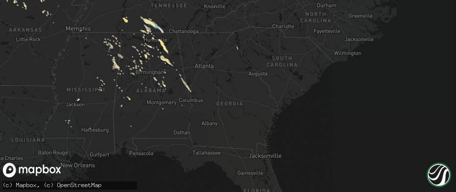
Hail Map in Georgia on June 1, 2026
The weather event in Georgia on June 1, 2026 includes Wind and Hail maps. 23 states and 861 cities were impacted and suffered possible damage. The total estimated number of properties impacted is 0.
Wind
Hail
0
Estimated number of impacted properties by a 1.00" hail or larger0
Estimated number of impacted properties by a 1.75" hail or larger0
Estimated number of impacted properties by a 2.50" hail or largerStorm reports in Georgia
Georgia
| Date | Description |
|---|---|
| 06/01/20266:54 PM CDT | Trees reported down over sr 39 at old river rd. |
| 06/01/20266:25 PM CDT | Several trees reported down around benevolence. |
| 06/01/20266:20 PM CDT | Public reports tree down near the intersection of highway 520 and wall street. |
| 06/01/20265:42 PM CDT | Ga power reports several customers without power in and around the midland community. |
| 06/01/20265:20 PM CDT | Public reports a large tree down along highway 27. |
| 06/01/20265:18 PM CDT | Ga power shows several thousand customers across the county without power from south of pine mountain to hamilton and surrounding communities. |
| 06/01/20265:18 PM CDT | Numerous trees down near ga hwy 116 and lower blue springs rd. One tree fell into a roof. |
| 06/01/20265:10 PM CDT | Emergency manager reports tree down near the intersection of oak grove road and south thompson road. |
| 06/01/20265:10 PM CDT | Public reports tree down along interstate 185 near mile marker 33. |
| 06/01/20264:49 PM CDT | Emergency manager reports tree down on a home along park avenue. No injuries reported. |
| 06/01/20264:44 PM CDT | *** 1 inj *** emergency manager reports tree down on a home along first avenue resulting in significant damage. Minor injuries to one occupant. |
| 06/01/20264:42 PM CDT | Tree damage near west point road and bradfield drive with numerous large branches and few a trees down. Power lines were knocked down by falling tree which landed on a |
| 06/01/20264:42 PM CDT | Emergency manager reports 40+ trees down across county from west point lake to lagrange and points southward. |
| 06/01/20264:40 PM CDT | Emergency manager reports tree down on a vehicle along north lake drive. No injuries reported. |
| 06/01/20263:56 PM CDT | 911 call center reported trees down near the intersection of lincolnton highway and welcome church road. |
| 06/01/20263:38 PM CDT | County official reported trees down on harpers ferry road. |
| 06/01/20263:30 PM CDT | County official reported trees down on william smith road. |
| 06/01/20263:16 PM CDT | Firefighter reported trees and powerlines down on montevideo road. |
| 06/01/20263:15 PM CDT | County official reported roof of a church was blown off. |
| 06/01/20263:07 PM CDT | Tree down in 4300 block of cokesbury hwy. |
| 06/01/20263:04 PM CDT | Firefighter reported trees and powerlines down on milford road. |
| 06/01/20263:04 PM CDT | Firefighter reported trees down on anderson highway. |
| 06/01/20263:00 PM CDT | Firefighter reported trees down on old 29 highway. |
| 06/01/20262:55 PM CDT | A severe thunderstorm produced a swath of 60-75 mph wind extending from just east of hartwell to far northeast elbert county. The damaging wind swath began near hart st |
| 06/01/20262:47 PM CDT | Numerous social media reports of downed and uprooted trees in reed creek. Time estimated from radar. |
| 05/31/20267:15 PM CDT | Tree reported down on s bridge rd in morgan. |
All States Impacted by Hail Map on June 1, 2026
Cities Impacted by Hail Map on June 1, 2026
- Sainte Genevieve, MO
- Calvert City, KY
- Burlington, CO
- Farmington, MO
- Saint Mary, MO
- Vergennes, IL
- Du Quoin, IL
- Gilbertsville, KY
- Benton, KY
- Idalia, CO
- Gorham, IL
- Murphysboro, IL
- Ava, IL
- Memphis, TN
- Kirksey, KY
- Mayfield, KY
- Dover, TN
- Symsonia, KY
- Utica, KS
- Ullin, IL
- Dongola, IL
- Kanorado, KS
- Smithland, KY
- Goodland, KS
- Grand Rivers, KY
- Marble Hill, MO
- Karnak, IL
- Grand Chain, IL
- Cypress, IL
- Hardin, KY
- Almo, KY
- Cobden, IL
- Anna, IL
- Olmsted, IL
- Vienna, IL
- Belknap, IL
- Dexter, KY
- La Center, KY
- Barlow, KY
- Metropolis, IL
- Mound City, IL
- Kevil, KY
- Wickliffe, KY
- Clinton, KY
- East Prairie, MO
- Charleston, MO
- Columbus, KY
- Bardwell, KY
- Cunningham, KY
- Arlington, KY
- Fancy Farm, KY
- Wingo, KY
- Hickory, KY
- Boaz, KY
- Farmington, KY
- Fulton, KY
- Sedalia, KY
- Union City, TN
- McKenzie, TN
- Gleason, TN
- Mount Pleasant, TN
- Columbia, TN
- Culleoka, TN
- Lynnville, TN
- Sherburn, MN
- Welcome, MN
- Lewisburg, TN
- Belfast, TN
- Cornersville, TN
- Petersburg, TN
- Pulaski, TN
- Ceylon, MN
- Fairmont, MN
- Decaturville, TN
- Waynesboro, TN
- Clifton, TN
- Dolliver, IA
- Linden, TN
- Armstrong, IA
- Corinth, MS
- Fayetteville, TN
- Ripley, MS
- Burnsville, MS
- Glen, MS
- Iuka, MS
- Ringsted, IA
- Kelso, TN
- Flintville, TN
- Mulberry, TN
- Frankewing, TN
- Ardmore, TN
- Dellrose, TN
- Prospect, TN
- Booneville, MS
- Rienzi, MS
- Belvidere, TN
- Huntland, TN
- Elora, TN
- Baldwyn, MS
- Goodspring, TN
- Minor Hill, TN
- Tishomingo, MS
- Taft, TN
- Savannah, TN
- Estillfork, AL
- Marietta, MS
- Ardmore, AL
- Killen, AL
- Florence, AL
- Elkmont, AL
- New Site, MS
- Dennis, MS
- Belmont, MS
- Blue Mountain, MS
- Guntown, MS
- Mantachie, MS
- Athens, AL
- Dumas, MS
- Gurley, AL
- Toney, AL
- Huntsville, AL
- Meridianville, AL
- Chalmette, LA
- Saltillo, MS
- Harvest, AL
- Madison, AL
- Amory, MS
- Golden, MS
- Red Bay, AL
- Paint Rock, AL
- Woodville, AL
- Scottsboro, AL
- Trinity, AL
- Moulton, AL
- Aberdeen, MS
- Russellville, AL
- Brownsboro, AL
- Fulton, MS
- Tremont, MS
- Decatur, AL
- Grant, AL
- Smithville, MS
- Hartselle, AL
- Houston, AL
- Somerville, AL
- Nettleton, MS
- Danville, AL
- Hamilton, AL
- Mount Hope, AL
- Greenwood Springs, MS
- Langston, AL
- Guntersville, AL
- Detroit, AL
- Logan, AL
- Cullman, AL
- Vinemont, AL
- Addison, AL
- Tupelo, MS
- Hamilton, MS
- Nauvoo, AL
- Beaverton, AL
- Falkville, AL
- Shannon, MS
- Union Grove, AL
- Arab, AL
- Vanzant, MO
- Albertville, AL
- Groveoak, AL
- Crane Hill, AL
- Arley, AL
- Caledonia, MS
- Haleyville, AL
- Winfield, AL
- Brilliant, AL
- Carbon Hill, AL
- Crossville, AL
- Colorado Springs, CO
- Hanceville, AL
- Lynn, AL
- Jasper, AL
- Double Springs, AL
- Altoona, AL
- Boaz, AL
- Geraldine, AL
- Denver, CO
- Blountsville, AL
- Fayette, AL
- Columbus, MS
- Vernon, AL
- Sulligent, AL
- Seneca, SC
- Walhalla, SC
- Eldridge, AL
- Oneonta, AL
- Horton, AL
- Bremen, AL
- Larkspur, CO
- Franktown, CO
- Gallant, AL
- Attalla, AL
- Steele, AL
- Cordova, AL
- Oldfield, MO
- Garrison, MO
- Millport, AL
- Parrish, AL
- Gadsden, AL
- West Plains, MO
- Berry, AL
- Oakman, AL
- Townley, AL
- Steens, MS
- Bankston, AL
- Rainbow City, AL
- Aurora, CO
- Commerce City, CO
- Dora, MO
- Wheatland, WY
- Drury, MO
- Littleton, CO
- Ethelsville, AL
- Northport, AL
- Quinton, AL
- Ashville, AL
- Bradleyville, MO
- Reform, AL
- Collinsville, AL
- Guernsey, WY
- Englewood, CO
- Wellington, AL
- Ohatchee, AL
- Fort Davis, TX
- Peyton, CO
- Brooksville, MS
- Lone Tree, CO
- Norwood, MO
- Caulfield, MO
- Pottersville, MO
- Elbert, CO
- Springfield, CO
- Talladega, AL
- Lincoln, AL
- Taneyville, MO
- Fort Laramie, WY
- Yoder, WY
- Lingle, WY
- Hartwell, GA
- Jacksonville, AL
- Alexandria, AL
- Weaver, AL
- Veteran, WY
- Torrington, WY
- Cedarcreek, MO
- Columbiana, AL
- Chelsea, AL
- Ava, MO
- Alpine, AL
- Heflin, AL
- Macon, MS
- Anniston, AL
- Watkins, CO
- Bennett, CO
- Moody, MO
- Aliceville, AL
- Wilsonville, AL
- Sylacauga, AL
- Menlo, IA
- Stuart, IA
- Goodwater, AL
- Centreville, AL
- Squires, MO
- Rueter, MO
- Mammoth Spring, AR
- Rockford, AL
- Alpine, TX
- Lodge Grass, MT
- Childersburg, AL
- Randolph, AL
- Lead Hill, AR
- Brixey, MO
- Strasburg, CO
- Scott City, KS
- Fort Morgan, CO
- Kellyton, AL
- West Blocton, AL
- Weogufka, AL
- Ackerman, MS
- Woodland, AL
- Roanoke, AL
- Boligee, AL
- Hardy, AR
- Deer Trail, CO
- Byers, CO
- Gainesville, MO
- Parker, CO
- Oil Trough, AR
- Healy, KS
- Woodrow, CO
- Edgemont, SD
- Louisville, MS
- Brookhaven, MS
- Billings, MT
- Williford, AR
- Five Points, AL
- Lamar, CO
- Harrison, AR
- Wesson, MS
- Lagrange, GA
- Montgomery, AL
- Ash Flat, AR
- Wiggins, CO
- Dighton, KS
- Woodland Park, CO
- Garryowen, MT
- Gallion, AL
- Forkland, AL
- West Point, GA
- Livingston, AL
- Alexander City, AL
- Ramer, AL
- Cherokee Village, AR
- Wellington, CO
- Laporte, CO
- Fort Collins, CO
- Carr, CO
- Cheyenne, WY
- Harrison, NE
- Morrill, NE
- Lance Creek, WY
- Big Flat, AR
- Harriet, AR
- Jefferson, IA
- Newark, AR
- Flippin, AR
- Lindon, CO
- Akron, CO
- Paton, IA
- Churdan, IA
- Pine Mountain, GA
- Panora, IA
- Clarendon, TX
- Claude, TX
- Kit Carson, CO
- Yellville, AR
- Everton, AR
- Saint Joe, AR
- De Kalb, MS
- Ruth, MS
- Tallulah, LA
- Onia, AR
- Marshall, AR
- Timbo, AR
- Philadelphia, MS
- Evening Shade, AR
- Newport, AR
- Holly, CO
- Granada, CO
- Noxapater, MS
- Dana, IA
- Horseshoe Bend, AR
- Valley Springs, AR
- Hattiesburg, MS
- Batesville, AR
- Bogue Chitto, MS
- Winona, KS
- Kendall, KS
- Chugwater, WY
- Saint Francis, KS
- Monument, CO
- Elizabeth, CO
- Gainestown, AL
- Byhalia, MS
- Sumrall, MS
- Cheyenne Wells, CO
- Sulphur Rock, AR
- Simla, CO
- Bethune, CO
- Tuckerman, AR
- Leslie, AR
- McCrory, AR
- Jamaica, IA
- Walnut Ridge, AR
- Madison, MS
- Ward, AL
- Pennington, AL
- Butler, AL
- Gilbert, AR
- Wallace, KS
- Fox, AR
- Walsh, CO
- Hurtsboro, AL
- Stinnett, TX
- Palmer Lake, CO
- Rosie, AR
- Midland, GA
- Busby, MT
- Brandon, MS
- Ridgeland, MS
- Smithdale, MS
- Morse, TX
- Thomasville, AL
- Compton, AR
- Marble Falls, AR
- Green Forest, AR
- Clinton, AR
- Tchula, MS
- Sweet Water, AL
- Olive Branch, MS
- Kiowa, CO
- Matheson, CO
- Alpena, AR
- Manter, KS
- Shirley, AR
- Tulsa, OK
- Pleasant Plains, AR
- Desha, AR
- Dennard, AR
- Thida, AR
- Alzada, MT
- Meadville, MS
- Holly Springs, MS
- Cusseta, GA
- Witts Springs, AR
- Hinton, OK
- Monument, KS
- Concord, AR
- Pine Hill, AL
- Lower Peach Tree, AL
- Edson, KS
- Jasper, AR
- Bradford, AR
- Floral, AR
- Ramah, CO
- Buffalo, SD
- Jackson, MS
- Belle Fourche, SD
- Nisland, SD
- Newell, SD
- Augusta, AR
- Mangham, LA
- Otis, CO
- Elkhart, KS
- Linden, AL
- Moorcroft, WY
- Wray, CO
- Tougaloo, MS
- Jonesboro, AR
- Lyman, NE
- Mitchell, NE
- Gering, NE
- Scottsbluff, NE
- Minatare, NE
- Angora, NE
- Bayard, NE
- Beeler, KS
- Garden City, KS
- Mount Judea, AR
- Tilly, AR
- Hector, AR
- Parthenon, AR
- Forsyth, MT
- Jackson, AL
- Rayville, LA
- Ness City, KS
- Bridgeport, NE
- Borger, TX
- Red Banks, MS
- Chunky, MS
- Hickory, MS
- Johnson, KS
- Newton, MS
- Lawrence, MS
- Louin, MS
- Pelsor, AR
- Rose Hill, MS
- Whitewood, SD
- Water Valley, MS
- Bruce, MS
- Drasco, AR
- Colby, KS
- Pangburn, AR
- Judsonia, AR
- Yuma, CO
- Bald Knob, AR
- Russell, AR
- Jetmore, KS
- Deer, AR
- Alicia, AR
- Vale, SD
- Cimarron, KS
- Banner, MS
- Frankville, AL
- Millry, AL
- Lamar, MS
- Mount Pleasant, AR
- Guion, AR
- Spring, TX
- Tomball, TX
- Dover, AR
- Pearl, MS
- Richland, MS
- Ida, AR
- Collierville, TN
- Eckley, CO
- Byram, MS
- Melbourne, AR
- Lindsay, MT
- Swifton, AR
- Cash, AR
- Wilburn, AR
- Raleigh, MS
- Marianna, FL
- Cottondale, FL
- Raymond, MS
- Bono, AR
- Pierceville, KS
- Pleasant Grove, AR
- Hagarville, AR
- Searcy, AR
- Bloomfield, MT
- Glendive, MT
- Ingalls, KS
- Lakeside, NE
- Oshkosh, NE
- Lake Cormorant, MS
- Senatobia, MS
- Richfield, KS
- Scotland, AR
- Marcella, AR
- Hernando, MS
- Nesbit, MS
- Ellsworth, NE
- Holyoke, CO
- Oakwood, OK
- Taloga, OK
- North Little Rock, AR
- Thomas, OK
- Carrollton, MS
- Holcomb, MS
- Jacksonville, AR
- Monroe, LA
- Sterlington, LA
- Mountain View, AR
- Jessieville, AR
- Champion, NE
- Haigler, NE
- Fay, OK
- Dodge City, KS
- Little Rock, AR
- Roland, AR
- Rolla, KS
- Sidney, AR
- Cave City, AR
- Little Rock Air Force Base, AR
- Cabot, AR
- Russellville, AR
- Coldwater, MS
- Clayton, LA
- Fisher, AR
- Hagerman, NM
- Sherwood, AR
- Wright, KS
- Putnam, OK
- Custer City, OK
- Indianola, MS
- Clarksville, AR
- Lamar, AR
- Sicily Island, LA
- Mountain Pine, AR
- Hot Springs Village, AR
- Batesville, MS
- Courtland, MS
- Alexander, AR
- Brickeys, AR
- Hughes, AR
- Gilmore, AR
- Scott, AR
- Benton, AR
- Montezuma, KS
- Harrisonburg, LA
- West Monroe, LA
- Marianna, AR
- Hensley, AR
- England, AR
- Spearville, KS
- Sheridan, AR
- Redfield, AR
- West Memphis, AR
- Leland, MS
- Ensign, KS
- Marion, AR
- Morland, KS
- Mabelvale, AR
- Hot Springs National Park, AR
- Wynne, AR
- Bauxite, AR
- Jefferson, AR
- White Hall, AR
- Minneola, KS
- Ford, KS
- Winona, MS
- McCarley, MS
- Tunica, MS
- McCracken, KS
- Brownell, KS
- Elsie, NE
- Hayes Center, NE
- Lisco, NE
- Sarah, MS
- Calhan, CO
- Fowler, KS
- Englewood, KS
- Limon, CO
- Widener, AR
- Heth, AR
- Mount Ida, AR
- Southaven, MS
- Vaiden, MS
- Coila, MS
- Royal, AR
- Grapevine, AR
- Hanston, KS
- Offerle, KS
- Bucklin, KS
- Ashland, KS
- Walls, MS
- Horn Lake, MS
- Proctor, AR
- Bazine, KS
- Meade, KS
- Edmondson, AR
- West, MS
- Forrest City, AR
- Cascilla, MS
- Story, AR
- Hugoton, KS
- Greensburg, KS
- Mullinville, KS
- Kinsley, KS
- Gate, OK
- Norman, AR
- Alexander, KS
- Caddo Gap, AR
- Bonnerdale, AR
- Rosston, OK
- El Dorado, AR
- Strong, AR
- Belzoni, MS
- Stapleton, NE
- Hollandale, MS
- Robinsonville, MS
- Burdett, KS
- Protection, KS
- Haviland, KS
- Overton, NE
- Benoit, MS
- Rozel, KS
- Larned, KS
- Ekalaka, MT
- Fountain Hill, AR
- Wilmar, AR
- Coldwater, KS
- Itta Bena, MS
- Greenville, MS
- Belpre, KS
- Lewis, KS
- Garfield, KS
- Hammond, MT
- Wilmore, KS
- Artesia, NM
- Brinkley, AR
- Hermitage, AR
- Buffalo, OK
- Macksville, KS
- Freedom, OK
- Mooreland, OK
- Pratt, KS
- Byers, KS
- St John, KS
- Alva, OK
- Coats, KS
- Louise, MS
- Silver City, MS
- Iuka, KS
- Sun City, KS
- Lake City, KS
- Sawyer, KS
- Medicine Lodge, KS
- Waynoka, OK
- Moro, AR
- Casscoe, AR
- Stuttgart, AR
- Roe, AR
- Inverness, MS
- Holly Grove, AR
- Decker, MT
- Fallon, MT
- Isola, MS
- Clarendon, AR
- Birney, MT
- Hardtner, KS
- Crocketts Bluff, AR
- Emerson, AR
- Stafford, KS
- Turon, KS
- Kiowa, KS
- Dacoma, OK
- Cherokee, OK
- Burlington, OK
- Isabel, KS
- Cunningham, KS
- Sharon, KS
- De Witt, AR
- Nashville, KS
- Hazelton, KS
- Carmen, OK
- Ethel, AR
- Spivey, KS
- Zenda, KS
- Attica, KS
- Waldron, KS
- Spearsville, LA
- Farmerville, LA
- Otter, MT
- Amorita, OK
- Kingman, KS
- Arlington, KS
- Harper, KS
- West Point, MS
- Snow Lake, AR
- Mellwood, AR
- Emelle, AL
- Crumrod, AR
- Carrollton, AL
- Pretty Prairie, KS
- Anthony, KS
- Goltry, OK
- Jet, OK
- Helena, OK
- Murdock, KS
- Manchester, OK
- Nash, OK
- Wakita, OK
- Kremlin, OK
- Bluff City, KS
- Enid, OK
- Pond Creek, OK
- Tichnor, AR
- Cleo Springs, OK
- Wolbach, NE
- Norwich, KS
- Cheney, KS
- Danville, KS
- Freeport, KS
- Medford, OK
- Argonia, KS
- Milton, KS
- Garden Plain, KS
- Haven, KS
- Conway Springs, KS
- Caldwell, KS
- Broadus, MT
- Gunnison, MS
- Ringwood, OK
- Tobias, NE
- Milligan, NE
- McGehee, AR
- Tillar, AR
- Minneapolis, KS
- Rosedale, MS
- Lamont, OK
- Almyra, AR
- Beulah, MS
- Exeter, NE
- Crete, NE
- Denton, NE
- Friend, NE
- Milan, KS
- Viola, KS
- Wellington, KS
- Mayfield, KS
- Clearwater, KS
- South Haven, KS
- Nardin, OK
- Braman, OK
- Deer Creek, OK
- Hunter, OK
- Geuda Springs, KS
- Blackwell, OK
- Lincoln, NE
- Martell, NE
- Fairmont, OK
- Douglas, OK
- Seward, NE
- Milford, NE
- Rohwer, AR
- Pleasant Dale, NE
- Waukomis, OK
- Billings, OK
- Preston, MS
- Beaver, IA
- Ogden, IA
- Grand Junction, IA
- Waverly, NE
- Yale, IA
- Bagley, IA
- Perry, OK
- Ceresco, NE
- Newkirk, OK
- Arkansas City, KS
- Ponca City, OK
- Tonkawa, OK
- Kaw City, OK
- Burbank, OK
- Red Rock, OK
- Marland, OK
- Fairfax, OK
- Garber, OK
- Ralston, OK
- Pawnee, OK
- Bellwood, NE
- Eagle, NE
- Alvo, NE
- Athens, LA
- Arcadia, LA
- Sutton, NE
- Greenwood, NE
- Henderson, NE
- Malcolm, NE
- Bastrop, LA
- Collinston, LA
- Ong, NE
- Woodward, OK
- Fort Supply, OK
- Raymond, NE
- Claremore, OK
- Davenport, NE
- Shickley, NE
- Edgar, NE
- Broken Arrow, OK
- Garland, NE
- Catoosa, OK
- Oak, NE
- Boynton, OK
- Owasso, OK
- Council Hill, OK
- Inola, OK
- Aline, OK
- Nowata, OK
- Checotah, OK
- Wagoner, OK
- Chouteau, OK
- Hulbert, OK
- Braggs, OK
- Muskogee, OK
- Pryor, OK
- Stanley, ND
- Powers Lake, ND
- Pana, IL
- Oconee, IL
- Elberton, GA


