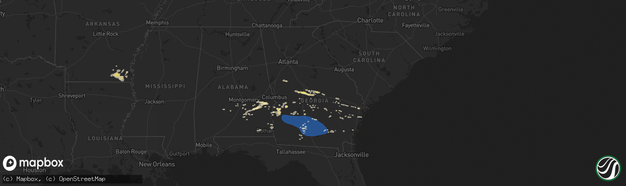
Hail Map in Georgia on August 8, 2023
The weather event in Georgia on August 8, 2023 includes Hail, Wind, and Tornado maps. 19 states and 553 cities were impacted and suffered possible damage. The total estimated number of properties impacted is 21,247.
Hail
Wind
Tornado
21,247
Estimated number of impacted properties by a 1.00" hail or larger0
Estimated number of impacted properties by a 1.75" hail or larger0
Estimated number of impacted properties by a 2.50" hail or largerStorm reports in Georgia
Georgia
| Date | Description |
|---|---|
| 08/08/20236:58 PM CDT | One tree reported down in midway... Ga. Time estimated from radar. |
| 08/08/20236:58 PM CDT | Tree reported down on ferguson avenue at marvalingrove dr. Time estimated from radar. |
| 08/08/20236:57 PM CDT | Tree reported down on northgate rd. Time estimated from radar. |
| 08/08/20236:55 PM CDT | Tree reported down on harlan dr. Time estimated from radar. |
| 08/08/20236:50 PM CDT | A total of 7 different reports of trees down in atkinson county. Most notable areas were near sunnyside church rd and tr hattaway rd areas. Time estimated from radar. |
| 08/08/20236:50 PM CDT | Tree reported down on grove point road. Time estimated from radar. |
| 08/08/20236:49 PM CDT | The university of georgia mesonet site at the zblu berry farm south of us highway 82 and west of us highway 301 reported this gust. |
| 08/08/20236:46 PM CDT | Multiple trees reported down in arcola... Ga. Time estimated from radar. |
| 08/08/20236:46 PM CDT | Tree reported down on augusta road at crossgate road. Time estimated from radar. |
| 08/08/20236:46 PM CDT | Tree down on old louisville road. Time estimated from radar. |
| 08/08/20236:46 PM CDT | Multiple trees down reported in brooklet... Ga. Time estimated from radar. |
| 08/08/20236:46 PM CDT | Multiple trees reported down in stilson... Ga. Time estimated from radar. |
| 08/08/20236:45 PM CDT | Trees and powerlines down along high bluff road. Report received via social media. Time was estimated by radar. |
| 08/08/20236:44 PM CDT | Tree reported down on salt creek road. Time estimated from radar. |
| 08/08/20236:42 PM CDT | Tree reported down on 600 block of railroad avenue in daisy... Ga. Time estimated from radar. |
| 08/08/20236:41 PM CDT | Tree reported down on abercorn street at gateway blvd. Time estimated from radar. |
| 08/08/20236:41 PM CDT | Multiple trees down reported in daisy... Ga. |
| 08/08/20236:40 PM CDT | One tree uprooted on chevis road. Time estimated from radar. |
| 08/08/20236:38 PM CDT | One tree reported down in hinesville... Ga. Time estimated from radar. |
| 08/08/20236:35 PM CDT | Multiple trees reported down across claxton... Ga. Time estimated from radar. |
| 08/08/20236:33 PM CDT | A metal street sign was blown over at the intersection of peterson ave and ward street. Time was estimated by radar. |
| 08/08/20236:32 PM CDT | Multiple trees down reported in register... Ga. Time estimated from radar. |
| 08/08/20236:30 PM CDT | Candler county sheriff's office reported trees and powerlines down near excelsior including on excelsior road and dutch fork road. |
| 08/08/20236:30 PM CDT | Tree down on billy rd. Time estimated from radar. |
| 08/08/20236:29 PM CDT | Metter fire department chief reported multiple trees down across the town of metter. |
| 08/08/20236:28 PM CDT | 911 call center reported power line down at the intersection of porterfield and indian trail rd. Time was estimated via radar data. |
| 08/08/20236:25 PM CDT | Metter airport gusted to 56 kts |
| 08/08/20236:22 PM CDT | Candler county sheriff's office reported trees and powerlines down in several locations including on macwac lake road... Holland road... And freedom lane. |
| 08/08/20236:22 PM CDT | Multiple trees reported down in bellville... Ga. Time estimated from radar. |
| 08/08/20236:20 PM CDT | Tree down on mershon rd. Time estimated from radar. |
| 08/08/20236:16 PM CDT | A 911 call center reported a power line down across the railroad track near the 3300 block of hwy 280 w. Time was estimated via radar data. |
| 08/08/20236:15 PM CDT | Tree on house. |
| 08/08/20236:15 PM CDT | 3 separate reports of trees down across roads in madray springs. Time estimated from radar. |
| 08/08/20236:15 PM CDT | Asos station kamg alma. |
| 08/08/20236:14 PM CDT | Candler county sheriff's office reported a tree down on powerlines near the intersection of griffin ferry road and 46 west. |
| 08/08/20236:13 PM CDT | A 911 call center reported a tree down across the roadway near the 4900 block of hwy 280 w. Time was estimated via radar data. |
| 08/08/20236:13 PM CDT | A 911 call center reported two trees and a power line down along hwy 280... Located near the cross streets of harvey rd as well as groveland nevils rd. Time was estimed |
| 08/08/20236:13 PM CDT | A 911 call center reported a tree down across the roadway near the 4900 block of hwy 280 w. Time was estimated via radar data. |
| 08/08/20236:13 PM CDT | Multiple trees reported down in reidsville... Ga. Time estimated from radar. |
| 08/08/20236:13 PM CDT | Multiple trees down in cobbtown... Ga. |
| 08/08/20236:13 PM CDT | Multiple trees reported down in collins... Ga. Time estimated from radar. |
| 08/08/20236:10 PM CDT | Trees down. |
| 08/08/20236:10 PM CDT | Trees down. |
| 08/08/20236:05 PM CDT | Numerous trees and power lines were blown down across the county. |
| 08/08/20236:05 PM CDT | Trees down. |
| 08/08/20236:02 PM CDT | Tree limbs and trees down near pearson. Radar estimated time. |
| 08/08/20235:50 PM CDT | Multiple reports of structural damage on the nw side of mt. Vernon along mckinnon street. |
| 08/08/20235:50 PM CDT | A tree was blown down onto a power line at 5100 fiveash road. |
| 08/08/20235:45 PM CDT | A tree was blown down onto a power line near coppage road and skipper bridge road. |
| 08/08/20235:45 PM CDT | Numerous trees down on the west side of berrien county. Storms still moving across eastern half of the county. |
| 08/08/20235:44 PM CDT | One tree reported down on hwy 144 and 178. Time estimated from radar. |
| 08/08/20235:42 PM CDT | Tree down on mccranie road in sparks. |
| 08/08/20235:40 PM CDT | Power pole down in pavo. |
| 08/08/20235:40 PM CDT | Powerlines down. |
| 08/08/20235:35 PM CDT | Trees were reported down all across coffee county. Time was estimated by radar. More specific locations will be provided later. |
| 08/08/20235:35 PM CDT | Trees were reported down all across coffee county. Time was estimated by radar. More specific locations will be provided later. |
| 08/08/20235:35 PM CDT | Tree down. |
| 08/08/20235:33 PM CDT | Tree down in coolidge. Time estimated by radar. |
| 08/08/20235:32 PM CDT | One tree reported down on oak road and church road. Time estimated from radar. |
| 08/08/20235:30 PM CDT | Tree down. |
| 08/08/20235:30 PM CDT | Tree down. |
| 08/08/20235:30 PM CDT | Tree down. |
| 08/08/20235:29 PM CDT | One tree down reported on hwy 292 and jack anderson rd. |
| 08/08/20235:26 PM CDT | A tree was reported down on a powerline along hwy 117. |
| 08/08/20235:25 PM CDT | Powerline down. |
| 08/08/20235:25 PM CDT | Several trees down across the county. |
| 08/08/20235:25 PM CDT | Powerlines down. |
| 08/08/20235:24 PM CDT | Tree down. |
| 08/08/20235:24 PM CDT | Tree down. |
| 08/08/20235:24 PM CDT | Tree down. |
| 08/08/20235:24 PM CDT | Tree down. |
| 08/08/20235:22 PM CDT | Tree down. |
| 08/08/20235:22 PM CDT | Large tree branches around 5 inches in diameter and one small tree were blown down. |
| 08/08/20235:20 PM CDT | Numerous trees down countywide. |
| 08/08/20235:20 PM CDT | Tree down. |
| 08/08/20235:20 PM CDT | Tree down. |
| 08/08/20235:17 PM CDT | Tree down. |
| 08/08/20235:15 PM CDT | A pecan tree and power lines were blown down on west roanoke drive. |
| 08/08/20235:15 PM CDT | Tree down. |
| 08/08/20235:15 PM CDT | Powerlines down. |
| 08/08/20235:12 PM CDT | Trees were blown down along walker ave on the west side of fitzgerald. |
| 08/08/20235:11 PM CDT | Trained spotter measured 60 mph gust on roof top anemometer. |
| 08/08/20235:08 PM CDT | Trees down on mount olive church road. One tree fell on a school bus. No injuries. |
| 08/08/20235:00 PM CDT | Numerous trees down countywide. |
| 08/08/20234:59 PM CDT | Handheld anemometer measured 70 mph gust. |
| 08/08/20234:54 PM CDT | 20 plus trees down and powerlines. |
| 08/08/20234:52 PM CDT | Tree down on 91 south in baker county. Time estimated by radar. |
| 08/08/20234:52 PM CDT | Trees and powerlines down on east crawford in colquitt. |
| 08/08/20234:50 PM CDT | Numerous trees down countywide. |
| 08/08/20234:50 PM CDT | Tree down. |
| 08/08/20234:50 PM CDT | Tree and powerlines downed along raven ave. |
| 08/08/20234:50 PM CDT | Tree down along royal crest circle. |
| 08/08/20234:50 PM CDT | Trees were blown down at oglethorpe boulevard/liberty expressway. |
| 08/08/20234:50 PM CDT | Numerous trees down countywide. |
| 08/08/20234:46 PM CDT | Tree and powerlines downed along lake placid dr. |
| 08/08/20234:45 PM CDT | Tree down. |
| 08/08/20234:45 PM CDT | Tree and powerline down on a car near the intersection of sandy run rd and s. Hwy 247. |
| 08/08/20234:45 PM CDT | Trees were blown down at the 1400 block of 11th avenue. |
| 08/08/20234:42 PM CDT | Tree down along garden ct. |
| 08/08/20234:41 PM CDT | Tree down on a house along lakeshore dr. |
| 08/08/20234:40 PM CDT | Trees were blown down at nottingham way/whispering pines road. |
| 08/08/20234:40 PM CDT | Tree down along bigham dr. |
| 08/08/20234:40 PM CDT | Tree down along rolling woods circle. |
| 08/08/20234:40 PM CDT | Tree down at the intersection of sonja dr and belmont dr. |
| 08/08/20234:40 PM CDT | Tree down on a house along welney circle. |
| 08/08/20234:39 PM CDT | Numerous trees down countywide. |
| 08/08/20234:35 PM CDT | Tree down along steeplechase run. |
| 08/08/20234:35 PM CDT | Trees down. |
| 08/08/20234:35 PM CDT | Trees down. |
| 08/08/20234:35 PM CDT | Trees knocked down destroying a wooden fence. |
| 08/08/20234:35 PM CDT | Trees were blown down at old dawson road/winifred road. |
| 08/08/20234:30 PM CDT | Tree and powerlines down. |
| 08/08/20234:30 PM CDT | 1.00 hail reported near the intersection of gunn rd and us hwy 41. |
| 08/08/20234:27 PM CDT | A local report indicates 1.00 inch wind near Byron |
| 08/08/20234:20 PM CDT | A couple trees down around leesburg. Stop light blown from overhanging wire and impacted car. Other stop light is still hanging from partially-downed wire. |
| 08/08/20234:00 PM CDT | Trees and powerlines reported down throughout ellaville including: 57th block of n. Stevens st. 465th block of n broad st. 39th block of bridges st. |
| 08/08/20234:00 PM CDT | Numerous trees down countywide. |
| 08/08/20233:45 PM CDT | Multiple trees were reported down across webster county including a number of roads that were impassable... All north of hwy 280. |
| 08/08/20233:45 PM CDT | A tree fell onto a power line on murray farm rd and caused a fire in a wooded area. |
| 08/08/20233:45 PM CDT | Numerous trees down across the county. |
| 08/08/20233:40 PM CDT | A tree fell onto power lines on school ave at 2nd st. |
| 08/08/20233:25 PM CDT | 2 trees down on winding way road. Time estimated by radar. |
| 08/08/20233:25 PM CDT | Tree down at the intersection of scott rd and hwy 26. |
| 08/08/20233:25 PM CDT | Tree downed along whitfield road. |
| 08/08/20233:20 PM CDT | Tree blocking both lanes of thompson rd. |
| 08/08/20233:19 PM CDT | A tree was reported down across thompson rd. |
| 08/08/20233:19 PM CDT | A tree was reported down across thompson rd. |
| 08/08/20239:07 AM CDT | Tree down. |
| 08/07/20237:42 PM CDT | Delayed report and time estimated by radar. A tree was reported down at sasser point on st simons island. |
| 08/07/20237:34 PM CDT | Delayed report and time estimated by radar. Tree reported down on bartow st in brunswick ga. |
| 08/07/20237:34 PM CDT | Delayed report and time estimated by radar. A tree down on magnolia avenue in brunswick ga. |
| 08/07/20237:14 PM CDT | Tybee south weather flow |
| 08/07/20237:09 PM CDT | One tree reported down on belle bluff road. Time estimated from radar. |
| 08/07/20237:05 PM CDT | *** 1 fatal *** chatham county police department and chatham county emergency management agency reported one fatality due to a tree falling on a vehicle in the 5600 blo |
| 08/07/20237:05 PM CDT | *** 1 fatal *** chatham county police department and chatham county emergency management agency reported one fatality due to a tree falling on a vehicle in the 5600 blo |
All States Impacted by Hail Map on August 8, 2023
Cities Impacted by Hail Map on August 8, 2023
- Seymour, TX
- Mena, AR
- Enid, OK
- Fairmont, OK
- Garber, OK
- Covington, OK
- Lucien, OK
- Douglas, OK
- Perry, OK
- Hennessey, OK
- Dover, OK
- Mulhall, OK
- Marshall, OK
- Bison, OK
- Crescent, OK
- Kingfisher, OK
- Cashion, OK
- Guthrie, OK
- Orlando, OK
- Coyle, OK
- Waukomis, OK
- Fairhaven, MA
- Mattapoisett, MA
- Portland, AR
- Hamburg, AR
- Wilmot, AR
- Parkdale, AR
- Crossett, AR
- Eudora, AR
- Isola, MS
- Wilmar, AR
- Lake Village, AR
- Montrose, AR
- Dermott, AR
- Oak Grove, LA
- Jones, LA
- Monticello, AR
- Fountain Hill, AR
- International Falls, MN
- Kabetogama, MN
- Orr, MN
- Gary, MN
- Mahnomen, MN
- Bejou, MN
- Crane Lake, MN
- Sheridan, WY
- Angora, NE
- Alliance, NE
- Bridgeport, NE
- Bayard, NE
- Sterling, CO
- Otis, CO
- Akron, CO
- Byron, GA
- Warner Robins, GA
- Centerville, GA
- Fort Valley, GA
- Albany, GA
- Leary, GA
- Dawson, GA
- Bronwood, GA
- Leesburg, GA
- Shellman, GA
- Morgan, GA
- Sylvester, GA
- Warwick, GA
- Poulan, GA
- Oakfield, GA
- Ty Ty, GA
- Ashburn, GA
- Tifton, GA
- Doerun, GA
- Sumner, GA
- Chula, GA
- Omega, GA
- Baconton, GA
- Lenox, GA
- Hawley, MN
- Norman Park, GA
- Moultrie, GA
- Pavo, GA
- Berlin, GA
- Adel, GA
- Barney, GA
- Ellenton, GA
- Sparks, GA
- Hahira, GA
- Valdosta, GA
- Morven, GA
- Willacoochee, GA
- Ray City, GA
- Alapaha, GA
- Enigma, GA
- Nashville, GA
- Oshkosh, NE
- Lake Park, MN
- Broadwater, NE
- Rebecca, GA
- Ocilla, GA
- Sycamore, GA
- Fitzgerald, GA
- Douglas, GA
- Pearson, GA
- Lakeland, GA
- Broxton, GA
- Wray, GA
- West Green, GA
- Ambrose, GA
- Nicholls, GA
- Homerville, GA
- Axson, GA
- Lakeside, NE
- Yuma, CO
- Ellsworth, NE
- Millwood, GA
- Tucson, AZ
- Audubon, MN
- Troy, AL
- Goshen, AL
- Andersonville, GA
- Oglethorpe, GA
- Dry Branch, GA
- Maybell, CO
- Eastman, GA
- Perry, GA
- Milan, GA
- Chauncey, GA
- Borup, MN
- Union Springs, AL
- Gay, GA
- Molena, GA
- Concord, GA
- Fleming, CO
- Chambers, AZ
- Fosston, MN
- Georgetown, MN
- Frazee, MN
- Richland, GA
- Arabi, GA
- Lapine, AL
- Montrose, GA
- Danville, GA
- Eufaula, AL
- Green Valley, AZ
- Aragon, NM
- Rock Springs, WY
- Cochran, GA
- Montgomery, AL
- Lumpkin, GA
- Cordele, GA
- Columbia, AL
- Abbeville, AL
- Blakely, GA
- Shorterville, AL
- Mandeville, LA
- Covington, LA
- Hawkinsville, GA
- Camden, AL
- Pine Apple, AL
- Midway, AL
- Hurtsboro, AL
- Hitterdal, MN
- Hayneville, AL
- Hope Hull, AL
- Newton, AL
- Slocomb, AL
- Daleville, AL
- Dothan, AL
- Georgetown, GA
- Brantley, AL
- Glenwood, AL
- Glyndon, MN
- Bonaire, GA
- Jeffersonville, GA
- Abbeville, GA
- Rochert, MN
- Detroit Lakes, MN
- Osage, MN
- Pittsview, AL
- Grady, AL
- Ramer, AL
- Pompano Beach, FL
- Luverne, AL
- Rutledge, AL
- Pinehurst, GA
- Byromville, GA
- Ogema, MN
- Macon, GA
- Ulen, MN
- Hatchechubbee, AL
- Roberta, GA
- Dublin, GA
- Irwinton, GA
- Omaha, GA
- Felton, MN
- Smithville, GA
- Preston, GA
- Americus, GA
- Plains, GA
- Leslie, GA
- De Soto, GA
- Woodbury, GA
- Highland Home, AL
- Hardaway, AL
- Tuskegee, AL
- McRae Helena, GA
- Alamo, GA
- Bushnell, NE
- Morris, GA
- Cuthbert, GA
- Fitzpatrick, AL
- Rhine, GA
- Pineview, GA
- Forest Home, AL
- Callaway, MN
- Buena Vista, GA
- Montezuma, GA
- Marshallville, GA
- Newville, AL
- Iliff, CO
- Eckley, CO
- Simla, CO
- Matheson, CO
- Limon, CO
- Hugo, CO
- Karval, CO
- Gordon, NE
- Joes, CO
- Merriman, NE
- Martin, SD
- Kirk, CO
- Vernon, CO
- Idalia, CO
- Haswell, CO
- Kit Carson, CO
- Burlington, CO
- Kanorado, KS
- Goodland, KS
- Quitaque, TX
- Clarendon, TX
- Lakeview, TX
- Childress, TX
- Memphis, TX
- Hedley, TX
- Lelia Lake, TX
- Wellington, TX
- Quail, TX
- Turkey, TX
- Mclean, TX
- Shamrock, TX
- Quanah, TX
- Hollis, OK
- Dodson, TX
- Flagler, CO
- Kearney, NE
- Odessa, NE
- Minden, NE
- Heartwell, NE
- Crook, CO
- North Platte, NE
- Arriba, CO
- Socorro, NM
- Pleasanton, NE
- Baxley, GA
- Lyons, GA
- Padroni, CO
- Barnesville, MN
- Pelican Rapids, MN
- Ludowici, GA
- Colorado Springs, CO
- Sabin, MN
- Bingham, NE
- Rushville, NE
- Hay Springs, NE
- Hemingford, NE
- Sutherland, NE
- Hershey, NE
- Los Lunas, NM
- Peetz, CO
- Sidney, NE
- Woodrow, CO
- Deer Trail, CO
- Rothsay, MN
- Wolverton, MN
- Haxtun, CO
- Huachuca City, AZ
- Tombstone, AZ
- Vidalia, GA
- Manor, GA
- Waycross, GA
- Concho, AZ
- Riceboro, GA
- Midway, GA
- Lumber City, GA
- Moorhead, MN
- Lakeside, AZ
- Gurley, NE
- Lewellen, NE
- Tuthill, SD
- Reidsville, GA
- Glennville, GA
- Cobbtown, GA
- Riverdale, NE
- Nahunta, GA
- Harrisburg, NE
- Lisco, NE
- Boone, CO
- Yoder, CO
- Odum, GA
- Estancia, NM
- Nelson, NE
- Oak, NE
- Dalton, NE
- Lodgepole, NE
- Brunswick, GA
- Jesup, GA
- Benson, AZ
- Saint David, AZ
- Collins, GA
- Albuquerque, NM
- Pena Blanca, NM
- Puposky, MN
- East Dublin, GA
- Ashby, NE
- Marana, AZ
- Agate, CO
- Willcox, AZ
- Thomasville, GA
- Pembroke, GA
- Screven, GA
- Peralta, NM
- Fellsmere, FL
- Sahuarita, AZ
- Savannah, GA
- Fort Stewart, GA
- Claxton, GA
- Pima, AZ
- Edgar, NE
- Allenhurst, GA
- Hinesville, GA
- Sedona, AZ
- Coolidge, GA
- Show Low, AZ
- Bloomingdale, GA
- Clay Center, NE
- Hazlehurst, GA
- Amherst, NE
- Saint Johns, AZ
- Maxwell, NE
- Cleveland, ND
- Medina, ND
- Pingree, ND
- Woodworth, ND
- Twin City, GA
- Swainsboro, GA
- Metter, GA
- Anton, CO
- Lindon, CO
- Gibbon, NE
- Kenesaw, NE
- Gould, OK
- Vinson, OK
- Eldorado, OK
- Mangum, OK
- Duke, OK
- Parker, CO
- Cheyenne Wells, CO
- Elizabeth, CO
- Kiowa, CO
- Granite, OK
- Willow, OK
- Erick, OK
- Carter, OK
- Elk City, OK
- Sayre, OK
- Canute, OK
- Dill City, OK
- Sentinel, OK
- Lone Wolf, OK
- Blair, OK
- Olustee, OK
- Altus, OK
- Hobart, OK
- Roosevelt, OK
- Clinton, OK
- Foss, OK
- Rocky, OK
- Cordell, OK
- Gotebo, OK
- Corn, OK
- Bessie, OK
- Bennett, CO
- Ramah, CO
- Mountain View, OK
- Binger, OK
- Lookeba, OK
- Colony, OK
- Hydro, OK
- Carnegie, OK
- Gracemont, OK
- Fort Cobb, OK
- Anadarko, OK
- Weatherford, OK
- Minco, OK
- Hinton, OK
- Great Bend, KS
- Hoisington, KS
- Olmitz, KS
- Alexander, KS
- Burdett, KS
- Nekoma, KS
- Bazine, KS
- Otis, KS
- Larned, KS
- Pawnee Rock, KS
- Rush Center, KS
- Rozel, KS
- Ness City, KS
- La Crosse, KS
- Albert, KS
- Bison, KS
- St John, KS
- Hudson, KS
- Miller, NE
- Genoa, CO
- Grant, NE
- Venango, NE
- Carleton, NE
- Hazard, NE
- Crawford, NE
- McCracken, KS
- Hays, KS
- Sabetha, KS
- Lemoyne, NE
- Cozad, NE
- Eads, CO
- Arapahoe, CO
- Sheridan Lake, CO
- Deshler, NE
- Davenport, NE
- Hebron, NE
- Gilead, NE
- Fairbury, NE
- Hubbell, NE
- Reynolds, NE
- Endicott, NE
- Ellis, KS
- Morrowville, KS
- Winona, KS
- Ransom, KS
- Scott City, KS
- Leoti, KS
- Weskan, KS
- Wallace, KS
- Tribune, KS
- Sharon Springs, KS
- Overton, NE
- Hollenberg, KS
- Hanover, KS
- Lexington, NE
- Ogallala, NE
- Aurora, CO
- Fairfield, NE
- Littlefork, MN
- Wakeeney, KS
- Quinter, KS
- Healy, KS
- Pfeifer, KS
- Seibert, CO
- Elm Creek, NE
- Barnard, KS
- Ravenna, NE
- Winkelman, AZ
- Dighton, KS
- Washington, KS
- Morrill, KS
- Ong, NE
- Big Springs, NE
- Grinnell, KS
- Kingman, KS
- Pretty Prairie, KS
- Utica, KS
- Collyer, KS
- Thayer, KS
- Galesburg, KS
- Ellinwood, KS
- Viola, KS
- Clearwater, KS
- Yellville, AR
- Hiawatha, KS
- Arlington, KS
- Partridge, KS
- Hutchinson, KS
- Huntsville, AR
- Raymond, KS
- Lyons, KS
- Chase, KS
- Rose Hill, KS
- Derby, KS
- Russell, KS
- Liebenthal, KS
- Beeler, KS
- Brownell, KS
- Arnold, KS
- Berryville, AR
- Schoenchen, KS
- Claflin, KS
- Fall River, KS
- Howard, KS
- Ganado, AZ
- Conway Springs, KS
- Augusta, KS
- Turon, KS
- Cunningham, KS
- Douglass, KS
- Murdock, KS
- Stuart, NE
- Atkinson, NE
- Altoona, KS
- Benedict, KS
- Fredonia, KS
- Isabel, KS
- Goddard, KS
- Colwich, KS
- Andale, KS
- Chanute, KS
- Green Forest, AR
- Mulvane, KS
- Surrency, GA
- Newport, NE
- Cheney, KS
- Garden Plain, KS
- Bluejacket, OK
- Lead Hill, AR
- Harrison, AR
- Omaha, AR
- Hindsville, AR
- Leon, KS
- Atlanta, KS
- Latham, KS
- Oswego, KS
- McCune, KS
- Oronogo, MO
- Pratt, KS
- Iuka, KS
- Cherokee, KS
- Saint Paul, KS
- Parsons, KS
- Highlandville, MO
- Jasper, MO
- Mount Hope, KS
- Baudette, MN
- Williams, MN