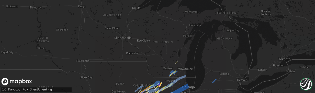
Hail Map in Wisconsin on April 2, 2026
The weather event in Wisconsin on April 2, 2026 includes Wind, Hail, and Tornado maps. 9 states and 518 cities were impacted and suffered possible damage. The total estimated number of properties impacted is 21,227.
Wind
Hail
Tornado
21,227
Estimated number of impacted properties by a 1.00" hail or larger0
Estimated number of impacted properties by a 1.75" hail or larger0
Estimated number of impacted properties by a 2.50" hail or largerStorm reports in Wisconsin
Wisconsin
| Date | Description |
|---|---|
| 04/02/20266:57 PM CDT | Jefferson county dispatch reports tree down on power line north of palmyra. |
| 04/02/20266:25 PM CDT | Tree down reported by lafayette county dispatchers. Time estimated by radar. |
| 04/02/20266:22 PM CDT | A local report indicates 1.50 inch wind near 2 NNE Janesville |
| 04/02/20266:19 PM CDT | Hail at mercy hospital. |
| 04/01/20268:10 PM CDT | Social media reports of multiple trees and power lines down in northern kenosha... With tree limbs on roofs as well. Siding missing from multiple houses |
| 04/01/20268:05 PM CDT | Fox6 milwaukee reports damage to trees and powerlines with 45th street blocked. Time estimated by radar. |
| 04/01/20267:47 PM CDT | Waukesha county dispatch reports tree on a power line in new berlin. Time estimated by radar. |
| 04/01/20267:44 PM CDT | Waukesha county dispatch reports a tree on a phone in line butler. Time estimated by radar. |
| 04/01/20267:31 PM CDT | Walworth county dispatch reports trees down in sugar creek township. Time estimated by radar. |
| 04/01/20267:19 PM CDT | Walworth county dispatch reports trees and powerlines down on northwest side of county as well as near whitewater. Time estimated by radar. |
| 04/01/20267:07 PM CDT | Facebook report of measured hail 1.25 inch with photo. |
| 04/01/20267:04 PM CDT | Tree down by gibbs lake reported by rock county dispatchers. Time estimated by radar. |
| 04/01/20267:02 PM CDT | Report from mping: quarter |
All States Impacted by Hail Map on April 2, 2026
Cities Impacted by Hail Map on April 2, 2026
- Syracuse, UT
- Layton, UT
- Clearfield, UT
- Hooper, UT
- Ogden, UT
- Roy, UT
- Hill Afb, UT
- Eden, UT
- Huntsville, UT
- Morgan, UT
- Cainsville, MO
- Blythedale, MO
- Davis City, IA
- Lineville, IA
- Leon, IA
- Allerton, IA
- Clio, IA
- Corydon, IA
- Princeton, MO
- Mercer, MO
- Zachary, LA
- Pride, LA
- Blakesburg, IA
- Ottumwa, IA
- Powersville, MO
- Albia, IA
- Melrose, IA
- Unionville, IA
- Lovilia, IA
- Hedrick, IA
- Lucerne, MO
- Fort Myers, FL
- Martinsburg, IA
- Packwood, IA
- Ollie, IA
- Sigourney, IA
- Keota, IA
- Harper, IA
- Eddyville, IA
- West Chester, IA
- Wellman, IA
- Washington, IA
- Drakesville, IA
- Cape Coral, FL
- Kirkville, IA
- Fremont, IA
- Cedar, IA
- Kalona, IA
- Williamsburg, IA
- Deep River, IA
- North English, IA
- Ladora, IA
- Millersburg, IA
- Marengo, IA
- Conroy, IA
- South Amana, IA
- Homestead, IA
- Ridgeway, MO
- Agency, IA
- Sperry, IA
- Decatur, IA
- Batavia, IA
- Riverside, IA
- Iowa City, IA
- Burlington, IA
- Oxford, IA
- Parnell, IA
- Fairfield, IA
- Bloomfield, IA
- Hills, IA
- Richland, IA
- Oakville, IA
- Mediapolis, IA
- South English, IA
- West Burlington, IA
- Aledo, IL
- Joy, IL
- West Branch, IA
- Middle Amana, IA
- Amana, IA
- Fairfax, IA
- Cedar Rapids, IA
- Swisher, IA
- Norway, IA
- Solon, IA
- Mount Vernon, IA
- Ely, IA
- Tiffin, IA
- Reynolds, IL
- Seaton, IL
- Brighton, IA
- Keithsburg, IL
- Dallas City, IL
- Niota, IL
- New Boston, IL
- Tipton, IA
- West Liberty, IA
- Milan, IL
- Coal Valley, IL
- Wayland, IA
- Lomax, IL
- Ainsworth, IA
- Clarence, IA
- Lowden, IA
- Oxford Junction, IA
- Lost Nation, IA
- Wheatland, IA
- Moline, IL
- Silvis, IL
- East Moline, IL
- Colona, IL
- Carbon Cliff, IL
- Hillsdale, IL
- Port Byron, IL
- Nichols, IA
- Lone Tree, IA
- Eldridge, IA
- McCausland, IA
- Long Grove, IA
- De Witt, IA
- Raritan, IL
- Media, IL
- Smithshire, IL
- Sherrard, IL
- Rose Hill, IA
- Atalissa, IA
- Mendon, IL
- Princeton, IA
- Fulton, IL
- North Liberty, IA
- Columbus Junction, IA
- Conesville, IA
- Bennett, IA
- Calamus, IA
- Maquoketa, IA
- Delmar, IA
- Coatsburg, IL
- Moscow, IA
- Muscatine, IA
- Wilton, IA
- Low Moor, IA
- Camanche, IA
- Clinton, IA
- Mount Carroll, IL
- Thomson, IL
- Matherville, IL
- Orion, IL
- Monmouth, IL
- Kirkwood, IL
- Roseville, IL
- Morrison, IL
- Chadwick, IL
- Wyoming, IA
- Cameron, IL
- Grand Mound, IA
- Savanna, IL
- Sabula, IA
- Geneseo, IL
- Erie, IL
- Galesburg, IL
- Welton, IA
- Stockton, IA
- Charlotte, IA
- Bryant, IA
- Goose Lake, IA
- Victoria, IL
- Prophetstown, IL
- Lyndon, IL
- Miles, IA
- Teeds Grove, IA
- Lanark, IL
- Donahue, IA
- Stronghurst, IL
- Beloit, WI
- Orfordville, WI
- Janesville, WI
- Tampico, IL
- Sterling, IL
- Rock Falls, IL
- La Fayette, IL
- Galva, IL
- Schoolcraft, MI
- Vicksburg, MI
- Portage, MI
- Milton, WI
- Kalamazoo, MI
- Scotts, MI
- Toulon, IL
- Rock Island, IL
- Dixon, IL
- Bettendorf, IA
- Bradford, IL
- Baldwin, IA
- Preston, IA
- Bellevue, IA
- Spragueville, IA
- Elizabeth, IL
- Hanover, IL
- Stockton, IL
- Pearl City, IL
- Durant, IA
- New Liberty, IA
- Blue Grass, IA
- Walcott, IA
- Davenport, IA
- Dixon, IA
- Le Claire, IA
- Cordova, IL
- Albany, IL
- Pleasant Valley, IA
- Harmon, IL
- Whitewater, WI
- Princeton, IL
- Tiskilwa, IL
- Buda, IL
- Freeport, IL
- Chana, IL
- Oregon, IL
- Ashton, IL
- Polo, IL
- Franklin Grove, IL
- Rochelle, IL
- Galesburg, MI
- Climax, MI
- Augusta, MI
- Battle Creek, MI
- Stillman Valley, IL
- Dunlap, IL
- Princeville, IL
- Fort Atkinson, WI
- Edwards, IL
- Elmwood, IL
- Edelstein, IL
- Brimfield, IL
- Chillicothe, IL
- Yates City, IL
- Maquon, IL
- Farmington, IL
- Fairview, IL
- Canton, IL
- Trivoli, IL
- Williamsfield, IL
- Laura, IL
- Speer, IL
- Wyoming, IL
- Wyanet, IL
- Sparland, IL
- Dover, IL
- Putnam, IL
- Henry, IL
- Malden, IL
- Peoria, IL
- Lindenwood, IL
- Davis Junction, IL
- Monroe Center, IL
- Esmond, IL
- Kirkland, IL
- Mendota, IL
- Spring Valley, IL
- Peru, IL
- Arlington, IL
- Utica, IL
- Troy Grove, IL
- Cherry, IL
- Evansville, WI
- Hennepin, IL
- Woosung, IL
- Byron, IL
- Marengo, IL
- Harvard, IL
- Cherry Valley, IL
- Kingston, IL
- Belvidere, IL
- Garden Prairie, IL
- Rockford, IL
- Genoa, IL
- Union, IL
- Holcomb, IL
- Woodstock, IL
- Triumph, IL
- Toluca, IL
- Varna, IL
- La Salle, IL
- Depue, IL
- Oglesby, IL
- La Rose, IL
- Standard, IL
- Dalzell, IL
- Mark, IL
- Lacon, IL
- Grand Ridge, IL
- Rutland, IL
- Streator, IL
- Bureau, IL
- La Moille, IL
- Washburn, IL
- Tonica, IL
- Wenona, IL
- Leonore, IL
- McNabb, IL
- Magnolia, IL
- Lostant, IL
- Lowpoint, IL
- Ottawa, IL
- Granville, IL
- Seatonville, IL
- Earlville, IL
- Ladd, IL
- Cedar Point, IL
- Dana, IL
- Ancona, IL
- Cornell, IL
- Marseilles, IL
- Manito, IL
- Mapleton, IL
- Glasford, IL
- Delta, IA
- Liverpool, IL
- Idaville, IN
- Monticello, IN
- Burket, IN
- Silver Lake, IN
- Star City, IN
- Warsaw, IN
- Macy, IN
- Royal Center, IN
- Winona Lake, IN
- Milford, IN
- Tippecanoe, IN
- Lucerne, IN
- Kewanna, IN
- North Webster, IN
- Etna Green, IN
- Winamac, IN
- Rochester, IN
- Argos, IN
- Logansport, IN
- Mentone, IN
- Burnettsville, IN
- Leesburg, IN
- Syracuse, IN
- Bourbon, IN
- Akron, IN
- Claypool, IN
- Pierceton, IN
- Atwood, IN
- Twelve Mile, IN
- Delphi, IN
- Pekin, IL
- Kingston Mines, IL
- Wedron, IL
- Seneca, IL
- Ransom, IL
- Sheridan, IL
- Verona, IL
- Morris, IL
- Serena, IL
- Mazon, IL
- Millington, IL
- Minooka, IL
- Sandwich, IL
- Yorkville, IL
- Newark, IL
- Plano, IL
- Bristol, IL
- Sugar Grove, IL
- Leland, IL
- Somonauk, IL
- Millbrook, IL
- Oswego, IL
- Montgomery, IL
- Aurora, IL
- Plainfield, IL
- Naperville, IL
- Joliet, IL
- Groveland, IL
- Lewistown, IL
- Topeka, IL
- Hanna City, IL
- Mossville, IL
- East Peoria, IL
- Metamora, IL
- Hebron, IL
- Ringwood, IL
- Wonder Lake, IL
- Twin Lakes, WI
- Genoa City, WI
- Richmond, IL
- Mchenry, IL
- Spring Grove, IL
- Fox Lake, IL
- Antioch, IL
- Lake Villa, IL
- Burlington, WI
- Wilmot, WI
- Trevor, WI
- Bristol, WI
- Salem, WI
- Kenosha, WI
- Pleasant Prairie, WI
- Wadsworth, IL
- Zion, IL
- Warrenville, IL
- Winfield, IL
- Carol Stream, IL
- North Aurora, IL
- Batavia, IL
- West Chicago, IL
- Wheaton, IL
- Glen Ellyn, IL
- Lisle, IL
- Lombard, IL
- Downers Grove, IL
- Bolingbrook, IL
- Lemont, IL
- Romeoville, IL
- Shorewood, IL
- Lockport, IL
- Woodridge, IL
- Crest Hill, IL
- Hinsdale, IL
- Darien, IL
- Oak Brook, IL
- Willowbrook, IL
- Westmont, IL
- Villa Park, IL
- Clarendon Hills, IL
- Willow Springs, IL
- Western Springs, IL
- Bellwood, IL
- Schiller Park, IL
- Franklin Park, IL
- Bensenville, IL
- Stone Park, IL
- Berkeley, IL
- Westchester, IL
- Melrose Park, IL
- Addison, IL
- La Grange, IL
- Elmhurst, IL
- Hillside, IL
- Morton, IL
- Brookfield, IL
- Maywood, IL
- Riverside, IL
- Berwyn, IL
- Summit Argo, IL
- Forest Park, IL
- River Forest, IL
- Broadview, IL
- Lyons, IL
- Justice, IL
- Hines, IL
- Cicero, IL
- Bridgeview, IL
- Elmwood Park, IL
- La Grange Park, IL
- Chicago, IL
- Oak Park, IL
- River Grove, IL
- Harwood Heights, IL
- Niles, IL
- Park Ridge, IL
- Morton Grove, IL
- Skokie, IL
- Lincolnwood, IL
- Des Plaines, IL
- Glendale Heights, IL
- Wood Dale, IL
- Big Rock, IL
- Evanston, IL
- Wilmette, IL
- Burbank, IL
- Hickory Hills, IL
- Palos Hills, IL
- Homer Glen, IL
- Oak Lawn, IL
- Juneau, WI
- Horicon, WI
- Mayville, WI
- Reelsville, IN
- Rockville, IN
- Harmony, IN
- Brazil, IN
- Staunton, IN
- Russellville, IN
- Riley, IN
- Rosedale, IN
- Carbon, IN
- Greencastle, IN
- Knightsville, IN
- Bridgeton, IN
- Roachdale, IN
- Cory, IN
- Bainbridge, IN
- West Terre Haute, IN
- Terre Haute, IN
- Roanoke, IN
- Ossian, IN
- Fort Wayne, IN
- Yoder, IN
- Cambridge, WI
- Edgerton, WI
- Palmyra, WI
- Eagle, WI
- Thayer, IA
- Woodburn, IA
- Osceola, IA
- New Virginia, IA
- Indianola, IA
- Lorimor, IA
- Afton, IA
- Murray, IA
- Darien, WI
- Avalon, WI
- Brodhead, WI
- Knoxville, IL
- East Galesburg, IL


