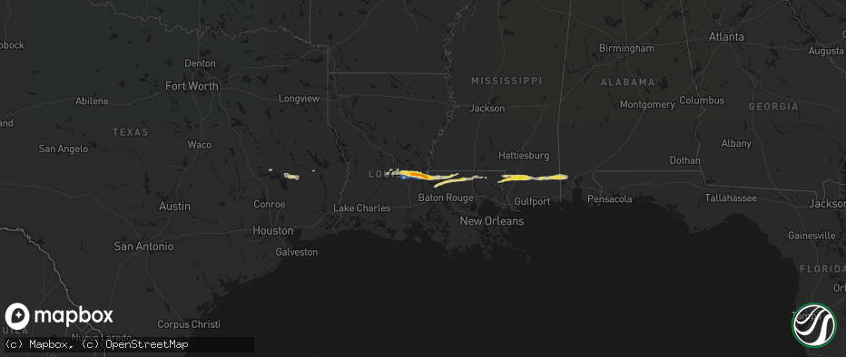
Hail Map on May 8, 2026
The weather event on May 8, 2026 includes Hail and Wind maps. 10 states and 438 cities were impacted and suffered possible damage. The total estimated number of properties impacted is 297,787.
Hail
Wind
297,787
Estimated number of impacted properties by a 1.00" hail or larger95,146
Estimated number of impacted properties by a 1.75" hail or larger26,100
Estimated number of impacted properties by a 2.50" hail or largerStates Impacted by Hail Map on May 8, 2026
Storm reports
North Dakota
| Date | Description |
|---|---|
| 05/08/20266:57 PM CDT | Uses 10m ndawn observation to correct previous non-tstm wnd gst report from 11 se wheelock. |
Arkansas
| Date | Description |
|---|---|
| 05/07/20269:18 PM CDT | Report from mping: quarter |
| 05/07/20269:15 PM CDT | Damage to vegetation reported. Time revised from radar estimate. |
| 05/07/20269:14 PM CDT | Report from mping: quarter |
| 05/07/20269:14 PM CDT | A local report indicates 1.75 inch wind near 1 E Fort Smith |
| 05/07/20269:09 PM CDT | A local report indicates 1.25 inch wind near 1 S Fort Smith |
| 05/07/20269:07 PM CDT | Relayed via spotter network. |
| 05/07/20269:05 PM CDT | Relayed via spotter network. |
| 05/07/20268:43 PM CDT | Report of hail the size of quarters in emmet... Arkansas. |
Florida
| Date | Description |
|---|---|
| 05/08/20266:15 PM CDT | Wesh 2 orlando relayed a video of hail ranging in size from pennies to quarters from a resident of port orange off of old sunbeam dr |
| 05/08/20265:00 PM CDT | Tree reported down on state road 11 near bunnell. Time of event based on radar. |
| 05/08/20264:28 PM CDT | Trees were reported down across e cracker swamp road and turner road. |
| 05/08/20262:09 PM CDT | Report of quarter size hail just west of the allentown community. |
| 05/08/20261:40 PM CDT | Reports of trees down blocking parts of highway 97 |
Missouri
| Date | Description |
|---|---|
| 05/08/20265:30 PM CDT | Butler eoc reports multiple trees and powerlines down... With roadways blocked. Time estimated from radar. |
Mississippi
| Date | Description |
|---|---|
| 05/08/202611:40 AM CDT | Late report of structural damage to a home near lumberton on cooley lake dr from thunderstorm winds. |
| 05/08/202611:40 AM CDT | Numerous reports of quarter size hail on the west side of stone county. |
| 05/08/202611:32 AM CDT | Damaged structure near the pearl river/stone county line along hwy 26. |
Texas
| Date | Description |
|---|---|
| 05/08/20261:11 AM CDT | Nickel to quarter size hail fell in karnack. |
| 05/08/202612:30 AM CDT | One inch hail reported at a local gas station in gilmer... Texas. |
| 05/08/202612:30 AM CDT | A picture of half dollar size hail that fell near uncertain was posted to social media. |
| 05/08/202612:27 AM CDT | Report from mping: quarter |
| 05/08/202612:13 AM CDT | Hail to the size of quarters reported in ore city... Texas. |
| 05/08/202612:03 AM CDT | A picture of nickel to quarter size hail that fell near avinger was posted to social media. |
| 05/07/202611:45 PM CDT | One inch hail reported at a gas station in winnsboro... Texas. |
| 05/07/202611:40 PM CDT | One inch hail reported along the camp/upshur county line. |
| 05/07/20269:14 PM CDT | Time estimated from radar. |
Oklahoma
| Date | Description |
|---|---|
| 05/08/20266:59 PM CDT | A local report indicates 1.75 inch wind near 1 SW Chickasha |
| 05/08/20266:57 PM CDT | A local report indicates 1.50 inch wind near 1 SW Chickasha |
| 05/08/20266:56 PM CDT | Reported 1 mile north of wagoner on highway 69. |
| 05/08/20266:55 PM CDT | Winds gusting 60-70mph as well. |
| 05/08/20266:55 PM CDT | Relayed via spotter network. Time of occurrence revised according to radar. |
| 05/08/20266:44 PM CDT | A local report indicates 1.75 inch wind near 3 E Verden |
| 05/08/20266:40 PM CDT | A local report indicates 2.00 inch wind near Chattanooga |
| 05/08/20266:39 PM CDT | A local report indicates 2.75 inch wind near Chattanooga |
| 05/08/20266:38 PM CDT | Time estimated from radar. |
| 05/08/20266:35 PM CDT | Report from mping: ping pong ball |
| 05/08/20266:34 PM CDT | Report from mping: golf ball |
| 05/08/20266:33 PM CDT | A local report indicates 1.75 inch wind near Chattanooga |
| 05/08/20266:32 PM CDT | Hail covering the roadway. Near intersection of 600 road and 425 road on the mayes and rogers county line. Photo shared by emergency management. Time estimated from rad |
| 05/08/20266:31 PM CDT | A local report indicates 1.00 inch wind near Chattanooga |
| 05/08/20266:30 PM CDT | A local report indicates 1.00 inch wind near 2 ESE Tulsa |
| 05/08/20266:30 PM CDT | A local report indicates 1.00 inch wind near 5 NE Verden |
| 05/08/20266:28 PM CDT | A local report indicates 1.50 inch wind near 1 NNW Inola |
| 05/08/20266:28 PM CDT | A local report indicates 1.00 inch wind near 1 SW Valley Brook |
| 05/08/20266:26 PM CDT | Report from mping: quarter |
| 05/08/20266:25 PM CDT | A local report indicates 1.00 inch wind near 3 SSW Moore |
| 05/08/20266:25 PM CDT | A local report indicates 1.00 inch wind near 4 W Moore |
| 05/08/20266:23 PM CDT | A local report indicates 1.00 inch wind near 1 WSW Moore |
| 05/08/20266:22 PM CDT | A local report indicates 1.00 inch wind near 2 SE Valley Brook |
| 05/08/20266:19 PM CDT | A local report indicates 1.00 inch wind near 2 SW Tinker Air Force B |
| 05/08/20266:19 PM CDT | A local report indicates 1.00 inch wind near 3 W Moore |
| 05/08/20266:16 PM CDT | A local report indicates 1.50 inch wind near 6 N Newcastle |
| 05/08/20266:15 PM CDT | A local report indicates 1.00 inch wind near 3 E Verdigris |
| 05/08/20266:15 PM CDT | A local report indicates 1.00 inch wind near 2 E Valley Brook |
| 05/08/20266:12 PM CDT | A local report indicates 1.00 inch wind near Verdigris |
| 05/08/20266:11 PM CDT | Report from mping: ping pong ball |
| 05/08/20266:11 PM CDT | A local report indicates 1.00 inch wind near 2 NE Moore |
| 05/08/20266:09 PM CDT | Report from mping: quarter |
| 05/08/20266:07 PM CDT | A local report indicates 1.00 inch wind near 5 E Mustang |
| 05/08/20266:06 PM CDT | A local report indicates 1.25 inch wind near 4 E Mustang |
| 05/08/20266:06 PM CDT | A local report indicates 1.25 inch wind near 2 N Mustang |
| 05/08/20266:00 PM CDT | A local report indicates 1.00 inch wind near 4 E Mustang |
| 05/08/20266:00 PM CDT | A local report indicates 1.75 inch wind near 3 SW Yukon |
| 05/08/20265:59 PM CDT | Report from mping: quarter |
| 05/08/20265:58 PM CDT | Report from mping: hen egg |
| 05/08/20265:55 PM CDT | Report from mping: half dollar |
| 05/08/20265:55 PM CDT | Report from mping: quarter |
| 05/08/20265:54 PM CDT | Report from mping: quarter |
| 05/08/20265:54 PM CDT | Report from mping: hen egg |
| 05/08/20265:54 PM CDT | Reported near 106th street north and 145th east avenue. Relayed by broadcast media. |
| 05/08/20265:53 PM CDT | Relayed by newton county missouri emergency management. Slightly larger than a golf ball 2 miles east of the limestone fire station. |
| 05/08/20265:53 PM CDT | Report from mping: half dollar |
| 05/08/20265:52 PM CDT | Report from mping: half dollar |
| 05/08/20265:52 PM CDT | Report from mping: golf ball |
| 05/08/20265:51 PM CDT | Report from mping: half dollar |
| 05/08/20265:50 PM CDT | A local report indicates 1.00 inch wind near 2 N Mustang |
| 05/08/20265:50 PM CDT | Report from mping: quarter |
| 05/08/20265:50 PM CDT | Report from mping: golf ball |
| 05/08/20265:49 PM CDT | A local report indicates 1.00 inch wind near 1 S Yukon |
| 05/08/20265:48 PM CDT | A local report indicates 1.75 inch wind near 3 SSE Yukon |
| 05/08/20265:47 PM CDT | A local report indicates 1.75 inch wind near 3 SW Yukon |
| 05/08/20265:46 PM CDT | Report from mping: half dollar |
| 05/08/20265:45 PM CDT | Third of a tree downed. Time estimated from radar. |
| 05/08/20265:45 PM CDT | Powerlines downed between 86th and 96th street north on garnett. Also a large tree snapped in half on north elm and owasso expressway just south of the documented locat |
| 05/08/20265:41 PM CDT | Quarter hail at 136th street north and highway 75. |
| 05/08/20265:40 PM CDT | Yukon mesonet. |
| 05/08/20265:39 PM CDT | Report from mping: golf ball |
| 05/08/20265:39 PM CDT | Report from mping: quarter |
| 05/08/20265:37 PM CDT | Report from mping: quarter |
| 05/08/20265:36 PM CDT | A local report indicates 1.00 inch wind near Guthrie |
| 05/08/20265:36 PM CDT | Report from mping: ping pong ball |
| 05/08/20265:35 PM CDT | Quite a bit of hail up to the size of quarters. |
| 05/08/20265:32 PM CDT | Report from mping: quarter |
| 05/08/20265:31 PM CDT | Quarter to half dollar size hail on the osage and tulsa county line just south of highway 20. |
| 05/08/20265:30 PM CDT | A local report indicates 1.75 inch wind near 4 NE Skiatook |
| 05/08/20265:27 PM CDT | Time estimated from radar. |
| 05/08/20265:24 PM CDT | Report from mping: quarter |
| 05/08/20265:05 PM CDT | Hail lasted about 20 minutes... Tree limbs down around the area as well. |
| 05/08/20265:02 PM CDT | A local report indicates 1.50 inch wind near Coyle |
| 05/08/20265:00 PM CDT | A local report indicates 1.00 inch wind near 3 W Langston |
| 05/08/20264:46 PM CDT | Media storm tracker report. |
| 05/08/20264:43 PM CDT | Golf balls and slightly larger hail reported in wynona... Along with estimated 60 mph winds. |
| 05/08/20264:40 PM CDT | Measured by the wynona oklahoma mesonet station. Gust from the northwest. |
| 05/08/20263:30 PM CDT | Golf ball to occasional hen egg sized hail in burbank. Reported to almost cover the ground. |
| 05/08/20262:38 PM CDT | Report from mping: ping pong ball |
| 05/07/202610:00 PM CDT | A local report indicates 1.00 inch wind near Poteau |
| 05/07/20269:50 PM CDT | Relayed via spotter network. |
| 05/07/20269:49 PM CDT | Reported at highway 75 and birch road. |
| 05/07/20269:35 PM CDT | Picture from x. Time estimated from radar. |
| 05/07/20269:03 PM CDT | A local report indicates 1.00 inch wind near 2 SW Comanche |
| 05/07/20268:59 PM CDT | A local report indicates 1.00 inch wind near 2 SW Comanche |
| 05/07/20268:58 PM CDT | A local report indicates 1.00 inch wind near Roland |
| 05/07/20268:50 PM CDT | Time estimated via radar. |
| 05/07/20268:49 PM CDT | Picture of hail damage to a vehicle relayed from broadcast media. Hail was estimated to be tennis ball size. Time approximated from ksrx radar. |
| 05/07/20268:49 PM CDT | Picture of hail damage to a vehicle relayed by broadcast media. Hail was estimated to be tennis ball size. Time approximated from ksrx radar. |
| 05/07/20268:42 PM CDT | Up to golf ball sized. |
| 05/07/20268:05 PM CDT | Estimated 60 mph winds. Power out. Tree debris of unknown size throughout the area. Time estimated from radar. |
| 05/07/20268:00 PM CDT | On 340 road just south of liberty road. Stripped trees in the area. Time estimated from radar. |
| 05/07/20267:55 PM CDT | A local report indicates 1.25 inch wind near 3 S Fletcher |
| 05/07/20267:52 PM CDT | A local report indicates 1.50 inch wind near 1 E Elgin |
| 05/07/20267:50 PM CDT | A local report indicates 1.75 inch wind near 2 N Elgin |
| 05/07/20267:49 PM CDT | A local report indicates 1.50 inch wind near 2 NE Elgin |
| 05/07/20267:48 PM CDT | Hail near highway 75 and hectorville rd. |
| 05/07/20267:17 PM CDT | Report from mping: hen egg+ |
| 05/07/20267:13 PM CDT | Report from mping: ping pong ball |
| 05/07/20267:07 PM CDT | Report from mping: quarter |
| 05/07/20267:07 PM CDT | A local report indicates 1.75 inch wind near Chickasha |
| 05/07/20267:06 PM CDT | A local report indicates 1.25 inch wind near 1 SSE Chickasha |
| 05/07/20267:05 PM CDT | A local report indicates 2.50 inch wind near 5 SW Etowah |
| 05/07/20267:05 PM CDT | A local report indicates 2.50 inch wind near 2 WSW Chickasha |
| 05/07/20267:03 PM CDT | A local report indicates 1.50 inch wind near 3 W Etowah |
| 05/07/20267:03 PM CDT | A local report indicates 2.75 inch wind near Etowah |
| 05/07/20267:02 PM CDT | Report from mping: golf ball |
| 05/07/20267:02 PM CDT | A local report indicates 1.00 inch wind near 3 SW Etowah |
| 05/07/20267:02 PM CDT | A local report indicates 1.75 inch wind near 3 SW Etowah |
| 05/07/20267:01 PM CDT | A local report indicates 1.25 inch wind near 3 W Etowah |
Louisiana
| Date | Description |
|---|---|
| 05/08/20264:06 PM CDT | Several trees... Power lines... And carports damaged on multiple streets along barriere road. Video shared by media also showed strong straight line winds impacting the |
| 05/08/20263:17 PM CDT | Measured by a vessel at mm 124 on the mississippi river. |
| 05/08/20263:16 PM CDT | Public reported of half dollar sized hail in destrehan. Time estimated by radar. |
| 05/08/20263:15 PM CDT | Public report of ping pong ball sized hail. Time estimated by radar. |
| 05/08/20263:05 PM CDT | Measured from a home weather station. |
| 05/08/20268:52 AM CDT | Corrects previous hail report from 5 n slaughter. Picture of quarter sized hail in ethel. |
| 05/08/20268:50 AM CDT | Video and picture of hail estimated around ping pong ball sized. |
| 05/08/20268:48 AM CDT | Trees down in batchelor. |
| 05/08/20268:48 AM CDT | Trees down in innis. |
| 05/08/20268:30 AM CDT | Repots of downed trees at the intersection of hwy 1179 and la 107. |
| 05/08/20268:30 AM CDT | Reports of 1.5 inch hail in dupont. |
| 05/08/20268:20 AM CDT | Media reports of quarter size hail in plaucheville. |
| 05/08/20268:10 AM CDT | Reports of wind damage to a gas station on the corner of hwy 29 and hwy 71 in bunkie. |
| 05/08/20268:00 AM CDT | An nws storm survey concluded that a widespread swath of wind damage extending from bunkie to plaucheville was the result of straight line thunderstorm winds occurring |
| 05/08/20267:52 AM CDT | Picture of quarter sized hail in ethel. |
| 05/08/20266:55 AM CDT | Tree down kohnke hill rd and monteleone ln in hammond. |
| 05/08/20266:48 AM CDT | Tree down whiskey ln and johns ln in tickfaw. |
| 05/08/20266:39 AM CDT | Tree down on la 442 east of la 43. |
| 05/08/20266:23 AM CDT | Trees down on hwy 1061 between hwy 440 and hwy 1057. |
| 05/08/20264:00 AM CDT | A few pine trees snapped near the intersection of scenic drive and airport rd and in the oakmont subdivision off airport rd. Time estimated by radar. |
| 05/08/20261:30 AM CDT | Ping pong ball sized hail near litton road and parks road intersection. |
| 05/08/20261:15 AM CDT | One inch sized hail south and southeast of benton... Louisiana. |
Cities Impacted by Hail Map on May 8, 2026
- Livingston, TX
- Glenmora, LA
- Moscow, TX
- Onalaska, TX
- Forest Hill, LA
- Cheneyville, LA
- Lecompte, LA
- Trinity, TX
- Ville Platte, LA
- Bunkie, LA
- Saint Landry, LA
- Cottonport, LA
- Evergreen, LA
- Ventress, LA
- Jarreau, LA
- Saint Francisville, LA
- Jackson, LA
- Plaucheville, LA
- Simmesport, LA
- Lettsworth, LA
- Batchelor, LA
- Morrow, LA
- Slaughter, LA
- Ethel, LA
- Melville, LA
- Clinton, LA
- Greensburg, LA
- Kentwood, LA
- Amite, LA
- Wilson, LA
- Fluker, LA
- Bogalusa, LA
- Poplarville, MS
- Franklinton, LA
- Mount Hermon, LA
- Lumberton, MS
- Angie, LA
- Wiggins, MS
- Perkinston, MS
- Lucedale, MS
- Wilmer, AL
- Semmes, AL
- Eight Mile, AL
- Chunchula, AL
- Bay Minette, AL
- McDavid, FL
- Molino, FL
- Ponca City, OK
- Kaw City, OK
- Shidler, OK
- Burbank, OK
- Newkirk, OK
- Boutte, LA
- Paradis, LA
- Hahnville, LA
- Thibodaux, LA
- Des Allemands, LA
- Luling, LA
- Destrehan, LA
- Norco, LA
- Saint Rose, LA
- Ama, LA
- Jay, FL
- Cedar Vale, KS
- Milton, FL
- Fairfax, OK
- Westwego, LA
- Palatka, FL
- Marrero, LA
- Braithwaite, LA
- Harvey, LA
- Belle Chasse, LA
- Marianna, FL
- Greenwood, FL
- East Palatka, FL
- Raceland, LA
- La Place, LA
- Wynona, OK
- Pawhuska, OK
- Marathon, TX
- Sneads, FL
- Grand Ridge, FL
- Crescent, OK
- Guthrie, OK
- Mulhall, OK
- Watonga, OK
- Donalsonville, GA
- Terrell, TX
- Wills Point, TX
- Omega, OK
- Kingfisher, OK
- Barnsdall, OK
- Marland, OK
- Cairo, GA
- Okarche, OK
- Coyle, OK
- Skiatook, OK
- Crescent City, FL
- Ochlocknee, GA
- Seville, FL
- Georgetown, FL
- Perkins, OK
- El Reno, OK
- Ramona, OK
- La Cygne, KS
- Amsterdam, MO
- Calumet, OK
- Pierson, FL
- Fort Stockton, TX
- Amoret, MO
- Butler, MO
- Collinsville, OK
- Yukon, OK
- Flagler Beach, FL
- Ormond Beach, FL
- Bunnell, FL
- Ralston, OK
- Wellston, OK
- Morrison, OK
- Glencoe, OK
- Stillwater, OK
- Piedmont, OK
- Owasso, OK
- Sperry, OK
- Oklahoma City, OK
- Pawnee, OK
- Snyder, OK
- Frederick, OK
- Tryon, OK
- De Leon Springs, FL
- Elk City, KS
- Oologah, OK
- Edmond, OK
- Carney, OK
- Palm Coast, FL
- Hinton, OK
- Perry, OK
- Indiahoma, OK
- Claremore, OK
- Catoosa, OK
- Binger, OK
- Minco, OK
- Mustang, OK
- Chandler, OK
- Tulsa, OK
- Agra, OK
- Prue, OK
- Maramec, OK
- Yale, OK
- Hominy, OK
- Lookeba, OK
- Fort Scott, KS
- Fulton, KS
- Montrose, MO
- Bethany, OK
- Wheatland, OK
- Cleveland, OK
- Jennings, OK
- Anadarko, OK
- Inola, OK
- Davenport, OK
- Daytona Beach, FL
- Appleton City, MO
- Loveland, OK
- Deland, FL
- Sand Springs, OK
- Galesburg, KS
- Chattanooga, OK
- Newcastle, OK
- Norman, OK
- Pocasset, OK
- Stroud, OK
- Broken Arrow, OK
- Union City, OK
- Tuttle, OK
- Spencer, OK
- Choctaw, OK
- Port Orange, FL
- Chickasha, OK
- Osage, OK
- Osceola, MO
- Verden, OK
- Wagoner, OK
- Coweta, OK
- Chouteau, OK
- Fargo, GA
- Blanchard, OK
- New Smyrna Beach, FL
- Erie, KS
- Noble, OK
- Lexington, OK
- Walters, OK
- Walnut, KS
- Locust Grove, OK
- Pryor, OK
- Newalla, OK
- Ninnekah, OK
- Hulbert, OK
- Macomb, OK
- Wanette, OK
- Grandfield, OK
- Devol, OK
- Randlett, OK
- Farlington, KS
- Hepler, KS
- Apache, OK
- Cement, OK
- Washington, OK
- Rush Springs, OK
- Bradley, OK
- Porter, OK
- Purcell, OK
- Tecumseh, OK
- Muskogee, OK
- Fort Gibson, OK
- Tahlequah, OK
- Cyril, OK
- Mounds, OK
- Wayne, OK
- Fletcher, OK
- Elgin, OK
- Braggs, OK
- Beggs, OK
- Okmulgee, OK
- Park Hill, OK
- Bixby, OK
- Haskell, OK
- Byars, OK
- Marlow, OK
- Kirbyville, TX
- Morris, OK
- Boynton, OK
- Lawton, OK
- Fort Sill, OK
- Jasper, TX
- Council Hill, OK
- Oktaha, OK
- Roff, OK
- Bunch, OK
- Sallisaw, OK
- Ada, OK
- Stratford, OK
- Bristow, OK
- Newton, TX
- Cookson, OK
- Vian, OK
- Gore, OK
- Sapulpa, OK
- Burkeville, TX
- Kellyville, OK
- Hope, AR
- Duncan, OK
- Cache, OK
- Fitzhugh, OK
- Muldrow, OK
- Roland, OK
- Evans, LA
- Leesville, LA
- Emmet, AR
- Checotah, OK
- Callahan, FL
- Wiergate, TX
- Faxon, OK
- Comanche, OK
- Warner, OK
- Porum, OK
- Van Buren, AR
- Arkoma, OK
- Fort Smith, AR
- Prescott, AR
- Anacoco, LA
- Odell, TX
- Geronimo, OK
- Vernon, TX
- Yulee, FL
- Rosston, AR
- Chillicothe, TX
- Waurika, OK
- Webbers Falls, OK
- Stigler, OK
- Loco, OK
- Stephens, AR
- Fulton, AR
- Lavaca, AR
- Barling, AR
- Charleston, AR
- Alma, AR
- Keota, OK
- Call, TX
- Bon Wier, TX
- Rudy, AR
- Cedarville, AR
- Quanah, TX
- Ryan, OK
- Henryetta, OK
- Deport, TX
- Lake Creek, TX
- Merryville, LA
- Magazine, AR
- Booneville, AR
- Branch, AR
- Shady Point, OK
- Wolfe City, TX
- Hampton, AR
- Poteau, OK
- Ringling, OK
- Davidson, OK
- Crowell, TX
- Burkburnett, TX
- Nocona, TX
- Hartford, AR
- Bokoshe, OK
- Singer, LA
- Deridder, LA
- Harrold, TX
- Electra, TX
- Ladonia, TX
- Henrietta, TX
- Wichita Falls, TX
- Iowa Park, TX
- Saint Jo, TX
- Montague, TX
- Sulphur Springs, TX
- Como, TX
- Longville, LA
- Pickton, TX
- Moreauville, LA
- Greenville, TX
- Campbell, TX
- Monterey, LA
- Dry Creek, LA
- Yantis, TX
- Winnsboro, TX
- Scroggins, TX
- Mittie, LA
- Leesburg, TX
- Kinder, LA
- Oberlin, LA
- Portland, AR
- Holliday, TX
- Seymour, TX
- Bellevue, TX
- Pittsburg, TX
- Windthorst, TX
- Scotland, TX
- Mamou, LA
- Ore City, TX
- Quitman, TX
- Jacksboro, TX
- Bowie, TX
- Newcastle, TX
- Olney, TX
- Avinger, TX
- Lone Star, TX
- Gilmer, TX
- Jefferson, TX
- Crossett, AR
- Bastrop, LA
- Eunice, LA
- Saltillo, TX
- Diana, TX
- Perrin, TX
- Jones, LA
- Hamburg, AR
- Bonita, LA
- Karnack, TX
- Opelousas, LA
- Washington, LA
- Port Barre, LA
- Big Sandy, TX
- Oak Grove, LA
- Fordoche, LA
- Lottie, LA
- Krotz Springs, LA
- Maringouin, LA
- Livonia, LA
- Mooringsport, LA
- Benton, LA
- Belcher, LA
- Shreveport, LA
- Oil City, LA
- Longview, TX
- Vivian, LA
- Harleton, TX
- Marshall, TX
- Lake Providence, LA
- Rolling Fork, MS
- Hallsville, TX
- Bossier City, LA
- Haughton, LA
- Oscar, LA
- Minden, LA
- Grosse Tete, LA
- Mayersville, MS
- Princeton, LA
- Sibley, LA
- Doyline, LA
- Dubberly, LA
- Port Allen, LA
- Heflin, LA
- Rosedale, LA
- Waskom, TX
- Castor, LA
- Gibsland, LA
- Jamestown, LA
- Barksdale Afb, LA
- Durant, MS
- Bienville, LA
- Mansura, LA
- Goodman, MS
- Sallis, MS
- Laredo, TX
- Jonesboro, LA
- Chatham, LA
- San Ygnacio, TX
- Saline, LA
- Zapata, TX
- Columbia, LA
- Grayson, LA
- Hebbronville, TX
- Eros, LA
- Winnsboro, LA
- Ponchatoula, LA
- Wisner, LA
- Fort Necessity, LA
- Sicily Island, LA
- Gilbert, LA
- Saint Joseph, LA
- Liberty, MS
- Magnolia, MS
- Osyka, MS
- Woodville, MS
- New Roads, LA
- Greenwood, LA
- Zachary, LA
- Roseland, LA
- Denham Springs, LA
- Vera, OK