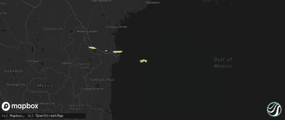
Hail Map on May 9, 2026
The weather event on May 9, 2026 includes Wind, Hail, and Tornado maps. 12 states and 235 cities were impacted and suffered possible damage. The total estimated number of properties impacted is 37,733.
Wind
Hail
Tornado
37,733
Estimated number of impacted properties by a 1.00" hail or larger19,459
Estimated number of impacted properties by a 1.75" hail or larger12,182
Estimated number of impacted properties by a 2.50" hail or largerStates Impacted by Hail Map on May 9, 2026
Storm reports
Michigan
| Date | Description |
|---|---|
| 05/09/20261:27 PM CDT | A local report indicates 1.00 inch wind near 2 E Clarkston |
Texas
| Date | Description |
|---|---|
| 05/09/20266:48 PM CDT | Tennis ball size hail reported 1 mile east of the intersection of highways 152 and 592 along highway 152. |
| 05/09/20266:41 PM CDT | Report of golf ball size hail eat of wheeler along tx highway 152. |
| 05/09/20266:41 PM CDT | Report near intersection of county road 22 and highway 152. |
| 05/09/20266:30 PM CDT | Golf ball size hail reported near intersection of county road 18 and county road j. |
| 05/09/20263:58 PM CDT | Large uprooted tree in mountain city on social media. Time estimated on radar. |
| 05/09/20263:45 PM CDT | Uprooted tree in the whispering hollow subdivision. Time estimated via radar. |
| 05/09/20263:38 PM CDT | Large snapped oak tree limbs of at least 6 to 12 inches in diameter at memorial miniature golf and wwii museum in buda. Time estimated via radar. |
| 05/09/20263:38 PM CDT | Emergency manager reports tree down blocking the road at 11500 block of old san antonio rd. Time estimated from radar. |
| 05/09/20262:20 PM CDT | Mping report... In addition... Received photo from broadcast media with stones ranging from penny to quarter size near pflugerville. |
| 05/09/202611:05 AM CDT | Mesonet station xspp spiw park. |
| 05/09/202611:00 AM CDT | Mesonet station dw1996 laguna vista. |
| 05/09/202610:30 AM CDT | Mesonet station twb79 russell farms. |
| 05/09/202610:30 AM CDT | Corrects previous tstm wnd dmg report from 2.5 nnw los fresnos. Public shared video of roof being blown off of home in laureles... Tx at 10:30 am. |
| 05/09/202610:30 AM CDT | Public shared video of roof being blown off of home in laureles... Tx at 10:30 am. |
| 05/09/202610:25 AM CDT | *** 2 inj *** corrects previous tstm wnd dmg report from 4 ese san benito. Corrects previous tstm wnd dmg report from 4 ese san benito. Emergency management reported a |
| 05/09/202610:25 AM CDT | *** 2 inj *** corrects previous tstm wnd dmg report from 4 ese san benito. Emergency management reported a destroyed mobile home with 2 injuries... No fatalities... 4 m |
| 05/09/202610:19 AM CDT | Corrects previous tstm wnd dmg report from 2.5 ese harlingen. Public reported a large tree snapped in half near mariposa ln and treasure hills blvd southeast of harling |
| 05/09/202610:19 AM CDT | Public reported a large tree snapped in half near mariposa ln and treasure hills blvd southeast of harlingen... Tx. |
| 05/09/202610:07 AM CDT | Corrects previous tstm wnd dmg report from 3.5 s harlingen. Public reported downed telephone poles on s. Ed carey dr. Radar estimated time. |
| 05/09/202610:07 AM CDT | Public reported tall signs... Vehicles... And canopied buildings damaged outside of a credit union and home improvement store around 2.5 miles sse of harlingen. |
| 05/09/202610:07 AM CDT | Corrects previous tstm wnd dmg report from 2.5 sse harlingen. Public reported tall signs... Vehicles... And canopied buildings damaged outside of a credit union and hom |
| 05/09/202610:07 AM CDT | Public reported downed telephone poles on s. Ed carey dr. Radar estimated time. |
| 05/09/20269:20 AM CDT | Corrects previous tstm wnd dmg report from .75 s san juan. Public reported large tree limb down near lincoln and nebraska roads in san juan... Tx. |
| 05/09/20269:20 AM CDT | Public reported large tree limb down near lincoln and nebraska roads in san juan... Tx. |
| 05/09/20269:14 AM CDT | Asos station kmfe mcallen. |
| 05/09/20266:43 AM CDT | A local report indicates 1.00 inch wind near Follett |
| 05/09/20266:28 AM CDT | A photo was taken around 0710cdt of hail that was still on the ground from the storm that passed through. Photo was then submitted to an emergency manager. Time of lsr |
| 05/09/20263:10 AM CDT | Spotter reports 2 inch hail near sherman. |
| 05/08/20267:13 PM CDT | Multiple rounds of hail were reported near cinco ranch... Including quarter size hail scattered among penny and nickel size hail. |
Colorado
| Date | Description |
|---|---|
| 05/09/20266:46 PM CDT | Mesonet station co043 briggsdale. |
| 05/08/202611:30 PM CDT | Media report of semi losing its load in high winds. |
| 05/08/202610:37 PM CDT | Asos station klic limon. |
| 05/08/20269:50 PM CDT | Asos station kitr burlington co airport. |
| 05/08/20269:36 PM CDT | Weatherlink. Brewerwx. |
| 05/08/20269:28 PM CDT | Pws-kcobethu5 11 miles north of bethune. |
| 05/08/20269:25 PM CDT | Weatehrlink. Livingston ranch. |
| 05/08/20269:09 PM CDT | Dietz_farms - ambient weather network. |
| 05/08/20268:34 PM CDT | 1 inch hail reported in town. |
| 05/08/20268:07 PM CDT | Awos station kako akron. |
Ohio
| Date | Description |
|---|---|
| 05/09/20266:42 PM CDT | Pole down and wires on fire. |
| 05/09/20266:37 PM CDT | Tree downed across road. Time estimated via radar. |
| 05/09/20266:20 PM CDT | Tree downed blocking whole road. |
| 05/09/20265:50 PM CDT | Two trees downed in chardon. |
| 05/09/20265:50 PM CDT | Tree/wires down in munson twp. |
| 05/09/20265:40 PM CDT | Tree/wires down in thompson twp. |
| 05/09/20265:38 PM CDT | Road closed due to down pole/wires. Time of damage estimated by radar. |
| 05/09/20265:32 PM CDT | Two telephone poles snapped. |
| 05/08/20267:00 PM CDT | Large tree and wires down across road... Closing the road. |
Nebraska
| Date | Description |
|---|---|
| 05/09/20266:19 PM CDT | Corrects previous hail report from 14 sse bushnell. |
| 05/08/20267:48 PM CDT | A local report indicates 1.00 inch wind near 14 SSE Bushnell |
North Carolina
| Date | Description |
|---|---|
| 05/09/20262:26 PM CDT | Damage in the vicinity of 1225 fertilizer road. 2 houses with roofs blown off. 1 shop roof blown off. |
| 05/09/20262:23 PM CDT | Columbus county 911 indicated a citizen at mcpherson's acme general located at 1355 old stage road saw the tornado briefly touchdown. And also reported a propane tank d |
| 05/09/20262:22 PM CDT | 911 center relayed report of power lines down near 356 delco school road. |
Oklahoma
| Date | Description |
|---|---|
| 05/09/20266:55 PM CDT | Spotter network. |
| 05/09/20266:43 PM CDT | Report from mping: hen egg |
| 05/09/20266:21 PM CDT | Report from mping: quarter |
| 05/09/20266:20 PM CDT | Report from mping: quarter |
| 05/09/20266:20 PM CDT | Photos relayed on social media. Time estimated by radar. |
| 05/09/20266:19 PM CDT | Report from mping: tennis ball |
| 05/09/20266:18 PM CDT | Report from mping: hen egg |
| 05/09/20266:18 PM CDT | Report from mping: ping pong ball |
| 05/09/20266:17 PM CDT | Report from mping: ping pong ball |
| 05/09/20266:14 PM CDT | A local report indicates 1.75 inch wind near Elk City |
| 05/09/20266:12 PM CDT | Report from mping: quarter |
| 05/09/20266:10 PM CDT | Spotter network. Time estimated by radar. |
| 05/09/20266:02 PM CDT | Report from mping: hen egg |
| 05/09/20265:57 PM CDT | Spotter network. Caliper measurement. |
| 05/09/20265:57 PM CDT | Report from mping: hen egg |
| 05/09/20265:34 PM CDT | Reported by a broadcast media storm chaser. |
| 05/09/20265:32 PM CDT | Report from mping: ping pong ball |
| 05/09/20265:30 PM CDT | A local report indicates 1.50 inch wind near 6 WSW Elk City |
| 05/09/20265:15 PM CDT | Spotter network. |
| 05/08/20269:36 PM CDT | A local report indicates 68 MPH wind near 6 NW Central High |
| 05/08/20269:35 PM CDT | Power lines down along oklahoma highway 65. Time estimated by radar. |
| 05/08/20269:30 PM CDT | Delayed report. Hay barn blown away. Time estimated by radar. |
| 05/08/20269:18 PM CDT | Power lines down. Time estimated by radar. |
| 05/08/20269:15 PM CDT | Report from mping: half dollar |
| 05/08/20269:10 PM CDT | Report from mping: golf ball |
| 05/08/20269:08 PM CDT | A local report indicates 1.00 inch wind near 1 W Lake Ellsworth |
| 05/08/20268:40 PM CDT | Alva mesonet. |
| 05/08/20268:35 PM CDT | Kavk. |
| 05/08/20268:10 PM CDT | Image shared on social media. Time estimated by radar. |
| 05/08/20268:10 PM CDT | Report from mping: half dollar |
| 05/08/20268:10 PM CDT | Weatherford mesonet. Probable heat burst. |
| 05/08/20268:05 PM CDT | Portions of the roof of a small warehouse blown off. Relayed image. Time estimated by radar. |
| 05/08/20268:05 PM CDT | Weatherford mesonet. Probable heat burst. |
| 05/08/20268:00 PM CDT | Large tree limbs blown down and minor siding damage to a church in sayre. Time estimated by radar. |
| 05/08/20267:52 PM CDT | Location is approximate. |
| 05/08/20267:51 PM CDT | Reported by a broadcast media storm chaser. |
| 05/08/20267:37 PM CDT | Spotter network. |
| 05/08/20267:20 PM CDT | Hinton mesonet. Probable heat burst. |
| 05/08/20267:17 PM CDT | A local report indicates 1.00 inch wind near 1 S Sweetwater |
| 05/08/20267:17 PM CDT | Report from mping: ping pong ball |
| 05/08/20267:15 PM CDT | Social media image with a ruler measurement. |
| 05/08/20267:00 PM CDT | Weatherford |
| 05/08/20267:00 PM CDT | Spotter network. Time estimated by radar. |
Wyoming
| Date | Description |
|---|---|
| 05/09/20266:00 PM CDT | Cwop member recorded a 64 mph wind gust at this location. |
| 05/09/20265:50 PM CDT | National weather service employee observed quarter-sized hail at this location. |
| 05/09/20265:46 PM CDT | Trained storm spotter reported ping-pong ball sized hail 1 mile north of pine bluff. |
| 05/09/20265:36 PM CDT | Mesonet station co128 085s30935rws1rhs - 0.2 mi s of w. |
| 05/09/20263:45 PM CDT | Lingering hail of 1.00 inch in diameter reported by former nws meteorologist. Time of report was based/estimated off radar imagery. |
| 05/09/20261:11 PM CDT | [landspout] video of rope landspout over open country north of ten sleep. |
Mississippi
| Date | Description |
|---|---|
| 05/09/20268:14 AM CDT | Tree down north side of pass christian. |
| 05/09/20268:10 AM CDT | Roof damage to our lady of the gulf church. |
| 05/09/20268:08 AM CDT | Tree down at bridges golf club. |
| 05/09/20268:04 AM CDT | Tree down on diamondhead dr east. |
| 05/09/20268:04 AM CDT | Tree uprooted in diamondhead... Via mping. |
| 05/09/20268:03 AM CDT | Tree down on ahoni st. |
Louisiana
| Date | Description |
|---|---|
| 05/09/20268:13 AM CDT | Mesonet station xlkf lakefront airport. |
| 05/09/20268:13 AM CDT | Corrects previous tstm wnd gst report from 6 wsw east new orleans. Mesonet station xlkf lakefront airport. |
| 05/09/20268:10 AM CDT | Asos station knew new orleans lakefront airport. |
| 05/09/20268:10 AM CDT | Corrects previous tstm wnd gst report from 6 wsw east new orleans. Asos station knew new orleans lakefront airport. |
| 05/09/20267:04 AM CDT | Two large trees blown down on mcclellan st in ponchatoula. |
Pennsylvania
| Date | Description |
|---|---|
| 05/08/20267:02 PM CDT | Wires down. |
| 05/08/20267:01 PM CDT | Tree down. |
New York
| Date | Description |
|---|---|
| 05/09/20266:55 PM CDT | Corrects previous tstm wnd dmg report from byron. Trees and wires downed. |
| 05/09/20266:35 PM CDT | Several reports of trees and wires down in batavia. |
| 05/09/20266:29 PM CDT | Tree downed. |
| 05/09/20266:25 PM CDT | Tree downed on fisher rd. |
| 05/09/20265:59 PM CDT | A local report indicates 58 MPH wind near Buffalo Airport |
| 05/09/20265:50 PM CDT | Delayed report. Trees downed. |
| 05/08/20267:25 PM CDT | Tree downed. |
| 05/08/20267:05 PM CDT | Trees and wires downed. |
Cities Impacted by Hail Map on May 9, 2026
- Roma, TX
- Carriere, MS
- Picayune, MS
- Rio Grande City, TX
- Kiln, MS
- Perkinston, MS
- Mcallen, TX
- Pharr, TX
- Alamo, TX
- Donna, TX
- San Juan, TX
- San Benito, TX
- Los Fresnos, TX
- Port Isabel, TX
- South Padre Island, TX
- Clarkston, MI
- Austin, TX
- Pflugerville, TX
- Manor, TX
- Bunnell, FL
- Rawlins, WY
- Burkeville, TX
- Wiergate, TX
- Hanna, WY
- Newton, TX
- Edgewater, FL
- Oak Hill, FL
- New Smyrna Beach, FL
- Fayetteville, TX
- Sweetwater, OK
- Hemphill, TX
- Sayre, OK
- Cheyenne, OK
- Elk City, OK
- Miami, TX
- Canadian, TX
- Mobeetie, TX
- Colmesneil, TX
- Canute, OK
- Wheeler, TX
- Briscoe, TX
- Pine Bluffs, WY
- Bushnell, NE
- Saint Francis, KS
- Wray, CO
- Bosler, WY
- Foss, OK
- Kimball, NE
- New Raymer, CO
- Cordell, OK
- Dill City, OK
- Lewisville, AR
- Woodville, TX
- East Aurora, NY
- Stoneham, CO
- Bessie, OK
- Corn, OK
- Sour Lake, TX
- Katy, TX
- Richmond, TX
- Goodland, KS
- Cheyenne, WY
- Edson, KS
- Grover, CO
- Carpenter, WY
- Balko, OK
- Houston, TX
- Warren, TX
- Hillister, TX
- Hereford, CO
- Briggsdale, CO
- Liberty, TX
- Laverne, OK
- Sterling, CO
- Bradley, AR
- Sentinel, OK
- Follett, TX
- Shattuck, OK
- Colby, KS
- Merino, CO
- Atwood, CO
- Buffalo, OK
- Fargo, OK
- Erick, OK
- Freedom, OK
- Rocky, OK
- May, OK
- Gotebo, OK
- Otis, CO
- Akron, CO
- Hobart, OK
- Woodward, OK
- Gage, OK
- Fort Supply, OK
- Alva, OK
- Mountain View, OK
- Carnegie, OK
- Arnett, OK
- Carter, OK
- Sharon, OK
- Wallisville, TX
- Dayton, TX
- Fort Cobb, OK
- Yuma, CO
- Vici, OK
- Gracemont, OK
- Anadarko, OK
- Apache, OK
- Waynoka, OK
- Aline, OK
- Dacoma, OK
- Carmen, OK
- Cope, CO
- Joes, CO
- Eckley, CO
- Fletcher, OK
- Buffalo, NY
- Clarence, NY
- Bowmansville, NY
- Lancaster, NY
- Depew, NY
- Alden, NY
- Akron, NY
- Corfu, NY
- Batavia, NY
- East Pembroke, NY
- Alexander, NY
- Elgin, OK
- Delco, NC
- Riegelwood, NC
- Cement, OK
- Kirk, CO
- Vona, CO
- Vernon, CO
- Stratton, CO
- Idalia, CO
- Rosenberg, TX
- Ninnekah, OK
- Deer Trail, CO
- Lawton, OK
- Burlington, CO
- Bethune, CO
- Kiowa, CO
- Marlow, OK
- Leedey, OK
- Duncan, OK
- Cheyenne Wells, CO
- Cyril, OK
- Geronimo, OK
- Custer City, OK
- Butler, OK
- Taloga, OK
- Comanche, OK
- Walters, OK
- Waurika, OK
- Kanorado, KS
- Weskan, KS
- Arapahoe, CO
- Ringling, OK
- Loco, OK
- Hammon, OK
- Chickasha, OK
- Wilson, OK
- Rush Springs, OK
- Bokoshe, OK
- Keota, OK
- Whitesboro, TX
- Sadler, TX
- Hendrix, OK
- Colbert, OK
- Lookeba, OK
- Denison, TX
- Sherman, TX
- Pottsboro, TX
- Minco, OK
- Binger, OK
- Spiro, OK
- Pocasset, OK
- Bells, TX
- Savoy, TX
- Muldrow, OK
- Gans, OK
- Telephone, TX
- Amber, OK
- Hinton, OK
- Ravenna, TX
- Dodd City, TX
- Windom, TX
- Honey Grove, TX
- Calumet, OK
- Bonham, TX
- Paris, TX
- Union City, OK
- El Reno, OK
- Blossom, TX
- Petty, TX
- Brookston, TX
- Sallisaw, OK
- Roxton, TX
- Pattonville, TX
- Howe, TX
- Deport, TX
- Detroit, TX
- Cooper, TX
- Pecan Gap, TX
- Gainesville, TX
- Lake Creek, TX
- Clarksville, TX
- Sulphur Bluff, TX
- Talco, TX
- Valley View, TX
- Avery, TX
- Collinsville, TX
- Tioga, TX
- Annona, TX
- Pilot Point, TX
- De Kalb, TX
- Tuttle, OK
- Blanchard, OK
- Aubrey, TX
- Celina, TX
- Little Elm, TX
- Purcell, OK
- Washington, OK
- Cartwright, OK
- Gruver, TX
- Yukon, OK
- Guymon, OK
- Booker, TX
- Hardesty, OK
- Kingston, OK
- Tom Bean, TX
- Whitewright, TX
- Spearman, TX
- Van Alstyne, TX