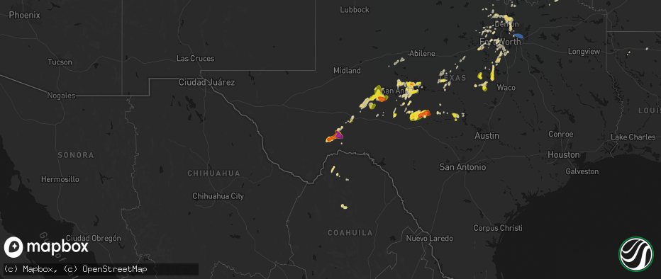
Hail Map on May 19, 2026
The weather event on May 19, 2026 includes Hail, Wind, and Tornado maps. 16 states and 514 cities were impacted and suffered possible damage. The total estimated number of properties impacted is 26,768.
Hail
Wind
Tornado
26,768
Estimated number of impacted properties by a 1.00" hail or larger594
Estimated number of impacted properties by a 1.75" hail or larger0
Estimated number of impacted properties by a 2.50" hail or largerStates Impacted by Hail Map on May 19, 2026
Storm reports
Texas
| Date | Description |
|---|---|
| 05/19/20266:53 PM CDT | Picture of quarter sized hail sent by em from between granger and jarrell. |
| 05/19/20266:47 PM CDT | Quarter sized hail reported in south mountain on hwy 84. |
| 05/19/20266:36 PM CDT | Media relayed tv viewers observing quarter sized hail in granger. |
| 05/19/20266:25 PM CDT | A local report indicates 1.25 inch wind near Mertzon |
| 05/19/20266:13 PM CDT | A local report indicates 1.00 inch wind near 1 ENE Mertzon |
| 05/19/20265:00 PM CDT | Member of the public sent a picture of approximately quarter-sized hail in big lake. |
| 05/19/20264:20 PM CDT | A local report indicates 1.00 inch wind near 12 NNW Barnhart |
| 05/19/20264:19 PM CDT | Brief tornado touchdown. |
| 05/19/20263:50 PM CDT | Trained spotter measured a 64 mph wind gust with a handheld anemometer. |
| 05/19/20263:30 PM CDT | A local report indicates 1.00 inch wind near 1 NNW Brownwood |
| 05/19/20261:00 PM CDT | A local report indicates 1.75 inch wind near 3 WSW Rowena |
| 05/19/202612:50 PM CDT | A local report indicates 1.25 inch wind near Miles |
| 05/19/20265:15 AM CDT | Awos station kras port aransas. |
| 05/19/20264:37 AM CDT | Asos station kcrp corpus christi. |
| 05/19/202612:00 AM CDT | Measured wind gusts of up to 55-60 miles per hour. Sustained winds of 20 miles per hour. Winds were measured on personal home weather station. Time estimated. |
| 05/18/202611:57 PM CDT | Metal roof panels torn from exxon gas station canopy with some deformation of the roof structure. Time estimated via radar with possible downburst signature. |
| 05/18/202611:16 PM CDT | Texas tech mesonet observed a 62 mph wind gusts 9 ssw of comfort. |
| 05/18/202611:16 PM CDT | Multiple trees down in center point on river road center point. In addition... On springs and southerland road. Time estimated on radar. |
| 05/18/202611:15 PM CDT | Awos station kerv kerrville muni arpt/louis schreiner field. |
| 05/18/202611:05 PM CDT | Hwy 16 and jefferson street in kerrville blocked by a downed tree. Time estimated on radar. |
| 05/18/202611:00 PM CDT | A local report indicates 64 MPH wind near 2 NNE Junction |
| 05/18/202610:50 PM CDT | Social media picture of estimated up to golfball size hail. |
| 05/18/202610:40 PM CDT | Social media picture; val verde estates. |
| 05/18/202610:24 PM CDT | Texas tech mesonet site at 6 w hunt. |
| 05/18/20269:51 PM CDT | Broadcast media reports tree down on fm 1004 northwest of buna. Time estimated by radar. |
| 05/18/20269:25 PM CDT | 74mph straight line winds measured on personal weather station and large tree branches down. |
| 05/18/20269:20 PM CDT | *** 1 inj *** thunderstorm winds caused a tree to fall on a man... Critically injuring him. |
| 05/18/20269:15 PM CDT | Photo received of medium to large downed branches near cr337 and cr124. Time estimated via radar. |
| 05/18/20269:12 PM CDT | Amateur radio report at sh 130 & i-35 under the sh 130 overpass near georgetown... Had street lights and several signs blown over. Raining completely horizontal... Abou |
| 05/18/20269:05 PM CDT | Power flashes in oak hill area of austin. 50 to 60 mph winds estimated by news media. |
| 05/18/20269:04 PM CDT | Metal roof panels mostly torn from service station canopy. Time estimated via radar. |
| 05/18/20269:00 PM CDT | Several calls for downed trees in the georgetown area. |
| 05/18/20268:51 PM CDT | Amateur radio network report of a 12 inch diameter tree snapped at stadium drive and north austin avenue in georgetown. |
| 05/18/20268:19 PM CDT | Quarter sized hail reported by trained spotter at andice. |
| 05/18/20268:05 PM CDT | Park manager of enchanted rock sna reported ping pong ball sized hail. |
| 05/18/20267:50 PM CDT | Ping pong sized hail relayed by em near enchanted rock state natural area. |
New Hampshire
| Date | Description |
|---|---|
| 05/19/20264:10 PM CDT | Davis pro weather station on south rd in rye recorded gust to 61 mph; branches and a few small trees downed across town. |
| 05/19/20264:10 PM CDT | Delayed report. Davis pro weather station on south rd in rye recorded gust to 61 mph; branches and a few small trees downed across town. |
| 05/19/20263:50 PM CDT | Delayed report. Trees and wires down off of wheel wright road. Tree down on parked car on kent farm road. |
Arkansas
| Date | Description |
|---|---|
| 05/19/20265:30 PM CDT | [landspout] video of brief landspout in open field near the shannondale community. No damage reported. |
| 05/19/20263:01 PM CDT | Emergency management received report of a tree on a vehicle on county rd 139 at the intersection of county rd 20. |
| 05/19/20262:40 PM CDT | Law enforcement received report of a tree falling on a house on south laurel street in hope. |
| 05/19/20269:45 AM CDT | Measured wind gusts 50 to 55 mph; large tree limbs downed. |
| 05/19/20268:07 AM CDT | Time estimated by radar; picture of large tree limb down sent in by the public and relayed by broadcast media. |
Michigan
| Date | Description |
|---|---|
| 05/19/20263:49 PM CDT | Report of a 20 to 30 ft tree down |
| 05/19/20263:48 PM CDT | A local report indicates 59 MPH wind near Monroe Custer Airport |
| 05/19/20263:23 PM CDT | Estimated 60 mph thunderstorm wind gust and pea size hail. |
| 05/19/20263:22 PM CDT | A few large tree limbs and wires reported down. |
| 05/19/20263:18 PM CDT | Report of dime to quarter size hail |
| 05/19/20262:50 PM CDT | Trees and wires reported down across portions of northern and northwest macomb county |
| 05/19/20262:39 PM CDT | Tree reported down... Along with large tree limbs. |
| 05/19/20262:07 PM CDT | Trees and wires reported down across portions of northern and northwest macomb county - corrected for time |
| 05/19/20262:04 PM CDT | Multiple trees down at stony creek metropark |
| 05/19/20261:55 PM CDT | Trees and wires reported down. |
| 05/19/20261:42 PM CDT | Large tree snapped. Large tree limbs also blown down... One crushing portions of a camper. |
| 05/19/20261:35 PM CDT | Large tree fell across elizabeth lake road just west of williams lake road. Numouers large limbs observed down in the vicinity of cooley lake and elizabeth lake roads. |
| 05/19/20261:35 PM CDT | Large tree fell across elizabeth lake road just west of williams lake road. |
| 05/19/20261:33 PM CDT | Observed downed tree and large tree limbs. |
| 05/19/20261:32 PM CDT | Several snapped trees at kensington metro park. |
West Virginia
| Date | Description |
|---|---|
| 05/19/20265:00 PM CDT | Tree limb went through roof of house and water pouring into house. |
New York
| Date | Description |
|---|---|
| 05/18/20268:15 PM CDT | Home weather station in hilton recorded a 51mph wind gust with several trees and power lines down in the neighborhood. |
| 05/18/20267:52 PM CDT | Tree down blocking traffic on ridge road. |
| 05/18/20267:47 PM CDT | Tree down in albion. |
| 05/18/20267:33 PM CDT | Trees and wires down in ridgeway. |
| 05/18/20267:32 PM CDT | Tree down in shelby. |
| 05/18/20267:30 PM CDT | Tree brought down lines on quaker road. |
| 05/18/20267:28 PM CDT | Tree and wires down near akron st. And davison rd. |
| 05/18/20267:27 PM CDT | Large tree down across north transit street. |
| 05/18/20267:27 PM CDT | Large tree and wires down on telegraph rd near vernon street. |
| 05/18/20267:22 PM CDT | Tree down on campbell blvd. |
| 05/18/20267:21 PM CDT | Tree down across jefferson dr. |
| 05/18/20267:20 PM CDT | Tree downed on thompson road between roll road and greiner road. |
| 05/18/20267:12 PM CDT | Tree fell down on wheatfield street... Partially blocking traffic. |
| 05/18/20267:08 PM CDT | Tree and several wires down on upper mountain road. |
| 05/18/20267:05 PM CDT | Large tree branch downed several lines at oneida st. And rudlen road. |
Missouri
| Date | Description |
|---|---|
| 05/19/20268:00 AM CDT | A few reports of trees down in mcdonald county from the storms this morning. Time was estimated via radar. One report was near southwest city on state highway pp... One |
Ohio
| Date | Description |
|---|---|
| 05/19/20266:37 PM CDT | Trees down. |
| 05/19/20266:21 PM CDT | 2 foot diameter branches down. |
| 05/19/20266:13 PM CDT | Gust recorded on weather station. Noted downed tree limbs onto powerlines. |
| 05/19/20265:58 PM CDT | Gust recorded on weather station. Also noted tree and minor shingle damage. |
| 05/19/20265:57 PM CDT | Trees down at ziegler and versailles roads. Photos posted. Time estimated from radar. |
| 05/19/20265:57 PM CDT | Very large tree down on brunson lane. |
| 05/19/20265:55 PM CDT | Erie county 911 dispatch reported several tree limbs down in perkins township. |
| 05/19/20265:55 PM CDT | Tree down on greenlee road. Photo posted. Time estimated by radar. |
| 05/19/20265:39 PM CDT | Tree fell on 2 trailers. |
| 05/19/20265:32 PM CDT | Metal roof damage. Photos posted. Time estimated by radar. |
| 05/19/20265:25 PM CDT | Tree down... Cr 170 and 119. |
| 05/19/20265:23 PM CDT | Numerous trees and power lines down in southwest corner of darke county... All south of us-36. Time estimated from radar. |
| 05/19/20265:20 PM CDT | Hancock county 911 dispatch reported a downed tree limb in arcadia. |
| 05/19/20265:18 PM CDT | A large tree branch fell onto a large propane tank... Causing a propane leak. |
| 05/19/20265:10 PM CDT | Picture shared on facebook by wlio of a large... Partially rotten tree snapped into a yard at shawnee rd and dogwood drive. |
| 05/19/20265:04 PM CDT | Tree limb down on house. Another tree down as well. |
| 05/19/20264:45 PM CDT | Wood county 911 dispatch reported 2 downed trees in pemberville. |
| 05/19/20264:44 PM CDT | Report of tree limbs down onto power lines in glandorf. |
| 05/19/20264:41 PM CDT | Power poles down west and northwest of ottoville. |
| 05/19/20264:30 PM CDT | Large tree downed near washington and henry street. Time estimated from radar. |
| 05/19/20264:23 PM CDT | Large trees downed onto a house. |
| 05/19/20264:21 PM CDT | Large tree limb downed near wolfecale and dull robinson road. |
| 05/19/20264:10 PM CDT | Damage to aluminum roofing at a manufacturing building. Time estimated from radar. |
| 05/19/20264:10 PM CDT | Delayed report of large tree limbs downed at a residence. Time estimated from radar. |
| 05/19/20263:57 PM CDT | Tree downed on state route 613. |
| 05/19/20263:40 PM CDT | Power lines down. |
| 05/19/20263:31 PM CDT | A couple utility poles were snapped in jackson. Time is estimated from radar. |
| 05/19/20263:27 PM CDT | Corrects previous tstm wnd dmg report from 3 wsw jackson. Several trees down in the area. Time is estimated from radar. |
| 05/19/20263:27 PM CDT | Several trees down in the area. |
| 05/18/20268:54 PM CDT | One tree down. |
| 05/18/20268:30 PM CDT | One tree down. |
| 05/18/20267:45 PM CDT | Tree limbs down and minor shed damage. Time estimated from radar. |
| 05/18/20267:33 PM CDT | Large tree downed across mineola ave near sunset view dr. Time estimated via radar. |
| 05/18/20267:31 PM CDT | 2 foot diameter limbs down. Fence down. |
| 05/18/20267:31 PM CDT | Power lines down between jamestown and shawnee hills. Time estimated from radar. |
| 05/18/20267:29 PM CDT | Around 20 trees were downed across the city of delaware... Blocking multiple streets. |
| 05/18/20267:21 PM CDT | Tree downed across south charleston road south of paullin road. Video evidence from area residents indicate a gustnado crossed west-to-east across south charleston road |
| 05/18/20267:21 PM CDT | Tree down on galloway street. Photo posted. Time estimated from radar. |
| 05/18/20267:18 PM CDT | Tree down on us-68. |
| 05/18/20267:13 PM CDT | Top 20 feet of a very large tree down. |
| 05/18/20267:13 PM CDT | Tree down on upper bellbrook road and shepherd road. Time estimated from radar. |
| 05/18/20267:07 PM CDT | Large healthy tree down. Time estimated from radar. |
| 05/18/20267:02 PM CDT | Trees down across roadways as well as on power lines... At east church st and merchant ave. |
Indiana
| Date | Description |
|---|---|
| 05/19/20265:52 PM CDT | Tree down on power line. Time estimated from radar. |
| 05/19/20265:44 PM CDT | Leaning and snapped utility poles from photos on social media. |
| 05/19/20265:07 PM CDT | Trees down in richmond. Time estimated from radar. |
| 05/19/20265:05 PM CDT | Photo posted on social media. |
| 05/19/20265:02 PM CDT | Trees down in centerville. Time estimated from radar. |
| 05/19/20264:45 PM CDT | A local report indicates 60 MPH wind near 2 SW Clifford |
| 05/19/20264:33 PM CDT | Reports of blown over semi on i69 at mile marker 249 southbound lanes. Time estimated from radar. |
| 05/19/20264:16 PM CDT | Utility pole is leaning from thunderstorm winds at olio road and sr38 in noblesville. |
| 05/19/20264:14 PM CDT | Tree blown down by thunderstorm winds. |
| 05/19/20264:11 PM CDT | Tree across roadway on quarry court in fishers. Time roughly estimated from radar. |
| 05/19/20263:56 PM CDT | Corrects the time on the previous tstm wnd dmg report from 5 wsw lapel. Utility pole is leaning from thunderstorm winds at olio road and sr38 in noblesville. Time has b |
| 05/19/20263:56 PM CDT | Tree fell on house and through the roof. North 11th street in noblesville. Time has been estimated from radar. |
| 05/19/20263:54 PM CDT | Downed utility lines on westfield blvd. Time is estimated from radar. |
| 05/19/20263:52 PM CDT | Utility lines were blown down by thunderstorm winds. Time estimated from radar. |
| 05/19/20263:40 PM CDT | Tree downed in gas city on south 5th street. Time estimated from radar. |
| 05/19/20263:39 PM CDT | Broadcast media relayed photos from a viewer in jonesboro of numerous large branches broken and a trampoline in the trees. Time estimated by radar. |
| 05/19/20263:32 PM CDT | A tree was blown down across a road by thunderstorm winds near the intersection of south county road 525 west and west county road 150 south southwest of danville. Time |
| 05/19/20263:11 PM CDT | A couple smaller trees and one large tree were blown down by thunderstorm winds. Time is estimated from radar. |
| 05/19/20262:57 PM CDT | Utility lines down. Time roughly estimated from radar. |
Louisiana
| Date | Description |
|---|---|
| 05/19/20265:30 PM CDT | Several trees down. |
| 05/18/202610:38 PM CDT | Photo of broken power poles. Time estimated by radar. |
| 05/18/202610:33 PM CDT | Photos received of a downed tree. Time estimated by radar. |
| 05/18/202610:22 PM CDT | Report of shingles blown off of a house near the national golf course. Time estimated by radar. |
| 05/18/202610:20 PM CDT | Photos of displaced and blown over outdoor furniture in westlake. Time estimated by radar. |
Kentucky
| Date | Description |
|---|---|
| 05/19/20266:32 PM CDT | Power lines down on jackson road. |
| 05/19/20266:20 PM CDT | Trees down blocking roadways within the area. |
| 05/19/20266:05 PM CDT | Whitley county 911 dispatch reported a down tree 1 mile north from the intersection of hightop road and us 25w on hightop road . Time estimated from radar. |
| 05/19/20265:50 PM CDT | Whitley county 911 center reported a tree down at the intersection of bee creek road and southwood estates. Time estimated from radar. |
| 05/19/20265:41 PM CDT | Photos via social media showed utility poles leaning along preston hwy. This resulting in power outages. |
| 05/19/20265:41 PM CDT | Tree down blocking the roadway. |
| 05/19/20265:14 PM CDT | Multiple trees down and blocking the road near the 300 block of woods pike road. |
| 05/19/20265:02 PM CDT | Tree down on power line on fairview court. |
| 05/19/20263:56 PM CDT | Reported on herbert road in herbert. |
| 05/19/20263:45 PM CDT | Tree down blocking roadway on s 6th street. |
| 05/19/20263:45 PM CDT | Several trees down blocking the road on rose island road. |
Massachusetts
| Date | Description |
|---|---|
| 05/19/20265:25 PM CDT | In norfolk... Wires were down on cleveland st. Relayed by amateur radio. |
| 05/19/20265:24 PM CDT | In milton... A tree was down on a car on ford ranch rd. |
| 05/19/20265:15 PM CDT | In needham on great plain avenue near the golf course a large tree branch was reported down. Relayed by amateur radio. |
| 05/19/20265:05 PM CDT | In sutton... A tree was down on wires causing them to catch on fire. |
| 05/19/20265:00 PM CDT | In northborough on west street trees and wires were reported down. Relayed by amateur radio. |
| 05/19/20265:00 PM CDT | In oxford trees and wires were reported down in multiple locations. Relayed by amateur radio. |
| 05/19/20265:00 PM CDT | Corrects previous tstm wnd dmg report from oxford. In oxford trees and wires were reported down in multiple locations including on cars. Relayed by amateur radio. |
| 05/19/20264:45 PM CDT | In paxton... Trees and wires were down on multiple streets including holbrook ln and west st. |
| 05/19/20264:40 PM CDT | Near worcester a part of a rubber roof on amory building blew off. Relayed by amateur radio. |
| 05/19/20264:34 PM CDT | Peak gust of 59 kts or 68 mph reported at worcester airport. |
| 05/19/20264:32 PM CDT | In hudson... A tree and wires were down on bertha st. Relayed by amateur radio. |
| 05/19/20264:28 PM CDT | *** 2 inj *** in concord a tree was reported down on a car. 2 minor injuries reported. Relayed by amateur radio. |
| 05/19/20264:26 PM CDT | In sudbury... A tree was down blocking half the road on hudson rd. |
| 05/19/20264:24 PM CDT | Near maynard tree reported down on sudbury road. Relayed by amateur radio. |
| 05/19/20264:20 PM CDT | Corrects previous tstm wnd dmg report from leicester. In leicester a large tree was reported down. |
| 05/19/20264:17 PM CDT | In lancaster tree and wires were reported down near havard road. Relayed by amateur radio. |
| 05/19/20264:15 PM CDT | In leicester a large tree was reported down. |
| 05/19/20264:11 PM CDT | In belchertown... A large tree and wires were down on michael sears rd and north liberty st. |
Connecticut
| Date | Description |
|---|---|
| 05/19/20264:58 PM CDT | In killingly... There was a tree and wires down on valley rd. Relayed by amateur radio. |
| 05/19/20264:35 PM CDT | In willington... A tree was down. Relayed by amateur radio. |
| 05/19/20264:30 PM CDT | In vernon... A tree and power lines were down. Relayed by amateur radio. |
| 05/19/20263:50 PM CDT | In burlington tree and wires reported down on johnnycake mountain road. Relayed by amateur radio. |
| 05/19/20263:50 PM CDT | In burlington tree and wires reported down on johnnycake mountain road. Relayed by amateur radio. |
Virginia
| Date | Description |
|---|---|
| 05/19/20261:50 PM CDT | Several large tree limbs blew down along va-42 senedo road from va-263 orkney grade to the 10000 block. |
Cities Impacted by Hail Map on May 19, 2026
- Afton, OK
- Tahlequah, OK
- Proctor, OK
- Eucha, OK
- Siloam Springs, AR
- Gentry, AR
- Checotah, OK
- Hulbert, OK
- Stigler, OK
- Eufaula, OK
- Decatur, AR
- Gravette, AR
- Porum, OK
- Indianola, OK
- Merkel, TX
- Heavener, OK
- Maryneal, TX
- Roscoe, TX
- Whitesboro, TX
- Gainesville, TX
- Sweetwater, TX
- Sadler, TX
- Bowie, TX
- Walnut Springs, TX
- Marietta, OK
- Saint Jo, TX
- Alvord, TX
- Sunset, TX
- Blackwell, TX
- Nolan, TX
- Perrin, TX
- Forestburg, TX
- Bridgeport, TX
- Weatherford, TX
- Poolville, TX
- Decatur, TX
- Powderly, TX
- Paris, TX
- Springtown, TX
- San Angelo, TX
- Miles, TX
- Arthur City, TX
- Grant, OK
- Krum, TX
- Sanger, TX
- Paradise, TX
- Hugo, OK
- Fort Towson, OK
- Millersview, TX
- Rowena, TX
- Boyd, TX
- Ballinger, TX
- Paint Rock, TX
- Comanche, TX
- De Leon, TX
- Pinckney, MI
- Rhome, TX
- Era, TX
- Brighton, MI
- Aubrey, TX
- Valley View, TX
- Denton, TX
- Whitmore Lake, MI
- Hamburg, MI
- Azle, TX
- Pilot Point, TX
- Robert Lee, TX
- Bronte, TX
- Lipan, TX
- Brookston, TX
- Sumner, TX
- Gorman, TX
- Dublin, TX
- Desdemona, TX
- Milford, MI
- New Hudson, MI
- South Lyon, MI
- Fort Worth, TX
- Newark, TX
- Stephenville, TX
- Little Elm, TX
- Mereta, TX
- Lake Dallas, TX
- Lewisville, TX
- Clay, KY
- Washington, MI
- Fredonia, KY
- Wall, TX
- Eola, TX
- Dixon, KY
- Marion, KY
- Aledo, TX
- Brownwood, TX
- Ray, MI
- Macomb, MI
- Utica, MI
- Providence, KY
- Naval Air Station Jrb, TX
- The Colony, TX
- Sebree, KY
- Morganfield, KY
- Grapevine, TX
- Slaughters, KY
- Benton, KY
- Almo, KY
- May, TX
- Cresson, TX
- Sidney, TX
- Hardinsburg, KY
- Vancourt, TX
- Hardin, KY
- Crowley, TX
- Flower Mound, TX
- Santa Anna, TX
- Swayzee, IN
- Livonia, MI
- Redford, MI
- Bangs, TX
- Windfall, IN
- Greentown, IN
- Utica, KY
- Canton, MI
- Ypsilanti, MI
- Plymouth, MI
- Burleson, TX
- Southfield, MI
- Dallas, TX
- Joshua, TX
- Marion, IN
- Jackson, OH
- Rockport, IN
- Cleburne, TX
- Rio Vista, TX
- Boonville, IN
- Chrisney, IN
- Fairmount, IN
- Pleasant Ridge, MI
- Ferndale, MI
- Oak Park, MI
- Detroit, MI
- Beaver, OH
- Fraser, MI
- Warren, MI
- Sterling Heights, MI
- Madison Heights, MI
- Clinton Township, MI
- Saint Clair Shores, MI
- Harrison Township, MI
- Center Line, MI
- Roseville, MI
- Westland, MI
- Dearborn Heights, MI
- Garden City, MI
- Dearborn, MI
- Coatesville, IN
- Avon, IN
- Danville, IN
- Clayton, IN
- Amo, IN
- Mertzon, TX
- Sterling City, TX
- Hazel Park, MI
- Royal Oak, MI
- Philpot, KY
- Whitesville, KY
- Kopperl, TX
- Early, TX
- Godley, TX
- Irving, TX
- Mount Clemens, MI
- Mansfield, TX
- Calhoun, KY
- Island, KY
- Richland, IN
- Carrollton, TX
- Paducah, KY
- Eldorado, TX
- Ferdinand, IN
- Saint Meinrad, IN
- Bremen, KY
- Calvert City, KY
- Altamont, TN
- Morrison, TN
- Evanston, IN
- Lamar, IN
- Reynolds Station, KY
- Morgan, TX
- Alvarado, TX
- Keene, TX
- Meridian, TX
- Boaz, KY
- Hamtramck, MI
- Highland Park, MI
- Christoval, TX
- Rector, AR
- Kennedale, TX
- Addison, TX
- Richardson, TX
- Garland, TX
- The Plains, VA
- Monroe, MI
- Symsonia, KY
- Bristow, IN
- Birdseye, IN
- North Vernon, IN
- Commiskey, IN
- Osceola, AR
- Ware, MA
- Gilbertville, MA
- Brookesmith, TX
- Blum, TX
- Central City, KY
- New Bavaria, OH
- Zephyr, TX
- Defiance, OH
- Paulding, OH
- Oakwood, OH
- Brookport, IL
- Holgate, OH
- Barnhart, TX
- West Brookfield, MA
- Menard, TX
- Spencer, MA
- North Brookfield, MA
- New Braintree, MA
- Centertown, KY
- Somerset, KY
- Grandview, TX
- Lillian, TX
- Venus, TX
- Rochelle, TX
- Harper Woods, MI
- Grosse Pointe, MI
- Dryden, TX
- Mesquite, TX
- Fort Jennings, OH
- Ottoville, OH
- Delphos, OH
- Eden, TX
- Oldsmar, FL
- Tampa, FL
- La Grange, KY
- Crestwood, KY
- Smithfield, KY
- Keiser, AR
- Midlothian, TX
- Fort McKavett, TX
- Big Lake, TX
- Sherman, TX
- Palm Harbor, FL
- Tarpon Springs, FL
- Clifton, TX
- Connersville, IN
- Milton, IN
- Iredell, TX
- Clifford, IN
- Columbus, IN
- Medora, IN
- Ringgold, LA
- Heflin, LA
- Hico, TX
- Ozona, TX
- Junction, TX
- Centerville, IN
- Eminence, KY
- Shelbyville, KY
- Union City, TN
- Iraan, TX
- Odessa, FL
- Hamilton, TX
- Brady, TX
- Simsboro, LA
- Pleasureville, KY
- Marianna, AR
- Sheffield, TX
- Valley Mills, TX
- Fort Stockton, TX
- New Port Richey, FL
- Tishomingo, OK
- Jonesboro, TX
- Llano, TX
- Marathon, TX
- Norman, IN
- Hext, TX
- Pontotoc, TX
- Mason, TX
- Corbin, KY
- Pickens, AR
- Dumas, AR
- Gatesville, TX
- Ruston, LA
- Williamsburg, KY
- Valley Spring, TX
- Louisville, KY
- Tow, TX
- Bluffton, TX
- Buchanan Dam, TX
- Hickory, KY
- Mayfield, KY
- Lake Village, AR
- Simpsonville, KY
- Petersburg, IN
- Bicknell, IN
- Wheatland, IN
- Fisherville, KY
- Granger, TX
- Bertram, TX
- Burnet, TX
- Vincennes, IN
- Bruceville, IN
- Plainville, IN
- Washington, IN
- Ragsdale, IN
- Sonora, TX
- Huntsville, TX
- Liberty Hill, TX
- Taylorsville, KY
- Florence, TX
- Lampasas, TX
- New Castle, KY
- Sulphur, KY
- London, TX
- Campbellsburg, KY
- Turners Station, KY
- Oglesby, TX
- Tupelo, OK
- New Waverly, TX
- Briggs, TX
- Bartlett, TX
- Jarrell, TX
- Allen, OK
- Sanders, KY
- Ghent, KY
- Holland, TX
- Salado, TX
- Kingsland, TX
- Florence, IN
- Warsaw, KY
- Vevay, IN
- Rising Sun, IN
- Marengo, OH
- Ashley, OH
- Temple, TX
- Cardington, OH
- Art, TX
- Willis, TX
- Sunbury, OH
- Fredericksburg, TX
- Galena, OH
- Belton, TX
- Lott, TX
- Troy, TX
- Durant, MS
- Georgetown, TX
- Marble Falls, TX
- Willow City, TX
- Doss, TX
- Round Mountain, TX
- Johnson City, TX
- Del Rio, TX
- Rocksprings, TX
- Rosebud, TX
- Spicewood, TX
- Monroe City, IN
- Leander, TX
- Montgomery, TX
- Kittery Point, ME
- Rye, NH
- Austin, TX
- Dripping Springs, TX
- Cedar Park, TX
- Driftwood, TX
- Boerne, TX
- Blanco, TX
- Stonewall, TX
- Hutto, TX
- Round Rock, TX
- Wimberley, TX
- Buda, TX
- Hunt, TX
- Taylor, TX
- Pflugerville, TX
- Lake Charles, LA
- Dequincy, LA
- Sulphur, LA
- Vinton, LA
- Leakey, TX
- Coupland, TX
- Manor, TX
- Westlake, LA
- Mountain Home, TX
- Buckholts, TX
- Thorndale, TX
- Brackettville, TX
- Barksdale, TX
- Thrall, TX
- Rockdale, TX
- Elgin, TX
- Vanderpool, TX
- Medina, TX
- Ingram, TX
- Manchaca, TX
- Kyle, TX
- Harper, TX
- Utopia, TX
- Uvalde, TX
- Lexington, TX
- Kerrville, TX
- McDade, TX
- Bastrop, TX
- Kinder, LA
- Ragley, LA
- Reeves, LA
- Iowa, LA
- Laughlin Afb, TX
- Lincoln, TX
- Dime Box, TX
- Giddings, TX
- Welsh, LA
- Ledbetter, TX
- Pipe Creek, TX
- Bandera, TX
- Center Point, TX
- Comfort, TX
- San Antonio, TX
- Mico, TX
- Helotes, TX
- Carmine, TX
- Quemado, TX
- Fayetteville, TX
- Bulverde, TX
- Spring Branch, TX
- New Braunfels, TX
- Bergheim, TX
- Kendalia, TX
- Batesville, TX
- Crystal City, TX
- Bedford, IN
- Grandview, IN
- Three Rivers, TX
- Kenedy, TX
- Goliad, TX
- Beeville, TX
- Runge, TX
- Karnes City, TX
- George West, TX
- Mathis, TX
- Skidmore, TX
- Sandia, TX
- Tynan, TX
- Sinton, TX
- Woodsboro, TX
- Refugio, TX
- Orange Grove, TX
- Robstown, TX
- Laredo, TX
- Odem, TX
- Corpus Christi, TX
- Taft, TX
- Portland, TX
- Gregory, TX
- Bayside, TX
- Aransas Pass, TX
- Rockport, TX
- Bishop, TX
- Kingsville, TX
- Fulton, TX
- Ingleside, TX
- Port Aransas, TX
- Sarita, TX
- Riviera, TX
- Armstrong, TX
- Grove City, OH
- Columbus, OH
- Galloway, OH
- Raymondville, TX
- San Perlita, TX
- Lyford, TX
- Port Mansfield, TX
- Blacklick, OH
- Rio Hondo, TX
- Sebastian, TX
- Los Fresnos, TX
- San Benito, TX
- Del Valle, TX
- Paige, TX
- La Grange, TX
- Smithville, TX
- Round Top, TX
- Port Isabel, TX
- Brownsville, TX
- South Padre Island, TX
- North Grafton, MA
- Leicester, MA
- Worcester, MA
- Holden, MA
- Shrewsbury, MA
- Westborough, MA
- Paxton, MA
- Castalia, OH
- Fremont, OH
- Oak Harbor, OH
- Vickery, OH
- Huron, OH
- Sandusky, OH
- Lakeside Marblehead, OH
- Port Clinton, OH
- Amherst, OH
- Vermilion, OH
- Oberlin, OH
- Milan, OH
- Berlin Heights, OH
- Collins, OH
- Wakeman, OH