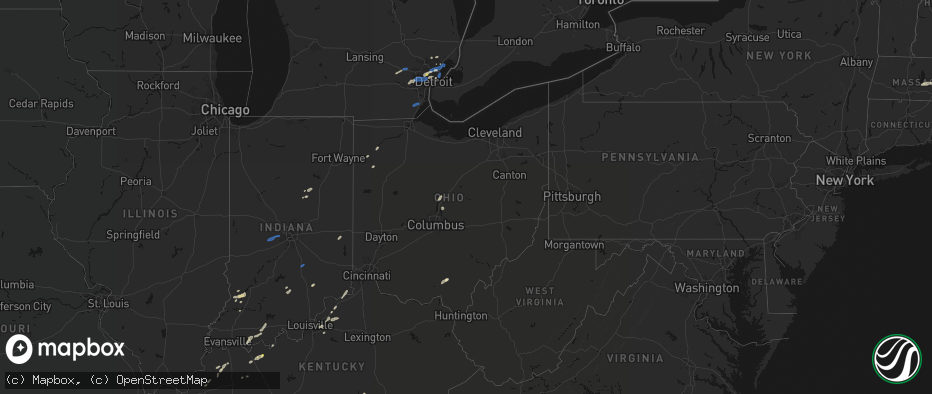
Hail Map in Ohio on May 19, 2026
The weather event in Ohio on May 19, 2026 includes Hail, Wind, and Tornado maps. 16 states and 514 cities were impacted and suffered possible damage. The total estimated number of properties impacted is 0.
Hail
Wind
Tornado
0
Estimated number of impacted properties by a 1.00" hail or larger0
Estimated number of impacted properties by a 1.75" hail or larger0
Estimated number of impacted properties by a 2.50" hail or largerStorm reports in Ohio
Ohio
| Date | Description |
|---|---|
| 05/19/20266:37 PM CDT | Trees down. |
| 05/19/20266:21 PM CDT | 2 foot diameter branches down. |
| 05/19/20266:13 PM CDT | Gust recorded on weather station. Noted downed tree limbs onto powerlines. |
| 05/19/20265:58 PM CDT | Gust recorded on weather station. Also noted tree and minor shingle damage. |
| 05/19/20265:57 PM CDT | Very large tree down on brunson lane. |
| 05/19/20265:57 PM CDT | Trees down at ziegler and versailles roads. Photos posted. Time estimated from radar. |
| 05/19/20265:55 PM CDT | Tree down on greenlee road. Photo posted. Time estimated by radar. |
| 05/19/20265:55 PM CDT | Erie county 911 dispatch reported several tree limbs down in perkins township. |
| 05/19/20265:39 PM CDT | Tree fell on 2 trailers. |
| 05/19/20265:32 PM CDT | Metal roof damage. Photos posted. Time estimated by radar. |
| 05/19/20265:25 PM CDT | Tree down... Cr 170 and 119. |
| 05/19/20265:23 PM CDT | Numerous trees and power lines down in southwest corner of darke county... All south of us-36. Time estimated from radar. |
| 05/19/20265:20 PM CDT | Hancock county 911 dispatch reported a downed tree limb in arcadia. |
| 05/19/20265:18 PM CDT | A large tree branch fell onto a large propane tank... Causing a propane leak. |
| 05/19/20265:10 PM CDT | Picture shared on facebook by wlio of a large... Partially rotten tree snapped into a yard at shawnee rd and dogwood drive. |
| 05/19/20265:04 PM CDT | Tree limb down on house. Another tree down as well. |
| 05/19/20264:45 PM CDT | Wood county 911 dispatch reported 2 downed trees in pemberville. |
| 05/19/20264:44 PM CDT | Report of tree limbs down onto power lines in glandorf. |
| 05/19/20264:41 PM CDT | Power poles down west and northwest of ottoville. |
| 05/19/20264:30 PM CDT | Large tree downed near washington and henry street. Time estimated from radar. |
| 05/19/20264:23 PM CDT | Large trees downed onto a house. |
| 05/19/20264:21 PM CDT | Large tree limb downed near wolfecale and dull robinson road. |
| 05/19/20264:10 PM CDT | Delayed report of large tree limbs downed at a residence. Time estimated from radar. |
| 05/19/20264:10 PM CDT | Damage to aluminum roofing at a manufacturing building. Time estimated from radar. |
| 05/19/20263:57 PM CDT | Tree downed on state route 613. |
| 05/19/20263:40 PM CDT | Power lines down. |
| 05/19/20263:31 PM CDT | A couple utility poles were snapped in jackson. Time is estimated from radar. |
| 05/19/20263:27 PM CDT | Several trees down in the area. |
| 05/19/20263:27 PM CDT | Corrects previous tstm wnd dmg report from 3 wsw jackson. Several trees down in the area. Time is estimated from radar. |
| 05/18/20268:54 PM CDT | One tree down. |
| 05/18/20268:30 PM CDT | One tree down. |
| 05/18/20267:45 PM CDT | Tree limbs down and minor shed damage. Time estimated from radar. |
| 05/18/20267:33 PM CDT | Large tree downed across mineola ave near sunset view dr. Time estimated via radar. |
| 05/18/20267:31 PM CDT | 2 foot diameter limbs down. Fence down. |
| 05/18/20267:31 PM CDT | Power lines down between jamestown and shawnee hills. Time estimated from radar. |
| 05/18/20267:29 PM CDT | Around 20 trees were downed across the city of delaware... Blocking multiple streets. |
| 05/18/20267:21 PM CDT | Tree downed across south charleston road south of paullin road. Video evidence from area residents indicate a gustnado crossed west-to-east across south charleston road |
| 05/18/20267:21 PM CDT | Tree down on galloway street. Photo posted. Time estimated from radar. |
| 05/18/20267:18 PM CDT | Tree down on us-68. |
| 05/18/20267:13 PM CDT | Top 20 feet of a very large tree down. |
| 05/18/20267:13 PM CDT | Tree down on upper bellbrook road and shepherd road. Time estimated from radar. |
| 05/18/20267:07 PM CDT | Large healthy tree down. Time estimated from radar. |
| 05/18/20267:02 PM CDT | Trees down across roadways as well as on power lines... At east church st and merchant ave. |
All States Impacted by Hail Map on May 19, 2026
Cities Impacted by Hail Map on May 19, 2026
- Afton, OK
- Tahlequah, OK
- Proctor, OK
- Eucha, OK
- Siloam Springs, AR
- Gentry, AR
- Checotah, OK
- Hulbert, OK
- Stigler, OK
- Eufaula, OK
- Decatur, AR
- Gravette, AR
- Porum, OK
- Indianola, OK
- Merkel, TX
- Heavener, OK
- Maryneal, TX
- Roscoe, TX
- Whitesboro, TX
- Gainesville, TX
- Sweetwater, TX
- Sadler, TX
- Bowie, TX
- Walnut Springs, TX
- Marietta, OK
- Saint Jo, TX
- Alvord, TX
- Sunset, TX
- Blackwell, TX
- Nolan, TX
- Perrin, TX
- Forestburg, TX
- Bridgeport, TX
- Weatherford, TX
- Poolville, TX
- Decatur, TX
- Powderly, TX
- Paris, TX
- Springtown, TX
- San Angelo, TX
- Miles, TX
- Arthur City, TX
- Grant, OK
- Krum, TX
- Sanger, TX
- Paradise, TX
- Hugo, OK
- Fort Towson, OK
- Millersview, TX
- Rowena, TX
- Boyd, TX
- Ballinger, TX
- Paint Rock, TX
- Comanche, TX
- De Leon, TX
- Pinckney, MI
- Rhome, TX
- Era, TX
- Brighton, MI
- Aubrey, TX
- Valley View, TX
- Denton, TX
- Whitmore Lake, MI
- Hamburg, MI
- Azle, TX
- Pilot Point, TX
- Robert Lee, TX
- Bronte, TX
- Lipan, TX
- Brookston, TX
- Sumner, TX
- Gorman, TX
- Dublin, TX
- Desdemona, TX
- Milford, MI
- New Hudson, MI
- South Lyon, MI
- Fort Worth, TX
- Newark, TX
- Stephenville, TX
- Little Elm, TX
- Mereta, TX
- Lake Dallas, TX
- Lewisville, TX
- Clay, KY
- Washington, MI
- Fredonia, KY
- Wall, TX
- Eola, TX
- Dixon, KY
- Marion, KY
- Aledo, TX
- Brownwood, TX
- Ray, MI
- Macomb, MI
- Utica, MI
- Providence, KY
- Naval Air Station Jrb, TX
- The Colony, TX
- Sebree, KY
- Morganfield, KY
- Grapevine, TX
- Slaughters, KY
- Benton, KY
- Almo, KY
- May, TX
- Cresson, TX
- Sidney, TX
- Hardinsburg, KY
- Vancourt, TX
- Hardin, KY
- Crowley, TX
- Flower Mound, TX
- Santa Anna, TX
- Swayzee, IN
- Livonia, MI
- Redford, MI
- Bangs, TX
- Windfall, IN
- Greentown, IN
- Utica, KY
- Canton, MI
- Ypsilanti, MI
- Plymouth, MI
- Burleson, TX
- Southfield, MI
- Dallas, TX
- Joshua, TX
- Marion, IN
- Jackson, OH
- Rockport, IN
- Cleburne, TX
- Rio Vista, TX
- Boonville, IN
- Chrisney, IN
- Fairmount, IN
- Pleasant Ridge, MI
- Ferndale, MI
- Oak Park, MI
- Detroit, MI
- Beaver, OH
- Fraser, MI
- Warren, MI
- Sterling Heights, MI
- Madison Heights, MI
- Clinton Township, MI
- Saint Clair Shores, MI
- Harrison Township, MI
- Center Line, MI
- Roseville, MI
- Westland, MI
- Dearborn Heights, MI
- Garden City, MI
- Dearborn, MI
- Coatesville, IN
- Avon, IN
- Danville, IN
- Clayton, IN
- Amo, IN
- Mertzon, TX
- Sterling City, TX
- Hazel Park, MI
- Royal Oak, MI
- Philpot, KY
- Whitesville, KY
- Kopperl, TX
- Early, TX
- Godley, TX
- Irving, TX
- Mount Clemens, MI
- Mansfield, TX
- Calhoun, KY
- Island, KY
- Richland, IN
- Carrollton, TX
- Paducah, KY
- Eldorado, TX
- Ferdinand, IN
- Saint Meinrad, IN
- Bremen, KY
- Calvert City, KY
- Altamont, TN
- Morrison, TN
- Evanston, IN
- Lamar, IN
- Reynolds Station, KY
- Morgan, TX
- Alvarado, TX
- Keene, TX
- Meridian, TX
- Boaz, KY
- Hamtramck, MI
- Highland Park, MI
- Christoval, TX
- Rector, AR
- Kennedale, TX
- Addison, TX
- Richardson, TX
- Garland, TX
- The Plains, VA
- Monroe, MI
- Symsonia, KY
- Bristow, IN
- Birdseye, IN
- North Vernon, IN
- Commiskey, IN
- Osceola, AR
- Ware, MA
- Gilbertville, MA
- Brookesmith, TX
- Blum, TX
- Central City, KY
- New Bavaria, OH
- Zephyr, TX
- Defiance, OH
- Paulding, OH
- Oakwood, OH
- Brookport, IL
- Holgate, OH
- Barnhart, TX
- West Brookfield, MA
- Menard, TX
- Spencer, MA
- North Brookfield, MA
- New Braintree, MA
- Centertown, KY
- Somerset, KY
- Grandview, TX
- Lillian, TX
- Venus, TX
- Rochelle, TX
- Harper Woods, MI
- Grosse Pointe, MI
- Dryden, TX
- Mesquite, TX
- Fort Jennings, OH
- Ottoville, OH
- Delphos, OH
- Eden, TX
- Oldsmar, FL
- Tampa, FL
- La Grange, KY
- Crestwood, KY
- Smithfield, KY
- Keiser, AR
- Midlothian, TX
- Fort McKavett, TX
- Big Lake, TX
- Sherman, TX
- Palm Harbor, FL
- Tarpon Springs, FL
- Clifton, TX
- Connersville, IN
- Milton, IN
- Iredell, TX
- Clifford, IN
- Columbus, IN
- Medora, IN
- Ringgold, LA
- Heflin, LA
- Hico, TX
- Ozona, TX
- Junction, TX
- Centerville, IN
- Eminence, KY
- Shelbyville, KY
- Union City, TN
- Iraan, TX
- Odessa, FL
- Hamilton, TX
- Brady, TX
- Simsboro, LA
- Pleasureville, KY
- Marianna, AR
- Sheffield, TX
- Valley Mills, TX
- Fort Stockton, TX
- New Port Richey, FL
- Tishomingo, OK
- Jonesboro, TX
- Llano, TX
- Marathon, TX
- Norman, IN
- Hext, TX
- Pontotoc, TX
- Mason, TX
- Corbin, KY
- Pickens, AR
- Dumas, AR
- Gatesville, TX
- Ruston, LA
- Williamsburg, KY
- Valley Spring, TX
- Louisville, KY
- Tow, TX
- Bluffton, TX
- Buchanan Dam, TX
- Hickory, KY
- Mayfield, KY
- Lake Village, AR
- Simpsonville, KY
- Petersburg, IN
- Bicknell, IN
- Wheatland, IN
- Fisherville, KY
- Granger, TX
- Bertram, TX
- Burnet, TX
- Vincennes, IN
- Bruceville, IN
- Plainville, IN
- Washington, IN
- Ragsdale, IN
- Sonora, TX
- Huntsville, TX
- Liberty Hill, TX
- Taylorsville, KY
- Florence, TX
- Lampasas, TX
- New Castle, KY
- Sulphur, KY
- London, TX
- Campbellsburg, KY
- Turners Station, KY
- Oglesby, TX
- Tupelo, OK
- New Waverly, TX
- Briggs, TX
- Bartlett, TX
- Jarrell, TX
- Allen, OK
- Sanders, KY
- Ghent, KY
- Holland, TX
- Salado, TX
- Kingsland, TX
- Florence, IN
- Warsaw, KY
- Vevay, IN
- Rising Sun, IN
- Marengo, OH
- Ashley, OH
- Temple, TX
- Cardington, OH
- Art, TX
- Willis, TX
- Sunbury, OH
- Fredericksburg, TX
- Galena, OH
- Belton, TX
- Lott, TX
- Troy, TX
- Durant, MS
- Georgetown, TX
- Marble Falls, TX
- Willow City, TX
- Doss, TX
- Round Mountain, TX
- Johnson City, TX
- Del Rio, TX
- Rocksprings, TX
- Rosebud, TX
- Spicewood, TX
- Monroe City, IN
- Leander, TX
- Montgomery, TX
- Kittery Point, ME
- Rye, NH
- Austin, TX
- Dripping Springs, TX
- Cedar Park, TX
- Driftwood, TX
- Boerne, TX
- Blanco, TX
- Stonewall, TX
- Hutto, TX
- Round Rock, TX
- Wimberley, TX
- Buda, TX
- Hunt, TX
- Taylor, TX
- Pflugerville, TX
- Lake Charles, LA
- Dequincy, LA
- Sulphur, LA
- Vinton, LA
- Leakey, TX
- Coupland, TX
- Manor, TX
- Westlake, LA
- Mountain Home, TX
- Buckholts, TX
- Thorndale, TX
- Brackettville, TX
- Barksdale, TX
- Thrall, TX
- Rockdale, TX
- Elgin, TX
- Vanderpool, TX
- Medina, TX
- Ingram, TX
- Manchaca, TX
- Kyle, TX
- Harper, TX
- Utopia, TX
- Uvalde, TX
- Lexington, TX
- Kerrville, TX
- McDade, TX
- Bastrop, TX
- Kinder, LA
- Ragley, LA
- Reeves, LA
- Iowa, LA
- Laughlin Afb, TX
- Lincoln, TX
- Dime Box, TX
- Giddings, TX
- Welsh, LA
- Ledbetter, TX
- Pipe Creek, TX
- Bandera, TX
- Center Point, TX
- Comfort, TX
- San Antonio, TX
- Mico, TX
- Helotes, TX
- Carmine, TX
- Quemado, TX
- Fayetteville, TX
- Bulverde, TX
- Spring Branch, TX
- New Braunfels, TX
- Bergheim, TX
- Kendalia, TX
- Batesville, TX
- Crystal City, TX
- Bedford, IN
- Grandview, IN
- Three Rivers, TX
- Kenedy, TX
- Goliad, TX
- Beeville, TX
- Runge, TX
- Karnes City, TX
- George West, TX
- Mathis, TX
- Skidmore, TX
- Sandia, TX
- Tynan, TX
- Sinton, TX
- Woodsboro, TX
- Refugio, TX
- Orange Grove, TX
- Robstown, TX
- Laredo, TX
- Odem, TX
- Corpus Christi, TX
- Taft, TX
- Portland, TX
- Gregory, TX
- Bayside, TX
- Aransas Pass, TX
- Rockport, TX
- Bishop, TX
- Kingsville, TX
- Fulton, TX
- Ingleside, TX
- Port Aransas, TX
- Sarita, TX
- Riviera, TX
- Armstrong, TX
- Grove City, OH
- Columbus, OH
- Galloway, OH
- Raymondville, TX
- San Perlita, TX
- Lyford, TX
- Port Mansfield, TX
- Blacklick, OH
- Rio Hondo, TX
- Sebastian, TX
- Los Fresnos, TX
- San Benito, TX
- Del Valle, TX
- Paige, TX
- La Grange, TX
- Smithville, TX
- Round Top, TX
- Port Isabel, TX
- Brownsville, TX
- South Padre Island, TX
- North Grafton, MA
- Leicester, MA
- Worcester, MA
- Holden, MA
- Shrewsbury, MA
- Westborough, MA
- Paxton, MA
- Castalia, OH
- Fremont, OH
- Oak Harbor, OH
- Vickery, OH
- Huron, OH
- Sandusky, OH
- Lakeside Marblehead, OH
- Port Clinton, OH
- Amherst, OH
- Vermilion, OH
- Oberlin, OH
- Milan, OH
- Berlin Heights, OH
- Collins, OH
- Wakeman, OH


