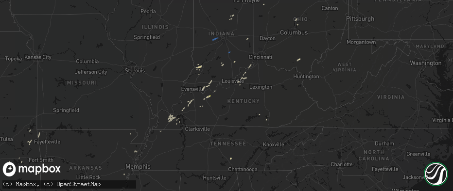
Hail Map in Kentucky on May 19, 2026
The weather event in Kentucky on May 19, 2026 includes Hail, Wind, and Tornado maps. 16 states and 514 cities were impacted and suffered possible damage. The total estimated number of properties impacted is 68.
Hail
Wind
Tornado
68
Estimated number of impacted properties by a 1.00" hail or larger0
Estimated number of impacted properties by a 1.75" hail or larger0
Estimated number of impacted properties by a 2.50" hail or largerStorm reports in Kentucky
Kentucky
| Date | Description |
|---|---|
| 05/19/20266:32 PM CDT | Power lines down on jackson road. |
| 05/19/20266:20 PM CDT | Trees down blocking roadways within the area. |
| 05/19/20266:05 PM CDT | Whitley county 911 dispatch reported a down tree 1 mile north from the intersection of hightop road and us 25w on hightop road . Time estimated from radar. |
| 05/19/20265:50 PM CDT | Whitley county 911 center reported a tree down at the intersection of bee creek road and southwood estates. Time estimated from radar. |
| 05/19/20265:41 PM CDT | Photos via social media showed utility poles leaning along preston hwy. This resulting in power outages. |
| 05/19/20265:41 PM CDT | Tree down blocking the roadway. |
| 05/19/20265:14 PM CDT | Multiple trees down and blocking the road near the 300 block of woods pike road. |
| 05/19/20265:02 PM CDT | Tree down on power line on fairview court. |
| 05/19/20263:56 PM CDT | Reported on herbert road in herbert. |
| 05/19/20263:45 PM CDT | Tree down blocking roadway on s 6th street. |
| 05/19/20263:45 PM CDT | Several trees down blocking the road on rose island road. |
All States Impacted by Hail Map on May 19, 2026
Cities Impacted by Hail Map on May 19, 2026
- Afton, OK
- Tahlequah, OK
- Proctor, OK
- Eucha, OK
- Siloam Springs, AR
- Gentry, AR
- Checotah, OK
- Hulbert, OK
- Stigler, OK
- Eufaula, OK
- Decatur, AR
- Gravette, AR
- Porum, OK
- Indianola, OK
- Merkel, TX
- Heavener, OK
- Maryneal, TX
- Roscoe, TX
- Whitesboro, TX
- Gainesville, TX
- Sweetwater, TX
- Sadler, TX
- Bowie, TX
- Walnut Springs, TX
- Marietta, OK
- Saint Jo, TX
- Alvord, TX
- Sunset, TX
- Blackwell, TX
- Nolan, TX
- Perrin, TX
- Forestburg, TX
- Bridgeport, TX
- Weatherford, TX
- Poolville, TX
- Decatur, TX
- Powderly, TX
- Paris, TX
- Springtown, TX
- San Angelo, TX
- Miles, TX
- Arthur City, TX
- Grant, OK
- Krum, TX
- Sanger, TX
- Paradise, TX
- Hugo, OK
- Fort Towson, OK
- Millersview, TX
- Rowena, TX
- Boyd, TX
- Ballinger, TX
- Paint Rock, TX
- Comanche, TX
- De Leon, TX
- Pinckney, MI
- Rhome, TX
- Era, TX
- Brighton, MI
- Aubrey, TX
- Valley View, TX
- Denton, TX
- Whitmore Lake, MI
- Hamburg, MI
- Azle, TX
- Pilot Point, TX
- Robert Lee, TX
- Bronte, TX
- Lipan, TX
- Brookston, TX
- Sumner, TX
- Gorman, TX
- Dublin, TX
- Desdemona, TX
- Milford, MI
- New Hudson, MI
- South Lyon, MI
- Fort Worth, TX
- Newark, TX
- Stephenville, TX
- Little Elm, TX
- Mereta, TX
- Lake Dallas, TX
- Lewisville, TX
- Clay, KY
- Washington, MI
- Fredonia, KY
- Wall, TX
- Eola, TX
- Dixon, KY
- Marion, KY
- Aledo, TX
- Brownwood, TX
- Ray, MI
- Macomb, MI
- Utica, MI
- Providence, KY
- Naval Air Station Jrb, TX
- The Colony, TX
- Sebree, KY
- Morganfield, KY
- Grapevine, TX
- Slaughters, KY
- Benton, KY
- Almo, KY
- May, TX
- Cresson, TX
- Sidney, TX
- Hardinsburg, KY
- Vancourt, TX
- Hardin, KY
- Crowley, TX
- Flower Mound, TX
- Santa Anna, TX
- Swayzee, IN
- Livonia, MI
- Redford, MI
- Bangs, TX
- Windfall, IN
- Greentown, IN
- Utica, KY
- Canton, MI
- Ypsilanti, MI
- Plymouth, MI
- Burleson, TX
- Southfield, MI
- Dallas, TX
- Joshua, TX
- Marion, IN
- Jackson, OH
- Rockport, IN
- Cleburne, TX
- Rio Vista, TX
- Boonville, IN
- Chrisney, IN
- Fairmount, IN
- Pleasant Ridge, MI
- Ferndale, MI
- Oak Park, MI
- Detroit, MI
- Beaver, OH
- Fraser, MI
- Warren, MI
- Sterling Heights, MI
- Madison Heights, MI
- Clinton Township, MI
- Saint Clair Shores, MI
- Harrison Township, MI
- Center Line, MI
- Roseville, MI
- Westland, MI
- Dearborn Heights, MI
- Garden City, MI
- Dearborn, MI
- Coatesville, IN
- Avon, IN
- Danville, IN
- Clayton, IN
- Amo, IN
- Mertzon, TX
- Sterling City, TX
- Hazel Park, MI
- Royal Oak, MI
- Philpot, KY
- Whitesville, KY
- Kopperl, TX
- Early, TX
- Godley, TX
- Irving, TX
- Mount Clemens, MI
- Mansfield, TX
- Calhoun, KY
- Island, KY
- Richland, IN
- Carrollton, TX
- Paducah, KY
- Eldorado, TX
- Ferdinand, IN
- Saint Meinrad, IN
- Bremen, KY
- Calvert City, KY
- Altamont, TN
- Morrison, TN
- Evanston, IN
- Lamar, IN
- Reynolds Station, KY
- Morgan, TX
- Alvarado, TX
- Keene, TX
- Meridian, TX
- Boaz, KY
- Hamtramck, MI
- Highland Park, MI
- Christoval, TX
- Rector, AR
- Kennedale, TX
- Addison, TX
- Richardson, TX
- Garland, TX
- The Plains, VA
- Monroe, MI
- Symsonia, KY
- Bristow, IN
- Birdseye, IN
- North Vernon, IN
- Commiskey, IN
- Osceola, AR
- Ware, MA
- Gilbertville, MA
- Brookesmith, TX
- Blum, TX
- Central City, KY
- New Bavaria, OH
- Zephyr, TX
- Defiance, OH
- Paulding, OH
- Oakwood, OH
- Brookport, IL
- Holgate, OH
- Barnhart, TX
- West Brookfield, MA
- Menard, TX
- Spencer, MA
- North Brookfield, MA
- New Braintree, MA
- Centertown, KY
- Somerset, KY
- Grandview, TX
- Lillian, TX
- Venus, TX
- Rochelle, TX
- Harper Woods, MI
- Grosse Pointe, MI
- Dryden, TX
- Mesquite, TX
- Fort Jennings, OH
- Ottoville, OH
- Delphos, OH
- Eden, TX
- Oldsmar, FL
- Tampa, FL
- La Grange, KY
- Crestwood, KY
- Smithfield, KY
- Keiser, AR
- Midlothian, TX
- Fort McKavett, TX
- Big Lake, TX
- Sherman, TX
- Palm Harbor, FL
- Tarpon Springs, FL
- Clifton, TX
- Connersville, IN
- Milton, IN
- Iredell, TX
- Clifford, IN
- Columbus, IN
- Medora, IN
- Ringgold, LA
- Heflin, LA
- Hico, TX
- Ozona, TX
- Junction, TX
- Centerville, IN
- Eminence, KY
- Shelbyville, KY
- Union City, TN
- Iraan, TX
- Odessa, FL
- Hamilton, TX
- Brady, TX
- Simsboro, LA
- Pleasureville, KY
- Marianna, AR
- Sheffield, TX
- Valley Mills, TX
- Fort Stockton, TX
- New Port Richey, FL
- Tishomingo, OK
- Jonesboro, TX
- Llano, TX
- Marathon, TX
- Norman, IN
- Hext, TX
- Pontotoc, TX
- Mason, TX
- Corbin, KY
- Pickens, AR
- Dumas, AR
- Gatesville, TX
- Ruston, LA
- Williamsburg, KY
- Valley Spring, TX
- Louisville, KY
- Tow, TX
- Bluffton, TX
- Buchanan Dam, TX
- Hickory, KY
- Mayfield, KY
- Lake Village, AR
- Simpsonville, KY
- Petersburg, IN
- Bicknell, IN
- Wheatland, IN
- Fisherville, KY
- Granger, TX
- Bertram, TX
- Burnet, TX
- Vincennes, IN
- Bruceville, IN
- Plainville, IN
- Washington, IN
- Ragsdale, IN
- Sonora, TX
- Huntsville, TX
- Liberty Hill, TX
- Taylorsville, KY
- Florence, TX
- Lampasas, TX
- New Castle, KY
- Sulphur, KY
- London, TX
- Campbellsburg, KY
- Turners Station, KY
- Oglesby, TX
- Tupelo, OK
- New Waverly, TX
- Briggs, TX
- Bartlett, TX
- Jarrell, TX
- Allen, OK
- Sanders, KY
- Ghent, KY
- Holland, TX
- Salado, TX
- Kingsland, TX
- Florence, IN
- Warsaw, KY
- Vevay, IN
- Rising Sun, IN
- Marengo, OH
- Ashley, OH
- Temple, TX
- Cardington, OH
- Art, TX
- Willis, TX
- Sunbury, OH
- Fredericksburg, TX
- Galena, OH
- Belton, TX
- Lott, TX
- Troy, TX
- Durant, MS
- Georgetown, TX
- Marble Falls, TX
- Willow City, TX
- Doss, TX
- Round Mountain, TX
- Johnson City, TX
- Del Rio, TX
- Rocksprings, TX
- Rosebud, TX
- Spicewood, TX
- Monroe City, IN
- Leander, TX
- Montgomery, TX
- Kittery Point, ME
- Rye, NH
- Austin, TX
- Dripping Springs, TX
- Cedar Park, TX
- Driftwood, TX
- Boerne, TX
- Blanco, TX
- Stonewall, TX
- Hutto, TX
- Round Rock, TX
- Wimberley, TX
- Buda, TX
- Hunt, TX
- Taylor, TX
- Pflugerville, TX
- Lake Charles, LA
- Dequincy, LA
- Sulphur, LA
- Vinton, LA
- Leakey, TX
- Coupland, TX
- Manor, TX
- Westlake, LA
- Mountain Home, TX
- Buckholts, TX
- Thorndale, TX
- Brackettville, TX
- Barksdale, TX
- Thrall, TX
- Rockdale, TX
- Elgin, TX
- Vanderpool, TX
- Medina, TX
- Ingram, TX
- Manchaca, TX
- Kyle, TX
- Harper, TX
- Utopia, TX
- Uvalde, TX
- Lexington, TX
- Kerrville, TX
- McDade, TX
- Bastrop, TX
- Kinder, LA
- Ragley, LA
- Reeves, LA
- Iowa, LA
- Laughlin Afb, TX
- Lincoln, TX
- Dime Box, TX
- Giddings, TX
- Welsh, LA
- Ledbetter, TX
- Pipe Creek, TX
- Bandera, TX
- Center Point, TX
- Comfort, TX
- San Antonio, TX
- Mico, TX
- Helotes, TX
- Carmine, TX
- Quemado, TX
- Fayetteville, TX
- Bulverde, TX
- Spring Branch, TX
- New Braunfels, TX
- Bergheim, TX
- Kendalia, TX
- Batesville, TX
- Crystal City, TX
- Bedford, IN
- Grandview, IN
- Three Rivers, TX
- Kenedy, TX
- Goliad, TX
- Beeville, TX
- Runge, TX
- Karnes City, TX
- George West, TX
- Mathis, TX
- Skidmore, TX
- Sandia, TX
- Tynan, TX
- Sinton, TX
- Woodsboro, TX
- Refugio, TX
- Orange Grove, TX
- Robstown, TX
- Laredo, TX
- Odem, TX
- Corpus Christi, TX
- Taft, TX
- Portland, TX
- Gregory, TX
- Bayside, TX
- Aransas Pass, TX
- Rockport, TX
- Bishop, TX
- Kingsville, TX
- Fulton, TX
- Ingleside, TX
- Port Aransas, TX
- Sarita, TX
- Riviera, TX
- Armstrong, TX
- Grove City, OH
- Columbus, OH
- Galloway, OH
- Raymondville, TX
- San Perlita, TX
- Lyford, TX
- Port Mansfield, TX
- Blacklick, OH
- Rio Hondo, TX
- Sebastian, TX
- Los Fresnos, TX
- San Benito, TX
- Del Valle, TX
- Paige, TX
- La Grange, TX
- Smithville, TX
- Round Top, TX
- Port Isabel, TX
- Brownsville, TX
- South Padre Island, TX
- North Grafton, MA
- Leicester, MA
- Worcester, MA
- Holden, MA
- Shrewsbury, MA
- Westborough, MA
- Paxton, MA
- Castalia, OH
- Fremont, OH
- Oak Harbor, OH
- Vickery, OH
- Huron, OH
- Sandusky, OH
- Lakeside Marblehead, OH
- Port Clinton, OH
- Amherst, OH
- Vermilion, OH
- Oberlin, OH
- Milan, OH
- Berlin Heights, OH
- Collins, OH
- Wakeman, OH


