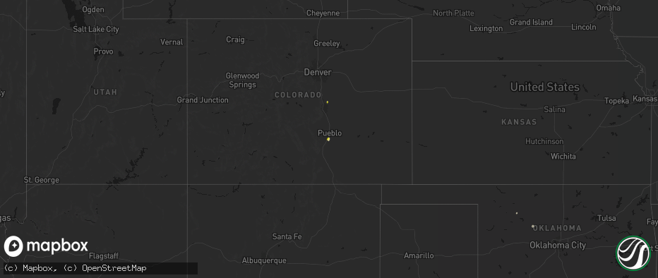
Hail Map on May 29, 2026
The weather event on May 29, 2026 includes Hail and Wind maps. 10 states and 273 cities were impacted and suffered possible damage. The total estimated number of properties impacted is 5,206.
Hail
Wind
5,206
Estimated number of impacted properties by a 1.00" hail or larger335
Estimated number of impacted properties by a 1.75" hail or larger2
Estimated number of impacted properties by a 2.50" hail or largerStates Impacted by Hail Map on May 29, 2026
Storm reports
Montana
| Date | Description |
|---|---|
| 05/28/202611:15 PM CDT | Mesonet station mtstm st. Marie mt-24 mp 18.0. |
| 05/28/20269:00 PM CDT | Wagm8 mesonet observation site. |
| 05/28/20268:25 PM CDT | Straight-line winds knocked down multiple tree limbs and caused the power to go out. Nearby automated sensors were gusting 35-40 mph. |
| 05/28/20267:30 PM CDT | A local report indicates 70 MPH wind near 13 ENE Roy |
Kansas
| Date | Description |
|---|---|
| 05/29/20266:58 PM CDT | A local report indicates 64 MPH wind near 3 NNE Centerview |
| 05/29/20266:50 PM CDT | A local report indicates 59 MPH wind near 3 NW Centerview |
| 05/29/20266:39 PM CDT | Nws employee reported estimated 50-60mph gusts. There was localized blowing dust from a feedlot nearby... Reducing visibility to around a mile. |
| 05/28/20269:47 PM CDT | A local report indicates 60 MPH wind near Geneseo |
| 05/28/20268:48 PM CDT | Ping pong ball sized hail reported along the stafford and pratt county line. |
| 05/28/20268:27 PM CDT | Social media report of quarter size hail on the southeast side of hays. Time estimated via radar. |
| 05/28/20268:27 PM CDT | Social media report of 55-60 mph winds in hays. Time estimated via radar. |
| 05/28/20268:16 PM CDT | Personal ambient weather station. |
| 05/28/20268:09 PM CDT | Report of shed damaged and moved 20 feet to the north. Time estimated via radar. |
| 05/28/20268:07 PM CDT | A local report indicates 74 MPH wind near 2 S Schoenchen |
| 05/28/20268:00 PM CDT | A local report indicates 73 MPH wind near 3 NNE Liebenthal |
| 05/28/20267:10 PM CDT | Brief gust up to 60 mph with little to no rain. Winds have calmed down since the initial wind gust. |
| 05/28/20267:04 PM CDT | A local report indicates 64 MPH wind near 3 NNE Centerview |
| 05/28/20267:02 PM CDT | A local report indicates 63 MPH wind near 3 SW Burdett |
New York
| Date | Description |
|---|---|
| 05/28/20268:50 PM CDT | Electrical transformer damaged. |
| 05/28/20268:47 PM CDT | Wires down in driveway. |
| 05/28/20268:45 PM CDT | Several trees down in the area. |
| 05/28/20268:23 PM CDT | Corrects the time of previous non-tstm wnd dmg report from new hope. Power pole snapped. |
| 05/28/20268:18 PM CDT | Tree on house & car with damage reported to house. Residents are out of the house. |
| 05/28/20268:08 PM CDT | Tree and wires down. |
| 05/28/20268:01 PM CDT | Several areas of trees and wires down... Near dewitt. |
| 05/28/20267:58 PM CDT | Several large branches down. |
| 05/28/20267:51 PM CDT | Tree fell on house with the front of the house partially collapsed. There were no known injuries. |
| 05/28/20267:44 PM CDT | Several trees down around liverpool. |
Utah
| Date | Description |
|---|---|
| 05/29/20266:10 PM CDT | Mesonet station utnbc i-15 north brigham city. |
| 05/29/20265:10 PM CDT | Mesonet station pc100 spring city east. |
| 05/29/20264:30 PM CDT | Mesonet station utsom us-89 at mp 254 south manti. |
| 05/29/20263:50 PM CDT | Mesonet station pc290 carter peak. |
| 05/29/20262:40 PM CDT | Measured at the i15 at mp 215 lampson canyon udot rwis site. |
| 05/29/20262:40 PM CDT | Mesonet station utlmp lampson canyon. |
| 05/28/20268:53 PM CDT | Corrects previous tstm wnd gst report from 1 ese vernal. |
| 05/28/20268:53 PM CDT | A local report indicates 58 MPH wind near 1 ESE Vernal |
Idaho
| Date | Description |
|---|---|
| 05/29/20266:10 PM CDT | Asos station kllj challis airport. |
| 05/28/20268:25 PM CDT | 3 inch diameter tree branch down. |
Oklahoma
| Date | Description |
|---|---|
| 05/29/20265:23 PM CDT | A local report indicates 65 MPH wind near Kremlin |
| 05/29/20264:50 PM CDT | A local report indicates 68 MPH wind near 1 W Lahoma |
| 05/29/20264:35 PM CDT | A local report indicates 1.00 inch wind near 4 S Drummond |
| 05/28/202610:45 PM CDT | A local report indicates 63 MPH wind near 3 W Gould |
| 05/28/20267:23 PM CDT | A local report indicates 1.00 inch wind near Marshall |
| 05/28/20267:23 PM CDT | A local report indicates 60 MPH wind near Marshall |
Nebraska
| Date | Description |
|---|---|
| 05/28/202611:15 PM CDT | Personal weather station reports gust to 67mph. |
| 05/28/20267:03 PM CDT | Storm chaser reported a few quarter-sized hail stones around 6pm. |
Colorado
| Date | Description |
|---|---|
| 05/29/20265:46 PM CDT | Asos station kitr burlington co airport. |
| 05/29/20265:43 PM CDT | Asos station kitr burlington co airport. |
| 05/29/20264:46 PM CDT | Spotter call; time estimated from radar. |
| 05/29/20264:23 PM CDT | Mesonet station up695 aroya |
| 05/29/20264:12 PM CDT | Twitter report with image and measurement of 1.13 inches. Time estimated from radar. |
Georgia
| Date | Description |
|---|---|
| 05/29/20265:45 PM CDT | *** 1 inj *** tree fell on mobile home with minor injuries to an occupant near 7000 block of benson ave. |
Texas
| Date | Description |
|---|---|
| 05/29/20266:53 PM CDT | A pantex weather station measured a 58 mph gust at this location. The anemometer height was reported to be 25 feet above ground level. |
| 05/29/20266:51 PM CDT | Randall county sheriff reported a house that had lost a roof at this location. |
| 05/29/20266:45 PM CDT | Report from mping: golf ball |
| 05/29/20266:43 PM CDT | Also gust to 58 mph at 641 pm. Measured by the west texas mesonet. |
| 05/29/20266:42 PM CDT | Large tree down blocking street. Many tree limbs knocked down throughout town. |
| 05/29/20264:18 PM CDT | Facebook report of quarter to half dollar size hail off hwy 281 north of stephenville. Location and time estimated. |
| 05/28/20269:29 PM CDT | A local report indicates 58 MPH wind near 3 W Dozier |
| 05/28/20268:44 PM CDT | Wtamu emergency management shared a report from an officer in clarendon of downed poles in the town. |
| 05/28/20268:37 PM CDT | Peak wind gust was 62 mph at 837 pm. The first gust was 58 mph at 836 pm. |
| 05/28/20268:12 PM CDT | Peak wind gust was 77 mph at 812 pm. Additional severe wind gusts of 73 and 61 mph occurred at 815 and 817 pm respectively. |
| 05/28/20268:12 PM CDT | A local report indicates 77 MPH wind near 15 WSW Clarendon |
| 05/28/20267:10 PM CDT | Quarter sized hail was measured 1 mile north of happy tx off of interstate 27. Small accumulating hail was also reported at this location. |
Cities Impacted by Hail Map on May 29, 2026
- Pueblo, CO
- Avondale, CO
- Colorado Springs, CO
- Peyton, CO
- Lead, SD
- Watonga, OK
- Hitchcock, OK
- Fairview, OK
- Kit Carson, CO
- Superior, MT
- Kingfisher, OK
- Okeene, OK
- Alberton, MT
- Hennessey, OK
- Ames, OK
- Waukomis, OK
- Drummond, OK
- Enid, OK
- Chinook, MT
- Geyser, MT
- Ringwood, OK
- Forest Grove, MT
- Meno, OK
- Stratton, CO
- Lahoma, OK
- Carrier, OK
- Hays, MT
- Isabella, OK
- Grass Range, MT
- Stanford, MT
- Bethune, CO
- Zortman, MT
- Hobson, MT
- Goltry, OK
- Helena, OK
- Kremlin, OK
- Clarendon, TX
- Plains, MT
- Saint Regis, MT
- Nash, OK
- Arlee, MT
- Frenchtown, MT
- Cheyenne Wells, CO
- Quitaque, TX
- Missoula, MT
- Avon Park, FL
- Silverton, TX
- Turkey, TX
- Summerfield, TX
- Hereford, TX
- Lloyd, MT
- Coffee Creek, MT
- Stevensville, MT
- Pond Creek, OK
- Rantoul, KS
- Paola, KS
- Sebring, FL
- Alva, OK
- Burlington, CO
- Hunter, OK
- Roundup, MT
- Lakeview, TX
- Oakley, KS
- Lorida, FL
- Harrisburg, NE
- Moccasin, MT
- Burlington, OK
- Medford, OK
- Memphis, TX
- Idalia, CO
- Albin, WY
- Lagrange, WY
- Dimmitt, TX
- Hawk Springs, WY
- Yoder, WY
- Spearville, KS
- Osawatomie, KS
- Winnett, MT
- Wright, KS
- Cherokee, OK
- Douglas, OK
- Yuma, CO
- Colby, KS
- Canyon, TX
- Happy, TX
- Wakita, OK
- Manchester, OK
- Torrington, WY
- Waldron, KS
- Amorita, OK
- Hazelton, KS
- Ronan, MT
- Tulia, TX
- Kiowa, KS
- Gem, KS
- Anthony, KS
- Medicine Lodge, KS
- Big Sandy, MT
- Peabody, KS
- Florence, KS
- Lingle, WY
- Atwood, KS
- Kinsley, KS
- Lewis, KS
- Mapleton, KS
- Redfield, KS
- Bronson, KS
- Ness City, KS
- Marshall, OK
- Sharon, KS
- Crescent, OK
- Attica, KS
- Clewiston, FL
- South Bay, FL
- Burdett, KS
- Belpre, KS
- Amarillo, TX
- Fort Scott, KS
- Bazine, KS
- Nashville, KS
- Hanston, KS
- Childress, TX
- Harper, KS
- Garfield, KS
- Larned, KS
- Zenda, KS
- Herndon, KS
- Rexford, KS
- Fort Stockton, TX
- Benkelman, NE
- Parks, NE
- Fontana, KS
- Belle Glade, FL
- Marion, KS
- McDonald, KS
- Wayside, TX
- Claude, TX
- Alexander, KS
- Sawyer, KS
- Isabel, KS
- Jay Em, WY
- Spivey, KS
- Kingman, KS
- Cunningham, KS
- Malta, MT
- Roy, MT
- Dix, NE
- McCracken, KS
- La Crosse, KS
- Iraan, TX
- Hays, KS
- Max, NE
- Stratton, NE
- St John, KS
- Levant, KS
- Great Bend, KS
- Macksville, KS
- Schoenchen, KS
- Victoria, KS
- Lelia Lake, TX
- Iuka, KS
- Stafford, KS
- Palisade, NE
- Potter, NE
- Hedley, TX
- Hayes Center, NE
- Ellinwood, KS
- Quail, TX
- Dalton, NE
- Gorham, KS
- Turon, KS
- McCook, NE
- Shamrock, TX
- Wellington, TX
- Selden, KS
- Oberlin, KS
- Chase, KS
- Bushton, KS
- Natoma, KS
- Paradise, KS
- Maywood, NE
- Bridgeport, NE
- Mclean, TX
- Gillette, WY
- Loring, MT
- Bunker Hill, KS
- Lyons, KS
- Russell, KS
- Geneseo, KS
- Danbury, NE
- Lebanon, NE
- Norcatur, KS
- Dorrance, KS
- Shidler, OK
- Wilsonville, NE
- Indianola, NE
- Luray, KS
- Dodson, TX
- Lucas, KS
- Hollis, OK
- Hinsdale, MT
- Cambridge, NE
- Pawhuska, OK
- Sylvan Grove, KS
- Hendley, NE
- Beaver City, NE
- Moorcroft, WY
- Arapahoe, NE
- Edison, NE
- Holbrook, NE
- Hunter, KS
- Gould, OK
- Bartlesville, OK
- Barnard, KS
- Beloit, KS
- Oxford, NE
- Bertrand, NE
- Miltonvale, KS
- Delphos, KS
- Minneapolis, KS
- Copan, OK
- Glasco, KS
- Stamford, NE
- Elwood, NE
- Duke, OK
- Dewey, OK
- Concordia, KS
- Quanah, TX
- Smithfield, NE
- Nowata, OK
- Delaware, OK
- Clay Center, KS
- Eldorado, OK
- Lexington, NE
- Clyde, KS
- Overton, NE
- Clifton, KS
- Leonardville, KS
- Randolph, KS
- Riley, KS
- Linn, KS
- Palmer, KS
- Olsburg, KS
- Saint George, KS
- Westmoreland, KS
- Burns, KS
- Frankfort, KS
- Onaga, KS
- Wamego, KS
- Adair, OK
- Pryor, OK
- Havensville, KS
- Wilson, KS
- Pickrell, NE
- Lewiston, NE
- Soldier, KS
- Lincoln, KS
- Crab Orchard, NE
- Oskaloosa, KS
- Shelby, NE
- Osceola, NE
- Leigh, NE
- Cameron, MO
- Westphalia, KS
- Colony, KS
- Lamont, OK
- Rayville, MO
- Lawson, MO
- Polo, MO
- Kincaid, KS
- Welda, KS
- Fulton, KS
- Uniontown, KS