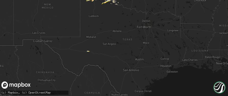
Hail Map in Texas on May 29, 2026
The weather event in Texas on May 29, 2026 includes Hail and Wind maps. 10 states and 273 cities were impacted and suffered possible damage. The total estimated number of properties impacted is 1,109.
Hail
Wind
1,109
Estimated number of impacted properties by a 1.00" hail or larger335
Estimated number of impacted properties by a 1.75" hail or larger2
Estimated number of impacted properties by a 2.50" hail or largerStorm reports in Texas
Texas
| Date | Description |
|---|---|
| 05/29/20266:53 PM CDT | A pantex weather station measured a 58 mph gust at this location. The anemometer height was reported to be 25 feet above ground level. |
| 05/29/20266:51 PM CDT | Randall county sheriff reported a house that had lost a roof at this location. |
| 05/29/20266:45 PM CDT | Report from mping: golf ball |
| 05/29/20266:43 PM CDT | Also gust to 58 mph at 641 pm. Measured by the west texas mesonet. |
| 05/29/20266:42 PM CDT | Large tree down blocking street. Many tree limbs knocked down throughout town. |
| 05/29/20264:18 PM CDT | Facebook report of quarter to half dollar size hail off hwy 281 north of stephenville. Location and time estimated. |
| 05/28/20269:29 PM CDT | A local report indicates 58 MPH wind near 3 W Dozier |
| 05/28/20268:44 PM CDT | Wtamu emergency management shared a report from an officer in clarendon of downed poles in the town. |
| 05/28/20268:37 PM CDT | Peak wind gust was 62 mph at 837 pm. The first gust was 58 mph at 836 pm. |
| 05/28/20268:12 PM CDT | A local report indicates 77 MPH wind near 15 WSW Clarendon |
| 05/28/20268:12 PM CDT | Peak wind gust was 77 mph at 812 pm. Additional severe wind gusts of 73 and 61 mph occurred at 815 and 817 pm respectively. |
| 05/28/20267:10 PM CDT | Quarter sized hail was measured 1 mile north of happy tx off of interstate 27. Small accumulating hail was also reported at this location. |
All States Impacted by Hail Map on May 29, 2026
Cities Impacted by Hail Map on May 29, 2026
- Pueblo, CO
- Avondale, CO
- Colorado Springs, CO
- Peyton, CO
- Lead, SD
- Watonga, OK
- Hitchcock, OK
- Fairview, OK
- Kit Carson, CO
- Superior, MT
- Kingfisher, OK
- Okeene, OK
- Alberton, MT
- Hennessey, OK
- Ames, OK
- Waukomis, OK
- Drummond, OK
- Enid, OK
- Chinook, MT
- Geyser, MT
- Ringwood, OK
- Forest Grove, MT
- Meno, OK
- Stratton, CO
- Lahoma, OK
- Carrier, OK
- Hays, MT
- Isabella, OK
- Grass Range, MT
- Stanford, MT
- Bethune, CO
- Zortman, MT
- Hobson, MT
- Goltry, OK
- Helena, OK
- Kremlin, OK
- Clarendon, TX
- Plains, MT
- Saint Regis, MT
- Nash, OK
- Arlee, MT
- Frenchtown, MT
- Cheyenne Wells, CO
- Quitaque, TX
- Missoula, MT
- Avon Park, FL
- Silverton, TX
- Turkey, TX
- Summerfield, TX
- Hereford, TX
- Lloyd, MT
- Coffee Creek, MT
- Stevensville, MT
- Pond Creek, OK
- Rantoul, KS
- Paola, KS
- Sebring, FL
- Alva, OK
- Burlington, CO
- Hunter, OK
- Roundup, MT
- Lakeview, TX
- Oakley, KS
- Lorida, FL
- Harrisburg, NE
- Moccasin, MT
- Burlington, OK
- Medford, OK
- Memphis, TX
- Idalia, CO
- Albin, WY
- Lagrange, WY
- Dimmitt, TX
- Hawk Springs, WY
- Yoder, WY
- Spearville, KS
- Osawatomie, KS
- Winnett, MT
- Wright, KS
- Cherokee, OK
- Douglas, OK
- Yuma, CO
- Colby, KS
- Canyon, TX
- Happy, TX
- Wakita, OK
- Manchester, OK
- Torrington, WY
- Waldron, KS
- Amorita, OK
- Hazelton, KS
- Ronan, MT
- Tulia, TX
- Kiowa, KS
- Gem, KS
- Anthony, KS
- Medicine Lodge, KS
- Big Sandy, MT
- Peabody, KS
- Florence, KS
- Lingle, WY
- Atwood, KS
- Kinsley, KS
- Lewis, KS
- Mapleton, KS
- Redfield, KS
- Bronson, KS
- Ness City, KS
- Marshall, OK
- Sharon, KS
- Crescent, OK
- Attica, KS
- Clewiston, FL
- South Bay, FL
- Burdett, KS
- Belpre, KS
- Amarillo, TX
- Fort Scott, KS
- Bazine, KS
- Nashville, KS
- Hanston, KS
- Childress, TX
- Harper, KS
- Garfield, KS
- Larned, KS
- Zenda, KS
- Herndon, KS
- Rexford, KS
- Fort Stockton, TX
- Benkelman, NE
- Parks, NE
- Fontana, KS
- Belle Glade, FL
- Marion, KS
- McDonald, KS
- Wayside, TX
- Claude, TX
- Alexander, KS
- Sawyer, KS
- Isabel, KS
- Jay Em, WY
- Spivey, KS
- Kingman, KS
- Cunningham, KS
- Malta, MT
- Roy, MT
- Dix, NE
- McCracken, KS
- La Crosse, KS
- Iraan, TX
- Hays, KS
- Max, NE
- Stratton, NE
- St John, KS
- Levant, KS
- Great Bend, KS
- Macksville, KS
- Schoenchen, KS
- Victoria, KS
- Lelia Lake, TX
- Iuka, KS
- Stafford, KS
- Palisade, NE
- Potter, NE
- Hedley, TX
- Hayes Center, NE
- Ellinwood, KS
- Quail, TX
- Dalton, NE
- Gorham, KS
- Turon, KS
- McCook, NE
- Shamrock, TX
- Wellington, TX
- Selden, KS
- Oberlin, KS
- Chase, KS
- Bushton, KS
- Natoma, KS
- Paradise, KS
- Maywood, NE
- Bridgeport, NE
- Mclean, TX
- Gillette, WY
- Loring, MT
- Bunker Hill, KS
- Lyons, KS
- Russell, KS
- Geneseo, KS
- Danbury, NE
- Lebanon, NE
- Norcatur, KS
- Dorrance, KS
- Shidler, OK
- Wilsonville, NE
- Indianola, NE
- Luray, KS
- Dodson, TX
- Lucas, KS
- Hollis, OK
- Hinsdale, MT
- Cambridge, NE
- Pawhuska, OK
- Sylvan Grove, KS
- Hendley, NE
- Beaver City, NE
- Moorcroft, WY
- Arapahoe, NE
- Edison, NE
- Holbrook, NE
- Hunter, KS
- Gould, OK
- Bartlesville, OK
- Barnard, KS
- Beloit, KS
- Oxford, NE
- Bertrand, NE
- Miltonvale, KS
- Delphos, KS
- Minneapolis, KS
- Copan, OK
- Glasco, KS
- Stamford, NE
- Elwood, NE
- Duke, OK
- Dewey, OK
- Concordia, KS
- Quanah, TX
- Smithfield, NE
- Nowata, OK
- Delaware, OK
- Clay Center, KS
- Eldorado, OK
- Lexington, NE
- Clyde, KS
- Overton, NE
- Clifton, KS
- Leonardville, KS
- Randolph, KS
- Riley, KS
- Linn, KS
- Palmer, KS
- Olsburg, KS
- Saint George, KS
- Westmoreland, KS
- Burns, KS
- Frankfort, KS
- Onaga, KS
- Wamego, KS
- Adair, OK
- Pryor, OK
- Havensville, KS
- Wilson, KS
- Pickrell, NE
- Lewiston, NE
- Soldier, KS
- Lincoln, KS
- Crab Orchard, NE
- Oskaloosa, KS
- Shelby, NE
- Osceola, NE
- Leigh, NE
- Cameron, MO
- Westphalia, KS
- Colony, KS
- Lamont, OK
- Rayville, MO
- Lawson, MO
- Polo, MO
- Kincaid, KS
- Welda, KS
- Fulton, KS
- Uniontown, KS


