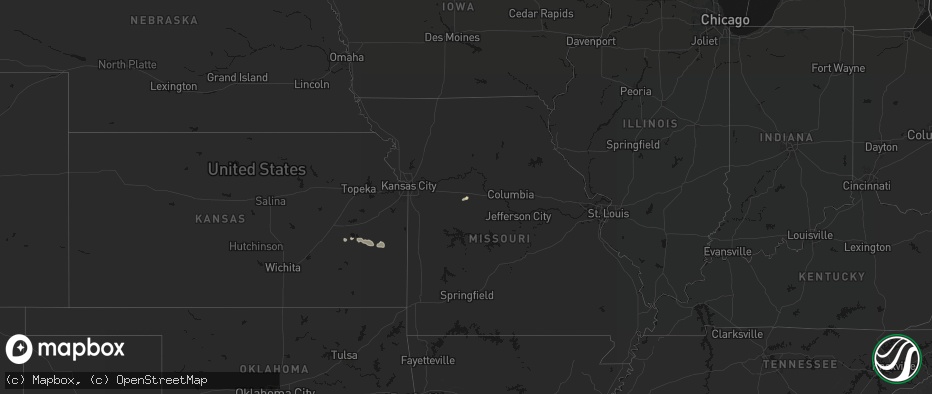
Hail Map on May 31, 2026
The weather event on May 31, 2026 includes Hail, Wind, and Tornado maps. 17 states and 717 cities were impacted and suffered possible damage. The total estimated number of properties impacted is 78,779.
Hail
Wind
Tornado
78,779
Estimated number of impacted properties by a 1.00" hail or larger8,041
Estimated number of impacted properties by a 1.75" hail or larger1,052
Estimated number of impacted properties by a 2.50" hail or largerStates Impacted by Hail Map on May 31, 2026
Storm reports
Arkansas
| Date | Description |
|---|---|
| 05/30/20268:17 PM CDT | A local report indicates 1.00 inch wind near Searcy |
| 05/30/20267:08 PM CDT | A local report indicates 1.00 inch wind near Scott |
Missouri
| Date | Description |
|---|---|
| 05/31/20266:05 PM CDT | A local report indicates 1.75 inch wind near Cooter |
| 05/31/20265:05 PM CDT | A local report indicates 1.00 inch wind near Oxly |
| 05/31/20264:52 PM CDT | Report received via social media. Time estimated via radar. |
| 05/31/20264:51 PM CDT | A local report indicates 1.00 inch wind near 2 S East Prairie |
| 05/31/20264:29 PM CDT | Large... Healthy tree downed across county road 212 near private drive 9277 |
| 05/31/20264:27 PM CDT | A medium/large healthy tree downed on a home in fredericktown. |
| 05/31/20264:22 PM CDT | A local report indicates 1.00 inch wind near 1 ENE Dexter |
| 05/31/20263:53 PM CDT | Gust measured at kcgi asos. |
| 05/31/20263:49 PM CDT | Tree limbs down 1.5 miles north of delta. |
| 05/31/20263:42 PM CDT | Report received via social media. Time estimated by radar. |
| 05/31/20263:39 PM CDT | Numerous trees and power lines down throughout cape girardeau county... Including millersville... Jackson... Cape girardeau... And gordonsville. |
| 05/31/20263:29 PM CDT | Power outages along county road 320 north of marble hill. |
| 05/31/20263:22 PM CDT | Trees blown down across county roads near patton. Some tree tops blown out. |
| 05/31/20263:22 PM CDT | Large tree limbs down. Power outages 5 miles north of greenville. |
| 05/31/20262:50 PM CDT | Extensive damage across farmstead. What appears to be a farm outbuilding was collapsed and a wooden beam was lodged into the top of a garage. Debris all over yard. Debr |
| 05/31/20262:50 PM CDT | Via facebook: a large... Rotted tree snapped near its base and took down powerlines on county road 221 near hwy j. A small/medium tree was snapped near its base. |
| 05/31/20262:50 PM CDT | Estimated 50-60 mph winds with small tree limbs down and debris on dd between oo and highway 67. |
| 05/31/20262:45 PM CDT | Via facebook: very large... Healthy branches split from tree. Some branches fell on a double wide residence and caused damage to gutters and roof. Extent of damage unkn |
| 05/31/20262:45 PM CDT | Via facebook: lots of trees and powerlines down in madison county. |
| 05/31/20262:35 PM CDT | 50-60 mph estimated winds with small limbs down. Time estimated from radar. |
| 05/31/20262:30 PM CDT | Report of numerous trees down in the southern portion of st. Francois county. Time estimated from radar. |
| 05/31/20262:25 PM CDT | Via facebook: a large healthy tree downed across hwy aa near farmington. |
| 05/31/20262:25 PM CDT | Via facebook: large... Healthy tree downed across driveway. Tree pulled powerlines to the ground... But did not completely down them. |
| 05/31/20262:16 PM CDT | Via facebook: numerous downed large tree branches along birch street. One large branch fell onto a metal outdoor pool and bent its frame. Time estimated from radar. |
| 05/31/20262:00 PM CDT | Tree down across highway 32. |
| 05/31/202612:39 PM CDT | Mshp relayed report of a tree down on highway z near trophy lane. Time estimated from radar. |
| 05/31/202612:36 PM CDT | Mshp report of few trees down in the area of highway 28 and highway pp. Time estimated from radar. |
| 05/31/202612:30 PM CDT | Mshp reports a few trees down on highway 133 to the west of dixon. Time estimated from radar. |
| 05/31/20266:32 AM CDT | Two trees down on sunlight road in belgrade... Mo. Time estimated from radar. |
| 05/31/20266:03 AM CDT | Tree fell into a home on maddox and fowler. Time estimated from radar. |
| 05/31/20264:02 AM CDT | Tree down on broadway and main. Time estimated from radar. |
| 05/31/20263:48 AM CDT | Tree down on glenwood and rollins. Time estimated from radar. |
| 05/31/20263:45 AM CDT | Tree down and blocking roadway on cedar grove lane. Time estimated from radar. |
| 05/31/20263:42 AM CDT | Tree down on hinkson and william street. Time estimated from radar. |
| 05/31/20263:34 AM CDT | Tree down on old hwy 124 at wright drive. Time estimated from radar. |
| 05/31/20263:33 AM CDT | Downed tree limbs and wires east of new franklin. Time estimated from radar. |
| 05/31/20263:32 AM CDT | Downed tree and wires near rockford hills avenue. Time confirmed from radar. |
| 05/31/20263:31 AM CDT | Tree down on riveria drive. Time estimated from radar. |
| 05/31/20263:30 AM CDT | Downed wires and several power outages along county road 424. Time confirmed from radar. |
| 05/31/20263:29 AM CDT | 3 foot diameter tree down on n meyerson drive. Time estimated from radar. |
| 05/31/20263:22 AM CDT | Several downed trees on property adjacent to king road. Time estimated from radar. |
| 05/31/20263:20 AM CDT | Relayed report of several downed trees and metal blown off a building at a residence south of alma. Time estimated from radar. |
| 05/31/20263:10 AM CDT | Multiple reports of downed power lines and power outages southeast of glasgow. Time confirmed from dispatch reports and radar. |
| 05/31/20263:01 AM CDT | Numerous reports of downed trees and wires near and east of route 240. Time based on dispatch reports and confirmed from radar. |
| 05/31/20263:00 AM CDT | Large tree downed at a residence near route w. Time estimated from radar. |
| 05/31/20263:00 AM CDT | Personal weather station measured 58 mph. |
| 05/31/20262:59 AM CDT | Downed wires near 59th street. Time estimated from radar. |
| 05/31/20262:54 AM CDT | Mping report of downed tree limbs on route 5. Time estimated from radar. |
| 05/31/20262:48 AM CDT | Downed wires near 41st and wayne. Time confirmed from radar. |
| 05/31/20262:48 AM CDT | Social media report. Hail up to quarter size covered the ground. Time based on video and confirmed from radar. |
| 05/31/20262:40 AM CDT | Mping report of downed tree limbs near givens avenue. Time estimated from radar. |
| 05/31/20262:40 AM CDT | Downed tree at a residence north of odessa. Time estimated from radar. |
| 05/31/20262:39 AM CDT | Personal weather station measured 58 mph. |
| 05/31/20262:33 AM CDT | Report from mping: quarter |
| 05/31/20262:24 AM CDT | Social media report of a large limb of a tree snapped at a residence north of norborne. Time estimated from radar. |
| 05/31/20262:17 AM CDT | Downed tree and wires near 5th street. Time estimated from radar. |
| 05/31/20262:09 AM CDT | Report from mping: quarter |
| 05/31/20261:56 AM CDT | Downed tree at a residence near rogers and sunset. Time estimated from radar. |
| 05/31/20261:56 AM CDT | Mping report of downed tree limbs near redwood drive. Time confirmed from radar. |
| 05/31/20261:53 AM CDT | Mping report of downed tree limbs near ashford court. Time confirmed from radar. |
| 05/31/20261:52 AM CDT | Large tree limb downed... Damaging a vehicle near hill park. Time estimated from radar. |
| 05/31/20261:46 AM CDT | Report from mping: quarter |
| 05/31/20261:41 AM CDT | Downed tree damaged a residence near tracy avenue. Time estimated from radar. |
| 05/31/20261:41 AM CDT | Several downed trees and limbs near 43rd street. Time estimated from radar. |
| 05/31/20261:38 AM CDT | Several trees down on 21st avenue. Time estimated from radar. |
| 05/31/20261:38 AM CDT | Kmkc airport reported a peak wind gust of 82 mph at 138 am cdt. |
| 05/31/20261:38 AM CDT | Social media report of an uprooted tree at north kansas city hospital. Time estimated from radar. |
| 05/31/20261:38 AM CDT | Several downed trees... Including onto vehicles... Near prather and 37th terrace. Time estimated from radar. |
| 05/31/20261:36 AM CDT | Downed wires near cheyenne circle. Time estimated from radar. |
| 05/31/20261:35 AM CDT | Several large trees downed from storms overnight. Time estimate via radar. |
| 05/31/20261:35 AM CDT | Several large branches down near swift st and 28th st. |
| 05/31/20261:34 AM CDT | Several downed trees near 32nd avenue. Time estimated from radar. |
| 05/31/20261:34 AM CDT | Downed tree at a residence near 38th and parvin. Time estimated from radar. |
| 05/31/20261:34 AM CDT | A local report indicates 74 MPH wind near Kansas City Downtown |
| 05/31/20261:34 AM CDT | Tree down on a vehicle and another tree fell onto a roof... Causing damage. Time estimated from radar. |
| 05/31/20261:31 AM CDT | Downed tree at a residence in gladstone. Time estimated from radar. |
| 05/31/20261:31 AM CDT | Social media report of an uprooted tree at anita gorman park. Time estimated from radar. |
| 05/31/20261:28 AM CDT | Social media report of tree damage at englewood park. Time estimated from radar. |
| 05/31/20261:25 AM CDT | Large tree downed at a residence in gladstone damaging the property. Time estimated from radar. |
| 05/31/20261:22 AM CDT | Social media report of a downed tree damaging a car at an apartment complex. Time estimated from radar. |
| 05/31/20261:20 AM CDT | Large tree blocking the roadway. Report relayed via em. Time estimated from radar. |
| 05/31/20261:18 AM CDT | Downed tree at a residence near 58th street. Time estimated from radar. |
| 05/31/20261:18 AM CDT | Tree down on wires near edgewood circle. Time estimated from radar. |
| 05/31/20261:12 AM CDT | Several trees snapped near barry and broadway. Time estimated from radar. |
| 05/31/20261:12 AM CDT | Downed tree into a house near metro north crossing. Time estimated from radar. |
| 05/31/20261:08 AM CDT | Social media report of trees down near barry and platte purchase. Time estimated from radar. |
| 05/31/202612:56 AM CDT | Social media report of multiple trees uprooted and several tree limbs down near oak and 96th. Time estimated from radar. |
| 05/31/202612:55 AM CDT | A local report indicates 2.00 inch wind near Trimble |
| 05/31/202612:53 AM CDT | Report from mping: quarter |
| 05/31/202612:51 AM CDT | Report from mping: hen egg |
| 05/31/202612:51 AM CDT | Public report of quarter size hail. |
| 05/31/202612:50 AM CDT | Report from mping: half dollar |
| 05/31/202612:47 AM CDT | Social media report. Time estimated from radar. |
| 05/31/202612:42 AM CDT | Social media report. Time estimated from radar. |
| 05/31/202612:33 AM CDT | Social media report. Time estimated from radar. |
| 05/31/202612:33 AM CDT | Social media report of downed tree at a residence in smithville. Time estimated from radar. |
| 05/31/202612:11 AM CDT | Downed wires near 125th street. Time estimated from radar. |
| 05/31/202612:03 AM CDT | A local report indicates 60 MPH wind near Platte Woods |
South Dakota
| Date | Description |
|---|---|
| 05/31/20266:58 PM CDT | Ping pong ball sized hail damaged young crops in fields. |
| 05/31/20266:51 PM CDT | Most hail was pea to quarter sized... But a few were as big as golf balls. Farm fields further north are more damaged than his. |
| 05/31/20266:45 PM CDT | No noticeable damage from the strong winds. |
| 05/31/20266:20 PM CDT | A local report indicates 1.00 inch wind near Leola |
| 05/31/20266:20 PM CDT | A local report indicates 1.00 inch wind near 3 SSW Leola |
| 05/31/20266:16 PM CDT | Hail was jagged... With some as long as a quarter... But most of it was pea to nickel sized. Heavy rainfall so far has been 1.75 inch. |
| 05/31/20266:07 PM CDT | Tornado is kicking up dust from the ground now. |
| 05/31/20265:30 PM CDT | Very heavy rain along with penny to quarter sized hail. Rainfall is already over 3 inches. |
| 05/31/20265:07 PM CDT | A local report indicates 1.25 inch wind near 2 W Vilas |
| 05/31/20264:28 PM CDT | Mostly dime size hail with the largest stones quarter size. Time estimated by radar. |
| 05/31/20264:25 PM CDT | Mostly nickel to quarter size. |
| 05/30/202610:05 PM CDT | Most hail was pea to nickel sized... But a few were quarter sized. Looked like a wall cloud was about 3 to 4 miles to the west. |
| 05/30/20269:28 PM CDT | Corrects time in previous hail report from 6 nnw vermillion. Report and photo via social media. |
| 05/30/20269:15 PM CDT | Mesonet station llks2 eureka 13 ene. |
| 05/30/20268:54 PM CDT | Tornado observed from chaser live feed. |
| 05/30/20268:45 PM CDT | A local report indicates 1.00 inch wind near Davis |
| 05/30/20268:36 PM CDT | Report via social media. |
| 05/30/20268:28 PM CDT | Report and photo via social media. |
| 05/30/20268:11 PM CDT | Radar confirmed tonado. |
| 05/30/20267:56 PM CDT | Report and photo via social media. |
| 05/30/20267:54 PM CDT | A local report indicates 1.00 inch wind near 2 WNW Davis |
| 05/30/20267:40 PM CDT | Report and photo via social media. |
| 05/30/20267:39 PM CDT | Report and video via social media. |
| 05/30/20267:33 PM CDT | A local report indicates 1.00 inch wind near 4 SW Hurley |
| 05/30/20267:26 PM CDT | In addition to hail up to the size of quarters... Heavy rainfall was reported. |
| 05/30/20267:20 PM CDT | Photo and report via social media. |
Tennessee
| Date | Description |
|---|---|
| 05/31/20266:46 PM CDT | Tree down on terry road. |
| 05/31/20266:31 PM CDT | Trees down along highway 190. |
| 05/31/20266:15 PM CDT | Large tree down on a home off of highway 54. |
| 05/31/20266:12 PM CDT | Trees on powerlines and homes. |
| 05/31/20265:28 PM CDT | Tree down on hwy 22 and bonnie hickman rd... Damage to vehicle. |
Georgia
| Date | Description |
|---|---|
| 05/31/20265:20 PM CDT | Tree down along highway 62 in calhoun county between leary and albany. |
| 05/31/20263:04 PM CDT | Tree down along branchview street. |
Texas
| Date | Description |
|---|---|
| 05/31/20266:48 PM CDT | A local report indicates 59 MPH wind near 1 NE Post |
| 05/31/20266:44 PM CDT | A local report indicates 1.00 inch wind near White River Lake |
| 05/30/202610:25 PM CDT | A local report indicates 58 MPH wind near Reese Center |
| 05/30/20267:47 PM CDT | A local report indicates 66 MPH wind near 2 SSE Hackberry |
Iowa
| Date | Description |
|---|---|
| 05/31/20262:08 AM CDT | Personal weather station measured wind gust. |
| 05/31/20261:45 AM CDT | Tree damage. Time estimated by radar. |
| 05/30/202611:56 PM CDT | A local report indicates 1.00 inch wind near Woodbine |
| 05/30/202611:33 PM CDT | Report via social media. |
| 05/30/202611:30 PM CDT | Report from social media. Time estimated by radar. |
Kansas
| Date | Description |
|---|---|
| 05/31/20262:48 AM CDT | Downed wires near melrose lane. Time confirmed from radar. |
| 05/31/202612:27 AM CDT | A local report indicates 1.00 inch wind near Neosho Falls |
| 05/31/202612:24 AM CDT | Also getting hail but cant see what size. |
| 05/30/202611:43 PM CDT | Report from mping: ping pong ball |
| 05/30/202611:26 PM CDT | Report from mping: golf ball |
| 05/30/202611:02 PM CDT | Spotter network report. |
| 05/30/202610:52 PM CDT | Delayed report. Video and pictures on social media from storm chaser. |
| 05/30/202610:52 PM CDT | Emergency manager relayed photo of estimated tennis ball size hail in gridley. Time estimated from radar. |
| 05/30/202610:50 PM CDT | Resent. Report from mping: hen egg+ |
| 05/30/202610:31 PM CDT | Report from mping. |
| 05/30/20269:43 PM CDT | Report received via image from social media. |
| 05/30/20269:04 PM CDT | A local report indicates 1.75 inch wind near 3 SW Olpe |
| 05/30/20268:38 PM CDT | Report from mping: half dollar |
Alabama
| Date | Description |
|---|---|
| 05/31/20265:26 PM CDT | Multiple trees own along cr 24 near st florian near the railroad tracks. |
| 05/31/20265:24 PM CDT | 63 mph gust reported at the tower at the renaissance shoals resort. |
| 05/31/20265:13 PM CDT | Trees/phone lines and pole down at intersection of cr 47 and cr 61. Time estimated from radar. |
| 05/30/20268:40 PM CDT | Multiple trees down along al hwy 35 in scottsboro. Time estimated by radar. |
| 05/30/20268:22 PM CDT | Multiple trees down along cr 8. Time estimated from radar. |
| 05/30/20268:17 PM CDT | Tree down at the intersection of cr 4 and al hwy 65 in the holly tree community. |
| 05/30/20268:03 PM CDT | Tree down along cr 457 in pisgah. Time estimated by radar. |
Cities Impacted by Hail Map on May 31, 2026
- Madison, KS
- Gridley, KS
- Burlington, KS
- Le Roy, KS
- Westphalia, KS
- Colony, KS
- Kincaid, KS
- Hughesville, MO
- La Monte, MO
- Houstonia, MO
- Bronson, KS
- Moran, KS
- Osceola, MO
- Wheatland, MO
- Weaubleau, MO
- Belle, MO
- Flemington, MO
- Climax Springs, MO
- Bland, MO
- Macks Creek, MO
- Camdenton, MO
- Dixon, MO
- Roach, MO
- Sunrise Beach, MO
- Gravois Mills, MO
- Linn Creek, MO
- Montreal, MO
- Richland, MO
- Vienna, MO
- Stoutland, MO
- Rolla, MO
- Crocker, MO
- Newburg, MO
- Brumley, MO
- Iberia, MO
- Laquey, MO
- Saint James, MO
- Brinktown, MO
- Waynesville, MO
- Saint Robert, MO
- Bourbon, MO
- Potosi, MO
- Sullivan, MO
- Devils Elbow, MO
- Jerome, MO
- Owensville, MO
- Fort Leonard Wood, MO
- Duke, MO
- Leasburg, MO
- Steelville, MO
- Cook Sta, MO
- Salem, MO
- Cherryville, MO
- Belgrade, MO
- Mineral Point, MO
- Bixby, MO
- Belleview, MO
- Rapid City, SD
- Keystone, SD
- Davisville, MO
- Black, MO
- Irondale, MO
- Hermosa, SD
- Bismarck, MO
- Park Hills, MO
- Lesterville, MO
- Caledonia, MO
- Leadwood, MO
- Bonne Terre, MO
- Ironton, MO
- Middle Brook, MO
- Pilot Knob, MO
- Doe Run, MO
- Ellington, MO
- Fort Meade, SD
- Sturgis, SD
- Nisland, SD
- Farmington, MO
- Annapolis, MO
- Vulcan, MO
- Piedmont, MO
- Albany, GA
- Leesburg, GA
- Patterson, MO
- Des Arc, MO
- Silva, MO
- Van Buren, MO
- Grandin, MO
- Greenville, MO
- Ellsinore, MO
- Williamsville, MO
- Mill Spring, MO
- Wappapello, MO
- Poplar Bluff, MO
- Roscoe, SD
- Emery, SD
- Alpine, TX
- Pecos, TX
- Monahans, TX
- Hague, ND
- Marathon, TX
- Dexter, MO
- Scott City, MO
- Fort Stockton, TX
- Alexandria, SD
- Sainte Genevieve, MO
- Arcadia, MO
- Fredericktown, MO
- Marquand, MO
- Oak Ridge, MO
- Patton, MO
- Sedgewickville, MO
- Perryville, MO
- Cape Girardeau, MO
- Daisy, MO
- Burfordville, MO
- Whitewater, MO
- Jackson, MO
- Glenallen, MO
- Marble Hill, MO
- Friedheim, MO
- Millersville, MO
- Saint Mary, MO
- Leopold, MO
- Jonesboro, IL
- McClure, IL
- Thebes, IL
- Benton, MO
- Chaffee, MO
- Tamms, IL
- Olive Branch, IL
- Cairo, IL
- Miller City, IL
- Charleston, MO
- Mounds, IL
- Pulaski, IL
- Villa Ridge, IL
- Mound City, IL
- Spencer, SD
- Barstow, TX
- Haleyville, AL
- Doniphan, MO
- Strasburg, ND
- Fairdealing, MO
- Billingsley, AL
- Prattville, AL
- Olmsted, IL
- Barlow, KY
- Ashland City, TN
- Chapmansboro, TN
- Charlotte, TN
- Canova, SD
- Marbury, AL
- Double Springs, AL
- Shellman, GA
- New Madrid, MO
- Wabbaseka, AR
- Oxly, MO
- Leola, SD
- Pyote, TX
- Birmingham, AL
- Florence, AL
- Campbell, MO
- Humphrey, AR
- Humnoke, AR
- Piggott, AR
- Naylor, MO
- Pollock, SD
- Fedora, SD
- Howard, SD
- Wink, TX
- Crosbyton, TX
- Hickman, KY
- Corning, AR
- Neelyville, MO
- Bragg City, MO
- Kennett, MO
- Dickens, TX
- Success, AR
- Union City, TN
- Clarkton, MO
- Nauvoo, AL
- Altheimer, AR
- Slaton, TX
- Tahoka, TX
- Ipswich, SD
- Knobel, AR
- Muscle Shoals, AL
- Steele, MO
- Kermit, TX
- Ralls, TX
- Linton, ND
- Hardy, AR
- Mammoth Spring, AR
- Williford, AR
- Ravenden, AR
- Carbon Hill, AL
- Ulm, AR
- Stuttgart, AR
- Bridgewater, SD
- Gobler, MO
- Sherrill, AR
- Caruthersville, MO
- Spur, TX
- Cavour, SD
- Star City, AR
- Canistota, SD
- Cooter, MO
- Hazelton, ND
- Huron, SD
- Finley, TN
- Martin, TN
- Ravenden Springs, AR
- Pocahontas, AR
- Jacksonville, AR
- North Little Rock, AR
- Post, TX
- Myrtle, MO
- Wilson, TX
- Dyersburg, TN
- De Valls Bluff, AR
- Seminole, TX
- Salem, SD
- Greenfield, TN
- Gleason, TN
- Sharon, TN
- Dresden, TN
- Blytheville, AR
- Yorktown, AR
- Jal, NM
- Andrews, TX
- Atwood, TN
- Milan, TN
- Clarksville, TN
- Trezevant, TN
- McKenzie, TN
- Kintyre, ND
- Grady, AR
- Pine Bluff, AR
- Montrose, SD
- Scott, AR
- Cumberland Furnace, TN
- Vanleer, TN
- Snyder, TX
- Justiceburg, TX
- Lonoke, AR
- Huntingdon, TN
- Humboldt, SD
- Westport, SD
- Volin, SD
- Orient, SD
- Irene, SD
- Viborg, SD
- Yuma, TN
- Kelso, TN
- Lubbock, TX
- Hobbs, NM
- Huntland, TN
- Estillfork, AL
- Paducah, TX
- Beebe, AR
- Miller, SD
- Grapevine, AR
- Flintville, TN
- Freeman, SD
- Hurley, SD
- Davis, SD
- Cresbard, SD
- Hartford, SD
- Elora, TN
- New Market, AL
- McRae, AR
- Frederick, SD
- Parker, SD
- Marion, SD
- Fayetteville, TN
- Searcy, AR
- Higginson, AR
- Garner, AR
- Loxahatchee, FL
- Chancellor, SD
- Crowell, TX
- Faulkton, SD
- Wakonda, SD
- Lennox, SD
- Olpe, KS
- Gayville, SD
- Mission Hill, SD
- Vermillion, SD
- Centerville, SD
- Beresford, SD
- Eureka, SD
- Old Glory, TX
- Aspermont, TX
- Memphis, TX
- Lorenzo, TX
- Hosmer, SD
- Emporia, KS
- Tea, SD
- Wellington, TX
- Childress, TX
- Tucker, AR
- England, AR
- Wolfforth, TX
- Shallowater, TX
- Quail, TX
- Ropesville, TX
- Aberdeen, SD
- Waterloo, NE
- Long Lake, SD
- Alcester, SD
- Hudson, SD
- Levelland, TX
- Burbank, SD
- Omaha, NE
- Elkhorn, NE
- Admire, KS
- Reading, KS
- Elk Point, SD
- Smyer, TX
- Hartford, KS
- Newcastle, NE
- Fairview, OK
- Longdale, OK
- Conway Springs, KS
- Argonia, KS
- Waverly, KS
- Gypsum, KS
- Seiling, OK
- Groton, SD
- Jacksonville, FL
- Bath, SD
- Lebo, KS
- Neosho Rapids, KS
- Tampa, KS
- Durham, KS
- Akron, IA
- Westfield, IA
- Ponca, NE
- Chester, OK
- Hope, KS
- Modale, IA
- Garnett, KS
- Wisner, NE
- Marion, KS
- Jefferson, SD
- Sioux City, IA
- Hillsboro, KS
- Mondamin, IA
- Merrill, IA
- Abilene, KS
- Hinton, IA
- Tekamah, NE
- Little Sioux, IA
- Pisgah, IA
- Dodge, NE
- Ashton, IA
- Logan, IA
- Persia, IA
- Portsmouth, IA
- Onawa, IA
- Taloga, OK
- Woodbine, IA
- Scribner, NE
- Lawton, IA
- Shelby, IA
- McLouth, KS
- Leavenworth, KS
- Kansas City, MO
- Platte City, MO
- Council Grove, KS
- Cottonwood Falls, KS
- Harlan, IA
- Strong City, KS
- Missouri Valley, IA
- Lyons, NE
- Bancroft, NE
- Neosho Falls, KS
- Smithville, MO
- Hooper, NE
- Welda, KS
- Iola, KS
- Hornick, IA
- Bronson, IA
- Moville, IA
- Salix, IA
- Alta Vista, KS
- Eureka, KS
- Piedmont, KS
- Walthill, NE
- Sloan, IA
- Decatur, NE
- Dwight, KS
- Alma, KS
- Arlington, NE
- Herman, NE
- Craig, NE
- Valley Falls, KS
- Silver Lake, KS
- Severy, KS
- Yates Center, KS
- Toronto, KS
- Macy, NE
- Avoca, IA
- La Harpe, KS
- Dalton, MO
- Kearney, MO
- Edgerton, MO
- Oakland, NE
- Howard, KS
- Trimble, MO
- Plattsburg, MO
- Allen, KS
- Oskaloosa, KS
- Keytesville, MO
- Rosalie, NE
- Neola, IA
- Eskridge, KS
- Virgil, KS
- Fredonia, KS
- Neal, KS
- Piqua, KS
- Blue Mound, KS
- Holt, MO
- Ozawkie, KS
- Blair, NE
- Riverside, MO
- Topeka, KS
- Fall River, KS
- Mutual, OK
- Salisbury, MO
- Paxico, KS
- Maple Hill, KS
- Buffalo, KS
- Kennard, NE
- Walnut, IA
- Uniontown, KS
- Hoyt, KS
- Kansas City, KS
- Lathrop, MO
- Liberty, MO
- Minden, IA
- Moberly, MO
- Elk City, KS
- Fort Calhoun, NE
- Humboldt, KS
- Hamilton, KS
- Mapleton, KS
- Benedict, KS
- Rossville, KS
- Independence, MO
- Hancock, IA
- Oakland, IA
- Glasgow, MO
- Marceline, MO
- Bennington, NE
- Altoona, KS
- Chanute, KS
- Erie, KS
- Warrensburg, MO
- Centerview, MO
- Turney, MO
- Cameron, MO
- Polo, MO
- Carson, IA
- Griswold, IA
- Neodesha, KS
- Thayer, KS
- Slater, MO
- Bloomsdale, MO
- Gilliam, MO
- Independence, KS
- Kingston, MO
- Stark, KS
- Underwood, IA
- McFarland, KS
- Saint Marys, KS
- Hardin, MO
- Norborne, MO
- Blue Springs, MO
- Fayette, MO
- Armstrong, MO
- Galesburg, KS
- Cherryvale, KS
- Napoleon, MO
- Newcastle, TX
- Council Bluffs, IA
- Bogard, MO
- Carrollton, MO
- Madison, MO
- Boys Town, NE
- Redfield, KS
- Shawnee, KS
- Henderson, IA
- Lees Summit, MO
- Franklin, MO
- Hamilton, MO
- Wellington, MO
- Sedan, KS
- Sibley, MO
- Treynor, IA
- Paris, MO
- Centralia, MO
- Peru, KS
- Red Oak, IA
- Clarence, MO
- Excello, MO
- Jacksonville, MO
- McClelland, IA
- Savonburg, KS
- Lexington, MO
- Silver City, IA
- Emerson, IA
- Elliott, IA
- New Franklin, MO
- Breckenridge, MO
- Bates City, MO
- Weston, MO
- Dearborn, MO
- Grain Valley, MO
- Oak Grove, MO
- Caney, KS
- Niotaze, KS
- Buckner, MO
- Havana, KS
- Santa Fe, MO
- Mexico, MO
- Richards, MO
- Rocheport, MO
- Chillicothe, MO
- Sturgeon, MO
- Dennis, KS
- Liberal, MO
- Nevada, MO
- Parsons, KS
- Harrisburg, MO
- Sheldon, MO
- Milo, MO
- Higginsville, MO
- Concordia, MO
- Alma, MO
- Corder, MO
- Blackburn, MO
- Clark, MO
- Stoutsville, MO
- Prairie Du Rocher, IL
- Old Monroe, MO
- Perry, MO
- California, MO
- Mendon, MO
- Elsberry, MO
- Winfield, MO
- Foley, MO
- Centertown, MO
- Jamestown, MO
- Saint Louis, MO
- Brunswick, MO
- Columbia, MO
- Russellville, MO
- Hallsville, MO
- Batchtown, IL
- Tina, MO
- Hale, MO
- Sumner, MO
- Triplett, MO
- Rothville, MO
- New Cambria, MO
- Bucklin, MO
- Brussels, IL
- Fieldon, IL
- Jefferson City, MO
- Hartsburg, MO
- Belleville, IL
- East Saint Louis, IL
- Ashland, MO
- Saint Charles, MO
- Lohman, MO
- Saint Thomas, MO
- Henley, MO
- Grafton, IL
- Vandalia, MO
- Monroe City, MO
- Fulton, MO
- Clarksville, MO
- Eolia, MO
- Hardin, IL
- New Bloomfield, MO
- Auxvasse, MO
- Kingdom City, MO
- Trenton, MO
- Freeburg, MO
- South Roxana, IL
- Hartford, IL
- Westphalia, MO
- Modoc, IL
- Evansville, IL
- Holts Summit, MO
- Troy, IL
- Maryville, IL
- Collinsville, IL
- Curryville, MO
- Williamsburg, MO
- Steedman, MO
- Mokane, MO
- Montgomery City, MO
- Martinsburg, MO
- Jamesport, MO
- Lock Springs, MO
- Scott Air Force Base, IL
- Argyle, MO
- Lebanon, IL
- Koeltztown, MO
- Mooresville, MO
- Roxana, IL
- Edwardsville, IL
- Glen Carbon, IL
- Meta, MO
- Tebbetts, MO
- Freeburg, IL
- New London, MO
- Morrison, MO
- Chamois, MO
- Rhineland, MO
- Portland, MO
- New Florence, MO
- Shambaugh, IA
- Clarinda, IA
- Braddyville, IA
- O'Fallon, MO
- Ellis Grove, IL
- Marine, IL
- New Athens, IL
- Bonnots Mill, MO
- Portage Des Sioux, MO
- Linn, MO
- Granite City, IL
- Red Bud, IL
- Mascoutah, IL
- New Baden, IL
- Loose Creek, MO
- Jonesburg, MO
- High Hill, MO
- Hermann, MO
- Warrenton, MO
- Rockport, IL
- Clearmont, MO
- Golden Eagle, IL
- Albers, IL
- O'Fallon, IL
- East Alton, IL
- Cuba, MO
- Kevil, KY
- Pittsfield, IL
- Pleasant Hill, IL
- Germantown, IL
- Bartelso, IL
- West Paducah, KY
- Metropolis, IL
- Caseyville, IL
- Berger, MO
- Wright City, MO
- Marthasville, MO
- Nebo, IL
- Pearl, IL
- Fairview Heights, IL
- Brookport, IL
- Ballwin, MO
- Madison, IL
- Paducah, KY
- Smithland, KY
- Chesterfield, MO
- Smithton, IL
- East Carondelet, IL
- Symsonia, KY
- Calvert City, KY
- Maryland Heights, MO
- Benton, KY
- Belknap, IL
- Grantsburg, IL
- Bridgeton, MO
- Earth City, MO
- Lenzburg, IL
- Cutler, IL
- Columbia, IL
- Millstadt, IL
- Simpson, IL
- Gilbertsville, KY
- Dupo, IL
- Golconda, IL
- Richwoods, MO
- Blackwell, MO
- Baldwin, IL
- Bethune, CO
- Dexter, KY
- Hardin, KY
- Cadet, MO
- Eminence, MO
- Pinckneyville, IL
- Du Quoin, IL
- Chester, IL
- Eddyville, IL
- Sparta, IL
- Burlington, CO
- Johnston City, IL
- Steeleville, IL
- Percy, IL
- Ledbetter, KY
- Winona, MO
- Marion, IL
- Marissa, IL
- Murray, KY
- Walsh, IL
- Coulterville, IL
- Mayview, MO
- Odessa, MO
- Lansing, KS
- Mission, KS