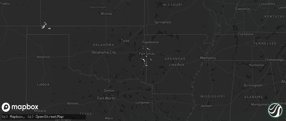
Hail Map on June 2, 2026
The weather event on June 2, 2026 includes Hail and Wind maps. 15 states and 542 cities were impacted and suffered possible damage. The total estimated number of properties impacted is 93,497.
Hail
Wind
93,497
Estimated number of impacted properties by a 1.00" hail or larger7,312
Estimated number of impacted properties by a 1.75" hail or larger367
Estimated number of impacted properties by a 2.50" hail or largerStates Impacted by Hail Map on June 2, 2026
Storm reports
New Mexico
| Date | Description |
|---|---|
| 06/02/20266:51 PM CDT | Mesonet station 107 endee 2 sw. |
| 06/02/20265:12 PM CDT | A local report indicates 68 MPH wind near 5 E Sumner Lake State P |
| 06/02/20265:07 PM CDT | Time estimated based on radar. |
| 06/02/20264:30 PM CDT | A local report indicates 3.50 inch wind near Mayhill |
| 06/02/20262:25 PM CDT | A local report indicates 1.50 inch wind near 11 E Cloudcroft |
| 06/01/20268:35 PM CDT | Public reports at least one tree down uprooted by thunderstorm winds. Time estimated by radar. |
| 06/01/20267:55 PM CDT | Seven rivers weather station recorded a thunderstorm wind gust of 66 mph. |
| 06/01/20267:55 PM CDT | Artesia awos recorded a thunderstorm wind gust of 62 mph. |
| 06/01/20267:41 PM CDT | Mesonet at carlsbad caverns np recorded a thunderstorm wind gust of 73 mph. |
Texas
| Date | Description |
|---|---|
| 06/02/20266:44 PM CDT | Huge limbs blown down on some back roads. |
| 06/02/20266:23 PM CDT | Egg size hail reported near lebanon rd in the colony. |
| 06/02/20266:15 PM CDT | 10 to 12 inch diameter trees reported down across white settlement rd just west of the parker county line. |
| 06/02/20266:06 PM CDT | A local report indicates 62 MPH wind near 4 WNW Stratford |
| 06/02/20265:42 PM CDT | Facebook photos showed a few trees down across grapevine including on oak grove loop and mustang drive. |
| 06/02/20265:38 PM CDT | Facebook report of quarter size hail reported along hwy 114 in grapevine. |
| 06/02/20265:38 PM CDT | Tree across fm2743 and fm3373. |
| 06/02/20265:31 PM CDT | Good size trees down and power out near cr32 in the ebenezer community. |
| 06/02/20265:29 PM CDT | Facebook report of a tree blown down on peak street. |
| 06/02/20265:25 PM CDT | Quarter to ping pong ball size hail at us 67 and cr 607 near venus. |
| 06/02/20265:25 PM CDT | Intermittent quarter to ping pong ball size hail at us 67 and fm 2738. |
| 06/02/20265:05 PM CDT | Utility poles and tree limbs down on seagoville rd near i 635 in balch springs. |
| 06/02/20265:05 PM CDT | Ping pong ball size hail reported on seagoville rd near i 635. |
| 06/02/20265:00 PM CDT | 911 dispatch reported a few trees down around the town of chireno. Time estimated by radar. |
| 06/02/20264:27 PM CDT | Report from mping: quarter |
| 06/02/20264:27 PM CDT | Report from mping: quarter |
| 06/02/20264:23 PM CDT | Report from mping: quarter |
| 06/02/20264:21 PM CDT | Report from mping: quarter |
| 06/02/20264:17 PM CDT | Broadcast media passed along a report from a caller... Mentioning hail was occurring along cypress north houston road. Hail was estimated at nickel to quarter size. |
| 06/02/20264:15 PM CDT | 911 dispatch reported a few trees down around the community of martinsville. Time estimated by radar. |
| 06/02/20264:12 PM CDT | Spotter report of a few large tree branches down in northeast part of combine. |
| 06/02/20263:50 PM CDT | Facebook report of large tree branches down and nickel size hail on beaver creek rd. Time estimated. |
| 06/02/20263:45 PM CDT | Trees down across harrison county. |
| 06/02/20263:40 PM CDT | A local report indicates 1.00 inch wind near Lavon |
| 06/02/20263:30 PM CDT | Facebook report and photos of several trees down in tennessee colony with one tree completely blocking fm 321. One home had minor roof damage. |
| 06/02/20262:45 PM CDT | Tree on house. |
| 06/02/20262:35 PM CDT | Trees down around lindale. |
| 06/02/20262:30 PM CDT | Trees down in hallsville. |
| 06/02/20262:00 PM CDT | Trees down across harrison county east of marshall. |
| 06/02/20261:48 PM CDT | Large tree blown down at corner of baylor drive and karen drive in tyler. |
| 06/02/20261:45 PM CDT | Corrects previous tstm wnd dmg report from whitehouse. Tree on house. |
| 06/02/20261:29 PM CDT | Local media provided picture of boat dock covering destroyed on lake tyler east. |
| 06/01/202611:35 PM CDT | Mesonet at seminole recorded a thunderstorm wind gust of 61 mph associated with outflow. |
| 06/01/20268:56 PM CDT | Awos station khyi san marcos regional arpt. |
| 06/01/20268:27 PM CDT | Report from mping. Quarter sized hail. |
| 06/01/20268:20 PM CDT | Facebook report of pea to quarter size hail on southwest side of hubbard creek lake. |
| 06/01/20268:15 PM CDT | Location and time approx based on radar. Social media post showed hail stones near 1 inch. |
| 06/01/20267:46 PM CDT | Broadcast media relayed a report and photo of several powerlines down on watson lane west between interstate 35 and farm to market road 1102. Time estimated by radar. |
North Dakota
| Date | Description |
|---|---|
| 06/02/20266:56 PM CDT | Quarter sized hail reported. Nearby report of smaller hail but a lot of hail. |
| 06/02/20266:37 PM CDT | Ndawn station 7 ne of zeeland. |
| 06/02/20266:06 PM CDT | Reported by ndawn. |
| 06/02/20265:50 PM CDT | Photo relayed from broadcast media of up to quarter sized hail lasting about 10 minutes in robinson. |
| 06/02/20265:24 PM CDT | A local report indicates 1.00 inch wind near 5 SW Brocket |
| 06/02/20265:01 PM CDT | A local report indicates 1.00 inch wind near 1 WSW Doyon |
| 06/02/20264:45 PM CDT | A local report indicates 1.00 inch wind near Calvin |
| 06/02/20263:10 PM CDT | A local report indicates 1.75 inch wind near 3 NNW Hansboro |
| 06/02/20263:05 PM CDT | Hail slightly bigger than quarter size fell for 2 to 3 minutes. |
| 06/02/20261:56 PM CDT | Golf ball sized hail estimated. Public report relayed by broadcast media. |
| 06/02/202612:30 PM CDT | A local report indicates 1.00 inch wind near 2 E Osnabrock |
| 06/01/20269:35 PM CDT | Measured wind gust at the awos station ks32 cooperstown ap nd. |
| 06/01/20268:30 PM CDT | 10 meter measured wind gust at 5 w courtenay ndawn station. |
| 06/01/20268:30 PM CDT | Measured wind gust at private weather station. |
| 06/01/20268:13 PM CDT | Measured wind gust from private weather station. |
| 06/01/20267:09 PM CDT | Measured wind gust from private weather station. |
Arkansas
| Date | Description |
|---|---|
| 06/02/20262:35 PM CDT | A downed tree and power line on us highway 371 just north of columbia road 27 south. |
| 06/02/20262:18 PM CDT | Large tree down on county road 22 between stamps and lewisville. |
| 06/02/20262:03 PM CDT | Tree down on highway 371 between taylor and springhill. |
| 06/02/20261:45 PM CDT | A few trees were knocked down onto powerlines. |
| 06/02/20261:45 PM CDT | A tree fell and snapped two power poles near the post office. This resulted in power outages in the downtown magnolia square and surrounding areas. |
| 06/02/20261:11 PM CDT | Tree down on highway 73 and hempstead 310 near crossroads. |
Oklahoma
| Date | Description |
|---|---|
| 06/01/202610:16 PM CDT | Kmko observation. |
West Virginia
| Date | Description |
|---|---|
| 06/02/20264:10 PM CDT | Tree contact with power lines. Tree down due to high wind. |
Louisiana
| Date | Description |
|---|---|
| 06/02/20265:24 PM CDT | Powerline downed by thunderstorm winds. |
| 06/02/20263:45 PM CDT | 911 dispatch reported trees down across the parish. Time estimated by radar. |
| 06/02/20263:00 PM CDT | Very large tree fell on a home on fairfield avenue in shreveport... Resulting in significant damage. |
| 06/02/20262:37 PM CDT | Tree down on whispering pine drive. |
| 06/02/20262:30 PM CDT | Trees down across claiborne parish. |
| 06/02/20261:35 PM CDT | Corrects previous tstm wnd dmg report from 3 ene shongaloo. 2 trees downed along hwy 615. |
| 06/02/20261:35 PM CDT | 2 trees downed along hwy 615. |
| 06/01/20267:10 PM CDT | Report from beauregard parish sheriffs office of a tree down on longville church road. |
Mississippi
| Date | Description |
|---|---|
| 06/02/20266:14 PM CDT | Tree downed on jasper county near hwy 15 and county rd 1553. |
| 06/02/20266:09 PM CDT | Law enforcement reported couple of trees down on dry grove in hinds county. |
| 06/02/20266:06 PM CDT | Law enforcement reported couple of trees down on neil collins rd in hinds county. |
| 06/02/20265:40 PM CDT | Tree downed near the intersection of mullican rd and hickory ridge rd. |
| 06/02/20265:35 PM CDT | Tree downed on smith county rd 106. |
| 06/02/20265:35 PM CDT | Tree downed near the 180 block of hayes place. |
| 06/02/20265:31 PM CDT | Tree downed on smith county rd 114. |
| 06/02/20265:23 PM CDT | Trees downed on smith county rd 77 and county rd 121. |
| 06/02/20265:17 PM CDT | Tree downed on smith county rd 540/2. |
| 06/02/20265:15 PM CDT | Tree downed on jasper county near hwy 15 and county rd 1553. |
| 06/02/20265:12 PM CDT | Tree downed on jasper county near hwy 15 and county rd 20. |
Florida
| Date | Description |
|---|---|
| 06/02/20265:11 PM CDT | Off duty nws employee shared photos of a large tree down on the northbound lanes of northwest 102nd avenue in doral... Florida as a result of severe wind gusts as a sev |
| 06/02/20264:45 PM CDT | Tree damage and roof damage at alan jay chevy gmc in sebring. |
| 06/02/20264:40 PM CDT | Ormond beach municipal airport measured a peak wind gust of 61mph/53kt from the east at 5:40 pm. |
| 06/02/20264:26 PM CDT | Broadcast media relayed picture of quarter size hail in new smyrna beach in the oliver estates subdivision near s glencoe rd. |
| 06/02/20262:45 PM CDT | Broadcast media relayed photo of a fallen large pine tree in century village west palm beach due to severe wind gusts with a severe thunderstorm that over the location |
| 06/01/20267:15 PM CDT | Broadcast media shared photos of a large tree down and trampoline stuck onto a roof after a severe thunderstorm moved through the arden community in palm beach county. |
Montana
| Date | Description |
|---|---|
| 06/01/20268:40 PM CDT | A local report indicates 3.00 inch wind near 9 SE Webster |
Wyoming
| Date | Description |
|---|---|
| 06/02/20266:46 PM CDT | Mesonet station ktmh i-25 twenty mile hill |
| 06/02/20265:14 PM CDT | Delayed report. Hail of at least ping pong ball sized was found 2-3 hours after the storm. Hail accumulation covered the ground and drifts of up to 1 to 2 feet deep wer |
| 06/02/20262:54 PM CDT | Multiple reports of another rope-like... Persistent tornado. Exact location is estimated. |
| 06/02/20262:40 PM CDT | Mesonet station pc229 little bitter creek |
| 06/02/20262:30 PM CDT | Multiple reports of a funnel cloud with a ground circulation. |
South Dakota
| Date | Description |
|---|---|
| 06/02/20266:43 PM CDT | Estimated ping pong ball size hail... Zero visibility... Very strong winds at least over 60 mph rocking truck back and forth. Street flooding now occurring across white |
| 06/02/20266:43 PM CDT | Estimated ping pong ball size hail... Zero visibility... Very strong winds at least over 60 mph rocking truck back and forth. Street flooding now occurring across white |
| 06/02/20266:38 PM CDT | A local report indicates 63 MPH wind near 9 ENE Belvidere |
| 06/02/20266:33 PM CDT | A local report indicates 59 MPH wind near 9 ENE Belvidere |
| 06/02/20266:25 PM CDT | The coop observer 1 mile southeast of artas recorded on his personal weather station a wind gust of 80 mph. A swingset was damaged and a camper blown off its blocks at |
| 06/02/20265:25 PM CDT | A local report indicates 60 MPH wind near 1 S Manderson |
| 06/02/20265:17 PM CDT | Estimated nickel to quarter size hail. |
| 06/02/20264:39 PM CDT | A local report indicates 1.00 inch wind near 8 SE Interior |
| 06/02/20264:07 PM CDT | A local report indicates 1.00 inch wind near Oglala |
| 06/02/20263:46 PM CDT | A local report indicates 1.00 inch wind near Oglala |
| 06/02/20263:42 PM CDT | A local report indicates 63 MPH wind near 4 E Cactus Flat |
| 06/02/20263:25 PM CDT | Small hail beginning to accumulate. |
| 06/02/20263:21 PM CDT | Falling at the conoco gas station. Time estimated based on radar and social media video. |
| 06/02/20263:19 PM CDT | A local report indicates 1.75 inch wind near Cactus Flat |
| 06/01/20269:58 PM CDT | A local report indicates 60 MPH wind near Mission |
| 06/01/20269:58 PM CDT | A local report indicates 1.75 inch wind near Mission |
| 06/01/20268:29 PM CDT | Picture submitted via social media. |
| 06/01/20267:33 PM CDT | Mesonet station 13 vivian |
Cities Impacted by Hail Map on June 2, 2026
- Bunch, OK
- Rolla, KS
- Chester, AR
- Natural Dam, AR
- Pocola, OK
- Fort Smith, AR
- Stilwell, OK
- Mountainburg, AR
- Goodwell, OK
- Booneville, AR
- Mansfield, AR
- Waldron, AR
- Heavener, OK
- Poteau, OK
- Mena, AR
- Shady Point, OK
- Sanborn, ND
- Rogers, ND
- Howe, OK
- Guymon, OK
- Hooker, OK
- Cooperstown, ND
- Aneta, ND
- Edmore, ND
- Conchas Dam, NM
- Milton, ND
- Osnabrock, ND
- Fairdale, ND
- Mescalero, NM
- Santa Rosa, NM
- McGregor, TX
- Richwood, WV
- Langdon, ND
- De Kalb, TX
- Cavalier, ND
- Walhalla, ND
- Mountain, ND
- Magnolia, AR
- Mosquero, NM
- Willow City, ND
- Oglesby, TX
- Mineral Springs, AR
- Moody, TX
- McCaskill, AR
- Emerson, AR
- Newkirk, NM
- Rolette, ND
- Hebron, NE
- Dunseith, ND
- Carleton, NE
- Athens, TX
- Okolona, AR
- Blevins, AR
- Reva, SD
- Tyler, TX
- Homer, LA
- Gatesville, TX
- Neche, ND
- Belcourt, ND
- Texarkana, TX
- Rugby, ND
- De Berry, TX
- Fort Hood, TX
- Waldo, AR
- Saint John, ND
- Belle Fourche, SD
- Whitehouse, TX
- Souris, ND
- Garita, NM
- Athens, LA
- Hope, AR
- Fairmont, NE
- Marshall, TX
- Minden, LA
- Haynesville, LA
- Troup, TX
- Overton, TX
- Hallsville, TX
- Newell, SD
- Rolla, ND
- Bottineau, ND
- Garland City, AR
- Gibsland, LA
- Lindale, TX
- Cookville, TX
- Mount Pleasant, TX
- Buffalo, SD
- Grafton, NE
- Jonesboro, TX
- Taylor, AR
- Nara Visa, NM
- Omaha, TX
- Pittsburg, TX
- Rosston, AR
- Jacksonville, TX
- Mayhill, NM
- Arcadia, LA
- West Palm Beach, FL
- Stamps, AR
- Benton, LA
- Max, ND
- Sibley, LA
- Bullard, TX
- Lewisville, AR
- Garrison, ND
- Buckner, AR
- Mount Calm, TX
- Hubbard, TX
- Coolidge, TX
- Canton, TX
- Vaughn, NM
- Mart, TX
- Riesel, TX
- Waco, TX
- Perth, ND
- Cloudcroft, NM
- Ben Wheeler, TX
- La Luz, NM
- Cranfills Gap, TX
- Meridian, TX
- Minot, ND
- Oelrichs, SD
- Rocklake, ND
- Hansboro, ND
- Bisbee, ND
- Sawyer, ND
- Mcclusky, ND
- Stephens, AR
- Kadoka, SD
- Pine Ridge, SD
- Jefferson, TX
- Henderson, TX
- Shreveport, LA
- Kemp, TX
- Winnsboro, TX
- Como, TX
- Quitman, TX
- Axtell, TX
- Gilmer, TX
- Norwich, ND
- Fort Davis, TX
- Interior, SD
- Butte, ND
- Vivian, LA
- Oglala, SD
- Surrey, ND
- Iredell, TX
- Scurry, TX
- Bent, NM
- Point, TX
- Lone Oak, TX
- Hannah, ND
- McNeil, AR
- Kyle, SD
- Kaufman, TX
- Wills Point, TX
- Joaquin, TX
- Tenaha, TX
- Gloster, LA
- Mercer, ND
- Drake, ND
- Philip, SD
- Karnack, TX
- Mineola, TX
- Nevada, TX
- Conroe, TX
- Ennis, TX
- Tularosa, NM
- Emory, TX
- Palm Beach Gardens, FL
- Big Sandy, TX
- Deering, ND
- Timpson, TX
- Sarles, ND
- Lavon, TX
- Alba, TX
- Cumby, TX
- Logansport, LA
- Grand Cane, LA
- Houston, TX
- Coushatta, LA
- Gladewater, TX
- Stephenville, TX
- Edgewood, TX
- Granville, ND
- Kiln, MS
- Dawson, TX
- Weed, NM
- Egeland, ND
- Corsicana, TX
- Fairfield, TX
- Streetman, TX
- Rosser, TX
- Cleburne, TX
- Spring, TX
- Calvin, ND
- Adrian, TX
- Bluff Dale, TX
- Daytona Beach, FL
- Anamoose, ND
- Wanblee, SD
- Mansfield, LA
- Barry, TX
- Leakesville, MS
- Neely, MS
- Devils Lake, ND
- Manderson, SD
- State Line, MS
- Fruitdale, AL
- Center, TX
- Pass Christian, MS
- Saucier, MS
- Gulfport, MS
- Alamogordo, NM
- Munich, ND
- Channing, TX
- Crandall, TX
- Seagoville, TX
- Tylertown, MS
- Van Horn, TX
- Holloman Air Force Base, NM
- Alto, TX
- Webster, ND
- Port Orange, FL
- Ferris, TX
- Porcupine, SD
- Cypress, TX
- Nacogdoches, TX
- Terrell, TX
- Forney, TX
- Lance Creek, WY
- Flagler Beach, FL
- Palm Coast, FL
- Purdon, TX
- Tolar, TX
- Douglass, TX
- Waller, TX
- Hockley, TX
- Saint Stephens, AL
- Leroy, AL
- New Smyrna Beach, FL
- Italy, TX
- Kilgore, TX
- Prairie View, TX
- Hempstead, TX
- Starkweather, ND
- Katy, TX
- Tolna, ND
- Warwick, ND
- Zolfo Springs, FL
- Ormond Beach, FL
- Brookhaven, MS
- Pinon, NM
- Miami, FL
- Kennard, TX
- Crockett, TX
- Irving, TX
- Grapeland, TX
- Sierra Blanca, TX
- Edgewater, FL
- Blooming Grove, TX
- Hope, NM
- Maddock, ND
- Allen, SD
- Hartley, TX
- Dalhart, TX
- Midlothian, TX
- Oak Hill, FL
- Osteen, FL
- Mesquite, TX
- Dallas, TX
- Buffalo, TX
- Crary, ND
- San Jon, NM
- Bard, NM
- Mansfield, TX
- Arlington, TX
- Bellville, TX
- Venus, TX
- Centerville, TX
- Grand Prairie, TX
- Lakota, ND
- Wells, TX
- Hammond, LA
- Valentine, TX
- Lawton, ND
- Buffalo Gap, SD
- Chacon, NM
- Mora, NM
- Esmond, ND
- Lovelady, TX
- Burleson, TX
- Pollok, TX
- Georgetown, LA
- Alvarado, TX
- Alsen, ND
- Douglas, WY
- Jasper, TX
- Richmond, TX
- Logan, NM
- Fulshear, TX
- Brookshire, TX
- Coppell, TX
- Hoven, SD
- Java, SD
- Harvey, ND
- Grapevine, TX
- Euless, TX
- White River, SD
- Selby, SD
- Broaddus, TX
- Lorida, FL
- Brocket, ND
- Bedford, TX
- Wales, ND
- Truth Or Consequences, NM
- Carrizozo, NM
- Grandview, TX
- Jewett, TX
- Plano, TX
- Fort Sumner, NM
- Fort Worth, TX
- Steele, ND
- Trinity, TX
- Hurst, TX
- Colleyville, TX
- Rosenberg, TX
- Fairburn, SD
- Oakwood, TX
- Marquez, TX
- Okeechobee, FL
- Hurdsfield, ND
- Chaseley, ND
- Sealy, TX
- Wallis, TX
- Cimarron, NM
- Chamisal, NM
- Bowdle, SD
- Normangee, TX
- Carrollton, TX
- Robinson, ND
- Dawson, ND
- Aledo, TX
- Adams, ND
- Hot Springs, SD
- Edgemont, SD
- Linton, ND
- Oral, SD
- Martin, SD
- Kintyre, ND
- Haltom City, TX
- Hampden, ND
- Hensel, ND
- Caldwell, TX
- Leesville, LA
- Cuervo, NM
- Frisco, TX
- Weatherford, TX
- The Colony, TX
- Eureka, SD
- Tappen, ND
- Dime Box, TX
- Napoleon, ND
- Balch Springs, TX
- Herreid, SD
- Upton, WY
- Godley, TX
- Cresson, TX
- Gause, TX
- Pettibone, ND
- Leander, TX
- Sundance, WY
- McLaughlin, SD
- Lexington, TX
- Tuthill, SD
- Schulenburg, TX
- Azle, TX
- Moorcroft, WY
- Selfridge, ND
- Murdo, SD
- Granbury, TX
- Dell City, TX
- Custer, SD
- Clewiston, FL
- Weimar, TX
- Lipan, TX
- Moore Haven, FL
- Draper, SD
- Rockdale, TX
- Cameron, TX
- Bathgate, ND
- Woodworth, ND
- Lehr, ND
- Milano, TX
- Gackle, ND
- Paige, TX
- Devils Tower, WY
- Hamilton, ND
- Fredonia, ND
- Hearne, TX
- Wood, SD
- Streeter, ND
- Seminary, MS
- Alva, WY
- Hammond, MT
- Lead, SD
- Hulett, WY
- Austin, TX
- Gillette, WY
- Mission, SD
- Vivian, SD
- Thrall, TX
- Thorndale, TX
- Del Valle, TX
- Presho, SD
- Okreek, SD
- Ekalaka, MT
- Michigan, ND
- Spearfish, SD
- Chadron, NE
- Cleveland, ND
- Medina, ND
- Edinburg, ND
- Harwood, TX
- Luling, TX
- Breckenridge, TX
- Coleman, TX
- Santa Anna, TX
- Brady, TX
- Buchanan, ND
- El Paso, TX
- Buda, TX
- Montpelier, ND
- Johnson City, TX
- Lankin, ND
- Kensal, ND
- Courtenay, ND
- Kyle, TX
- Hoople, ND
- Gonzales, TX
- Pingree, ND
- Park River, ND
- Glenfield, ND
- Voca, TX
- Jamestown, ND
- Alzada, MT
- Boyes, MT
- Nixon, TX
- Fort Bliss, TX
- Wimberley, TX
- Tuttle, ND
- Blanco, TX
- Dripping Springs, TX
- Hannaford, ND
- Sutton, ND
- Binford, ND
- Spiritwood, ND
- Fordville, ND
- Mason, TX
- Tahlequah, OK
- Seguin, TX
- Petersburg, ND
- Broken Arrow, OK
- Tulsa, OK
- Wimbledon, ND
- San Marcos, TX
- Baker, MT
- Martindale, TX
- Maxwell, TX
- Melrose, NM
- Mcville, ND
- Wounded Knee, SD
- Dazey, ND
- Roswell, NM
- Smiley, TX
- Hay Springs, NE
- Stockdale, TX
- Whitney, NE
- Dahlen, ND
- Finley, ND
- Jessie, ND
- Sharon, ND
- Niagara, ND
- Gillett, TX
- Rushville, NE
- Menard, TX
- Hext, TX
- Saint Francis, SD
- Batesland, SD
- Roscoe, TX
- Rhame, ND
- Fort Pierre, SD
- Maryneal, TX
- Norris, SD
- Mandan, ND
- Harrold, SD
- Amidon, ND
- Bowman, ND
- Lower Brule, SD
- Bismarck, ND
- Kennebec, SD
- Pierre, SD
- Post, TX
- Reliance, SD
- Snyder, TX
- Hermleigh, TX
- Highmore, SD
- Holabird, SD
- Ira, TX
- Tahoka, TX
- Parmelee, SD
- Wilson, TX
- Muskogee, OK
- Fluvanna, TX
- Hermosa, SD
- Gordon, NE
- Gail, TX
- Clovis, NM
- Larimore, ND
- Merriman, NE
- Odonnell, TX
- Cody, NE
- Nenzel, NE
- Kilgore, NE
- Ackerly, TX
- Fessenden, ND
- Kress, TX
- Wood Lake, NE
- Springview, NE
- Silverton, TX
- Howes, SD
- Hialeah, FL
- Dexter, NM
- Hagerman, NM
- Artesia, NM
- Lake Arthur, NM
- Loving, NM
- Carlsbad, NM
- Taiban, NM
- Stratford, TX
- Zeeland, ND
- Ashley, ND