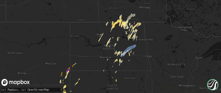
Hail Map in North Dakota on June 2, 2026
The weather event in North Dakota on June 2, 2026 includes Hail and Wind maps. 15 states and 542 cities were impacted and suffered possible damage. The total estimated number of properties impacted is 5,856.
Hail
Wind
5,856
Estimated number of impacted properties by a 1.00" hail or larger2,853
Estimated number of impacted properties by a 1.75" hail or larger0
Estimated number of impacted properties by a 2.50" hail or largerStorm reports in North Dakota
North Dakota
| Date | Description |
|---|---|
| 06/02/20266:56 PM CDT | Quarter sized hail reported. Nearby report of smaller hail but a lot of hail. |
| 06/02/20266:37 PM CDT | Ndawn station 7 ne of zeeland. |
| 06/02/20266:06 PM CDT | Reported by ndawn. |
| 06/02/20265:50 PM CDT | Photo relayed from broadcast media of up to quarter sized hail lasting about 10 minutes in robinson. |
| 06/02/20265:24 PM CDT | A local report indicates 1.00 inch wind near 5 SW Brocket |
| 06/02/20265:01 PM CDT | A local report indicates 1.00 inch wind near 1 WSW Doyon |
| 06/02/20264:45 PM CDT | A local report indicates 1.00 inch wind near Calvin |
| 06/02/20263:10 PM CDT | A local report indicates 1.75 inch wind near 3 NNW Hansboro |
| 06/02/20263:05 PM CDT | Hail slightly bigger than quarter size fell for 2 to 3 minutes. |
| 06/02/20261:56 PM CDT | Golf ball sized hail estimated. Public report relayed by broadcast media. |
| 06/02/202612:30 PM CDT | A local report indicates 1.00 inch wind near 2 E Osnabrock |
| 06/01/20269:35 PM CDT | Measured wind gust at the awos station ks32 cooperstown ap nd. |
| 06/01/20268:30 PM CDT | 10 meter measured wind gust at 5 w courtenay ndawn station. |
| 06/01/20268:30 PM CDT | Measured wind gust at private weather station. |
| 06/01/20268:13 PM CDT | Measured wind gust from private weather station. |
| 06/01/20267:09 PM CDT | Measured wind gust from private weather station. |
All States Impacted by Hail Map on June 2, 2026
Cities Impacted by Hail Map on June 2, 2026
- Bunch, OK
- Rolla, KS
- Chester, AR
- Natural Dam, AR
- Pocola, OK
- Fort Smith, AR
- Stilwell, OK
- Mountainburg, AR
- Goodwell, OK
- Booneville, AR
- Mansfield, AR
- Waldron, AR
- Heavener, OK
- Poteau, OK
- Mena, AR
- Shady Point, OK
- Sanborn, ND
- Rogers, ND
- Howe, OK
- Guymon, OK
- Hooker, OK
- Cooperstown, ND
- Aneta, ND
- Edmore, ND
- Conchas Dam, NM
- Milton, ND
- Osnabrock, ND
- Fairdale, ND
- Mescalero, NM
- Santa Rosa, NM
- McGregor, TX
- Richwood, WV
- Langdon, ND
- De Kalb, TX
- Cavalier, ND
- Walhalla, ND
- Mountain, ND
- Magnolia, AR
- Mosquero, NM
- Willow City, ND
- Oglesby, TX
- Mineral Springs, AR
- Moody, TX
- McCaskill, AR
- Emerson, AR
- Newkirk, NM
- Rolette, ND
- Hebron, NE
- Dunseith, ND
- Carleton, NE
- Athens, TX
- Okolona, AR
- Blevins, AR
- Reva, SD
- Tyler, TX
- Homer, LA
- Gatesville, TX
- Neche, ND
- Belcourt, ND
- Texarkana, TX
- Rugby, ND
- De Berry, TX
- Fort Hood, TX
- Waldo, AR
- Saint John, ND
- Belle Fourche, SD
- Whitehouse, TX
- Souris, ND
- Garita, NM
- Athens, LA
- Hope, AR
- Fairmont, NE
- Marshall, TX
- Minden, LA
- Haynesville, LA
- Troup, TX
- Overton, TX
- Hallsville, TX
- Newell, SD
- Rolla, ND
- Bottineau, ND
- Garland City, AR
- Gibsland, LA
- Lindale, TX
- Cookville, TX
- Mount Pleasant, TX
- Buffalo, SD
- Grafton, NE
- Jonesboro, TX
- Taylor, AR
- Nara Visa, NM
- Omaha, TX
- Pittsburg, TX
- Rosston, AR
- Jacksonville, TX
- Mayhill, NM
- Arcadia, LA
- West Palm Beach, FL
- Stamps, AR
- Benton, LA
- Max, ND
- Sibley, LA
- Bullard, TX
- Lewisville, AR
- Garrison, ND
- Buckner, AR
- Mount Calm, TX
- Hubbard, TX
- Coolidge, TX
- Canton, TX
- Vaughn, NM
- Mart, TX
- Riesel, TX
- Waco, TX
- Perth, ND
- Cloudcroft, NM
- Ben Wheeler, TX
- La Luz, NM
- Cranfills Gap, TX
- Meridian, TX
- Minot, ND
- Oelrichs, SD
- Rocklake, ND
- Hansboro, ND
- Bisbee, ND
- Sawyer, ND
- Mcclusky, ND
- Stephens, AR
- Kadoka, SD
- Pine Ridge, SD
- Jefferson, TX
- Henderson, TX
- Shreveport, LA
- Kemp, TX
- Winnsboro, TX
- Como, TX
- Quitman, TX
- Axtell, TX
- Gilmer, TX
- Norwich, ND
- Fort Davis, TX
- Interior, SD
- Butte, ND
- Vivian, LA
- Oglala, SD
- Surrey, ND
- Iredell, TX
- Scurry, TX
- Bent, NM
- Point, TX
- Lone Oak, TX
- Hannah, ND
- McNeil, AR
- Kyle, SD
- Kaufman, TX
- Wills Point, TX
- Joaquin, TX
- Tenaha, TX
- Gloster, LA
- Mercer, ND
- Drake, ND
- Philip, SD
- Karnack, TX
- Mineola, TX
- Nevada, TX
- Conroe, TX
- Ennis, TX
- Tularosa, NM
- Emory, TX
- Palm Beach Gardens, FL
- Big Sandy, TX
- Deering, ND
- Timpson, TX
- Sarles, ND
- Lavon, TX
- Alba, TX
- Cumby, TX
- Logansport, LA
- Grand Cane, LA
- Houston, TX
- Coushatta, LA
- Gladewater, TX
- Stephenville, TX
- Edgewood, TX
- Granville, ND
- Kiln, MS
- Dawson, TX
- Weed, NM
- Egeland, ND
- Corsicana, TX
- Fairfield, TX
- Streetman, TX
- Rosser, TX
- Cleburne, TX
- Spring, TX
- Calvin, ND
- Adrian, TX
- Bluff Dale, TX
- Daytona Beach, FL
- Anamoose, ND
- Wanblee, SD
- Mansfield, LA
- Barry, TX
- Leakesville, MS
- Neely, MS
- Devils Lake, ND
- Manderson, SD
- State Line, MS
- Fruitdale, AL
- Center, TX
- Pass Christian, MS
- Saucier, MS
- Gulfport, MS
- Alamogordo, NM
- Munich, ND
- Channing, TX
- Crandall, TX
- Seagoville, TX
- Tylertown, MS
- Van Horn, TX
- Holloman Air Force Base, NM
- Alto, TX
- Webster, ND
- Port Orange, FL
- Ferris, TX
- Porcupine, SD
- Cypress, TX
- Nacogdoches, TX
- Terrell, TX
- Forney, TX
- Lance Creek, WY
- Flagler Beach, FL
- Palm Coast, FL
- Purdon, TX
- Tolar, TX
- Douglass, TX
- Waller, TX
- Hockley, TX
- Saint Stephens, AL
- Leroy, AL
- New Smyrna Beach, FL
- Italy, TX
- Kilgore, TX
- Prairie View, TX
- Hempstead, TX
- Starkweather, ND
- Katy, TX
- Tolna, ND
- Warwick, ND
- Zolfo Springs, FL
- Ormond Beach, FL
- Brookhaven, MS
- Pinon, NM
- Miami, FL
- Kennard, TX
- Crockett, TX
- Irving, TX
- Grapeland, TX
- Sierra Blanca, TX
- Edgewater, FL
- Blooming Grove, TX
- Hope, NM
- Maddock, ND
- Allen, SD
- Hartley, TX
- Dalhart, TX
- Midlothian, TX
- Oak Hill, FL
- Osteen, FL
- Mesquite, TX
- Dallas, TX
- Buffalo, TX
- Crary, ND
- San Jon, NM
- Bard, NM
- Mansfield, TX
- Arlington, TX
- Bellville, TX
- Venus, TX
- Centerville, TX
- Grand Prairie, TX
- Lakota, ND
- Wells, TX
- Hammond, LA
- Valentine, TX
- Lawton, ND
- Buffalo Gap, SD
- Chacon, NM
- Mora, NM
- Esmond, ND
- Lovelady, TX
- Burleson, TX
- Pollok, TX
- Georgetown, LA
- Alvarado, TX
- Alsen, ND
- Douglas, WY
- Jasper, TX
- Richmond, TX
- Logan, NM
- Fulshear, TX
- Brookshire, TX
- Coppell, TX
- Hoven, SD
- Java, SD
- Harvey, ND
- Grapevine, TX
- Euless, TX
- White River, SD
- Selby, SD
- Broaddus, TX
- Lorida, FL
- Brocket, ND
- Bedford, TX
- Wales, ND
- Truth Or Consequences, NM
- Carrizozo, NM
- Grandview, TX
- Jewett, TX
- Plano, TX
- Fort Sumner, NM
- Fort Worth, TX
- Steele, ND
- Trinity, TX
- Hurst, TX
- Colleyville, TX
- Rosenberg, TX
- Fairburn, SD
- Oakwood, TX
- Marquez, TX
- Okeechobee, FL
- Hurdsfield, ND
- Chaseley, ND
- Sealy, TX
- Wallis, TX
- Cimarron, NM
- Chamisal, NM
- Bowdle, SD
- Normangee, TX
- Carrollton, TX
- Robinson, ND
- Dawson, ND
- Aledo, TX
- Adams, ND
- Hot Springs, SD
- Edgemont, SD
- Linton, ND
- Oral, SD
- Martin, SD
- Kintyre, ND
- Haltom City, TX
- Hampden, ND
- Hensel, ND
- Caldwell, TX
- Leesville, LA
- Cuervo, NM
- Frisco, TX
- Weatherford, TX
- The Colony, TX
- Eureka, SD
- Tappen, ND
- Dime Box, TX
- Napoleon, ND
- Balch Springs, TX
- Herreid, SD
- Upton, WY
- Godley, TX
- Cresson, TX
- Gause, TX
- Pettibone, ND
- Leander, TX
- Sundance, WY
- McLaughlin, SD
- Lexington, TX
- Tuthill, SD
- Schulenburg, TX
- Azle, TX
- Moorcroft, WY
- Selfridge, ND
- Murdo, SD
- Granbury, TX
- Dell City, TX
- Custer, SD
- Clewiston, FL
- Weimar, TX
- Lipan, TX
- Moore Haven, FL
- Draper, SD
- Rockdale, TX
- Cameron, TX
- Bathgate, ND
- Woodworth, ND
- Lehr, ND
- Milano, TX
- Gackle, ND
- Paige, TX
- Devils Tower, WY
- Hamilton, ND
- Fredonia, ND
- Hearne, TX
- Wood, SD
- Streeter, ND
- Seminary, MS
- Alva, WY
- Hammond, MT
- Lead, SD
- Hulett, WY
- Austin, TX
- Gillette, WY
- Mission, SD
- Vivian, SD
- Thrall, TX
- Thorndale, TX
- Del Valle, TX
- Presho, SD
- Okreek, SD
- Ekalaka, MT
- Michigan, ND
- Spearfish, SD
- Chadron, NE
- Cleveland, ND
- Medina, ND
- Edinburg, ND
- Harwood, TX
- Luling, TX
- Breckenridge, TX
- Coleman, TX
- Santa Anna, TX
- Brady, TX
- Buchanan, ND
- El Paso, TX
- Buda, TX
- Montpelier, ND
- Johnson City, TX
- Lankin, ND
- Kensal, ND
- Courtenay, ND
- Kyle, TX
- Hoople, ND
- Gonzales, TX
- Pingree, ND
- Park River, ND
- Glenfield, ND
- Voca, TX
- Jamestown, ND
- Alzada, MT
- Boyes, MT
- Nixon, TX
- Fort Bliss, TX
- Wimberley, TX
- Tuttle, ND
- Blanco, TX
- Dripping Springs, TX
- Hannaford, ND
- Sutton, ND
- Binford, ND
- Spiritwood, ND
- Fordville, ND
- Mason, TX
- Tahlequah, OK
- Seguin, TX
- Petersburg, ND
- Broken Arrow, OK
- Tulsa, OK
- Wimbledon, ND
- San Marcos, TX
- Baker, MT
- Martindale, TX
- Maxwell, TX
- Melrose, NM
- Mcville, ND
- Wounded Knee, SD
- Dazey, ND
- Roswell, NM
- Smiley, TX
- Hay Springs, NE
- Stockdale, TX
- Whitney, NE
- Dahlen, ND
- Finley, ND
- Jessie, ND
- Sharon, ND
- Niagara, ND
- Gillett, TX
- Rushville, NE
- Menard, TX
- Hext, TX
- Saint Francis, SD
- Batesland, SD
- Roscoe, TX
- Rhame, ND
- Fort Pierre, SD
- Maryneal, TX
- Norris, SD
- Mandan, ND
- Harrold, SD
- Amidon, ND
- Bowman, ND
- Lower Brule, SD
- Bismarck, ND
- Kennebec, SD
- Pierre, SD
- Post, TX
- Reliance, SD
- Snyder, TX
- Hermleigh, TX
- Highmore, SD
- Holabird, SD
- Ira, TX
- Tahoka, TX
- Parmelee, SD
- Wilson, TX
- Muskogee, OK
- Fluvanna, TX
- Hermosa, SD
- Gordon, NE
- Gail, TX
- Clovis, NM
- Larimore, ND
- Merriman, NE
- Odonnell, TX
- Cody, NE
- Nenzel, NE
- Kilgore, NE
- Ackerly, TX
- Fessenden, ND
- Kress, TX
- Wood Lake, NE
- Springview, NE
- Silverton, TX
- Howes, SD
- Hialeah, FL
- Dexter, NM
- Hagerman, NM
- Artesia, NM
- Lake Arthur, NM
- Loving, NM
- Carlsbad, NM
- Taiban, NM
- Stratford, TX
- Zeeland, ND
- Ashley, ND


