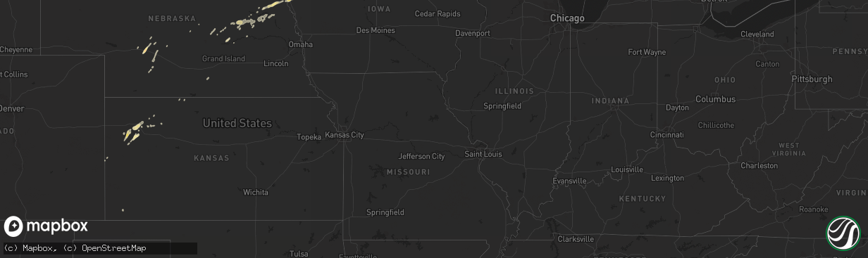
Hail Map in Iowa on June 3, 2011
The weather event in Iowa on June 3, 2011 includes Hail map. 13 states and 242 cities were impacted and suffered possible damage. The total estimated number of properties impacted is 0.
Hail
0
Estimated number of impacted properties by a 1.00" hail or larger0
Estimated number of impacted properties by a 1.75" hail or larger0
Estimated number of impacted properties by a 2.50" hail or largerStorm reports in Iowa
Iowa
| Date | Description |
|---|---|
| 06/03/20114:30 AM CDT | Pea to quarter sized hail |
| 06/03/20114:20 AM CDT | Mostly half inch hail with a few embedded one inch hail stones. Some corn leaves stripped in farm fields. Hail damage swath noted from 1 mile north to 1.5 miles south o |
| 06/03/20114:20 AM CDT | Primarily quarter sized hail with a few larger stones. Some damage to corn crops. |
| 06/03/20113:35 AM CDT | A local report indicates 65 MPH wind near STORM LAKE |
| 06/03/20113:20 AM CDT | Mostly half inch hail with a few embedded one inch hail stones. Some corn leaves stripped in farm fields. Hail damage swath noted from 1 mile north to 1.5 miles south o |
| 06/03/20113:20 AM CDT | Primarily quarter sized hail with a few larger stones. Some damage to corn crops. |
All States Impacted by Hail Map on June 3, 2011
Cities Impacted by Hail Map on June 3, 2011
- Shell Rock, IA
- Waverly, IA
- Lorman, MS
- Grand Marais, MI
- Newberry, MI
- Winnebago, NE
- Anthon, IA
- Moville, IA
- Climbing Hill, IA
- Hornick, IA
- Colquitt, GA
- Girard, GA
- Brooklet, GA
- Lanse, MI
- Dougherty, IA
- Aredale, IA
- Sheffield, IA
- Correctionville, IA
- Glidden, WI
- Clarksville, IA
- Plainfield, IA
- Hovland, MN
- Grand Marais, MN
- Bay Minette, AL
- Herbster, WI
- Bayfield, WI
- Cornucopia, WI
- Indian River, MI
- Afton, MI
- Toccoa, GA
- Palmer, NE
- Bristow, IA
- Clayton, LA
- Ferriday, LA
- Winona, KS
- Leigh, NE
- Clarkson, NE
- Stanton, NE
- Loxley, AL
- Stapleton, AL
- Lucedale, MS
- Spalding, NE
- Keysville, GA
- Waynesboro, GA
- Louisville, GA
- Clarion, IA
- Goldfield, IA
- Minneapolis, MN
- Hampton, IA
- Primrose, NE
- Onaway, MI
- Galva, IA
- Mohawk, MI
- Copper Harbor, MI
- Defuniak Springs, FL
- Lula, GA
- Alto, GA
- North Platte, NE
- Clare, IA
- Eagle Grove, IA
- Badger, IA
- Fort Dodge, IA
- Vincent, IA
- Register, GA
- Statesboro, GA
- Galt, IA
- Wayne, NE
- Pender, NE
- Wisner, NE
- Wakefield, NE
- Pocahontas, IA
- Gilmore City, IA
- Palmer, IA
- Hoxie, KS
- Clovis, NM
- Belgrade, NE
- Humboldt, IA
- Thor, IA
- Lake Linden, MI
- Copper City, MI
- Allouez, MI
- Calumet, MI
- Ahmeek, MI
- Salix, IA
- Sloan, IA
- Oto, IA
- Glennville, GA
- Pilger, NE
- Ontonagon, MI
- Dumont, IA
- Clarkesville, GA
- Claxton, GA
- Reidsville, GA
- Jonesville, LA
- Sicily Island, LA
- Storm Lake, IA
- Schaller, IA
- Early, IA
- Tribune, KS
- Sheridan Lake, CO
- Cornelia, GA
- Maysville, GA
- Mount Airy, GA
- Homer, GA
- Baldwin, GA
- Lyons, GA
- Whigham, GA
- Natchez, MS
- Alanson, MI
- Cheboygan, MI
- Chassell, MI
- Toivola, MI
- Portal, GA
- Skanee, MI
- Emerson, NE
- Thurston, NE
- Colby, KS
- Sylvania, GA
- Wadley, GA
- Gilbert, LA
- Levant, KS
- Ojibwa, WI
- Exeland, WI
- Winter, WI
- Radisson, WI
- Madison, NE
- Cushing, IA
- Albion, NE
- Manson, IA
- Pomeroy, IA
- Jolley, IA
- Grand Portage, MN
- Silver Bay, MN
- Two Harbors, MN
- Monument, KS
- Oakley, KS
- Melrose, NM
- Vidalia, LA
- Pembroke, GA
- Almena, KS
- Greenwood, FL
- Marianna, FL
- Wilmer, AL
- Nemaha, IA
- Eckerman, MI
- Paradise, MI
- Robertsdale, AL
- Daphne, AL
- Sardis, GA
- Brutus, MI
- Newman Grove, NE
- Humphrey, NE
- Lindsay, NE
- Demorest, GA
- Midville, GA
- Wolbach, NE
- Greeley, NE
- Creston, NE
- Floyd, NM
- Columbus, NE
- Vidalia, GA
- Eight Mile, AL
- Semmes, AL
- Citronelle, AL
- Beemer, NE
- Holstein, IA
- Brady, NE
- Howells, NE
- Long Island, KS
- Ponce De Leon, FL
- Westville, FL
- Callaway, NE
- Molino, FL
- Bronson, IA
- Roswell, NM
- Collins, GA
- Newell, IA
- Alexander, IA
- Belmond, IA
- La Pointe, WI
- Pelkie, MI
- Atlantic Mine, MI
- Port Wing, WI
- Houghton, MI
- Saint Edward, NE
- Camilla, GA
- Michigamme, MI
- Pengilly, MN
- Ida Grove, IA
- Saint Ignace, MI
- Selden, KS
- Rexford, KS
- Gem, KS
- Vinegar Bend, AL
- Damascus, GA
- Burwell, NE
- Curtis, NE
- Milton, FL
- Cairo, GA
- Pelham, GA
- Bainbridge, GA
- Stapleton, NE
- Fonda, IA
- Latimer, IA
- Central City, NE
- Maxwell, NE
- Fullerton, NE
- Cuthbert, GA
- Rocky Ford, GA
- Alta, IA
- Odebolt, IA
- Sac City, IA
- Varina, IA
- Battle Creek, IA
- Danbury, IA
- Albert City, IA
- North Loup, NE
- Scotia, NE
- Grady, NM
- Millersburg, MI
- Comstock, NE
- Goetzville, MI
- Minden, NE
- Woolstock, IA
- Edson, KS
- Hoskins, NE
- Winside, NE
- Portales, NM
- Elida, NM
- Port Gibson, MS
- Maywood, NE
- Bascom, FL
- Millen, GA
- Moran, MI
- Norfolk, NE
- Dows, IA
- Hershey, NE
- Grand Rapids, MN
- Broadview, NM
- Hessel, MI
- Poplarville, MS
- Hugoton, KS