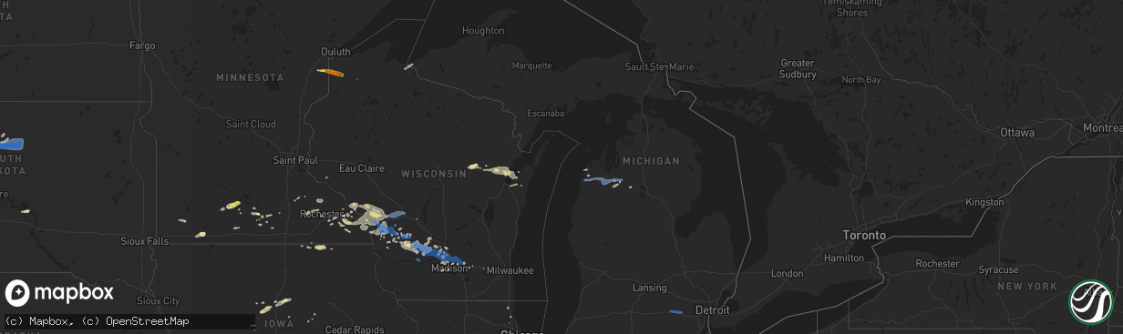
Hail Map in Michigan on July 18, 2019
The weather event in Michigan on July 18, 2019 includes Hail, Wind, and Tornado maps. 19 states and 432 cities were impacted and suffered possible damage. The total estimated number of properties impacted is 0.
Hail
Wind
Tornado
0
Estimated number of impacted properties by a 1.00" hail or larger0
Estimated number of impacted properties by a 1.75" hail or larger0
Estimated number of impacted properties by a 2.50" hail or largerStorm reports in Michigan
Michigan
| Date | Description |
|---|---|
| 07/18/20191:32 PM CDT | Multiple power lines downed closing all eb lanes of i-94 and one wb lane near steinbach road. Time estimated via radar. |
| 07/18/20196:27 AM CDT | Trees down. |
| 07/18/20196:14 AM CDT | Trees down reported by law enforcement. |
| 07/18/20195:50 AM CDT | Corrects previous tstm wnd dmg report from 2 se interlochen. Trees down. |
| 07/17/20199:29 PM CDT | At 229 PM EDT, a severe thunderstorm was located near Dexter, moving east at 40 mph. HAZARD...60 mph wind gusts. SOURCE...Radar indicated. IMPACT...Expect damage to roofs, siding, and trees. This severe thunderstorm will be near... Ann Arbor and Saline around 240 PM EDT. Ypsilanti and Dixboro around 250 PM EDT. Salem around 255 PM EDT.Other locations impacted by this severe thunderstorm include HudsonMills, Pittsfield Township, Whittaker, Hudson Mills Metropark,Bridgewater, Delhi Mills, Pleasant Lake and Barton Hills.People attending Ann Arbor Art Festival should seek safe shelter immediately! |
All States Impacted by Hail Map on July 18, 2019
Cities Impacted by Hail Map on July 18, 2019
- Meadow, SD
- Buffalo, SD
- Ludlow, SD
- Cazenovia, WI
- Lilesville, NC
- Kenyon, MN
- Wells, MN
- Cuthbert, GA
- Shellman, GA
- Estill, SC
- Varnville, SC
- Avera, GA
- South Boardman, MI
- Fife Lake, MI
- Marshalltown, IA
- Gladbrook, IA
- Sheridan, IL
- Earlville, IL
- Utica, IL
- Mendota, IL
- Serena, IL
- Ottawa, IL
- Peru, IL
- Troy Grove, IL
- La Salle, IL
- Nashville, NC
- Saint James, MN
- Alzada, MT
- Capitol, MT
- Reva, SD
- Newell, SD
- Belle Fourche, SD
- Mud Butte, SD
- Hammond, MT
- Foxboro, WI
- Gaston, NC
- Blakely, GA
- Hanska, MN
- Metter, GA
- Fort Stewart, GA
- Meigs, GA
- Solon Springs, WI
- Barnum, MN
- Superior, WI
- Holyoke, MN
- Abbeville, AL
- Shorterville, AL
- Loris, SC
- Hampton, SC
- Apopka, FL
- Longwood, FL
- Gresham, WI
- Albany, GA
- Reinbeck, IA
- Abrams, WI
- Faith, SD
- Luxemburg, WI
- Kewaunee, WI
- Alden, IA
- Iowa Falls, IA
- Tabor City, NC
- Viola, WI
- La Farge, WI
- Lawrenceville, VA
- Dupree, SD
- Isabel, SD
- McIntosh, SD
- McLaughlin, SD
- Trail City, SD
- Lodgepole, SD
- Watauga, SD
- Keldron, SD
- Morristown, SD
- Lemmon, SD
- Columbia, AL
- Newville, AL
- Eagle Butte, SD
- Saluda, SC
- Johnston, SC
- Ward, SC
- Camp Crook, SD
- Williams, IA
- Plain, WI
- Hillpoint, WI
- Ekalaka, MT
- Baker, MT
- Okabena, MN
- Brewster, MN
- Lime Springs, IA
- Richland Center, WI
- Hillsboro, WI
- Littleton, NC
- New Ulm, MN
- Sleepy Eye, MN
- Comfrey, MN
- Selby, SD
- Altura, MN
- Rollingstone, MN
- Washington, GA
- Lincolnton, GA
- Duncombe, IA
- Midland City, AL
- Headland, AL
- Kite, GA
- Broadus, MT
- Kasson, MN
- Dodge Center, MN
- Mantorville, MN
- Madison, WI
- Sun Prairie, WI
- Sobieski, WI
- Oconto Falls, WI
- Krakow, WI
- Pulaski, WI
- Otter, MT
- Battleboro, NC
- Roebuck, SC
- Fort Gaines, GA
- Lantry, SD
- Midville, GA
- Swainsboro, GA
- Bartow, GA
- Wadley, GA
- Pinewood, SC
- Summerton, SC
- Saint Stephen, SC
- Stratford, IA
- Adams, MN
- Bison, SD
- McIntire, IA
- Chester, IA
- Riceville, IA
- Claxton, GA
- Soldiers Grove, WI
- Viroqua, WI
- Peterson, MN
- Lanesboro, MN
- Slayton, MN
- Iona, MN
- Chandler, MN
- Kenly, NC
- Smithfield, NC
- Princeton, NC
- Selma, NC
- Pine Level, NC
- Clayton, NC
- Garnett, SC
- Waverly, GA
- West Salem, WI
- Bangor, WI
- Galesville, WI
- Holmen, WI
- Ettrick, WI
- Mindoro, WI
- Melrose, WI
- Baraboo, WI
- Ralph, SD
- Doerun, GA
- Moultrie, GA
- Chaseburg, WI
- La Crosse, WI
- Cashton, WI
- Stoddard, WI
- Westby, WI
- Rockland, WI
- Coon Valley, WI
- Sparta, WI
- Battle Ground, IN
- Brookston, IN
- Merrimac, WI
- Johnsonville, SC
- Naples, FL
- Dawson, GA
- Lyons, GA
- Collins, GA
- Cobbtown, GA
- Maiden Rock, WI
- Hamilton, GA
- Arcadia, WI
- Fountain City, WI
- New Lisbon, WI
- Browns Summit, NC
- Greensboro, NC
- Winona, MN
- Waynesville, GA
- Coleman, GA
- Jesup, GA
- Townsend, GA
- Round O, SC
- Saxon, WI
- Lodi, WI
- Cottageville, SC
- Dakota, MN
- La Crescent, MN
- Poynette, WI
- Manning, SC
- Chatfield, MN
- Cottage Grove, WI
- Deerfield, WI
- Marshall, WI
- West Lafayette, IN
- Rochester, MN
- Oronoco, MN
- Byron, MN
- Leopolis, WI
- Bowler, WI
- Shawano, WI
- Lower Brule, SD
- Ontario, WI
- Norwalk, WI
- Wanamingo, MN
- Brownsville, MN
- Hokah, MN
- Walterboro, SC
- Cloudcroft, NM
- Greeleyville, SC
- Minnesota City, MN
- Tarrytown, GA
- Statesboro, GA
- Brooklet, GA
- Aynor, SC
- Conway, SC
- Galivants Ferry, SC
- Inman, SC
- Traphill, NC
- Twin City, GA
- Little Suamico, WI
- Register, GA
- Good Thunder, MN
- North Freedom, WI
- Lime Ridge, WI
- Loganville, WI
- Reedsburg, WI
- Rock Springs, WI
- La Valle, WI
- Winter Park, FL
- Casselberry, FL
- Winter Springs, FL
- Leesburg, GA
- Mapleton, MN
- New Zion, SC
- Kingstree, SC
- Timber Lake, SD
- Waseca, MN
- Camden, SC
- Middleton, WI
- Waunakee, WI
- Prospect Heights, IL
- Webb, AL
- Ashford, AL
- Norway, SC
- Hartsfield, GA
- Grand Junction, IA
- Sandy Hook, KY
- Tilleda, WI
- Rushford, MN
- Onalaska, WI
- Dodge, WI
- Trempealeau, WI
- Caledonia, MN
- Lewiston, MN
- Utica, MN
- Houston, MN
- Gettysburg, SD
- Kingsley, MI
- Wakpala, SD
- Prairie Du Sac, WI
- Lakefield, MN
- Dover, MN
- Halifax, NC
- Jackson, NC
- Garysburg, NC
- Grand Ridge, IL
- Marseilles, IL
- Dane, WI
- Turbeville, SC
- Libertyville, IL
- Grayslake, IL
- Gurnee, IL
- Sullivan, WI
- Ogden, IA
- Webster City, IA
- Kamrar, IA
- Stanhope, IA
- Jewell, IA
- Elkmont, AL
- Prospect, TN
- Pine Island, MN
- Zumbro Falls, MN
- Mazeppa, MN
- Stacyville, IA
- Osage, IA
- Bronwood, GA
- Rhame, ND
- Pulaski, TN
- Cecil, WI
- Green Sea, SC
- Green Bay, WI
- Waterloo, WI
- Pineville, SC
- Cross, SC
- Truman, MN
- Lugoff, SC
- Pulaski, GA
- Saint Ansgar, IA
- Boyes, MT
- Minnesota Lake, MN
- Saint Charles, MN
- Garden City, MN
- Pemberton, MN
- Janesville, MN
- Spartanburg, SC
- Honor, MI
- Ocoee, FL
- Orlando, FL
- Delavan, MN
- Easton, MN
- Ridgeway, SC
- Bonita Springs, FL
- Lake City, MI
- Brussels, WI
- Eutawville, SC
- Lake Mills, WI
- Gresham, SC
- Darfur, MN
- Moore, SC
- Wrightsville, GA
- Adrian, GA
- Wadesboro, NC
- Rockmart, GA
- Aragon, GA
- New Providence, IA
- Bonduel, WI
- Oconto, WI
- Green Valley, WI
- Suamico, WI
- New Franken, WI
- Gordon, WI
- Fort Thompson, SD
- Denmark, SC
- Olar, SC
- Valentines, VA
- Norman Park, GA
- Batesburg, SC
- Radcliffe, IA
- Windermere, FL
- Winter Garden, FL
- Genoa, WI
- Maria Stein, OH
- Madelia, MN
- Blackville, SC
- Ellsworth, WI
- Verona, WI
- Lake Mary, FL
- Manton, MI
- Fairmont, MN
- Worthington, MN
- Elroy, WI
- Wonewoc, WI
- Johnson Creek, WI
- Orangeburg, SC
- Dothan, AL
- Aiken, SC
- Monetta, SC
- Lyndon Station, WI
- Wisconsin Dells, WI
- Climax, GA
- Empire, MI
- Mankato, MN
- Lincolnshire, IL
- Lake Forest, IL
- South Range, WI
- Van Wert, OH
- Convoy, OH
- Yorkshire, OH
- Piqua, OH
- Fort Loramie, OH
- Houston, OH
- Osgood, OH
- New Weston, OH
- Saint Henry, OH
- Sidney, OH
- Fairfield, OH
- Hamilton, OH
- Hilliard, OH
- Plain City, OH
- West Jefferson, OH
- Ashland, OH
- Greenwich, OH
- New London, OH
- Shiloh, OH
- Nova, OH
- Crooks, SD
- Ridgeview, SD
- Whitehorse, SD
- Java, SD
- Hoven, SD
- Tolstoy, SD
- De Mossville, KY
- Falmouth, KY
- Grawn, MI
- Traverse City, MI
- Benzonia, MI
- Thompsonville, MI
- Buckley, MI
- Beulah, MI
- Interlochen, MI
- Dexter, MI
- Chelsea, MI
- Ann Arbor, MI
- Tomah, WI
- Windsor, WI
- Deforest, WI
- Morrisonville, WI
- Arlington, WI
- Sauk City, WI
- Spring Green, WI
- Lexington, NC
- Graham, NC
- Burlington, NC
- Raleigh, NC
- Pikeville, NC
- Goldsboro, NC
- Sunset, SC
- Salem, SC
- Lyman, SC
- Greer, SC
- Campobello, SC
- Prosperity, SC
- Newberry, SC
- Swansea, SC
- Gaston, SC


