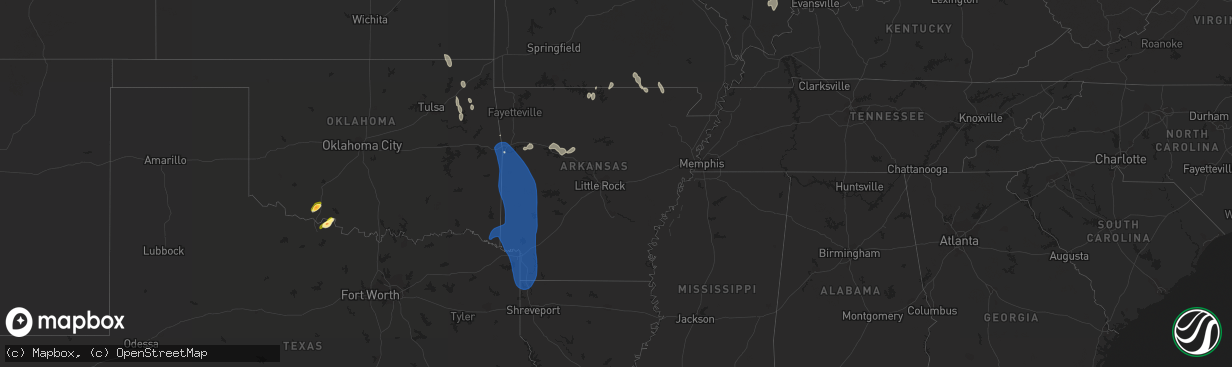
Hail Map in Arkansas on July 23, 2014
The weather event in Arkansas on July 23, 2014 includes Hail and Wind maps. 17 states and 231 cities were impacted and suffered possible damage. The total estimated number of properties impacted is 0.
Hail
Wind
0
Estimated number of impacted properties by a 1.00" hail or larger0
Estimated number of impacted properties by a 1.75" hail or larger0
Estimated number of impacted properties by a 2.50" hail or largerStorm reports in Arkansas
Arkansas
| Date | Description |
|---|---|
| 07/23/20146:48 PM CDT | A tree fell across us 63 n near the pansy community. |
| 07/23/20146:30 PM CDT | Trees power lines down county wide |
| 07/23/20146:24 PM CDT | Trees down on county road 17. |
| 07/23/20146:23 PM CDT | Trees and power lines down |
| 07/23/20146:21 PM CDT | Trees and power lines down genoa... Fouke... Texarkana... And dodridge |
| 07/23/20146:05 PM CDT | Trees and power lines were downed in several locations across the city. |
| 07/23/20146:04 PM CDT | Several trees reported down |
| 07/23/20146:04 PM CDT | Power lines down |
| 07/23/20146:01 PM CDT | Trees and powerlines down on east whelen road. |
| 07/23/20146:00 PM CDT | Several trees reported down |
| 07/23/20145:55 PM CDT | Trees down on kansas road. |
| 07/23/20145:50 PM CDT | Corn crop was flattened by damaging thunderstorm winds. |
| 07/23/20145:40 PM CDT | Trees were toppled in redfield. |
| 07/23/20145:35 PM CDT | Wide spread power outages through city |
| 07/23/20145:30 PM CDT | Numerous trees and power lines down county wide |
| 07/23/20145:23 PM CDT | Trees down in hollywood. |
| 07/23/20145:20 PM CDT | Limbs blown off trees... Power out |
| 07/23/20145:05 PM CDT | Some large limbs and debris were blown around. Wind were estimated at 60 mph. |
| 07/23/20144:50 PM CDT | Trees down county wide |
| 07/23/20144:48 PM CDT | Power lins down and trees uprooted on crosstrails road. |
| 07/23/20144:47 PM CDT | Several metal buildings damaged in beebe. |
| 07/23/20144:46 PM CDT | Arkansas state police reported a tree down over highway 227. |
| 07/23/20144:45 PM CDT | Thunderstorm winds pushed over trees at cabot. |
| 07/23/20144:44 PM CDT | A local report indicates 70 MPH wind near DE QUEEN |
| 07/23/20144:41 PM CDT | Dequeen asos 51 kts peak wind |
| 07/23/20144:36 PM CDT | Strong wind gust blew down pine tree... Limbs down... Heavy rain - 2 east of athens |
| 07/23/20144:20 PM CDT | Tree fell on a vehicle in rover. |
| 07/23/20144:20 PM CDT | On bailey hill road a mobile home was destroyed by a tree. |
| 07/23/20144:15 PM CDT | Highway 278 was blocked by downed trees east of wickes. |
| 07/23/20144:15 PM CDT | Trees down in augusta. |
| 07/23/20144:15 PM CDT | Trees were toppled along highway 33 south of augusta. |
| 07/23/20144:10 PM CDT | Several trees were downed along highway 71 near cove. |
| 07/23/20144:10 PM CDT | Large trees were downed at prince and salem in conway. |
| 07/23/20144:08 PM CDT | Tree down on highway 28 between plainview and ola. |
| 07/23/20144:05 PM CDT | Roof damage to houses in hatfield. |
| 07/23/20144:05 PM CDT | Downed trees were on highway 33 north of augusta. |
| 07/23/20144:01 PM CDT | Trees and power lines down in springfield. |
| 07/23/20144:01 PM CDT | Trees and power lines down in morrilton. |
| 07/23/20144:00 PM CDT | A tree fell on a house on highway 8 west of mena. |
| 07/23/20144:00 PM CDT | Power line was downed just east of cherry hill. |
| 07/23/20144:00 PM CDT | Tree down on arkansas highway 8 east of mena airport. |
| 07/23/20144:00 PM CDT | A tree fell onto a brand new school bus. |
| 07/23/20143:45 PM CDT | A tree fell on a house in batesville. Property damage was substantial. |
| 07/23/20143:40 PM CDT | A tree fell on a house and caused minor damage. Another downed tree destroyed a mobile home. No injuries were reported. |
| 07/23/20143:30 PM CDT | A couple trees down. |
| 07/23/20143:30 PM CDT | Thunderstorm winds gusted to 67 mph at the airport at newport. |
| 07/23/20143:30 PM CDT | A tree was toppled onto a law enforcement vehicle in tuckerman. No injuries resulted. |
| 07/23/20143:30 PM CDT | Large limb fell and destroyed a personal workshop. |
| 07/23/20143:20 PM CDT | A roof was removed from a local night club. |
| 07/23/20143:20 PM CDT | A metal building was damaged in booneville. |
| 07/23/20143:12 PM CDT | Trees down along highway 115 near maynard. |
| 07/23/20143:10 PM CDT | Trees down on lawson road. Power lines and trees down on highway 63 and on harrisburg road and highland road just south of jonesboro. |
| 07/23/20143:10 PM CDT | Large tree fell on house damaging roof. |
| 07/23/20143:10 PM CDT | Damage to several buildings. |
| 07/23/20143:03 PM CDT | Power lines down near fort smith regional airport. |
| 07/23/20143:00 PM CDT | A large tree was uprooted behind a home in dardanelle. |
| 07/23/20142:57 PM CDT | Trees snapped and uprooted...roof damage to homes. |
| 07/23/20142:57 PM CDT | Trees snapped and uprooted... Fence and roof damage to residential homes... Power out |
| 07/23/20142:56 PM CDT | A local report indicates 58 MPH wind near 2 ENE JONESBORO |
| 07/23/20142:55 PM CDT | Large tree limbs were downed at russellville. |
| 07/23/20142:55 PM CDT | Tree blown down |
| 07/23/20142:54 PM CDT | Trees down south of mountain home. |
| 07/23/20142:53 PM CDT | 24 inch diamter tree down over the road at highway 23 south and highway 96. |
| 07/23/20142:50 PM CDT | Construction barrels were blown around on interstate 40 near pottsville. |
| 07/23/20142:50 PM CDT | 2 homes damaged west of ozark. |
| 07/23/20142:50 PM CDT | Trained spotter reported quarter size hail 4 miles west of mountain home. |
| 07/23/20142:50 PM CDT | A local report indicates 1.00 inch wind near 1 E OZARK |
| 07/23/20142:49 PM CDT | Thunderstorm wind gusts to 66 mph at the fort smith regional aiport. |
| 07/23/20142:45 PM CDT | Windows blown out in downtown van buren. |
| 07/23/20142:45 PM CDT | Trees and power lines blown down on north b street |
| 07/23/20142:40 PM CDT | Several damaged trees and some were uprooted. |
| 07/23/20142:39 PM CDT | Large branches and trees down. Monor damage to homes. Estimated 70 mph. |
| 07/23/20142:35 PM CDT | A local report indicates 1.00 inch wind near 5 NW RUSSELLVILLE |
| 07/23/20142:31 PM CDT | Buzzard roost marina sustained some dock damage. Rural parts of baxter county had trees down as well. |
| 07/23/20142:30 PM CDT | Huddle house restaraunt lost large sign in gusty winds. |
| 07/23/20142:30 PM CDT | A local report indicates 62 MPH wind near PARAGOULD |
| 07/23/20142:30 PM CDT | Trees down in beaver lake area in carroll county. |
| 07/23/20142:29 PM CDT | Tree limbs broken |
| 07/23/20142:28 PM CDT | Large tree limbs down. Estimated wind gust at 60 mph. |
| 07/23/20142:25 PM CDT | Thunderstorm gusts downed a tree onto a car at lamar. |
| 07/23/20142:25 PM CDT | Thunderstorm gusts were estimated around 60 mph a couple of miles north of mountain home. |
| 07/23/20142:21 PM CDT | Multiple homes in pea ridge have sustained shingle damage. |
| 07/23/20142:20 PM CDT | High winds blew taco bell sign onto highway 412 near paragould also roof damage..tiles and shingles blown off nearby homes north of junction of highway 49 on highway 41 |
| 07/23/20142:15 PM CDT | Trees and power lines down around clay county. Several county roads are blocked by the trees and power lines. |
| 07/23/20142:15 PM CDT | Large tree limbs down in east fayetteville. Estimated 60 mph gust. |
| 07/23/20142:13 PM CDT | Numerous smaller trees down in centerton. |
| 07/23/20142:03 PM CDT | Thunderstorm wind gust to 61 mph at fayetteville drake field. |
| 07/23/20142:00 PM CDT | Several trees snapped or uprooted |
| 07/23/20141:55 PM CDT | Thunderstorm wind gusts to 61 mph measured at the siloam springs airport. |
| 07/23/20141:55 PM CDT | Tree blown down...corrected for event time. |
| 07/23/20141:55 PM CDT | Roof turbine blown off in rector. |
| 07/23/20141:55 PM CDT | Damage reported to a building at the northwest arkansas regional airport. |
| 07/23/20141:53 PM CDT | Thunderstorm wind gust to 59 mph at the northwest arkansas regional airport. |
| 07/23/20141:45 PM CDT | A tree branch 9 inches in diameter snapped by wind gust |
| 07/23/20141:44 PM CDT | Trees down in town |
| 07/23/20141:35 PM CDT | Trees down in town |
| 07/22/20148:00 PM CDT | Trees down over northern part of parish |
| 07/22/20147:10 PM CDT | Large autozone sign bent to the ground by strong wind |
| 07/22/20147:05 PM CDT | Trees down in el dorado... Smackover... And strong |
| 07/22/20147:00 PM CDT | Tree fell on a vehicle on us278 w near banks. |
All States Impacted by Hail Map on July 23, 2014
Cities Impacted by Hail Map on July 23, 2014
- Clarkston, WA
- Pomeroy, WA
- Turner, MT
- Saint Maries, ID
- Pullman, WA
- Walters, OK
- Locust Grove, OK
- Peggs, OK
- Ozark, AR
- Charleston, AR
- Cecil, AR
- Altus, AR
- Petrolia, TX
- Byers, TX
- Wichita Falls, TX
- Big Cabin, OK
- Vinita, OK
- Adair, OK
- Kettle Falls, WA
- Hayes Center, NE
- Wellfleet, NE
- Poplar, MT
- Jordan, MT
- Devol, OK
- Randlett, OK
- Maywood, NE
- Uniontown, AR
- Wallace, ID
- Kingston, ID
- Covington, VA
- Hershey, NE
- Sutherland, NE
- Palouse, WA
- Colton, WA
- Chouteau, OK
- Pryor, OK
- Inola, OK
- Mountain Home, AR
- Clarkridge, AR
- Kellogg, ID
- Colville, WA
- Evans, WA
- Grandin, MO
- Gassville, AR
- Hogeland, MT
- West Plains, MO
- Koshkonong, MO
- Horseheads, NY
- Troy, NY
- Couch, MO
- Ravenden, AR
- Alton, MO
- Thayer, MO
- Birch Tree, MO
- Curtis, NE
- Powers Lake, ND
- McGee, MO
- Gepp, AR
- Caulfield, MO
- Moody, MO
- Viola, AR
- Moscow, ID
- Arapahoe, NE
- Melrose, NY
- New Madrid, MO
- Russellville, AR
- Knoxville, AR
- London, AR
- Lamar, AR
- Dover, AR
- Albion, IL
- Grayville, IL
- Arthur, NE
- Mcgregor, ND
- Hattieville, AR
- Jerusalem, AR
- Atkins, AR
- Hector, AR
- Fort Smith, AR
- Spavinaw, OK
- Salina, OK
- Lebanon, IN
- Springerton, IL
- McLeansboro, IL
- Dale, IL
- Macedonia, IL
- Norris City, IL
- Dahlgren, IL
- Broughton, IL
- Eldorado, IL
- Wayne City, IL
- Keenes, IL
- Venango, NE
- Chappell, NE
- Julesburg, CO
- Loring, MT
- Bloomfield, MO
- Advance, MO
- Puxico, MO
- Dexter, MO
- Sturdivant, MO
- Dudley, MO
- Cotter, AR
- Flippin, AR
- Lakeview, AR
- Midway, AR
- Pocahontas, AR
- Ravenden Springs, AR
- Warm Springs, AR
- Maynard, AR
- Doniphan, MO
- Marston, MO
- Minden, NE
- North Platte, NE
- Dickens, NE
- Paxton, NE
- Golden Gate, IL
- Ellery, IL
- Wagoner, OK
- Coffeyville, KS
- Wann, OK
- S Coffeyville, OK
- Lenapah, OK
- Butte, MT
- Tryon, NE
- Temple, OK
- Toms Brook, VA
- Maurertown, VA
- Strasburg, VA
- Breesport, NY
- Pine Valley, NY
- Erin, NY
- Wilcox, NE
- Alma, NE
- Holdrege, NE
- Orleans, NE
- Edison, NE
- Oxford, NE
- Elwood, NE
- Stamford, NE
- Bertrand, NE
- Garfield, WA
- Colfax, WA
- Viola, ID
- Potlatch, ID
- Waldron, AR
- Ashdown, AR
- Van Buren, AR
- Cove, AR
- Pocola, OK
- Barling, AR
- Greenwood, AR
- Newhope, AR
- Grannis, AR
- Alleene, AR
- Mineral Springs, AR
- Ozan, AR
- Bloomburg, TX
- Bradley, AR
- Dierks, AR
- Mena, AR
- Heavener, OK
- Hackett, AR
- Mount Ida, AR
- Bivins, TX
- Gillham, AR
- Washington, AR
- Midland, AR
- Hosston, LA
- Amity, AR
- Plain Dealing, LA
- Parks, AR
- Caddo Gap, AR
- Idabel, OK
- Lavaca, AR
- Ida, LA
- Murfreesboro, AR
- Cameron, OK
- Garland City, AR
- Texarkana, TX
- Doddridge, AR
- Roland, OK
- Columbus, AR
- Maud, TX
- Horatio, AR
- Boles, AR
- Hatfield, AR
- Winthrop, AR
- Huntington, AR
- Nashville, AR
- Muldrow, OK
- Pencil Bluff, AR
- Ogden, AR
- Rudy, AR
- Mansfield, AR
- Hartford, AR
- Hope, AR
- Lewisville, AR
- Fouke, AR
- Oden, AR
- Umpire, AR
- De Queen, AR
- Norman, AR
- Vandervoort, AR
- Queen City, TX
- Alma, AR
- Kirby, AR
- Booneville, AR
- Poteau, OK
- Eagletown, OK
- Arkoma, OK
- Wilton, AR
- Atlanta, TX
- Haworth, OK
- Sims, AR
- McCaskill, AR
- Jefferson, TX
- Harvey, AR
- Saratoga, AR
- Vivian, LA
- Foreman, AR
- Langley, AR
- Texarkana, AR
- Spiro, OK
- Glenwood, AR
- Hooks, TX
- Lockesburg, AR
- Nash, TX
- Wickes, AR
- Rodessa, LA
- Fulton, AR


