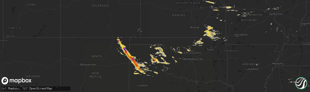
Hail Map on August 18, 2015
The weather event on August 18, 2015 includes Hail map. 20 states and 395 cities were impacted and suffered possible damage. The total estimated number of properties impacted is 9,004.
Hail
9,004
Estimated number of impacted properties by a 1.00" hail or larger1,534
Estimated number of impacted properties by a 1.75" hail or larger57
Estimated number of impacted properties by a 2.50" hail or largerStates Impacted by Hail Map on August 18, 2015
Storm reports
Illinois
| Date | Description |
|---|---|
| 08/18/20156:12 PM CDT | 4 to 6 inch diameter tree branches blown down in congerville |
| 08/18/20156:09 PM CDT | Delayed report. Weak tornado damaged pine trees... Downed tree limbs onto three homes... And damaged crops in a path 50 to 75 yards wide for 2 miles. Tornado dissipated in (i |
| 08/18/20155:55 PM CDT | Power line blown down on oak street in hopedale. |
| 08/18/20155:53 PM CDT | 45 by 50 foot pole barn under construction was blown over |
| 08/18/20155:40 PM CDT | A mesonet station near mccluggage bridge and us-24/150 measured a 59 mph gust. |
| 08/18/20155:24 PM CDT | Estimated 50-60 mph wind gusts bending trees over on i-74 near exit 82...no damage noted at this time...swop report |
| 08/18/20155:13 PM CDT | Trained spotter reported tree damage near eden and route 8...relayed by emergency manager |
| 08/18/20155:10 PM CDT | Relayed by state police. Location estimated from radar. |
| 08/18/20155:05 PM CDT | 5 miles s of pontiac or 2 miles north of chenoa. Just west of i-55. Brief ef-0 touchdown with no damage observed. |
| 08/18/20154:56 PM CDT | A local report indicates 1.00 inch wind near 2 S FARMINGTON |
| 08/18/20154:32 PM CDT | Brief touchdown. Ef-0 tornado with no damage observed. |
| 08/17/20158:06 PM CDT | Brief...weak ef-0 tornado with maximum winds of 65-70 mph...path length of 0.25 miles and path width of 50-75 yards. A few hardwood trees snapped...one snapped a powerp |
| 08/17/20158:05 PM CDT | Several 2-4 inch branches down and 18-20 inch tree top snapped off in green valley forest preserve. Time estimated. |
| 08/17/20157:55 PM CDT | Ef-0 tornado with maximum winds of 70-80 mph...path length of 3.01 miles and path width of 50-75 yards tracked from extreme southeast naperville to eastern woodridge. S |
| 08/17/20157:45 PM CDT | 5-inch tree limbs were blown down |
| 08/17/20157:32 PM CDT | At gardner fire department. |
| 08/17/20157:30 PM CDT | Delayed report. Roof off of garage in central city neighborhood between braceville and coal city. Also small tree limbs and powerlines down in area. Report relayed via |
| 08/17/20157:00 PM CDT | About 7 trees damaged in the sandrock subdivision. Trees and large limbs down...one vehicle was damaged by a downed tree |
Kansas
| Date | Description |
|---|---|
| 08/18/20155:46 PM CDT | A local report indicates 1.00 inch wind near 10 SW LAWRENCE |
| 08/18/20155:33 PM CDT | Small tree limbs down as well |
| 08/17/20158:25 PM CDT | Ema reports large tree limbs down in baxter springs. Time estimated by radar. |
| 08/17/20158:22 PM CDT | Estimated wind gust at koam-tv studios |
| 08/17/20158:02 PM CDT | Power lines down. |
| 08/17/20157:56 PM CDT | Trees reported down 2 miles south of hallowell. Time estimated by radar. |
| 08/17/20157:49 PM CDT | A local report indicates 1.00 inch wind near CHERRYVALE |
| 08/17/20157:43 PM CDT | Wind speed estimated by emergency manager |
| 08/17/20157:43 PM CDT | Winds estimated at 60+ mph. |
| 08/17/20157:43 PM CDT | Ema reported large tree limbs down in weir. Time estimated by radar. |
| 08/17/20157:41 PM CDT | Large tree over gove road. |
| 08/17/20157:25 PM CDT | Two foot diameter trees down with some structures damaged. |
| 08/17/20157:15 PM CDT | Trees and power poles down. Estimated 65 mph wind. |
| 08/17/20157:13 PM CDT | A local report indicates 59 MPH wind near PARSONS TRI CITY AIRPOR |
New York
| Date | Description |
|---|---|
| 08/18/20155:15 PM CDT | Trees down in village. |
| 08/18/20154:10 PM CDT | Spotter reported multiple trees down on suny oswego campus. |
| 08/18/20154:02 PM CDT | Large tree down |
| 08/18/20153:45 PM CDT | Estimated 12 trees down near berg/county line rds...one on home |
| 08/18/20153:38 PM CDT | Trees down |
| 08/18/20153:15 PM CDT | Trees on rec vehicles...other rec vehicles blown over at crosslake park |
| 08/18/20153:14 PM CDT | Several trees and wires down... Multiple roads closed |
| 08/18/20153:14 PM CDT | Multiple trees and wires down |
| 08/18/20153:00 PM CDT | Three trees down on elderberry lane - one down on wires blocking the road |
| 08/18/20152:05 PM CDT | Tree down near gildner road |
| 08/18/20152:05 PM CDT | Several trees and power lines down |
| 08/18/20152:05 PM CDT | Power pole snapped off at base on kellar road |
| 08/18/20152:03 PM CDT | Tree down blocking rte 37. |
| 08/18/20152:00 PM CDT | Three trees down on elderberry lane - one down on wires blocking the road |
| 08/18/20151:50 PM CDT | At least 15 trees down along guy young road. Trees ranged from 1 to 3 feet in diameter. Some uprooted and some snapped. |
| 08/17/20157:30 PM CDT | Tree down on county route 49 |
| 08/17/20157:13 PM CDT | Trees and poles down |
| 08/17/20157:00 PM CDT | Trees down and roof damage to structure |
| 08/17/20157:00 PM CDT | A local report indicates 58 MPH wind near POTSDAM AIRPORT |
New Mexico
| Date | Description |
|---|---|
| 08/18/20156:58 PM CDT | A local report indicates 70 MPH wind near 14 NE GLADSTONE |
| 08/18/20156:15 PM CDT | A local report indicates 1.75 inch wind near CAPULIN |
| 08/18/20156:10 PM CDT | A local report indicates 1.75 inch wind near 3 NNE CAPULIN |
| 08/18/20156:09 PM CDT | Dents to vehicle from golfball sized hail. |
| 08/18/20156:06 PM CDT | A local report indicates 1.50 inch wind near 5 NW DES MOINES |
| 08/17/201510:30 PM CDT | A local report indicates 1.50 inch wind near CAPULIN |
| 08/17/201510:00 PM CDT | A local report indicates 1.50 inch wind near FOLSOM |
| 08/17/20159:30 PM CDT | A local report indicates 1.00 inch wind near NARA VISA |
| 08/17/20158:55 PM CDT | A local report indicates 1.00 inch wind near 6 S AMISTAD |
| 08/17/20158:35 PM CDT | A local report indicates 1.75 inch wind near ROSEBUD |
| 08/17/20158:24 PM CDT | A local report indicates 2.75 inch wind near HAYDEN |
Oklahoma
| Date | Description |
|---|---|
| 08/18/20156:20 PM CDT | A local report indicates 1.00 inch wind near 5 NE PONCA CITY |
| 08/18/201512:14 AM CDT | Hail up to quarter size was falling near the oklahoma state line. |
| 08/17/20157:35 PM CDT | A local report indicates 70 MPH wind near 7 W HINTON |
| 08/17/20157:30 PM CDT | A local report indicates 61 MPH wind near 7 W HINTON |
| 08/17/20157:11 PM CDT | A local report indicates 1.00 inch wind near 10 W BURBANK |
Georgia
| Date | Description |
|---|---|
| 08/18/20155:02 PM CDT | A local report indicates 1.00 inch wind near 1 NE CAIN MANOR |
| 08/17/20158:23 PM CDT | Spotter reported two trees down and shingles torn off roof on burkhalter road near five chop road. |
| 08/17/20158:15 PM CDT | Public reported two trees down at the 500 block of south well lane. |
| 08/17/20158:05 PM CDT | Public reported 10-15 large pine trees down on middle ground road near mallard pond road. |
| 08/17/20158:05 PM CDT | Warning point reported large tree down at the intersection of lakeview road and bernard smith road. |
Mississippi
| Date | Description |
|---|---|
| 08/18/20155:15 PM CDT | Quarter size hail fell just south of highway 8 near trebloc. Time is radar estimated. |
Alabama
| Date | Description |
|---|---|
| 08/18/20155:30 PM CDT | Tree limbs downing power lines across various parts of town. Winds estimated 40-50 mph. |
Iowa
| Date | Description |
|---|---|
| 08/18/20153:50 PM CDT | 10 to 12 inch diameter tree branches down. |
| 08/18/20153:18 PM CDT | Several trees down in town. |
| 08/18/20153:13 PM CDT | Ef0 tornado touched down in a farm field. Wind speeds were estimated at 70 mph. Duration of the tornado was approximately one minute. No damage was found as result of t |
Missouri
| Date | Description |
|---|---|
| 08/18/20154:10 PM CDT | Power poles and power lines down in the lafayette square area. |
| 08/18/20153:15 PM CDT | Large tree blown over. |
| 08/18/20153:05 PM CDT | Sporadic tree limbs down across town. Largest branches about 6 inches in diameter down near highway n and z. |
| 08/18/20152:44 PM CDT | Small winds down west of washington... Mo |
| 08/18/20152:36 PM CDT | Soptter repoted 50 - 60 mph wind gusts. |
| 08/18/20152:30 PM CDT | Large tree limb fell on a car causing extensive damage. |
| 08/17/201511:21 PM CDT | Trained spotter measured 72 mph gust at ground level. Some downed trees also reported. |
| 08/17/201511:14 PM CDT | 6 to 8 inch diameter tree snapped along verna lane between gregg and nicholas road. |
| 08/17/201511:10 PM CDT | More than 20 trees damaged on property on county road 436. Two fallen limbs broke two windows on a nearby house. |
| 08/17/201511:01 PM CDT | 1/2 mile west of nicholas road on highway 14... Numerous 3 to 4 inch tree limbs down. |
| 08/17/201511:00 PM CDT | Large tree reported down one block east of the square in the city of ozark. |
| 08/17/201510:55 PM CDT | A large tree that was damaged by thunderstorm wind gust monday evening...fell onto a house behind caseys in sparta when additional thunderstorms moved through this even |
| 08/17/201510:50 PM CDT | Measured 45 gusting to 58 mph. |
| 08/17/201510:33 PM CDT | Media relayed a report...shed heavily damaged. |
| 08/17/201510:30 PM CDT | Large tree down. |
| 08/17/201510:20 PM CDT | Report relayed by media...tree snapped at base. |
| 08/17/201510:09 PM CDT | Shop destroyed along with damage to a house... Truck and boat. |
| 08/17/20159:10 PM CDT | Numerous tree limbs down with a large tree uprooted on the north side of town. Power out in parts of town. Delayed report. |
| 08/17/20157:38 PM CDT | Multiple trees down in grain valley near valley speedway. |
Texas
| Date | Description |
|---|---|
| 08/18/20153:05 AM CDT | 3 to 4 inch diameter tree limbs down |
| 08/18/20152:35 AM CDT | Measured by the west texas mesonet |
| 08/18/20152:16 AM CDT | A local report indicates 63 MPH wind near 2 NE LAKE TANGLEWOOD |
| 08/18/20152:15 AM CDT | A local report indicates 59 MPH wind near 3 NNE UMBARGER |
| 08/18/20152:15 AM CDT | Measured 58 mph thunderstorm wind gust. Tree blown down facing southwest direction and several two to three inch diameter tree branches broken off. |
| 08/18/20152:12 AM CDT | A local report indicates 64 MPH wind near 3 NNE UMBARGER |
| 08/18/20152:10 AM CDT | An empty tractor trailer was blown up on top of a 10 foot stack of equipment and was resting on its side. Power is out and there is quite a bit of fence damage. Also... |
| 08/18/20152:10 AM CDT | Detached garage levelled. Swimming pool half full of water flipped. Swing set blown across the yard. Time estimated by radar. |
| 08/18/20152:07 AM CDT | 6 inch diameter tree limb down. |
| 08/18/20152:07 AM CDT | Numerous large tree limbs up to 8 diameter snapped at camp don harrington. |
| 08/18/20152:05 AM CDT | 300 feet of a 14 by 500 foot metal rv storage building was destroyed near hester and 335 loop. |
| 08/18/20152:05 AM CDT | Power poles down just east of canyon.. Trees blown down just north of canyon. An rv trailer was flipped over just north of canyon as well. |
| 08/18/20152:05 AM CDT | 300 feet of a 14 by 500 foot metal rv storage building was destroyed near hester and 335 loop. |
| 08/18/20152:04 AM CDT | A local report indicates 58 MPH wind near CANYON |
| 08/18/20152:01 AM CDT | Large metal carports and garage buildings lifted from anchors and rolled at dealer. Power poles also broken. Structures where later rolled back to southwest due to stro |
| 08/18/20152:00 AM CDT | Semi trailer rolled 50 yards and a manufactured home was pushed off its blocks. This occurred near mcafee road and fm 1541. Time estimated by radar. |
| 08/18/20151:55 AM CDT | Large trees blown down. Damage to stables and fences. |
| 08/18/20151:55 AM CDT | Windows blown out of at least 18 vehicles. Gravel and debris in vehicles. Time estimated by radar. |
| 08/18/20151:55 AM CDT | Power poles snapped... Barn destroyed... Fifth wheel rv blown over and a horse trailer pushed into a truck. Just southeast of interstate 27 and rockwell road. Time esti |
| 08/18/20151:50 AM CDT | Roof was ripped off of an empty mobile home. |
| 08/18/20151:12 AM CDT | A local report indicates 60 MPH wind near 3 W DOZIER |
| 08/18/201512:50 AM CDT | 8 inch diameter tree and 2 foot diameter partially dead tree blown over along highway 273. |
| 08/17/201511:59 PM CDT | A local report indicates 1.75 inch wind near LEFORS |
| 08/17/201511:19 PM CDT | Late report of nickel to quarter size hail. Time estimated by radar. |
| 08/17/201510:52 PM CDT | A local report indicates 1.00 inch wind near 6 E WOLF CREEK PARK |
| 08/17/201510:50 PM CDT | Quarter size hail fell until 1055 pm. |
| 08/17/201510:18 PM CDT | Delayed report of 4 to 5 inch tree limbs down. Time estimated by radar. |
| 08/17/201510:18 PM CDT | Delayed report. Time estimated by radar. |
Wisconsin
| Date | Description |
|---|---|
| 08/17/20159:48 PM CDT | Tree damage reported in southwest waukesha. Time estimated from radar. |
| 08/17/20159:48 PM CDT | Ef-0 tornado confirmed in waukesha near intersection of genesee road and wisconsin 59. Primarily tree damage along path. |
| 08/17/20159:44 PM CDT | Trees down greater than 12 inches in diameter |
| 08/17/20159:37 PM CDT | Downed power lines and tree damage. Small patch of flattened corn stalks. Time estimated from radar. Possible tornado. |
| 08/17/20159:31 PM CDT | Ef1 tornado caused roof and siding damage. Winds estimated around 100 mph. Time estimated from radar. |
| 08/17/20159:15 PM CDT | Metal roofing and debris near intersection of hwy 120 and hwy 12. Doors ripped off aurora healthcare building. Trees down. Possible tornado. |
| 08/17/20158:58 PM CDT | Ef1 tornado caused significant roof damage to several industrial buildings. Winds estimated at 110 mph. Time estimated from radar. |
Massachusetts
| Date | Description |
|---|---|
| 08/18/20155:18 PM CDT | Amateur radio |
Florida
| Date | Description |
|---|---|
| 08/18/20155:50 PM CDT | Tree down across ferry road in palatka. |
| 08/18/20155:20 PM CDT | Quarter size hail at the nws office. |
Cities Impacted by Hail Map on August 18, 2015
- Prattsburgh, NY
- Tulia, TX
- Kress, TX
- Hereford, TX
- Panhandle, TX
- Adrian, TX
- Vega, TX
- Silverton, TX
- Happy, TX
- Channing, TX
- Erick, OK
- Texola, OK
- Fairfax, OK
- Burbank, OK
- Ponca City, OK
- Higgins, TX
- Mosquero, NM
- Roy, NM
- Pampa, TX
- Canadian, TX
- Miami, TX
- Wellington, TX
- Shamrock, TX
- Muleshoe, TX
- Dimmitt, TX
- Canton, IL
- Farmington, IL
- Hennessey, OK
- Warrensburg, MO
- Bonne Terre, MO
- Buffalo, KS
- Mayetta, KS
- Holton, KS
- Soldier, KS
- Capulin, NM
- Des Moines, NM
- Groom, TX
- Independence, MO
- Amistad, NM
- Seiling, OK
- Taloga, OK
- Brooksville, FL
- Shidler, OK
- Garnett, KS
- Richmond, KS
- Childress, TX
- Brighton, IL
- East Palatka, FL
- Folsom, NM
- Logan, NM
- Nara Visa, NM
- Dalhart, TX
- Grenville, NM
- Clayton, NM
- Wildorado, TX
- Raton, NM
- Canyon, TX
- Nazareth, TX
- Amarillo, TX
- Mount Olive, IL
- Jamestown, MO
- Hartsburg, MO
- Billings, OK
- Perry, OK
- Red Rock, OK
- Oak Grove, MO
- Buckner, MO
- Grain Valley, MO
- Blue Springs, MO
- Lees Summit, MO
- Kansas City, MO
- Mclean, TX
- Marionville, MO
- Suwanee, GA
- Dacula, GA
- Buford, GA
- Lawrenceville, GA
- Fall River, KS
- Butler, OK
- Clinton, OK
- Edgar, NE
- Ong, NE
- Beebe, AR
- Waukomis, OK
- Fairview, OK
- Mayview, MO
- Lexington, MO
- Ellington, MO
- Centerville, MO
- Knob Noster, MO
- Severy, KS
- Fredonia, KS
- California, MO
- Fayette, AL
- Lenapah, OK
- Reydon, OK
- Overbrook, KS
- Lawrence, KS
- Booker, TX
- Lipscomb, TX
- McCune, KS
- Mulhall, OK
- Hart, TX
- Hydro, OK
- Cedar Vale, KS
- Napoleon, MO
- Sibley, MO
- Howard, KS
- Moline, KS
- Niotaze, KS
- Grenola, KS
- Sedan, KS
- Havana, KS
- Elk Falls, KS
- Peru, KS
- Longton, KS
- Elk City, KS
- Wann, OK
- Cordell, OK
- Windsor, MO
- Register, GA
- Spooner, WI
- Trego, WI
- Springbrook, WI
- Corn, OK
- Green Ridge, MO
- Ralston, OK
- Marland, OK
- Blue Mound, KS
- Centerville, KS
- Mound City, KS
- Corydon, KY
- Savanna, IL
- Houlka, MS
- Okolona, MS
- Astoria, IL
- Ames, OK
- Borger, TX
- Westmoreland, KS
- Van Horn, TX
- Alamogordo, NM
- Cherryvale, KS
- Independence, KS
- Garber, OK
- Wheeler, TX
- Briscoe, TX
- Hoyt, KS
- Havensville, KS
- Denison, KS
- Onaga, KS
- Marshall, OK
- Turkey, TX
- Shrewsbury, MA
- Boylston, MA
- Otterville, MO
- Syracuse, MO
- Florence, MO
- Kingfisher, OK
- Woodward, OK
- Godfrey, IL
- Wayside, TX
- Enid, OK
- De Witt, IA
- Roseville, IL
- Good Hope, IL
- Benedict, KS
- Eureka, KS
- Toronto, KS
- Claude, TX
- Yulee, FL
- Callahan, FL
- Perryton, TX
- Rushville, IL
- Ringwood, OK
- Brunswick, GA
- Jersey Shore, PA
- Cogan Station, PA
- Linden, PA
- Liberty, IL
- Payson, IL
- Quincy, IL
- Brussels, IL
- Sharon, OK
- Bolton, MA
- Berlin, MA
- Oak Ridge, MO
- Jackson, MO
- Canton, OK
- Watonga, OK
- Sweetwater, OK
- Thayer, KS
- Altoona, KS
- Neodesha, KS
- Sayre, OK
- Willow, OK
- Spearman, TX
- Oakwood, OK
- Higginsville, MO
- Tipton, MO
- Smithland, KY
- Hampton, KY
- Newnan, GA
- Cleo Springs, OK
- Barker, NY
- Appleton, NY
- Hedley, TX
- Lelia Lake, TX
- Shawnee, KS
- Stoutsville, MO
- Montgomery, AL
- Delia, KS
- Caney, KS
- Coffeyville, KS
- Pomona Park, FL
- Oswego, KS
- White Deer, TX
- Vici, OK
- Palo, IA
- Versailles, MO
- Maxwell, NE
- Curtis, NE
- Bunceton, MO
- Dow, IL
- Grafton, IL
- Balko, OK
- Goose Lake, IA
- Charlotte, IA
- Millersville, MO
- Union Springs, AL
- Fort Davis, AL
- Tuskegee, AL
- Friona, TX
- Ashland, MO
- Billings, MO
- Prairie, MS
- Aberdeen, MS
- Auburn, GA
- Flomot, TX
- Mission, KS
- Kansas City, KS
- Marquand, MO
- Patton, MO
- Gould, OK
- Odessa, MO
- Holden, MO
- Centerview, MO
- Troy, MO
- Old Monroe, MO
- Winfield, MO
- Moscow Mills, MO
- Kingsville, MO
- Pleasant Hill, MO
- Bates City, MO
- Lone Jack, MO
- Durham, OK
- Romeoville, IL
- Bolingbrook, IL
- Avoca, NY
- Marion, AL
- Carbondale, KS
- Wakarusa, KS
- Berryton, KS
- Hope Hull, AL
- Welch, OK
- Clarksburg, MO
- Mangum, OK
- Quapaw, OK
- Miami, OK
- Pawnee, OK
- West Alton, MO
- Elsah, IL
- Bethalto, IL
- Moro, IL
- Dorsey, IL
- Baxter Springs, KS
- Stover, MO
- Mound Valley, KS
- Fredericktown, MO
- Houston, MS
- Chester, OK
- Cole Camp, MO
- Mora, MO
- Blair, OK
- Woodland, MS
- West Point, MS
- Dequincy, LA
- Topeka, KS
- Silver Lake, KS
- Douglas, OK
- Bison, OK
- Piedmont, KS
- Bluejacket, OK
- Alton, IL
- Butler, AL
- Dodson, TX
- Longdale, OK
- Sedalia, MO
- Greenwood, MO
- Raymore, MO
- Bunker Hill, IL
- Crest Hill, IL
- Lockport, IL
- Joliet, IL
- Plainfield, IL
- Mutual, OK
- Wyandotte, OK
- Jacksonville, FL
- Seneca, MO
- Neosho, MO
- Burt, NY
- Lockport, NY
- Newfane, NY
- Bessie, OK
- Altamont, KS
- Valley Falls, KS
- Hollis, OK
- Vinson, OK
- Sierra Blanca, TX
- Brewerton, NY
- Clay, NY
- Warrenton, MO
- Duluth, GA
- Cumming, GA
- Alpharetta, GA
- Guyton, GA
- Kinderhook, IL
- Barry, IL
- Irondale, MO
- Park Hills, MO
- Mineral Point, MO
- Ottawa, KS
- Baldwinsville, NY
- Smithton, MO
- Lockney, TX
- Bryant, IL
- Cuba, IL
- Lewistown, IL
- Arcadia, MO
- Ironton, MO
- Ward, AR
- Calamus, IA
- Owasso, OK
- Sperry, OK
- Millbrook, AL
- Wright City, MO
- Parsons, KS
- Galesburg, KS
- Lecompton, KS
- Northborough, MA
- Schell City, MO
- Newburgh, NY
- Mount Carroll, IL
- Stockton, IL
- Elizabeth, IL
- Blackwell, OK
- Vermont, IL
- Townsend, GA
- Edna, KS
- Dearing, KS
- Tyro, KS
- S Coffeyville, OK
- Liberty, KS
- Copan, OK
- Dennis, KS
- Clinton, MA
- Lancaster, MA
- Delaware, OK
- Clarendon, TX
- Pleasanton, KS
- Avon, IL
- Berwick, IL
- Pekin, IL
- Hyde Park, NY
- Kent, IL
- Pearl City, IL
- Vinita, OK
- Fairmont, OK
- Norris, IL
- Kaw City, OK
- Tonkawa, OK
- Blackwater, MO
- Browning, IL
- Ipava, IL
- Mapleton, IL
- Peoria, IL
- Grandview, MO
- Foss, OK
- Perryville, MO
- Junction City, KS
- Canandaigua, NY
- Crescent, OK
- Trivoli, IL
- Elmwood, IL
- Baldwin City, KS
- Hoschton, GA