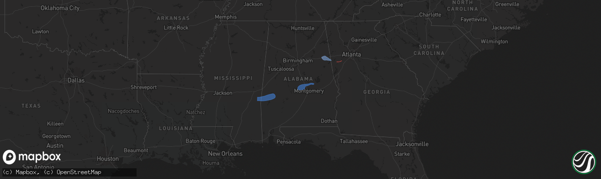
Hail Map in Alabama on January 10, 2026
The weather event in Alabama on January 10, 2026 includes Wind and Tornado maps. 3 states and 57 cities were impacted and suffered possible damage. The total estimated number of properties impacted is 0.
Wind
Tornado
0
Estimated number of impacted properties by a 1.00" hail or larger0
Estimated number of impacted properties by a 1.75" hail or larger0
Estimated number of impacted properties by a 2.50" hail or largerStorm reports in Alabama
Alabama
| Date | Description |
|---|---|
| 01/10/202610:27 AM CST | Trees and powerlines down in the salem community. |
| 01/10/20269:41 AM CST | Tree down on powerline on stone park rd. Time estimated by radar. |
| 01/10/20269:40 AM CST | Tree down on canadian drive near jacksons gap. Time estimated by radar. |
| 01/10/20269:31 AM CST | Tree on home on e 3rd st in montgomery. Time estimated by radar. |
| 01/10/20269:29 AM CST | Reports of multiple trees down in the eclectic community of elmore county. Time estimated by radar. |
| 01/10/20269:27 AM CST | Downed tree partially blocking roadway on woodmere dr. Time estimated by radar. |
| 01/10/20269:18 AM CST | Reports of trees and power lines down near wetumpka. Time estimated by radar. |
| 01/10/20269:18 AM CST | Rep |
| 01/10/20269:08 AM CST | Report of a tree down near coosada. |
| 01/10/20269:05 AM CST | Trained spotter recorded 60 mph wind gust in deatsville at 9:05 am. |
| 01/10/20269:01 AM CST | Reports of debris... Fences down... Trees down near pine level in autauga county. Time estimated by radar. |
| 01/10/20268:55 AM CST | Reports of a tree down near marbury. Time estimated by radar. |
| 01/10/20268:48 AM CST | Roof damage to a few chicken houses near the intersection of county rd 65 and county rd 40. Time estimated by radar. |
| 01/10/20268:22 AM CST | Ema shared an unconfirmed report of a tree down on a house in selma. Time estimated by radar. Additionally... Power outages are reported in areas of the county. |
| 01/10/20268:18 AM CST | Tree on a home on warrior dr. |
| 01/10/20268:12 AM CST | Trees were downed around talladega... Alpine... And munford... Including cheaha rd... Alipine winterboro rd... Renfroe rd... And grizzle ln. |
| 01/10/20268:10 AM CST | Public report of trees and power lines down with some trees possibly down on structures near marion junction... Along county road 930 near moores ferry road. Time estim |
| 01/10/20268:09 AM CST | Trees were downed around the sylacauga area... Including odens mill rd and new county line rd at coaling rd. |
| 01/10/20267:46 AM CST | A few trees and power lines were downed around pell city... Including cook springs rd... Mountain top loop rd... Wolf creek rd... And old coal city rd at florida rd. |
| 01/10/20267:35 AM CST | Trees down in the thomaston area. |
| 01/10/20267:25 AM CST | Numerous trees down across southern marengo county south of linden. |
| 01/10/20266:57 AM CST | Corrects previous tstm wnd dmg report from 2 wsw mars hill. Roof damage to a few chicken houses near the intersection of county rd 65 and county rd 40. |
All States Impacted by Hail Map on January 10, 2026
Cities Impacted by Hail Map on January 10, 2026
- Quitman, MS
- Butler, AL
- Lisman, AL
- Needham, AL
- Toxey, AL
- Gilbertown, AL
- Jachin, AL
- Pennington, AL
- Ward, AL
- Linden, AL
- Sweet Water, AL
- Thomasville, AL
- Billingsley, AL
- Prattville, AL
- Autaugaville, AL
- Marbury, AL
- Booth, AL
- Selma, AL
- Wetumpka, AL
- Elmore, AL
- Deatsville, AL
- Millbrook, AL
- Titus, AL
- Eclectic, AL
- Carrollton, GA
- Whitesburg, GA
- Newnan, GA
- Delta, AL
- Heflin, AL
- Anniston, AL
- Ranburne, AL
- Bowdon, GA
- Fruithurst, AL
- Muscadine, AL
- Waco, GA
- Graham, AL
- Woodland, AL
- Franklin, GA
- Roopville, GA
- Hogansville, GA
- Grantville, GA
- Moreland, GA
- Villa Rica, GA
- Winston, GA
- Douglasville, GA
- Palmetto, GA
- Fairburn, GA
- Atlanta, GA
- Tyrone, GA
- Union City, GA
- Fayetteville, GA
- Sharpsburg, GA
- Peachtree City, GA
- Senoia, GA
- Tallapoosa, GA
- Bremen, GA
- Temple, GA


