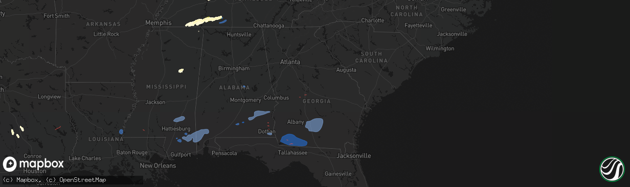
Hail Map in Georgia on March 11, 2026
The weather event in Georgia on March 11, 2026 includes Wind, Tornado, and Hail maps. 17 states and 692 cities were impacted and suffered possible damage. The total estimated number of properties impacted is 0.
Wind
Tornado
Hail
0
Estimated number of impacted properties by a 1.00" hail or larger0
Estimated number of impacted properties by a 1.75" hail or larger0
Estimated number of impacted properties by a 2.50" hail or largerStorm reports in Georgia
Georgia
| Date | Description |
|---|---|
| 03/11/20266:43 AM CDT | *** 2 inj *** corrects previous tstm wnd dmg report from 3 ssw ashton. Shed overturned on wren rd in ben hill county reported via x. 2 injuries reported. |
| 03/11/20266:34 AM CDT | Irrigation pivot overturned off of cranford sumner road east of lenox. |
| 03/11/20266:33 AM CDT | Trees down near i-75 and rest area. Debris across highway. |
| 03/11/20266:30 AM CDT | Mesonet station uga03 tifton. |
| 03/11/20266:30 AM CDT | Two trees down and damage to mailbox near omega. |
| 03/11/20266:30 AM CDT | Colquitt county dispatch reports trees down across the county. |
| 03/11/20266:28 AM CDT | Public reported a tree and power lines down at n clarke street and w montgomery street. |
| 03/11/20266:26 AM CDT | The emergency manager relayed a report of damage to the public works building... Including several damaged doors and a blown over fuel pump canopy. |
| 03/11/20266:25 AM CDT | The emergency manager reported a tree on a home along baldwin avenue. |
| 03/11/20266:25 AM CDT | The emergency manager relayed a report of multiple trees down on blandy road near highway 49... Impacting power to public schools and gcsu. |
| 03/11/20266:16 AM CDT | Turner county em reports a porch roof blown off a house on whiddon rd. |
| 03/11/20266:15 AM CDT | Mesonet station uga23 cairo. |
| 03/11/20266:12 AM CDT | Turner county em reports a tree blown over... Irrigation pivots blown over... And a barn collapsed on reid rd. |
| 03/11/20266:10 AM CDT | Powerlines down along scuffleboro road near the intersection of gregory lane. |
| 03/11/20266:03 AM CDT | Worth county sheriffs office reports trees blocking joe sumner rd between shingler little river rd and ephesus church rd. |
| 03/11/20266:00 AM CDT | Powerlines down along south leisure lane near the intersection of dogwood drive southeast. |
| 03/11/20265:59 AM CDT | Worth county sheriffs office reports 3 trees completely blocking hwy 256. |
| 03/11/20265:58 AM CDT | Worth county sheriffs office reports trees blocking the roadway of hwy 112n south of ephesus church rd. |
| 03/11/20265:58 AM CDT | Tree down near bethel church. |
| 03/11/20265:58 AM CDT | Worth county sheriffs office reports trees blocking doe hill rd. |
| 03/11/20265:58 AM CDT | A tree down and damage to a window and siding of a home on dewberry drive. |
| 03/11/20265:57 AM CDT | Worth county sheriffs office reports a tree down on isabella st at hwy 82. |
| 03/11/20265:57 AM CDT | Worth county sheriffs office reports trees blocking hwy 33n about 5 miles outside the city limits. |
| 03/11/20265:57 AM CDT | Worth county sheriffs county reports eldridge street in sylvester is blocked with trees. |
| 03/11/20265:57 AM CDT | Multiple trees and powerlines down near i-75 and hwy 96. Damage also noted around ponderosa campgrounds. This lines up with tds from kjgx. No injuries reported. |
| 03/11/20265:57 AM CDT | Worth county sheriffs office reports a tree on a home on livingston st. |
| 03/11/20265:56 AM CDT | Worth county sheriffs office reports tree and power line blocking massey airport rd. |
| 03/11/20265:55 AM CDT | Worth county sheriffs office reports trees down along the 2400 block of hwy 313. |
| 03/11/20265:55 AM CDT | The emergency manager relayed a report of a large tree down on a home on marshall drive. |
| 03/11/20265:53 AM CDT | 5 power poles down and several trees down on frontage rd in front of crisp county high school. |
| 03/11/20265:53 AM CDT | Corrects time from previous tstm wnd dmg report from 2 nne payne city. The emergency manager relayed a report of a tree down at edward place and victoria circle. |
| 03/11/20265:51 AM CDT | 2 trees down that fell onto homes in the 900 block of scenic route off lake blackshear. |
| 03/11/20265:50 AM CDT | Public reported damage to a neighborhood off mumford road... Including ironwood court. Damage included impacts to roof... Siding... And hvac system and concrete foundat |
| 03/11/20265:50 AM CDT | Worth county sheriffs office reports trees blocking woodcrest rd. |
| 03/11/20265:48 AM CDT | Worth county sheriffs office reports a tree on a home on birch rd. |
| 03/11/20265:47 AM CDT | The emergency manager relayed a report of trees down with powerlines on tucker road at i-475. |
| 03/11/20265:47 AM CDT | The emergency manager relayed reports of damaged homes in the lochwolde subdivision off thomaston road... Including lochwolde drive... York lane and mccleary lane. Torn |
| 03/11/20265:47 AM CDT | The emergency manager relayed a report of a tree down at edward place and victoria circle. |
| 03/11/20265:47 AM CDT | Worth county sheriffs office reports red rock rd is closed between peafowl rd and county line due to trees down. |
| 03/11/20265:45 AM CDT | The emergency manager reported a tree down at johnson and thomaston roads. |
| 03/11/20265:40 AM CDT | Initial reports of a trailer rolled over and multiple trees across the road near marshallville. Tds seen from kjgx supports that this was likely a tornado. |
| 03/11/20265:40 AM CDT | Multiple trees down around heritage elementary school along thomaston road. A few trees down near the intersection of thomaston road... Lochwolde drive and york lane. |
| 03/11/20265:40 AM CDT | Tree down near ga hwy 311. |
| 03/11/20265:39 AM CDT | A local report indicates 62 MPH wind near 1 WSW Bainbridge |
| 03/11/20265:35 AM CDT | Metal roof blown off the albany 8 inn. |
| 03/11/20265:35 AM CDT | Dougherty county dispatch reports numerous trees and power lines down across the county along with several instances of trees on residences. |
| 03/11/20265:35 AM CDT | Public reports trees down on force dr. |
| 03/11/20265:31 AM CDT | Public reports a tree down on lullwater rd at gillionville rd. |
| 03/11/20265:23 AM CDT | Baker/miller county dispatch reports several trees and power lines down across baker county. |
| 03/11/20265:14 AM CDT | Lee county dispatch reports trees down and power outages across smithville. |
| 03/11/20265:13 AM CDT | Miller/baker county dispatch reports numerous trees and power lines down across miller county. |
| 03/11/20265:10 AM CDT | Seminole county dispatch reports power lines down and blocking hebrew hwy between parker ln and 9 hole rd. |
| 03/11/20265:06 AM CDT | Terrell county dispatch reports trees down all over the county. |
| 03/11/20265:03 AM CDT | Calhoun county dispatch reports trees and power lines down all over the county. |
| 03/11/20265:00 AM CDT | Multiple trees down near edison... Ga. |
| 03/11/20264:58 AM CDT | Raws station. |
| 03/11/20264:48 AM CDT | Regional dispatch |
| 03/11/20264:41 AM CDT | A tree down on a house reported on gordon st in cuthbert. |
| 03/11/20264:30 AM CDT | A local report indicates 58 MPH wind near Experiment |
| 03/11/20264:27 AM CDT | Clay county dispatch reports numerous trees and power lines down across the county. |
| 03/11/20264:10 AM CDT | Several trees down at florence marina near the intersection of florence road and marina road. |
| 03/11/20263:45 AM CDT | Tree down at dividend drive near falcon drive. |
| 03/11/20263:20 AM CDT | Tree downed in subdivision off of exit 56 on interstate 85. |
| 03/11/20262:35 AM CDT | Em reports tree down at 3000 block of van wert rd. |
| 03/11/20262:32 AM CDT | Em reports tree down at 900 block of lovvorn rd. |
| 03/11/20262:25 AM CDT | Em reports tree down harper ln and clark rd. |
| 03/11/20262:22 AM CDT | Em reports tree down across rd at lucky ln and melear rd. |
| 03/11/20262:15 AM CDT | Em reports tree down on road at saxon rd and dot rd. |
All States Impacted by Hail Map on March 11, 2026
Cities Impacted by Hail Map on March 11, 2026
- Fordyce, AR
- Kingsland, AR
- New Edinburg, AR
- Rison, AR
- Pine Bluff, AR
- Huntington, TX
- Etoile, TX
- San Augustine, TX
- Albany, IN
- Anderson, IN
- Muncie, IN
- Gaston, IN
- Eaton, IN
- Dunkirk, IN
- Cicero, IN
- Daleville, IN
- Noblesville, IN
- Frankton, IN
- Yorktown, IN
- Lapel, IN
- Alexandria, IN
- Atlanta, IN
- Pittsboro, IN
- Lizton, IN
- Roachdale, IN
- Brownsburg, IN
- Zionsville, IN
- Carmel, IN
- North Salem, IN
- Lebanon, IN
- Westfield, IN
- Jamestown, IN
- Whitestown, IN
- Portland, IN
- Redkey, IN
- Ridgeville, IN
- West Milton, OH
- Greenville, OH
- Ludlow Falls, OH
- Pitsburg, OH
- Arcanum, OH
- New Madison, OH
- West Manchester, OH
- Laura, OH
- Troy, OH
- Vandalia, OH
- Englewood, OH
- Brookville, OH
- Lewisburg, OH
- Tipp City, OH
- Eldorado, OH
- New Paris, OH
- Minster, OH
- Botkins, OH
- Houston, OH
- Russia, OH
- Sidney, OH
- Jackson Center, OH
- Yorkshire, OH
- Anna, OH
- Fort Loramie, OH
- Ada, OH
- Kirby, OH
- Lakeview, OH
- Harpster, OH
- La Rue, OH
- Bloomville, OH
- Lewistown, OH
- Nevada, OH
- Forest, OH
- McCutchenville, OH
- Morral, OH
- Wapakoneta, OH
- Huntsville, OH
- New Hampshire, OH
- Kenton, OH
- Dunkirk, OH
- Russells Point, OH
- Wharton, OH
- McGuffey, OH
- Carey, OH
- Belle Center, OH
- Alger, OH
- Harrod, OH
- Sycamore, OH
- Upper Sandusky, OH
- Roundhead, OH
- Tiffin, OH
- Dola, OH
- Bucyrus, OH
- Waynesfield, OH
- Willard, OH
- New London, OH
- Wakeman, OH
- New Washington, OH
- Tiro, OH
- Bellevue, OH
- Attica, OH
- Huron, OH
- Greenwich, OH
- North Fairfield, OH
- Plymouth, OH
- Chatfield, OH
- Collins, OH
- Sandusky, OH
- Monroeville, OH
- Milan, OH
- Green Springs, OH
- Norwalk, OH
- Berlin Heights, OH
- Republic, OH
- Castalia, OH
- Amherst, OH
- Oberlin, OH
- Elyria, OH
- Vermilion, OH
- Kipton, OH
- Wellington, OH
- Lorain, OH
- Spencer, OH
- Homerville, OH
- Sullivan, OH
- Lagrange, OH
- Grafton, OH
- Nova, OH
- Lodi, OH
- Litchfield, OH
- West Salem, OH
- Ashland, OH
- Polk, OH
- Shiloh, OH
- Columbia Station, OH
- North Ridgeville, OH
- Olmsted Falls, OH
- Valley City, OH
- Medina, OH
- Strongsville, OH
- North Olmsted, OH
- Avon, OH
- Sheffield Lake, OH
- Linesville, PA
- Hartstown, PA
- Conneaut Lake, PA
- Cambridge Springs, PA
- Conneautville, PA
- Saegertown, PA
- Harmonsburg, PA
- Meadville, PA
- Guys Mills, PA
- Townville, PA
- Jamestown, PA
- Caldwell, OH
- Pocahontas, TN
- Sarahsville, OH
- Selmer, TN
- Ramer, TN
- Waverly, TN
- Chillicothe, OH
- Kingston, OH
- Stantonville, TN
- Guys, TN
- Hurricane Mills, TN
- Adamsville, TN
- Crump, TN
- Michie, TN
- Counce, TN
- Savannah, TN
- Shiloh, TN
- Olivehill, TN
- Collinwood, TN
- Waynesboro, TN
- Lutts, TN
- Burnsville, MS
- Iuka, MS
- Ashland City, TN
- Joelton, TN
- Lawrenceburg, TN
- Goodlettsville, TN
- Nashville, TN
- Whites Creek, TN
- Perryopolis, PA
- Westpoint, TN
- Ethridge, TN
- Hendersonville, TN
- Madison, TN
- Mount Juliet, TN
- Gallatin, TN
- Star Junction, PA
- Vanderbilt, PA
- Leoma, TN
- Loretto, TN
- Penn Run, PA
- Clymer, PA
- Indiana, PA
- Commodore, PA
- Cherry Tree, PA
- Mentcle, PA
- Northern Cambria, PA
- Spangler, PA
- Marsteller, PA
- Nicktown, PA
- Emeigh, PA
- Hastings, PA
- Carrolltown, PA
- Patton, PA
- Saint Boniface, PA
- Flinton, PA
- Fallentimber, PA
- Lafayette, TN
- Hartsville, TN
- Dixon Springs, TN
- Coalport, PA
- Blandburg, PA
- Tyrone, PA
- Philipsburg, PA
- Smithmill, PA
- Red Boiling Springs, TN
- Hunker, PA
- Mount Pleasant, PA
- Tarrs, PA
- Ruffs Dale, PA
- Alverton, PA
- Scottdale, PA
- New Stanton, PA
- Moss, TN
- Whitleyville, TN
- Celina, TN
- Acme, PA
- Greensburg, PA
- Burkesville, KY
- Tompkinsville, KY
- Hestand, KY
- Stahlstown, PA
- Laughlintown, PA
- Ligonier, PA
- Rector, PA
- Boswell, PA
- Latrobe, PA
- Somerset, PA
- Donegal, PA
- Jerome, PA
- Stoystown, PA
- Johnstown, PA
- Jennerstown, PA
- Windber, PA
- Hollsopple, PA
- Davidsville, PA
- Gray, PA
- Jenners, PA
- Seanor, PA
- Cairnbrook, PA
- Central City, PA
- Friedens, PA
- Hooversville, PA
- Acosta, PA
- New Enterprise, PA
- Queen, PA
- New Paris, PA
- Martinsburg, PA
- Alum Bank, PA
- Claysburg, PA
- Imler, PA
- Osterburg, PA
- Roaring Spring, PA
- Woodbury, PA
- Portage, PA
- Sproul, PA
- Hollidaysburg, PA
- Sidman, PA
- Duncansville, PA
- East Freedom, PA
- Daisytown, PA
- Coal Center, PA
- California, PA
- Brownsville, PA
- Grindstone, PA
- Fayette City, PA
- Dawson, PA
- Connellsville, PA
- Everson, PA
- White, PA
- Normalville, PA
- Champion, PA
- Melcroft, PA
- Indian Head, PA
- Hidden Valley, PA
- Jones Mills, PA
- Saxton, PA
- Williamsburg, PA
- James Creek, PA
- Loysville, PA
- Blain, PA
- Pulaski, TN
- Landisburg, PA
- New Bloomfield, PA
- Shermans Dale, PA
- Elliottsburg, PA
- Duncannon, PA
- Dauphin, PA
- Harrisburg, PA
- Grantville, PA
- Alexandria, LA
- Lecompte, LA
- Starkville, MS
- Maben, MS
- Sturgis, MS
- Ackerman, MS
- Mathiston, MS
- Marksville, LA
- Effie, LA
- Frederick, MD
- Thurmont, MD
- Walkersville, MD
- Woodsboro, MD
- Keymar, MD
- Union Bridge, MD
- New Windsor, MD
- Westminster, MD
- Damascus, MD
- Gaithersburg, MD
- Mount Airy, MD
- Sealy, TX
- Cat Spring, TX
- Brookeville, MD
- Glenelg, MD
- Glenwood, MD
- Woodbine, MD
- West Friendship, MD
- Cooksville, MD
- Ellicott City, MD
- Dayton, MD
- Sykesville, MD
- Marriottsville, MD
- Woodstock, MD
- Windsor Mill, MD
- Randallstown, MD
- Pikesville, MD
- Baltimore, MD
- Gwynn Oak, MD
- Owings Mills, MD
- Lutherville Timonium, MD
- Towson, MD
- Stevenson, MD
- Reisterstown, MD
- Hunt Valley, MD
- Cockeysville, MD
- Glen Arm, MD
- Sparks Glencoe, MD
- Phoenix, MD
- Baldwin, MD
- Hydes, MD
- Monkton, MD
- Fallston, MD
- Jackson, KY
- Clayhole, KY
- Vest, KY
- Gunlock, KY
- Salyersville, KY
- Franklin, TX
- Marquez, TX
- David, KY
- Blue River, KY
- Prestonsburg, KY
- South Fork, PA
- Saint Michael, PA
- Salix, PA
- Elton, PA
- Beaverdale, PA
- Buffalo, TX
- El Campo, TX
- Garwood, TX
- Waynesburg, PA
- Sycamore, PA
- Jefferson, PA
- Mather, PA
- Carmichaels, PA
- Clarksville, PA
- Rices Landing, PA
- Adah, PA
- East Millsboro, PA
- Crucible, PA
- McClellandtown, PA
- New Salem, PA
- Fairbank, PA
- Uniontown, PA
- Smock, PA
- Waltersburg, PA
- Keisterville, PA
- Dunbar, PA
- West Leisenring, PA
- Lemont Furnace, PA
- Mount Braddock, PA
- Youngwood, PA
- Centerville, TX
- Normangee, TX
- Middletown, DE
- Townsend, DE
- Odessa, DE
- Smithdale, MS
- Liberty, MS
- Monterey, LA
- Woodville, MS
- Vidalia, LA
- Amite, LA
- Roseland, LA
- Fluker, LA
- Kentwood, LA
- Mount Hermon, LA
- Independence, LA
- Greensburg, LA
- Holden, LA
- Franklinton, LA
- Loranger, LA
- Folsom, LA
- Covington, LA
- Bush, LA
- Ellisville, MS
- Seminary, MS
- Soso, MS
- Laurel, MS
- Ovett, MS
- Heidelberg, MS
- Shubuta, MS
- Pearl River, LA
- Wiggins, MS
- Brooklyn, MS
- Perkinston, MS
- Beaumont, MS
- McLain, MS
- Neely, MS
- Leakesville, MS
- Lucedale, MS
- Citronelle, AL
- Vinegar Bend, AL
- Tibbie, AL
- Deer Park, AL
- McIntosh, AL
- Chunchula, AL
- Wilmer, AL
- Mount Vernon, AL
- Rockford, AL
- Weogufka, AL
- Frisco City, AL
- Jackson, AL
- Uriah, AL
- Little River, AL
- Wagarville, AL
- Atmore, AL
- Repton, AL
- Brewton, AL
- Monroeville, AL
- Stockton, AL
- Perdido, AL
- Range, AL
- Lenox, AL
- Castleberry, AL
- Gainestown, AL
- Evergreen, AL
- Red Level, AL
- McKenzie, AL
- Dozier, AL
- Brantley, AL
- Church Point, LA
- Goshen, AL
- Glenwood, AL
- Troy, AL
- Banks, AL
- Brundidge, AL
- Louisville, AL
- Clayton, AL
- Midway, AL
- Abbeville, AL
- Headland, AL
- Dothan, AL
- Ashford, AL
- Cottonwood, AL
- Pansey, AL
- Bainbridge, GA
- Climax, GA
- Marshallville, GA
- Fort Valley, GA
- Warner Robins, GA
- Whigham, GA
- Cairo, GA
- Brinson, GA
- Ochlocknee, GA
- Iron City, GA
- Donalsonville, GA
- Thomasville, GA
- Boston, GA
- Camilla, GA
- Attapulgus, GA
- Colquitt, GA
- Meigs, GA
- Pelham, GA
- Chula, GA
- Norman Park, GA
- Lenox, GA
- Enigma, GA
- Ty Ty, GA
- Ocilla, GA
- Adel, GA
- Tifton, GA
- Omega, GA
- Wray, GA
- Alapaha, GA
- Sparks, GA
- Sumner, GA
- Nashville, GA
- Ashburn, GA
- Fitzgerald, GA
- Douglas, GA
- Willacoochee, GA
- Ambrose, GA
- Dixie, GA
- Quitman, GA
- Macon, GA
- Gray, GA
- Eatonton, GA
- Sparta, GA
- Haddock, GA
- Milledgeville, GA
- Hillsboro, GA
- Monticello, GA
- Doerun, GA
- Albany, GA
- Sylvester, GA
- Poulan, GA
- Pearson, GA
- Williamstown, NJ
- New Castle, DE
- Elkton, MD
- Pitman, NJ
- Blackwood, NJ
- Newark, DE
- Sewell, NJ
- Sicklerville, NJ
- Salem, NJ
- Glassboro, NJ
- Swedesboro, NJ
- Mullica Hill, NJ
- Woodstown, NJ
- Pennsville, NJ
- Penns Grove, NJ
- Monroeville, NJ
- Bear, DE
- Elmer, NJ
- Malaga, NJ
- Bridgeton, NJ
- Vineland, NJ
- Newfield, NJ
- Franklinville, NJ
- North East, MD
- Elk Mills, MD
- Pedricktown, NJ
- Charles Town, WV
- Summit Point, WV
- Winchester, VA
- Berryville, VA
- Boyce, VA
- Clarksburg, MD
- Ijamsville, MD
- Dickerson, MD
- Boyds, MD
- Germantown, MD
- Ingalls, IN
- Markleville, IN
- Indianapolis, IN
- Middletown, IN
- Fishers, IN
- Springport, IN
- Shirley, IN
- Pendleton, IN
- Fortville, IN
- Mccordsville, IN
- Nineveh, IN
- Edinburgh, IN
- Franklin, IN
- Winchester, IN
- Salamonia, IN
- Selma, IN
- Versailles, OH
- Rossburg, OH
- Farmland, IN
- New Weston, OH
- Coldwater, OH
- Saint Henry, OH
- Saratoga, IN
- Fort Recovery, OH
- Montezuma, OH
- Osgood, OH
- Burkettsville, OH
- Ansonia, OH
- Union City, IN
- Union City, OH
- Celina, OH
- Maria Stein, OH
- Parker City, IN
- Chickasaw, OH
- New Knoxville, OH
- Clyde, OH
- New Bremen, OH
- Eaton, OH
- Connersville, IN
- Richmond, IN
- Greens Fork, IN
- Boston, IN
- Cambridge City, IN
- Brownsville, IN
- Milton, IN
- Glenwood, IN
- Rushville, IN
- Centerville, IN
- Falmouth, IN
- Liberty, IN
- Ariton, AL
- Ozark, AL
- Skipperville, AL
- Clopton, AL
- Webb, AL
- Freeport, FL
- Ponce De Leon, FL
- Vernon, FL
- Ebro, FL
- Panama City Beach, FL
- Panama City, FL
- Lynn Haven, FL
- Griffin, GA
- Columbia, AL
- Blakely, GA
- Damascus, GA
- Box Springs, GA
- Mauk, GA
- Clinton, LA
- Greenwell Springs, LA
- Mandeville, LA
- Ponchatoula, LA
- Slidell, LA
- Perry, GA
- Oglethorpe, GA
- Kathleen, GA
- Bonaire, GA
- Bluffton, IN
- Tickfaw, LA
- Hammond, LA
- Albany, LA
- Ruth, MS
- Bogue Chitto, MS
- Jayess, MS
- Carson, MS
- Oak Vale, MS
- Bassfield, MS
- Sumrall, MS
- Kiln, MS
- Lacombe, LA
- Gulfport, MS
- Pass Christian, MS
- Bay Saint Louis, MS
- New Orleans, LA
- Long Beach, MS
- Waveland, MS
- Diamondhead, MS
- Biloxi, MS
- Pearlington, MS
- Lynnville, TN
- Summertown, TN
- Petersburg, TN
- Shelbyville, TN
- Cornersville, TN
- Lewisburg, TN
- Belfast, TN
- Old Hickory, TN
- Bethpage, TN
- Albany, KY
- Oneida, KY
- Keavy, KY
- Somerset, KY
- Manchester, KY
- London, KY
- Sextons Creek, KY
- Annville, KY
- Corbin, KY
- Lily, KY
- Parkers Lake, KY
- Columbus, GA
- Phenix City, AL
- Smiths Station, AL
- Pinehurst, GA
- Unadilla, GA
- Silas, AL
- Summit, MS
- Mccomb, MS


