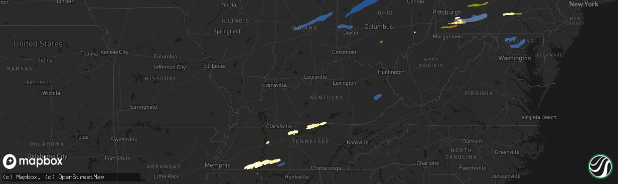
Hail Map in Kentucky on March 11, 2026
The weather event in Kentucky on March 11, 2026 includes Wind, Tornado, and Hail maps. 17 states and 692 cities were impacted and suffered possible damage. The total estimated number of properties impacted is 0.
Wind
Tornado
Hail
0
Estimated number of impacted properties by a 1.00" hail or larger0
Estimated number of impacted properties by a 1.75" hail or larger0
Estimated number of impacted properties by a 2.50" hail or largerStorm reports in Kentucky
Kentucky
| Date | Description |
|---|---|
| 03/11/20266:32 PM CDT | Social media picture of a tree blown down on a mobile home. Time estimated from radar. |
| 03/11/20266:01 PM CDT | Social media post of a bent flag pole at a residence. Time estimated from radar. |
| 03/11/20266:00 PM CDT | Carport was flipped and mangled. |
| 03/11/20265:50 PM CDT | Social media report of multiple trees down on the road near the wolf coal fire department building. This is at the intersection of ky 1110 and ky 1933. Time estimated v |
| 03/11/20265:46 PM CDT | Social media report of several trees down along bowlings creek road near buckhorn. Exact address unknown. There were also reports of power outages in this portion of br |
| 03/11/20265:11 PM CDT | A tree was reported down near the 1800 block of east laurel road... Close to the intersection of ky-1581. |
| 03/11/20265:06 PM CDT | A local report indicates 70 MPH wind near London-Corbin Airport |
| 03/11/20263:55 PM CDT | Trees down on ky-639. |
| 03/11/20263:55 PM CDT | Multiple trees down and roof blown off a trailer on wisdom dock rd |
| 03/11/20263:31 PM CDT | Tree down over part of hwy 100. |
All States Impacted by Hail Map on March 11, 2026
Cities Impacted by Hail Map on March 11, 2026
- Fordyce, AR
- Kingsland, AR
- New Edinburg, AR
- Rison, AR
- Pine Bluff, AR
- Huntington, TX
- Etoile, TX
- San Augustine, TX
- Albany, IN
- Anderson, IN
- Muncie, IN
- Gaston, IN
- Eaton, IN
- Dunkirk, IN
- Cicero, IN
- Daleville, IN
- Noblesville, IN
- Frankton, IN
- Yorktown, IN
- Lapel, IN
- Alexandria, IN
- Atlanta, IN
- Pittsboro, IN
- Lizton, IN
- Roachdale, IN
- Brownsburg, IN
- Zionsville, IN
- Carmel, IN
- North Salem, IN
- Lebanon, IN
- Westfield, IN
- Jamestown, IN
- Whitestown, IN
- Portland, IN
- Redkey, IN
- Ridgeville, IN
- West Milton, OH
- Greenville, OH
- Ludlow Falls, OH
- Pitsburg, OH
- Arcanum, OH
- New Madison, OH
- West Manchester, OH
- Laura, OH
- Troy, OH
- Vandalia, OH
- Englewood, OH
- Brookville, OH
- Lewisburg, OH
- Tipp City, OH
- Eldorado, OH
- New Paris, OH
- Minster, OH
- Botkins, OH
- Houston, OH
- Russia, OH
- Sidney, OH
- Jackson Center, OH
- Yorkshire, OH
- Anna, OH
- Fort Loramie, OH
- Ada, OH
- Kirby, OH
- Lakeview, OH
- Harpster, OH
- La Rue, OH
- Bloomville, OH
- Lewistown, OH
- Nevada, OH
- Forest, OH
- McCutchenville, OH
- Morral, OH
- Wapakoneta, OH
- Huntsville, OH
- New Hampshire, OH
- Kenton, OH
- Dunkirk, OH
- Russells Point, OH
- Wharton, OH
- McGuffey, OH
- Carey, OH
- Belle Center, OH
- Alger, OH
- Harrod, OH
- Sycamore, OH
- Upper Sandusky, OH
- Roundhead, OH
- Tiffin, OH
- Dola, OH
- Bucyrus, OH
- Waynesfield, OH
- Willard, OH
- New London, OH
- Wakeman, OH
- New Washington, OH
- Tiro, OH
- Bellevue, OH
- Attica, OH
- Huron, OH
- Greenwich, OH
- North Fairfield, OH
- Plymouth, OH
- Chatfield, OH
- Collins, OH
- Sandusky, OH
- Monroeville, OH
- Milan, OH
- Green Springs, OH
- Norwalk, OH
- Berlin Heights, OH
- Republic, OH
- Castalia, OH
- Amherst, OH
- Oberlin, OH
- Elyria, OH
- Vermilion, OH
- Kipton, OH
- Wellington, OH
- Lorain, OH
- Spencer, OH
- Homerville, OH
- Sullivan, OH
- Lagrange, OH
- Grafton, OH
- Nova, OH
- Lodi, OH
- Litchfield, OH
- West Salem, OH
- Ashland, OH
- Polk, OH
- Shiloh, OH
- Columbia Station, OH
- North Ridgeville, OH
- Olmsted Falls, OH
- Valley City, OH
- Medina, OH
- Strongsville, OH
- North Olmsted, OH
- Avon, OH
- Sheffield Lake, OH
- Linesville, PA
- Hartstown, PA
- Conneaut Lake, PA
- Cambridge Springs, PA
- Conneautville, PA
- Saegertown, PA
- Harmonsburg, PA
- Meadville, PA
- Guys Mills, PA
- Townville, PA
- Jamestown, PA
- Caldwell, OH
- Pocahontas, TN
- Sarahsville, OH
- Selmer, TN
- Ramer, TN
- Waverly, TN
- Chillicothe, OH
- Kingston, OH
- Stantonville, TN
- Guys, TN
- Hurricane Mills, TN
- Adamsville, TN
- Crump, TN
- Michie, TN
- Counce, TN
- Savannah, TN
- Shiloh, TN
- Olivehill, TN
- Collinwood, TN
- Waynesboro, TN
- Lutts, TN
- Burnsville, MS
- Iuka, MS
- Ashland City, TN
- Joelton, TN
- Lawrenceburg, TN
- Goodlettsville, TN
- Nashville, TN
- Whites Creek, TN
- Perryopolis, PA
- Westpoint, TN
- Ethridge, TN
- Hendersonville, TN
- Madison, TN
- Mount Juliet, TN
- Gallatin, TN
- Star Junction, PA
- Vanderbilt, PA
- Leoma, TN
- Loretto, TN
- Penn Run, PA
- Clymer, PA
- Indiana, PA
- Commodore, PA
- Cherry Tree, PA
- Mentcle, PA
- Northern Cambria, PA
- Spangler, PA
- Marsteller, PA
- Nicktown, PA
- Emeigh, PA
- Hastings, PA
- Carrolltown, PA
- Patton, PA
- Saint Boniface, PA
- Flinton, PA
- Fallentimber, PA
- Lafayette, TN
- Hartsville, TN
- Dixon Springs, TN
- Coalport, PA
- Blandburg, PA
- Tyrone, PA
- Philipsburg, PA
- Smithmill, PA
- Red Boiling Springs, TN
- Hunker, PA
- Mount Pleasant, PA
- Tarrs, PA
- Ruffs Dale, PA
- Alverton, PA
- Scottdale, PA
- New Stanton, PA
- Moss, TN
- Whitleyville, TN
- Celina, TN
- Acme, PA
- Greensburg, PA
- Burkesville, KY
- Tompkinsville, KY
- Hestand, KY
- Stahlstown, PA
- Laughlintown, PA
- Ligonier, PA
- Rector, PA
- Boswell, PA
- Latrobe, PA
- Somerset, PA
- Donegal, PA
- Jerome, PA
- Stoystown, PA
- Johnstown, PA
- Jennerstown, PA
- Windber, PA
- Hollsopple, PA
- Davidsville, PA
- Gray, PA
- Jenners, PA
- Seanor, PA
- Cairnbrook, PA
- Central City, PA
- Friedens, PA
- Hooversville, PA
- Acosta, PA
- New Enterprise, PA
- Queen, PA
- New Paris, PA
- Martinsburg, PA
- Alum Bank, PA
- Claysburg, PA
- Imler, PA
- Osterburg, PA
- Roaring Spring, PA
- Woodbury, PA
- Portage, PA
- Sproul, PA
- Hollidaysburg, PA
- Sidman, PA
- Duncansville, PA
- East Freedom, PA
- Daisytown, PA
- Coal Center, PA
- California, PA
- Brownsville, PA
- Grindstone, PA
- Fayette City, PA
- Dawson, PA
- Connellsville, PA
- Everson, PA
- White, PA
- Normalville, PA
- Champion, PA
- Melcroft, PA
- Indian Head, PA
- Hidden Valley, PA
- Jones Mills, PA
- Saxton, PA
- Williamsburg, PA
- James Creek, PA
- Loysville, PA
- Blain, PA
- Pulaski, TN
- Landisburg, PA
- New Bloomfield, PA
- Shermans Dale, PA
- Elliottsburg, PA
- Duncannon, PA
- Dauphin, PA
- Harrisburg, PA
- Grantville, PA
- Alexandria, LA
- Lecompte, LA
- Starkville, MS
- Maben, MS
- Sturgis, MS
- Ackerman, MS
- Mathiston, MS
- Marksville, LA
- Effie, LA
- Frederick, MD
- Thurmont, MD
- Walkersville, MD
- Woodsboro, MD
- Keymar, MD
- Union Bridge, MD
- New Windsor, MD
- Westminster, MD
- Damascus, MD
- Gaithersburg, MD
- Mount Airy, MD
- Sealy, TX
- Cat Spring, TX
- Brookeville, MD
- Glenelg, MD
- Glenwood, MD
- Woodbine, MD
- West Friendship, MD
- Cooksville, MD
- Ellicott City, MD
- Dayton, MD
- Sykesville, MD
- Marriottsville, MD
- Woodstock, MD
- Windsor Mill, MD
- Randallstown, MD
- Pikesville, MD
- Baltimore, MD
- Gwynn Oak, MD
- Owings Mills, MD
- Lutherville Timonium, MD
- Towson, MD
- Stevenson, MD
- Reisterstown, MD
- Hunt Valley, MD
- Cockeysville, MD
- Glen Arm, MD
- Sparks Glencoe, MD
- Phoenix, MD
- Baldwin, MD
- Hydes, MD
- Monkton, MD
- Fallston, MD
- Jackson, KY
- Clayhole, KY
- Vest, KY
- Gunlock, KY
- Salyersville, KY
- Franklin, TX
- Marquez, TX
- David, KY
- Blue River, KY
- Prestonsburg, KY
- South Fork, PA
- Saint Michael, PA
- Salix, PA
- Elton, PA
- Beaverdale, PA
- Buffalo, TX
- El Campo, TX
- Garwood, TX
- Waynesburg, PA
- Sycamore, PA
- Jefferson, PA
- Mather, PA
- Carmichaels, PA
- Clarksville, PA
- Rices Landing, PA
- Adah, PA
- East Millsboro, PA
- Crucible, PA
- McClellandtown, PA
- New Salem, PA
- Fairbank, PA
- Uniontown, PA
- Smock, PA
- Waltersburg, PA
- Keisterville, PA
- Dunbar, PA
- West Leisenring, PA
- Lemont Furnace, PA
- Mount Braddock, PA
- Youngwood, PA
- Centerville, TX
- Normangee, TX
- Middletown, DE
- Townsend, DE
- Odessa, DE
- Smithdale, MS
- Liberty, MS
- Monterey, LA
- Woodville, MS
- Vidalia, LA
- Amite, LA
- Roseland, LA
- Fluker, LA
- Kentwood, LA
- Mount Hermon, LA
- Independence, LA
- Greensburg, LA
- Holden, LA
- Franklinton, LA
- Loranger, LA
- Folsom, LA
- Covington, LA
- Bush, LA
- Ellisville, MS
- Seminary, MS
- Soso, MS
- Laurel, MS
- Ovett, MS
- Heidelberg, MS
- Shubuta, MS
- Pearl River, LA
- Wiggins, MS
- Brooklyn, MS
- Perkinston, MS
- Beaumont, MS
- McLain, MS
- Neely, MS
- Leakesville, MS
- Lucedale, MS
- Citronelle, AL
- Vinegar Bend, AL
- Tibbie, AL
- Deer Park, AL
- McIntosh, AL
- Chunchula, AL
- Wilmer, AL
- Mount Vernon, AL
- Rockford, AL
- Weogufka, AL
- Frisco City, AL
- Jackson, AL
- Uriah, AL
- Little River, AL
- Wagarville, AL
- Atmore, AL
- Repton, AL
- Brewton, AL
- Monroeville, AL
- Stockton, AL
- Perdido, AL
- Range, AL
- Lenox, AL
- Castleberry, AL
- Gainestown, AL
- Evergreen, AL
- Red Level, AL
- McKenzie, AL
- Dozier, AL
- Brantley, AL
- Church Point, LA
- Goshen, AL
- Glenwood, AL
- Troy, AL
- Banks, AL
- Brundidge, AL
- Louisville, AL
- Clayton, AL
- Midway, AL
- Abbeville, AL
- Headland, AL
- Dothan, AL
- Ashford, AL
- Cottonwood, AL
- Pansey, AL
- Bainbridge, GA
- Climax, GA
- Marshallville, GA
- Fort Valley, GA
- Warner Robins, GA
- Whigham, GA
- Cairo, GA
- Brinson, GA
- Ochlocknee, GA
- Iron City, GA
- Donalsonville, GA
- Thomasville, GA
- Boston, GA
- Camilla, GA
- Attapulgus, GA
- Colquitt, GA
- Meigs, GA
- Pelham, GA
- Chula, GA
- Norman Park, GA
- Lenox, GA
- Enigma, GA
- Ty Ty, GA
- Ocilla, GA
- Adel, GA
- Tifton, GA
- Omega, GA
- Wray, GA
- Alapaha, GA
- Sparks, GA
- Sumner, GA
- Nashville, GA
- Ashburn, GA
- Fitzgerald, GA
- Douglas, GA
- Willacoochee, GA
- Ambrose, GA
- Dixie, GA
- Quitman, GA
- Macon, GA
- Gray, GA
- Eatonton, GA
- Sparta, GA
- Haddock, GA
- Milledgeville, GA
- Hillsboro, GA
- Monticello, GA
- Doerun, GA
- Albany, GA
- Sylvester, GA
- Poulan, GA
- Pearson, GA
- Williamstown, NJ
- New Castle, DE
- Elkton, MD
- Pitman, NJ
- Blackwood, NJ
- Newark, DE
- Sewell, NJ
- Sicklerville, NJ
- Salem, NJ
- Glassboro, NJ
- Swedesboro, NJ
- Mullica Hill, NJ
- Woodstown, NJ
- Pennsville, NJ
- Penns Grove, NJ
- Monroeville, NJ
- Bear, DE
- Elmer, NJ
- Malaga, NJ
- Bridgeton, NJ
- Vineland, NJ
- Newfield, NJ
- Franklinville, NJ
- North East, MD
- Elk Mills, MD
- Pedricktown, NJ
- Charles Town, WV
- Summit Point, WV
- Winchester, VA
- Berryville, VA
- Boyce, VA
- Clarksburg, MD
- Ijamsville, MD
- Dickerson, MD
- Boyds, MD
- Germantown, MD
- Ingalls, IN
- Markleville, IN
- Indianapolis, IN
- Middletown, IN
- Fishers, IN
- Springport, IN
- Shirley, IN
- Pendleton, IN
- Fortville, IN
- Mccordsville, IN
- Nineveh, IN
- Edinburgh, IN
- Franklin, IN
- Winchester, IN
- Salamonia, IN
- Selma, IN
- Versailles, OH
- Rossburg, OH
- Farmland, IN
- New Weston, OH
- Coldwater, OH
- Saint Henry, OH
- Saratoga, IN
- Fort Recovery, OH
- Montezuma, OH
- Osgood, OH
- Burkettsville, OH
- Ansonia, OH
- Union City, IN
- Union City, OH
- Celina, OH
- Maria Stein, OH
- Parker City, IN
- Chickasaw, OH
- New Knoxville, OH
- Clyde, OH
- New Bremen, OH
- Eaton, OH
- Connersville, IN
- Richmond, IN
- Greens Fork, IN
- Boston, IN
- Cambridge City, IN
- Brownsville, IN
- Milton, IN
- Glenwood, IN
- Rushville, IN
- Centerville, IN
- Falmouth, IN
- Liberty, IN
- Ariton, AL
- Ozark, AL
- Skipperville, AL
- Clopton, AL
- Webb, AL
- Freeport, FL
- Ponce De Leon, FL
- Vernon, FL
- Ebro, FL
- Panama City Beach, FL
- Panama City, FL
- Lynn Haven, FL
- Griffin, GA
- Columbia, AL
- Blakely, GA
- Damascus, GA
- Box Springs, GA
- Mauk, GA
- Clinton, LA
- Greenwell Springs, LA
- Mandeville, LA
- Ponchatoula, LA
- Slidell, LA
- Perry, GA
- Oglethorpe, GA
- Kathleen, GA
- Bonaire, GA
- Bluffton, IN
- Tickfaw, LA
- Hammond, LA
- Albany, LA
- Ruth, MS
- Bogue Chitto, MS
- Jayess, MS
- Carson, MS
- Oak Vale, MS
- Bassfield, MS
- Sumrall, MS
- Kiln, MS
- Lacombe, LA
- Gulfport, MS
- Pass Christian, MS
- Bay Saint Louis, MS
- New Orleans, LA
- Long Beach, MS
- Waveland, MS
- Diamondhead, MS
- Biloxi, MS
- Pearlington, MS
- Lynnville, TN
- Summertown, TN
- Petersburg, TN
- Shelbyville, TN
- Cornersville, TN
- Lewisburg, TN
- Belfast, TN
- Old Hickory, TN
- Bethpage, TN
- Albany, KY
- Oneida, KY
- Keavy, KY
- Somerset, KY
- Manchester, KY
- London, KY
- Sextons Creek, KY
- Annville, KY
- Corbin, KY
- Lily, KY
- Parkers Lake, KY
- Columbus, GA
- Phenix City, AL
- Smiths Station, AL
- Pinehurst, GA
- Unadilla, GA
- Silas, AL
- Summit, MS
- Mccomb, MS


