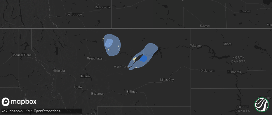
Hail Map on May 13, 2026
The weather event on May 13, 2026 includes Hail, Wind, and Tornado maps. 8 states and 154 cities were impacted and suffered possible damage. The total estimated number of properties impacted is 13,360.
Hail
Wind
Tornado
13,360
Estimated number of impacted properties by a 1.00" hail or larger0
Estimated number of impacted properties by a 1.75" hail or larger0
Estimated number of impacted properties by a 2.50" hail or largerStates Impacted by Hail Map on May 13, 2026
Storm reports
Virginia
| Date | Description |
|---|---|
| 05/13/20266:22 PM CDT | Thunderstorm winds blew down several large tree limbs close to the intersection of ingalls street and chestnut street. |
| 05/13/20266:01 PM CDT | Thunderstorm winds blew down one tree along the 5300 block of dunlap creek road and partially blocked the road when it fell. |
| 05/13/20265:33 PM CDT | Trained spotter measured wind gusts at 61 mph. |
| 05/12/20267:00 PM CDT | A local report indicates 1.00 inch wind near 2 SW Churchville |
Idaho
| Date | Description |
|---|---|
| 05/13/20266:45 PM CDT | Itd mesonet near yale itd12. |
| 05/13/20266:40 PM CDT | Mesonet station 2983 d4 conner summit id-77. |
| 05/13/20266:25 PM CDT | Power outage. |
| 05/13/20266:15 PM CDT | Mesonet station itde1 d5 blackfoot river bridge id-34. |
| 05/13/20266:12 PM CDT | Power outage. |
| 05/13/20266:11 PM CDT | Power outages - hibbard area. |
| 05/13/20265:53 PM CDT | A local report indicates 60 MPH wind near Burley |
| 05/13/20265:50 PM CDT | Mesonet station pc506 sheep creek hills. |
| 05/13/20265:47 PM CDT | Power outages. |
| 05/13/20265:41 PM CDT | Power outage. |
| 05/13/20265:41 PM CDT | Power outage. |
| 05/13/20265:40 PM CDT | Power outages. |
| 05/13/20265:40 PM CDT | Power outages. |
| 05/13/20265:40 PM CDT | Chain reaction mulit-vehcile crash on idaho highway 34. Several people injured. |
| 05/13/20265:31 PM CDT | Power outage. |
| 05/13/20265:30 PM CDT | Mesonet station pc219 galbraith. |
| 05/13/20265:29 PM CDT | Power outage. |
| 05/13/20265:27 PM CDT | Power outages. |
| 05/13/20265:23 PM CDT | Power outages. |
| 05/13/20265:20 PM CDT | Mesonet station pc362 oneida narrows. |
| 05/13/20265:20 PM CDT | Mesonet station pc639 mink creek. |
| 05/13/20265:15 PM CDT | Mesonet station grei 1 nw niter. |
| 05/13/20265:15 PM CDT | Mesonet station itdb6 d5 treasureton summit id-34. |
| 05/13/20265:14 PM CDT | Power outages. |
| 05/13/20265:13 PM CDT | Power outages. |
| 05/13/20265:11 PM CDT | Power outages. |
| 05/13/20265:10 PM CDT | Mesonet station pc497 station canyon. |
| 05/13/20265:10 PM CDT | Power outage. |
| 05/13/20265:10 PM CDT | Mesonet station pc130 cub river. |
| 05/13/20265:09 PM CDT | Power outages. |
| 05/13/20265:08 PM CDT | Power outages. |
| 05/13/20265:03 PM CDT | Power outages. |
| 05/13/20265:00 PM CDT | Mesonet station itdd9 d5 holbrook id-38. |
| 05/13/20265:00 PM CDT | Mesonet station sug 2 nne sugar city. |
| 05/13/20264:57 PM CDT | Power outages. |
| 05/13/20264:55 PM CDT | Power outage. |
| 05/13/20264:54 PM CDT | Mesonet station pbui1 potter butte. |
| 05/13/20264:54 PM CDT | Asos station krxe rexburg-madison airport. |
| 05/13/20264:54 PM CDT | Power outages. |
| 05/13/20264:53 PM CDT | Asos station krxe rexburg-madison airport. |
| 05/13/20264:52 PM CDT | Power outages. |
| 05/13/20264:50 PM CDT | Mesonet station lof inl specific manufacturing. |
| 05/13/20264:49 PM CDT | Power outages. |
| 05/13/20264:45 PM CDT | Mesonet station sosmc specific manufacturing capabilit. |
| 05/13/20264:45 PM CDT | Mesonet station 3306 d6 osgood i-15. |
| 05/13/20264:40 PM CDT | Mesonet station sosan sand dunes. |
| 05/13/20264:40 PM CDT | Mesonet station pc374 reno gulch. |
| 05/13/20264:39 PM CDT | Mesonet station mofi1 moburg canyon. |
| 05/13/20264:39 PM CDT | Power outages. |
| 05/13/20264:37 PM CDT | Power outages. |
| 05/13/20264:37 PM CDT | Power outages. |
| 05/13/20264:30 PM CDT | Mesonet station itdd3 d6 junction summit id-22/id-33. |
| 05/13/20264:30 PM CDT | Mesonet station rob 1 n roberts. |
| 05/13/20264:30 PM CDT | Mesonet station tra inl reactor tech complex. |
| 05/13/20264:27 PM CDT | Power outage. |
| 05/13/20264:25 PM CDT | Mesonet station ter 1 ne terreton. |
| 05/13/20264:20 PM CDT | Mesonet station abe 1 ne aberdeen. |
| 05/13/20264:20 PM CDT | Mesonet station ket kettle butte. |
| 05/13/20264:20 PM CDT | Mesonet station rwm inl radioactive waste mgmt. |
| 05/13/20264:17 PM CDT | Power outages. |
| 05/13/20264:16 PM CDT | Power outages. |
| 05/13/20264:15 PM CDT | Power outages. |
| 05/13/20264:14 PM CDT | Power outages. |
| 05/13/20264:10 PM CDT | Mesonet station sobas base of howe peak. |
| 05/13/20264:04 PM CDT | Power outages. |
| 05/13/20264:03 PM CDT | Asos station kllj challis airport. |
| 05/13/20264:00 PM CDT | Mesonet station sorwm radioactive waste management. |
| 05/13/20264:00 PM CDT | Mesonet station somfc materials and fuels complex. |
| 05/13/20264:00 PM CDT | Mesonet station 8419 d6 kettle butte us-20. |
| 05/13/20264:00 PM CDT | Mesonet station 3699 d6 inl puzzle us-20/us-26. |
| 05/13/20264:00 PM CDT | Mesonet station 3255 d4 sweetzer summit i-84. |
| 05/13/20264:00 PM CDT | Mesonet station ebr inl materials fuels complex. |
| 05/13/20264:00 PM CDT | Mesonet station 3004 d4 juniper interchange i-84. |
| 05/13/20264:00 PM CDT | Numeorus power outages in western jefferson county. |
| 05/13/20263:58 PM CDT | Power outages. |
| 05/13/20263:49 PM CDT | Power outages. |
| 05/13/20263:45 PM CDT | Mesonet station sum big southern butte. |
| 05/13/20263:45 PM CDT | Mesonet station blu blue dome. |
| 05/13/20263:45 PM CDT | Mesonet station soblu blue dome. |
| 05/13/20263:45 PM CDT | Mesonet station itdc4 d5 tilden flats us-26. |
| 05/13/20263:40 PM CDT | Mesonet station tab 3 w taber. |
| 05/13/20263:38 PM CDT | Asos station kllj challis airport. |
| 05/13/20263:31 PM CDT | Power outages. |
| 05/13/20263:25 PM CDT | Mesonet station sodub dubois. |
| 05/13/20263:21 PM CDT | Power outage. |
| 05/13/20263:20 PM CDT | Mesonet station sodea dead man canyon. |
| 05/13/20263:20 PM CDT | Mesonet station dea dead man canyon. |
| 05/13/20263:15 PM CDT | Mesonet station dub 5 nne dubois. |
| 05/13/20263:15 PM CDT | Mesonet station san 12 e howe. |
| 05/13/20263:15 PM CDT | Mesonet station sosan sand dunes. |
| 05/13/20263:10 PM CDT | Mesonet station bas base of howe peak. |
| 05/13/20263:10 PM CDT | Mesonet station pc371 medicine lodge. |
| 05/13/20263:10 PM CDT | Mesonet station sodea dead man canyon. |
| 05/13/20263:00 PM CDT | Mesonet station 2979 d6 botts id-33. |
| 05/13/20263:00 PM CDT | Mesonet station pc141 canyon creek. |
| 05/13/20263:00 PM CDT | Numerous power outages fairview aberdeen sterling grandview areas. |
| 05/13/20263:00 PM CDT | Mesonet station pc371 medicine lodge. |
| 05/13/20263:00 PM CDT | Mesonet station rrwbt relay ridge wind. |
| 05/13/20262:59 PM CDT | Asos station kbyi burley municipal airport. |
| 05/13/20262:55 PM CDT | Mesonet station min 6 nw minidoka. |
| 05/13/20262:55 PM CDT | Mesonet station somin minidoka. |
| 05/13/20262:54 PM CDT | Power outages. |
| 05/13/20262:52 PM CDT | Power outage. |
| 05/13/20262:50 PM CDT | Mesonet station somin minidoka. |
| 05/13/20262:50 PM CDT | Mesonet station pc371 medicine lodge. |
| 05/13/20262:50 PM CDT | Power outages near minidoka. |
| 05/13/20262:45 PM CDT | Mesonet station 2983 d4 conner summit id-77. |
| 05/13/20262:40 PM CDT | Mesonet station pc371 medicine lodge. |
| 05/13/20262:39 PM CDT | Power outages. |
| 05/13/20262:35 PM CDT | Mesonet station somin minidoka. |
| 05/13/20262:30 PM CDT | Mesonet station 3004 d4 juniper interchange i-84. |
| 05/13/20262:30 PM CDT | Mesonet station itde3 d6 camas i-15. |
| 05/13/20262:25 PM CDT | Mesonet station ham 1 wnw camas. |
| 05/13/20262:25 PM CDT | Mesonet station soham hamer. |
| 05/13/20262:20 PM CDT | Mesonet station soket kettle butte. |
| 05/13/20262:15 PM CDT | Mesonet station rov 9 ssw mud lake. |
| 05/13/20262:15 PM CDT | Mesonet station sorov rover. |
| 05/13/20262:15 PM CDT | Rover arl site. |
| 05/13/20262:15 PM CDT | Mesonet station rrwbt relay ridge wind. |
| 05/13/20262:10 PM CDT | Mesonet station ato atomic city. |
| 05/13/20262:05 PM CDT | Mesonet station soest east butte. |
| 05/13/20261:30 PM CDT | Mesonet station 2250 d5 sterling id-39. |
| 05/13/202612:47 PM CDT | Mesonet station crii1 cotton ridge. |
| 05/12/20267:00 PM CDT | Trees blown over from strong winds around 6 pm. Tree fell on truck. |
West Virginia
| Date | Description |
|---|---|
| 05/13/20266:00 PM CDT | Tree down at paynes ford road and trent arden court. |
| 05/13/20265:50 PM CDT | Tree down at cherry run road and hedgesville road |
| 05/13/20265:36 PM CDT | Tree was reported down on underwood road in lewisburg west virginia by the 911 call center. |
| 05/13/20265:23 PM CDT | Tree down on a power line at the intersection of ewing st. And dawson st. |
| 05/13/20264:59 PM CDT | A couple reports of trees and large limbs down in romney. |
| 05/13/20264:40 PM CDT | Trees down near d street and w piedmont |
| 05/13/20264:15 PM CDT | Tree down along with several branches. Time is estimated by radar. |
| 05/13/20263:45 PM CDT | Large tree uprooted. |
| 05/13/20263:39 PM CDT | A local report indicates 1.00 inch wind near 3 S Morgantown |
| 05/13/20263:32 PM CDT | Complete metal roof uplift of smokin jacks bar & grill. |
| 05/13/20263:31 PM CDT | At 4:31pm on may... 13th... A strong thunderstorm moved across preston county and produced one tornado... As confirmed by video footage along wagner lane. There was con |
| 05/13/20263:18 PM CDT | Trees down on smithtown road near 119. |
| 05/13/20263:18 PM CDT | Tree down on squirrel run road. |
| 05/13/20263:15 PM CDT | Report from mping: quarter |
| 05/13/20263:12 PM CDT | Multiple trees down on pricketts fort road. |
| 05/13/20263:05 PM CDT | Tree down catawba road. |
| 05/13/20262:58 PM CDT | Time estimated by radar. |
| 05/13/20262:10 PM CDT | A tree was reported blown over. |
Maryland
| Date | Description |
|---|---|
| 05/13/20266:30 PM CDT | Tree down at the intersection of old kiln rd. And orndorff rd. |
| 05/13/20266:10 PM CDT | Tree down at the intersection of old kiln rd. And orndorff rd. |
| 05/13/20266:02 PM CDT | A few reports of trees and power lines down in hagerstown. |
| 05/13/20265:57 PM CDT | One tree down in williamsport |
| 05/13/20264:42 PM CDT | Tree down at old waxler road. |
| 05/13/20264:09 PM CDT | Trees down on broadford road and deer park hotel road. |
New York
| Date | Description |
|---|---|
| 05/13/20264:30 PM CDT | Tree and wires down. Radar-estimated time. |
| 05/13/20264:05 PM CDT | Wires down. Radar-estimated time. |
| 05/13/20263:55 PM CDT | Wires down. Radar-estimated time. |
| 05/13/20263:30 PM CDT | Wires down in one location... Tree down in another... Both in vicinity of adams street as per county dispatch feed. Radar-estimated time. |
| 05/13/20263:30 PM CDT | Large tree and wires down on potter road as per county dispatch feed. Radar-estimated time. |
| 05/13/20263:07 PM CDT | Tree and wires down on route 414. |
| 05/13/20262:56 PM CDT | Tree down on wires on carter road in geneva. |
Montana
| Date | Description |
|---|---|
| 05/13/20266:59 PM CDT | Ambient weather station: 2flagsweather. |
| 05/13/20266:55 PM CDT | Winnett sw station |
| 05/13/20266:55 PM CDT | Awos station k00u 2 wnw hardin. |
| 05/13/20266:53 PM CDT | Asos station klvm livingston. |
| 05/13/20266:45 PM CDT | A local report indicates 65 MPH wind near 1 SE Busby |
| 05/13/20266:45 PM CDT | Mesonet station beacon hill us 87 mp 35 |
| 05/13/20266:40 PM CDT | Mesonet station dw8455 livingston. |
| 05/13/20266:15 PM CDT | Mesonet station mtchk chinook us-2 mp 403.5. |
| 05/13/20266:05 PM CDT | A local report indicates 62 MPH wind near 7 N Lavina |
| 05/13/20265:53 PM CDT | Trained spotter reported a 62 mph wind gust. |
| 05/13/20265:50 PM CDT | A local report indicates 80 MPH wind near 7 W Lodge Grass |
| 05/13/20265:46 PM CDT | Asos station khvr havre airport. |
| 05/13/20265:45 PM CDT | Mesonet station gw6393 kremlin 3ese. |
| 05/13/20265:45 PM CDT | Mesonet station dvi02964 havre. |
| 05/13/20265:45 PM CDT | Mesonet station gw0416 joplin. |
| 05/13/20265:45 PM CDT | Mesonet station mtm06 arc-n havre. |
| 05/13/20265:40 PM CDT | Mesonet station gw6390 gildford 6se. |
| 05/13/20265:35 PM CDT | Mesonet station dbym8 derby mountain. |
| 05/13/20265:31 PM CDT | Mesonet station mthls harlowton south us-191 mp 22.0. |
| 05/13/20265:30 PM CDT | Mesonet station gw4079 inverness ten south southeast. |
| 05/13/20265:30 PM CDT | Mesonet station dw4821 chester. |
| 05/13/20265:30 PM CDT | Mesonet station mtinv inverness |
| 05/13/20265:30 PM CDT | Mesonet station ew1931 rudyard. |
| 05/13/20265:30 PM CDT | Mesonet station gw3530 rudyard eleven south. |
| 05/13/20265:20 PM CDT | Big sandy nw montana mesonet measured a 85 mph wind gust. |
| 05/13/20265:15 PM CDT | Mesonet station gw6710 meadowlane. |
| 05/13/20265:15 PM CDT | Awos station k6s0 big timber. |
| 05/13/20265:15 PM CDT | Mesonet station gw4015 chester four ne. |
| 05/13/20265:00 PM CDT | Mesonet station gw6710 meadowlane. |
| 05/13/20265:00 PM CDT | Mesonet station gw3487 tiber dam six east. |
| 05/13/20265:00 PM CDT | Mesonet station mtlrh livingston river hill. |
| 05/13/20265:00 PM CDT | Mesonet station gw4098 tiber dam twelve se. |
| 05/13/20265:00 PM CDT | Mesonet station gw3478 tctiber. |
| 05/13/20265:00 PM CDT | Corrects previous tstm wnd gst report from 11 sse big sandy. Montana mesonet big sandy se. |
| 05/13/20265:00 PM CDT | [landspout] delayed report. High quality video of dust-wrapped circulation in contact with the ground ahead of destructive thunderstorm outflow containing significant |
| 05/13/20265:00 PM CDT | Mesonet station mtspd springdale i-90 mp 352.3. |
| 05/13/20264:55 PM CDT | Awos station k79s 1 ne fort benton. |
| 05/13/20264:53 PM CDT | Asos station klvm livingston. |
| 05/13/20264:45 PM CDT | Mesonet station mtlrh livingston river hill. |
| 05/13/20264:45 PM CDT | Mesonet station mtelv 3.3 e livingston |
| 05/13/20264:40 PM CDT | Carter n montana mesonet measured a 61 mph wind gust. |
| 05/13/20264:35 PM CDT | Mesonet station dvi04529 fort benton. |
| 05/13/20264:30 PM CDT | Ambient weather station: my weather station. |
| 05/13/20264:22 PM CDT | Asos station kdln dillon airport. |
| 05/13/20264:16 PM CDT | Mesonet station mttos toston bridge us-287 mp 87.0. |
| 05/13/20264:15 PM CDT | Mesonet station mtm45 3.2 sw loma |
| 05/13/20264:09 PM CDT | Asos station kgtf great falls airport. |
| 05/13/20264:00 PM CDT | Mesonet station mtbwg browning |
| 05/13/20264:00 PM CDT | Mesonet station mtgys geyser |
| 05/13/20264:00 PM CDT | Mt mesonet belt nw. |
| 05/13/20264:00 PM CDT | Montana mesonet highwood bench. |
| 05/13/20263:56 PM CDT | Asos station kgtf great falls airport. |
| 05/13/20263:55 PM CDT | Awos station k1am alpha. |
| 05/13/20263:47 PM CDT | Awos station k1im india. |
| 05/13/20263:45 PM CDT | Mesonet station mtm76 cascade e mda. |
| 05/13/20263:45 PM CDT | Mesonet station mtbwg browning |
| 05/13/20263:35 PM CDT | Awos station krvf 1 ese twin bridges. |
| 05/13/20263:30 PM CDT | Corrects previous non-tstm wnd gst report from 1 n raynolds pass. Mesonet station mtray raynolds pass |
| 05/13/20263:16 PM CDT | Asos station kdln dillon airport. |
| 05/13/20263:15 PM CDT | Mesonet station mtm70 3.0 ne dillon |
| 05/13/20263:05 PM CDT | Asos station kdln dillon airport. |
| 05/12/202611:35 PM CDT | Mosby nw mesonet mobm8. |
| 05/12/202611:30 PM CDT | Mesonet station mtbal ballantine i-94 mp 15.0. |
| 05/12/202611:25 PM CDT | Valentine east mesonet vltm8. |
| 05/12/202611:15 PM CDT | Corrects previous non-tstm wnd gst report from 1 nnw winnett. Mesonet station mtwin winnett mt-200 mp 136.0. |
| 05/12/202611:15 PM CDT | Corrects previous non-tstm wnd gst report from 5 wnw landusky. Mesonet station mthay 6.1 sw hays |
| 05/12/202611:00 PM CDT | Winnett sw mesonet wiem8. |
| 05/12/202610:55 PM CDT | War horse sw mesonet wrhm8. |
| 05/12/20269:50 PM CDT | Larslan sw mesonet llnm8. |
| 05/12/20269:29 PM CDT | A local report indicates 70 MPH wind near 22 SW Fort Smith |
| 05/12/20269:12 PM CDT | Mesonet station tt453 crazy. |
| 05/12/20268:53 PM CDT | Asos station kbil billings. |
| 05/12/20268:35 PM CDT | Awos station k6s8 2 nne laurel. |
| 05/12/20268:22 PM CDT | Mesonet station fslm8 fishtail. |
| 05/12/20268:15 PM CDT | Mesonet station au397 big timber. |
| 05/12/20268:15 PM CDT | Sun prairie station |
| 05/12/20268:08 PM CDT | Mesonet station ssmm8 south sawmill creek. |
| 05/12/20268:00 PM CDT | A local report indicates 60 MPH wind near 3 NW Cooney Reservoir S |
| 05/12/20267:41 PM CDT | Dry blood creek raws. |
| 05/12/20267:15 PM CDT | Mesonet station mtspd springdale i-90 mp 352.3. |
| 05/12/20267:05 PM CDT | War horse nw station |
| 05/12/20267:00 PM CDT | Montana mesonet big sandy se. |
| 05/12/20267:00 PM CDT | Mesonet station mtlrh livingston river hill. |
| 05/12/20267:00 PM CDT | Mesonet station mtelv 3.3 e livingston |
| 05/12/20267:00 PM CDT | Mesonet station mtwin winnett mt-200 mp 136.0. |
North Dakota
| Date | Description |
|---|---|
| 05/13/20265:31 AM CDT | Ndawn 10 meter peak wind gust measurement. |
Pennsylvania
| Date | Description |
|---|---|
| 05/13/20266:50 PM CDT | Trees down. |
| 05/13/20266:45 PM CDT | Trees down. |
| 05/13/20266:40 PM CDT | Trees down. |
| 05/13/20266:40 PM CDT | Tree down on sidewalk. |
| 05/13/20266:15 PM CDT | Tree down blocking both lanes. No wires. |
| 05/13/20266:07 PM CDT | Steeple blown down off church. |
| 05/13/20265:05 PM CDT | Corrects previous tstm wnd dmg report from 2 ene blain. Wires came down on a combine. |
| 05/13/20264:30 PM CDT | Wire down and sparking. |
| 05/13/20264:09 PM CDT | Tree on wires. |
| 05/13/20264:00 PM CDT | Large tree down blocking charleston road; car ran into tree. |
| 05/13/20263:30 PM CDT | Time estimated via radar. |
| 05/13/20262:55 PM CDT | A local report indicates 1.00 inch wind near 2 ENE West Newton |
| 05/13/20262:51 PM CDT | A local report indicates 1.00 inch wind near West Newton |
| 05/13/20262:15 PM CDT | The hail lasted for 5 minutes. |
| 05/13/20261:22 PM CDT | A local report indicates 1.00 inch wind near Clarion |
| 05/13/20261:14 PM CDT | A local report indicates 1.00 inch wind near 4 NW Fryburg |
| 05/13/202612:50 PM CDT | A local report indicates 1.00 inch wind near 1 NE Franklin |
| 05/12/20267:40 PM CDT | Tree down. |
| 05/12/20267:35 PM CDT | Tree fell on wires. |
| 05/12/20267:25 PM CDT | Tree and wires down. |
| 05/12/20267:20 PM CDT | Wires down. |
| 05/12/20267:10 PM CDT | Tree down. |
| 05/12/20267:00 PM CDT | Tree down. |
Wyoming
| Date | Description |
|---|---|
| 05/13/20266:38 PM CDT | Awos station kjac jackson airport |
| 05/13/20266:15 PM CDT | Mesonet station up146 7.8 ne carter. |
| 05/13/20265:46 PM CDT | Mesonet station wy33 coal road. |
| 05/13/20265:40 PM CDT | Mesonet station pc450 evanston north. |
| 05/13/20265:36 PM CDT | Mesonet station kfir first divide. |
| 05/13/20265:36 PM CDT | Mesonet station av868 medicine butte mountain. |
| 05/13/20265:28 PM CDT | Asos station kevw evanston-uinta cnty airport. |
| 05/13/20263:46 PM CDT | Mesonet station kmtr wy120 meeteetse rim |
| 05/13/20263:40 PM CDT | Mesonet station pc450 evanston north. |
| 05/13/20263:40 PM CDT | Mesonet station av868 medicine butte mountain. |
| 05/13/20263:20 PM CDT | Mesonet station pc581 canyon compression. |
| 05/12/202610:27 PM CDT | Asos station kshr sheridan. |
| 05/12/20267:56 PM CDT | Mesonet station wy55 2.9 n banner |
| 05/12/20267:00 PM CDT | Mesonet station up199 7.5 w granger. |
Utah
| Date | Description |
|---|---|
| 05/13/20266:35 PM CDT | Mesonet station freut fremont island - miller hill. |
| 05/13/20266:30 PM CDT | Mesonet station pc291 scipio summit. |
| 05/13/20266:30 PM CDT | Mesonet station pc367 east bearlake. |
| 05/13/20266:15 PM CDT | Mesonet station ccput currant creek peak. |
| 05/13/20266:15 PM CDT | Mesonet station ogp snowbasin - mount ogden. |
| 05/13/20266:10 PM CDT | Mesonet station pc338 horse haven. |
| 05/13/20266:00 PM CDT | Mesonet station pc098 gunnison reservior. |
| 05/13/20266:00 PM CDT | Mesonet station pc104 grantsville south. |
| 05/13/20265:50 PM CDT | Mesonet station utstv us-40 at starvation. |
| 05/13/20265:45 PM CDT | Mesonet station psrim peter sinks rim. |
| 05/13/20265:36 PM CDT | Mesonet station ucl02 paradise. |
| 05/13/20265:31 PM CDT | Mesonet station ur400 2.4 sw castle rock. |
| 05/13/20265:30 PM CDT | Mesonet station drrd dry ridge. |
| 05/13/20265:30 PM CDT | Mesonet station pc295 gunnison ridge. |
| 05/13/20265:26 PM CDT | Mesonet station fw8325 garden city. |
| 05/13/20265:20 PM CDT | Mesonet station utusu us-89 at usu. |
| 05/13/20265:20 PM CDT | Mesonet station pc295 gunnison ridge. |
| 05/13/20265:10 PM CDT | Mesonet station utrmd us-91 at mp 39 richmond. |
| 05/13/20265:00 PM CDT | Mesonet station pc358 hansel valley. |
| 05/13/20265:00 PM CDT | Mesonet station pc124 crow mountain. |
| 05/13/20265:00 PM CDT | Mesonet station wdypk windy peak. |
| 05/13/20265:00 PM CDT | Mesonet station smt south mountain. |
| 05/13/20265:00 PM CDT | Mesonet station lgp logan peak. |
| 05/13/20265:00 PM CDT | Multi-vehicle crash due to strong thunderstorm winds. |
| 05/13/20265:00 PM CDT | Swath of tree damage and downed power lines from the logan airport to smithfield. |
| 05/13/20265:00 PM CDT | Mesonet station lofty trial lake. |
| 05/13/20264:54 PM CDT | Asos station klgu logan-cache airport. |
| 05/13/20264:50 PM CDT | Mesonet station utpow sr-158 at mp 11.5 powder mountai. |
| 05/13/20264:50 PM CDT | Mesonet station ut30 sr-30. |
| 05/13/20264:50 PM CDT | Mesonet station pc254 the elbow. |
| 05/13/20264:40 PM CDT | Mesonet station utcur curlew junction. |
| 05/13/20264:40 PM CDT | Mesonet station uttol tollgate canyon. |
| 05/13/20264:40 PM CDT | Mesonet station pc123 murray's hill. |
| 05/13/20264:30 PM CDT | Mesonet station ut215 i-215 at i-80. |
| 05/13/20264:30 PM CDT | Mesonet station utnbc i-15 north brigham city. |
| 05/13/20264:30 PM CDT | Mesonet station pc172 junction south. |
| 05/13/20264:30 PM CDT | Mesonet station pc409 mws ut 5 big mountain pass. |
| 05/13/20264:30 PM CDT | Mesonet station ut31 i-80 at mp 78. |
| 05/13/20264:30 PM CDT | Mesonet station utecy i-80 at mp 134 east canyon. |
| 05/13/20264:30 PM CDT | Mesonet station utckh chaulk hill. |
| 05/13/20264:30 PM CDT | Mesonet station ut201 sr-201 at i-80. |
| 05/13/20264:30 PM CDT | Mesonet station ut28 tremonton. |
| 05/13/20264:25 PM CDT | Semi blown over near mile post 77 along i-80. |
| 05/13/20264:20 PM CDT | Mesonet station agd alta - guard house. |
| 05/13/20264:20 PM CDT | Mesonet station pc597 huntington sw. |
| 05/13/20264:20 PM CDT | Mesonet station pc490 kennecott rd lake point. |
| 05/13/20264:20 PM CDT | Mesonet station utoly i-215 at olympus cove. |
| 05/13/20264:20 PM CDT | Mesonet station utqry parleys canyon quarry. |
| 05/13/20264:20 PM CDT | Mesonet station utcur curlew junction. |
| 05/13/20264:20 PM CDT | Mesonet station utstr s-turns - big cottonwood canyon. |
| 05/13/20264:15 PM CDT | Trees and power lines down. |
| 05/13/20264:15 PM CDT | Public photo of large tree split and downed along the 9 line trail on 900 s near 300 e. |
| 05/13/20264:10 PM CDT | Mesonet station pc482 bull claim hill. |
| 05/13/20264:05 PM CDT | Mesonet station freut fremont island - miller hill. |
| 05/13/20264:00 PM CDT | Mesonet station dw9435 draper. |
| 05/13/20264:00 PM CDT | Mesonet station utalp point of the mountain. |
| 05/13/20264:00 PM CDT | Mesonet station freut fremont island - miller hill. |
| 05/13/20264:00 PM CDT | Mesonet station fg011 tintic. |
| 05/13/20263:55 PM CDT | Mesonet station gni gunnison island. |
| 05/13/20263:55 PM CDT | Mesonet station fps flight park south. |
| 05/13/20263:50 PM CDT | Mesonet station utpcr pioneer crossing. |
| 05/13/20263:50 PM CDT | Mesonet station cw9635 salt lake city. |
| 05/13/20263:45 PM CDT | Mesonet station wdypk windy peak. |
| 05/13/20263:44 PM CDT | Mesonet station up068 marsh. |
| 05/13/20263:42 PM CDT | Mesonet station rsbu1 rosebud. |
| 05/13/20263:40 PM CDT | Mesonet station hatut hat island. |
| 05/13/20263:35 PM CDT | Mesonet station gni gunnison island. |
| 05/13/20263:30 PM CDT | Mesonet station utedl i-80 at mp 71 east delle. |
| 05/13/20263:10 PM CDT | Mesonet station utwdl i-80 at mp 68 west delle. |
| 05/13/20263:06 PM CDT | Awos station ku16 14 sw lakeside. |
| 05/13/20263:00 PM CDT | Mesonet station pc298 the head. |
| 05/13/20263:00 PM CDT | Mesonet station wdypk windy peak. |
| 05/13/20262:35 PM CDT | Awos station ksvr slc arpt no. 2. |
| 05/13/20262:20 PM CDT | Mesonet station ut23 i-15/2400 s. |
| 05/12/20267:10 PM CDT | Mesonet station pc349 nephi west. |
| 05/12/20267:00 PM CDT | Mesonet station utmpk monument peak. |
Nebraska
| Date | Description |
|---|---|
| 05/12/202611:53 PM CDT | Asos station kcdr chadron airport - cdr. Occured under a 26 dbz shower as it was collapsing. Minimal lightning associated with it. |
Cities Impacted by Hail Map on May 13, 2026
- Franklin, PA
- Seneca, PA
- Oil City, PA
- Saint Clairsville, OH
- Franklinville, NY
- Martins Ferry, OH
- Dillonvale, OH
- Adena, OH
- Venus, PA
- Cranberry, PA
- Avella, PA
- Lewis Run, PA
- Hickory, PA
- Washington, PA
- Gifford, PA
- Cyclone, PA
- New Martinsville, WV
- Canonsburg, PA
- Houston, PA
- Eighty Four, PA
- Sistersville, WV
- Venetia, PA
- Ridgway, PA
- Proctor, WV
- Finleyville, PA
- Littleton, WV
- Brockway, PA
- Middlebourne, WV
- Metz, WV
- Mannington, WV
- Burton, WV
- Jacksonburg, WV
- Monongahela, PA
- Donora, PA
- Wana, WV
- Fairview, WV
- Belle Vernon, PA
- West Newton, PA
- Farmington, WV
- Webster, PA
- Smithton, PA
- Yukon, PA
- Waterloo, NY
- New Stanton, PA
- Bentleyville, PA
- West Union, WV
- Pullman, WV
- Ruffs Dale, PA
- Wyano, PA
- Lyons, NY
- Sodus, NY
- Rivesville, WV
- Morgantown, WV
- Hunker, PA
- Maidsville, WV
- New Milton, WV
- Troy, WV
- Camden, WV
- Weston, WV
- Alum Bridge, WV
- Coxs Mills, WV
- Auburn, WV
- Berea, WV
- Acme, PA
- Austin, PA
- Savannah, NY
- Fairmont, WV
- Clyde, NY
- Millstone, WV
- Orma, WV
- Arnoldsburg, WV
- Latrobe, PA
- Smithville, WV
- Stahlstown, PA
- Ligonier, PA
- Strabane, PA
- Marianna, PA
- Daisytown, PA
- Beallsville, PA
- Brownsville, PA
- Scenery Hill, PA
- Richeyville, PA
- Fredericktown, PA
- Jane Lew, WV
- Lost Creek, WV
- Greensburg, PA
- Mount Pleasant, PA
- Ireland, WV
- Napier, WV
- Geraldine, MT
- Fort Benton, MT
- Chinook, MT
- Rudyard, MT
- Denton, MT
- Winifred, MT
- Hingham, MT
- Havre, MT
- Lloyd, MT
- Loma, MT
- Box Elder, MT
- Big Sandy, MT
- Gildford, MT
- Kremlin, MT
- Shelley, ID
- Firth, ID
- Blackfoot, ID
- Idaho Falls, ID
- Pingree, ID
- Rigby, ID
- Ririe, ID
- Iona, ID
- Basalt, ID
- Romney, WV
- Slanesville, WV
- Green Spring, WV
- Points, WV
- Levels, WV
- Springfield, WV
- Paw Paw, WV
- Great Cacapon, WV
- Oldtown, MD
- Augusta, WV
- Winchester, VA
- Bunker Hill, WV
- Gore, VA
- Bloomery, WV
- Inwood, WV
- Berkeley Springs, WV
- Cross Junction, VA
- Capon Bridge, WV
- High View, WV
- Glengary, WV
- Hedgesville, WV
- Gerrardstown, WV
- Clear Brook, VA
- Yellow Spring, WV
- Williamsville, VA
- Winnett, MT
- Grass Range, MT
- Deerfield, VA
- Millboro, VA
- Roy, MT
- Brusett, MT
- Jordan, MT
- Malta, MT
- Zortman, MT
- Fort Peck, MT
- Hinsdale, MT
- Glasgow, MT
- Herminie, PA
- Madison, PA
- Clarington, PA
- Marienville, PA
- Kingwood, WV