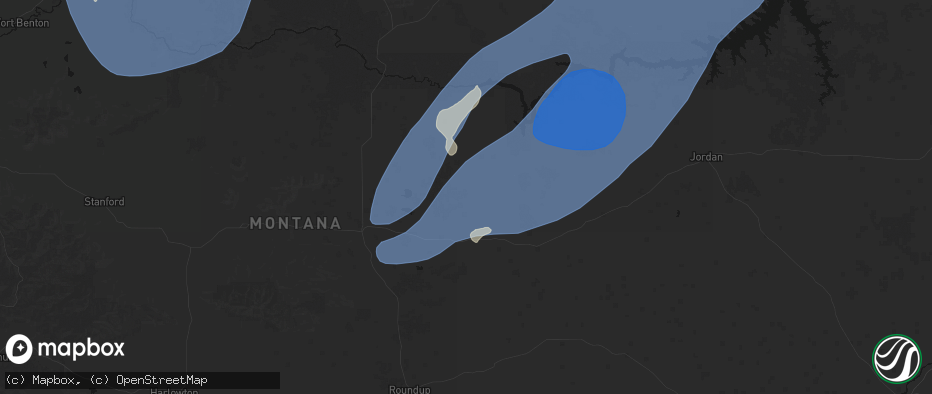
Hail Map in Winnett, MT on May 13, 2026
The weather event in Winnett, MT on May 13, 2026 includes Hail, Wind, and Tornado maps. 8 states and 154 cities were impacted and suffered possible damage. The total estimated number of properties impacted is 0.
Hail
Wind
Tornado
0
Estimated number of impacted properties by a 1.00" hail or larger0
Estimated number of impacted properties by a 1.75" hail or larger0
Estimated number of impacted properties by a 2.50" hail or largerStorm reports in Winnett, MT
Winnett, MT
| Date | Description |
|---|---|
| 05/13/20266:55 PM CDT | Winnett sw station |
| 05/12/202611:35 PM CDT | Mosby nw mesonet mobm8. |
| 05/12/202611:25 PM CDT | Valentine east mesonet vltm8. |
| 05/12/202611:15 PM CDT | Corrects previous non-tstm wnd gst report from 1 nnw winnett. Mesonet station mtwin winnett mt-200 mp 136.0. |
| 05/12/202611:00 PM CDT | Winnett sw mesonet wiem8. |
| 05/12/202610:55 PM CDT | War horse sw mesonet wrhm8. |
| 05/12/20267:41 PM CDT | Dry blood creek raws. |
| 05/12/20267:05 PM CDT | War horse nw station |
| 05/12/20267:00 PM CDT | Mesonet station mtwin winnett mt-200 mp 136.0. |
All States Impacted by Hail Map on May 13, 2026
All Cities Impacted by Hail Map on May 13, 2026
- Franklin, PA
- Seneca, PA
- Oil City, PA
- Saint Clairsville, OH
- Franklinville, NY
- Martins Ferry, OH
- Dillonvale, OH
- Adena, OH
- Venus, PA
- Cranberry, PA
- Avella, PA
- Lewis Run, PA
- Hickory, PA
- Washington, PA
- Gifford, PA
- Cyclone, PA
- New Martinsville, WV
- Canonsburg, PA
- Houston, PA
- Eighty Four, PA
- Sistersville, WV
- Venetia, PA
- Ridgway, PA
- Proctor, WV
- Finleyville, PA
- Littleton, WV
- Brockway, PA
- Middlebourne, WV
- Metz, WV
- Mannington, WV
- Burton, WV
- Jacksonburg, WV
- Monongahela, PA
- Donora, PA
- Wana, WV
- Fairview, WV
- Belle Vernon, PA
- West Newton, PA
- Farmington, WV
- Webster, PA
- Smithton, PA
- Yukon, PA
- Waterloo, NY
- New Stanton, PA
- Bentleyville, PA
- West Union, WV
- Pullman, WV
- Ruffs Dale, PA
- Wyano, PA
- Lyons, NY
- Sodus, NY
- Rivesville, WV
- Morgantown, WV
- Hunker, PA
- Maidsville, WV
- New Milton, WV
- Troy, WV
- Camden, WV
- Weston, WV
- Alum Bridge, WV
- Coxs Mills, WV
- Auburn, WV
- Berea, WV
- Acme, PA
- Austin, PA
- Savannah, NY
- Fairmont, WV
- Clyde, NY
- Millstone, WV
- Orma, WV
- Arnoldsburg, WV
- Latrobe, PA
- Smithville, WV
- Stahlstown, PA
- Ligonier, PA
- Strabane, PA
- Marianna, PA
- Daisytown, PA
- Beallsville, PA
- Brownsville, PA
- Scenery Hill, PA
- Richeyville, PA
- Fredericktown, PA
- Jane Lew, WV
- Lost Creek, WV
- Greensburg, PA
- Mount Pleasant, PA
- Ireland, WV
- Napier, WV
- Geraldine, MT
- Fort Benton, MT
- Chinook, MT
- Rudyard, MT
- Denton, MT
- Winifred, MT
- Hingham, MT
- Havre, MT
- Lloyd, MT
- Loma, MT
- Box Elder, MT
- Big Sandy, MT
- Gildford, MT
- Kremlin, MT
- Shelley, ID
- Firth, ID
- Blackfoot, ID
- Idaho Falls, ID
- Pingree, ID
- Rigby, ID
- Ririe, ID
- Iona, ID
- Basalt, ID
- Romney, WV
- Slanesville, WV
- Green Spring, WV
- Points, WV
- Levels, WV
- Springfield, WV
- Paw Paw, WV
- Great Cacapon, WV
- Oldtown, MD
- Augusta, WV
- Winchester, VA
- Bunker Hill, WV
- Gore, VA
- Bloomery, WV
- Inwood, WV
- Berkeley Springs, WV
- Cross Junction, VA
- Capon Bridge, WV
- High View, WV
- Glengary, WV
- Hedgesville, WV
- Gerrardstown, WV
- Clear Brook, VA
- Yellow Spring, WV
- Williamsville, VA
- Winnett, MT
- Grass Range, MT
- Deerfield, VA
- Millboro, VA
- Roy, MT
- Brusett, MT
- Jordan, MT
- Malta, MT
- Zortman, MT
- Fort Peck, MT
- Hinsdale, MT
- Glasgow, MT
- Herminie, PA
- Madison, PA
- Clarington, PA
- Marienville, PA
- Kingwood, WV


