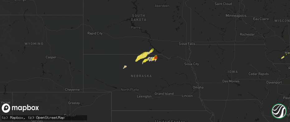
Hail Map on May 17, 2026
The weather event on May 17, 2026 includes Hail, Wind, and Tornado maps. 13 states and 1,536 cities were impacted and suffered possible damage. The total estimated number of properties impacted is 139,486.
Hail
Wind
Tornado
139,486
Estimated number of impacted properties by a 1.00" hail or larger27,608
Estimated number of impacted properties by a 1.75" hail or larger4,817
Estimated number of impacted properties by a 2.50" hail or largerStates Impacted by Hail Map on May 17, 2026
Storm reports
Colorado
| Date | Description |
|---|---|
| 05/17/20266:07 PM CDT | Trained spotter reported a 74 mph gust. |
| 05/17/20266:04 PM CDT | Time estimated from radar. |
| 05/17/20266:03 PM CDT | Location estimated; measured by anemometer. |
| 05/17/20265:59 PM CDT | Asos station kitr burlington co airport. |
| 05/17/20265:39 PM CDT | Mostly dime & quarter sized hail with a few quarters. |
| 05/17/20265:33 PM CDT | Nws employee reported downed tree. Tree appears to be dead. Time approximated from radar. |
| 05/17/20265:33 PM CDT | Nws employee reported a fallen tree. The tree appears to be dead. Time approximated from radar. |
| 05/17/20265:33 PM CDT | Awn; braxman. |
| 05/17/20265:15 PM CDT | Trained spotter reports hail up to quarter in size. Lots of it that covered the ground. |
| 05/17/20264:19 PM CDT | Asos station klic limon. |
| 05/17/20264:04 PM CDT | A local report indicates 60 MPH wind near 8 WSW Limon |
| 05/17/20263:30 PM CDT | A local report indicates 1.25 inch wind near Hayden |
| 05/17/20262:53 PM CDT | A local report indicates 66 MPH wind near 1 S Meeker |
Georgia
| Date | Description |
|---|---|
| 05/17/20265:40 PM CDT | Loss of some roof covering and the side wall of a building collapsed onto parked cars in tifton. |
| 05/17/20265:20 PM CDT | Berrien county dispatch reported downed powelines on mussel white store rd. |
| 05/17/20265:20 PM CDT | Berrien county dispatch reported a downed tree on hillard weeks. |
| 05/17/20265:15 PM CDT | A large tree fell across calvary church road near b w webb road... Blocking both lanes. |
| 05/17/20265:15 PM CDT | A tree fell across myrtle st near brookwood st. |
| 05/17/20265:08 PM CDT | Public reported hail up to quarter size in the dudley area. |
| 05/17/20264:40 PM CDT | Berrien county dispatch reported a downed tree on south dogwood dr. |
| 05/17/20264:40 PM CDT | One inch hail at ga 29 and union camp rd. |
| 05/17/20264:00 PM CDT | Several trees were blown down along temperance road. |
| 05/17/20263:50 PM CDT | Several trees were downed along prison camp rd. |
| 05/17/20263:40 PM CDT | One inch hail reported in jacksonville... Ga at water tower rd and north ocmulgee blvd. |
| 05/17/20263:40 PM CDT | One inch hail reported in jacksonville... Ga at east dogwood drive and batten blvd. |
| 05/17/20263:32 PM CDT | Cell tower collapsed and large tree branches down near 400 charter blvd and forest hill road. |
Florida
| Date | Description |
|---|---|
| 05/17/20265:18 PM CDT | Trees were reported down along county road 6 east. Time of event based on radar. |
| 05/17/20264:50 PM CDT | Trees and powerlines reported down along county road 150. Time estimated from radar. |
| 05/17/20263:39 PM CDT | Fswn madison greenville reported an 82 mph wind gust. This site is elevated and exposed... And is more representative of a 30 meter wind gust rather than the standard 1 |
| 05/17/20263:35 PM CDT | Tree down near us 90 east of greenville... Fl. |
| 05/17/20262:40 PM CDT | [landspout] a possible landspout/tornado reported via social media video which showed debris circling in the air. |
Kansas
| Date | Description |
|---|---|
| 05/17/20266:47 PM CDT | Social media report estimated 1.5 inch hail with photo; time estimated from radar. |
| 05/17/20266:46 PM CDT | Report of half-dollar sized hail with photos. |
| 05/17/20266:43 PM CDT | Public report of pictured quarter size hail. |
| 05/17/20266:41 PM CDT | Public report of roughly 1 inch hail with video and picture. |
| 05/17/20266:37 PM CDT | A local report indicates 1.75 inch wind near Dorrance |
| 05/17/20266:37 PM CDT | A local report indicates 1.00 inch wind near Otis |
| 05/17/20266:37 PM CDT | Report from mping: quarter |
| 05/17/20266:35 PM CDT | A local report indicates 1.00 inch wind near 1 WNW Beloit |
| 05/17/20266:34 PM CDT | Mostly pea size hail with a few quarters mixed in. |
| 05/17/20266:26 PM CDT | Report from mping: half dollar |
| 05/17/20266:11 PM CDT | A local report indicates 1.75 inch wind near 5 SW Dorrance |
| 05/17/20266:05 PM CDT | A local report indicates 1.00 inch wind near 3 SSE Lucas |
| 05/17/20266:05 PM CDT | [landspout] |
| 05/17/20265:50 PM CDT | A local report indicates 1.75 inch wind near 2 NNW Hunter |
| 05/17/20265:36 PM CDT | Report from social media with picture. |
| 05/17/20265:30 PM CDT | [landspout] video of a brief landspout south of timken. |
| 05/17/20264:58 PM CDT | A local report indicates 1.00 inch wind near Esbon |
| 05/16/202610:53 PM CDT | A local report indicates 1.75 inch wind near Wilson |
| 05/16/202610:19 PM CDT | 2.25 inch hail measured. |
| 05/16/202610:13 PM CDT | A local report indicates 1.25 inch wind near 4 WNW Susank |
| 05/16/20269:35 PM CDT | A local report indicates 1.00 inch wind near 4 NE Minneapolis |
| 05/16/20269:30 PM CDT | Delayed report. Relayed via photos. |
| 05/16/20269:30 PM CDT | County dispatch reported half-dollar sized hail. |
| 05/16/20269:29 PM CDT | A local report indicates 1.75 inch wind near Tescott |
| 05/16/20269:10 PM CDT | Mping report of ping ball ball sized hail. |
| 05/16/20269:06 PM CDT | Report received from social media. |
| 05/16/20269:05 PM CDT | 50-60 mph winds. |
| 05/16/20268:49 PM CDT | Half-dollar sized hail reported. |
| 05/16/20268:40 PM CDT | Report was from social media with photos. |
| 05/16/20268:36 PM CDT | Reported nickel to quarter size hail covering the ground. |
| 05/16/20268:23 PM CDT | A local report indicates 1.00 inch wind near 4 E Hollenburg |
| 05/16/20268:20 PM CDT | A local report indicates 1.00 inch wind near 1 E Beverly |
| 05/16/20268:05 PM CDT | Personal weather station. |
| 05/16/20268:03 PM CDT | Corrects previous hail report from 9 s nekoma. Social media report of half-dollar sized hail. |
| 05/16/20267:59 PM CDT | Kcnk. |
| 05/16/20267:55 PM CDT | Kcnk. |
| 05/16/20267:55 PM CDT | A local report indicates 1.75 inch wind near 3 NE Ada |
| 05/16/20267:50 PM CDT | A local report indicates 1.50 inch wind near 8 NNW Rozel |
| 05/16/20267:44 PM CDT | Social media picture of half0dollar size hail. |
| 05/16/20267:28 PM CDT | A local report indicates 1.25 inch wind near 3 W Wilson |
| 05/16/20267:24 PM CDT | Report from mping: quarter |
| 05/16/20267:09 PM CDT | Quarter to half dollar hail covering the ground. |
| 05/16/20267:03 PM CDT | Social media report of half-dollar sized hail. |
| 05/16/20267:02 PM CDT | A local report indicates 1.25 inch wind near 5 ESE Milberger |
| 05/16/20267:00 PM CDT | A local report indicates 1.25 inch wind near 10 SSW Edson |
South Dakota
| Date | Description |
|---|---|
| 05/17/20265:02 PM CDT | A local report indicates 1.00 inch wind near Valley Springs |
| 05/17/20264:47 PM CDT | A local report indicates 1.50 inch wind near 4 SSE Sioux Falls |
| 05/17/20264:45 PM CDT | Large tree limbs down. |
| 05/17/20264:38 PM CDT | A local report indicates 1.00 inch wind near Tea |
| 05/17/20264:36 PM CDT | Report from 85th and western of quarter size hail. |
| 05/17/20264:32 PM CDT | Report from mping. |
| 05/17/20264:17 PM CDT | Quarter size hail along with estimated 40-50 mph winds reported. |
| 05/17/20264:17 PM CDT | Via personal weather station. Exact time estimated via radar. |
| 05/17/20264:15 PM CDT | 70 mph caused downed tree branches. |
| 05/17/20264:14 PM CDT | Via personal weather station. Exact time estimated via radar. |
| 05/17/20264:09 PM CDT | Power poles snapped and irrigation pivots flipped near the intersection of 276th st and 456th ave. Time estimated from radar. |
| 05/17/20264:06 PM CDT | Video via social media of brief gustnado. Location estimated. |
| 05/17/20263:47 PM CDT | Spotter estimated 50-60 mph winds along with half dollar size hail. |
| 05/17/20263:44 PM CDT | Via mping. Time estimated via radar. |
| 05/17/20263:44 PM CDT | Via mping. Time estimated via radar. |
| 05/17/20263:42 PM CDT | Mesonet station 163 sd rwis freeman. |
| 05/17/20263:42 PM CDT | Damage to large road signs near intersection of hwy 18/81. |
| 05/17/20263:38 PM CDT | Mesonet station mnms2 menno 7ese |
| 05/17/20263:37 PM CDT | Large garage door on outbuilding bowed in. Time estimated from radar. |
| 05/17/20263:36 PM CDT | Corrects time of previous hail report from 3 e menno. Via mping. Time estimated via radar. |
| 05/17/20263:36 PM CDT | Photo of roughly golf ball size hail. Time estimated via radar. |
| 05/17/20263:24 PM CDT | Asos station kmhe mitchell municipal airport. |
| 05/17/20263:16 PM CDT | Via personal weather station. |
| 05/17/20263:15 PM CDT | 65 to 70 mph downed small trees. Quarter sized hail also occurred. |
| 05/17/20263:05 PM CDT | Farm out-buildings severely damaged and 5th wheel camper overturned. |
| 05/17/20263:00 PM CDT | Via personal weather station. Exact time estimated via radar. |
| 05/17/20262:58 PM CDT | Mesonet station avms2 avon 3e |
| 05/17/20262:54 PM CDT | Trained spotter reported a shed with its roof blown off. |
| 05/17/20262:53 PM CDT | Photo of blown in grain bins via em. Time estimated via radar. |
| 05/17/20262:52 PM CDT | Mesonet station 324 sd rwis wagner. |
| 05/17/20262:50 PM CDT | Mesonet station 304 sd rwis corsica. |
| 05/17/20262:50 PM CDT | Mobile trailer flipped... Dismantled... And moved about 60 ft. Pickup truck tipped on its side. Time estimated from radar. |
| 05/17/20262:50 PM CDT | A local report indicates 58 MPH wind near 4 SW Stickney |
| 05/17/20262:48 PM CDT | Awos station kagz wagner. |
| 05/17/20262:48 PM CDT | Broken power poles. Time estimated from radar. |
| 05/17/20262:46 PM CDT | Wind gusts 50-60 mph broke down 1.5 to 2 inch tree branches. Sheets of heavy rain and pea hail were also falling. |
| 05/17/20262:46 PM CDT | Heavily damaged outbuilding. Time estimated from radar. |
| 05/17/20262:44 PM CDT | A mile of power lines down near the intersection of 298th st and 393rd ave. Time estimated from radar. |
| 05/17/20262:40 PM CDT | Via personal weather station. Exact time estimated via radar. |
| 05/17/20262:40 PM CDT | Full trees down along with older farm outbuildings collapsed. Time estimated via radar. |
| 05/17/20262:37 PM CDT | Winds estimated 40-50 mph. |
| 05/17/20262:34 PM CDT | Via personal weather station. Exact time estimated via radar. |
| 05/17/20262:34 PM CDT | Open front cattle barn and hay shed destroyed. A couple houses in the area also had missing shingles. |
| 05/17/20262:30 PM CDT | Mesonet station 244 sd rwis ft. Randall dam. |
| 05/17/20262:07 PM CDT | Via personal weather station. Exact time estimated via radar. |
| 05/17/20261:56 PM CDT | Via personal weather station. Exact time estimated via radar. |
| 05/17/20261:45 PM CDT | Via personal weather station. Exact time estimated via radar. |
| 05/17/20261:40 PM CDT | In addtion to half dollar sized hail... Heavy rain is falling. |
Missouri
| Date | Description |
|---|---|
| 05/17/20266:20 AM CDT | Large trees and limbs down on the north side of vandalia. Time estimated from radar. |
| 05/17/20265:50 AM CDT | Corrects previous tstm wnd dmg report from 2 s columbia. Numerous reports of trees... Large limbs... And power lines blocking roadways in and south of columbia. Time es |
| 05/17/20265:50 AM CDT | Numerous reports of trees and large limbs blocking roadways in and south of columbia. |
| 05/17/20263:36 AM CDT | Private weather sensor. |
| 05/17/20263:05 AM CDT | A local report indicates 60 MPH wind near Kirksville Regional |
| 05/17/20261:21 AM CDT | Private weather sensor. |
| 05/16/202611:36 PM CDT | Private weather sensor. |
| 05/16/202611:15 PM CDT | A local report indicates 58 MPH wind near 2 W Maryville |
| 05/16/202611:12 PM CDT | Downed wires near quill road. Time estimated from radar. |
| 05/16/202611:12 PM CDT | Report of trees blown over... Time estimated from radar. |
| 05/16/202611:06 PM CDT | Pws measured 58 mph wind gust north of maryville. |
| 05/16/202610:51 PM CDT | Private weather sensor. |
| 05/16/202610:37 PM CDT | Pws measured 62 mph wind gusts northeast of westboro. |
| 05/16/202610:31 PM CDT | Downed wires near n avenue. Time estimated from radar. |
| 05/16/202610:22 PM CDT | Downed wires near 245 street. Time estimated from radar. |
| 05/16/202610:22 PM CDT | Downed wires near route 111. Time estimated from radar. |
| 05/16/202610:20 PM CDT | Downed wires near 260 street. Time estimated from radar. |
Wisconsin
| Date | Description |
|---|---|
| 05/17/20264:00 PM CDT | Multiple trees downed and uprooted in two rivers. |
| 05/17/20264:00 PM CDT | Downed trees and power lines along sandy bay road just south of lake breeze way. Time estimated from radar. |
| 05/17/20263:56 PM CDT | Tree uprooted. Time estimated from radar. |
| 05/17/20263:50 PM CDT | Nws damage survey determined straight line thunderstorm winds moved through two rivers between 3:50 and 3:56 pm. The storms snapped and uprooted over 100 trees... Power |
| 05/17/20263:50 PM CDT | 3 to 4 trees downed along county road b. |
| 05/17/20263:47 PM CDT | Roof damage to barn along state highway 310. Time estimated from radar. |
| 05/17/20263:09 PM CDT | Barn damaged. Time estimated from radar. |
| 05/17/20263:07 PM CDT | Damage to barn... Trailer flipped. Along highway 32/57 southeast of chilton. Time estimated from radar. |
| 05/17/20262:56 PM CDT | Large limbs snapped on a healthy tree. |
| 05/17/20262:15 PM CDT | At 230pm... Law enforcement reported ~4 telephone poles down near the intersection of county hwy ff and state hwy 42. Damage time estimated from radar |
Nebraska
| Date | Description |
|---|---|
| 05/17/20266:59 PM CDT | A local report indicates 1.75 inch wind near 2 SW Wisner |
| 05/17/20266:57 PM CDT | A local report indicates 1.00 inch wind near Wisner |
| 05/17/20266:53 PM CDT | Tight circulation and tds evident. |
| 05/17/20266:43 PM CDT | Family member of nws employee. |
| 05/17/20266:37 PM CDT | Public weather station. |
| 05/17/20266:36 PM CDT | Corrects previous hail report from clarkson. |
| 05/17/20266:36 PM CDT | A local report indicates 1.00 inch wind near Clarkson |
| 05/17/20266:35 PM CDT | Large tree down in friend. |
| 05/17/20266:34 PM CDT | A local report indicates 2.50 inch wind near Deshler |
| 05/17/20266:33 PM CDT | A local report indicates 67 MPH wind near 2 WSW Bruning |
| 05/17/20266:33 PM CDT | A local report indicates 1.00 inch wind near Clarks |
| 05/17/20266:30 PM CDT | Image sent in of 2 hail. |
| 05/17/20266:30 PM CDT | Facebook photo of estimated hail larger than 2 inches. |
| 05/17/20266:29 PM CDT | Public weather station. |
| 05/17/20266:25 PM CDT | A local report indicates 59 MPH wind near 9 WNW Genoa |
| 05/17/20266:20 PM CDT | Personal weather station. |
| 05/17/20266:19 PM CDT | A local report indicates 1.00 inch wind near Central City |
| 05/17/20266:15 PM CDT | Report from mping: ping pong ball |
| 05/17/20266:15 PM CDT | A local report indicates 58 MPH wind near 3 ENE Geneva |
| 05/17/20266:14 PM CDT | Corrects previous tstm wnd gst report from 5 s monroe. Nebraska mesonet. |
| 05/17/20266:14 PM CDT | Nebraska mesonet. |
| 05/17/20266:12 PM CDT | Reports of downed power lines. |
| 05/17/20266:10 PM CDT | A local report indicates 1.00 inch wind near Byron |
| 05/17/20266:08 PM CDT | A local report indicates 58 MPH wind near 4 S Geneva |
| 05/17/20266:08 PM CDT | Powerlines down. |
| 05/17/20266:06 PM CDT | (gid |
| 05/17/20266:06 PM CDT | A local report indicates 1.50 inch wind near 3 SW Henderson |
| 05/17/20266:05 PM CDT | Personal weather station. |
| 05/17/20266:01 PM CDT | A local report indicates 59 MPH wind near 3 N Genoa |
| 05/17/20266:00 PM CDT | A local report indicates 1.75 inch wind near Fullerton |
| 05/17/20266:00 PM CDT | A local report indicates 74 MPH wind near 2 W Central City |
| 05/17/20265:52 PM CDT | A local report indicates 59 MPH wind near 9 WNW Genoa |
| 05/17/20265:47 PM CDT | Pea to dime sized hail... 50-60 mph winds. |
| 05/17/20265:43 PM CDT | A local report indicates 1.50 inch wind near 1 S Deweese |
| 05/17/20265:43 PM CDT | A local report indicates 1.50 inch wind near 3 SSE Deweese |
| 05/17/20265:40 PM CDT | A local report indicates 1.75 inch wind near 1 N Superior |
| 05/17/20265:39 PM CDT | A local report indicates 61 MPH wind near 5 N Palmer |
| 05/17/20265:36 PM CDT | A local report indicates 1.75 inch wind near 2 W Superior |
| 05/17/20265:35 PM CDT | A local report indicates 60 MPH wind near 3 NNW Oak |
| 05/17/20265:32 PM CDT | Corrects previous tstm wnd gst report from 5 n palmer. |
| 05/17/20265:30 PM CDT | A local report indicates 60 MPH wind near 3 WSW Oak |
| 05/17/20265:27 PM CDT | A local report indicates 1.75 inch wind near 5 N Guide Rock |
| 05/17/20265:27 PM CDT | A local report indicates 3.00 inch wind near 1 NE Dannebrog |
| 05/17/20265:25 PM CDT | A local report indicates 3.50 inch wind near 1 W Palmer |
| 05/17/20265:18 PM CDT | A local report indicates 63 MPH wind near 5 W Palmer |
| 05/17/20265:17 PM CDT | A local report indicates 64 MPH wind near 3 SSE Fairmont |
| 05/17/20265:15 PM CDT | A local report indicates 2.50 inch wind near 5 ESE Saint Paul |
| 05/17/20265:14 PM CDT | A local report indicates 1.50 inch wind near Saint Paul |
| 05/17/20265:12 PM CDT | A local report indicates a tornado near 7 N Saint Libory |
| 05/17/20265:11 PM CDT | A local report indicates 2.75 inch wind near Dannebrog |
| 05/17/20265:10 PM CDT | Damage to structures reported. |
| 05/17/20265:09 PM CDT | A local report indicates a tornado near 4N Saint Libory |
| 05/17/20265:04 PM CDT | A local report indicates a tornado near 2 W Saint Libory |
| 05/17/20265:04 PM CDT | A local report indicates 2.75 inch wind near Dannebrog |
| 05/17/20264:58 PM CDT | Corrects previous hail report from dannebrog. |
| 05/17/20264:58 PM CDT | Corrects previous hail report from 1 ne dannebrog. |
| 05/17/20264:56 PM CDT | A local report indicates 1.00 inch wind near 1 N Elba |
| 05/17/20264:54 PM CDT | A local report indicates 2.75 inch wind near Elba |
| 05/17/20264:52 PM CDT | Report from mping: golf ball |
| 05/17/20264:51 PM CDT | A local report indicates a tornado near 4 NNE Cairo |
| 05/17/20264:51 PM CDT | Danny near ashton. |
| 05/17/20264:50 PM CDT | A local report indicates 2.00 inch wind near 3 ENE Ashton |
| 05/17/20264:44 PM CDT | A local report indicates 1.75 inch wind near Dannebrog |
| 05/17/20264:43 PM CDT | A local report indicates 3.00 inch wind near Ashton |
| 05/17/20264:35 PM CDT | A local report indicates 1.75 inch wind near 3.5 WSW Ashton |
| 05/17/20264:34 PM CDT | A local report indicates 1.75 inch wind near Boelus |
| 05/17/20264:30 PM CDT | A local report indicates 2.50 inch wind near Ashton |
| 05/17/20264:14 PM CDT | A local report indicates 1.00 inch wind near 3 SE Ravenna |
| 05/17/20262:15 PM CDT | Roof partially blowm off a gas station. Several large tree branches down. |
| 05/17/20262:15 PM CDT | A local report indicates 77 MPH wind near 2 SE Spencer |
| 05/17/20262:08 PM CDT | A local report indicates 64 MPH wind near 3 SW Spencer |
| 05/17/20261:45 PM CDT | Wind gusts from 50 to 60 mph. |
| 05/17/20261:19 PM CDT | Lots of hail up to nickel size. Damaging to the house siding and shredded tree leaves. |
| 05/17/20261:00 PM CDT | Corrects previous thunderstorm wind gust report from 5 miles west of burton. |
| 05/17/20261:00 PM CDT | A local report indicates 60 MPH wind near 11 ESE Sparks |
| 05/16/20269:55 PM CDT | Personal weather station gusted to 59 mph 2 miles wnw of humboldt... Ne. |
| 05/16/20269:42 PM CDT | Personal weather station measured 60 mph. |
| 05/16/20269:37 PM CDT | Personal weather station. |
| 05/16/20269:30 PM CDT | Personal weather station. |
| 05/16/20269:04 PM CDT | Report of quarter sized hail in avoca... Relayed via nwschat by em. |
| 05/16/20268:46 PM CDT | Report of damage to homes south of plattsmouth from possible tornado. Additional chaser photo of possible tornado in the same area. Time is estimated. |
| 05/16/20268:44 PM CDT | Trained weather spotter reported estimated 60 mph wind gusts along with pea size hail. |
| 05/16/20268:42 PM CDT | Personal weather station. |
| 05/16/20268:37 PM CDT | Spotter report of 60 to 70 mph estimated wind gusts. |
| 05/16/20268:27 PM CDT | Asos koma reporting peak gust of 63 mph at 827pm. |
| 05/16/20268:26 PM CDT | Personal weather station. |
| 05/16/20268:21 PM CDT | Tree branches down with damage to a street light. Time is estimated from radar. |
| 05/16/20268:21 PM CDT | Public photo of broken tree branch approximately 4 inches in diameter. Time is estimated from radar. |
| 05/16/20268:15 PM CDT | A local report indicates 58 MPH wind near 3 SE Firth |
| 05/16/20268:15 PM CDT | A local report indicates 70 MPH wind near 4 NW Waverly |
| 05/16/20268:14 PM CDT | Downed tree branches resulted in rain gutter being partially torn off a home. Time is estimated from radar. |
| 05/16/20268:10 PM CDT | A few tree tops gone. Tree branches flying/fallen. |
| 05/16/20268:01 PM CDT | Report from mping: quarter |
| 05/16/20267:55 PM CDT | Large trees and limbs down on roads. Time is estimated. |
| 05/16/20267:54 PM CDT | Asos station klnk lincoln airport. |
| 05/16/20267:50 PM CDT | Personal weather station. |
| 05/16/20267:44 PM CDT | Awos station kfet fremont airport. |
| 05/16/20267:44 PM CDT | Personal weather station gust to 66 mph. |
| 05/16/20267:31 PM CDT | Em estimated 60+ mph winds in lincoln. |
| 05/16/20267:30 PM CDT | Personal weather station. |
| 05/16/20267:28 PM CDT | Personal weather station. |
| 05/16/20267:28 PM CDT | Estimating half dollar. |
| 05/16/20267:27 PM CDT | Personal weather station. |
| 05/16/20267:26 PM CDT | A local report indicates 60 MPH wind near Strang |
| 05/16/20267:21 PM CDT | A local report indicates 60 MPH wind near 3 E Strang |
| 05/16/20267:21 PM CDT | Wind damage in winnebago and points south. Trees down. Possible tornado damage. |
| 05/16/20267:20 PM CDT | Image sent in over social media. |
| 05/16/20267:20 PM CDT | Widespread tree branches down... 5 inch diameter. Time is estimated. |
| 05/16/20267:16 PM CDT | A local report indicates 1.00 inch wind near Pender |
| 05/16/20267:16 PM CDT | Estimated wind speeds. |
| 05/16/20267:15 PM CDT | Personal weather station. |
| 05/16/20267:14 PM CDT | Upr station. |
| 05/16/20267:10 PM CDT | Report on social media of a tree knocked over tree. |
| 05/16/20267:09 PM CDT | Power is out in bancroft. |
| 05/16/20267:07 PM CDT | A local report indicates 58 MPH wind near 4 NNW Ohiowa |
| 05/16/20267:02 PM CDT | Had many reports of 3/4 inch mixed in with the inch hail. |
Minnesota
| Date | Description |
|---|---|
| 05/17/20266:56 PM CDT | In addition to hail up to the size of quarters... Winds gusted up about 40 mph and a quick heavy rain occurred. No damage was noticed. |
| 05/17/20266:26 PM CDT | Via personal weather station. Exact time estimated via radar. |
| 05/17/20266:24 PM CDT | Picture with 1 inch hailstone and ruler. |
| 05/17/20266:22 PM CDT | Mping: quarter |
| 05/17/20266:18 PM CDT | Report from mping: time estimated via radar. |
| 05/17/20266:15 PM CDT | Unconfirmed report of tornado approximately 1 mile southwest of worthington. Debris currently being observed. |
| 05/17/20266:01 PM CDT | Mesonet station mn160 u.s.14 - florence - mp 21.2. Time estimated via radar. |
| 05/17/20266:01 PM CDT | Mping: half dollar |
| 05/17/20265:54 PM CDT | A local report indicates 1.75 inch wind near Lismore |
| 05/17/20265:50 PM CDT | A local report indicates 1.50 inch wind near 1 N Adrian |
| 05/17/20265:44 PM CDT | Via personal weather station. Exact time estimated via radar. |
| 05/17/20265:36 PM CDT | Report from mping. |
| 05/17/20265:26 PM CDT | Awos station klyv luverne airport. |
| 05/17/20265:18 PM CDT | Mesonet station mn006 i-90 - beaver creek mp 4. |
| 05/16/202610:57 PM CDT | A local report indicates 61 MPH wind near Austin Airport |
| 05/16/202610:42 PM CDT | A local report indicates 63 MPH wind near 2 WSW Austin |
| 05/16/202610:29 PM CDT | Delayed report... Time estimated from radar. Partial machine shed destroyed. Possible tornado. |
| 05/16/202610:28 PM CDT | Delayed report... Time estimated from radar. Large tree down. |
| 05/16/202610:20 PM CDT | Delayed report... Time estimated from radar. Damage to trees and partial roof damage to a house. Possible end point of a tornado that started southwest of conger. |
| 05/16/202610:18 PM CDT | Delayed report... Possible tornado start. Exterior garage wall blown out. |
| 05/16/202610:18 PM CDT | Delayed report... Time estimated from radar. Damage to out buildings... And swirls in farm field match up with other reports. Possible tornado start. |
| 05/16/202610:12 PM CDT | Delayed photo report of tree damage shared by broadcast media. Large branch snapped from base of tree. Time estimated by radar. |
| 05/16/202610:10 PM CDT | Delayed photo report of tree damage shared by broadcast media. Several large branches snapped from base of tree. Time estimated by radar. |
| 05/16/20267:45 PM CDT | Delayed photo report of hail shared by broadcast media. Time estimated by radar. |
| 05/16/20267:12 PM CDT | Short rope tornado northwest of fairmont north of mile marker 99 along i-90. Confirmed by law enforcement and trained spotter. |
Mississippi
| Date | Description |
|---|---|
| 05/17/20266:52 PM CDT | Tree limbs were blown down across mitchell road. |
| 05/17/20266:39 PM CDT | Reported along lakewood dr. |
| 05/17/20266:35 PM CDT | A tree was blown down along belknap road. |
| 05/17/20266:30 PM CDT | A few trees and power lines were blown down along springridge road between raymond road and the southern city limits for clinton. |
| 05/17/20266:15 PM CDT | Reported along w flowers rd. |
| 05/17/20266:08 PM CDT | A 64 mph wind gust was measured with a handheld anemometer along w flowers rd. |
| 05/17/20266:02 PM CDT | Corrects time and source of previous tstm wnd dmg report from 4 w terry. Trees and power lines were blown down in 5 or 6 locations near midway road between tank road an |
| 05/16/20267:42 PM CDT | Trees and power lines were blown down in 5 or 6 locations near midway road between tank road and owens road. |
Michigan
| Date | Description |
|---|---|
| 05/17/20266:30 PM CDT | One tree downed across a road. A number of smaller limbs and branches downed. Social media report. |
| 05/17/20266:26 PM CDT | Media relayed a public report of golf ball sized hail in ruth. |
| 05/17/20266:26 PM CDT | Media relayed a photo of roughly 2.5 inch hailstone in ruth. |
| 05/17/20266:06 PM CDT | Media relayed a photo of roughly quarter sized hail near ubly. |
| 05/17/20266:00 PM CDT | Delayed report. Public report... With photo evidence... Of multiple trees down along psutka rd near the betsie river. Time estimated via radar and public. |
| 05/17/20265:55 PM CDT | Delayed report. Images shared by broadcast media of damaged/collapsed roof of an outbuilding. Time estimated via radar. |
| 05/17/20265:16 PM CDT | Report of quarter sized hail near unionville via both mping and trained spotter report. Spotter also noted small branches down in the area. |
| 05/17/20265:13 PM CDT | Media relayed social media photo from public of 2 inch hailstone in unionville. |
| 05/17/20265:03 PM CDT | Parts of a roof removed from a pole barn and blown across the property... One large tree split... And other trees with branches down. |
| 05/17/20264:31 PM CDT | Amateur radio relayed photo of roughly half a dozen half dollar sized hail stones in frankenlust twp. |
| 05/17/20264:22 PM CDT | Amateur radio relayed photo of roughly a dozen quarter sized hail stones in frankenlust twp. |
| 05/17/20264:08 PM CDT | Quarter sized hail reported by trained spotter. Photo also relayed via social media. |
| 05/17/20264:01 PM CDT | Half dollar sized hail reported by trained spotter. Photo also relayed via social media. |
Iowa
| Date | Description |
|---|---|
| 05/17/20266:50 PM CDT | Photo via social media. Time estimated by radar. |
| 05/17/20266:43 PM CDT | Photo via social media. Time estimated via radar. |
| 05/17/20265:14 PM CDT | Social media report with picture and coin for size comparison. Time estimated by radar. |
| 05/17/20263:54 AM CDT | A local report indicates 1.00 inch wind near 1 WSW Bettendorf |
| 05/17/20263:51 AM CDT | A local report indicates 1.25 inch wind near 2 N Bettendorf |
| 05/17/20263:51 AM CDT | Half dollar size hail reported by off duty nws employee. |
| 05/17/202612:44 AM CDT | Two power poles snapped north of town near hwy 13. Time estimated from radar. |
| 05/16/202610:34 PM CDT | A local report indicates 70 MPH wind near Nora Springs |
| 05/16/202610:27 PM CDT | Local fire reports tornado on ground. |
| 05/16/202610:25 PM CDT | A local report indicates 69 MPH wind near 4 WNW Mason City |
| 05/16/202610:24 PM CDT | Local fire reports tornado on ground. Time estimated via radar. |
| 05/16/202610:21 PM CDT | Fire reported tornado on ground. Time estimated via radar. |
| 05/16/202610:18 PM CDT | A local report indicates 63 MPH wind near 6 NNW Rockwell |
| 05/16/202610:11 PM CDT | A local report indicates 67 MPH wind near 6 NE Ledyard |
| 05/16/202610:10 PM CDT | Structure damage. Time estimated via radar. |
| 05/16/202610:10 PM CDT | A local report indicates 62 MPH wind near 5 NW Thompson |
| 05/16/20269:59 PM CDT | Reports of power line sparking/flashing. |
| 05/16/20269:42 PM CDT | Couple of trees down. Time estimated via radar. |
| 05/16/20269:41 PM CDT | Asos station kest estherville airport. |
| 05/16/20269:39 PM CDT | Downed tree limb on home. Time estimated via radar. |
| 05/16/20269:38 PM CDT | Confirmed tornado via emergency management. |
| 05/16/20269:34 PM CDT | Semi tipped over. |
| 05/16/20269:33 PM CDT | Delayed report - received photo on social media of large tree limb on home. |
| 05/16/20269:33 PM CDT | Tree uprooted near lone rock. Delayed report from broadcast media... Time estimated by radar. |
| 05/16/20269:28 PM CDT | Confirmed tornado estimated via webcam. |
| 05/16/20269:27 PM CDT | Multiple trees down upwards of 8 inches in diameter. Time estimated via radar. |
| 05/16/20269:23 PM CDT | 2-3 inch diameter limbs down. Time estimated via radar. |
| 05/16/20269:19 PM CDT | Personal weather station. |
| 05/16/20269:16 PM CDT | Personal weather station. |
| 05/16/20269:14 PM CDT | Reports of power pole and tree damage in town. Time estimated by radar. |
| 05/16/20269:12 PM CDT | Daily cocorahs observer notes from ia-pa-5 stated there was damage to a machine shed 1 mile ese of their location... Which is the location of this report. Time estimate |
| 05/16/20269:12 PM CDT | Via personal weather station. |
| 05/16/20269:10 PM CDT | Delayed report - report of trees and power lines down in rockwell city. Time estimated from radar. |
| 05/16/20269:08 PM CDT | Viewed on social media. |
| 05/16/20269:05 PM CDT | Between pocahontas and havelock. |
| 05/16/20269:01 PM CDT | Local fire department reports tornado. |
| 05/16/20268:55 PM CDT | A local report indicates 70 MPH wind near Sac City |
| 05/16/20268:51 PM CDT | Via personal weather station. |
| 05/16/20268:49 PM CDT | Damage to the greenville grain elevator. Branches and power lines also downed. Time estimated from radar. |
| 05/16/20268:48 PM CDT | Via personal weather station. |
| 05/16/20268:35 PM CDT | Awos station kslb storm lake airport. |
| 05/16/20268:33 PM CDT | Personal weather station. |
| 05/16/20268:31 PM CDT | Via personal weather station. |
| 05/16/20268:31 PM CDT | Social media video relayed by emergency manager of brief tornado. Location estimated. |
| 05/16/20268:29 PM CDT | Via personal weather station. Exact time estimated via radar. |
| 05/16/20268:29 PM CDT | Storm chasers reported a brief tornado on the ground 2 to 3 minutes. Time and location confirmed with radar. |
| 05/16/20268:29 PM CDT | Awos station kckp cherokee municipal airport. |
| 05/16/20268:22 PM CDT | Mesonet station rigi4 ida grove. |
| 05/16/20268:12 PM CDT | Video of brief gustnado. Location estimated. |
| 05/16/20268:09 PM CDT | Report from mping: golf ball |
| 05/16/20268:03 PM CDT | Via personal weather station. Exact time estimated via radar. |
| 05/16/20268:03 PM CDT | Photos via social media of destroyed outbuilding and tree damage 6 miles west of washta. |
| 05/16/20267:57 PM CDT | Via personal weather station. Exact time estimated via radar. |
| 05/16/20267:57 PM CDT | Kingsley fire reported brief tornado near c60 and pioneer ave. |
| 05/16/20267:56 PM CDT | Via personal weather station. Exact time estimated via radar. |
| 05/16/20267:54 PM CDT | Via personal weather station. Exact time estimated via radar. |
| 05/16/20267:51 PM CDT | Several videos and photos via social media of large trees down... Including some on houses or other structures. |
| 05/16/20267:50 PM CDT | Via personal weather station. Exact time estimated via radar. |
| 05/16/20267:49 PM CDT | Via personal weather station. |
| 05/16/20267:48 PM CDT | Personal weather station. |
| 05/16/20267:48 PM CDT | Via personal weather station. |
| 05/16/20267:36 PM CDT | Via personal weather station. Exact time estimated via radar. |
| 05/16/20267:35 PM CDT | Several videos via social media of brief gustnado. Location estimated. |
| 05/16/20267:32 PM CDT | Several videos via social media of brief gustnado. Location estimated. |
| 05/16/20267:32 PM CDT | Several photos via social media of large tree branches down in the morningside neighborhood. |
| 05/16/20267:31 PM CDT | Emergency manager reports tornado near salix. |
| 05/16/20267:29 PM CDT | Via personal weather station. Exact time estimated via radar. |
| 05/16/20267:23 PM CDT | Tree branches 10-12 inches in diameter downed. Time estimated from radar. |
Cities Impacted by Hail Map on May 17, 2026
- Hollandale, WI
- Darlington, WI
- Blanchardville, WI
- Mineral Point, WI
- Mount Horeb, WI
- Barneveld, WI
- Valentine, NE
- Whitman, NE
- Madison, WI
- Verona, WI
- Middleton, WI
- Wood Lake, NE
- Johnstown, NE
- Springview, NE
- Sparks, NE
- Ainsworth, NE
- Winner, SD
- Colome, SD
- Mills, NE
- Dallas, SD
- Long Pine, NE
- Bassett, NE
- Gregory, SD
- Screven, GA
- Burke, SD
- Herrick, SD
- Stuart, NE
- Atkinson, NE
- Eden, WI
- Campbellsport, WI
- Newport, NE
- Lomira, WI
- Naples, FL
- Butte, NE
- Patterson, GA
- Glenbeulah, WI
- Plymouth, WI
- Saint Cloud, WI
- Cascade, WI
- Bristol, GA
- Naper, NE
- Saint Charles, SD
- Spencer, NE
- Oneill, NE
- Fairfax, SD
- Bristow, NE
- Axson, GA
- Pearson, GA
- Estero, FL
- Fort Myers, FL
- Odum, GA
- Platte, SD
- Lynch, NE
- Wagner, SD
- Lake Andes, SD
- Mayo, FL
- Nashville, GA
- Danville, GA
- Irwinton, GA
- Cleveland, WI
- Elkhart Lake, WI
- Nicholls, GA
- Cochran, GA
- Alapaha, GA
- Bonesteel, SD
- Geddes, SD
- Pickstown, SD
- Armour, SD
- Harrison, SD
- Corsica, SD
- Dante, SD
- Avon, SD
- Delmont, SD
- New Holland, SD
- Stickney, SD
- White Lake, SD
- Day, FL
- Franktown, CO
- Douglas, GA
- Ocilla, GA
- Niobrara, NE
- Willacoochee, GA
- Ocklawaha, FL
- McIntyre, GA
- Broxton, GA
- West Green, GA
- Gordon, GA
- Macon, GA
- Springfield, SD
- Elizabeth, CO
- Elbert, CO
- Weirsdale, FL
- Tampa, FL
- Blackshear, GA
- Cape Coral, FL
- Greenville, FL
- Kewaskum, WI
- Adell, WI
- Waldo, WI
- Sheboygan Falls, WI
- Sheboygan, WI
- Newton, WI
- Tripp, SD
- Tyndall, SD
- Scotland, SD
- Uvalda, GA
- Dublin, GA
- Covington, GA
- Rentz, GA
- Baxley, GA
- Immokalee, FL
- Denton, GA
- Haddock, GA
- Lesterville, SD
- Tabor, SD
- Parkston, SD
- Kaylor, SD
- Mount Vernon, SD
- Dimock, SD
- Menno, SD
- Olivet, SD
- Utica, SD
- Irene, SD
- Jonesboro, GA
- McAlpin, FL
- Lake City, FL
- Wellborn, FL
- Milledgeville, GA
- Gray, GA
- Saint Louis, MI
- Madison, FL
- Mount Vernon, GA
- O'Brien, FL
- Alachua, FL
- High Springs, FL
- Trenton, FL
- Atlanta, GA
- Riverdale, GA
- Shepherd, MI
- Viborg, SD
- Freeman, SD
- Hurley, SD
- Marion, SD
- Forest Park, GA
- Wray, GA
- Jacksonville, GA
- McRae Helena, GA
- Ailey, GA
- Fitzgerald, GA
- Stockton, GA
- Lehigh Acres, FL
- Hillsboro, GA
- Newberry, FL
- Breckenridge, MI
- Midland, MI
- Simla, CO
- Emery, SD
- Lake Park, GA
- Juliette, GA
- Mission Hill, SD
- Live Oak, FL
- Hazlehurst, GA
- Milan, GA
- Lake Butler, FL
- Monticello, FL
- Hemlock, MI
- Freeland, MI
- Volin, SD
- Parker, SD
- Bell, FL
- Lumber City, GA
- Du Pont, GA
- Labelle, FL
- Cody, NE
- Glenwood, GA
- Davis, SD
- Tea, SD
- Lennox, SD
- Chancellor, SD
- Sioux Falls, SD
- Harrisburg, SD
- Worthing, SD
- Ravenna, NE
- Bridgewater, SD
- Forsyth, GA
- Matheson, CO
- Limon, CO
- Chauncey, GA
- Eastman, GA
- Soperton, GA
- Rockledge, GA
- Tarrytown, GA
- Rhine, GA
- Brooker, FL
- Alamo, GA
- Monticello, GA
- Flovilla, GA
- Fort White, FL
- Branford, FL
- Saginaw, MI
- University Center, MI
- Bay City, MI
- Crofton, NE
- Lulu, FL
- Inglis, FL
- Bloomfield, NE
- Yankton, SD
- Loup City, NE
- Merrill, MI
- Hahira, GA
- Valdosta, GA
- Ray City, GA
- Boelus, NE
- Rockville, NE
- Cairo, NE
- Dannebrog, NE
- Fordyce, NE
- Gayville, SD
- Naylor, GA
- Genoa, CO
- Ashton, NE
- Essexville, MI
- Munger, MI
- Swainsboro, GA
- Twin City, GA
- Hugo, CO
- Vidalia, GA
- Lyons, GA
- Jenkinsburg, GA
- Locust Grove, GA
- Moody Afb, GA
- Jackson, GA
- Arriba, CO
- Adrian, GA
- Wakonda, SD
- Centerville, SD
- Jasper, FL
- Jennings, FL
- Lebanon, KS
- Esbon, KS
- Canton, SD
- Elba, NE
- Farwell, NE
- Greeley, NE
- Scotia, NE
- Saint Paul, NE
- Fairgrove, MI
- Unionville, MI
- Akron, MI
- Dexter, GA
- Dudley, GA
- Saint Helena, NE
- Vermillion, SD
- Hartford, SD
- East Dublin, GA
- Griffin, GA
- Brandon, SD
- Hawkinsville, GA
- Crystal River, FL
- Larchwood, IA
- Valley Springs, SD
- Beaver Creek, MN
- Hills, MN
- Luverne, MN
- Steen, MN
- Burr Oak, KS
- Beresford, SD
- Seibert, CO
- Flagler, CO
- Caro, MI
- Guide Rock, NE
- Red Cloud, NE
- Wolbach, NE
- Palmer, NE
- Chiefland, FL
- Alcester, SD
- Cordele, GA
- Belgrade, NE
- Vona, CO
- Gagetown, MI
- Inwood, IA
- Mankato, KS
- Sebewaing, MI
- Burbank, SD
- Superior, NE
- Lawrence, NE
- White Springs, FL
- Bunker Hill, KS
- Magnolia, MN
- Fairfield, NE
- Deweese, NE
- Nelson, NE
- Hunter, KS
- Sylvan Grove, KS
- Lucas, KS
- Bad Axe, MI
- Ubly, MI
- Cass City, MI
- Fullerton, NE
- Stratton, CO
- Dorrance, KS
- Archer, NE
- Kanaranzi, MN
- Kenneth, MN
- Rock Valley, IA
- Hudson, SD
- Owendale, MI
- Fairview, SD
- Wrightsville, GA
- Rock Rapids, IA
- Ellsworth, MN
- Cedar Rapids, NE
- Albion, NE
- Central City, NE
- Genoa, NE
- Inland, NE
- Harvard, NE
- Newman Grove, NE
- Bethune, CO
- Adrian, MN
- Edgar, NE
- Saint Edward, NE
- Ruskin, NE
- Russell, KS
- Lecanto, FL
- Homosassa, FL
- Lismore, MN
- Beloit, KS
- Clay Center, NE
- Sutton, NE
- Saronville, NE
- Chapman, NE
- Burlington, CO
- Saint Libory, NE
- Alvord, IA
- Wilmont, MN
- Crystal Springs, MS
- Perry, GA
- Hoisington, KS
- Hardy, NE
- Doon, IA
- Hull, IA
- Terry, MS
- Henderson, NE
- Aurora, NE
- Hampton, NE
- Rushmore, MN
- Minden City, MI
- Elko, GA
- Edgerton, MN
- Thonotosassa, FL
- Zephyrhills, FL
- Deshler, NE
- Webber, KS
- Courtland, KS
- Formoso, KS
- Glen Elder, KS
- Silver Creek, NE
- Lindsay, NE
- Republic, KS
- Byron, NE
- Belleville, KS
- Snover, MI
- Deckerville, MI
- Luray, KS
- Ruth, MI
- Harbor Beach, MI
- Blue Hill, NE
- Kanorado, KS
- Goodland, KS
- Weskan, KS
- Sharon Springs, KS
- Brewster, MN
- Worthington, MN
- Bradshaw, NE
- Monroe, NE
- Humphrey, NE
- Battle Creek, NE
- Madison, NE
- Marquette, NE
- Hordville, NE
- Clarks, NE
- Norfolk, NE
- Platte Center, NE
- Reading, MN
- Jewell, KS
- Westfield, IA
- Akron, IA
- Bigelow, MN
- Sibley, IA
- Giltner, NE
- Byram, MS
- Raymond, MS
- Plant City, FL
- Fulda, MN
- York, NE
- Davenport, NE
- Hebron, NE
- Carleton, NE
- Ashton, IA
- Wesley Chapel, FL
- Millwood, GA
- Little Rock, IA
- George, IA
- Randall, KS
- Hoskins, NE
- Elk Point, SD
- Round Lake, MN
- Okabena, MN
- Lakefield, MN
- Otis, KS
- Albert, KS
- Bison, KS
- Stanton, NE
- Strang, NE
- Le Mars, IA
- Ireton, IA
- Hawarden, IA
- Benedict, NE
- Stromsburg, NE
- Jackson, MS
- Oak, NE
- Belvidere, NE
- Bruning, NE
- Winside, NE
- Columbus, NE
- Polk, NE
- Osceola, NE
- Leigh, NE
- Creston, NE
- Wilson, KS
- Olmitz, KS
- Norway, KS
- Clarkson, NE
- Heron Lake, MN
- Dunnell, MN
- Pilger, NE
- Wayne, NE
- Chester, NE
- Sherburn, MN
- Trimont, MN
- Western, NE
- Bee, NE
- Seward, NE
- Lincoln, KS
- Ceylon, MN
- Wisner, NE
- Edson, KS
- Jackson, MN
- Saint James, MN
- Butterfield, MN
- Ohiowa, NE
- Alexandria, NE
- Odin, MN
- Wakefield, NE
- Emerson, NE
- Pender, NE
- Thurston, NE
- Sheldon, IA
- Valparaiso, NE
- Dwight, NE
- Maurice, IA
- Beemer, NE
- Welcome, MN
- Fairmont, MN
- Mahaska, KS
- Jackson, NE
- Hubbard, NE
- Dahlonega, GA
- Dorchester, NE
- Wilber, NE
- Crete, NE
- Barnard, KS
- Truman, MN
- Dodge, NE
- Howells, NE
- Ormsby, MN
- Pleasant Dale, NE
- Shelby, NE
- Duncan, NE
- Orange City, IA
- Shickley, NE
- Ong, NE
- Fairmont, NE
- Geneva, NE
- Milligan, NE
- Exeter, NE
- Friend, NE
- Cordova, NE
- McCool Junction, NE
- Beaver Crossing, NE
- Lincoln, NE
- Milford, NE
- Denton, NE
- Garland, NE
- Malcolm, NE
- Remsen, IA
- Alton, IA
- Gilead, NE
- Alpha, MN
- Haddam, KS
- Walthill, NE
- Sanborn, IA
- Rush Center, KS
- Larned, KS
- Waterbury, NE
- Endicott, NE
- Fairbury, NE
- Morrowville, KS
- Merrill, IA
- Bancroft, NE
- West Point, NE
- Dakota City, NE
- Windom, MN
- North Sioux City, SD
- Homer, NE
- South Sioux City, NE
- North Bend, NE
- Ceresco, NE
- Raymond, NE
- Davey, NE
- Brunsville, IA
- Prague, NE
- Weston, NE
- Malmo, NE
- Bellwood, NE
- Schuyler, NE
- Winnebago, NE
- Grand Island, NE
- Primrose, NE
- Levant, KS
- Brewster, KS
- Colby, KS
- Beverly, KS
- Minneapolis, KS
- Glasco, KS
- Rising City, NE
- David City, NE
- Mountain Lake, MN
- Winterville, GA
- Washington, KS
- Sioux City, IA
- Hanska, MN
- Simpson, KS
- Tobias, NE
- Granada, MN
- Blue Earth, MN
- Winnebago, MN
- Snyder, NE
- Scribner, NE
- Burdett, KS
- Rozel, KS
- Bingham Lake, MN
- Concordia, KS
- Hooper, NE
- Lewisville, MN
- Nekoma, KS
- Gresham, NE
- Daykin, NE
- Granville, IA
- Macy, NE
- Lyons, NE
- Fremont, NE
- Ithaca, NE
- Wahoo, NE
- Grafton, NE
- Waco, NE
- Salix, IA
- Swanton, NE
- Hallam, NE
- Lawton, IA
- Martell, NE
- Moville, IA
- Colbert, GA
- Rosalie, NE
- Hollenberg, KS
- Waverly, NE
- Yutan, NE
- Ashland, NE
- Mead, NE
- Oakland, NE
- Hinton, IA
- Bronson, IA
- Sergeant Bluff, IA
- Hospers, IA
- Delphos, KS
- Arlington, NE
- Craig, NE
- Herman, NE
- Nickerson, NE
- Sloan, IA
- Decatur, NE
- Walton, NE
- Greenwood, NE
- Murdock, NE
- Eagle, NE
- Louisville, NE
- Alvo, NE
- Elmwood, NE
- Sutherland, IA
- Royal, IA
- Peterson, IA
- Hartley, IA
- Springfield, NE
- Gretna, NE
- South Bend, NE
- Memphis, NE
- Waterloo, NE
- Archer, IA
- Rogers, NE
- Linwood, NE
- Ames, NE
- Morse Bluff, NE
- Cedar Bluffs, NE
- Valley, NE
- Elkhorn, NE
- Sprague, NE
- Roca, NE
- Hickman, NE
- Bennet, NE
- Clatonia, NE
- Omaha, NE
- Cedar Creek, NE
- Plattsmouth, NE
- Bellevue, NE
- Papillion, NE
- Uehling, NE
- Winslow, NE
- New Ulm, MN
- Gibbon, MN
- Madelia, MN
- Vernon Center, MN
- Oyens, IA
- Clyde, KS
- Tescott, KS
- Primghar, IA
- Amboy, MN
- Tekamah, NE
- Melvin, IA
- Diller, NE
- Steele City, NE
- Hanover, KS
- Byers, CO
- Whiting, IA
- Onawa, IA
- Kingsley, IA
- Climbing Hill, IA
- Hornick, IA
- Anthon, IA
- Pierson, IA
- Correctionville, IA
- Marcus, IA
- Colon, NE
- Palmyra, NE
- Cleghorn, IA
- Modale, IA
- Washta, IA
- Moorhead, IA
- Little Sioux, IA
- Mapleton, IA
- Soldier, IA
- Smithland, IA
- Bennington, NE
- Oto, IA
- Crescent, IA
- Kennard, NE
- La Vista, NE
- Pisgah, IA
- Blencoe, IA
- Boys Town, NE
- Blair, NE
- Fort Calhoun, NE
- Rodney, IA
- Castana, IA
- Washington, NE
- Mondamin, IA
- Missouri Valley, IA
- Meriden, IA
- Weeping Water, NE
- Manley, NE
- De Witt, NE
- Offutt Afb, NE
- Silver City, IA
- Carter Lake, IA
- Ute, IA
- McClelland, IA
- Council Bluffs, IA
- Logan, IA
- Danbury, IA
- Honey Creek, IA
- Pacific Junction, IA
- Underwood, IA
- Mineola, IA
- Glenwood, IA
- Woodbine, IA
- Neola, IA
- Magnolia, IA
- Dunlap, IA
- Miltonvale, KS
- Paullina, IA
- Lake Crystal, MN
- Adams, NE
- Cortland, NE
- Firth, NE
- Panama, NE
- Lafayette, MN
- Unadilla, NE
- Douglas, NE
- Winthrop, MN
- Calumet, IA
- Quimby, IA
- Murray, NE
- Nehawka, NE
- Syracuse, NE
- Avoca, NE
- Otoe, NE
- Holstein, IA
- Larrabee, IA
- Ricketts, IA
- Dow City, IA
- Ida Grove, IA
- Battle Creek, IA
- Persia, IA
- Portsmouth, IA
- Cherokee, IA
- Schleswig, IA
- Cushing, IA
- Treynor, IA
- Charter Oak, IA
- Aurelia, IA
- Galva, IA
- Denison, IA
- Everly, IA
- Pickrell, NE
- Bennington, KS
- Aurora, KS
- Linn, KS
- Agenda, KS
- Clifton, KS
- Palmer, KS
- Clay Center, KS
- Morganville, KS
- Mapleton, MN
- Longford, KS
- Wakefield, KS
- Solomon, KS
- Abilene, KS
- Thurman, IA
- Sterling, NE
- Cook, NE
- Tecumseh, NE
- Burr, NE
- Talmage, NE
- Lorton, NE
- Nebraska City, NE
- Union, NE
- Dunbar, NE
- Odell, NE
- Alta, IA
- Storm Lake, IA
- Sioux Rapids, IA
- Arnolds Park, IA
- Shelby, IA
- Odebolt, IA
- Minden, IA
- Fostoria, IA
- Schaller, IA
- Greenville, IA
- Arion, IA
- Spencer, IA
- Linn Grove, IA
- Arthur, IA
- Rembrandt, IA
- Kiron, IA
- Earling, IA
- Milford, IA
- Panama, IA
- Spirit Lake, IA
- Okoboji, IA
- Ocheyedan, IA
- Greenleaf, KS
- Green, KS
- Barnes, KS
- Wymore, NE
- Bremen, KS
- Alexander, KS
- Garden City, MN
- Delavan, MN
- Lake Park, IA
- Harris, IA
- Percival, IA
- Manilla, IA
- Harlan, IA
- Emerson, IA
- Tabor, IA
- Oakland, IA
- Malvern, IA
- Early, IA
- Farragut, IA
- Defiance, IA
- Johnson, NE
- Macedonia, IA
- Deloit, IA
- Hamburg, IA
- Westphalia, IA
- Avoca, IA
- Truesdale, IA
- Hastings, IA
- Randolph, IA
- Hancock, IA
- Henderson, IA
- Brock, NE
- Carson, IA
- Sidney, IA
- Imogene, IA
- Albert City, IA
- Marathon, IA
- Good Thunder, MN
- Filley, NE
- Beatrice, NE
- Blue Springs, NE
- Virginia, NE
- Crab Orchard, NE
- Dickens, IA
- Gillett Grove, IA
- Vail, IA
- Nemaha, IA
- Webb, IA
- Irwin, IA
- Wall Lake, IA
- Superior, IA
- Estherville, IA
- Terril, IA
- Kirkman, IA
- Pocahontas, IA
- Laurens, IA
- Havelock, IA
- Pomeroy, IA
- Peru, NE
- Riverton, IA
- Julian, NE
- Auburn, NE
- Rock Port, MO
- Garretson, SD
- Boyden, IA
- Liberty, NE
- Burchard, NE
- Lewiston, NE
- Ness City, KS
- Lester, IA
- La Crosse, KS
- Claflin, KS
- Ruthven, IA
- Mankato, MN
- Randolph, KS
- Marysville, KS
- Oketo, KS
- Waterville, KS
- Barneston, NE
- Riley, KS
- Leonardville, KS
- Blue Rapids, KS
- Lake View, IA
- Newell, IA
- Armstrong, IA
- Ellsworth, KS
- Emmetsburg, IA
- Graettinger, IA
- Rockwell City, IA
- Taopi, MN
- Le Roy, MN
- Ayrshire, IA
- Jetmore, KS
- Home, KS
- Elk Creek, NE
- Pawnee City, NE
- Beattie, KS
- Frankfort, KS
- Milford, KS
- Summerfield, KS
- Steinauer, NE
- Manhattan, KS
- Junction City, KS
- Fort Riley, KS
- Chapman, KS
- Olsburg, KS
- Watson, MO
- Red Oak, IA
- Breda, IA
- Kimballton, IA
- Manning, IA
- Walnut, IA
- Elliott, IA
- Shenandoah, IA
- Lewis, IA
- Marne, IA
- Essex, IA
- Elk Horn, IA
- Atlantic, IA
- Sac City, IA
- Aspinwall, IA
- Audubon, IA
- Arcadia, IA
- Coin, IA
- Westside, IA
- Griswold, IA
- Auburn, IA
- Templeton, IA
- Mallard, IA
- Exira, IA
- Stanton, IA
- Carroll, IA
- Varina, IA
- Clarinda, IA
- Ringsted, IA
- Halbur, IA
- Gray, IA
- Wallingford, IA
- Dolliver, IA
- Jolley, IA
- Curlew, IA
- Lytton, IA
- Brayton, IA
- Fonda, IA
- Lake City, IA
- Cylinder, IA
- Clare, IA
- Swea City, IA
- Glidden, IA
- Villisca, IA
- Elmore, MN
- Lakota, IA
- Scranton, IA
- Algona, IA
- Fort Dodge, IA
- Lone Rock, IA
- Ottosen, IA
- Corwith, IA
- Barnum, IA
- Anita, IA
- Manson, IA
- Churdan, IA
- Dedham, IA
- Lidderdale, IA
- Wiota, IA
- Humboldt, IA
- Grant, IA
- Buffalo Center, IA
- Wesley, IA
- Rutland, IA
- Ralston, IA
- Moorland, IA
- Dakota City, IA
- Bancroft, IA
- Knierim, IA
- West Bend, IA
- Gowrie, IA
- Titonka, IA
- Hardy, IA
- Plover, IA
- Fenton, IA
- Burt, IA
- Badger, IA
- Bradgate, IA
- Guthrie Center, IA
- Forest City, IA
- Lanesboro, IA
- Woden, IA
- Britt, IA
- Whittemore, IA
- Coon Rapids, IA
- Callender, IA
- Lohrville, IA
- Ledyard, IA
- Jefferson, IA
- Gilmore City, IA
- Bayard, IA
- Farnhamville, IA
- Somers, IA
- Lu Verne, IA
- Palmer, IA
- Cumberland, IA
- Renwick, IA
- Rolfe, IA
- Bode, IA
- Hamlin, IA
- Adair, IA
- Livermore, IA
- Elkton, MN
- Lindon, CO
- Cimarron, KS
- Westmoreland, KS
- Vermillion, KS
- Baileyville, KS
- Axtell, KS
- Humboldt, NE
- Table Rock, NE
- Du Bois, NE
- Seneca, KS
- Saint George, KS
- Wamego, KS
- Ogden, KS
- Centralia, KS
- Onaga, KS
- Bern, KS
- Salina, KS
- New Cambria, KS
- Talmage, KS
- Alma, KS
- Corning, KS
- Nodaway, IA
- New Market, IA
- Corning, IA
- Carbon, IA
- Casey, IA
- Massena, IA
- Gravity, IA
- Dana, IA
- Fontanelle, IA
- Goldfield, IA
- Paton, IA
- Yorktown, IA
- Thor, IA
- Bridgewater, IA
- Panora, IA
- Bagley, IA
- Otho, IA
- Bedford, IA
- Prescott, IA
- Yale, IA
- Vincent, IA
- Glenville, MN
- Ogden, IA
- Dayton, IA
- Rippey, IA
- Goodell, IA
- Crystal Lake, IA
- Burnside, IA
- Webster City, IA
- Wells, MN
- Harcourt, IA
- Lehigh, IA
- Conger, MN
- Northwood, IA
- Emmons, MN
- Klemme, IA
- Garner, IA
- Lake Mills, IA
- Fertile, IA
- Thompson, IA
- Dawson, IA
- Clear Lake, IA
- Eagle Grove, IA
- Duncombe, IA
- Orient, IA
- Frost, MN
- Alden, MN
- Ventura, IA
- Scarville, IA
- Kanawha, IA
- Joice, IA
- Bricelyn, MN
- Woolstock, IA
- Jamaica, IA
- Clarion, IA
- Pilot Mound, IA
- Twin Lakes, MN
- Belmond, IA
- Grand Junction, IA
- Hayward, MN
- Kiester, MN
- Greenfield, IA
- Leland, IA
- Albert Lea, MN
- Beaver, IA
- Rake, IA
- Boxholm, IA
- Stuart, IA
- Menlo, IA
- Brownville, NE
- Mason City, IA
- Spring Valley, MN
- Greenwood, WI
- Neillsville, WI
- New Richland, MN
- Freeborn, MN
- Hartland, MN
- Easton, MN
- Minnesota Lake, MN
- Waldorf, MN
- Ellendale, MN
- Owatonna, MN
- Waseca, MN
- Fairfax, MO
- Goff, KS
- Hanston, KS
- Clarks Grove, MN
- Morrill, KS
- Falls City, NE
- Shubert, NE
- Salem, NE
- Sabetha, KS
- Havensville, KS
- Belvue, KS
- Verdon, NE
- Nemaha, NE
- Tarkio, MO
- Oneida, KS
- Stella, NE
- Dawson, NE
- Westboro, MO
- Northboro, IA
- McFarland, KS
- Circleville, KS
- Saint Marys, KS
- Hiawatha, KS
- Paxico, KS
- Soldier, KS
- Delia, KS
- Holton, KS
- Maple Hill, KS
- Fairview, KS
- Wetmore, KS
- Emmett, KS
- Powhattan, KS
- Netawaka, KS
- Janesville, MN
- Holyrood, KS
- Loyal, WI
- Blooming Prairie, MN
- Kenyon, MN
- Medford, MN
- Geneva, MN
- Hope, MN
- West Concord, MN
- Claremont, MN
- Faribault, MN
- Hollandale, MN
- Wanamingo, MN
- Thornton, IA
- Dodge Center, MN
- Kensett, IA
- Perry, IA
- Stratford, IA
- Linden, IA
- Manly, IA
- Boone, IA
- Hanlontown, IA
- Pine Island, MN
- Hayfield, MN
- Zumbrota, MN
- Austin, MN
- Creston, IA
- Minburn, IA
- Galt, IA
- Kamrar, IA
- Blairsburg, IA
- Cromwell, IA
- Meservey, IA
- Stanhope, IA
- Woodward, IA
- Rowan, IA
- Clearfield, IA
- Redfield, IA
- Sharpsburg, IA
- Lenox, IA
- Adel, IA
- Bouton, IA
- Dexter, IA
- Alexander, IA
- Dows, IA
- Dexter, MN
- Grand Meadow, MN
- Lorraine, KS
- Craig, MO
- Mayetta, KS
- Hoyt, KS
- Horton, KS
- Rossville, KS
- Topeka, KS
- Silver Lake, KS
- Whiting, KS
- Rulo, NE
- Valley Falls, KS
- Denison, KS
- Meriden, KS
- White Cloud, KS
- Muscotah, KS
- Pickering, MO
- Maryville, MO
- Fillmore, MO
- Highland, KS
- Braddyville, IA
- Burlington Junction, MO
- Everest, KS
- Skidmore, MO
- Mound City, MO
- Maitland, MO
- Bolckow, MO
- Hopkins, MO
- Clearmont, MO
- Barnard, MO
- Oregon, MO
- Elmo, MO
- Robinson, KS
- Troy, KS
- Blanchard, IA
- Denton, KS
- Lancaster, KS
- Effingham, KS
- Forest City, MO
- Graham, MO
- Sheridan, MO
- College Springs, IA
- Shambaugh, IA
- Gentry, MO
- Denver, MO
- Albany, MO
- Savannah, MO
- Conception Junction, MO
- Nortonville, KS
- Worth, MO
- Conception, MO
- Stanberry, MO
- Atchison, KS
- Ravenwood, MO
- Grant City, MO
- Blockton, IA
- Guilford, MO
- Amazonia, MO
- King City, MO
- Clyde, MO
- Parnell, MO
- Rosendale, MO
- Rea, MO
- Bendena, KS
- Wathena, KS
- Kellerton, IA
- Saint Charles, IA
- Lyle, MN
- Polk City, IA
- Dallas Center, IA
- West Des Moines, IA
- Grimes, IA
- Popejoy, IA
- Alden, IA
- Madrid, IA
- Benton, IA
- Earlham, IA
- Van Meter, IA
- De Soto, IA
- Randall, IA
- Swaledale, IA
- Ellsworth, IA
- Slater, IA
- Cumming, IA
- Radcliffe, IA
- Winterset, IA
- Grafton, IA
- Mount Ayr, IA
- Story City, IA
- Booneville, IA
- Jewell, IA
- Murray, IA
- Coulter, IA
- Waltham, MN
- Rockwell, IA
- Johnston, IA
- Clive, IA
- Gilbert, IA
- Saint Ansgar, IA
- Thayer, IA
- Urbandale, IA
- Macksburg, IA
- Sheffield, IA
- Tingley, IA
- Hatfield, MO
- Ames, IA
- Luther, IA
- Latimer, IA
- Diagonal, IA
- Granger, IA
- Lansing, MN
- Hampton, IA
- Redding, IA
- Waukee, IA
- Kelley, IA
- Lorimor, IA
- Williams, IA
- Peru, IA
- Shannon City, IA
- Ellston, IA
- Afton, IA
- Black River Falls, WI
- Pawnee Rock, KS
- Kanopolis, KS
- Hixton, WI
- Union Star, MO
- Rushville, MO
- Helena, MO
- Elwood, KS
- Darlington, MO
- Saint Joseph, MO
- Cosby, MO
- Cummings, KS
- Alma Center, WI
- Merrillan, WI
- Melrose, WI
- Melbourne, IA
- Elkhart, IA
- Truro, IA
- Rockford, IA
- New Providence, IA
- Allison, IA
- Martensdale, IA
- Bradford, IA
- Saint Anthony, IA
- Mantorville, MN
- Hubbard, IA
- Des Moines, IA
- Wellsburg, IA
- Mitchellville, IA
- Grand River, IA
- Rock Falls, IA
- Nora Springs, IA
- Cambridge, IA
- Nevada, IA
- Garden City, IA
- Berwick, IA
- Marble Rock, IA
- Indianola, IA
- Alleman, IA
- Sargeant, MN
- Carpenter, IA
- Osceola, IA
- Huxley, IA
- Aredale, IA
- State Center, IA
- Mingo, IA
- Iowa Falls, IA
- Saint Marys, IA
- Chapin, IA
- Runnells, IA
- Zearing, IA
- Clemons, IA
- Baxter, IA
- Colfax, IA
- Brownsdale, MN
- Altoona, IA
- Marshalltown, IA
- Rose Creek, MN
- Collins, IA
- Bevington, IA
- Rudd, IA
- Steamboat Rock, IA
- Grundy Center, IA
- New Virginia, IA
- Sheldahl, IA
- Ackley, IA
- Dumont, IA
- Prole, IA
- Whitten, IA
- Kasson, MN
- McCallsburg, IA
- Patterson, IA
- Osage, IA
- Conrad, IA
- Bondurant, IA
- Albion, IA
- Greene, IA
- Carlisle, IA
- Roland, IA
- Austinville, IA
- Eldora, IA
- Plymouth, IA
- Windsor Heights, IA
- Union, IA
- Pleasant Hill, IA
- Norwalk, IA
- Geneva, IA
- Colo, IA
- Liscomb, IA
- Dougherty, IA
- Bristow, IA
- Rhodes, IA
- Ankeny, IA
- Aplington, IA
- Maxwell, IA
- Humbird, WI
- Hartford, IA
- Ira, IA
- Van Wert, IA
- Lamoni, IA
- Ackworth, IA
- Great Bend, KS
- Brookville, KS
- Augusta, WI
- Turtle Lake, WI
- Stewartville, MN
- Kesley, IA
- Adams, MN
- Little Cedar, IA
- Byron, MN
- Orchard, IA
- Stacyville, IA
- Floyd, IA
- Charles City, IA
- Riceville, IA
- Eyota, MN
- Mazeppa, MN
- Clarksville, IA
- Racine, MN
- Zumbro Falls, MN
- McIntire, IA
- Chester, IA
- Oronoco, MN
- Elgin, MN
- Ostrander, MN
- Rochester, MN
- Parkersburg, IA
- Elma, IA
- Colwell, IA
- Alta Vista, IA
- Wykoff, MN
- Lime Springs, IA
- Holland, IA
- Nashua, IA
- Shell Rock, IA
- Harmony, MN
- Preston, MN
- Chatfield, MN
- Ionia, IA
- New Hartford, IA
- Plainfield, IA
- New Hampton, IA
- Newton, IA
- Dike, IA
- Waverly, IA
- Prairie City, IA
- Stout, IA
- Beaman, IA
- Milo, IA
- Laurel, IA
- Swan, IA
- Haverhill, IA
- Lucas, IA
- Woodburn, IA
- Pleasantville, IA
- Monroe, IA
- Gladbrook, IA
- Reinbeck, IA
- Cedar Falls, IA
- Cresco, IA
- Enterprise, KS
- Medford, WI
- Stetsonville, WI
- Hope, KS
- Athens, WI
- Rib Lake, WI
- Geneseo, KS
- Harshaw, WI
- Rhinelander, WI
- Bushton, KS
- Meeker, CO
- Agate, CO
- Three Lakes, WI
- Eagle River, WI
- Argonne, WI
- Davenport, IA
- Rock Island, IL
- Milan, IL
- Crystal Falls, MI
- Tipton, KS
- Michigamme, MI
- Eldridge, IA
- Bettendorf, IA
- Amasa, MI
- Republic, MI
- Champion, MI
- Camanche, IA
- Princeton, IA
- East Moline, IL
- Pleasant Valley, IA
- Moline, IL
- Hampton, IL
- Clinton, IA
- Le Claire, IA
- Taylor Ridge, IL
- Channing, MI
- Reynolds, IL
- Coal Valley, IL
- Sagola, MI
- Long Grove, IA
- Mount Carroll, IL
- Savanna, IL
- Geneseo, IL
- Colona, IL
- Felch, MI
- Blue Grass, IA
- McCausland, IA
- Andalusia, IL
- Oquawka, IL
- Sherrard, IL
- Aledo, IL
- Erie, IL
- Hillsdale, IL
- Orion, IL
- Darien, WI
- Delavan, WI
- Sharon, WI
- Elkhorn, WI
- Tiskilwa, IL
- Princeton, IL
- Montrose, GA
- Cordova, IL
- Gibbs, MO
- Brashear, MO
- Kirksville, MO
- Hurdland, MO
- La Plata, MO
- Chilton, WI
- Malone, WI
- Mount Calvary, WI
- Fond Du Lac, WI
- Kiel, WI
- Valders, WI
- New Holstein, WI
- Onekama, MI
- Bear Lake, MI
- Lynd, MN
- Tyler, MN
- Russell, MN
- Balaton, MN
- Ruthton, MN
- Wallace, KS
- Winona, KS