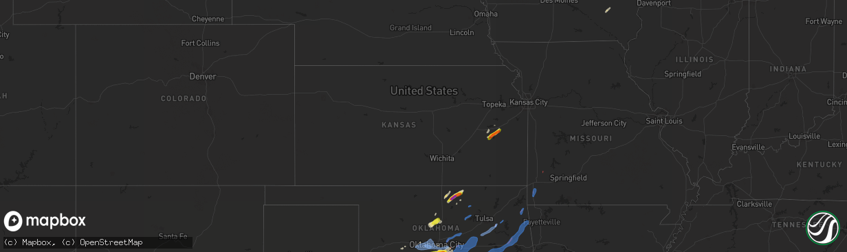
Hail Map in Kansas on October 10, 2021
The weather event in Kansas on October 10, 2021 includes Hail, Wind, and Tornado maps. 9 states and 441 cities were impacted and suffered possible damage. The total estimated number of properties impacted is 1,016.
Hail
Wind
Tornado
1,016
Estimated number of impacted properties by a 1.00" hail or larger624
Estimated number of impacted properties by a 1.75" hail or larger0
Estimated number of impacted properties by a 2.50" hail or largerStorm reports in Kansas
Kansas
| Date | Description |
|---|---|
| 10/10/20212:57 AM CDT | At 757 PM CDT, a severe thunderstorm was located 7 miles northeast of Grainola, or 8 miles south of Cedar Vale, moving northeast at 30 mph. HAZARD...60 mph wind gusts and quarter size hail. SOURCE...Radar indicated. IMPACT...Hail damage to vehicles is expected. Expect wind damage to roofs, siding, and trees. Locations impacted include... Sedan, Cedar Vale and Elgin. |
| 10/10/20212:56 AM CDT | At 755 PM CDT, a severe thunderstorm was located near Williamsburg, moving northeast at 45 mph. HAZARD...60 mph wind gusts and quarter size hail. SOURCE...Radar indicated. IMPACT...Hail damage to vehicles is expected. Expect wind damage to roofs, siding, and trees. Locations impacted include... Ottawa, Richmond, Williamsburg, Princeton, Lane and Rantoul. This includes Interstate 35 between mile markers 168 and 195. |
| 10/10/20212:33 AM CDT | At 732 PM CDT, a severe thunderstorm was located near New Strawn, moving northeast at 35 mph. HAZARD...60 mph wind gusts and quarter size hail. SOURCE...Radar indicated. IMPACT...Hail damage to vehicles is expected. Expect wind damage to roofs, siding, and trees. Locations impacted include... Burlington, Waverly, New Strawn and Harris. |
| 10/10/20211:51 AM CDT | At 651 PM CDT, a severe thunderstorm was located 7 miles southwest of Kaw City, moving northeast at 50 mph. HAZARD...60 mph wind gusts and quarter size hail. SOURCE...Radar indicated. IMPACT...Hail damage to vehicles is expected. Expect wind damage to roofs, siding, and trees. Locations impacted include... Kaw City and Kaw Lake. |
| 10/10/20211:47 AM CDT | At 647 PM CDT, a severe thunderstorm was located 8 miles southeast of Ponca City, moving northeast at 45 mph. HAZARD...60 mph wind gusts and half dollar size hail. SOURCE...Radar indicated. IMPACT...Hail damage to vehicles is expected. Expect wind damage to roofs, siding, and trees. Locations in or near the path include... Shidler... Burbank... Grainola... Foraker... Webb City... Apperson... |
| 10/10/202112:55 AM CDT | At 555 PM CDT, severe thunderstorms were located along a line extending from 5 miles northeast of Elbing to 7 miles east of Potwin to 5 miles northwest of Leon, moving northeast at 60 mph. HAZARD...60 mph wind gusts and quarter size hail. SOURCE...Radar indicated. IMPACT...Hail damage to vehicles is expected. Expect wind damage to roofs, siding, and trees. Locations impacted include... El Dorado, Cottonwood Falls, Strong City, Florence, Elbing, Burns, Cassoday, Bazaar, Elmdale, Matfield Green, Cedar Point, El Dorado State Park, Hymer, Wonsevu, Tallgrass Prairie, El Dorado Airport, El Dorado Lake, Saffordville and Tallgrass Prairie Preserve.This includes Interstate 35 between Mile Markers 68 and 116. |
| 10/09/20217:35 PM CDT | Time estimated from radar. Spotter reported brief hail up to golf-ball size. |
All States Impacted by Hail Map on October 10, 2021
Cities Impacted by Hail Map on October 10, 2021
- Ponca City, OK
- Blair, OK
- Mountain Park, OK
- Altus, OK
- Headrick, OK
- Mountain View, OK
- Roosevelt, OK
- Hobart, OK
- Electra, TX
- Iowa Park, TX
- Roanoke, TX
- Comanche, TX
- Santa Anna, TX
- Brownwood, TX
- Bangs, TX
- Sidney, TX
- May, TX
- Norman, OK
- Newcastle, OK
- Iredell, TX
- Stephenville, TX
- Cleburne, TX
- Glen Rose, TX
- Hico, TX
- Nemo, TX
- Rio Vista, TX
- Covington, TX
- Blum, TX
- Grandview, TX
- Kopperl, TX
- Walnut Springs, TX
- Bluff Dale, TX
- Itasca, TX
- Hillsboro, TX
- Morgan, TX
- Cache, OK
- Saint Jo, TX
- Shidler, OK
- Burbank, OK
- Kaw City, OK
- Marland, OK
- Blanchard, OK
- Olney, TX
- Ralston, OK
- Whitney, TX
- Alex, OK
- Lawton, OK
- Washington, OK
- Burnet, TX
- Breckenridge, TX
- Burlington, KS
- Waverly, KS
- Purcell, OK
- Williamsburg, KS
- Zephyr, TX
- Early, TX
- Wichita Falls, TX
- Temple, OK
- Randlett, OK
- Burkburnett, TX
- Devol, OK
- Moran, TX
- Chickasha, OK
- Azle, TX
- Hydro, OK
- Cross Plains, TX
- San Saba, TX
- Lampasas, TX
- Sigourney, IA
- Harper, IA
- Caddo, TX
- Strawn, TX
- Weatherford, TX
- Lipan, TX
- Indianola, OK
- Irving, TX
- Euless, TX
- Arlington, TX
- Grand Prairie, TX
- Fort Worth, TX
- Marshall, OK
- Crescent, OK
- Mulhall, OK
- Orlando, OK
- Hennessey, OK
- Newcastle, TX
- Millsap, TX
- Boyd, TX
- Haslet, TX
- Newark, TX
- Justin, TX
- Paradise, TX
- Rhome, TX
- Springtown, TX
- Poolville, TX
- Palo Pinto, TX
- Decatur, TX
- Mineral Wells, TX
- Grand Marais, MN
- Fort Cobb, OK
- Gracemont, OK
- Anadarko, OK
- Keota, IA
- Priddy, TX
- Mullin, TX
- Noble, OK
- Lexington, OK
- Graham, TX
- Melvern, KS
- Keller, TX
- Godley, TX
- Granbury, TX
- Colony, OK
- Hurst, TX
- Bedford, TX
- North Richland Hills, TX
- Calvin, OK
- Allen, OK
- Graford, TX
- Dublin, TX
- Newkirk, OK
- Pocasset, OK
- Amber, OK
- Purmela, TX
- Gatesville, TX
- Mcalester, OK
- Oklahoma City, OK
- Tolar, TX
- Duluth, MN
- Stamford, TX
- Tonkawa, OK
- Roff, OK
- Harper, TX
- Fredericksburg, TX
- Tecumseh, OK
- Macomb, OK
- Ranger, TX
- Cisco, TX
- Albany, TX
- Altus Afb, OK
- Carnegie, OK
- Verden, OK
- Apache, OK
- Mcloud, OK
- Snyder, OK
- Ninnekah, OK
- Cement, OK
- Newalla, OK
- Olustee, OK
- Shawnee, OK
- Tuttle, OK
- Gotebo, OK
- Bend, TX
- Lometa, TX
- Weinert, TX
- Commerce, TX
- Klondike, TX
- Whitesboro, TX
- Sadler, TX
- Gordonville, TX
- Ringling, OK
- Healdton, OK
- Ladonia, TX
- Wolfe City, TX
- Hanna, OK
- Eufaula, OK
- Munday, TX
- Thackerville, OK
- Tow, TX
- Throckmorton, TX
- Nashwauk, MN
- Rising Star, TX
- Denton, TX
- Hamilton, TX
- Evant, TX
- Chattanooga, OK
- Loveland, OK
- Indiahoma, OK
- Baird, TX
- Perrin, TX
- Stonewall, OK
- Stuart, OK
- Ada, OK
- Atwood, OK
- Honey Grove, TX
- Covington, OK
- Burkett, TX
- Jacksboro, TX
- Walters, OK
- El Reno, OK
- Haltom City, TX
- Rochelle, TX
- Abbott, TX
- Lebo, KS
- Fitzhugh, OK
- Gordon, TX
- Utopia, TX
- Cooper, TX
- Pecan Gap, TX
- Woodson, TX
- Fairfax, OK
- Gainesville, TX
- Muenster, TX
- Lindsay, TX
- Greenville, TX
- Gillham, AR
- De Queen, AR
- Dierks, AR
- Norman, AR
- Vandervoort, AR
- Cove, AR
- Grannis, AR
- Umpire, AR
- Eagletown, OK
- Watson, OK
- Mount Ida, AR
- Broken Bow, OK
- Oden, AR
- Wickes, AR
- Mena, AR
- Elgin, OK
- Sudan, TX
- Muleshoe, TX
- Earth, TX
- Fieldton, TX
- Littlefield, TX
- Amherst, TX
- Avoca, TX
- Abilene, TX
- Clyde, TX
- Hawley, TX
- Lueders, TX
- Hastings, OK
- Comanche, OK
- Waurika, OK
- Aubrey, TX
- Ponder, TX
- Mingus, TX
- Krum, TX
- Santo, TX
- Coppell, TX
- Grapevine, TX
- Naval Air Station Jrb, TX
- Sanger, TX
- Southlake, TX
- Duncanville, TX
- Kennedale, TX
- Carrollton, TX
- Pilot Point, TX
- Bridgeport, TX
- South Bend, TX
- Colleyville, TX
- Crowley, TX
- Whitt, TX
- Dallas, TX
- Eastland, TX
- Aledo, TX
- Jermyn, TX
- Bryson, TX
- Loving, TX
- Bonham, TX
- Plano, TX
- Bailey, TX
- Sachse, TX
- Brookston, TX
- Sumner, TX
- Rockwall, TX
- Nevada, TX
- Princeton, TX
- Richardson, TX
- Petty, TX
- Rowlett, TX
- Mckinney, TX
- Blue Ridge, TX
- Wylie, TX
- Lavon, TX
- Farmersville, TX
- Windom, TX
- Royse City, TX
- Garland, TX
- Dodd City, TX
- Roxton, TX
- Leonard, TX
- Caddo Mills, TX
- Celeste, TX
- Allen, TX
- Wilson, OK
- Springer, OK
- Ryan, OK
- Sulphur, OK
- Lone Grove, OK
- Ardmore, OK
- Caddo, OK
- Nocona, TX
- Mead, OK
- Burneyville, OK
- Chico, TX
- Forestburg, TX
- Caney, OK
- Pottsboro, TX
- Colbert, OK
- Montague, TX
- Madill, OK
- Calera, OK
- Sunset, TX
- Kingston, OK
- Lebanon, OK
- Durant, OK
- Denison, TX
- Bokchito, OK
- Bennington, OK
- Bowie, TX
- Marietta, OK
- Cartwright, OK
- Venus, TX
- Lillian, TX
- Cedar Hill, TX
- Mansfield, TX
- Red Oak, TX
- Burleson, TX
- Midlothian, TX
- Maypearl, TX
- Alvarado, TX
- Gorman, TX
- Desdemona, TX
- Joshua, TX
- Cresson, TX
- De Leon, TX
- Desoto, TX
- Keene, TX
- Rainbow, TX
- Forreston, TX
- Milford, TX
- Waxahachie, TX
- Italy, TX
- Kaufman, TX
- Terrell, TX
- Crandall, TX
- Palmer, TX
- Quinlan, TX
- Wills Point, TX
- Forney, TX
- Ferris, TX
- Seagoville, TX
- Garnett, KS
- Goodman, MO
- Neosho, MO
- Golden City, MO
- Cyril, OK
- Tipton, OK
- Elmer, OK
- Mustang, OK
- Hinton, OK
- Union City, OK
- Harrah, OK
- Bethany, OK
- Wheatland, OK
- Yukon, OK
- Minco, OK
- Choctaw, OK
- Faxon, OK
- Wellston, OK
- Luther, OK
- Jones, OK
- Stroud, OK
- Davenport, OK
- Chandler, OK
- Earlsboro, OK
- Paden, OK
- Boley, OK
- Castle, OK
- Meeker, OK
- Prague, OK
- Wewoka, OK
- Okemah, OK
- Seminole, OK
- Bristow, OK
- Bixby, OK
- Mounds, OK
- Beggs, OK
- Coweta, OK
- Okmulgee, OK
- Haskell, OK
- Wagoner, OK
- Inola, OK
- Chouteau, OK
- Crowder, OK
- Canadian, OK
- Sasakwa, OK
- Fittstown, OK
- Lamar, OK
- Dustin, OK
- Gore, OK
- Stigler, OK
- Tahlequah, OK
- Mill Creek, OK
- Muskogee, OK
- Loco, OK
- Tupelo, OK
- Stilwell, OK
- Proctor, OK
- Tishomingo, OK
- Elmore City, OK
- Warner, OK
- Bunch, OK
- Graham, OK
- Wetumka, OK
- Davis, OK
- Holdenville, OK
- Welling, OK
- Cookson, OK
- Hennepin, OK
- Dougherty, OK
- Tussy, OK
- Duncan, OK
- Vian, OK
- Ratliff City, OK
- Porum, OK
- Checotah, OK
- Wynnewood, OK
- Westville, OK
- Foster, OK
- Watts, OK
- Webbers Falls, OK
- Park Hill, OK
- Colcord, OK
- Kansas, OK
- Jay, OK
- Cleveland, OK
- Jennings, OK
- Terlton, OK
- Hominy, OK
- Cook, MN
- Hibbing, MN
- Ely, MN
- Embarrass, MN
- Lena, IL
- Warren, IL
- Stockton, IL
- Winslow, IL
- Browntown, WI


