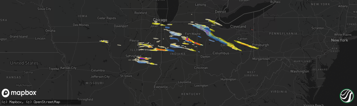
Hail Map in Indiana on March 26, 2026
The weather event in Indiana on March 26, 2026 includes Hail, Wind, and Tornado maps. 8 states and 517 cities were impacted and suffered possible damage. The total estimated number of properties impacted is 83,149.
Hail
Wind
Tornado
83,149
Estimated number of impacted properties by a 1.00" hail or larger8,923
Estimated number of impacted properties by a 1.75" hail or larger667
Estimated number of impacted properties by a 2.50" hail or largerStorm reports in Indiana
Indiana
| Date | Description |
|---|---|
| 03/26/20266:58 PM CDT | Report from mping: quarter |
| 03/26/20266:54 PM CDT | Tree down on utility lines. Power out. Located in just north of river road on morrison road...aka 300 w...in yorktown area. Time estimated from radar. |
| 03/26/20266:48 PM CDT | A local report indicates 1.50 inch wind near Veedersburg |
| 03/26/20266:42 PM CDT | Photo from emergency manager of hail estimated to be quarter size in west liberty. Time estimated via radar. |
| 03/26/20266:42 PM CDT | Photo on facebook showing large hailstones estimated to be up to ping pong ball size. Time estimated via radar. |
| 03/26/20266:40 PM CDT | Photo on facebook showing hail estimated to be a quarter in size near the grant county municipal airport. Time estimated via radar. |
| 03/26/20266:39 PM CDT | A local report indicates 1.00 inch wind near 2 E Balbec |
| 03/26/20266:30 PM CDT | Delayed report or tree down across the road on greenlawn drive. Time estimated from radar. |
| 03/26/20266:30 PM CDT | Media report relayed of golf ball sized hail south of poneto... In. Time estimated from radar. |
| 03/26/20266:23 PM CDT | Estimated half dollar sized hail near warren... In. Time estimated from radar. |
| 03/26/20266:20 PM CDT | Quarter size hail 2 miles south of j edward roush lake. Time given in report. |
| 03/26/20266:20 PM CDT | Corrects previous hail report from 3 nnw majenica. Quarter size hail 2 miles south of j edward roush lake. Time given in report. |
| 03/26/20266:19 PM CDT | Time estimated from radar. |
| 03/26/20266:19 PM CDT | Thunderstorm winds blew a healthy pine tree down over in tipton on south west street that is approximately 14 inches in circumference. |
| 03/26/20266:18 PM CDT | Numerous photos and reports showing quarter size hail in warren. Time estimated via radar. |
| 03/26/20266:18 PM CDT | Majority of a garage roof was blown off. Part of a fence was blown down. Located on west division road. |
| 03/26/20266:18 PM CDT | Storm chaser reports golf ball size hail on sr 218 near warren. Time estimated via radar. |
| 03/26/20266:18 PM CDT | Damage to what appears to be a pole barn and trees down on division road ...including one on a road. Time estimated from radar. |
| 03/26/20266:17 PM CDT | Delayed report of damage to a shed and tree damage with large limbs downed near 400n and 1150e. |
| 03/26/20266:17 PM CDT | Ping pong to golf ball sized hail near intersection of i 69 and warren road. |
| 03/26/20266:15 PM CDT | Photo on facebook showing two very large trees uprooted in van buren. Time estimated via radar. |
| 03/26/20266:14 PM CDT | Tree and power lines down near county road 10 and county road 13. |
| 03/26/20266:12 PM CDT | Photo on facebook show hail between quarter and golf ball size near lancaster. Time estimated via radar. |
| 03/26/20266:12 PM CDT | Emergency management relays photos of quarter to golf ball size hail south of huntington. Time estimated via radar. |
| 03/26/20266:11 PM CDT | Golf ball hail reported state road 9 and 200 south. Time estimated from radar. |
| 03/26/20266:10 PM CDT | Photo on facebook showing hailstone the size of a medium sized lemon |
| 03/26/20266:10 PM CDT | Photo on facebook showing 2 inch diameter hail in mount etna. Time estimated via radar. |
| 03/26/20266:10 PM CDT | A local report indicates 1.00 inch wind near 4 S Andrews |
| 03/26/20266:07 PM CDT | Delayed report of roof damage to a residence. Time estimated from radar. |
| 03/26/20266:06 PM CDT | Photo on facebook showing quarter size hail. Time estimated via radar. |
| 03/26/20266:06 PM CDT | Delayed report of some roof damage and a tree downed. Time estimated from radar. |
| 03/26/20266:06 PM CDT | Damage to silos and sheds near 9670w and 1200s. Time estimated from radar. |
| 03/26/20266:03 PM CDT | Large tree limbs downed near america rd and 1050 s. Time estimated from radar. |
| 03/26/20266:02 PM CDT | Numerous trees...limbs...and utility poles were blown down by thunderstorm winds in clinton county...especially the eastern portion. Time estimated from radar. |
| 03/26/20266:00 PM CDT | Reported by trained spotter. |
| 03/26/20266:00 PM CDT | Semi blown over at mile marker 337 on interstate 69. |
| 03/26/20265:56 PM CDT | Small tree snapped off near base. Time estimated from radar. |
| 03/26/20265:55 PM CDT | A local report indicates 60 MPH wind near 3 W Frankfort |
| 03/26/20265:45 PM CDT | Mesonet station fw1989 walton. |
| 03/26/20265:45 PM CDT | Report from mping: quarter |
| 03/26/20265:40 PM CDT | Trees downed east of logansport on logansport road. Time estimated from radar. |
| 03/26/20265:40 PM CDT | Delayed report of downed tree. Time estimated from radar. |
| 03/26/20265:37 PM CDT | Damage to house... Ripped fascia and some damage to part of roof. Time estimated from radar. |
| 03/26/20265:36 PM CDT | Tree downed near cliff drive and cicott street. Time estimated from radar. |
| 03/26/20265:35 PM CDT | A local report indicates 1.00 inch wind near 2 W Rochester |
| 03/26/20265:33 PM CDT | Photo on facebook of mainly dime to penny size hail with a few quarters mixed in. Time estimated via radar. |
| 03/26/20265:30 PM CDT | Large tree downed on state road 17 and 1227 n. |
| 03/26/20265:30 PM CDT | Corrects previous tstm wnd dmg report from fulton. Roof damage to a store in fulton... In. Time estimated from radar. |
| 03/26/20265:30 PM CDT | Tree down 6 miles north of logansport on sr 25. Time estimated via radar. |
| 03/26/20265:30 PM CDT | Tree down onto the 2800 block of high street. Time estimated via radar. |
| 03/26/20265:25 PM CDT | A local report indicates 1.00 inch wind near 6 WSW Ripley |
| 03/26/20265:25 PM CDT | A local report indicates 1.00 inch wind near 1 NNE Lake Manitou |
| 03/26/20265:24 PM CDT | Photo on facebook of a large tree uprooted in winamac. Time estimated via radar. |
| 03/26/20265:20 PM CDT | Tree downed. |
| 03/26/20264:51 PM CDT | A local report indicates 1.00 inch wind near 2 NE Highland |
| 03/25/20267:30 PM CDT | Hail up to ping pong size reported by amateur radio operator. |
| 03/25/20267:28 PM CDT | A local report indicates 1.00 inch wind near 2 WSW Home Corner |
| 03/25/20267:07 PM CDT | Report from mping: golf ball |
| 03/25/20267:00 PM CDT | Report from mping: golf ball |
| 03/25/20267:00 PM CDT | A local report indicates 2.00 inch wind near Bryant |
All States Impacted by Hail Map on March 26, 2026
Cities Impacted by Hail Map on March 26, 2026
- Homer Glen, IL
- Orland Park, IL
- Palos Park, IL
- Alsip, IL
- Palos Heights, IL
- Crestwood, IL
- Midlothian, IL
- Blue Island, IL
- Riverdale, IL
- Robbins, IL
- Cissna Park, IL
- Milford, IL
- Lemont, IL
- Oak Forest, IL
- Posen, IL
- Minier, IL
- Willow Springs, IL
- Stanford, IL
- Bloomington, IL
- Danvers, IL
- Gary, IN
- Hobart, IN
- Lake Station, IN
- Shirley, IL
- Highland, IN
- Munster, IN
- Hammond, IN
- Griffith, IN
- Homewood, IL
- Glenwood, IL
- Harvey, IL
- Chicago, IL
- Schererville, IN
- Danforth, IL
- Lowell, IN
- Crown Point, IN
- Hebron, IN
- Kentland, IN
- Lansing, IL
- Chicago Heights, IL
- Thornton, IL
- Valparaiso, IN
- San Pierre, IN
- North Judson, IN
- Medaryville, IN
- Winamac, IN
- Wanatah, IN
- Monterey, IN
- Francesville, IN
- Watseka, IL
- Gilman, IL
- Crescent City, IL
- Athens, MI
- East Leroy, MI
- Ellsworth, IL
- Downs, IL
- Le Roy, IL
- Bellflower, IL
- Wheatfield, IN
- La Crosse, IN
- Kouts, IN
- Monon, IN
- Arrowsmith, IL
- Maumee, OH
- Star City, IN
- Kewanna, IN
- Rochester, IN
- Lagrange, IN
- Knox, IN
- Ora, IN
- Culver, IN
- Monticello, IN
- Foosland, IL
- Macy, IN
- Hudson, IN
- Pleasant Lake, IN
- Ashley, IN
- Corunna, IN
- Waterloo, IN
- Lafayette, IN
- Dayton, IN
- Rossville, IN
- Mulberry, IN
- Wolcottville, IN
- Orland, IN
- Bronson, MI
- Angola, IN
- Howe, IN
- Carlock, IL
- McLean, IL
- Akron, IN
- Normal, IL
- Mackinaw, IL
- Rossville, IL
- Alvin, IL
- Cortland, OH
- Vienna, OH
- Fowler, OH
- Hamilton, IN
- Butler, IN
- Edon, OH
- Edgerton, OH
- Bryan, OH
- Hicksville, OH
- Montpelier, OH
- Burghill, OH
- Frankfort, IN
- Lagro, IN
- Andrews, IN
- Heyworth, IL
- Delphi, IN
- Towanda, IL
- Williamsport, IN
- West Lebanon, IN
- Saint Joseph, IL
- Urbana, IL
- Huntington, IN
- Wabash, IN
- La Fontaine, IN
- Peru, IN
- Denver, IN
- Roann, IN
- Armstrong, IL
- Fithian, IL
- Veedersburg, IN
- Mellott, IN
- Wingate, IN
- Waynetown, IN
- Hillsboro, IN
- Crawfordsville, IN
- New Richmond, IN
- Ney, OH
- Warren, IN
- Sherwood, OH
- Van Buren, IN
- Marion, IN
- Defiance, OH
- Evansport, OH
- Stryker, OH
- Archbold, OH
- Napoleon, OH
- Wauseon, OH
- Ridgeville Corners, OH
- Fisher, IL
- West Unity, OH
- Collison, IL
- Oakwood, IL
- Danville, IL
- Urbana, IN
- North Manchester, IN
- Saybrook, IL
- Anchor, IL
- Palmyra, MI
- Blissfield, MI
- Adrian, MI
- Woodridge, IL
- La Grange, IL
- Westmont, IL
- Downers Grove, IL
- Darien, IL
- Willowbrook, IL
- Lockport, IL
- Ogden, IL
- Royal, IL
- Michigantown, IN
- Cutler, IN
- Bringhurst, IN
- Forest, IN
- Jasper, MI
- Liberty Center, OH
- Mark Center, OH
- Clayton, MI
- Attica, IN
- Linden, IN
- Darlington, IN
- Bluffton, IN
- Liberty Center, IN
- Poneto, IN
- Holgate, OH
- New Bavaria, OH
- Leipsic, OH
- Miller City, OH
- Continental, OH
- Dewey, IL
- Ottawa, OH
- Hamler, OH
- Bismarck, IL
- Covington, IN
- Delta, OH
- Lebanon, IN
- Thorntown, IN
- Jamestown, IN
- Gibson City, IL
- Mahomet, IL
- Farmer City, IL
- Paxton, IL
- Ludlow, IL
- Russiaville, IN
- Buck Creek, IN
- Tipton, IN
- Sharpsville, IN
- Goldsmith, IN
- Kempton, IN
- Perrysburg, OH
- Lambertville, MI
- Riga, MI
- Ottawa Lake, MI
- Petersburg, MI
- Temperance, MI
- Deerfield, MI
- Rantoul, IL
- Windfall, IN
- Markle, IN
- Mansfield, IL
- Dolton, IL
- Colfax, IL
- Keystone, IN
- Petroleum, IN
- Montpelier, IN
- Toledo, OH
- Oregon, OH
- Northwood, OH
- Deshler, OH
- McComb, OH
- Geneva, IN
- Bryant, IN
- Harbor View, OH
- Elwood, IN
- Reynolds, IN
- Erie, MI
- Curtice, OH
- Bowling Green, OH
- Weston, OH
- Potomac, IL
- Summitville, IN
- Alexandria, IN
- East Chicago, IN
- Walbridge, OH
- Rossford, OH
- Millbury, OH
- Sylvania, OH
- Portland, IN
- Coldwater, OH
- Fort Recovery, OH
- Celina, OH
- Frankton, IN
- Oak Harbor, OH
- Martin, OH
- Cygnet, OH
- Custar, OH
- Rudolph, OH
- Portage, OH
- North Baltimore, OH
- Port Clinton, OH
- Graytown, OH
- Penfield, IL
- Yorktown, IN
- Anderson, IN
- Michigan City, IN
- La Porte, IN
- Westville, IN
- Chesterton, IN
- Mount Cory, OH
- Findlay, OH
- Benton Ridge, OH
- Rawson, OH
- Pandora, OH
- Columbus Grove, OH
- Bluffton, OH
- Milton Center, OH
- Wayne, OH
- Jerry City, OH
- Bloomdale, OH
- Fostoria, OH
- Muncie, IN
- Van Buren, OH
- Selma, IN
- Parker City, IN
- Farmland, IN
- Losantville, IN
- Arcadia, OH
- Jenera, OH
- Arlington, OH
- Alvada, OH
- Vanlue, OH
- Carey, OH
- Mount Blanchard, OH
- Williamstown, OH
- Forest, OH
- Wharton, OH
- Saint Henry, OH
- Dunkirk, OH
- Upper Sandusky, OH
- Kirby, OH
- Nevada, OH
- Daleville, IN
- Newtown, IN
- Flora, IN
- Malinta, OH
- McClure, OH
- Perrysville, IN
- Greentown, IN
- Converse, IN
- Swayzee, IN
- Winchester, IN
- Modoc, IN
- Maria Stein, OH
- Bucyrus, OH
- Harpster, OH
- Morral, OH
- Marion, OH
- Chickasaw, OH
- New Bremen, OH
- Shreve, OH
- Holmesville, OH
- Fredericksburg, OH
- Jonesboro, IN
- Gas City, IN
- Millersburg, OH
- Dundee, OH
- Wilmot, OH
- Beach City, OH
- Sugarcreek, OH
- Strasburg, OH
- Lynn, IN
- Bolivar, OH
- Dover, OH
- Grelton, OH
- Grand Rapids, OH
- Hoytville, OH
- Minster, OH
- Bolingbrook, IL
- Romeoville, IL
- Tinley Park, IL
- Markham, IL
- Clarendon Hills, IL
- Justice, IL
- Palos Hills, IL
- Worth, IL
- Summit Argo, IL
- Western Springs, IL
- Hinsdale, IL
- Westpoint, IN
- Romney, IN
- Upland, IN
- Hartford City, IN
- New Philadelphia, OH
- Mineral City, OH
- Caledonia, OH
- Galion, OH
- Edison, OH
- Mansfield, OH
- Mount Gilead, OH
- Amboy, IN
- Calumet City, IL
- Dennison, OH
- Sherrodsville, OH
- Bowerston, OH
- Leesville, OH
- Fredericktown, OH
- Bellville, OH
- Butler, OH
- Danville, OH
- Howard, OH
- Mount Vernon, OH
- Plainfield, IL
- Naperville, IL
- Carrollton, OH
- Scio, OH
- Jewett, OH
- Amsterdam, OH
- Hopedale, OH
- Pennville, IN
- South Whitley, IN
- Bloomingdale, OH
- Blue Mound, IL
- Stonington, IL
- Glenmont, OH
- Moweaqua, IL
- Macon, IL
- Brinkhaven, OH
- Steubenville, OH
- Waverly, IL
- Walhonding, OH
- Gambier, OH
- Divernon, IL
- Virden, IL
- Auburn, IL
- Pawnee, IL
- Glenarm, IL
- South Holland, IL
- Dalton City, IL
- Bethany, IL
- Richmond, OH
- Mingo Junction, OH
- Follansbee, WV
- Rayland, OH
- Dillonvale, OH
- Wellsburg, WV
- Brilliant, OH
- Avella, PA
- Burgettstown, PA
- Colliers, WV
- Warsaw, OH
- Coshocton, OH
- Edinburg, IL
- Taylorville, IL
- Kincaid, IL
- Morrisonville, IL
- Bulpitt, IL
- Tovey, IL
- Fairmount, IL
- Cantril, IA
- Keosauqua, IA
- Milton, IA
- Sullivan, IL
- Bethany, WV
- Hickory, PA
- Washington, PA
- Canonsburg, PA
- Killbuck, OH
- Mount Sterling, IA
- Bonaparte, IA
- Owaneco, IL
- Palmer, IL
- Arbela, MO
- Dresden, OH
- Conesville, OH
- Adamsville, OH
- Kimbolton, OH
- Newcomerstown, OH
- Arthur, IL
- West Lafayette, OH
- Plainfield, OH
- New Concord, OH
- Luray, MO
- Cambridge, OH
- Kahoka, MO
- Farmington, IA
- Meadow Lands, PA
- Houston, PA
- Lore City, OH
- Donnellson, IA
- Pana, IL
- Beason, IL
- Assumption, IL
- Tower Hill, IL
- Clinton, IL
- Kenney, IL
- Pulaski, IA
- Nokomis, IL
- Rosamond, IL
- Frazeysburg, OH
- Shelbyville, IL
- Lakewood, IL
- Findlay, IL
- Windsor, IL
- Strasburg, IL
- Strabane, PA
- Eighty Four, PA
- Argyle, IA
- Sibley, IL
- Pleasant Plains, IL
- Wayland, MO
- Trilla, IL
- Lerna, IL
- Toledo, IL
- Greenup, IL
- De Land, IL
- Weldon, IL
- Mattoon, IL
- Gays, IL
- Neoga, IL
- Casey, IL
- White Heath, IL
- Seymour, IL
- Mechanicsburg, IL
- Mount Auburn, IL
- Cooksville, IL
- Champaign, IL
- Martinsville, IL
- Bondville, IL
- Luna Pier, MI
- Colchester, IL
- Macomb, IL
- Muncie, IL
- Lovington, IL
- Humboldt, IL
- Arcola, IL
- Genoa, OH
- Dunkirk, IN
- Ridgeville, IN
- Union City, IN
- Van Wert, OH
- Convoy, OH
- Walton, IN
- Royal Center, IN
- Burnettsville, IN
- Idaville, IN
- Logansport, IN
- Galveston, IN
- Kenton, OH
- McGuffey, OH
- Mount Victory, OH
- Ada, OH
- Harrod, OH
- Alger, OH
- Cardington, OH
- La Rue, OH
- Chesterville, OH
- New Madison, OH
- Greenville, OH
- Arcanum, OH
- Williston, OH
- Lacarne, OH
- Rocky Ridge, OH
- Lima, OH


