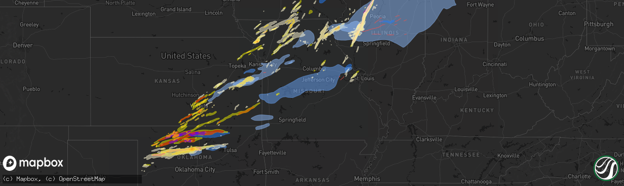
Hail Map in Missouri on April 17, 2026
The weather event in Missouri on April 17, 2026 includes Hail, Tornado, and Wind maps. 10 states and 2,021 cities were impacted and suffered possible damage. The total estimated number of properties impacted is 60,787.
Hail
Tornado
Wind
60,787
Estimated number of impacted properties by a 1.00" hail or larger1,172
Estimated number of impacted properties by a 1.75" hail or larger0
Estimated number of impacted properties by a 2.50" hail or largerStorm reports in Missouri
Missouri
| Date | Description |
|---|---|
| 04/17/20266:57 PM CDT | Power outages due to thunderstorm winds north of el dorado springs. |
| 04/17/20266:55 PM CDT | Powerline was down at the entrance to osage bluff campground. |
| 04/17/20266:54 PM CDT | Downed wires near route 52. Time estimated from radar. |
| 04/17/20266:52 PM CDT | Downed wires near 1301 road. Time estimated from radar. |
| 04/17/20266:46 PM CDT | Downed wires and power outages near 1100 road. Time estimated from radar. |
| 04/17/20266:32 PM CDT | Downed wires near charles e. Calvird drive. Time estimated from radar. |
| 04/17/20266:28 PM CDT | Private weather sensor. |
| 04/17/20266:27 PM CDT | Downed limbs and wires near route 5. Time estimated from radar. |
| 04/17/20266:23 PM CDT | Report from mping: quarter |
| 04/17/20266:21 PM CDT | Several reports of trees and power lines down in macon county... Including near macon... East of new cambria... And south of atlanta. Time estimated from radar. |
| 04/17/20266:17 PM CDT | A local report indicates 76 MPH wind near 4 E Malta Bend |
| 04/17/20266:15 PM CDT | Downed wires near 11001 road. Time estimated from radar. |
| 04/17/20266:09 PM CDT | Powerlines reported down by passer byer a hwy and m hwy between lowry city and appleton city. |
| 04/17/20266:06 PM CDT | Outbuilding severely damaged and an irrigation pivot blown over near carrollton. Time estimated from radar. |
| 04/17/20266:03 PM CDT | Downed power poles on u.s. Highway 65 between carrollton and waverly. Time estimated from radar. |
| 04/17/20266:03 PM CDT | Downed trees in carrollton. Time estimated from radar. |
| 04/17/20266:03 PM CDT | Power poles down on hwy 65 between carrollton and waverly. Time estimated from radar. |
| 04/17/20266:03 PM CDT | Downed wires near county road 253. Time estimated from radar. |
| 04/17/20266:01 PM CDT | Several power poles downed and widespread power outages. Time estimated from radar. |
| 04/17/20265:57 PM CDT | Social media reports of tree limbs and wires down near elmer. Time estimated from radar. |
| 04/17/20265:54 PM CDT | Downed wires near county road 271. Time estimated from radar. |
| 04/17/20265:54 PM CDT | Several reports of downed wires and power outages near dover. Time estimated from radar. |
| 04/17/20265:52 PM CDT | Downed wires and power outages near route bb. Time estimated from radar. |
| 04/17/20265:51 PM CDT | Downed wires near gilman street. Time estimated from radar. |
| 04/17/20265:51 PM CDT | Downed trees on broadway. Time estimated from radar. |
| 04/17/20265:50 PM CDT | Door blown open from walkout basement and intense winds at a residence. Additional public reports of limbs and wires down. Time estimated from radar. |
| 04/17/20265:46 PM CDT | Multiple reports of downed wires east of amoret. Time estimated from radar. |
| 04/17/20265:43 PM CDT | Downed limbs and property damage... Including equipment blown into a nearby lake. Time estimated from radar. |
| 04/17/20265:43 PM CDT | A local report indicates 64 MPH wind near Kirksville Regional |
| 04/17/20265:41 PM CDT | A local report indicates 61 MPH wind near Bucklin |
| 04/17/20265:40 PM CDT | Downed wires and power outages near 1200th road. Time estimated from radar. |
| 04/17/20265:37 PM CDT | Downed limbs and wires near vernon road. Time estimated from radar. |
| 04/17/20265:37 PM CDT | Downed wires near julep road. Time estimated from radar. |
| 04/17/20265:37 PM CDT | Downed tree limbs and wires near 40th street. Time estimated from radar. |
| 04/17/20265:35 PM CDT | Downed wires near salt lick circle. Time estimated from radar. |
| 04/17/20265:34 PM CDT | Downed wires and power outages near tribble street. Time estimated from radar. |
| 04/17/20265:34 PM CDT | Downed wires near route 2. Time estimated from radar. |
| 04/17/20265:34 PM CDT | Downed tree damaged a roof of a house in brookfield. Time estimated from radar. |
| 04/17/20265:31 PM CDT | Downed wires and power outages near jennings road. Time estimated from radar. |
| 04/17/20265:31 PM CDT | Downed wires near rock island road. Time estimated from radar. |
| 04/17/20265:28 PM CDT | Downed wires near 89th street. Time estimated from radar. |
| 04/17/20265:28 PM CDT | Downed tree limbs and wires near stillhouse road. Time estimated from radar. |
| 04/17/20265:25 PM CDT | Public report of a tornado touch down. |
| 04/17/20265:25 PM CDT | Reports of trees and power lines down. Time estimated from radar. |
| 04/17/20265:23 PM CDT | Mping report of trees uprooted near ashford court. Time estimated from radar. |
| 04/17/20265:19 PM CDT | Mping report of shingles blown off a house near summer street. Time estimated from radar. |
| 04/17/20265:19 PM CDT | An intense line of thunderstorms moving across miami county kansas into cass county missouri through 5 pm resulted in an embedded circulation which resulted in an ef 1 |
| 04/17/20265:16 PM CDT | Multiple reports from emergency management and the public of 60 to 70 mph winds on the south side of independence and near the kansas city sports complex. Multiple repo |
| 04/17/20265:16 PM CDT | Downed tree limbs and wires near grand avenue. Time estimated from radar. |
| 04/17/20265:14 PM CDT | A local report indicates 70 MPH wind near 3 NNW Raytown |
| 04/17/20265:13 PM CDT | Downed wires and power outages near 41st terrace. Time estimated from radar. |
| 04/17/20265:10 PM CDT | Mping report of tree limbs down near blue parkway drive. Time estimated from radar. |
| 04/17/20265:08 PM CDT | Downed tree limbs and wires near norton avenue. Time estimated from radar. |
| 04/17/20265:08 PM CDT | Downed wires near 62nd street. Time estimated from radar. |
| 04/17/20265:08 PM CDT | Downed wires near mcgee street. Time estimated from radar. |
| 04/17/20265:08 PM CDT | Downed tee limb and wires near glen arbor terrace. Time confirmed from radar. |
| 04/17/20265:08 PM CDT | Time estimated from radar... Social media video of tornado taken from near bethel looking north towards plevna. |
| 04/17/20265:00 PM CDT | Social media report. Time confirmed from radar. |
| 04/17/20264:58 PM CDT | Multiple reports of power lines and trees down in northwest and north-central caldwell county from strong winds. Time estimated from radar. |
| 04/17/20264:56 PM CDT | Report from mping: quarter |
| 04/17/20264:50 PM CDT | Power lines down and one tree in a house. |
| 04/17/20264:49 PM CDT | Mkc asos measured a 63 mph wind gust. |
| 04/17/20264:48 PM CDT | Several reports of power lines down and power outages in southern daviess county. Time estimated from radar. |
| 04/17/20264:47 PM CDT | Report from mping: golf ball |
| 04/17/20264:45 PM CDT | Private weather sensor. |
| 04/17/20264:40 PM CDT | Multiple reports of trees and wires down in cameron. Time estimated from radar. |
| 04/17/20264:22 PM CDT | Social media report. Time confirmed from radar. |
| 04/17/20264:19 PM CDT | A local report indicates 1.00 inch wind near Laredo |
| 04/17/20264:15 PM CDT | Social media report. Time estimated from radar. |
| 04/17/20264:15 PM CDT | Report from mping: quarter |
| 04/17/20264:08 PM CDT | A local report indicates 1.00 inch wind near 3 NNE Saint Charles |
| 04/17/20264:05 PM CDT | Report from mping: quarter |
| 04/17/20264:04 PM CDT | Social media report and video. Time confirmed from radar. |
| 04/17/20264:03 PM CDT | Report from mping: quarter |
| 04/17/20264:00 PM CDT | Social media report. Time estimated from radar. |
| 04/17/20264:00 PM CDT | A local report indicates 1.00 inch wind near 1 NNW Mexico |
| 04/17/20264:00 PM CDT | A local report indicates 1.00 inch wind near 1 W Mexico |
| 04/17/20263:51 PM CDT | Downed tree limbs in wheeling. Time estimated from radar. |
| 04/17/20263:51 PM CDT | Social media report. Time estimated from radar. |
| 04/17/20263:49 PM CDT | Report from mping: quarter |
| 04/17/20263:48 PM CDT | A local report indicates 1.00 inch wind near Cottleville |
| 04/17/20263:47 PM CDT | Social media report. Time estimated from radar. |
| 04/17/20263:46 PM CDT | Report from mping: quarter |
| 04/17/20263:45 PM CDT | Report from mping: quarter |
| 04/17/20263:45 PM CDT | Report from social media... Largest hail stone around 1 inch. |
| 04/17/20263:44 PM CDT | A local report indicates 1.00 inch wind near Trenton |
| 04/17/20263:42 PM CDT | A local report indicates 1.00 inch wind near 2 SSW Harvester |
| 04/17/20263:40 PM CDT | Tree on powerline. |
| 04/17/20263:40 PM CDT | A local report indicates 1.00 inch wind near 2 ENE Weldon Spring |
| 04/17/20263:39 PM CDT | Downed wires near route 6. Time estimated from radar. |
| 04/17/20263:39 PM CDT | Report from mping: quarter |
| 04/17/20263:38 PM CDT | Corrects previous hail report from newtown. Time corrected from radar. |
| 04/17/20263:37 PM CDT | Report of a 5 inch diameter tree limb snapped. |
| 04/17/20263:35 PM CDT | Report of multiple smaller limbs snapped off large trees. |
| 04/17/20263:35 PM CDT | Tree with shallow root system came down as well as 4-6 inch and 12 inch limbs down. |
| 04/17/20263:35 PM CDT | A local report indicates 1.00 inch wind near 3 WNW Chesterfield |
| 04/17/20263:32 PM CDT | Social media report. Time estimated from radar. |
| 04/17/20263:30 PM CDT | Power pole snapped. |
| 04/17/20263:28 PM CDT | Power poles snapped along martin road. |
| 04/17/20263:28 PM CDT | Time estimated from radar. |
| 04/17/20263:27 PM CDT | 6 inch diameter tree limb down out of healthy tree. |
| 04/17/20263:25 PM CDT | Report of trees down and limbs snapped off. |
| 04/17/20263:25 PM CDT | Corrects previous tstm wnd dmg report from 3 n flint hill. Power pole snapped. |
| 04/17/20263:24 PM CDT | Report of a 6inch limb snapped. |
| 04/17/20263:20 PM CDT | Power poles snapped with lots of wires down along hwy 61. |
| 04/17/20263:18 PM CDT | A local report indicates 1.00 inch wind near Bethany |
| 04/17/20263:15 PM CDT | Report from mping: quarter |
| 04/17/20263:15 PM CDT | Tree/branches... Powerlines on road. |
| 04/17/20263:15 PM CDT | Powerlines on road. |
| 04/17/20263:15 PM CDT | Tree down on powerline. |
| 04/17/20263:13 PM CDT | A local report indicates 1.00 inch wind near Helena |
| 04/17/20263:12 PM CDT | Trees and transformer down on road. |
| 04/17/20263:10 PM CDT | Power pole down. |
| 04/17/20263:10 PM CDT | Corrects previous tstm wnd dmg report from 3 wnw new melle. Caller reported large trees twisted off and lying in different directions. Wrought iron outdoor table and ch |
| 04/17/20263:05 PM CDT | Social media report of a downed tree in moberly. Time estimated from radar. |
| 04/17/20263:03 PM CDT | A local report indicates 1.75 inch wind near 2 NE Country Club Villa |
| 04/17/20263:00 PM CDT | A local report indicates 1.00 inch wind near 4 W Cosby |
| 04/17/20263:00 PM CDT | A local report indicates 1.00 inch wind near 6 S Columbia |
| 04/17/20262:56 PM CDT | A local report indicates 1.00 inch wind near Country Club Villa |
| 04/17/20262:54 PM CDT | A local report indicates 1.00 inch wind near 1 N Union Star |
| 04/17/20262:53 PM CDT | A local report indicates 1.75 inch wind near Country Club Villa |
| 04/17/20262:51 PM CDT | A local report indicates 1.00 inch wind near 2 SE Amazonia |
| 04/17/20262:43 PM CDT | A local report indicates 1.50 inch wind near Darlington |
| 04/17/20261:28 PM CDT | A local report indicates 1.25 inch wind near 1 S Maryville |
| 04/17/20261:23 PM CDT | Social media report. Time estimated from radar. |
| 04/16/202611:30 PM CDT | A tree was downed on state highway w south of lakeview lane. |
| 04/16/20269:51 PM CDT | Caller reported large trees twisted off and lying in different directions. Wrought iron outdoor table and chairs blown into yard... Few shingles missing from new roof. |
| 04/16/20269:50 PM CDT | Power poles down. Time estimated from radar. |
| 04/16/20269:45 PM CDT | Thunderstorm winds downed a tree into powerlines south of carthage. |
| 04/16/20269:44 PM CDT | Tree fell on line causing outages in joplin. |
| 04/16/20269:43 PM CDT | Nws survey team found an ef-1 tornado southwest of troy... Mo. The tornado produced mostly tree damage along its 2.73 mile path... But did cause mostly minor damage to |
| 04/16/20269:43 PM CDT | Corrects previous tornado report from 4 sw troy. Nws survey team found an ef-1 tornado southwest of troy... Mo. The tornado produced mostly tree damage along its 3.72 m |
| 04/16/20269:35 PM CDT | Power lines down. Time estimated from radar. |
| 04/16/20269:35 PM CDT | Report of a tree limbs falling into powerlines and a tree down in webb city. |
| 04/16/20269:30 PM CDT | Report of a broken power pole due to thunderstorm winds north of webb city. |
| 04/16/20269:29 PM CDT | Corrects previous tornado report from 3 wnw treloar. Nws survey team found an ef-1 tornado mostly south of pinckney. The tornado produced tree damage. It had a path len |
| 04/16/20269:28 PM CDT | 15 inch diameter tree down across the road. Time estimated from radar. |
| 04/16/20269:26 PM CDT | 6-10 inch diameter tree blocking road. |
| 04/16/20269:22 PM CDT | A local report indicates 60 MPH wind near New Florence |
| 04/16/20268:40 PM CDT | Old kfal radio tower knocked down. |
| 04/16/20268:40 PM CDT | Stoplights at bluff and industrial ave damaged... As is the sign for the sonic on north bluff street and numerous street lights. |
| 04/16/20268:40 PM CDT | Via facebook: video of damage on william woods university campus. Large... Healthy trees uprooted... Large branches snapped... Metal bleachers blown... Debris in trees. |
| 04/16/20268:39 PM CDT | Via facebook: small... Healthy... Fully leafed tree trunk at least 5-6 inches in diameter snapped a foot or so above trunk base. Numbers estimated from damage photo. |
| 04/16/20268:36 PM CDT | Tree down across the roadway in miller county on mo-17 at rt k north of the pulaski miller county line. |
| 04/16/20268:34 PM CDT | Via facebook: a tree fell on a home. Timing and location based on radar and post. |
| 04/16/20268:33 PM CDT | Part of a hangar roof was torn off at the fulton airport. |
| 04/16/20268:27 PM CDT | Several large tree limbs down near falcon lane and route m. Time estimated from radar. |
| 04/16/20268:20 PM CDT | Tree limb down near 179 and sunflower road. Time estimated from radar. |
| 04/16/20268:16 PM CDT | Video of several trees downed in a forest on heckemeyer road. Additional tree damage reported on dawson road. Time est from radar. |
| 04/16/20268:15 PM CDT | Mesonet station gw3917 versailles. |
| 04/16/20268:11 PM CDT | Large branch blocking road. |
| 04/16/20268:09 PM CDT | Small tree... 6-8 inches in diameter... Broken near base. Time estimated from radar. |
| 04/16/20268:04 PM CDT | Powerlines down on oak road. |
| 04/16/20267:50 PM CDT | Tree down in morgan county on mo-5 just north of rt p in the gravois mills area. Blocking all of southbound lanes of mo-5. |
| 04/16/20267:45 PM CDT | Public report of several trees down blocking the road in this area near the lake. |
| 04/16/20267:44 PM CDT | Reports of powerlines down and large debris across roadways. |
| 04/16/20267:35 PM CDT | Awos station kraw warsaw awos. |
| 04/16/20267:32 PM CDT | Numerous powerlines down on state highway h. |
| 04/16/20267:30 PM CDT | Trees down on skyview street. |
| 04/16/20267:29 PM CDT | Debris and tree damage near some buildings at the warsaw airport. |
| 04/16/20267:27 PM CDT | Report of a small damage path of trees down near highway 65 and highway 83. |
| 04/16/20267:27 PM CDT | Image via social media of roof paneling torn of a restaurant. Time estimated via radar. |
| 04/16/20267:27 PM CDT | Several branches and powerlines down in the road on state highway mm. |
| 04/16/20267:27 PM CDT | Several trees down on rexschell lane just east of grandview beach. |
| 04/16/20267:26 PM CDT | A trailer was flipper over with other debris scattered in the roadway n dam access road and highway 65. |
| 04/16/20267:25 PM CDT | Numerous trees and powerlines down in and around the city of warsaw. Power lost in the city. |
| 04/16/20267:25 PM CDT | A tree fell on a car on hawthorne drive in warsaw. |
| 04/16/20267:25 PM CDT | Tree down on sue street in warsaw. |
| 04/16/20267:25 PM CDT | Roof damage to the el camino real restaurant. |
| 04/16/20267:25 PM CDT | Images received of the truman dam visitor center with windows blown out. Time estimated via radar. |
| 04/16/20267:24 PM CDT | Damage to storage units on margarett lane. |
| 04/16/20267:18 PM CDT | Mesonet station gw3465 osceola. |
| 04/16/20267:15 PM CDT | Trees and power lines down in huntsville. |
| 04/16/20267:15 PM CDT | Several reports of minor tree damage between higbee and moberly... Potentially from thunderstorm outflow. Time estimated from radar. |
| 04/16/20267:14 PM CDT | Downed trees and wires near 700 road. Time estimated from radar. |
| 04/16/20267:12 PM CDT | Downed tree limbs and wires near 671 road. Time estimated from radar. |
| 04/16/20267:12 PM CDT | Signs blown off building and doors blown open at a school near route 7. Time estimated from radar. |
| 04/16/20267:12 PM CDT | Downed trees on route z. Time estimated from radar. |
| 04/16/20267:07 PM CDT | Downed trees and wires near 523p road. Time estimated from radar. |
| 04/16/20267:04 PM CDT | Downed wires and power outages south of sedalia. Time estimated from radar. |
| 04/16/20267:00 PM CDT | Trees down on poorboy road. |
All States Impacted by Hail Map on April 17, 2026
Cities Impacted by Hail Map on April 17, 2026
- New Ulm, MN
- Lafayette, MN
- Saint Peter, MN
- Nicollet, MN
- Lake Crystal, MN
- Courtland, MN
- Mankato, MN
- Le Sueur, MN
- Kasota, MN
- Eagle Lake, MN
- Henderson, MN
- Cleveland, MN
- Madison Lake, MN
- Elysian, MN
- Waterville, MN
- Le Center, MN
- Gibbon, MN
- Kilkenny, MN
- Janesville, MN
- Montgomery, MN
- Faribault, MN
- Morristown, MN
- Dundas, MN
- Warsaw, MN
- Northfield, MN
- Nerstrand, MN
- Farmington, MN
- Dennison, MN
- Cannon Falls, MN
- Kenyon, MN
- Randolph, MN
- Hampton, MN
- Hastings, MN
- Welch, MN
- Prescott, WI
- River Falls, WI
- Hammond, WI
- Barronett, WI
- Monticello, IA
- Hopkinton, IA
- Anamosa, IA
- Cedar Rapids, IA
- Shell Lake, WI
- Spooner, WI
- Sarona, WI
- Ely, IA
- Mount Vernon, IA
- Cascade, IA
- Swisher, IA
- Dyersville, IA
- Hayfield, MN
- Blooming Prairie, MN
- Austin, MN
- Martelle, IA
- Springville, IA
- Maryville, MO
- New Vienna, IA
- Farley, IA
- West Concord, MN
- Ravenwood, MO
- Parnell, MO
- Bernard, IA
- Epworth, IA
- Peosta, IA
- Kasson, MN
- Pine Island, MN
- Wanamingo, MN
- Zumbrota, MN
- Wyoming, IA
- Center Junction, IA
- Olin, IA
- Dubuque, IA
- Zwingle, IA
- Worthington, IA
- Morley, IA
- Mechanicsville, IA
- Lisbon, IA
- Dodge Center, MN
- Waltham, MN
- Goddard, KS
- Garden Plain, KS
- Isle, MN
- Claremont, MN
- Bolckow, MO
- Byron, MN
- Sandstone, MN
- Valley Center, KS
- Maize, KS
- Colwich, KS
- Wichita, KS
- Newton, KS
- Sedgwick, KS
- Onslow, IA
- La Motte, IA
- Andale, KS
- Sargeant, MN
- Ankeny, IA
- Elkhart, IA
- Barnard, MO
- Guilford, MO
- Whitewater, KS
- Anthony, KS
- Rochester, MN
- Hoyt, KS
- Meriden, KS
- Stewartville, MN
- Valley Falls, KS
- Denison, KS
- Waldron, KS
- West Des Moines, IA
- Cumming, IA
- Red Wing, MN
- Goodhue, MN
- Dexter, MN
- Cheyenne, OK
- Hammon, OK
- Baldwin, IA
- Monmouth, IA
- Maxwell, IA
- Grant City, MO
- Eden Prairie, MN
- Shakopee, MN
- Minneapolis, MN
- Bellevue, IA
- Maquoketa, IA
- Dumont, IA
- Osage, IA
- Clyde, MO
- Conception Junction, MO
- Brook Park, MN
- Hinckley, MN
- Sheridan, MO
- Ackley, IA
- Winfield, KS
- Riceville, IA
- Harper, KS
- Bay City, WI
- Hager City, WI
- Cottonwood Falls, KS
- Strong City, KS
- Ellsworth, WI
- Emporia, KS
- Viola, KS
- Clearwater, KS
- Atchison, KS
- Aplington, IA
- Allison, IA
- Little Cedar, IA
- Stanberry, MO
- Gentry, MO
- Racine, MN
- Newkirk, OK
- Collins, IA
- Arkansas City, KS
- Elbing, KS
- Star Prairie, WI
- Deer Park, WI
- Amery, WI
- Cadott, WI
- Boyd, WI
- Mingo, IA
- Conception, MO
- Bristow, IA
- State Center, IA
- Grand Meadow, MN
- New Richmond, WI
- East Dubuque, IL
- Elmdale, KS
- Rea, MO
- Woodward, OK
- Graham, MO
- Galena, IL
- Stacyville, IA
- McIntire, IA
- Bondurant, IA
- Cambridge, IA
- Argonia, KS
- Danville, KS
- Eyota, MN
- Knoxville, IA
- Cheney, KS
- Burns, KS
- Potwin, KS
- Des Moines, IA
- Mooreland, OK
- Melbourne, IA
- Marshalltown, IA
- Haverhill, IA
- Colo, IA
- Rhodes, IA
- Baxter, IA
- Altoona, IA
- Prairie City, IA
- Mitchellville, IA
- Newton, IA
- Colfax, IA
- Pella, IA
- Reasnor, IA
- Monroe, IA
- Sharon, OK
- Merrillan, WI
- Alma Center, WI
- Dexter, KS
- Burden, KS
- Stanley, WI
- Parkersburg, IA
- De Kalb, MO
- Worth, MO
- Denver, MO
- Van Wert, IA
- Rushville, MO
- Milton, KS
- Conway Springs, KS
- Kechi, KS
- Albany, MO
- Superior, WI
- Chatfield, MN
- Kaw City, OK
- Redding, IA
- King City, MO
- Ponca City, OK
- Cloquet, MN
- Clear Lake, WI
- Elgin, MN
- Alva, OK
- Columbia, IA
- Chariton, IA
- Hanover, IL
- Richland Center, WI
- Muscoda, WI
- Lake City, MN
- Elma, IA
- Orchard, IA
- Excelsior Springs, MO
- Lawson, MO
- Kingston, MO
- Hamilton, MO
- Polo, MO
- Peabody, KS
- Kellogg, IA
- Winchester, KS
- Amorita, OK
- Weston, MO
- Savannah, MO
- Black River Falls, WI
- Florence, KS
- Barnum, MN
- Carlton, MN
- Nortonville, KS
- Humbird, WI
- Fairchild, WI
- South Range, WI
- Corydon, IA
- Benton, KS
- Towanda, KS
- Greenwich, KS
- Saint Joseph, MO
- Amazonia, MO
- Wathena, KS
- Effingham, KS
- Cummings, KS
- Saint Charles, MN
- Dover, MN
- Cedar Point, KS
- La Valle, WI
- Cazenovia, WI
- Reedsburg, WI
- Roberts, WI
- Esko, MN
- Duluth, MN
- Spragueville, IA
- Frontenac, MN
- Plainview, MN
- Cowgill, MO
- Allerton, IA
- Lineville, IA
- Gilman, IA
- Grinnell, IA
- Tama, IA
- North English, IA
- Savanna, IL
- Montour, IA
- Le Grand, IA
- Laurel, IA
- Garwin, IA
- Millville, MN
- Shell Rock, IA
- Waverly, IA
- Shidler, OK
- Maple City, KS
- Cambridge, KS
- Russell, IA
- Martinsville, MO
- Hatfield, MO
- Jamesport, MO
- Chillicothe, MO
- Union Star, MO
- Cedar Vale, KS
- Moline, KS
- Clayton, WI
- Turtle Lake, WI
- Faucett, MO
- Woodburn, IA
- Weldon, IA
- Humeston, IA
- Elizabeth, IL
- Bussey, IA
- Harvey, IA
- Tracy, IA
- Foxboro, WI
- Thorp, WI
- Lublin, WI
- Willard, WI
- Princeton, MO
- Millerton, IA
- Neillsville, WI
- Waynoka, OK
- Americus, KS
- Cosby, MO
- Gilman, WI
- Danbury, WI
- Eagleville, MO
- Darlington, MO
- Helena, MO
- New Hampton, MO
- Freeport, KS
- Trenton, MO
- Scales Mound, IL
- Rayville, MO
- Parnell, IA
- Williamsburg, IA
- Norwalk, WI
- Cashton, WI
- Ontario, WI
- Granton, WI
- Pittsville, WI
- El Dorado, KS
- Braymer, MO
- Breckenridge, MO
- Sedan, KS
- Apple River, IL
- Columbia, MO
- Spring Valley, WI
- Baldwin, WI
- Hillpoint, WI
- Plano, IA
- Melrose, IA
- Cumberland, WI
- Comstock, WI
- Almena, WI
- Elk Falls, KS
- Wilton, WI
- Tomah, WI
- Allen, KS
- Admire, KS
- Chester, OK
- Toledo, IA
- Leighton, IA
- Bethany, MO
- Ridgeway, MO
- Gladbrook, IA
- Mercer, MO
- Galt, MO
- Wilson, WI
- Promise City, IA
- Lovilia, IA
- Arkansaw, WI
- Plum City, WI
- Agency, MO
- Maiden Rock, WI
- Traer, IA
- Ferguson, IA
- Stockton, IL
- Searsboro, IA
- Sully, IA
- Lynnville, IA
- Benton, WI
- Cuba City, WI
- Hudson, WI
- Dacoma, OK
- McFall, MO
- Grenola, KS
- Utica, MN
- Withee, WI
- Norwich, KS
- Cassoday, KS
- Medford, WI
- Kellogg, MN
- Clutier, IA
- New Sharon, IA
- Albia, IA
- Osceola, IA
- Peck, KS
- Wellington, KS
- Aline, OK
- Carmen, OK
- Belle Plaine, KS
- Dearborn, MO
- Longton, KS
- Matfield Green, KS
- Two Harbors, MN
- Silver Bay, MN
- Easton, MO
- Stewartsville, MO
- Hamilton, IA
- Burlington, OK
- Cherokee, OK
- Wabasha, MN
- Altura, MN
- Alma, WI
- Sumner, IA
- Reading, KS
- Bluff City, KS
- Spickard, MO
- Powersville, MO
- Wentzville, MO
- Foristell, MO
- Cainsville, MO
- Blythedale, MO
- Chelsea, IA
- Chili, WI
- Marshfield, WI
- Seymour, IA
- Warrens, WI
- Pacific, MO
- Saint Albans, MO
- Chesterfield, MO
- Wildwood, MO
- Woodville, WI
- Osage City, KS
- Burlingame, KS
- Scranton, KS
- Altoona, KS
- Glenwood City, WI
- Lucerne, MO
- Shullsburg, WI
- Fredonia, KS
- Elk City, KS
- Warren, IL
- Neodesha, KS
- Haysville, KS
- Hazel Green, WI
- Marthasville, MO
- Madison, MO
- Ballwin, MO
- Rollingstone, MN
- Morrison, OK
- Perry, OK
- Lewiston, MN
- Tripoli, IA
- Mulvane, KS
- Cochrane, WI
- Winona, MN
- Minnesota City, MN
- Marion, IA
- Robins, IA
- Hiawatha, IA
- Derby, KS
- Dysart, IA
- Malcom, IA
- Brooklyn, IA
- Lena, IL
- Montezuma, IA
- Eureka, KS
- McConnell, IL
- Kent, IL
- Winslow, IL
- Nora, IL
- Independence, WI
- Rose Hill, KS
- Spencer, WI
- Olpe, KS
- Newtown, MO
- Saint Charles, MO
- Andover, KS
- Milan, KS
- Caldwell, KS
- Mcconnell Afb, KS
- Oregon, MO
- Fillmore, MO
- Eolia, MO
- Silex, MO
- Pearl City, IL
- Manchester, OK
- Clarence, MO
- Excello, MO
- Waterloo, IA
- Labadie, MO
- Pawnee, OK
- Sparta, WI
- Jacksonville, MO
- Amana, IA
- Oxford, IA
- Harris, MO
- Moscow Mills, MO
- Mooresville, MO
- Utica, MO
- Ludlow, MO
- Old Monroe, MO
- Mount Carroll, IL
- Auxvasse, MO
- Mexico, MO
- Thompson, MO
- Fountain City, WI
- Wright City, MO
- Unionville, MO
- Hawkeye, IA
- Lentner, MO
- Stillwater, OK
- Orangeville, IL
- Freeport, IL
- Hartford, KS
- Neosho Rapids, KS
- Lebo, KS
- West Union, IA
- Ossian, IA
- Elgin, IA
- Clermont, IA
- Lime Springs, IA
- North Buena Vista, IA
- Cassville, WI
- Holy Cross, IA
- Osborn, MO
- Arcadia, WI
- Vinton, IA
- Center Point, IA
- Centerville, IA
- Exline, IA
- Saint Louis, MO
- Udall, KS
- Douglass, KS
- Moulton, IA
- Bloomfield, IA
- Unionville, IA
- Drakesville, IA
- Shelbyville, MO
- Leonard, MO
- Clarksville, MO
- Carbondale, KS
- Overbrook, KS
- Easton, KS
- Gower, MO
- Potosi, WI
- Maryland Heights, MO
- Saint Peters, MO
- Stone Lake, WI
- Birchwood, WI
- Mayfield, KS
- Keystone, IA
- Humphreys, MO
- Barnes City, IA
- Fairbank, IA
- Westgate, IA
- Readlyn, IA
- Mystic, IA
- Dunkerton, IA
- Norway, IA
- Arnett, OK
- Palo, IA
- Augusta, KS
- Auburndale, WI
- Arpin, WI
- Sherrill, IA
- Durango, IA
- Castalia, IA
- Cincinnati, IA
- Wakita, OK
- Milladore, WI
- Hewitt, WI
- Novelty, MO
- Madison, KS
- Troy, MO
- Alburnett, IA
- Toddville, IA
- Winfield, MO
- Elsberry, MO
- Foley, MO
- Waverly, KS
- Cedarville, IL
- Dakota, IL
- Monroe, WI
- Lancaster, WI
- Postville, IA
- Rock City, IL
- Juda, WI
- Blair, WI
- Wheeling, MO
- Chula, MO
- Linneus, MO
- Burlington, KS
- Newark, MO
- Knox City, MO
- Bethel, MO
- Taylor, WI
- Independence, KS
- Ferryville, WI
- Eastman, WI
- La Belle, MO
- Cherryvale, KS
- Couderay, WI
- Hayward, WI
- Mineral Point, WI
- Belle Plaine, IA
- Hartwick, IA
- Fayette, IA
- Platteville, WI
- Guttenberg, IA
- Masonville, IA
- Winthrop, IA
- Nebo, IL
- South Wayne, WI
- Gratiot, WI
- Udell, IA
- Walker, IA
- Dodgeville, WI
- Cameron, MO
- Milan, MO
- Pollock, MO
- Mosinee, WI
- Stratford, WI
- Bridgeton, MO
- Earth City, MO
- Darlington, WI
- Laredo, MO
- Plattsburg, MO
- Urbana, IA
- Williamsburg, KS
- Melvern, KS
- Ottumwa, IA
- Eddyville, IA
- Lyndon, KS
- Garnett, KS
- Quenemo, KS
- Davis, IL
- Thayer, KS
- Pomona, KS
- Richmond, KS
- Princeton, KS
- Spring Green, WI
- Barneveld, WI
- Arena, WI
- Ridgeway, WI
- Ridott, IL
- Pecatonica, IL
- Brodhead, WI
- Durand, IL
- Ottawa, KS
- Manchester, IA
- Leon, KS
- Mutual, OK
- Jet, OK
- Tripoli, WI
- Colesburg, IA
- Shellsburg, IA
- Oskaloosa, IA
- Livingston, WI
- Central City, IA
- Brantwood, WI
- Radisson, WI
- Ojibwa, WI
- Milton, IA
- Browning, MO
- Purdin, MO
- Gallatin, MO
- Hedrick, IA
- Galesburg, KS
- Erie, KS
- Saint Paul, KS
- Baldwin City, KS
- Lawrence, KS
- Osseo, WI
- Helena, OK
- Beloit, WI
- Rockton, IL
- Winnebago, IL
- Rantoul, KS
- Osawatomie, KS
- Lane, KS
- Greeley, KS
- Wellsville, KS
- Paola, KS
- Edgar, WI
- Exeland, WI
- Athens, WI
- Merrill, WI
- Coggon, IA
- Hixton, WI
- Williamstown, MO
- Kahoka, MO
- Wyaconda, MO
- Griggsville, IL
- Chambersburg, IL
- Versailles, IL
- Chanute, KS
- Glen Haven, WI
- Parsons, KS
- Westphalia, KS
- Howard, KS
- Lock Springs, MO
- Rewey, WI
- Ladora, IA
- Marengo, IA
- Hillview, IL
- Winchester, IL
- Roodhouse, IL
- Argyle, WI
- Browntown, WI
- Kansas City, MO
- Martinsburg, IA
- Montfort, WI
- Winter, WI
- Mission, KS
- Kansas City, KS
- Shawnee, KS
- Stitzer, WI
- Rosalia, KS
- Nash, OK
- Keosauqua, IA
- Douds, IA
- Meredosia, IL
- Gardner, KS
- Eldon, IA
- Floris, IA
- Severy, KS
- Kidder, MO
- Tomahawk, WI
- Hazelhurst, WI
- Edgerton, KS
- Spring Hill, KS
- Pond Creek, OK
- Walnut, KS
- Eudora, KS
- Olathe, KS
- De Soto, KS
- Schofield, WI
- Ringle, WI
- Fairview, OK
- Monticello, WI
- Rockford, IL
- Shirland, IL
- South Beloit, IL
- Cobb, WI
- Highland, WI
- Williamson, IA
- Selma, IA
- Frederick, IL
- Lenexa, KS
- Langworthy, IA
- Wayland, MO
- Independence, MO
- Oxford, KS
- Beardstown, IL
- Mount Sterling, IL
- Green Castle, MO
- Winigan, MO
- Green City, MO
- Skidmore, MO
- Moravia, IA
- Jacksonville, IL
- Fall River, KS
- Rushville, IL
- Mapleton, KS
- Uniontown, KS
- Anabel, MO
- Arenzville, IL
- Goltry, OK
- Bloomington, WI
- Bonaparte, IA
- Donnellson, IA
- Farmington, IA
- Glidden, WI
- Irma, WI
- Stark, KS
- Garrison, IA
- Prairieburg, IA
- Hepler, KS
- Farlington, KS
- Fort Scott, KS
- Louisburg, KS
- Bucyrus, KS
- Butternut, WI
- Park Falls, WI
- Overland Park, KS
- Leawood, KS
- Prairie Village, KS
- Grandview, MO
- Cleveland, MO
- Stilwell, KS
- Belton, MO
- Verona, WI
- Mount Horeb, WI
- Medford, OK
- Rock, KS
- Cleo Springs, OK
- Atlanta, KS
- Janesville, WI
- Liberty, MO
- Browning, IL
- Astoria, IL
- West Point, IA
- Girard, KS
- Edina, MO
- Lake Tomahawk, WI
- Eagle River, WI
- Butler, MO
- Pleasant Hill, MO
- Kingsville, MO
- Burlington Junction, MO
- Redfield, KS
- Belleville, WI
- Lime Ridge, WI
- Albany, WI
- Junction City, WI
- Springbrook, WI
- Mellen, WI
- Wauzeka, WI
- Black Earth, WI
- Evansville, WI
- Roscoe, IL
- Gays Mills, WI
- Benedict, KS
- Checotah, OK
- Riverside, IA
- Washington, IA
- Clinton, WI
- Nichols, IA
- Wellman, IA
- Ollie, IA
- Richland, IA
- West Chester, IA
- Brighton, IA
- Columbus Junction, IA
- Ainsworth, IA
- Lone Tree, IA
- Packwood, IA
- Iowa City, IA
- Keota, IA
- Conesville, IA
- Kalona, IA
- Fairfield, IA
- Raymore, MO
- Blue Springs, MO
- Buckner, MO
- Lees Summit, MO
- West Liberty, IA
- Grain Valley, MO
- Oak Grove, MO
- Ringwood, OK
- Harrisonville, MO
- Freeman, MO
- Peculiar, MO
- Greenwood, MO
- Deerfield, WI
- Marshall, WI
- Waterloo, WI
- Latham, KS
- Orfordville, WI
- Ipava, IL
- Cuba, IL
- Smithfield, IL
- Vermont, IL
- Lewistown, IL
- New Glarus, WI
- Sibley, MO
- Laclede, MO
- Rutledge, MO
- Boscobel, WI
- Steuben, WI
- Savonburg, KS
- Walker, MO
- Centerview, MO
- Warrensburg, MO
- Mayview, MO
- Holden, MO
- Odessa, MO
- Ewing, MO
- Avalon, WI
- Darien, WI
- Sharon, WI
- Solon, IA
- Napoleon, MO
- Bates City, MO
- Wellington, MO
- Levasy, MO
- Carrier, OK
- Camden, MO
- Richmond, MO
- Henrietta, MO
- Orrick, MO
- Lexington, MO
- Ellisville, IL
- Fairview, IL
- London Mills, IL
- Canton, IL
- Deer Creek, OK
- Footville, WI
- Milton, WI
- Higginsville, MO
- Dover, MO
- Wilton, IA
- Tipton, IA
- Atalissa, IA
- Moscow, IA
- Hardin, MO
- Norborne, MO
- Waverly, MO
- Maquon, IL
- Farmington, IL
- Johnson Creek, WI
- Watertown, WI
- Novinger, MO
- Lewistown, MO
- Blue Mounds, WI
- New Boston, MO
- Brookfield, MO
- Kirksville, MO
- Lenox, IA
- Belmont, WI
- Buffalo, KS
- Yates City, IL
- Delavan, WI
- Whitewater, WI
- Enid, OK
- Sumner, MO
- Marceline, MO
- Bucklin, MO
- New Cambria, MO
- Lone Jack, MO
- Strasburg, MO
- La Plata, MO
- Ethel, MO
- Elmer, MO
- Atlanta, MO
- Macon, MO
- Bevier, MO
- Callao, MO
- Waunakee, WI
- Cross Plains, WI
- Middleton, WI
- Brimfield, IL
- Elmwood, IL
- Gilson, IL
- Dahinda, IL
- Williamsfield, IL
- Monticello, MO
- Afton, WI
- Saint Patrick, MO
- Canton, MO
- Rich Hill, MO
- Braman, OK
- South Haven, KS
- Laura, IL
- Nevada, MO
- Alma, MO
- Blackburn, MO
- Kremlin, OK
- Carrollton, MO
- Meno, OK
- Lahoma, OK
- Walcott, IA
- Muscatine, IA
- Stockton, IA
- Durant, IA
- Blue Grass, IA
- Davenport, IA
- Toulon, IL
- Princeville, IL
- Speer, IL
- Mercer, WI
- Rockville, MO
- Schell City, MO
- Harwood, MO
- Lamont, OK
- Warsaw, IL
- Geuda Springs, KS
- Brashear, MO
- Winterset, IA
- Juneau, WI
- Lebanon, WI
- Seiling, OK
- Dexter, IA
- Orient, IA
- Greenfield, IA
- Raritan, IL
- Media, IL
- Palmyra, WI
- Nauvoo, IL
- La Fayette, IL
- Wyoming, IL
- Appleton City, MO
- Osceola, MO
- Hunter, OK
- Bettendorf, IA
- Long Grove, IA
- Princeton, IA
- Le Claire, IA
- Eldridge, IA
- West Point, IL
- Sutter, IL
- Van Meter, IA
- Adel, IA
- Taloga, OK
- Vici, OK
- Urbandale, IA
- Clive, IA
- Basco, IL
- Booneville, IA
- Waukee, IA
- Earlham, IA
- Fort Atkinson, WI
- Nardin, OK
- Rubicon, WI
- Neosho, WI
- Johnston, IA
- Buda, IL
- Bradford, IL
- Neponset, IL
- Gibbs, MO
- Hurdland, MO
- Tonkawa, OK
- Blackwell, OK
- Wyanet, IL
- Garber, OK
- Billings, OK
- Red Rock, OK
- Camanche, IA
- De Witt, IA
- Clinton, IA
- McCausland, IA
- Low Moor, IA
- Biggsville, IL
- Lomax, IL
- Ixonia, WI
- Monmouth, IL
- Oquawka, IL
- Grimes, IA
- Alexandria, MO
- Montrose, IA
- Keokuk, IA
- Carthage, IL
- Lowry City, MO
- Dallas City, IL
- Sheffield, IL
- Princeton, IL
- Prescott, KS
- Hume, MO
- Fulton, KS
- Richards, MO
- Elkhorn, WI
- Walnut, IL
- El Dorado Springs, MO
- Milo, MO
- Harshaw, WI
- Cairo, MO
- Melrose, WI
- Hamilton, IL
- Deepwater, MO
- Roseville, IL
- Isabella, OK
- Tiskilwa, IL
- Shelbina, MO
- Moberly, MO
- Cameron, IL
- Smithshire, IL
- Kirkwood, IL
- Jefferson, WI
- Philadelphia, MO
- Mendon, IL
- La Harpe, IL
- East Troy, WI
- Burbank, OK
- Marland, OK
- Longdale, OK
- Okeene, OK
- Leaf River, IL
- German Valley, IL
- Canton, OK
- Blandinsville, IL
- Ames, OK
- Eureka, MO
- Eagle, WI
- Knoxville, IL
- Bowen, IL
- Plymouth, IL
- La Grange, MO
- Elvaston, IL
- Ursa, IL
- Niota, IL
- Argyle, IA
- Loraine, IL
- La Prairie, IL
- Clayton, IL
- Golden, IL
- Camp Point, IL
- Augusta, IL
- Tennessee, IL
- Timewell, IL
- Huntsville, IL
- Colchester, IL
- Camden, IL
- Macomb, IL
- Good Hope, IL
- Industry, IL
- Sciota, IL
- Littleton, IL
- Bushnell, IL
- Leedey, OK
- Victoria, IL
- Southard, OK
- Palmyra, MO
- Mukwonago, WI
- Saint Germain, WI
- Woodruff, WI
- Adair, IL
- Marietta, IL
- Prairie City, IL
- Bardolph, IL
- Table Grove, IL
- De Soto, IA
- Waterford, WI
- Fairfax, OK
- Pawhuska, OK
- Fowler, IL
- Quincy, IL
- Coatsburg, IL
- Paloma, IL
- Liberty, IL
- Kingfisher, OK
- Hennessey, OK
- Saint Augustine, IL
- Avon, IL
- Abingdon, IL
- Galesburg, IL
- Waukomis, OK
- Montrose, MO
- Clinton, MO
- Caledonia, IL
- Harvard, IL
- Poplar Grove, IL
- Chana, IL
- Camargo, OK
- Burlington, WI
- Bartlesville, OK
- Ashton, IL
- Franklin Grove, IL
- Oregon, IL
- Collins, MO
- Gravois Mills, MO
- Wheatland, MO
- Versailles, MO
- Rocky Mount, MO
- Climax Springs, MO
- Lincoln, MO
- Edwards, MO
- Eldon, MO
- Quincy, MO
- Stover, MO
- Warsaw, MO
- Barnett, MO
- Cross Timbers, MO
- Hermitage, MO
- Macks Creek, MO
- Roach, MO
- Camdenton, MO
- Sunrise Beach, MO
- Lake Ozark, MO
- Latham, MO
- Syracuse, MO
- Mora, MO
- Tipton, MO
- Cole Camp, MO
- Calhoun, MO
- Windsor, MO
- Fortuna, MO
- Smithton, MO
- Florence, MO
- Ionia, MO
- Otterville, MO
- Bison, OK
- Havana, IL
- Bath, IL
- Chandlerville, IL
- Virginia, IL
- Chapin, IL
- Bryant, IL
- Glasford, IL
- Trivoli, IL
- Liverpool, IL
- Saint David, IL
- Norris, IL
- Forreston, IL
- Cherry Valley, IL
- Dixon, IL
- Belvidere, IL
- Clare, IL
- Esmond, IL
- Byron, IL
- Holcomb, IL
- Woosung, IL
- Rochelle, IL
- Monroe Center, IL
- Kirkland, IL
- Kingston, IL
- Sterling, IL
- Mount Morris, IL
- Polo, IL
- Davis Junction, IL
- Lindenwood, IL
- Stillman Valley, IL
- Oakwood, OK
- Russellville, MO
- Kaiser, MO
- Osage Beach, MO
- Eugene, MO
- Clarksburg, MO
- Olean, MO
- Ulman, MO
- Iberia, MO
- Tuscumbia, MO
- California, MO
- Lohman, MO
- Centertown, MO
- New Bloomfield, MO
- Jefferson City, MO
- Ashland, MO
- Henley, MO
- Jamestown, MO
- Saint Elizabeth, MO
- Hartsburg, MO
- Preston, MO
- Capron, IL
- Walworth, WI
- Big Bend, WI
- Waukesha, WI
- Lake Geneva, WI
- Richmond, IL
- Union, IL
- Sycamore, IL
- Union Grove, WI
- Hebron, IL
- Muskego, WI
- Garden Prairie, IL
- Salem, WI
- Fontana, WI
- Williams Bay, WI
- Woodstock, IL
- Marengo, IL
- Kansasville, WI
- Genoa City, WI
- Genoa, IL
- Loves Park, IL
- Twin Lakes, WI
- Franksville, WI
- Machesney Park, IL
- Wonder Lake, IL
- Chillicothe, IL
- Peoria, IL
- Peoria Heights, IL
- East Peoria, IL
- Easton, IL
- Topeka, IL
- Kilbourne, IL
- Hanna City, IL
- Dunlap, IL
- Metamora, IL
- Mapleton, IL
- Mossville, IL
- Edwards, IL
- Kingston Mines, IL
- Manito, IL
- Forest City, IL
- Caledonia, WI
- Mason City, IL
- Pekin, IL
- Edelstein, IL
- Washington, IL
- Lowpoint, IL
- Creve Coeur, IL
- Douglas, OK
- Marshall, OK
- Butler, OK
- Holts Summit, MO
- Tebbetts, MO
- Fulton, MO
- Meta, MO
- Westphalia, MO
- Saint Thomas, MO
- Bonnots Mill, MO
- Koeltztown, MO
- Argyle, MO
- Sparland, IL
- Granville, IL
- Henry, IL
- Putnam, IL
- Hennepin, IL
- Spring Valley, IL
- Watonga, OK
- Ladd, IL
- Depue, IL
- Seatonville, IL
- Bureau, IL
- Malden, IL
- La Moille, IL
- Arlington, IL
- Mendota, IL
- Compton, IL
- Dover, IL
- Ohio, IL
- West Brooklyn, IL
- Sublette, IL
- Kewanee, IL
- Galva, IL
- Altona, IL
- Wataga, IL
- Oneida, IL
- East Galesburg, IL
- Berwick, IL
- Hitchcock, OK
- San Jose, IL
- Green Valley, IL
- Lucien, OK
- Orlando, OK
- Covington, OK
- South Pekin, IL
- Silver Lake, WI
- Oak Creek, WI
- Spring Grove, IL
- Sturtevant, WI
- Racine, WI
- Franklin, WI
- Ringwood, IL
- Kenosha, WI
- Trevor, WI
- Bristol, WI
- Antioch, IL
- Wilmot, WI
- Mchenry, IL
- Lake Villa, IL
- Huntley, IL
- Ingleside, IL
- Crystal Lake, IL
- Fox Lake, IL
- Pleasant Prairie, WI
- Oakford, IL
- Ashland, IL
- Washburn, IL
- Pleasant Plains, IL
- Lacon, IL
- Cherry, IL
- Greenview, IL
- Mark, IL
- Dalzell, IL
- Petersburg, IL
- Groveland, IL
- Tallula, IL
- Oglesby, IL
- Standard, IL
- Triumph, IL
- Toluca, IL
- La Salle, IL
- Cedar Point, IL
- Peru, IL
- La Rose, IL
- McNabb, IL
- Earlville, IL
- Tremont, IL
- Waterman, IL
- Delavan, IL
- Wenona, IL
- Troy Grove, IL
- Leland, IL
- Magnolia, IL
- Morton, IL
- Lostant, IL
- Tonica, IL
- Ottawa, IL
- Paw Paw, IL
- Varna, IL
- Utica, IL
- Lake In The Hills, IL
- Hampshire, IL
- Freeburg, MO
- Vienna, MO
- Loose Creek, MO
- Linn, MO
- Eureka, IL
- Roanoke, IL
- Shabbona, IL
- Somonauk, IL
- Hinckley, IL
- Deer Creek, IL
- Hopedale, IL
- Dover, OK
- Middletown, IL
- New Holland, IL
- Minier, IL
- Sheridan, IL
- Minonk, IL
- Athens, IL
- Emden, IL
- Cantrall, IL
- Mackinaw, IL
- Lee, IL
- Dekalb, IL
- Maple Park, IL
- Sandwich, IL
- Malta, IL
- Streator, IL
- Leonore, IL
- Grand Ridge, IL
- Dana, IL
- Benson, IL
- Danvers, IL
- Carlock, IL
- Goodfield, IL
- Congerville, IL
- Hartsburg, IL
- El Paso, IL
- Armington, IL
- Rutland, IL
- Stanford, IL
- Secor, IL
- Kingdom City, MO
- Belle, MO
- Mokane, MO
- Marseilles, IL
- Wedron, IL
- Serena, IL
- Ancona, IL
- Seneca, IL
- Long Point, IL
- Chamois, MO
- Zion, IL
- Round Lake, IL
- Island Lake, IL
- Wauconda, IL
- Wadsworth, IL
- Springfield, IL
- Elkhart, IL
- Atlanta, IL
- Lincoln, IL
- Sherman, IL
- Williamsville, IL
- Steedman, MO
- Hermann, MO
- Owensville, MO
- Bland, MO
- Morrison, MO
- Mount Sterling, MO
- Portland, MO
- Williamsburg, MO
- Rhineland, MO
- Sayre, OK
- Elk City, OK
- Glencoe, OK
- Crescent, OK
- Montgomery City, MO
- Cornell, IL
- Millbrook, IL
- Ransom, IL
- Millington, IL
- Flanagan, IL
- Yorkville, IL
- Big Rock, IL
- Morris, IL
- Plano, IL
- Newark, IL
- Bristol, IL
- Sugar Grove, IL
- Aurora, IL
- Montgomery, IL
- Downs, IL
- Le Roy, IL
- Ellsworth, IL
- McLean, IL
- Wapella, IL
- Warrensburg, IL
- Buffalo, IL
- Lexington, IL
- Chenoa, IL
- Niantic, IL
- Lawndale, IL
- Mount Pulaski, IL
- Beason, IL
- Clinton, IL
- Hudson, IL
- Shirley, IL
- Illiopolis, IL
- Normal, IL
- Kenney, IL
- Waynesville, IL
- Graymont, IL
- Pontiac, IL
- Towanda, IL
- Heyworth, IL
- Latham, IL
- Chestnut, IL
- Bloomington, IL
- Maroa, IL
- Blackstone, IL
- Gridley, IL
- Riverton, IL
- Mulhall, OK
- Yale, OK
- Maramec, OK
- Jennings, OK
- Cleveland, OK
- Coyle, OK
- Guthrie, OK
- Terlton, OK
- Hominy, OK
- Wellsville, MO
- Jonesburg, MO
- Bellflower, MO
- New Florence, MO
- Middletown, MO
- Berger, MO
- High Hill, MO
- Warrenton, MO
- Rosebud, MO
- Martinsburg, MO
- New Haven, MO
- Gerald, MO
- Truxton, MO
- Verona, IL
- Cooksville, IL
- Plainfield, IL
- Oswego, IL
- Odell, IL
- Kinsman, IL
- Minooka, IL
- Mazon, IL
- Dwight, IL
- Colfax, IL
- Oreana, IL
- Lane, IL
- Decatur, IL
- Arrowsmith, IL
- Fairbury, IL
- Dewitt, IL
- Farmer City, IL
- Argenta, IL
- Forsyth, IL
- Weldon, IL
- Fairmont, OK
- Osage, OK
- Prue, OK
- Joliet, IL
- Cabery, IL
- Emington, IL
- Channahon, IL
- Cropsey, IL
- Forrest, IL
- Elwood, IL
- Anchor, IL
- Braidwood, IL
- Reddick, IL
- Buckingham, IL
- Cullom, IL
- Gardner, IL
- Braceville, IL
- Campus, IL
- Essex, IL
- Shorewood, IL
- Wilmington, IL
- South Wilmington, IL
- Saunemin, IL
- Coal City, IL
- Sand Springs, OK
- Skiatook, OK
- Mansfield, IL
- Ivesdale, IL
- Cerro Gordo, IL
- Milmine, IL
- Monticello, IL
- Gibson City, IL
- Foosland, IL
- Melvin, IL
- Sibley, IL
- Piper City, IL
- Strawn, IL
- Chatsworth, IL
- Seymour, IL
- White Heath, IL
- De Land, IL
- Dewey, IL
- Fisher, IL
- Cisco, IL
- Mahomet, IL
- Saybrook, IL
- Kempton, IL
- Bellflower, IL
- Champaign, IL
- Atwood, IL
- La Place, IL
- Lovington, IL
- Hammond, IL
- Bement, IL
- Roberts, IL
- Bonfield, IL
- Union Hill, IL
- Herscher, IL
- Corn, OK
- Manhattan, IL
- Bondville, IL
- Arthur, IL
- Clifton, IL
- Elliott, IL
- Hawk Point, MO
- Truesdale, MO
- Hydro, OK
- Colony, OK
- O'Fallon, MO
- Urbana, IL
- Kankakee, IL
- Thomasboro, IL
- Pesotum, IL
- Gifford, IL
- Ogden, IL
- Tolono, IL
- Tuscola, IL
- Rankin, IL
- Royal, IL
- Buckley, IL
- Homer, IL
- Onarga, IL
- Thawville, IL
- Villa Grove, IL
- Danforth, IL
- Chebanse, IL
- Loda, IL
- Saint Joseph, IL
- Rantoul, IL
- Savoy, IL
- Philo, IL
- Cissna Park, IL
- Manteno, IL
- Paxton, IL
- Gilman, IL
- Sadorus, IL
- Ludlow, IL
- Sidney, IL
- Penfield, IL
- Ashkum, IL
- Longview, IL
- Arcola, IL
- Broadlands, IL
- Fairmount, IL
- Potomac, IL
- Crescent City, IL
- Collison, IL
- Milford, IL
- Fithian, IL
- Rossville, IL
- Armstrong, IL
- Bourbonnais, IL
- Danville, IL
- Hoopeston, IL
- Watseka, IL
- Oakwood, IL
- Monee, IL
- Saint Anne, IL
- Beecher, IL
- Pembroke Township, IL
- Grant Park, IL
- Papineau, IL
- Wellington, IL
- Bradley, IL
- Martinton, IL
- Frankfort, IL
- Crete, IL
- University Park, IL
- Aroma Park, IL
- Momence, IL
- Peotone, IL
- Mangum, OK
- Columbus, KS
- Scammon, KS
- Cherokee, KS
- McCune, KS
- West Mineral, KS
- Pittsburg, KS
- Weir, KS
- Galena, KS
- Carl Junction, MO
- Jasper, MO
- Carthage, MO
- Opolis, KS
- Asbury, MO
- Purcell, MO
- Oronogo, MO
- Neck City, MO
- Webb City, MO
- Alba, MO
- Golden City, MO
- Reeds, MO
- Dyer, IN
- Saint John, IN
- Sheldon, IL
- Morocco, IN
- Lake Village, IN
- Schneider, IN
- Crown Point, IN
- Cedar Lake, IN
- Schererville, IN
- Beaverville, IL
- Donovan, IL
- Iroquois, IL
- Lowell, IN
- Brook, IN
- Merrillville, IN
- Kentland, IN
- Demotte, IN
- Henning, IL
- Fowler, IN
- Bismarck, IL
- Earl Park, IN
- Ambia, IN
- Stockland, IL
- Alvin, IL
- Hebron, IN
- Muncie, IL
- Williamsport, IN
- Rensselaer, IN
- Boone Grove, IN
- Valparaiso, IN
- Fair Oaks, IN
- Mount Ayr, IN
- Shelby, IN
- Hobart, IN
- Thayer, IN
- Goodland, IN
- Wheatfield, IN
- West Lebanon, IN
- Attica, IN
- Pine Village, IN
- Wolcott, IN
- Monon, IN
- Francesville, IN
- Kouts, IN
- Boswell, IN
- Brookston, IN
- Reynolds, IN
- Oxford, IN
- Templeton, IN
- Otterbein, IN
- Remington, IN
- Medaryville, IN
- Chalmers, IN
- Duke, OK
- West Lafayette, IN
- Washington, MO
- San Pierre, IN
- La Crosse, IN
- Wanatah, IN
- Westville, IN
- Winamac, IN
- North Judson, IN
- Monticello, IN
- Miami, OK
- Picher, OK
- Quapaw, OK
- Commerce, OK
- Joplin, MO
- Seneca, MO
- Neosho, MO
- Wyandotte, OK
- Diamond, MO
- Sarcoxie, MO
- Altus, OK
- Olustee, OK
- Hanna, IN
- Star City, IN
- Union Mills, IN
- Michigan City, IN
- La Porte, IN
- Knox, IN
- Hamlet, IN
- Kingsford Heights, IN
- Grovertown, IN
- Ora, IN
- Monterey, IN
- Rochester, IN
- Kewanna, IN
- Culver, IN
- Plymouth, IN
- Argos, IN
- Throckmorton, TX
- Woodson, TX
- Albany, TX
- Newcastle, TX
- Olney, TX
- Breckenridge, TX
- Abilene, TX
- Corder, MO
- Malta Bend, MO
- Marshall, MO
- Miami, MO
- Caddo, OK
- Durant, OK
- Calera, OK
- Bokchito, OK
- Fay, OK
- Bennington, OK
- Boswell, OK
- Soper, OK
- Hugo, OK
- Sterling City, TX
- Robert Lee, TX
- Blackwell, TX
- Big Lake, TX
- Garden City, TX
- Lawn, TX
- Goldsboro, TX
- Ovalo, TX
- Mertzon, TX
- Clyde, TX
- Cross Plains, TX
- Baird, TX
- Clio, IA
- Berwick, IA
- Prole, IA
- Beldenville, WI
- North Aurora, IL
- Mokena, IL
- Lemont, IL
- La Grange, IL
- Woodridge, IL
- Villa Park, IL
- Palos Hills, IL
- Wheaton, IL
- Harwood Heights, IL
- Bridgeview, IL
- Clarendon Hills, IL
- Burbank, IL
- Franklin Park, IL
- Lombard, IL
- Chicago, IL
- Justice, IL
- Skokie, IL
- Lincolnwood, IL
- Lyons, IL
- Oak Park, IL
- River Grove, IL
- Elmhurst, IL
- Crest Hill, IL
- Bellwood, IL
- Stone Park, IL
- Evanston, IL
- Glendale Heights, IL
- Hillside, IL
- Westchester, IL
- West Chicago, IL
- Palos Park, IL
- Park Ridge, IL
- Naperville, IL
- Wood Dale, IL
- Wilmette, IL
- Elburn, IL
- Brookfield, IL
- Lisle, IL
- Berkeley, IL
- Carol Stream, IL
- River Forest, IL
- Hickory Hills, IL
- Hines, IL
- Downers Grove, IL
- Bolingbrook, IL
- Broadview, IL
- Morton Grove, IL
- Maywood, IL
- Geneva, IL
- Bensenville, IL
- Winfield, IL
- Warrenville, IL
- Romeoville, IL
- Homer Glen, IL
- Schiller Park, IL
- Cicero, IL
- Itasca, IL
- La Grange Park, IL
- Niles, IL
- Mooseheart, IL
- Darien, IL
- Bloomingdale, IL
- Riverside, IL
- Willowbrook, IL
- Berwyn, IL
- Des Plaines, IL
- Westmont, IL
- Hinsdale, IL
- Glen Ellyn, IL
- Hanover Park, IL
- Willow Springs, IL
- Summit Argo, IL
- Orland Park, IL
- Medinah, IL
- Lockport, IL
- New Lenox, IL
- Oak Brook, IL
- Addison, IL
- Elmwood Park, IL
- Western Springs, IL
- Forest Park, IL
- Elk Grove Village, IL
- Melrose Park, IL
- Batavia, IL
- Saint Charles, IL
- Bartlett, IL
- Wayne, IL
- Roselle, IL
- Golf, IL
- Glenview, IL
- Worth, IL
- Evergreen Park, IL
- Hometown, IL
- Crestwood, IL
- Tinley Park, IL
- Alsip, IL
- Oak Lawn, IL
- Palos Heights, IL
- Midlothian, IL
- Chicago Ridge, IL
- Oak Forest, IL
- Robbins, IL
- Blue Island, IL
- Turney, MO
- Mount Prospect, IL
- Arlington Heights, IL
- Harpers Ferry, IA
- Woodman, WI
- Mount Hope, WI
- Peterson, MN
- Lanesboro, MN
- Newhall, IA
- Atkins, IA
- Watkins, IA
- Van Horne, IA
- Blairstown, IA
- Milledgeville, IL
- Lyndon, IL
- Fulton, IL
- Hillsdale, IL
- Albany, IL
- Goose Lake, IA
- Fenton, IL
- Cordova, IL
- Lanark, IL
- Thomson, IL
- Erie, IL
- Wayland, IA
- Chadwick, IL
- Morrison, IL
- Port Byron, IL
- Sabula, IA
- Shannon, IL
- Donahue, IA
- Dixon, IA
- Gladstone, IL
- Wever, IA
- Carman, IL
- Stronghurst, IL
- Burlington, IA
- New Liberty, IA
- Grand Mound, IA
- Mediapolis, IA
- Wapello, IA
- Sperry, IA
- Oakville, IA
- Taylor Ridge, IL
- Aledo, IL
- New Boston, IL
- Little York, IL
- Joy, IL
- Seaton, IL
- Keithsburg, IL
- Alexis, IL
- Reynolds, IL
- Gerlaw, IL
- North Henderson, IL
- Milan, IL
- Viola, IL
- New Windsor, IL
- Sherrard, IL
- Matherville, IL
- Illinois City, IL
- Morning Sun, IA
- Geneseo, IL
- Coal Valley, IL
- Colona, IL
- Orion, IL
- Lynn Center, IL
- Osco, IL
- Ophiem, IL
- Alpha, IL
- Andover, IL
- Cambridge, IL
- Rio, IL
- Woodhull, IL
- Bishop Hill, IL
- Henderson, IL
- East Moline, IL
- Moline, IL
- Silvis, IL
- Rock Island, IL
- Pittsfield, IL
- Pleasant Hill, IL
- Bluffs, IL
- Patterson, IL
- Concord, IL
- Wingate, TX
- Maryneal, TX
- Merkel, TX
- Tuscola, TX
- Bronte, TX
- Nolan, TX
- McGregor, IA
- Prairie Du Chien, WI
- Lansing, IA
- Wausau, WI
- South Bend, IN


